|
 If
you ever find yourself in the high desert near Barstow with some
serious time to kill, and the factory outlet mall just isn't
your scene, Black
Canyon may be a better option. If
you ever find yourself in the high desert near Barstow with some
serious time to kill, and the factory outlet mall just isn't
your scene, Black
Canyon may be a better option.
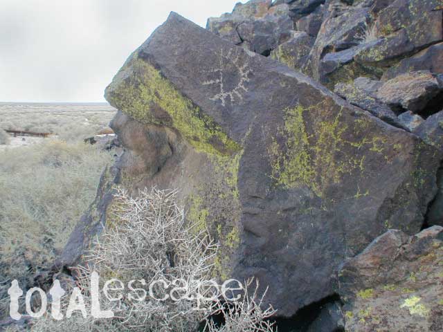
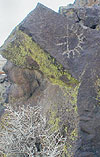
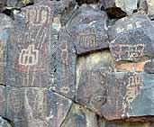
Tucked way up in an ancient lava canyon deep in the Mojave
-- the indian art of Inscription Canyon. It's gonna take
you a while to get here. Northwest of Rainbow Basin, about 10
miles, on rugged dirt roads. Black Canyon is easily accessible
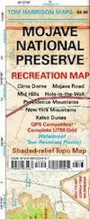
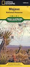
from the south via Hinkley Rd from National Trails Highway. Mojave Desert Maps, topographic maps & GPS are highly advised. A good sense of direction is always helpful when traveling the earth.
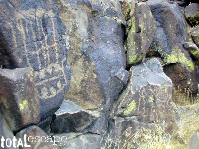
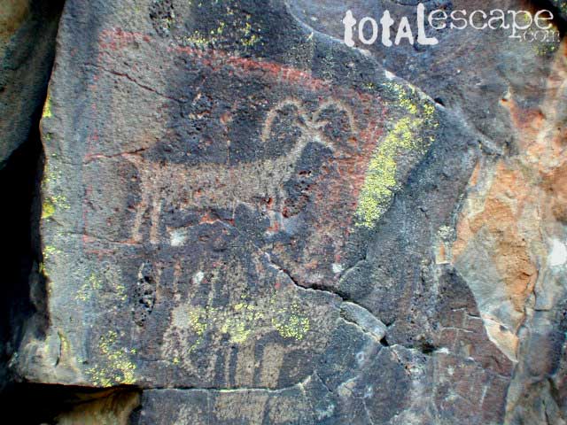
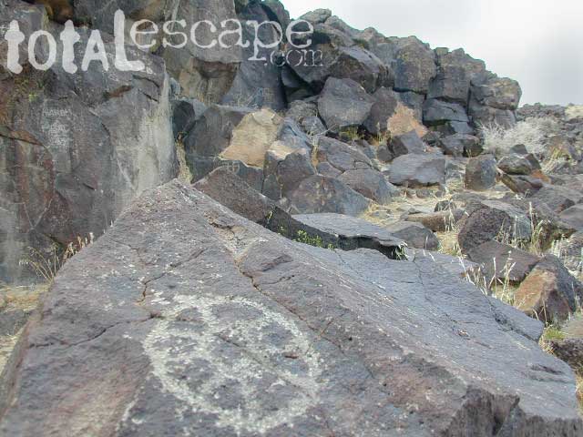
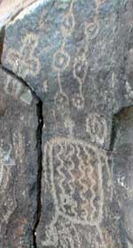
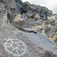
Nearly 10,000 petroglyphs & pictographs can be found in
Black Canyon & the surrounding regions. Scattered through
the area one can discover stone circles, dead end canyons, small springs, caves, lava, and even defaced rock where vandals have stolen a piece of ancient history (totally illegal).
|
While motorized travel is prohibited in some canyons leading
to wilderness areas, hikers can leave the main dirt road to discover
mysteries of those who once roamed this ancient land.
sad but true: Some of the ancient rock art suffers from man-made
damage. Many petroglyphs are marred by graffiti & bullet
holes. Big portions have been destroyed by idiots attempting
to chisel them off.
|
|

If you plan to backpack and camp overnight in the designated Wilderness Area, contact the Mojave BLM Barstow field office for wilderness permits and BLM maps. They can inform you about any possible restrictions, trails closures and advise on the best spots for viewing more native rock art in the Mojave.
|
Primitive Camping

along Backroads
A Barstow back roads topo map of the area is very helpful when exploring the vast and remote desert land. Open dispersed camping is allowed on dirt roads (but OHV traffic is common), so choose a private camp site wisely. Up against a rock wall, far from the main drag. The only campground back in here with facilities is Owl Canyon Campground located in Rainbow Basin.
 

|