|
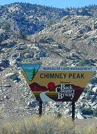
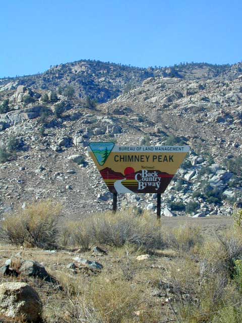
Chimney Peak Road is Chimney Peak Backcountry Byway, a graded dirt road cutting thru BLM land in eastern Kern County. This route is also known as Canebrake Road and is unique geological area where the Mojave deserts meets the Southern Sierra mountain ranges. Sections of the road are closed, but the detour is Long Valley loop (a full day adventure) so there is hope. A 4 wheel drive could be needed in certain sections or most definitely in wet weather. Wash out are common.
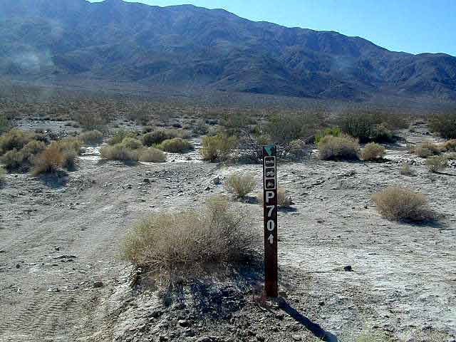
Rugged forested canyons in the high desert area of Hwy. 178 leads all the way north to the southern Sierras & Kennedy Meadows. Joshua trees are abundant along highway & the pinyon pine trees are up on the hills and peaks. Canebrake Road heads north off of Hwy. 178, about 15 mi. east of Lake Isabella. There is entrance signs & the remainder is graded dirt roads. Some small spur roads may require 4WD. Natural points of interest and attractions on this route include: wilderness trailheads for backpackers, equestrian trails, fishing creeks, dirt back roads, small secluded campgrounds, day hiking Kern, wildflower meadows, Eastern Sierra granite mountain peaks.
Chimney Peak Backcountry Byway
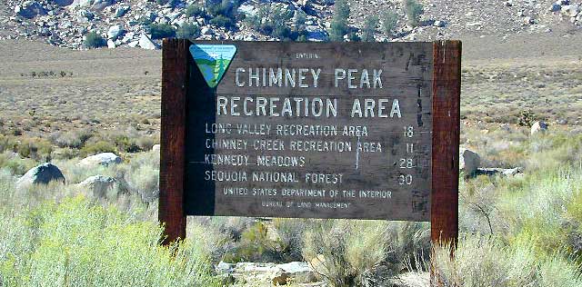
Chimney Peak Recreation Area
Chimney Peak Wilderness
Dome Land Wilderness
Owens Peak Wilderness
Sacatar Trail Wilderness
Pacific Crest Trail
Chimney Creek Campground 5700'
Long Valley Campground 5200'
Long Valley Loop Road
Chimney Rock
Chimney Peak 7990'
Lamont Peak 7510' (aka Lamont Pinnacles)
Sawtooth Peak 7970'
Sacatar Canyon
White Dome
Plenty of rugged canyons and ranches up near the Canebrake
turn off. All primitive camping in this section, so bring your water. Springtime the creeks can be flowing. Make sure to obey 'private property' and the BLM signs, or you coul wake up with Mister Rancher interupting your sweet slumber.
|
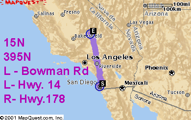
An alternate way to get to this area from SoCal & avoid
LA traffic
is to take Interstate 15 N over Cajon Pass;
just before Hesperia/Victorville, veer north on Hwy. 395. Continue
all the way thru the Mojave Desert & just before the small
town of Inyokern, take Bowman Road (west) across to Hwy.14, left & then quick right on to Hwy. 178 and climb the mountain to Canebrake, CA
A nice high desert section, perfect for a driving stretch break in the joshua trees, is just east of here along the highway on the other side of Walker Pass; Walker Pass is the only designated campground along this end of the 178 highway & mainly used for a backpackers trailhead camp for those wishing to hike the Pacific Crest Trail.
If you happen to need a good Mexican food meal in this vast Mojave region, take Hwy 58 to the town of Boron, exit Boron Ave and look for Domingos Mexican Food on Main Street or Twenty Mule Team Road. (this one is a wheelers secret tip from Lttlbddy Steve.)
|


