all towns by county coastal deserts urban mountains countryside snow towns parks & forests cali maps
Advertisement


Destinations | Mountain

town.aspendell

Photo Credit Copyright DanaMite

Aspendell, not Aspendale. In California? Way higher in elevation than Donner Pass & Truckee, this Eastern Sierra granite canyon is located north of Mount Whitney, along the upper portion of Bishop Creek. The large groves of aspen trees can be spectacular in autumn. West of Bishop CA / Hwy 395 @ the dead end Highway 168. You can reach it in less than an hours drive up, from the 395/Main St/Line St intersection... with minimal sightseeing stops along the way.

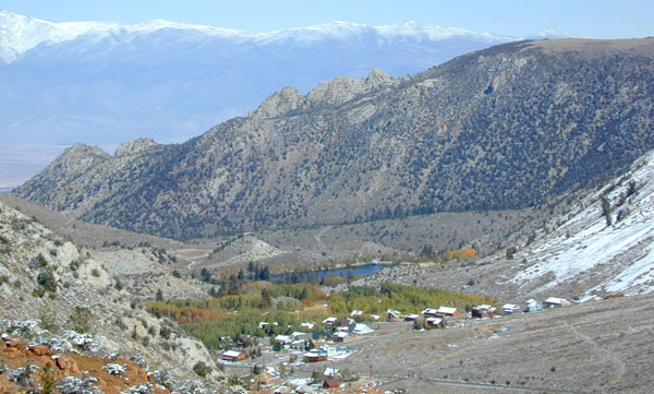
aspendell, California

elevation: 8500'
population: 100
zip code: 93515

Mountain

mountain
terrain
:
high altitude canyon w/ creek, surrounded by much higher elevation granite peaks


View Larger Map

location:
Inyo County
W of Bishop, CA
Hwy 168, Eastern Sierra

recreation

recreation:

  • backpacking
  • camping
  • hiking
  • horseback riding
  • rock climbing
  • fishing
  • kayaking
  • mountaineering
  • mountain biking
  • snow shoeing
  • Sabrina Basin Hike
  • Sabrina Lake Trail
  • parks, forests, rivers & lakes

    parks, forests, rivers & lakes:
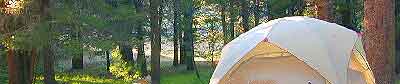
  • Inyo National Forest
  • John Muir Wilderness
  • South Lake Bishop
  • North Lake Bishop
  • Lake Sabrina California
  • Middle Fork Bishop Creek
  • description:
    Highest elevation cabin community in the Eastern Sierra, west of Bishop and the Three Flags Highway

    nearby towns
    nearby towns:
    Bishop
    Big Pine
    Tom's Place
    Independence
    Benton
    Crowley Lake


    Autumn Aspens in California

    North Lake in Autumn

    Road to Sabrina Lake
    Total Escape California Camping

    Advertisement


    California Weekends


    Total Escape has been an AmazonAssociate for 20 years!
    Earnings from purchases keeps this site alive.


    Copyright © 1996-2024 Total Escape, totalescape.com / All Rights Reserved.

    classic | lodge | recreation | destinations | journey | ads | sitemap | outside | maps | gear | mobile