Tag Archives: freeway

Buellton Wineries

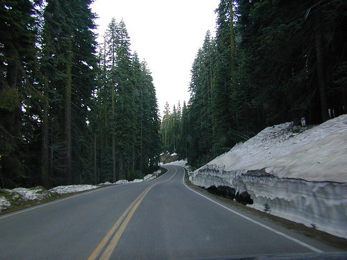
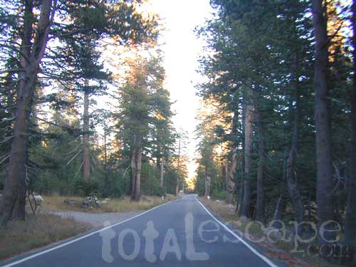
Buellton Winery Solvang
Coastal Vineyards US 101
Santa Barbara Wines

Rolling hills of La Purisima Conservation Bank

lodge

Brick Barn Wine Estate
795 W Hwy 246
Buellton, CA 93427
+18056861208

Crawford Family Wines
92 2nd St unit G
Buellton, CA 93427
+18056983889

Dragonette Cellars
55 Los Padres Way
Buellton, CA 93427
+18056888440

Ken Brown Wines
157 W Hwy 246
Buellton, CA 93427
+18056889400

Lafond Winery
6855 Santa Rosa Rd
Buellton, CA 93427
+18056887921

Lavender Oak Vineyard
9450 Santa Rosa Rd
Buellton, CA 93427
+13107211988

Margerum Wine Company
59 Industrial Way
Buellton, CA 93427
+18056868500

Martellotto Winery
100 Los Padres Way Unit 7
Buellton, CA 93427
+16195679244

McClain Cellars
283 Pamela Wy Suite 104
Buellton, CA 93427
+18054264441

Peake Ranch Winery
7290 Santa Rosa Rd
Buellton, CA 93427
+18056887093

Pence Vineyards
1909 Hwy 246
Buellton, CA 93427
+18057357000

Roark Wine Co
84 Industrial Way C
Buellton, CA 93427
+18053508027

Sapien Wine
90 Easy St
Buellton, CA 93427
+18052428438

Section Wines
65 Los Padres Way
Buellton, CA 93427
+18053503323

Standing Sun Wines
92 2nd St
Buellton, CA 93427
+18056919413

Summerland Wine Brands
35 Industrial Way
Buellton, CA 93427
+18056869400

Vega Vineyard and Farm
9496 Santa Rosa Rd
Buellton, CA 93427
+18056882415

US101


town  BUELLTON, CALIFORNIA

SANTA BARBARA COUNTY

Ostrich farm

see also –

Lompoc Winery
Solvang Wineries

Helpful Routes

Southern California Short Cuts

Must head North out of LA? Skirting the backside of Los Angeles is always a possibility on a FRIDAY night. Taking 15N, 10W, 210W will put you in the opposite direction of most of the bad traffic flow.

Merge back up with I-5 North of San Fernando Valley. If you must get West to the coast, the Simi Valley 118, or the 126 through Fillmore, is the best option.

camp in routeRvs camping in route

Plenty of jump off spots for overnight camping on the Grapevine, inside Angeles National Forest & Los Padres National Forest.

food

#1 – Avoid Los Angeles area, if possible. This will add 1-4 extra hours on to your road trip depending on the ‘hellish & hectic’ reasons this area normally experiences. If you must venture through, try doing so at night after dark. Gas up and eat a meal before you reach this area, to avoid needing to stop in L.A.

gasoline

Watch out for frequent Cal-Trans freeway closures starting
in the midnight hours.

Inland Crawl: The Interstate 91 & Interstate 10 Eastbound are both bad situations during winter months due to Palm Springs weekenders & if snow is decent, the Big Bear ski crowds.

Angeles Forest Hikes Los Padres National Forest Maps San Berdardino mountains

desert roads

california

Lets face it, Vegas traffic back to Cali sucks.

The Interstate 15 is the main corridor that gets backed up on Friday nights Northbound at the I-10 & the I- 215 junction.


Southbound on Sundays is awful from Barstow to San Bernardino. An alternate route is historic Route 66 & avoid the bumper to bumper in the high desert Mojave region.

OLD ROUTE 66, anyone?


Driving from Southern California

Headed to the Eastern Sierra or Death Valley – Make sure to take Interstate 15 straight up to US Highway 395N. The turn off is just south of Victorville. On the Road – gas up & quick food stop on US 395 available in Adelanto & in a region known as ‘Four Corners’ @ Highway 58 junction.

Be warned: It can get a little congested on Friday nights. An alternate is Interstate 15N to Interstate 215N to avoid most of the traffic from the west.

Typical afternoon rush hour problem spots in San Diego.

A small detour, if traffic is bad on Hwy. 78 in North County San Diego & you are headed Interstate 15 North. Twin Oaks Valley Road leads right up to Deer Springs Road & the Avocado Highway known as 15.

Population in SoCal has increased in the past 30 years and surely the traffic problems are worse than my memories. When you get sick of it, head to North, to any part of rural California. Where traffic lights are few and space is plenty.

State Atlas Maps

Regional Maps

camptruck

dangerous

NOTE: I am keeping the old screen shot maps from MapQuest on this page to prove my age and experience on such topics. And I thank you for using my independent California site. DanaMite

Driving Speeds of California

Traffic Lanes & Driving Speeds

hwysaab

california freeways

# 1 lane # 2 lane # 3 lane # 4 lane
the passing lane cruising lane truck lane merging lane
speeders: 80 mph avg speed: 70 mph avg speeds: 65 mph avg speed: 55 mph

The chart above is NOT considered legal speeds, but they are kinda realistically what to expect on the FREEWAY. Interstates and busy freeways in California get cranking and CHP is usually out in force, earning revenue for the state, as well as ensuring the safety of the roads.

Senior drivers, tourists & outta state visitors be warned – the closer you get to a big urban area, the higher speeds and the more aggressive the drivers will be. More commerce, means more trucks and delivery drivers. Southern California is notorius for bad traffic jams, and the Bay Area ain’t much better – just more spread out w/ bridges. Large 18 wheeler rigs and SUVs kill with impact, so slow down a little folks.

gasoline

So much for Sammy’s “Can’t Drive 55”

Californians can’t drive anywhere near 55. Now that the laws have increased the statewide speed to 65 or 70 mph, there is no stopping ’em. Unfortunately the average speeds are increasing all over the west, as people zoom from place to place, city to city, in a never ending transient society. This leaves way more dirt roads and rural backcountry highways left to us Escapers.

TIP: Exit the rat race & take your time, for your sanity sake & safety… slow down.

On average 3500 people die on California roadways each year.
Texas has even more driving deaths, but a lot lower population. 80 mph, go figure.

Fatality Facts State by state

califrepublic

freewaybackup

where is that high speed rail?

train

California State Route (SR) =
CA Highway (Hwy)

The freeway speeds above do not apply to narrower state routes and rural county highways. Most of these are one lane blacktop in each direction and are labeled 55 mph. Maybe slower for curves, tunnels and bridges. Be alert when driving and know that cell phone service is not always abundant on the back roads. At any time you can experience: wildlife crossing, rock slides across the road, downed tree (or branches) in the roadway, stalled vehicles w/ stranded motorists, heavy rains, snow blizzard, hail, sleet, ice, or any other hazards that accompany typical backcountry travel.

snow

No Guard Rails

La Porte Snow

California Highways
California: Outside