Category Archives: California Coast

Driving on the Beach

beach sunset

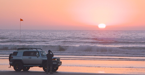
Driving on the Beach in California

Gone are the days of ‘beach blanket bingo’ where film crews glamorized California – the beautiful people, the nice vehicles, the sport of surfing and the glorious beaches. There are very few places left on the California coast that you can actually drive a vehicle on the sand, right next to the ocean. The military bases, oil corporations and the utility companies have the front row seats to the Pacific genocide, and the rest of the population is restricted with extreme limited access.

Baja California has minimal regulations on coastal access with a car. No pavement, no signs, no cell phone signal, and no help for miles – something to consider if you get stuck south of the border in Mexico. Baja has numerous places to explore below Ensenada, but asking locals is always a favored approach. Pay attention to private property signs and always close the cattle gate (if you found it closed).

silverstrand

Southern California, no beaches allow vehicle traffic. San Diego offers a sliver of sand @ Silver Strand SB, which is a developed campground for motorhomes and car campers, located right on the beach south of Coronado, CA. Fiesta Island in Mission Bay, San Diego allows driving on sand and a favorite among active dogs, but not camping is allowed. In Los Angeles you can park a motorhome at a sandy, paved campground for a hefty overnight fee. Dockweiler Beach, right near the Chevron plant and LA sewage treatment facility. Sounds delightful, not.

Ventura & Santa Barbara Coastal Regions have many awesome State Beaches, but none allow vehicles on the sand.

AWD on the sand

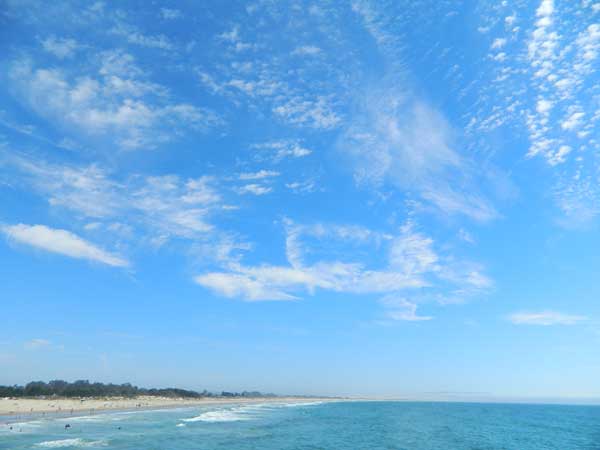
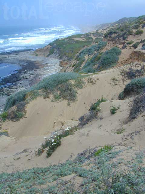
Central Coast California:

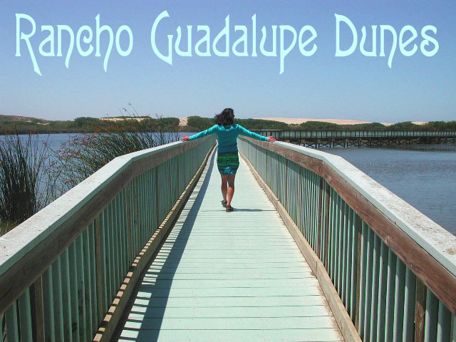
  • Oceano SVRA – off road sand dunes and open camping on the beach. Day use or overnight camp fee required; near Pismo Beach, CA
  • Red, White and Blue Beach – nude beach w/ campground (now closed); north of Santa Cruz, CA

Northern California:
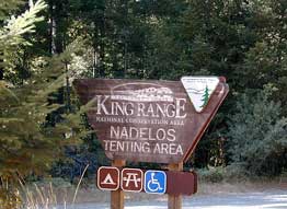
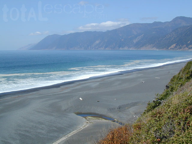
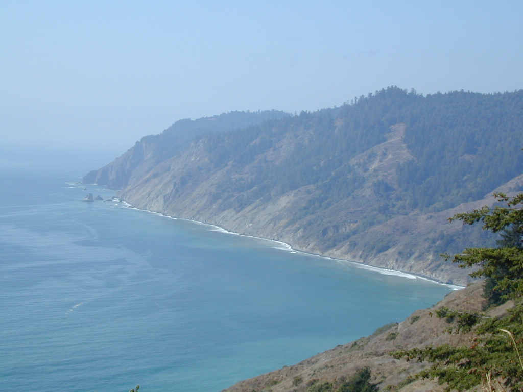
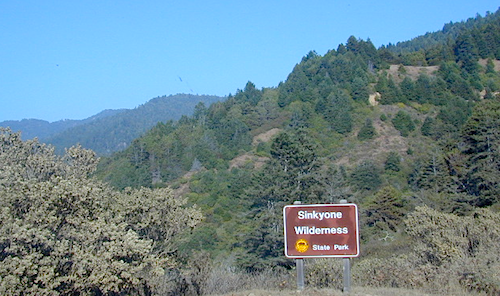
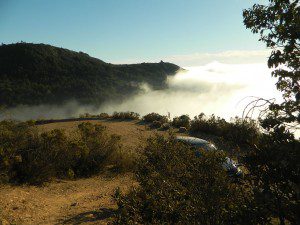
Lost Coast

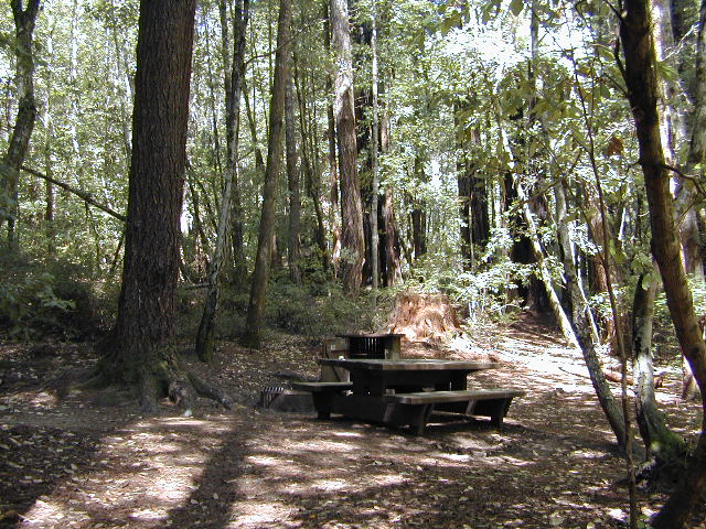
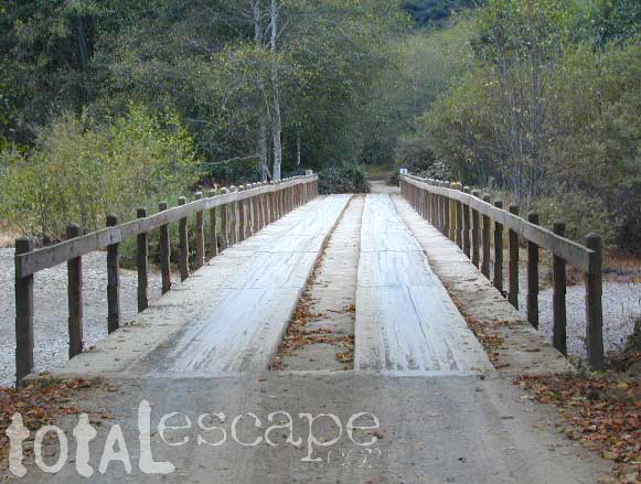
  • Usal Beach Campground – redwood creeks and forests meets coast and cliffs. Camp fee for overnight use. Long dirt road access. No RVs!
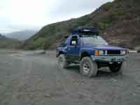
  • Black Sands Beach (OHV 4×4 trail, now closed to all vehicles) near Shelter Cove, CA

chico couple

after-the-fun maintenance tip:

Salt water and sand is very corrosive to metal – which will rust your truck or car badly. Now that you’ve had fun on the beach, we remind you to clean the underneath of your vehicle ASAP. Spraying powerful hose in your wheel wells and all underneath the vehicle. You might need to lay on the ground and get wet to do this job properly. Some car wash places might be able to do this service for you, but it will cost ya.

Marin Camping Point Reyes

Marin County Camping

Point Reyes Peninsula / Pt Reyes Campgrounds

Ocean View CampsitesOne of the most visited coastlines in the world, San Francisco – where 2 peninsulas almost meet – at the mouth of the “hidden bay”.

This is the Golden Gate to California and the Wild West.

So, you wanna escape the tourist masses… and camp out, overlooking an amazing place?

(put on your hiking boots)

lighthouse
Pt Reyes Lighthouse

Nope, the Lighthouse doesn’t have a campground! There are no camping facilities at Muir Woods National Monument, nor Muir Beach. No camping at Stinson Beach, nor Bolinas.

canoe
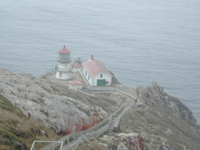
The Tule Elk Reserve has no camping at all. Tomales Bay State Park no longer has car camping or RV camping available; hike-in or boat-in
camping, maybe.

What is available for campground camping on “the Point” is listed below, with phone numbers and links for more info.

foggy seashore

POINT REYES, CALIFORNIA

Point Reyes National Seashore Campground
reservations required
hike-in, bike-in, and boat-in camp sites only
415-464-5100
415-464-5137

Mount Tamalpais State Park Campground State Parks
reservations required
415-388-2070camp

  • Alice Eastwood Campground
  • Frank Valley Campground
  • Horse Camp Campground
  • Pantoll Campground
  • Steep Ravine Campground
  • Steep Ravine Cabins

Marin Headlands Camping
reservations required; no pets & no RVshiker
415-331-1540

Samuel P. Taylor Redwood State Park State Parks
reservations recommended; open year round
415-488-9897

  • Devils Gulch Horse Camp
  • Historic Camp Taylor
  • Madrone Group Camp
  • Car Camping / Tent Camp
  • RV max 27′
  • Cabin Rentals @ SPT

DSCN4484

Cycling, hiking, backpacking, mountain biking, kayaking and boating are all popular outdoor recreation activities.

Small towns located on the Point Reyes peninsula do have a few private campgrounds, some of which can accommodate motorhomes. Follow towns links for those.

RV camping

There are no RV parks, camper trailers or motorhomes allowed in campgrounds on the steep coastal region of Point Reyes. Most of the narrow, winding roads are forbidden for motorhome travels. No shoulder, no guard rails, on many curvy roads. Great viewpoints are best when you STOP to look, off the roadway.

hike NPS

Golden Gate National Recreation Area NPS

Point Reyes National Seashore

Stinson Beach Park

Tomales Bay State Park State Park

Tule Elk Reserve

dockside

nearby towns – 


Campgrounds Beach

California Campgrounds –
Camping at the Beach

Costal Cliffs

Autumn and Spring are often the best months to enjoy the (somewhat) uncrowded coastline of California. Kids are in school, summer vacation rush is over, and there is plenty of sunshine before those winter storms come rolling in.

reservations are highly recommended

Anything & any place along the coast is “much desired”, worthy of charging for. From seaside restaurants to convenient, paid parking lots – face it – California can be expensive.

Beach camping is no different. Coast camping in California is abundant, but state run campgrounds will run you a pretty penny. Camping fees are well above $20 per night. If you want flush toilets in the bathroom and a level, paved spot for a big RV, it will cost even more. Make sure to reserve a campsite as far ahead as possible. Ask about off-season months to visit.

Privately run campgrounds are often more expensive, but they might be a nicer facility and be in a better location. If you want free camping, then head to the northern part of the state – and take a dirt road to reach your seclusion. Both the Big Sur and Lost Coast both have excellent dispersed camping on backroads, at no charge, and a campfire permit is required for such camping.

Campgrounds situated on a sandy beach or right on a cliff edge overlooking the ocean. Private cove camp sites, tent cabin rentals, yurt resorts, RV campgrounds; Several coastal canyons (from sycamores to redwoods) usually have creeks and abundant camping options.

Pismo Clear Winter Day

Campgrounds Beach: a popular search phrase for camping near the coast in California. The best months to camp along the coast depends on what part of California you wish to visit – at what time of the year.

With 700 miles of ocean front there is a lot to choose from – RV parks w/ small marina, 4×4 camps, hike-in only sites, and plenty of California State Parks & Beaches.

Much of the coastal camping is NOT “on-the-sand” beach camping. Most of the coastline in California is rugged, some forested and usually full of ‘wildfire prone’ chaparral. Cliffside campgrounds, redwood canyons with creeks, green grassy lawns w/ shade trees and paved camp sites, US 101 busy, freeway campgrounds; all are close enough to the shore to be considered COASTAL camping.

Tents at Capinteria
Tents at Capinteria SB

Even in winter, the coast can be quite mild in Southern Cal, so the campgrounds are open all year long. NorCal Coast gets the brunt of WET & COLD winter weather, so those camps are open seasonally, during warmer, drier months (APRIL-OCT).

JUNE GLOOM is a cloud layer that covers the coastline in the early part of summer. Weather is warm to cool with clouds, or the weather can be bright and sunny – if the marine layer ‘burns off’ by mid-day. Consider these local weather patterns, May Gray & June Gloom, when planning a vacation to the beaches of California.

listed from south to north

Southern California Beach Camping

Coronado Island
San Diego Beach Camping
Encinitas
Carlsbad
Orange County Beach Camping
San Clemente
Dana Point
Laguna Beach

carpinteriabeach

carpfirewood

Los Angeles Beach Camping

Bolsa Chica State Beach
Capinteria SB
Doheny State Beach
Malibu Creek State Park
Ventura Coast Camping

Coast Campgrounds


Central Coast Beach Camping

Santa Barbara Beach Camping
Pismo Beach Camping
Morro Bay Camping
Big Sur Campground

marina

Monterey Bay Camping

Monterey Bay Camping
Half Moon Bay
Santa Cruz Camping
Santa Cruz Redwoods

Angel Island

San Francisco Camping

Point Reyes Camping
Marin Redwoods Camping
Sonoma Coast – Camping Jenner

Northern California Coast Camping

Mendocino Coast
Kings Range
Lost Coast: Shelter Cove
Usal Beach Campground
NorCal Redwoods Camping
Crescent City Camping

Stairwell to Beach


California Elevations

conradkid
High Sierra hiking @ 12,000 feet above sea level

elevation

high altitude towns    well above sea level

The majority of California cities are located near sea level, with low lying farmlands and populated coastlines common throughout world geography. California has super diversity w/ the population, as well as the elevation and the terrain. Vast rugged deserts bordering Nevada, from high deserts (8000′ @ Bodie ghost town) to low deserts (below sea level for Mecca) near the Salton Sea. Towering granite peaks with minimal vegetation, to fern canyons and redwood groves at the coast, California has quite the unique landscape.

The beautiful golden state is also home to the highest and lowest point within the lower 48 states; and those points are only about 100 miles apart – Death Valley  (-282′ elev) and  Mount Whitney  (14,494′ elev).

I-80 Donner PassMTN TOWN: upper elevation mountain towns w/ forests and flowing water, are primarily located in the Sierra Nevada range which runs the backbone of California in a north-south direction,  separating the Pacific Ocean from the Great Basin. High altitudes are abundant in California, especially in the Eastern Sierra – but most are only accessible by foot.

Mountain communities in Southern California includes places like Mount Laguna, Palomar, Big Bear, Arrowhead, Idyllwild and Mount Pinos.

The coastal mountain range and the Sierra Nevada  encompasses most of Central California. The rest of the space is dedicated to large cities, farmlands and farming towns – which are most lower elevation. Orchards and vineyards can be found in the foothills (200′-2000′ elevation)

Northern California has more mountains and rivers, generally higher elevations and plenty more space to explore. Secluded forests, rivers, creeks, lakes, and reservoirs can be found above 2000′ elevation, north of Sacramento. The bigger mountains in the far north part of the state are part of the Cacade Range, which is volcanic in nature. (Mt. Lassen & Mt. Shasta). More water, more trees and more land – NorCal is very different than the lower half of the golden state.

hwy33overlook
North of Ojai, CA – Highway 33 winds up to Los Padres NF

California Elevation Breakdown

  • Alpine lakes, streams, forests, mountain peaks, granite scenery is abundant above 6000′ elev.
  • Pine forests, junipers, sage chaparral, manzanita, joshua trees can be found between 3000-6000′
  • Hot Springs, creek canyons and cottonwoods are usually discovered above 2000′ elev.
  • Oak hills, ghost pines, creek beds, river canyons  and most agriculture range from 1000-3000′
  • Under 1000′ elevation is the majority of the populated cities and towns within California; coastline, urban areas, foothills, farmland and a few reservoirs
Mecca Hills
Mecca Hills, below sea level

GoogleMaps – groundbreaking tool for trip planning and checking out trailheads, camps and dirt roads from overhead

USGS Viewer – topographic overlays for altitude estimates, and various imagery

California Elevations Map

shaverMS

snowflake
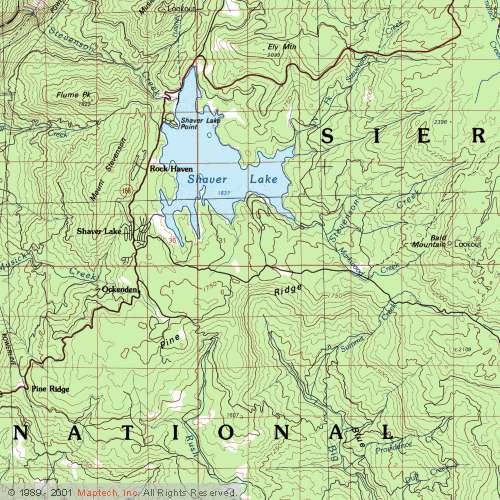
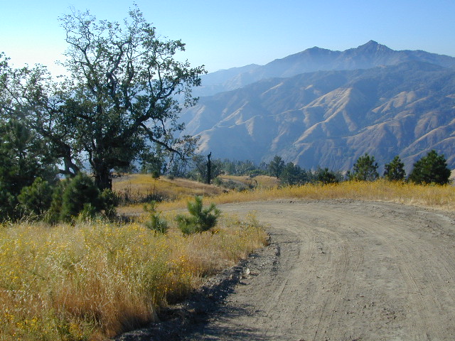
Snow is always a factor in mid to high altitude towns with road conditions being unpredictable with each mountain range and each micro-climate. Winter months range from late October to May, so be warned. Above 3000′ elevation usually gets some snow. Serious snow above 5000′. Some High Sierra Passesdon’t open until JULY (Yosemite Hwy 120 & Sonora Hwy 108). Carry tire chains or have 4×4 to travel safely on snowy roads. Guard rails are seldom around every curve.

list of California towns
by elevation


Rainbow Lodge California

bishopbelow
Above Owens Valley (US 395) at sunset, as seen from the Sierra side (8000′ elev)

Big Sur Campground

Big Sur Camping Sites & Campgrounds

big sur camping

Plaskett Creek Campground has green lawns, pine trees, & flush toilets. Located across the highway from Sand Dollar Beach, right on Hwy 1. Ponderosa Campground, on the other hand, has native grasses, oak trees, a seasonal creek and is located on a paved back road, with easy access from US Hwy 101

Central Coast Camping

Monterey Ranger District of Los Padres National Forest manages several Campgrounds along the Central Coast. Some are first come, first serve.

aldercamp
Alder Creek Camp
willowcreekrdsign
Willow Creek Road #23S01

hikes

Los Padres National Forest

Backpacking trails lead into the wilderness backcountry, along ridge lines with vast ocean views and also deep into fern creeks with redwood canyons. Sykes Hot Springs is a remote destination, if you like to hike, although summer can get crowded. Overnight wilderness permits and campfire permits may be needed.

mcwayfalls
McWay Falls @ Julia Pfieffer Burns SP

Free camping in Big Sur
can be found on dirt back roads:

primitive camp sites

DISPERSED CAMP: No charge camp sites means dirt road access, tighter camp fire restrictions & no facilities (table, bathrooms, fire pits). Campfire permits are required for primitive camping (stoves & BBQ), but unfortunately much of the time camp fires are not even allowed in the backcountry due to extreme wildfire danger.

None of these free camp sites are located on the beach or ocean shoreline. They are situated in the mountains near the coast.  These premium, hard to find camp spots usually require that you venture off the beaten path – w/ a National Forest map or regional topo map. If you want to camp without the tourists and crowds, with excellent views of the coast & the night sky, plus avoiding all fees – then take one of these dirt roads off the main highway & start exploring (preferably before sunset, with a high clearance vehicle).

prewittroads

Free camping California

Big Sur Private Campgrounds –

camp

Big Sur State Park Campgrounds –CA state parks

Big Sur Coastal Towns –

Prewitt Ridge Camping

Hiking California Coast

California Coast Trails

Big Sur Coast 
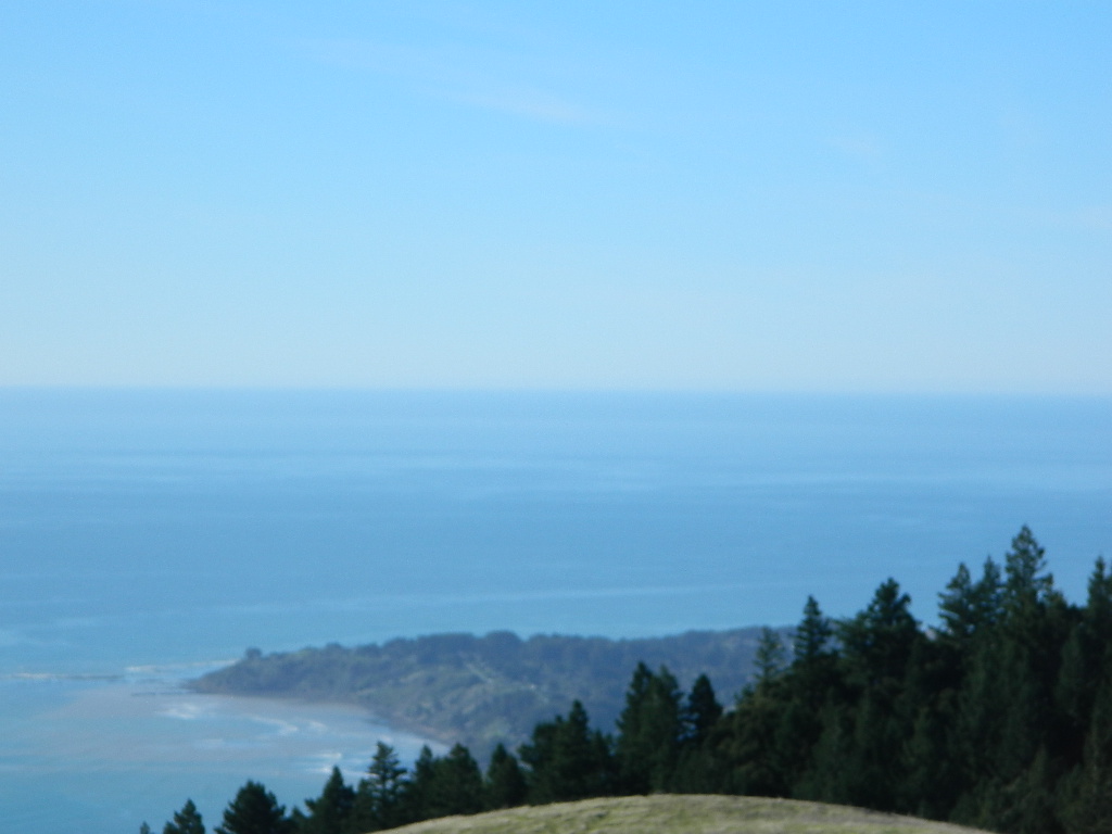
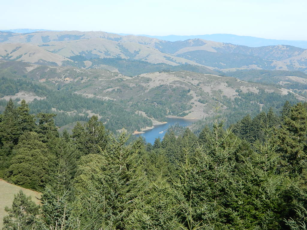
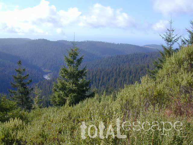
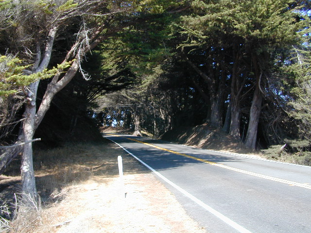
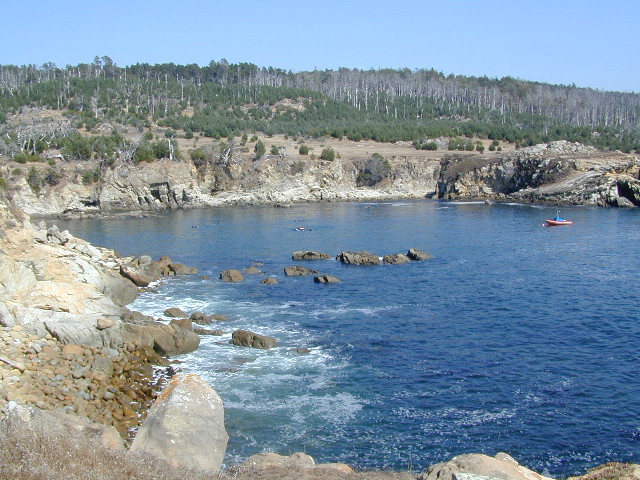
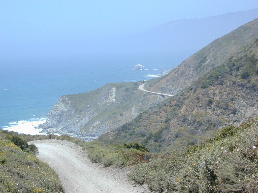
Coastal hikes are the mildest trails California has to offer, ranging from scenic strolls along the base of beach cliffs to steep redwood forested canyons. From Torrey Pines in San Diego to the multiple redwood parks along the North Coast, there is no shortage of hiking near the coastline. Southern California has more beaches than parks, with tide pool areas being a favorite destination for many. Central Coast has lush, fern canyons with year-round flowing creeks and numerous bluffs and rugged beaches. Bay Area has hiking trails nearly everywhere – along the bay, in the woods or on the coast. NorCal has all the wilderness, parks and remote beaches one could ever hope for. What are you waiting for? Get out there.

Pacific Valley Hiking

San Francisco Bay Area Hiking

Limekiln Hikes

hiking trail maps

NorthMarin
Channel Island National Park Map
Los Angeles Hiking Maps
Los Padres NF South (Ojai, Santa Barbara, Frazier)
Los Padres NF North (San Luis Obispo, Big Sur)
Marin Hiking Maps
Mendocino National Forest Map
Six Rivers National Forest Map
Redwoods Map
Ventana Wilderness Map w/ Silver Peak

Sand Dollar Beach

Santa Cruz Redwoods

hippytownway
BSA Camp Cutter

Santa Cruz Mountains & Santa Cruz Redwood Parks

overnight in the redwoods

Camping out in the Santa Cruz mountains can be a magical experience. It is here where some city dweller first get a glimpse of the coastal giant trees. Towering above in several Redwood Parks, the hiking & camping are endless. Backpacking, day hiking, mountain biking and horseback riding are all popular activities in this region.

NOTE: There is no off-roading, 4×4, OHV trails in these coastal mountains, so it will be more peaceful. Peace and quiet, remember that?

redwoods Santa Cruz

Since this mountain range is in between the Santa Cruz coastline and THE CITY, San Francisco, and situated right next to the mega-city “Bay Area”, you can always expect a few tourists about and lots of locals out enjoying their backyard (at all times of the year).

Make campground or cabin reservations as far in advance as possible. Summers are the busiest months!

State Park hikes tent camp RV

Tent Cabins
Tent Cabins: Big Basin Cabins can be arranged at Big Basin State Park. Campgrounds can be found at all State Parks and some county parks. Private vacation homes are found nearby; a few small towns on Hwy 9 offer hotel accommodations. On the coastal side of this ‘mountain’ is the small community of Pescadero w/ Butano SP.

Small towns nearby offer lodging & dining:

Big Basin Redwoods Camping

Redwood Beach Camping

NorCal Redwood Coastal Camping

Redwood Campgrounds

Del Norte County, Northern California

redwood101

There are a few special places in California where redwood trees grow right down to the shore, but it is rare. Searching for place to pitch a tent (under the redwoods at the coast) is possible, but a bit harder to find than you might imagine. State Parks usually offer the standard paved camp site. Maybe need to drive dirt roads to find redwood seclusion.

Crescent City Camping

redwoodmap

Klamath Coast Camping

blue links lead to State Park pages with camp reservations.

State Park

Redwood Park Campgrounds State Parks

Redwood National Park National Park
Camping 

  • Demartin Campground
  • Flint Ridge Campground
  • Mill Creek Campground
  • Nickel Creek Campground (backcountry)

Eureka RV Campgrounds

redwood camping norcal

If you are seeking free or dirt cheap, primitive camping on the coast, then LOST COAST CAMPING on the Mendocino border is one option. Or head east, inland to the abundant National Forest. Dirt roads of the Six Rivers National Forest offer old logging roads, creeks, and secluded places to pitch a tent. Campfire permits are needed for dispersed camping, or ‘boondocking’ as some call it.

Dirt back roads can get muddy during the wet season, so know your vehicles capability and if you are unsure, check with the local rangers over the phone (preferably a ‘field ranger’) before venturing out. Remember that rain and mud are the norm, most of the year.

Fog is typical of the region. Enjoy the sunshine – when you can!

see more towns nearby –

Smith River
Crescent City
Klamath
Orick
Trinidad
Arcata
Eureka
Scotia
Ferndale
Petrolia
Garberville
Redway
Shelter Cove

Mendocino Beach Camping

Mendocino Coast Campgrounds

villageoncliff
Tent camping directly on a sandy beach can be found at USAL BEACH – on remote reaches of the rugged Lost Coast, via long dirt roads (not recommended for RV or camper trailers). Numerous small, cheap, forested campgrounds can be found on the Kings Range (dirt) roads. The area is also known as Honeydew or the Emerald Triangle. The “emerald” comes from the color of the main economic staple, cannabis. Heed all warnings. Private Property signs and gates mean that you need to turn arund and look for camping elsewhere. (Before you hear the gun shots.)

The remainder of camp accommodations are State Parks and State Beaches on the Mendo coast, offering developed campgrounds and most are first come, first serve. 

There are no campgrounds inside the popular, historic village of Mendocino, CA , but two state parks are within a mile to the north and south side of town: Van Damme Campground & Russian Gulch Campground. Local KOA and a few private RV parks make up the rest of the scenic coastline.

Lost Coast Camping BLM

Kings Range National Conservation Area

camp on the sand

Lost Coast Bridge

Westport Union Landing State Beach

MacKerricher State Park

  • Pinewood Campground
  • Surfwood Campground

dscn0083

Fort Bragg, California Campgrounds

Cleone Campground

Hidden Pines Camp & RV Park

Jug Handle Creek Farm & Campground

Pomo RV Park & Campground

Sportsmans RV Park

Woodside RV Park & Campground

Caspar Beach RV Park Campground

Camping Mendocino Village Area

Mendocino Coast Village

Mendocino Coast –
Albion, Pt. Arena & Gualala

camp

Manchester State Park

Manchester KOA Campground

Anchor Bay Campground @ Fish Rock Beach

Gualala River Redwood Park

Redwood forest

Mendocino Coast towns:
Albion
Caspar
Elk
Fort Bragg
Gualala
Little River
Mendocino

Humboldt Beach Camping

Humboldt Camping Sites

dscn0088

The sheer beauty of real weather, the clashing storms and ocean with the land. Cold and wet half the year (or more), Northern Cal has less people and more scenery. More nature, more land, more forests, more view points, more wild beauty – than the rest of the California coast.

Maybe more hippies too!

The fantastic coastlines of Northern California are forested, rugged, rocky and they receive a lot more rain than the rest of California. Coastal fog or deep cloud layers are common, even in warmer months.

Tall cliffs, large lagoons, rural towns, and foggy beaches. Beaches filled with small rocks. No sand? Minimal access to the coast in some areas.

Super tall, coastal redwood trees thrive along this oceanfront wildness. They are located just a skip away from the sea. Most groves located miles inland, near US 101 highway. Close enough, but not out there on the windy beach, exposed with the elements.

redwood101

NorCal Coast Campgrounds are located generally along river ways, near redwood forests and near paved roads. Redwood Campgrounds are all over up here. Literally, everywhere. Some camps are better suited for RV campers than others. A few parks have walk-in or hike-in access to camp sites.

Several redwood parks are 20 miles from the coast, so know the exact location before you book a campsite online. Driving “over to coast for a quick day trip” is no easy task, since routes can be narrow backroads with many curves. Pavement, if you’re lucky.

listed below:
campgrounds actually located at the coastline are labeled in bold text

When the weather is warm and sunny, people – flock to the hidden coves, rugged beaches, or they float, kayak, fish or raft on the rivers, or the enjoy long day hikes.

blue links lead to State Park pages with camp reservations.

State Park

NorCal Redwoodsstate parks
State Parks 
& Campgrounds

Humboldt Lagoon State Park

  • Stone Lagoon Campground
  • Dry Lagoon Hike-in Sites

Humboldt Redwoods State Park & Campground camp

Little River State Beach Campground

Patricks Point State Park Campground  camp

Prairie Creek Redwood State Park camp

  • Butler Creek Walk-in Camp
  • Elk Prairie Campground
  • Gold Bluffs Campground

Richardson Grove State Park camp

humboldtSP

Some redwoods parks are open year round, others only in summer months. Reservations for campgrounds is common along this desired vacation region of California. River kayakers, mountain bikers, tent campers, avid hikers, road trippers and RV campers.

camps actually located at the coastline are labeled in bold text

California Redwood forests are found along the NorthCoast; coastal redwoods. And in the Sierra Nevada mountains; those big redwoods are called Sequoias.

see more big, old trees

redwood parks

Humboldt County Parks with Camping


Lost Coast Camping BLM BLM camping

USA Lumber Company

USA Lumber (historic site) & Campground

Usal Beach Campground
(on the border of Mendocino and Humboldt Counties)

Flint Ridge Campground
(on the border of DelNorte and Humboldt Counties)


redwood parks

Black Sands Beach, California

Humboldt towns along the coast –

(listed from south to north)


Lost Coast Drive Dirt Roads
Lost Coast: Drive Dirt Roads – USAL ROAD# 431, this road is the hard left off HWY 1, just as it peels away from coast and heads into redwoods and US 101. Follow this dirt and gravel scenic wonder drive out to Usal Beach Campground, Sinkyone Wilderness and Shelter Cove. The pavement picks up again near Honeydew, a rugged 30-something miles north. Real 4×4 may be needed in wet weather.

California Water Information

California Reservoirs
California Water Resources

water resources / water scarcity / land and water

snow flakes

SNOW PACK

State Snow Depths – Wunderground
SNOTEL Snow Depth Reports
http://www.wunderground.com/StateSnowDepth.asp?state=CA

California Snow Water Equivalents
Sierra Snow Pack Data
https://cdec.water.ca.gov/snow/current/snow/

Eastern Sierra Snow Pack by Sierra Wave
Article published Feb 2014
http://www.sierrawave.net/tag/eastern-sierra-snowpack/

Eastern Sierra Avalanche Center
Snowpack summaries published Dec 2014
http://www.esavalanche.org/content/snowpack-summaries-begin-soon

Sierra Avalanche Center
Sierra Nevada Mountain Snow in California
http://www.sierraavalanchecenter.org/


snow flakes

LAKES & RESERVOIRS

The Lowest Lake Levels in California
List of Reservoirs below 30% full, as reported Jan. 2015


Conditions for Major Reservoirs in California

http://cdec.water.ca.gov/

  • Trinity Lake
  • Lake Shasta
  • Lake Oroville
  • Folsom Lake
  • New Melones Lake
  • Millerton Lake
  • San Luis Reservoir
  • Don Pedro Reservoir
  • Pine Flat Lake
  • Pyramid Lake
  • Castaic Lake

San Diego River & Reservoir Data
Map of San Diego Hydrology, Water Storage
http://www.cnrfc.noaa.gov/

San Luis Obispo Reservoir Data
Lakes on the Central Coast of California
http://www.slocountywater.org/

  • Lake Nacimiento
  • Whale Rock Reservoir
  • Lake Lopez
  • Santa Margarita Lake
  • Twitchell Reservoir

Ventura County Watershed Map
Watershed Protection District
http://www.vcwatershed.net/

snow flakes

RIVER FLOWS

California River Forecast Center Map
Overview for recent rainfall data, snow depths, and ocean temperature
http://www.cnrfc.noaa.gov/google.php

California Current River Conditions
CA.gov Dept of Water Resources
http://cdec.water.ca.gov/river/rivcond.html

California River Forecast
California Nevada River Forecast Center
http://cdec.water.ca.gov/rivforecasts.html
Drought Info
http://www.cnrfc.noaa.gov/droughtInfo.php

Upper Sacramento River Forecast
Northern Sacto River
http://cdec.water.ca.gov/cgi-progs/rivfcast/USACBUL

snow flakes

NEWS & STATISTICS

Irrigated Lands in California – Farming Map

Dry Wells in California – DanaMite’s Map
More than 1,480 domestic well failures in 36 counties have been reported to the state of California recently.

California will need 11 trillion gallons of water to end epic drought by Mashable.com
http://mashable.com/

California Department of Water Resources
http://www.water.ca.gov/

Water in California – Wikipedia
Reservoirs, Water Sources, Aquaducts, Water Distribution
https://en.wikipedia.org/wiki/Water_in_California

Residential Per Capita Water Use across California
Water conservation measures and stats per city
http://www.californiadrought.org/

Aquafornia, the Water Education Foundation
California water news from various news sources
http://www.watereducation.org/aquafornia

Association of California Water Agencies
Largest statewide coalition of public water agencies
http://www.acwa.com/content/water-information

USGS Water Data for California
The United States Geological Survey
http://waterdata.usgs.gov/ca/nwis

EPA – Environmental Protection Agency
California Drinking Water | Local Drinking Water Information
http://water.epa.gov/drink/local/ca.cfm

California Water Impact Network, C-WIN
Advocates for equitable and environmentally sensitive use of California’s water
http://www.c-win.org/

California Drought Map
National Drought Mitigation Center
http://droughtmonitor.unl.edu/Home/StateDroughtMonitor.aspx?CA


snow flakes

PACIFIC OCEAN

Heal the Bay
Volunteer, Beach Cleanups, Santa Monica Pier Aquarium
http://www.healthebay.org/

The Pacific Genocide

  • Fukushima Meltdown
  • Acidification of Oceans
  • Overfishing
  • Pollution & Oil Spills
  • Marine Life Watch

Northern California Redwoods

Northern California Coast Hotels & Camps

redwoods parks
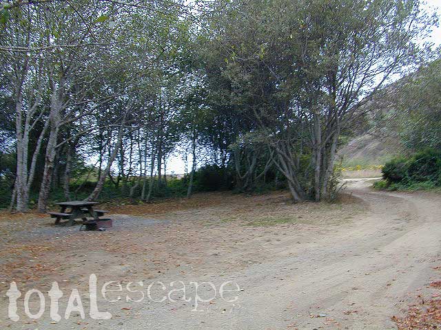
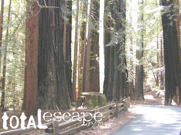
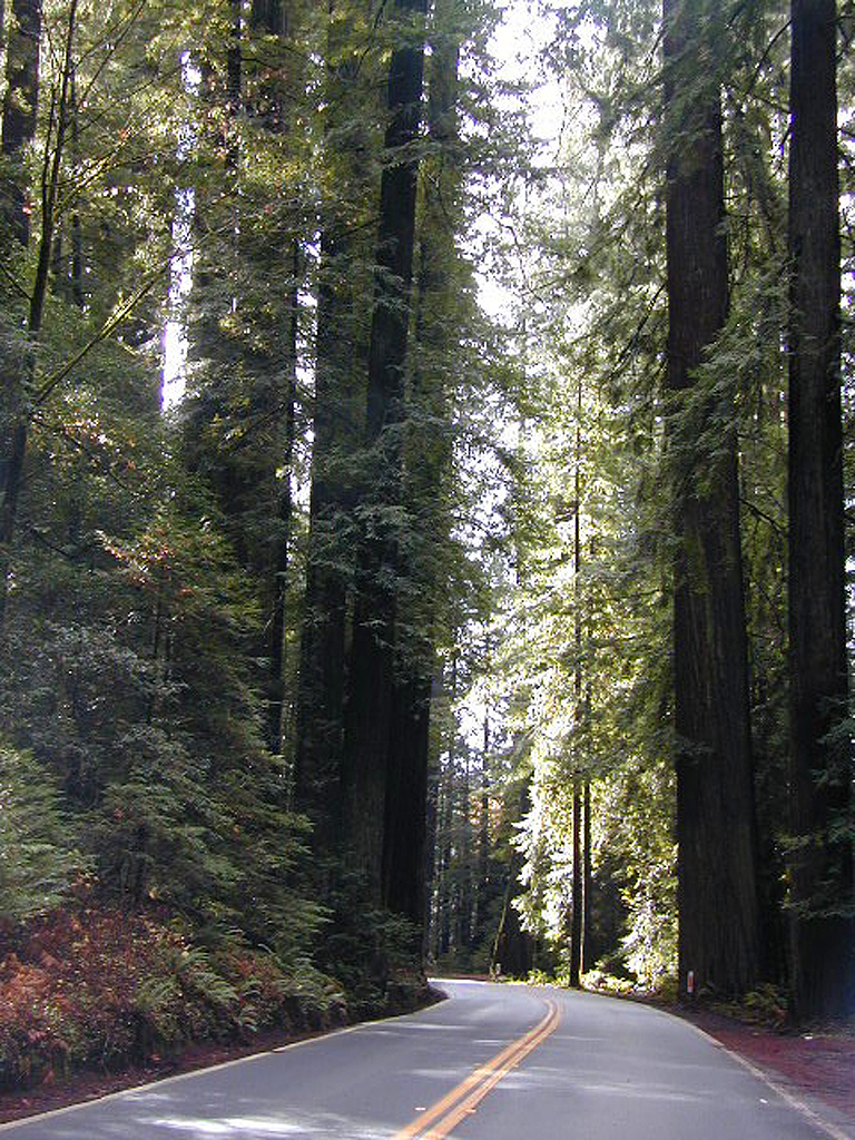
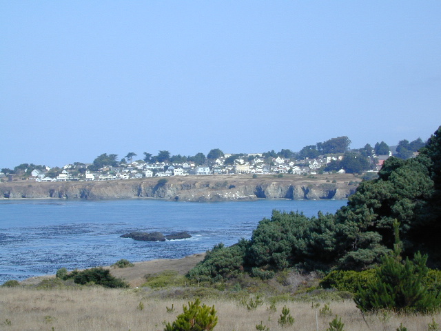
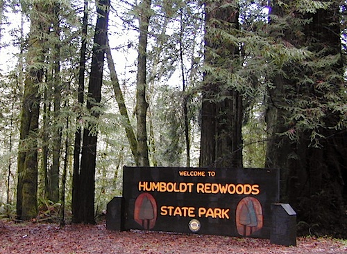
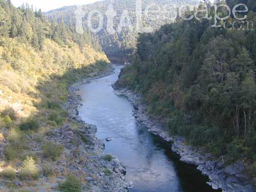
The north coast of California is dubbed the Redwood Empire, and driving north on US Hwy 101 passing the well-known wine country and communities near Clear Lake, means you’ve entered the official redwood region of Cali.

With over 150 mile stretch between Ukiah & Crescent City, on the Oregon border, coastal redwoods thrive in this wet climate. All along US Highway 101 you can find every assortment of lodging, from standard hotels walking distance to village shops, to small secluded cottages tucked behind a winery. Sonoma & Mendocino vineyards merge on ridge lines, at the edge of oak countryside, with redwood forests & recreational rivers to the north.

BALD HILLS ROAD: Old logging roads lead way up in elevation, behind Redwood National Park, where you can find free camping spots and firewood piles all over the clearings. A real 4×4 vehicle will be needed in wet or snowy weather conditions. AWD wagons should be cautious of deep mud and know the weather conditions ahead of time. The main gravel/dirt route traverses the Bald Hills range at 3000′ elevation and ‘epic view’ campsites are abundant. Pine Creek Road drops east into Klamath River Canyon down to Klamath Hwy 96.

Bald Hills Rd

USAL BEACH: In the olden days, USA Lumber Company had a prime place on the Lost Coast. Now it is a wonderful destination w/ remote beach campground hidden in the trees, next to the redwoods and creek, and the cliffs – and a big sandy beach w/ giant driftwood!

Towns w/ Redwood Lodging in NorCal – 

Redwood Parks in NorCal –

(from south to north, with closest town)

REDWOOD MAP


Redwood Map Topo

Topographic hiking and camping maps of the NorCal Redwood region –

Sinkyone Wilderness

Lost Coast of California

Lost Coast California Sinkyone Wilderness State Park

NPS  King Range National Conservation Area

Redwood groves and wilderness meet the Pacific Ocean at the infamous Lost Coast of California. Northern California is NorCal – steep trails, creeks, waterfalls, ocean views, and coastal cliffs. Mendocino and Humboldt County has numerous redwood parks and picnic grounds located near Pacific Coast Hwy 1 & US Hwy 101. This particular wilderness area is located in between Westport and Shelter Cove, just west of Leggett, CA. Situated on the west side of US Hwy 101 and only accessible via a long dirt road. The Sinkyone wild lands are managed under the California State Park system.

Sinkyone Wilderness hike Ranger Station 707-986-7711

Sinkyone Wilderness access –

North end – Needle Rock: 36 miles southwest of Garberville & Redway, California. Briceland Road west from Redway, this road becomes Mendocino County Road 435. The last 3.5 miles are unpaved, steep, & narrow. South end – Usal Beach: Approximately one hour north of Ft Bragg on PCH or 15 miles west of Leggett on PCH from Highway 101. Look for mile marker 90.88 on PCH. Turn north on small dirt road; 6 miles to Usal on unpaved, steep, narrow road.

ROADS MAY BE IMPASSABLE IN WET WEATHER. RV’S & TRAILERS NOT RECOMMENDED.

  View Larger Map

dscn0147 Usal Campground

LOST COAST CAMPING

Usal Campground – USA Lumber Company staged a logging operation here in the early 1900’s. Now this remote spot is a popular back road campground accessibly only by a long dirt road drive. 4×4 and car camping only; No trailers or RV campers!

NEARBY TOWNS

Wilderness State Park

Sonoma Beach Camping

Sonoma Coast Campgrounds

Gerstle Cove @ Salt Point
Gerstle Cove @ Salt Point SP

tent camp RV camps

Sonoma Coast State Park  State Park

  • Bodega Dunes Campground
  • Wrights Beach Campground

dscn0045

Salt Point State Park Camping State Park

  • Woodside Campground
  • Gerstle Cove Campground

Fort Ross State Historic Park 
(a Russian fur trading fort from 1812)

  • Reef Campground – 21 camp spots
    No RV hookups. No reservations
    [2018 CLOSED for repairs]
    707-847-3437

coast

Sonoma County Parks Campgrounds

Private campgrounds @ Sonoma Coast –

Sonoma coastal towns –

Woodside Campground
Woodside Campground @ Salt Point State Park

California North Coast

Northern CA Coast / Northern Coast of California

The redwood north coast of California is very forested region with many rivers & streams running throughout. Fishing, kayaking, rafting, camping & backpacking are all superb here. The wilderness rules, as the majority of the landscape is wild & untouched by development. Mountain ranges near the north California coast span in elevation from 1000′ to 8000′. The Klamath River, Eel River & Trinity River are the predominate waterways in this region, with designated National Forest lining their canyons. There are over 10 parks along the coast that feature the redwood trees as the main attraction. The ones listed below are the inland, mountainous areas of Northern California.

klamath river

Mendocino National Forest

Clear Lake, Kelseyville, Ukiah

north coast CA

Redwood National Park

Klamath, Orick

north coast CA

Six Rivers National Forests

north coast CA

Smith River Recreation Area

Crescent City, Orleans

Seal Beach Holiday Parade

SBP 16

Seal Beach Christmas Parade


A ‘continuous motion’ holiday parade that highlights youth groups, sports groups, schools, businesses, first responders and other organizations from Seal Beach and surrounding coastal areas. Seal Beach is located in between Long Beach and Newport Beach on the Los Angeles coastline.

Annual event: December
Seal Beach, CA

sealbeachlions.org/christmas-parade

Seal Beach Holiday Parade, December 2009

Seal Beach Holiday Parade, December 2009

23S01 – Los Padres NF

Big Sur Dirt Roads

Los Padres National Forest Road #23S01

Willow Creek Road
Los Burros Road

South Big Sur Coast Dirt Roads & super scenic US HWY 1 – North of San Simeon and Hearst Castle, north of Ragged Point and just past Gorda, CA a dirt shoulder, widens, a break in the bushes on the right side of the highway, a small wooden sign for the Yurt Resort called Treebones and the turn off to the back-country of Los Padres National Forest Road #23S01

Willow Creek is a steep coastal canyon w/ Willow Creek Trail #5E08 in the creek below and the dirt road 1000′ above. Willow Creek Day Use Area, the Willow Creek bridge and Willow Creek beach w/ restrooms, picnic tables, and paved parking lot near the highway.

DIRT ROAD, high clearance is recommended, but not required. 4×4 may be needed in wet weather. Motorhomes, trucks w/ trailers and RV campers are not gonna like this rugged, narrow, steep, dirt road and are advised to stick to the pavement. Camper vans and SUVs are be better suited for this terrain.

  • Both Thomas Bros. Maps & Benchmark Map’s California Atlas has this route listed as Los Burros Road
  • Google Maps has this route named Will Creek Road
  • Yahoo Maps has this route as Willow Creek – Los Burros Road
  • Mapquest has this one listed as Los Burros Rd – Fort Hunter Liggett (which is a military base,  on the opposite side of the mountain range near US Hwy 101)


View Larger Map


Free Camping in Big Sur

Willow Creek Rd

Several primitive camp sites can be found along this rugged dirt road, which climbs steeply and switchbacks thru redwoods, madrones, cedars, grass lands and oak hills. Sites within the first 3 miles  of this road offer the serene sounds of the ocean – waves, seals, sea lions as well as traffic on the busy highway. There are a few private properties back here in the boonies too, so read signs and don’t go exploring this region in the dark.

About 8 miles back on Willow Creek Rd is Alder Creek Campground – a small developed camp w/ only 2 camp sites and no piped water and no fees.

Prewitt Ridge  also has numerous ideal top-of-the-world, free camp sites, which do require a lot more dirt road driving and a very good backcountry map.

  • Sycamore Flat Road intersects @ 3 miles up
  • Alder Peak Camp is San Martin Top @ 12 miles up
  • South Coast Ridge Road is at the very top @ 14 miles
  • Lions Den Camp is 19 miles of dirt road driving
  • Three Peaks Camp is 21 miles way back there
Los Padres Monterey District Big Sur Map NatGeo

California Lighthouses

California Lighthouse Vacations

Historic lighthouses below are vacation destinations that offer overnight stays at the lighthouse, or lodging close by.


CENTRAL COAST CALIFORNIA


Avila Beach, CA


SAN FRANCISCO AREA


Montara, CA


Pescadero CA


Point Reyes, CA


MENDOCINO COAST


Mendocino, CA


Point Arena, CA


NORTHERN CALIFORNIA


Trinidad CA

Rancho Guadalupe Dunes Park

Guadalupe Dunes / Rancho Guadalupe Dunes County Park

Gualupe Dunes Park

Beach sand dunes on the Central California coastline, located in between Point Sal and Pismo Beach. Three different wildlife preserves (and one oil refinery) make up this sandy beach strand W of Guadalupe, CA

From the north

  • Oceano Dunes SVRA – also known as Pismo Dunes this is where all the yahoos can get their thrills riding quads and driving on the beach dunes. One of the few spots in ca, where you can drive your vehicle on the beach, right at the tideline.
  • OSO FLACO LAKE – estuary with boardwalk on the California Central Coast, surrounded by sand dunes and farm lands. Birdwatch right from the middle of the lagoon. Bring a picnic too!
  • Guadalupe-Nipomo Dunes National Wildlife Refuge – the refuge is situated between Oso Flaco Lake & Ranch Guadalupe Dunes. The main office is located along Highway 1, at 1045 Guadalupe Street, Guadalupe, CA
  • Rancho Guadalupe Dunes County Park – just north of Point Sal is this public access beach. Well known for miles of pristine sand dunes. This is a place to truly enjoy nature and solitude. Near to Pismo Dunes, Rancho Guadalupe is a county park in the Santa Barbara County Parks system. This protected wildlife area is north of Lompoc & south of Pismo Beach CA.  The refuge was established to protect breeding habitat for the endangered species.

All this located west of Santa Maria & Nipomo CA. The Santa Maria River meet the Pacific ocean here at this estuary and sand dune area. From Coast Hwy 101, exit Main Street in Santa Maria; follow Hwy 166 west, past the small town of Guadalupe, CA & past the farmlands – straight to the coast.

6999 W Main St
Guadalupe, CA 93434
805-343-2354


View Larger Map

Horses & dogs are not allowed in the preserve. Off-road vehicle play area is to the north of Oso Flaco Lake. The fence line is visible from the beach hike and engine noises can be heard from Oso Flaco. Enter the Ocean Dunes SVRA (State Vehicular Recreation Area), further up Hwy 1 at Oceano CA

more info
dunescenter.org
Some photos