Tag Archives: 4×4

Split Mountain Anza Borrego Desert

Split Mountain Road

Fish Creek Wash
Anza Borrego Desert State Park
Ocotillo Wells, CA

Fish Creek Wash @ Split Mountain

Explore Anza Borrego State Park desert deeper for the secluded hidden treasures. Find yourself traveling the east San Diego county desert, on Highway 78 eastbound on the way to the Salton Sea. Passing the turn offs for Borrego Springs, slow down and look for the intersection of off-roaders & ATVs @ Ocotillo Wells, California. Ocotillo Wells State Vehicluar Recreation Area is on the north (left) side of the highway and Split Mountain is on the right.

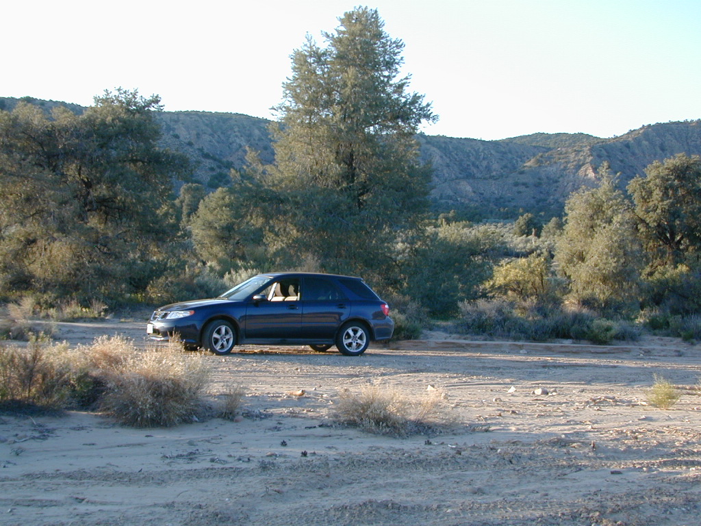
From highway turn south (right) on to Split Mountain Road, which leads to numerous back road destinations. Ranch homes and private property line the first mile of the road, neighborhood general store and a tiny saloon, RV park and an ATV rental shop.

Old Kane Springs Road is a main dirt road that parallels the highway from the narrows at San Felipe Wash to the Salton Sea. Old Kane Springs Rd intersect the Split Mountain route about 1 mile south of highway.


View Larger Map

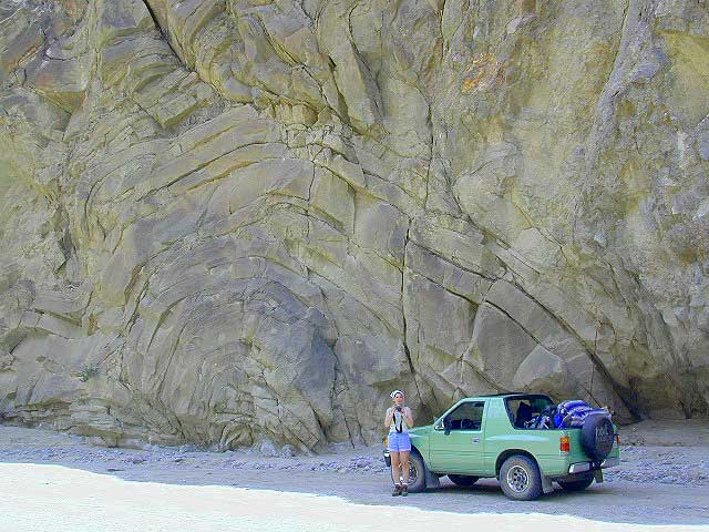
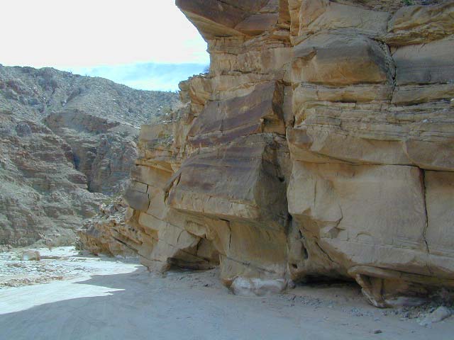
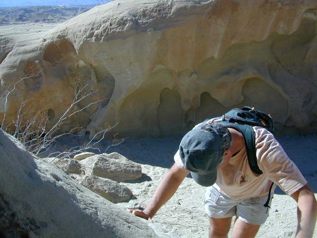
Split Mountain ranger station is before the Elephant Trees nature trail. Near the railroad track, the paved road turns into Fish Creek Wash near Fish Creek Campground. If you have a low rider passenger car, you might wanna park it here and walk in to the canyon. Within the first few miles there is a lot to explore – fossils in walls, huge cliffs, wind caves, narrow canyons.

The actual “split in the mountain” section is located just beyond the campground on a sandy desert road.
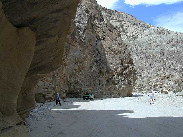
Anza Borrego’s Split Mountain

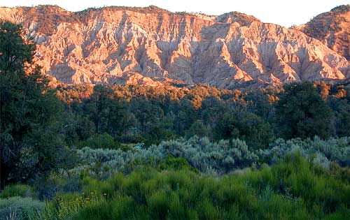
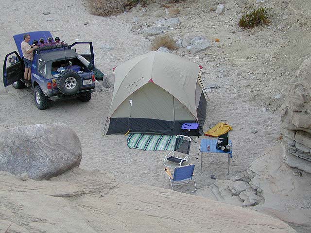
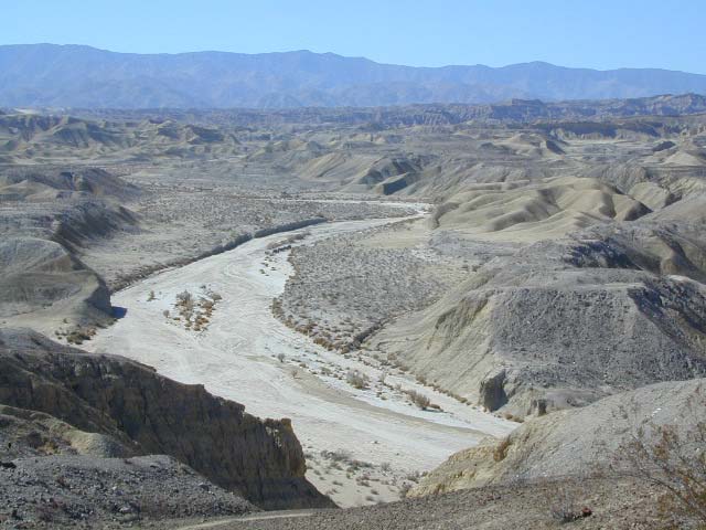
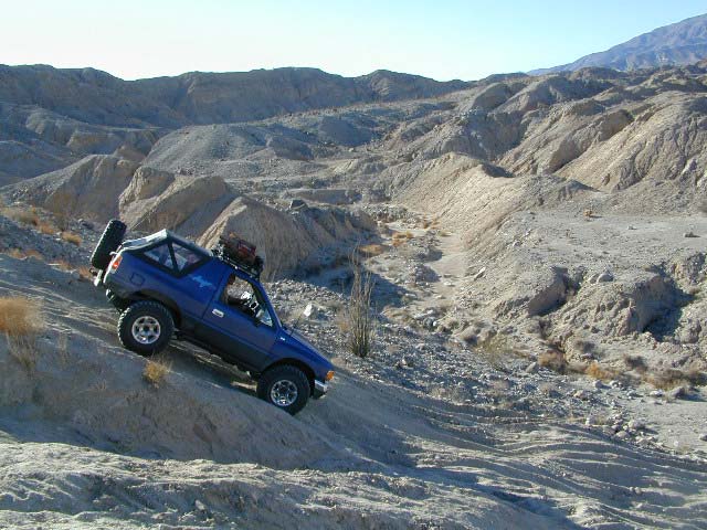
Fish Creek Wash continues south, deep into the Carrizo badlands where 4×4 is definitely needed. The trail system eventually loops back over to paved S2 @ Canebrake, via Pinyon Mountain w/ the Squeeze, or Canon Sin Nombre. Unlimited primitive camp sites, found inside every other nook and cranny. Numerous hidden slot canyons, sandstone cliffs and wide sandy washes becomes a literal maze of off-road trails so you better carry a good back roads topographic map.

Dome Springs Campground

Domesprings

Los Padres NF – Frazier Park Camping

Dome Springs Campground

Los Padres Forest Rd #8N40

North of Lockwood Valley Rd. 20 miles W of Frazier Park, CA

Free, small campgrounds are abundant inside the Los Padres. Pinyon pine forest & a wide high desert wash, steep canyons and mountain wilderness. Kern County’s highest peak sits nearby @ Mount Pinos 8831′, with neighboring Mount Able 8286′ directly west of Pinos. Peak to Peak hike is a popular attraction for day hikers and backpackers alike.

Saabaru Off-Roader

Lockwood Valley Camping

free campground  / badlands terrain

When mountain winter temps set in (around the holiday season), camping overnight in the low lands might be more appealing. Domesprings is a perfect camp spot for car campers, off roaders, hunters or even mountain bikers. OHV trails, target shooting areas are abundant, as well as hiking and stargazing opportunities. The main wash is called Dry Canyon, which is nice when there has been some mild rain for minimal dust. No motor bike, vehicles or bicycles in the neighboring Chumash Wilderness, which borders this region on the north next to Mt Pinos.

Dome Springs – Dry Canyon main access road #8N40 can be sandy at times and 4×4 might be needed to reach camp during drier months. Snow or wet weather might also pose a problem with this road, so always check weather and call the rangers ahead of time to find out current road conditions. Most of the time you can get back here with a low rider passenger car.

Elevation: 4,585′
Number of Sites: 4
Camping Reservations: No
Sites Available: First come, First serve
Vehicle Accessibility: small RVs
Length of Stay: 14 Days
Water: No Piped; seasonal creek iffy
Toilet: Vault
Season: Open all year
Fee: No
Operated By: National Forest Service
Closest Town: Frazier Park, CA

Los Padres National Forest
Lockwood Ranger Station
661-245-3731

camp

2 other big washes off this mountain ridge are –

Apache Canyon Road #8N06Nettle Spring Campground, running to the west.

Quatal Canyon Road #9N09Toad Spring Campground, running to the west.


litterlogs_med

4×4 Rock Crawling

poppin

Rock Crawling has gained massive exposure in the two last decade with new suspensions, after market part for nicer rigs & of course, the main stream media. Red Bull, Skyjacker & other corporate sponsors have dug their hands into this new sport & the profits.

Crawlin’ is the off road hobby of wheelin’ well built rigs over the rocky terrain and obstacles, instead of around it. Sandstone walls, granite boulders of the High Sierra, hand made “rock gardens” in the Mojave, practice runs @ the local OHV parks.

Breaking things is the norm in this game. Expect this past time addiction to cost a bundle – on auto parts & on your free time. On the trail repairs are common, so go prepared w/ your tools, overnight gear & your crawling buddies (as back up).

From the adventure lands of Moab, Utah to the Mojave Desert of SoCal, rock crawling is not about speed, but all about the delicately chosen lines & slowness. The technique, the rigs & preferably no body damage. Just get rid of the body!

How slow can you go? How high can you handle?

Popular rock crawling areas around the Southwest U.S. –

California OHV Trail Maps

OHV Routes, Motorcross & ATV Maps

local boys Los Padres

San Diego Trails

San Diego Hiking – San Diego County Trails

horse hiking

Cedar Creek Falls
3 mi RT / moderate; off Hwy 78

From Santa Ysabel on Hwy. 78, drive E 6 mi, turn right on Pine Hills Rd.
1.50 mi., bear right on Eagle Peak Rd.
1.25 bear right again (signs point to Eagle Peak Ranch)
Drive 8 mi. (dirt & paved) to Saddleback, 4 way junction.
Park & hike the fire road downhill for 1.25 mi.
At the fork, bear left & continue into the Cedar Creek bed
Some rock scrambling down to the swimming hole

Hot Springs Mountain
5.5 miles RT/ strenuous (elevation gain/loss =1,250 feet)
Near Warner Springs, 10 miles northeast of Lake Henshaw; Off Highway 79

From Temecula Interstate 15, take Highway 79 East to Warner Springs
Drive up Los Coyotes’ Indian Reservations main road, past the intersection of Middle Fork Borrego Palm Canyon (6.1 miles past the entrance gate )
Turn left (west) and drive up the valley on a sandy road to reach a saddle above the valley 2.2 mi. farther
At Nelson’s Camp, on the left side of the road, Park at the camp
Begin hiking southwest up along a small tributary stream that flows north & west into Agua Caliente Creek.
Follow an old Jeep trail up, gaining more than 500 feet in just over a mile.
At the top, you’ll meet a better road that runs up the south slope to Hot Springs Mountain
Turn left (west) on this road and climb another 1.6 miles along the ridge line to the tower.
Pass through dense forests of black oak, Coulter pine and white fir, and across meadows dotted in late spring with wildflowers.
Lookout tower, dilapidated and seemingly on its last leg, sits on the west shoulder of the mountain.
Go a bit higher on the ridge by following a faint trail through thick brush and around boulders to the true summit. A flat concrete platform caps the summit block.
option – Seven-mile dirt road going up the mountain’s southern slope (drive, hike or mountain bike)

Maps Mountains / San Diego Maps

see also – San Diego Anza Borrego 4×4

9N09 – Los Padres NF

Quatal Canyon

Quattale

Quatal Cyn: Forest Road #9N09 – Los Padres National Forest

Toad Spring Campground is located at high elevations (5700′) of Quatal Canyon, on a dirt road, half mile off the pavement of Cerro Noroeste Rd. The Chumash Wilderness, the Cuyama River Valley, Apache Saddle, Mount Abel plus the Bittercreek National Wildlife Refuge all surround this region. Los Padres National Forest meets the vineyards, orchards & farmlands, near Ventucopa. This is the badlands – 18 mile scenic dirt road, well signed at Hwy 33 & mostly graded. Quatal Cyn connects Ojai’s Highway 33 to the pinyon pine forest above near Pine Mountain Club (@ nearly a straight line?) Motorcycle dirt bikes & off-roaders dig this place. Street bikes will prefer paved Cerro Noroeste which runs the rim above to the north.

This major dirt road is not gated at either end, but winter sometimes closes the route due to snow depth. It never stays closed very long, as some beefy 4×4 will break thru the snow berm soon enough. Top elevation @ Cerro Noreste is approximately 5500′.

Quatal Canyon (possible Chumash word for Snake) is a giant high desert wash, ripping down from Cerro Noroeste (aka Mt Abel). Serious erosion w/ San Andreas fault lines – make it a very interesting canyon to explore on foot, horseback, motorbike, or mountain bike. The lupine & wildflowers here are incredible in late Spring in this red dirt canyon. Both nearby mountain peaks of Mount Abel & Mount Pinos are the tallest in Kern County.

This rugged primitive canyon gets torn up during a good storm in late summer or a big winter storm. Red dirt gets very slippery – especially on the edges of a cliff. Boulders in the road, flash floods – or no road, river of mud! 2WD passenger cars can take this route in dry months, but high clearance is usually preferred. 4×4 is needed during heavy rain or snow – which could be half the year (Nov-April). Flash flooding is possible all over Los Padres NF, so know the weather forecast in advance.

Seen small RVs, trucks pulling trailers & even a U-haul moving truck down this way. MapQuest always amazes me where they route you. This is a graded dirt road, some of the time. MapQuest should post a ‘see Total Escape for this route’. Come on folks, if you’re traveling cross-country, while moving your residence, buy a real map to explore the National Forests of California. You may end up sleeping way out here – broken down in the moving van, in the boonies & no cell coverage, cuz you had a one page, wrinkled map in faded ink, wet & smeared. And MapQuest told you it was paved. It’s not paved 90% of the way.

Primitive camping is also allowed in the canyon wash or on the side routes, in certain seasons. Use an existing camp site when possible. Clean out the rock fire ring of litter & bottles, pull back all dry brush at camps & leave these places better than you found ’em. There are hundreds of dispersed campsites out here. The open wash is especially nice on a full moon hike, just bring friends – cuz it is considered “big cat country”. Camp fire restrictions are in tight control on this SoCal region. You will need a camp fire permit, a big shovel & lotsa water. Check with the Los Padres rangers to make sure. Recently Zaca Fire (2007) & the month long Day Fire (2006) both came very close to this precious sanctuary.

The high desert terrain is pinyon forest, with yucca & manzanita. The eroded cliffs of red rock, white & orange hues, glow best during the clearest sunsets. You will almost think your in Utah, until you get up on a ridge & see the smog in the Central Valley of California.

Mahu Tasen, a Native American camp and sweat lodge, has ceremonial grounds in a canyon off of Quatal. There is also a large rock quarry mining operation, as well as numerous wineries and ranches along this route. Several private residences too.

Ballinger Canyon OHV Park is close by, 5 miles N on Hwy 33

Carrizo Plain National Monument is also pretty close, N off Hwy 166

towns nearby –

PINE MOUNTAIN CA

MARICOPA CA

VENTUCOPA CA

helpful maps of the region –

Quatal Chumash Lands