
N2E Race
Yacht race from Newport Beach to Ensenada, Baja California Mexico. This boat race is celebrating its 75th year in 2022.
Annual event; April
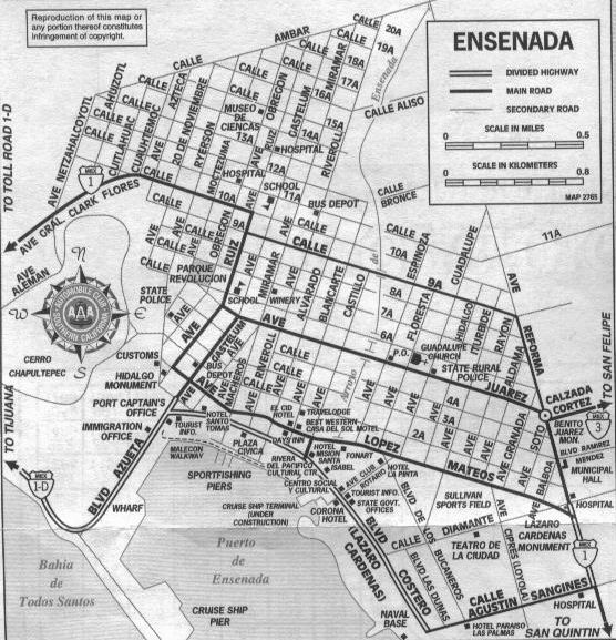
NEWPORT BEACH, CA
ENSENADA, BC
NOSA = Newport Ocean Sailing Association
nosa.org


Yacht race from Newport Beach to Ensenada, Baja California Mexico. This boat race is celebrating its 75th year in 2022.
Annual event; April
NEWPORT BEACH, CA
ENSENADA, BC
NOSA = Newport Ocean Sailing Association
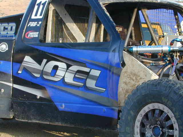
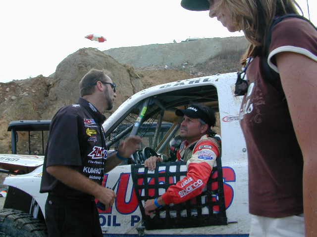
Score International holds off road races throughout California & Baja. The Baja 500 Race is epic, historic, south of the border race action. Ensenada hosts several races throughout the year. This one is held in summer and is very popular.

Annual event; June
Single loop race: 500 miles
aka Laguna Juarez, Baja California Mexico

(Laguna is Lagoon or Lake in Spanish)
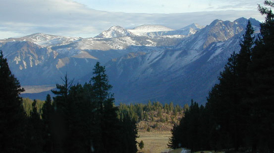
elevation: 5,500′
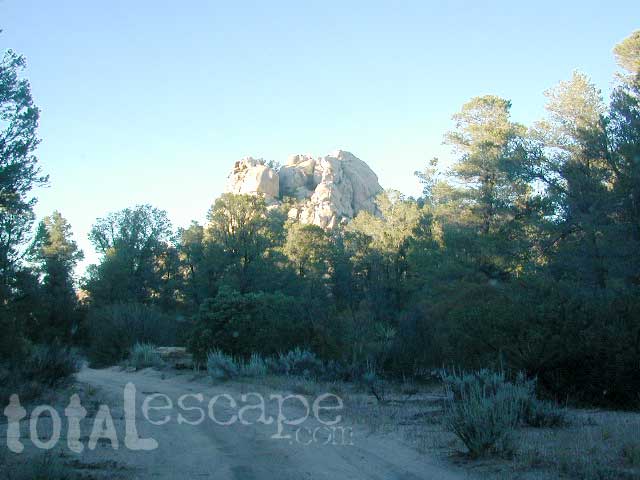
Located inside the Sierra Juarez Mountains
Parque Nacional Constitucion de 1857, or
Constitucion de 1857 National Park, Baja California, Mexico
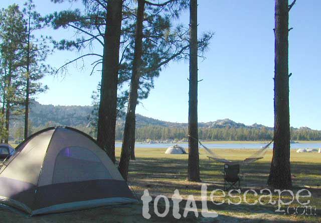
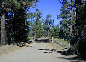
Pine forests in Baja California: Dirt roads access Laguna Hanson, so come prepared to drive many miles with dust & potholes — more than 20+ miles from the paved highway just to reach this prime high elevation destination. Since most of Baja is desert, dirt and coastline, this location is a rare treat for those wishing to travel (off the beaten path). The tallest mountain peak in Baja is nearby with the University Observatory.

 Baja Camping in the Mountains
Water levels drop well below normal & what we end up with is a shallow lake with huge boulders emerged. Kinda surreal looking. Tall pines & dense forest surrrounding lake. Wide open & flat areas perfect for biking, stargazing and group camping.
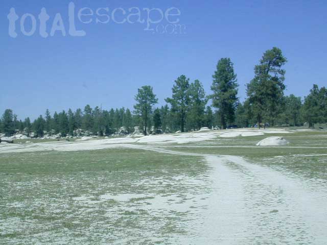
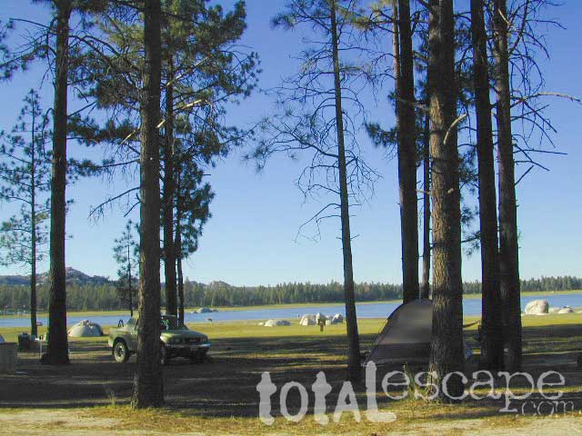
 This Baja National Park campground is more like dispersed, or open camping around lake shore. Very popular place in the summer months & if you want seclusion camp away from the lake, deep in the forest. The best quiet spots are located in the north east vicinity.
No motorhomes allowed: the road is steep, long, all dirt and narrow in certain spots.
No services at lake. Minimal camping facilities. Self sufficient campers a must.
 BRING EVERYTHING = ice chest w/ block ice, drinking water, flat tire repair kits, tow strap; extra blankets, medication, first aid kit. There is no store within 30+ miles of here, and the dirt road is very long (both ways) – so it is best to be prepared with all food and beverages.
LOCALS NOTE: An occasional rancher may approach your camp with his farm truck, selling fresh made cheese, beef jerky or other farm produce.
 No pavement, no picnic tables.
Minimal pit toilets, few rangers patrolling and rock fire rings.
CAMPERS TIP: The toilets can be nasty!! Bring a shovel and wipes; walk into the forest for your bathroom break.
See our CAMP POTTY page for pooping in the wild
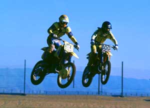
 OHV trails are nearby. OFF ROADING, dirt biking and 4×4 routes are essentially any dirt road that is within this forest; Drive slower, keep your ears peeled and watch out when they pass you, cuz they are most nimble and quicker.
No motorcycles signs are posted, but that doesn’t stop them riding all hours of the night. The mountains near Tecate and Mike’s Sky Ranch both cater to dirt bikers and tours, and are located nearby (sorta).
Park rangers & rules here are a lot more lax that in the “States”.
MAP NOTE: Google Maps has this place listed as Laguna Juarez
Long Way Down BMW Check out the Bikes!
California Scenic Drives – On a Road to Nowhere
Google Earth Community – California Motorcycle Riding Areas
Motorcycle Ride California – Tours & Trails
CA Motorcycle Maps & OHV Maps California – All Roads, All Trails
Off Road Destinations – Baja California MX Towns
California Motorcycle Events & Races
California Motorcycle Association – Racing as a Business


Topographic Maps of California Baja

BAJA MEXICO MAP
The mysterious topographic map maker, Landon Crumpton, is gone. Although his Baja Almanac book of the Mexican peninsula is still as popular as ever.

The Total Escape crew has been using this amazing topo map for Baja Mexico since our the very first excursions in 1990. Click below to read more about the famous, hard-to-find Baja Almanac publication.
Topographic Map Book of Baja California
NatGeo Baja California Mexico Maps

Obscure Books & Maps, AAA Maps of Baja

RV Camping in Baja California Mexico can be quite a challenge, especially if you do not know where you are going. Best bet is to get a good road map, and choose your destination wisely. Travel times are much longer in route in Baja than on modern US freeways, so plan accordingly. Below are some popular Baja destinations for camping, outdoor recreation, sightseeing cities, beaches & villages.