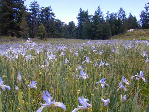
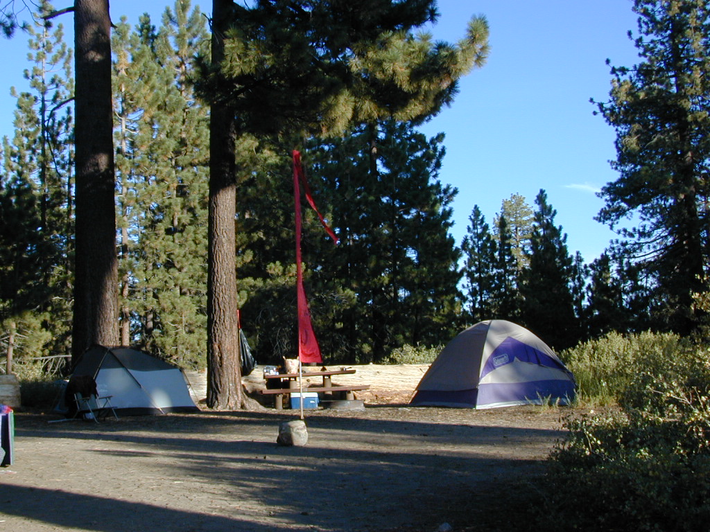
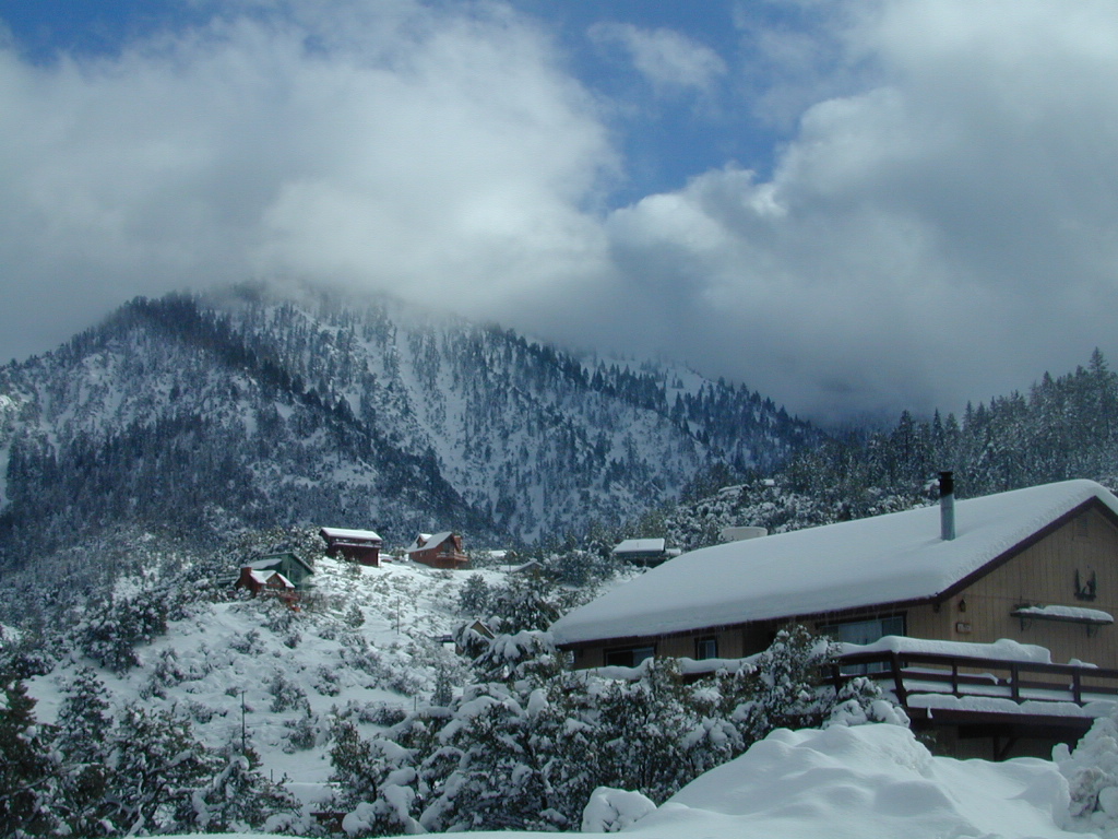
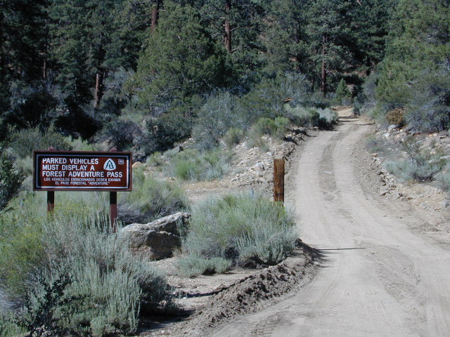
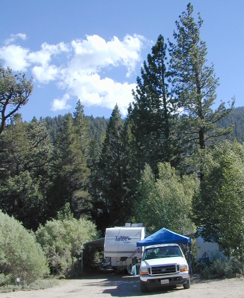
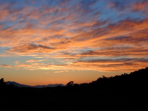
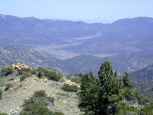
A little bit of high altitude, alpine forests in Southern Cal. Mount Pinos campgrounds are the ones on the way up to Mt Pinos 8831′ on the paved route to the top parking lot, Mount Pinos Road. Only 2 campgrounds take reservations & can be busy in summer months. Chula Vista Camp (at the top parking lot, short walk on trail) has an amazing wildflower meadow w/ group camp area. Drum circles are common on summer weekends.
backpacking
camping
hiking
mountain biking
sledding & snow play
stargazing
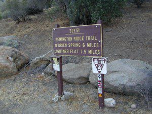
Mount Pinos parking lot is well known among RVers, astronomers & cross country skiers. If the 2 snow gates are open, you’ll find RVs camping out here until winter officially starts. The peak to peak trail from Mt Pinos to Mt Abel 8243′ starts at this parking area & trail head. Cool ski hut that no Forest Personnel every seems to be operating. Portable toilets available.
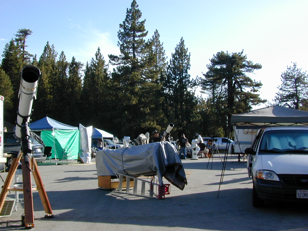
Pinos Star Party
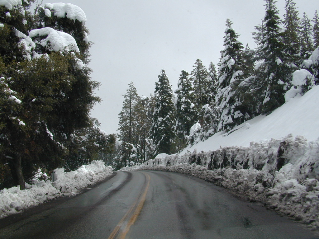
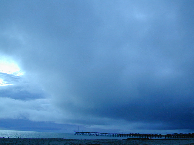
In the mid-winter, snow is almost guaranteed up here. Families & sledders flock to this region for snow play causing major traffic jams & parking problems. On the busiest of weekends w/ a recent snow storm, you may find several miles of vehicles, backed up from Pinos to the freeway (causing 10 miles of traffic jam in the mountains). It is not uncommon to see CHP managing traffic flow on the weekend. Snow play areas are located at the top on Pinos, if the gates are open.
Mil Potreo Highway, on a good winter 2005
If not the “Y” – where Cuddy Valley meets Mil Potrero Hwy. is the main snow-play destination. This is a very busy intersection at all times of the year, as it is the main route entering Pine Mountain Club, located 5 miles to the west. Be considerate! Do not litter and please park OFF THE PAVEMENT; keep kiddies, sleds & BBQs out of the road ways.
The pinyon pine forests surrounding Mount Pinos Recreation Area is Los Padres National Forest, where there is every kinda camping imaginable.
Outdoor resort communities such as Pine Mountain Club & Lockwood Valley Road are close by and surround the highest mountain peak in Kern County. Mil Potrero Campground, developed NFS Campground, open during summer only.
Rugged backpacking, or back road motorcycle 4×4 camps – with maybe one camp fire ring (still intact). Windwolves Preserve, Quatal Canyon, Cerro Noroeste, Valle Vista, Lockwood & Cuyama Valley.
BALCH PARK campground is on a first come basis; no campground reservations needed.
2021 – THIS CAMPGROUND IS CLOSED indefinitely, due to the Castle Fire 2020
Balch Park open May to October
Park info # 559 539-3896
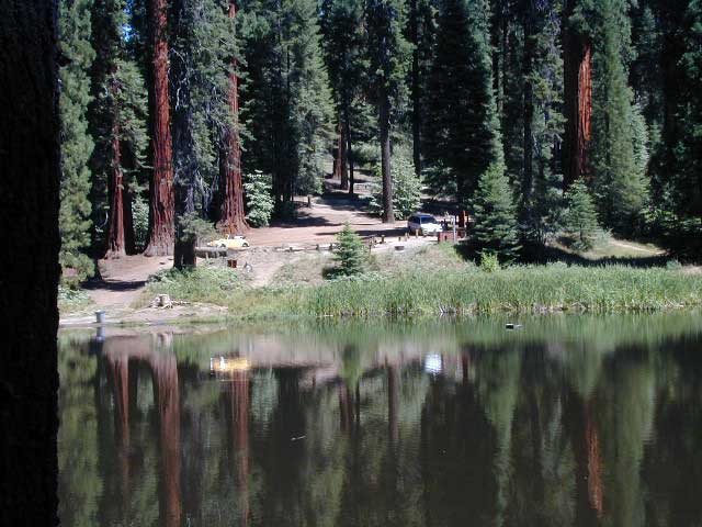
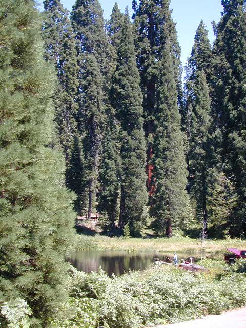
Hedrick Pond lined w/ Sequoia trees
Balch County Park is right in the middle of Mountain Home State Forest, which is within the bigger Sequoia National Forest (aka Giant Sequoia National Monument). But don’t let all the bureaucracy mislead you, this is an ideal park and location, well worth your trip. The campground is the most developed one within the area – with paved roads, RV spaces, flush toilets and a fee to go along with all that. Even gotta fishing pond.
Bears are a big deal in these neck of the woods. Please store all your food properly to avoid a un-welcomed visitor
A Sequoia Grove is nearby with plenty of creeks & meadows.
Trailers not recommended due to the long curvy road leading up the mountain.
Balch Park & Campground NOT TO BE CONFUSED with utility company residences of BALCH CAMP between Pine Flat & Blackrock Reservoirs
Rock climbing, backpacking, fly fishing creeks, snowmobiling, you name it. No matter what kind of trail you seek in California, we have the maps to get you out there, this weekend. If you seek a week long adventure in the Sierra high country, or a weekend getaway destination you’ve never heard of, or a quick after work hike near your home town, we just might have it listed. And we probably have the waterproof, topographical map too.
DOGS & BIKES on TRAILS:
Dog friendly trails include almost anything within the CA National Forests. Remember that most National Parks & State Parks literally forbid dogs on hiking trails. Mountain bikes can access only certain trails in parks, but in the National Forests nearly every trail or dirt road is up for grabs.
OHV ROUTES:
Motorized vehicles, such as quads, ATVs, dirt bikes, Jeeps & 4x4s must stick to designated routes signed specifically for OHV (off highway vehicle) & you won’t be finding many of those inside National Parks & State Parks, so it’s best to look for BLM or NF lands. Many regular, forest, back roads close in winter due to heavy snow pack & thus become cross country ski, snowshoe or even snowmobiling trails. The best ones can be found in the Sierra Nevada mountains.
And if you ever get bored with “reading” text about trails, you can always search the visual database of amazing Cali scenery over at DanaMite’s flickr site
If you’ve had it with the traditions, the big meal prep, or just sick of the family. Maybe you are a solo traveler, or a new transplant to California and need to explore more. Take a holiday away – for once this time.
Camping for turkey day? What a concept.
California is the perfect place for camping, all year long!
Stick to the lower elevations, look for canyons, and seek seclusion
California mountains often have snow during November. Avoid camping in snow @ 4000-5000′ elevation and above; Freezing temps above 3000-4000′ elevation.
Deserts, coastal regions and foothills are top choices for late Autumn car camping. Always check the weather ahead of departure, and have a plan B as an alternative. NorCal will be much wetter than the rest of the state.
MEALS: Prepare dinner meals ahead of trip departure. Bake turkey days before your trip and create meals based around that. Make mash potatoes at home and don’t forget to bring the butter. Pack pre-baked turkey for sandwiches, plus other quick snacks & meals for on-the-go travel.
Non Traditional: Seafood Feast
Desert Camping is premium at this time of year. Luckily the eastern half of Southern Cal is desert. The lower the elevation, the better the temps will be overnight. Be prepared for wind when the ‘storm fronts’ approach, the winds do get a cranking! Dirt roads can become flowing washes during a good rainstorm, so know the weather forecast.
Coastal campgrounds may need advanced reservations. Be prepared for wet weather, especially up north. The redwoods groves are gorgeous anytime of year.
Gold County Reservoirs are prime areas for relaxing in nature, while everyone else is out shopping. Oak hills, rivers and canyons. RV campers love these large lakes; boating, fishing, mountain biking trails, kayak rentals, hiking near historic Gold Rush towns.
River Canyons of California are always beautiful destinations in the autumn months with fall leaves changing color. Many campgrounds can be found at lower elevation, river access areas.
California’s abundant Hot Springs are also top picks for holiday weekends.
Anza Borrego Desert State Park is always a nice, easy and relatively close get-away for any holiday. Open camping on the backroads (for free) makes it one of the most attractive camping options in all of SoCal. Many dirt roads are accessible for passenger cars, if extreme caution is used. Don’t plan on driving more than a few miles on dirt.
froaders
Masses of off roaders love to camp out, especially on Thanksgiving weekend. Wheel all day, eat, drink, bon fires every night and rumor has it ‘they roast their big bird outdoors – deep in a dirt pit’. Really?
El Centro, Glamis, Imperial Dunes, Ocotillo Wells, Truckhaven Hills, Johnson Valley. All popular off roading areas in Southern California, so consider yourself warned.
Mojave Desert, near US Hwy 395 Jawbone Canyon expect to see RVs, toy-boxes and families outside enjoying the weekend. OHV style. Often the group tries to create a round corral with their huge convoy of vehicles, to keep thru traffic to a minimum around “their camp”. Just stay well away from those gear-heads. In general, it is a very busy area around Mojave up to Hwy 178 during the holidays. Try high desert Horse Canyon instead.
Cleveland National Forest Camping – San Diego Campgrounds – Desert Camping Anza Borrego – SD County Campgrounds – BLM Campgrounds – San Diego Beach Camping – San Diego Mountains
Indian Flats Campground is located on a dirt road off Hwy 79, near Warner Springs CA. Boulder ridges & manzanita surround this oak filled secluded canyon. Small seasonal creek & waterfall is a short walk from campsite.
Los Coyotes Campground is a tribal camp, located on Hot Spring Mountain in North San Diego County. High desert chaparral, oak groves and boulders.
Anza Borrego Desert by far has the best free camping options available near San Diego.
Maps Mountains / Desert Topo / San Diego Area Maps
Mountains of Northern California / NorCal Mountain
California sure has a lot of mountains. West Coast land is home to the tallest Sierra Nevada range, plus the Cascade range, which extends northwards to Canada. (Many of which have volcanic peaks.)
We break down all the mountainous regions in the north part of the state below w/ links, topo maps, lakes, rivers, wilderness, parks and forests. Small towns & cities are linked in red.
Sacramento River, above Lake Shasta
North Coast Mountains
Redwood forests and rivers are what make up most of the Northwest part of California, just below the Oregon coast. Logging and fishing are the big industries up here. Lumber mill towns and camps still exists today. Wilderness areas, dirt back roads, river kayaking, stream fishing, camping and real wild indians. Oh yeah, and Big Foot!
The landscape in more dramatic along the North Coast of California, as the steep rocky terrain tumbles into the sea w/ the San Andreas fault running parallel to the shore. Marine life, rocky shores w/ small towns. Del Norte County & Humboldt County. Wild rainy weather, at least half the year; fog and sun the other half.
The furthest north is Siskiyou County, which borders the state of Oregon. We have the Klamath River flowing south into California, with plenty of mountain peaks, forests and wilderness. Interstate 5, Highway 3 and Highway 96
Pacific Crest Trail passes through the area and backpacking is common (all year long). Notable spots – Klamath Knot and The Eddy’s. Prominent Mount Shasta is actually situated inside Siskiyou County, not Shasta.
Giant Mount Shasta is located inside Siskiyou County, and Shasta County & Trinity is everything located to the south of it. Interstate 5, Highway 3 and Highway 299. Recreational lakes, rivers and streams, and off roading trails.
Waterfalls, hot springs, mountain biking and stream fishing can be found within this region. Mining history and museums are primarily situated around Weaverville. Houseboats and boat rentals can be found on the big reservoirs. Whiskeytown was totally toasted in wildfire of 2018. Alpine lakes, granite spires, campgrounds and cavern tours, all located along the Interstate 5 corridor.
Beautiful park setting @ Lee Fong Park, in historic Weaverville, CATrinity River Camping, Douglas City, CA
Mendocino Mountains
Coastal mountains located above the Napa & Sonoma wine country. US 101 & Highway 20. Rivers, forests, wilderness and redwoods is the key terrain that make up the Mendocino County mountains.
There is a fair amount of off road trails and dirt roads located in and around Mendocino, so you can expect to see 4x4s, dirt bikes and toy haulers on the east side of the mountain range. The coastal side of the Mendo National Forest will have the rivers and redwood parks.
Northern Sierra Nevada mountains is where the granite rock of the Sierra meets to volcanic rock of Lassen Volcano. Butte County and Plumas County is the Feather River drainage, all flowing south from Mount Lassen.
Pacific Crest Trail is routed through Bucks Lake Wilderness and the Feather River Canyon, so backpacking is popular. Highway 70
Technically speaking, the Susan River is the top waterway of the Sierra Nevada mountains. Lassen County spans the distance from the Nevada state line, west to Plumas forest and the Feather Rivers (all 4 forks).
Lassen Peak is the middle of the National Park and the National Forest totally surrounds that. Numerous lakes, hiking trails, wilderness areas and dirt roads make up this huge forested area. Snow-mobiling is popular in winter months around the town of Chester.
The far northeast corner of the golden state is the remote cattle range lands of Modoc Country inside Modoc County. Drier than the rest of NorCal, the high desert sage brush meadows, a few lakes and pine forest mountains. Highway 299 & US 395
Small campgrounds and secluded camps, accessible by dirt bikes or 4-wheel drive vehicles. Numerous dirt roads, sand dunes and canyons to explore, some with developed campgrounds, other areas w/ primitive camping. Self sufficient campers will enjoy this list.
4×4 camping in California
Okay, you got your 4 wheel drive vehicle dirty, it is now several years old & maybe you even have a scratch or two. Now is the time to finally start using that beast for real off road adventures. The real edge-of-wilderness trips you dream about when your sitting in your cubical wondering what life is really about. Fishing, camping, off roading and enjoying nature, of course!
4×4 camping in California is plentiful. California has trails for OHV use – which means ‘off highway vehicle’, that can accommodate your machine. These remote camps are always primitive camp sites, with picnic tables, fire rings & maybe a pit toilet (if you are lucky). You can find total seclusion on these back roads & trails, well away from the developed campgrounds & RV parks.
Anza Borrego Desert 4×4 Trails – pretty much everywhere in Borrego desert is off road heaven. Minimal pavement and maximum desert means dirt roads galore, white sandy washes, slot canyons, badlands, wind caves, wildflowers, petroglyphs, boulder outcroppings, old railroad trestles and so much more. The San Diego desert elevations range from near sea level to 4000′ on the eastern slopes of Laguna Mountain.
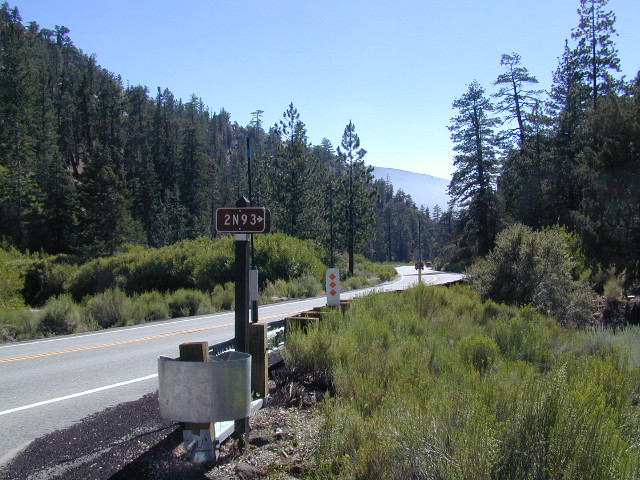
San Bernardino National Forest – has a few trail camps for 4×4 enthusiasts. John Bull Trail (near Holcomb Valley) has one real awesome camp spot with great views over the desert night lights. Holcomb Creek Trail also has a few spots near the creek. Overall this area is somewhat crowded for wheelin’ (especially on the weekends), as the population is so dense nearby.
Los Padres National Forest – the most 4×4 camping, readily accessible to Southern California. This is truly the best kept secret for Angelinos wanting an escape. The southern portion of the forests has Tecuya Ridge #9N22, with several camps only minutes from I-5. Cherry Creek 4×4 Camp, with a few other campsites tucked way back in there. Dome Springs Campground is located off Lockwood Valley Road, while Nettle Springs Campground is over near Highway 33.
Out west, Cerro Noroeste Road has the Blue Ridge w/ Marion and Caballo Camps. Red dirt high desert wash Quatal Canyon #9N09, is right next to the Chumash Wilderness.
2 OHV parks in the Los Padres Area: Hungry Valley & Ballinger both serve the off road crowds and have ample facilities, large camp spots to accommodate RVs and trailers.
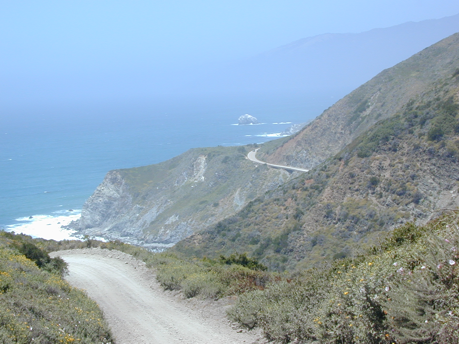
The northern section of Los Padres (near Big Sur) has plenty of dirt roads & primitive camps, but none are truly 4×4 routes, as most can be accessed easily with a passenger car. See more on Big Sur Camping and Big Sur BackRoads.
Sequoia National Forest– Southern Sierra Nevada area has 4×4 camping right along the Kern River @ Keyesville, at the junction where Hwy 178 meets Hwy 155. Also, further up the river, Forest Rd#22S82 leads to primitive Camp 4, where there are several spots near granite pools, that can only be accessed by 4 wheel drive. The Big Meadows area also has some gorgeous forested back roads worth exploring. Kern Plateau has hundreds of miles of OHV trails near Troy Meadow.
High elevation Monache Meadows is a prime fishing & hiking destination on the south fork of the Kern River, accessed by an authentic “Jeep Road”.
Sierra National Forest– central Sierra forest has plenty of 4×4 routes that lead to granite rock gardens & mighty fine, secluded, forested camp sites. Gorgeous Red Lake & Coyote Lake are popular spots that require some technical skills & much patience to access. Both are frequented by fishermen & horses. Bald Mountain trailhead has awesome creekside camps on Rock Creek. Up near Wishon Reservoir is the dead end trail of Spanish Lake. Onion Springs Meadow is awesome back behind Edison Lake. Near the granite wonderland Courtright Reservoir is the infamous Dusy Trail signed #28E34 (aka #7S32, the Dusy Ershim), second only to the Rubicon Trail for high Sierra granite.
Stanislaus National Forest– camping in the Crandall & Niagara Creek OHV section of the forest, right off Hwy 108. Elevations range from 5000′-7000′. Higher up on the other side, Levitt Lake (access road near Levitt Falls) on the east end of the mountain range, east of the Sonora Pass sign.
El Dorado National Forest – has an area called Rock Creek for off roading in the Gold Country. Plus the ever popular Rubicon Trail starts hear (near Georgetown) & leads 20 miles across the High Sierra Nevada granite slabs to Lake Tahoe. Tons of camping back here in the National Forest.
Lakes Basin Recreation Area – Northern Gold County, just above the Yuba River. Gold Lake has many campable lakes. The area sees a lot of snowmobile traffic during winter snows, but warmer months are the time for fishing and camping. Most of the big lakes have small developed campgrounds, some are minimal, or primitive style camp sites on dirt roads without facilities. Maybe a picnic table at most.
Smith Lake is a place that fishermen and 4×4 enthusiasts love. It is small, secluded and kinda hard to find. You’ll need a good topo map of the region. Situated on the border of Tahoe and Plumas National Forest off the Gold Lake Hwy (aka Road #24). The PCT cuts thru this Lakes Basin area w/ Sierra Buttes There are dirt roads and off road trails leading deep into the backcountry from the Packer Lake and Gold Lake areas. Snag Lake is a free camp right on the main road.
Snake Lake Campground has numerous dirt roads and trails leading out to Butterfly Valley. Horse campers use this popular camp spot, so no loud vehicle activity inside the campground. No shooting up the bear locker either!
Milsap Bar is a long, narrow 9 mile dirt road which leads from Bald Rock Road in Berry Creek, down to the Middle fork of the Feather River. NFS Campground on the big river without fees!
China Gulch Road #60, a very long and winding dirt road, leads from Oro-Quincy Highway down to the Little North Fork. Although the NFS Campground is closed due to a landslide (1 mi before camp) there still is primitive camping at the second bridge. Be warned: the campsite at the first bridge is often over run with giant, juicy slugs at night.
Out there east of Quincy, somewhere off the historic, long and winding La Port Road, a few decent 4WD trails thru forest, access ridge lines or the big river below. Great fishing, amazing scenery & very secluded.
(north of La Porte Road)
– Feather River access
@ Cleghorn Bar Campground, 4 campsites (Road #23N24)
@ Stag Point Campground, 5 campsites (Road #22N80Y)
@ Hartman Bar NRT to Dan Beebe Camp (Road 94 to #22N42Y)
(south of La Porte Road)
– Poker Flat Camp near Sawmill Ridge & Table Rock (Road 800)
Sly Creek Reservoir is a super popular NFS Campground with trailheads and dirt roads leading deeper into the forests. The camp area is a favorite amongst the off roaders and dirt bikers that migrate up to the mountains for the weekend, to escape from the heat of the summer in the Sacramento Valley. LGVR is another body of water back in these parts and is more scenic and peaceful than the Sly Creek.
This coastal range is dirt road heaven, graded dirt roads, ridge routes, hiking trails, equestrian trails, big lakes, small lakes, creeks, meadows, forests, wilderness and 4×4 routes. Snow can be the most fun and challenging for the 4WD crews. Mud, snow, some road closures seasonally.
2019 WILDFIRE: Ranch Fire – wiped out most of this area. South of Snow Mountain Wilderness, plenty off road trails leading to peaks and ridge lines. Numerous small campgrounds to choose from, trailheads everywhere, acres and acres of wild mountainous areas, and a lake resort nearby. Lake Pillsbury is kinda the center of all the 4×4 action in Mendo.
Fouts Springs – Numerous NFS Campgrounds catering to the off-road types a portion of the year, but mostly quiet other times.
Heart Bar to Big Bear Lake, via the dirt road
San Bernardino National Forest
Big Bear Back Roads
Highway 38, East of Heart Bar @ Road #1N02
Southern California
alt big bear
This 8 mile long forested, dirt road begins right off Hwy 38, just east of Heart Bar Campground and is an easy turn to miss. One tiny, brown sign is all that is found (on the guard rail). Driving too fast, you are bound to miss it.
The unimproved route heads north through the National Forest, up and over and around SugarLoaf Mountain (elev 9952′), then down to the Big Bear Lake region.
Several primitive sites – yellow post camp sites – can be found way back in here, but you might NOT be able to have a campfire (depending on fire restrictions). Check w/ local rangers before you head out.
Forest roads are often closed (gated) during the winter, when snow and rain make a muddy mess of the terrain. Rock slides are also common in wetter months. Call the local rangers to inquire on road conditions or if this route is open.
The whole Big Bear Mountain area is a SoCal favorite forest destination, for weekenders and travelers alike. Mountain biking, hiking, backpacking, horseback riding, camping and 4-wheeling.
Plus the recreational lake is full of more water recreation w/ tourist shops and restaurants. Stay away from the crowds and take the back roads for adventure and recreation. Spend less money, stay outta town and camp for free.
Yosemite is a top destination, all year long. California masses converge on the sacred valley each summer, so expect more as the buses keep rolling in. Plan a Yosemite trip before Memorial Day weekend – or after Labor Day weekend, for less people.
Camping close to Yosemite National Park without being inside the park boundaries. The scenery and wildness doesn’t stop in the back country. There are numerous National Forests surrounding the popular National Park, so much public land has been set aside for these recreation purposes. Granite-lined mountain meadows, dense forests, raging creeks, wildlife and real seclusion. Plenty of great paved back roads, dirt roads and camping options in the Sierra Nevada.
No campground reservations needed, cheaper fees (or free), less crowds, less noise. More freedom, more privacy, more nature.
Hundreds of developed, small campgrounds can be found around Yosemite. A few private RV resorts, cabin rentals, lodging on the main highways. Primitive style camping is considered “camping outside of developed campgrounds”. USDA National Forests usually allows open-camping within the forest boundary – with a required camp fire permit. Sometimes wildfire danger is too extreme, so they often ban campfires in dry conditions.
Gold Country Foothills – listed below are valley reservoirs. Oaks, dry hills, which can can be super hot in summer. Boating, camping and water recreation can be found at most Reservoirs, out in these parts.
Tioga Pass on Hwy 120 (elevation 9410′) is only open during summer months. Generally June through October. Always check road conditions before your trip.
Camping Hiking Lakes @ Tioga Very high elevation meadows, aspen groves, snowmelt lakes. Just east of Yosemite National Park border, near the EAST GATE, inside Inyo National Forest
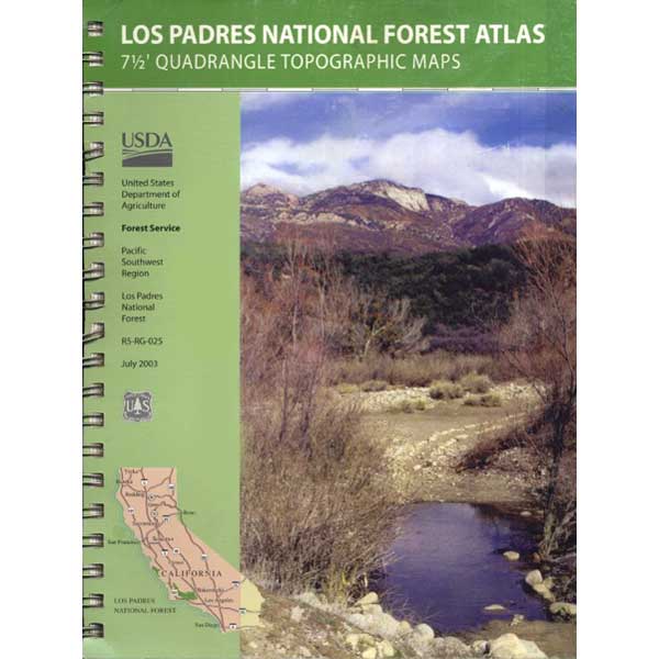
7 minute QUADS (topo maps) inside a spiral bound book. Covers both north & south part of Los Padres National Forest. This map book can be found at ranger station – Los Padres USFS or click the book above to take you to the Total Escape Map Shop!
Waterproof plastic map; USDA National Forest Service Maps
Inyo Forest Campgrounds – Eastern Sierra Campgrounds
areas include: Lone Pine, Mount Whitney, Independence, Onion Valley, Ancient Bristlecone Pines, Big Pine, Bishop [Hwy 168], High Sierra, Owens River, Lake Crowley, Rock Creek, Mammoth Lakes [Hwy 203], June Lake Loop [Hwy 158], Lee Vining & East Yosemite National Park [Hwy 120]. Camping on Eastern Sierra Highway 395
Eastern Sierra recreation – backpacking, horse packing, day hiking, creek fishing, mountain biking, mountaineering, rock climbing
Listed below are Inyo National Forest campgrounds, County Parks, BLM public camps for outdoor recreation. Many campgrounds are closed for winter months. Blue links lead to more camp information. Boldface links to detailed information & photos on campground.
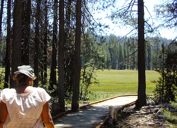
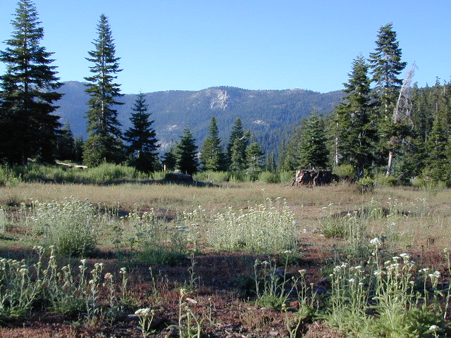
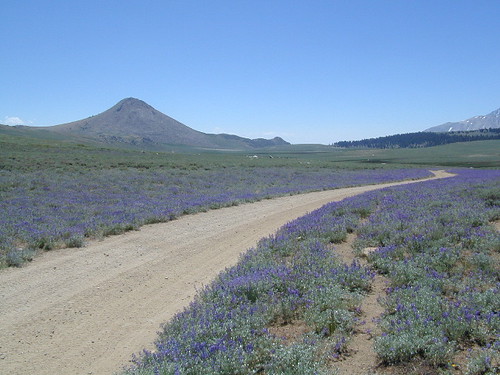
California meadow is a common term people search for when dreaming of their mountain retreat vacation or upcoming weekend camping trip.
Meadows are places in the forest where cool air collects and settles. Deer among other wildlife, can often be found here grazing around dawn and dusk. Alpine meadows are usually surrounded by trees with lush green grasses, located at higher altitudes above 6000′ – the ‘highcountry’ as most like to say.
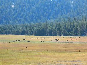
Find meadows on National Forest lands from 3000-10,000′ elevation, and it is not uncommon to see cattle grazing in these same regions. California National Parks have some of the most protected meadows in the golden state!
MT SAGE – mountain sage meadows
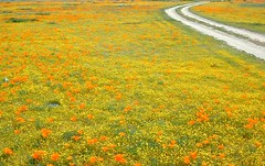
High desert mountains have drier landscapes, with large sage brush meadows surrounded by sparse pinon pine and/or juniper forest. The Mojave desert’s sagebrush reaches out westward to the peaks of West Kern County. High deserts and mountain meadows can both have significant wildflower blooms. The deserts start to show color in March & April, while the highest elevations of the Sierra Nevada can bloom as late as July & August. All California Wildflowers depend on autumn seasonal rains & snow melt.
Kennedy Meadows from Bald Mountain Fire Lookout
Wilderness Meadows
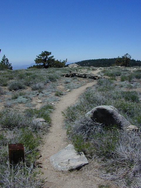
The best places to find secluded wildflower meadows is on the high country trails of various mountains – Mount Pinos, Sierra Nevada, Shasta, Trinity & Lassen – all have marvelous meadows, some have easy access w/ parking nearby and others are hike-in only. Locate hiking trailheads for meadows and possibly find camp nearby.
Excellent near Meadows:
Stargazing, Wildflowers, Wildlife Viewing, Horse Camping
Explore dirt back roads of California to find your very own meadow. If you would like to explore at this level, a good topo map is highly advised. The Sierra Nevada mountains have the most beautiful meadows in the state (by far). Their scenery w/ granite outcroppings and wild flowers, surpasses all else. Although on rare occasions, even the Antelope Valley can look amazing — with poppies.
Mountain Meadows are sacred spaces: Do not disturb the lush, grassy landscape, as wildlife rely on these areas for survival.
No driving on meadows. No camping on meadows; No Campfires; Camp next to (or nearby), but not on top of the meadow. Picnicking should be kept on the sidelines.
Stay on designated dirt roads: No tires across the meadow; No mountain biking, No dirt bikes, No off roading. You’re not spreading the seeds, you’re destroying a fragile ecosystem.
Ranch FENCING w/ barbed-wire is quite common around meadows, to keep cattle out of certain problem areas. Fences also help keep the wandering public out of private lands or sensitive areas.
When hiking – stay out of the muddy spots and know that if you choose to hike directly across meadow, you may encounter water and deep, sinking mud. HINT: There is usually a shallow creek running through most meadows, during all times of the year.
Winter snow usually blankets these fragile areas in winter, and when deep enough – making this terrain prime destinations for snowmobilers.
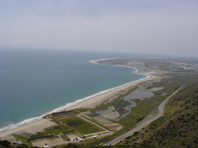
North of Santa Barbara, CA East of Santa Maria, CA South of New Cuyama, CA West of Ventucopa, CA
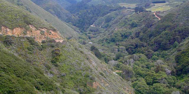
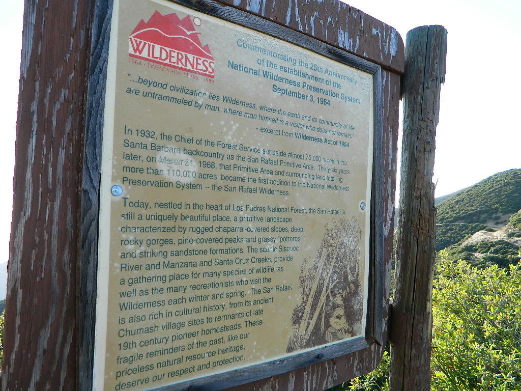
San Rafael Wilderness is otherwise known as the Santa Barbara backcountry. The Sierra Madre mountains and San Rafael mountains make up the this chunk of wilderness, a vast open space near the coast – which extends from Lake Cachuma to the Cuyama River Valley. This is the southern ridge line along Highway 166, with few pine trees, mostly oaks, leading west to Santa Maria River.
Figueroa Mountain and Lake Cachuma are to the south near Santa Barbara. Vineyards and wineries skirt the western hills of Santa Maria, cattle grazing, oil fields and agriculture line the northern borders near Cuyama Valley. Dick Smith Wilderness is just to the east a little bit, spanning over toward Hwy 33.
OHV: better known as off-roading and dirt biking is common in the foothills behind Santa Barbara, as well as on the west side of the San Rafael Wilderness, near Miranda Pine and Tepusquet Road. Numerous small campgrounds on dirt roads are positioned around the perimeter, but no OHV trails lead into the wilderness areas.
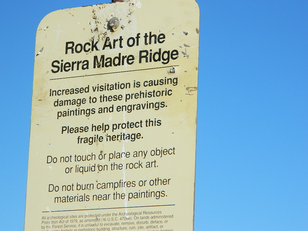
Native American petroglyphs can be found in this remote region of Central California, but may require topographic skills, detective work, trekking and at least a full day of physical action.
Access to ”Painted Rock” on Sierra Madre ridge is hike/bike in only. The dirt road that access these trailheads are rough road and not maintained. High clearance may be needed. This day trip is an all-day adventure and you might want to consider bringing the mountain bike. Just stay on the road, as rangers will ticket for riding in the designated Wilderness Areas.
from the west – If you plan to visit the rock art from the west side, take Cottonwood Canyon (small sign) turn off of Hwy 166. Pay attention to private property signs, cuz the locals are serious about their lands. Keep on driving up the mountain. Above Bates Canyon Campground up on the ridge, turn left, east on dirt road #32S13 – proceed several miles to the dirt parking area at the pig pen w/ locked gated and signed trailhead.
from the east – dirt road hike is about 10 miles (one way) and it starts at the Santa Barbara Canyon trailhead @ locked gated. Rural back road access requires a good topo map. Find Cuyama River @ Hwy 166, take the route on west side of bridge. East of New Cuyama, CA
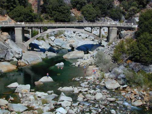
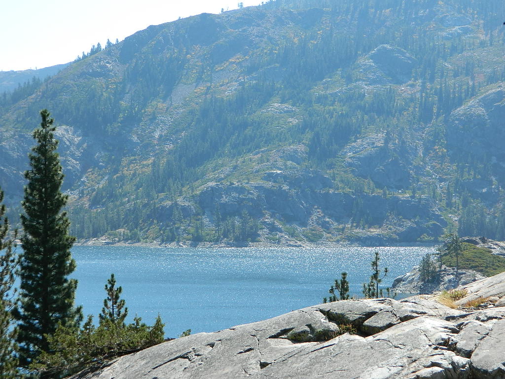
Yuba county, city and river are located in the upper Sierra Nevada, north Gold Country. Only a few small towns around here, but lotsa National Forest land and gorgeous granite rock. Yuba City is well known for its orchards, agriculture and diverse population. Yuba River is a recreation hot spot most of the year – spanning from the foothill canyons up to higher elevation alpine lakes. Camping, kayaking, fishing, camping, hiking, swimming holes & waterfalls.
Most of us want to dunk ourselves in a cool mountain stream when the temperatures get beyond 100 degrees, which is summer months in Central California. Big rivers, like the Yuba are popular spots for all kinds of outdoor recreation and they really draw the crowds. Find your own piece of solitude by getting a good topo map of the region and exploring well away from the main road.
This Yuba River gold country region of the Sierra Nevada mountains, is only about an hour drive up the hill from Sacramento; obviously, the further you drive the better it gets. Tons of one lane and dirt roads to explore. Fishing and camping almost everywhere.
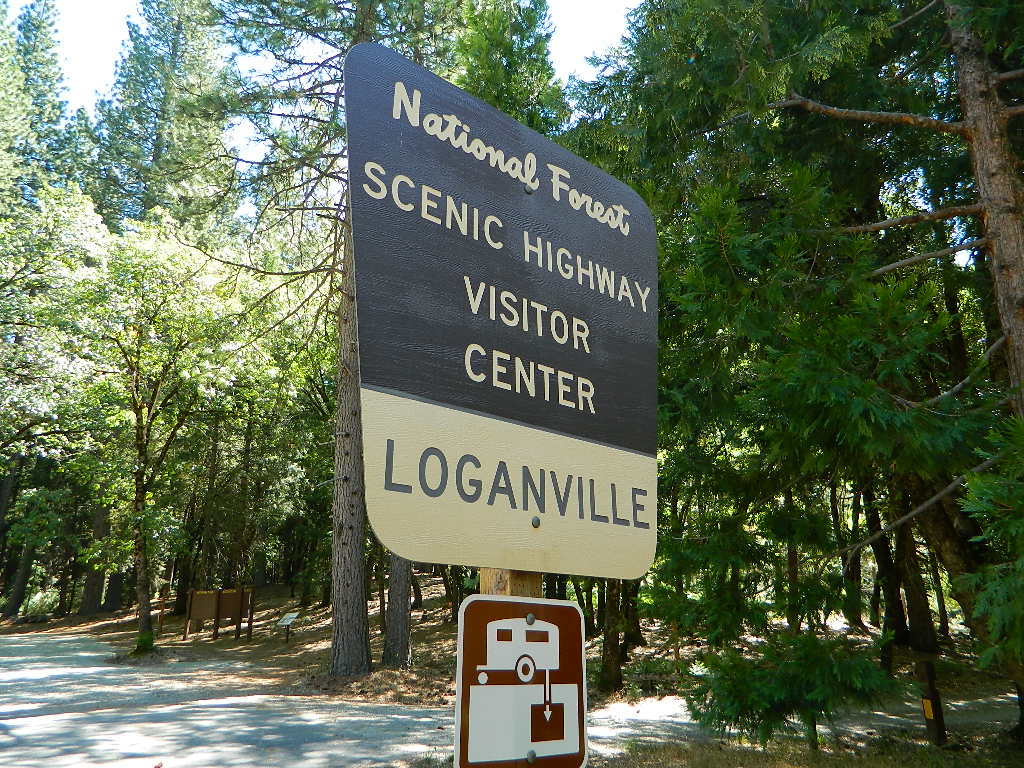
Loganville CampgroundIndian Valley Campground, Tahoe National Forest
Several NFS Campgrounds, line the North Yuba River right along the Highway 49, between Bassetts and North San Juan, CA
Wild Plum Campground
Loganville Campground
Union Flat Campground
Cannon Point Campground
Ramshorn Campground
Rock Rest Campground
Indian Valley Campground
Fiddle Creek Campground
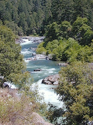
MIDDLE FORK of the YUBA
This water comes from the rugged and remote Henness Pass area. The long, dirt, historic route Road 293 which connects Reno, NV to the old mining camps along Highway 49 @ Camptonville, south of Downieville.
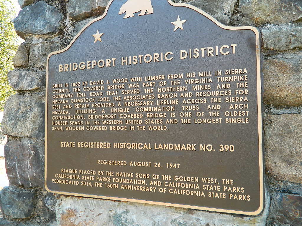
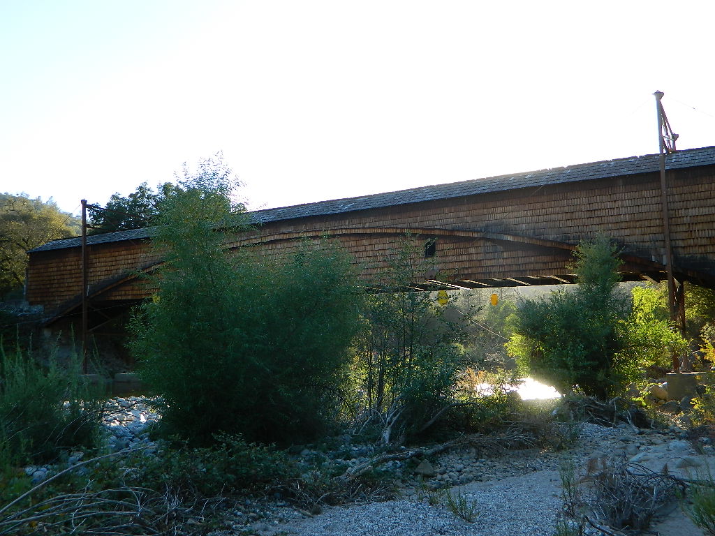
The Oregon covered bridge and the Bridgeport covered bridge run along this fork of the river. There is another State Park down @ Bridgeport; although bridge may be in reconstruction 2020.
A nice place to dip into the this fork of the river – is right off main Highway 49 on Moonshine Road, a secondary road that leads over to Bullards Bar Lake. Minimal parking spots and a steep hike down to the river; and you may have the whole place to yourself (on a weekday morning.)
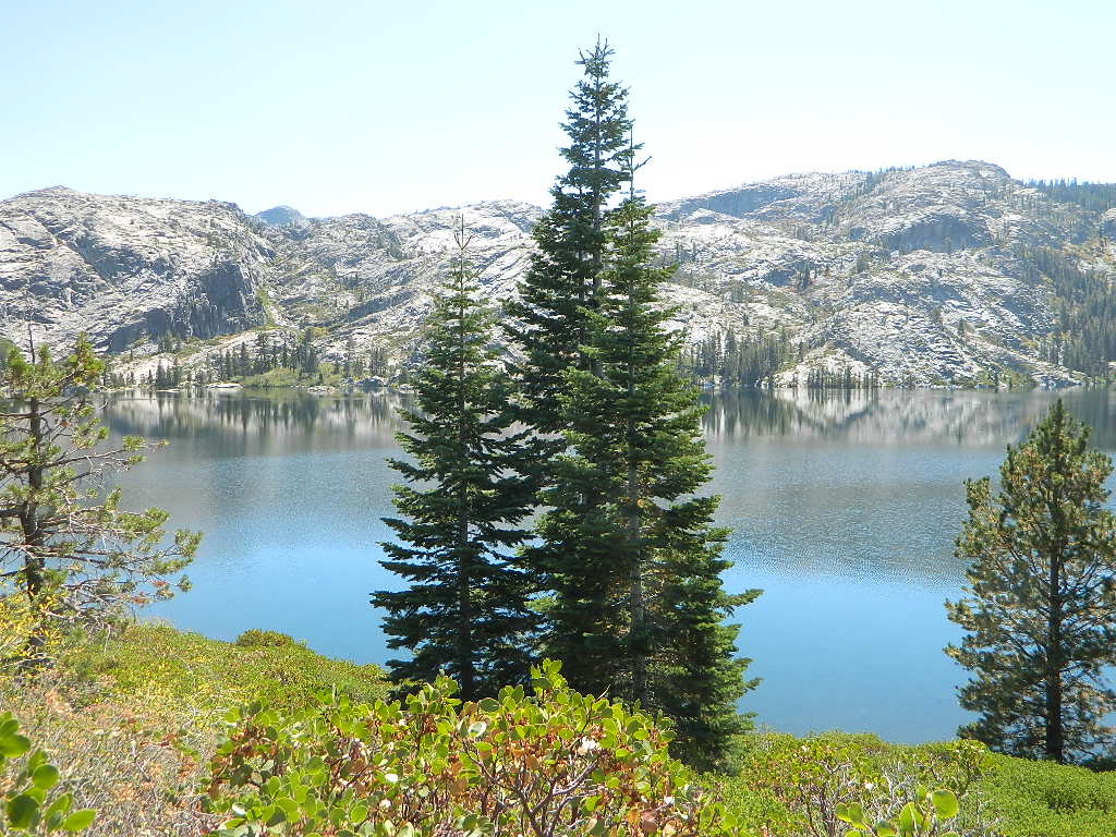
SOUTH FORK of the YUBA
Donner Pass in the Truckee region, North side of Interstate 80. Snowmelt becomes creeks, around alpine lakes like Spaulding, Bowman, which all flow west. Graniteville & Washington, CA
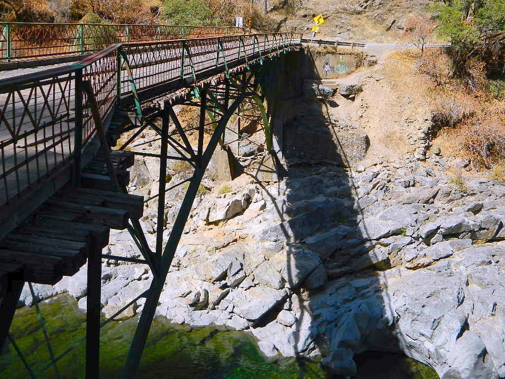
Edwards Crossing from 1898
A very popular State Park for South Yuba is located along Hwy 49, north of Nevada City, CA. Many backpacking trails, mountain biking trails and day hiking trails, plus several old bridges (crossings), built before 1900 still exist and in use. Bureau of Land Management has the quietest and cheapest developed campground around these parts, accessible only by dirt road (North Bloomfield Road).
Few National Forest Campgrounds are located on the South Fork. Many scenic, small lakes exist up in these higher altitudes, where the best camping is. Granite peaks, numerous creeks, forests and gravel roads.
Big Bowman Lake
BEAR RIVER, Lake Faucherie, Sawmill Lake and Bowman Lake are all part of this Yuba watershed, along with about a dozen other lakes. Rugged granite gravel rock rocks will lead deep into these areas. 4WD or high clearance vehicle may be needed to reach these destinations.
The whole region gets buried DEEP feet in snow, so access is usually limited to summer and autumn only.
Mountain biking has become a popular sport especially in California. We’ve got so much great terrain, so close to home (the urban sprawl), that this outdoor hobby is bound to get you back in shape, fast. Start slow to avoid burnout and injury. The weather is awesome, just go. Plan a camping weekend & bring your bike!
Obvious (but humorous) information on bike riding or mountain biking in Sequoia NP. Upon doing research for this page, noticed a heck of a lotta folks typing in the phrase
Sequoia National Park Bike Trail
I laugh…. but plenty people are searching for bike trails near Sequoia groves, inside the most protected of lands, the National Parks.
Firstly, most National Parks in California do not allow bikes on hiking trails. The Sierra Nevada has NO National Parks that allow mountain biking on their trails. (official words are: Biking is allowed on the main roads in the parks but is prohibited on park trails.)
Yuk. Who wants to ride on asphalt in the wild?
Yosemite & Lake Almanor both have nice paved bike paths. But you may want dirt trails for biking. Be it mellow mountain biking on forest roads, or the hard core Downie-droppers.
California Wilderness Areas are the same rules, but even tighter. So that brings us to Sequoia National Forest. Yes, indeed California National Forests allow mountain bikes on most trails, in most cases. The popular trails might even get small brown signs showing bikes that are allowed.
Second, there are no bike rentals inside Sequoia National Park (or Kings), so you must bring yours in, or better yet ride in. I dare you. Although you cannot take said bike on a dirt trail, so you’ll need to stick to pavement only. The main highway (Hwy 198) has got to be one of the curviest, narrow, fern lined ridge routes of the region. You would be a fool to ride this area, as a senior citizen w/ a 40 foot motorhome or a speeding SUV may take you out on a curve. Seriously! You better be in great shape if you plan to descend into Kings Cyn. That route is just as dangerous if not more so. These 2 National Parks – Sequoia & kings, both get a lotta traffic. Year round.
Thirdly – here is the biggest tip of the whole topic. In between Kings Canyon & Sequoia National Parks is a slice of Sequoia National Forest land. (Meaning you can ride bikes or mountain bikes here) Most call it Big Meadows Road # 14S11 & there is plenty camping all down this road – 12 miles with spur roads in every direction. A nice chunk of forest with rocks, meadows, camps & dirt roads. Granite & great scenery. What more could you ask for? More forest roads than single track trails tho and please watch for equestrian traffic. The dead end of this road leads out to 2 Wilderness areas, so be prepared to navigate with a good map in hand. No bikes are allowed in the Wilderness, remember?
Spicer Meadow Reservoir & more lakes: Paved Forest Rd #7N01
Spicer, Utica & Union Reservoirs, Central Sierra, Stanislaus National Forest
Stanislaus National Forest
North Fork of the Stanislaus River
Highland Creek
Carson Iceberg Wilderness Area
Spicer Meadow Reservoir (6418′ elev)
Union Reservoir (6850′ elev)
Utica Reservoir
Spicer Meadow Reservoir can also be found on various publications, listed as Spicer Meadows, Spicer Mdws, Spicer Lake and Spicer Reservoir.
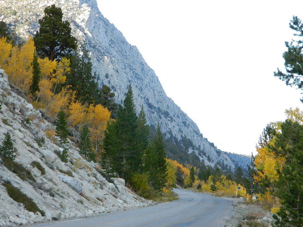
Ebbett’s Pass is California State Route (SR 4) Highway 4, which cuts thru the middle of the Sierra Nevada mountains (east-west). Wilderness peaks and rivers surround this whole region. Deep snow pack is common, so much of this region is off-limits half the year (or more). Always check with local rangers by phone before venturing out, as winter conditions can keep these roads closed late into the year.
N of Arnold, California; Continue up SR 4. Passing Calaveras Big Trees State Park & Camp Connell; After Big Meadow Campground, take the paved right turn for Spicer Meadow; This is forest road 7N01. Meandering thru a forest and descending in elevation, road will dead end at Spicer Reservoir.
7N01, the main paved mountain road, is located on the south side of the highway. The highway turn off reads ‘Spicer Reservoir’. Suitable for travel w/ RVs and trucks with boat trailers. Quite curvy, scenic and about 7 miles long. There are developed campgrounds in the vicinity.
The dirt side roads off the pavement can be narrow, muddy, rocky and overgrown, so be cautious when exploring. Choosing a dispersed camp site should be done during daylight hours, and will require a campfire permit ahead of time. Use an existing camp site whenever possible, instead of creating new ones.
Several man-made reservoirs attract outdoor seekers, mountain bikers, campers, canoes and fishermen. Kayakers tend to love Union and Utica, but power boats and sail boats prefer Spicer Lake.
Volcanic features mix with Sierra granite in this part of the forest, and geologic formations make for interesting hikes. Mountain biking is common around these lakes, as well as day hiking and backpacking.
NFS Campgrounds in the region:
Stanislaus River Campground
Spicer Campground
Spicer Group Camp
Campgrounds only open June-September. Some campsites at the campground are wheelchair accessible. Boat ramp located near campgrounds.
Left fork turn off, Dirt Road #7N05 leads out to Utica & Union Reservoirs. Granite rock, alpines lakes w/ forests surrounding. No motorized boats allowed on those two lakes. Very popular among the stand up paddlers (SUP), all kayaks and canoes.
No developed campgrounds back that way either. No flush toilets, nor paved roads. No flat RV spots; only primitive style camping. These 2 scenic lakes get crowded during summer weekends, so opt for a mid-week stay if possible.
Another dirt road treks steeply up the hill from Union Reservoir to Lake Alpine (at the highway). That primitive truck trail is actually a (somewhat designated, but not well-signed) 4×4 route and suitable for high clearance vehicles only.
Spur Road #7N29Y is another small dirt road which leads a couple miles into the forest, over to overgrown trailheads and primitive camping options. Ideal for accessing all the lakes (on foot) from this prime location. A camp fire permit is required. No water, no bathrooms, no facilities, no garbage services.
7N01 – Los Padres NF
There is another USFS Road in California named 7N01, but that one is a 4×4 OHV access route @ Dutchman Campground, located in South Central California; the southern part of Los Padres National Forest. We have mention of it on the page for Frazier Park Camping.
One of the most remote & biologically intact watersheds left inside California. The headwaters of the Salmon River flow from the Trinity Alps, Marble Mountains, and the Russian Wilderness Areas. 850,000 acres of Wilderness surrounding the Salmon River watershed.
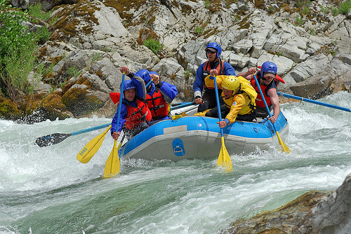
You gotta know how to read a map if you wanna find this hidden gem. For those who love seclusion! This NorCal river region is a prime destination for true nature lovers: campers, hikers, fishermen, river rafters, river kayakers, mountain bikers, backpackers, birdwatchers and horse enthusiasts. Summer is the busiest time and of course, the best weather. The remainder of the year, you’ll basically have the place all to yourself. Winters can be wet and sloppy, so don’t get stuck in the mud. Cell phone reception is minimal in these densely forested backwoods.
Rafting, river beaches, kayak spots. Campground camping, RV camping, tent camping, primitive and wilderness too.
A significant part of the Klamath River’s watershed is in the Karuk Tribe’s Ancestral Territory. Karuk Indians have carefully managed their lands through an integrated continuum with the aquatic and terrestrial ecosystem functions for thousands of years. Salmon, or “Ama” in the Karuk language, was a major source of food and spiritual renewal.
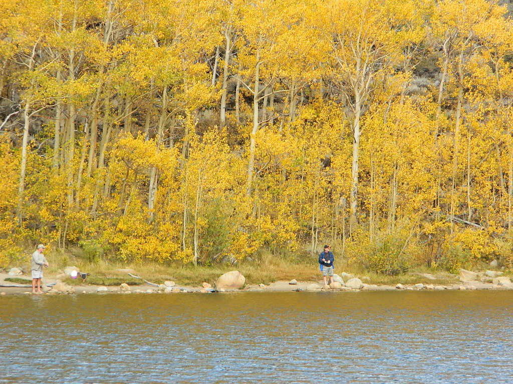
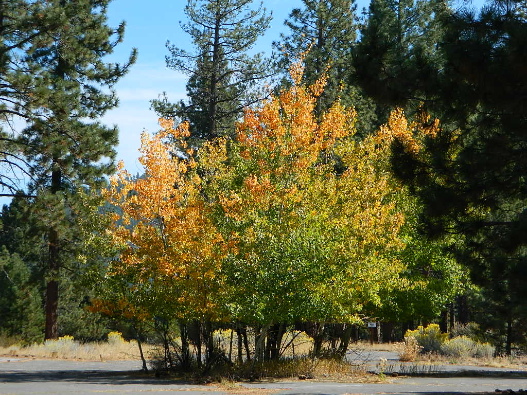
Amazing autumn colors can be found through OCTOBER and NOVEMBER in California, but you’ll need to leave the city in order to find the very best colors and scenic beauty. Fall season happens quickly (within weeks) in the high country and slower (months) in the lowlands. Plenty canyons and parks in the urban centers have hiking trails thru some nice trees, but nothing compares to the backroads, creeks and rivers of the big mountains.
Elevations, the higher the better, is where you’ll find the real displays of color. Aspen groves can be found along mountain slopes, creek canyons from 5000′-10,000′ in elevation. Cottonwood trees are found in the drier regions, in ranching areas and in desert canyons – up to about 6000′ elevation. Aspen trees start to turn yellow as soon as the chill of nights drop; if the temperature shift is subtle, the aspen leaves become more orange as the days go into the fall season. If an early snow or freeze happens, just one night, the glorious foliage becomes dead brown crispies dangling in the wind.
CAMP FIRE RESTRICTIONS are still be in place from the dry summer, and now comes the autumn winds. Any decent amount of rain can change the fire burn status, so make sure to check with the rangers for up-to-date fire info.
Best Autumn Campgrounds in California
Many of these campgrounds are located in or near aspen groves & are simply spectacular during the fall months. Some may be located near alder groves. Maple trees located along rivers turn golden between September and October.
Higher elevation (7000′-9000′) colors will change faster and earlier in the year (as soon as September), whereas the lower countryside may wait until late October.
Pack warmly, cuz the cooler temps at night (20-30 degrees) is what makes these awesome, little autumn leaves change colors. The change can happen very fast (in days). When the early season snows move in – usually a minimal dusting by October, fall colors can fade fast.
The North Sierra Nevada Mountains covers the region with Lake Tahoe and Donner Pass, and north Gold Country. River canyons with fall colors include American River,Yuba River, and the Feather River.
Aspen Group Campground
@ Jackson Meadows Reservoir
near Truckee, CA
Berry Creek, CA
Milsap Bar, Middle Fork of the Feather River
Bucks Lake, CA
Haskins Valley & Grizzly Creek Campground
Oro-Quincy Highway – Plumas NF
The Eastern slopes of the Sierra Nevada is the ‘place to be’ for Autumn Colors in California. The dramatic desert meets the tallest granite peaks. Every canyon is a different scene, many lakes lined with aspen groves, some have a creek with aspens.
Aspendell, CA
North Lake Campground
Lake Sabrina Road
Bishop Pass (high country hikes)
Lee Vining, CA
Lee Vining Canyon / Hwy 120
One of the biggest aspen grove canyons in the state of California.
NFS Campgrounds in Lee Vining Canyon: Big Bend, Aspen Grove, Boulder, Moraine, and Cattleguard Campground.
NFS Camps @ Yosemite’s EAST GATE (9000′ elev): Ellery Lake, Junction, Saddlebag Lake, and Sawmill Campground.
Impressive Rock Creek Road #4S12 in Rock Creek Canyon, one of the very best “Scenic Autumn Drives” in the whole Eastern Sierra. Numerous NFS Campgrounds on this road; many of which close for the season, just about the time then fall colors peak.


 Motorized vehicles, such as quads, ATVs, dirt bikes, Jeeps & 4x4s must stick to designated routes signed specifically for OHV (off highway vehicle) & you won’t be finding many of those inside National Parks & State Parks, so it’s best to look for BLM or NF lands. Many regular, forest, back roads close in winter due to heavy snow pack & thus become cross country ski, snowshoe or even snowmobiling trails. The best ones can be found in the Sierra Nevada mountains.


 Redwood forests and rivers are what make up most of the Northwest part of California, just below the Oregon coast. Logging and fishing are the big industries up here. Lumber mill towns and camps still exists today. Wilderness areas, dirt back roads, river kayaking, stream fishing, camping and real wild indians. Oh yeah, and Big Foot!
 The furthest north is


 Coastal mountains located above the Napa & Sonoma wine country. US 101 & Highway 20. Rivers, forests, wilderness and redwoods is the key terrain that make up the
 Northern Sierra Nevada mountains is where the granite rock of the Sierra meets to volcanic rock of Lassen Volcano.
 Technically speaking, the Susan River is the top waterway of the Sierra Nevada mountains.


 Gold Country Foothills – listed below are valley reservoirs. Oaks, dry hills, which can can be super hot in summer. Boating, camping and water recreation can be found at most Reservoirs, out in these parts.


 Eastern Sierra communities include:


