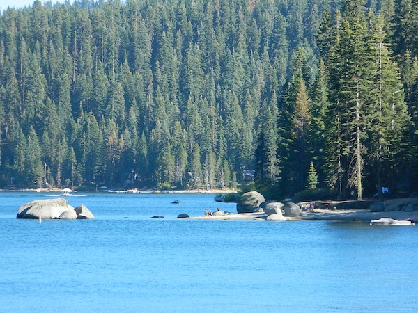
Indian Rock is a beach (day use only) on the west side.
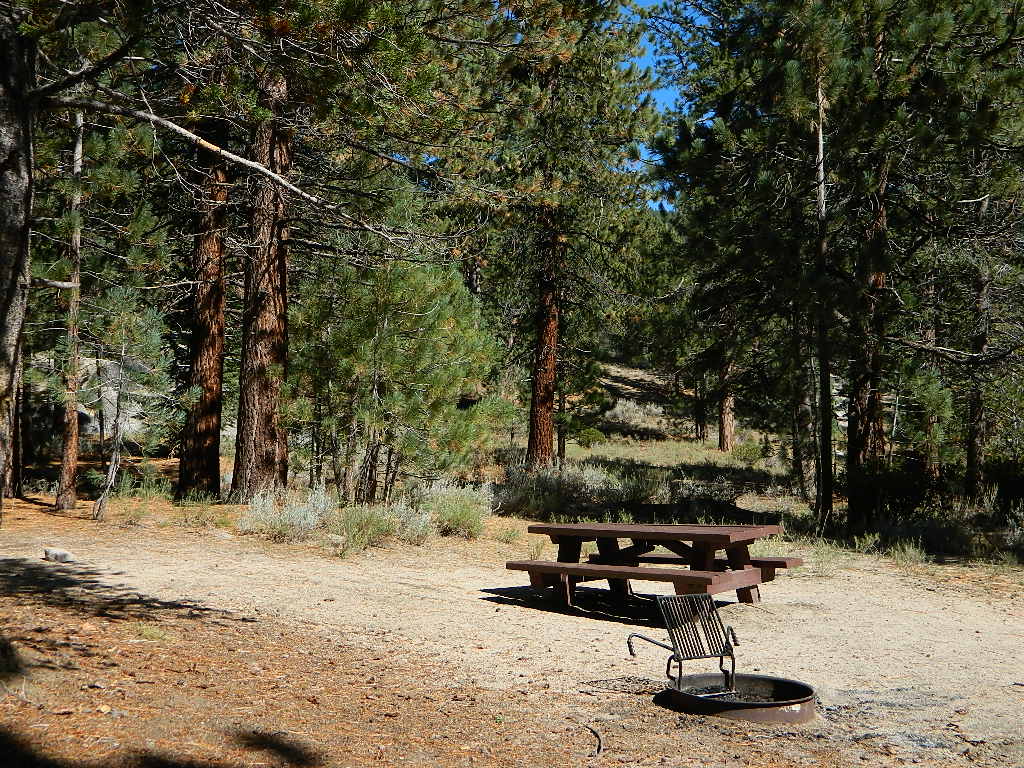
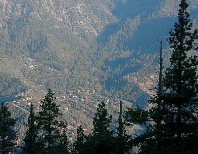
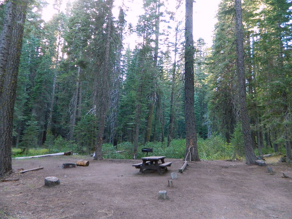
Bucks Lake, California
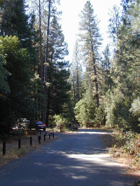
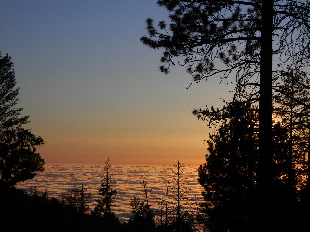
Below is a list of all the developed campgrounds & RV Parks surrounding the Bucks Lake region of Plumas National Forest in the Northern Sierra Nevada mountains. The infamous Pacific Crest Trail (PCT) runs through Bucks Lake Wilderness, so there are also trailhead camps and backcountry camp sites that are not in this list. This high elevation region closes the campgrounds for winter: NOV- APRIL
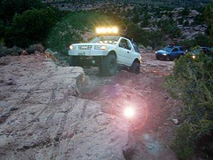
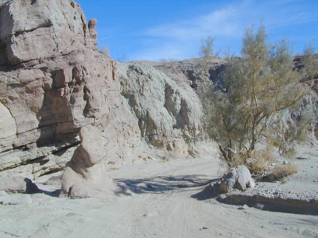
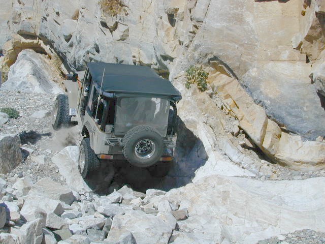
When people hear the phrase “off road” a hundred things can come to mind. Granola types envision rednecks, guns & beer cans tearing up the wilderness; while teen boys may like dirt bikes or motocross races; your co-worker digs the rock crawling rigs (on TV); your lesbian pals like to do desert & ghost town exploring in their Jeep & a million families like to camp out with RV & toys in tow. The quads, the sand rails, the rock crawling machines, the custom built buggies. Trophy trucks, rally racing Subies, 4WD camper vans, dirt bikes, the standard stock SUV, some w/ 4-wheel drive and who can forget the ever-freaking-popular jeaps. Sunday drivers sightseeing or hard core dare devil racers can be found in the realm of off-road: Off pavement.
They are ALL off roaders! And they are all unique, custom & no two created equal. There is certainty of it & the passionate fans will tell you. The off roading interest has gained popularity as more & more recreation vehicles become available to the main stream market. And TV shows promote these awesome rigs, the sport of dirt racing, rock crawling & the fantastic terrain. (And if you still watch television, that will soon change!)
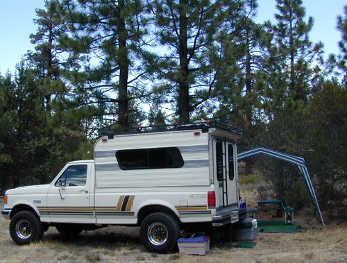
Baby boomers seek retirement vacations: compact 4WD camper vans, or smaller RVs capable of trailering an off-road machine; Fathers look for ways to entertain family out of doors, or escape on solo trips (for sanity sake). The off-road sport and interest has literally exploded over the past 20 years w/ media, hobby, competitions & after market products – along with the rising gas & tire prices.
Plan better trips, learn to really read a topographic map, depart for your trip over-prepared and find new, amazing destinations all over California. Use Total Escape often and get a bumper sticker for your rig!
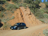
Many folks drive dirt roads just to get to a trailhead and go hiking, mountain biking or rock climbing. Many backpackers trailheads are indeed located miles off pavement on forest dirt roads.
Some outdoor enthusiasts crave seclusion: peace and quite, away from city life, city folks, all noise… well away from the crowds. Preferring to camp outside of developed campgrounds, which means free camping (mostly on dirt roads). Campfire permits are always required. Many excellent, hidden camp sites can be found on rugged, unpaved back roads – some requiring 4 wheel drive, others not.
Gear Heads: those who value ‘vehicle time’ over ‘real nature’ will literally SIT inside their rigs (almost all day) – enjoying scenery from a safe distance. Picnic spot, viewpoint, yes, but rarely ever seeking out a hike, or a waterfall. Should a break-down occur, these dedicated guys will have their heads under the hoods or crawling underneath, for hours if needbe. Always be prepared with food in the cooler.
And believe it or not, some off-roaders will not even tent camp! They do not sleep on the ground. They prefer a local lodge in the nearest small town or they could own a luxury RV (towing a trailer w/ the overbuilt Jeep). Talk about gas guzlers.
Backcountry routes may be signed – high clearance needed, or not. Black diamond, double diamond trail. Yikes 4×4 required, what! Did we miss a sign or take a wrong turn?
SIGNS are not always reliable on the back roads.
Small Signs: get shot at, run over, blown over and washed away with erosion… so best have a hard copy map (at all times).
In Trinity, locals have been known to remove forest road signs to confuse tourists and prevent traffic in certain directions. I can’t imagine why. Cough, cough, Hyampom!
PVT – private property
This brings us to private ROADS & LAND. Just because a dirt road is located in a forest or rural region doesn’t mean it is open to the public. Generally private lands are well marked w/ ‘No Trespassing’ notices, some fenced and gated. In Baja and in ranching areas in general, public access may be allowed to pass through. Inquire at a local ranger stations for the area you wish to explore.
Litter removal 101 should be the norm; Don’t Trash California! Teach your children well. Respect the land and always Tread Lightly! Find more about ECO – CAMPING
Plaskett Creek Campground has green lawns, pine trees, & flush toilets. Located across the highway from Sand Dollar Beach, right on Hwy 1. Ponderosa Campground, on the other hand, has native grasses, oak trees, a seasonal creek and is located on a paved back road, with easy access from US Hwy 101
Central Coast Camping
Monterey Ranger District of Los Padres National Forest manages several Campgrounds along the Central Coast. Some are first come, first serve.
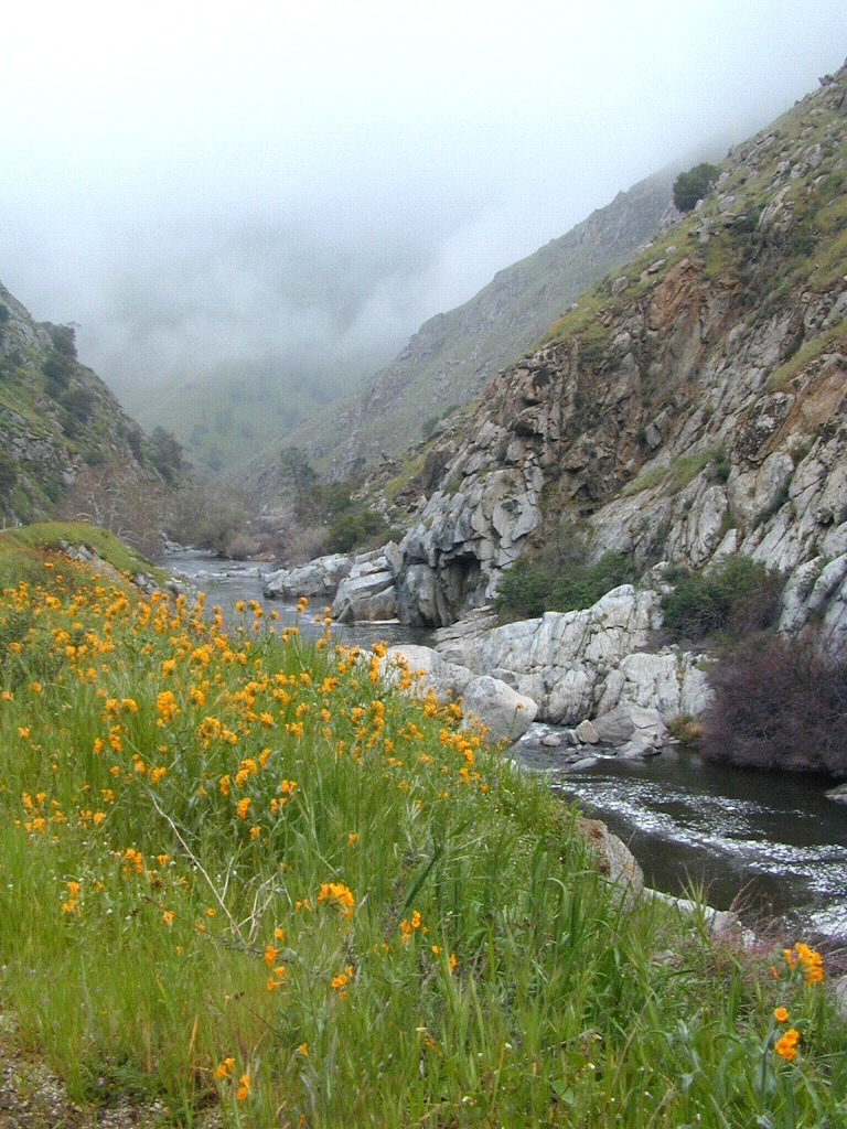
Backpacking trails lead into the wilderness backcountry, along ridge lines with vast ocean views and also deep into fern creeks with redwood canyons. Sykes Hot Springs is a remote destination, if you like to hike, although summer can get crowded. Overnight wilderness permits and campfire permits may be needed.
Free camping in Big Sur
can be found on dirt back roads:
DISPERSED CAMP: No charge camp sites means dirt road access, tighter camp fire restrictions & no facilities (table, bathrooms, fire pits). Campfire permits are required for primitive camping (stoves & BBQ), but unfortunately much of the time camp fires are not even allowed in the backcountry due to extreme wildfire danger.
None of these free camp sites are located on the beach or ocean shoreline. They are situated in the mountains near the coast. These premium, hard to find camp spots usually require that you venture off the beaten path – w/ a National Forest map or regional topo map. If you want to camp without the tourists and crowds, with excellent views of the coast & the night sky, plus avoiding all fees – then take one of these dirt roads off the main highway & start exploring (preferably before sunset, with a high clearance vehicle).
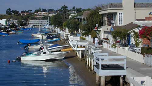
The overdeveloped Orange County coast is packed with condos, homes, parks and beaches, coastal villages, restaurants, shops and train tracks, so campgrounds in this region are few and far more popular than one might expect. Since Los Angeles has very limited beach camping options, most tourists wander further south for SoCal beach camping on the OC or San Diego coast line.
blue links lead to State Park pages with camp reservations.
Orange County Coast Campground reservations are highly recommended all year long, so make sure to plan ahead.
There are very few camping options along the Los Angeles coastline and what is available is geared toward RV campers and the dreaded, amusement parks. Orange County Coastline has the best camping near the Los Angeles region (without needing to smell the oil refineries). Ventura and Santa Barbara, both north of L.A. also have excellent camping beaches.
blue links lead to State Park pages with camp reservations.
SoCal Camping
Sunny and near perfect temperatures all year long, Southern California seriously pulls in the tourists. L.A. is a major metropolis city right next to the Pacific Ocean. With 22 million people residing in Southern California, and millions of visitors annually, this region is pretty busy all the time – even in winter months. Off season for camping might be November-March, when most of the precipitation falls for the year, but campground reservations are highly recommended all year long.
Dockweiler State Beach RV Park
Situated near LAX airport, the Chevron refinery and the main sewage treatment plant, this location can be stinky at times. Paved bike path along the beach leads north & south.
North of Ojai, Highway 33 meets Highway 166: Ozena, Ventucopa, & New Cuyama make up the 3 small communities inside the Cuyama River Valley, located in south of the San Joaquin (California’s Central) Valley.
On the outter edge of Santa Barbara County, where Kern, San Luis Obispo & Ventura counties all meet, you can find great solitude, a large red dirt, high desert wash & plenty rural trails. Off-roading, backcountry camping, hiking, mountain biking all over this region.
Ozena Ranger Station sits at the south end of Cuyama, at the intersection of Lockwood Valley Rd & Hwy 33. Ozena Campground with 10 spots @ 3660′ elevation, is to the east off Lockwood.
Nettle Springs Campground (8 spots @ 4400′ elevation) can be accessed via Apache Canyon, a 10 mile long dirt road# 8N06, off Hwy 33
2 smaller campgrounds – Tinta and Ranch Nuevo are on the west side of Hwy 33 & may require a high clearance vehicle to reach. Trails out of these campgrounds lead to the Dick Smith Wilderness.
Chumash Wilderness is just east of Ventucopa, as Los Padres National Forest surround this agricultural valley. Quatal Canyon and Quatal Wash reach from the upper elevations of pinyon pines near Mount Able to Cuyama river bed below, as Cerro Noroeste Road skirts the northern rim of the impressive red rock canyon. Toad Spring Campground is at the top. Apache Saddle and Pine Mountain Club are just east of Quatal Cyn.
Cuyama riverbed follows Highway 33 and then turns west, following Highway 166, past the ranch lands, the volcano hills and notorious Rock Front Ranch.
All the pavement around Cuyama is very popular amongst motorcyclists. Scenic touring kinda roads. A very nice 100 mile loop trip is from Pine Mountain Club – W on Mil Potrero Hwy, W on Cerro Noroeste Rd, W on Hwy 166, S on Hwy 33, East on Lockwood Valley Road – back to Frazier Park & I-5 Lebec.
Mahutasan, the indian sweat lodge and the extremely rustic Sage Brush Annies Restaurant w/ winery are the highlights of this rural agriculture valley called Ventucopa CA. Cuyama Peak and fire lookout tower overlooks the whole Cuayama Valley & can be accessed via Santa Barbara Canyon Rd. 4×4 may be required in certain spots. This lovely oak and manzanita lined canyon was scorched by the Zaca Wildfire in mid 2007.
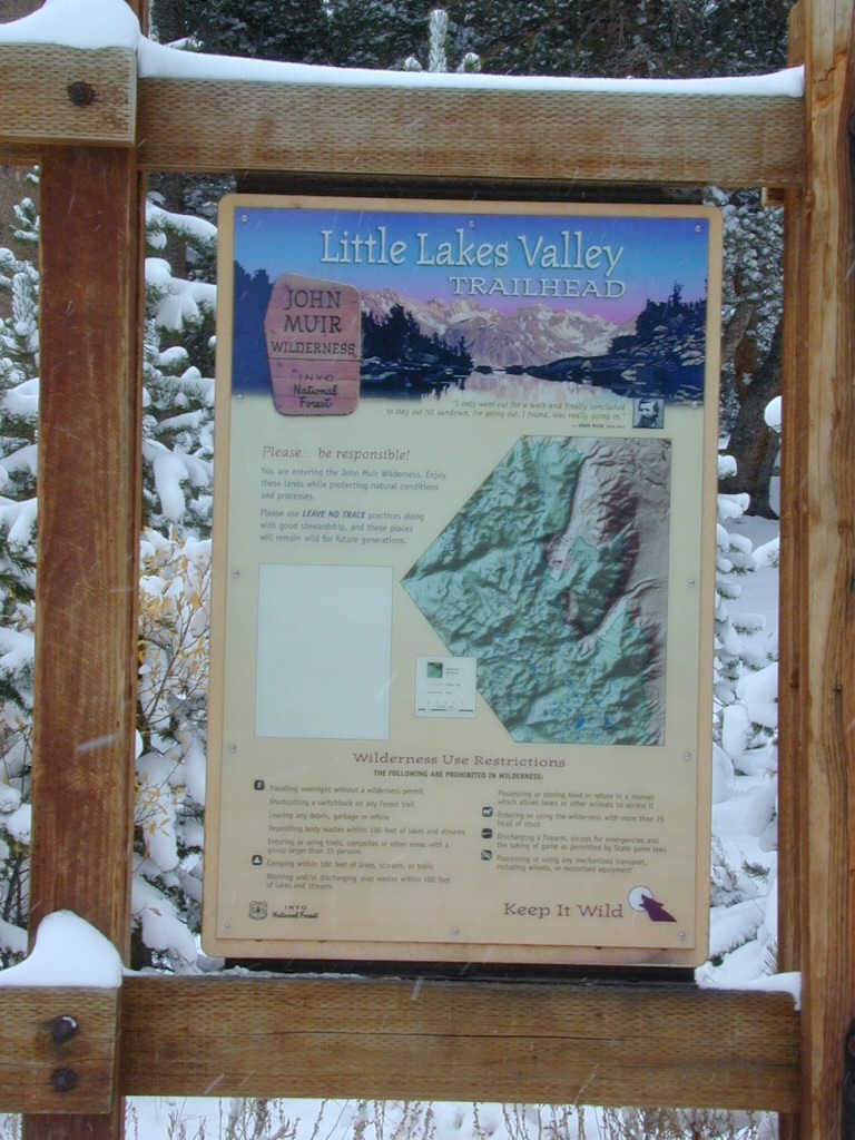
Mosquito Flat Walk-In Campground is intended for backpackers departing overnight into the backcountry the following day. Single night stay ONLY. Please camp down canyon if you plan to stay for more than one night. Bear lockers are provided at campgrounds for proper storage of food items, so use them!
No campfires are allowed outside of developed campgrounds. Day use does not require a permit. Wilderness permits are required for overnight trips into the John Muir Wilderness. Bear containers are required for backpackers. Permits for these trails are issued at Inyo National Forest ranger station in Mammoth, or the Eastern Sierra Visitors Center (ESIA) near Olancha.
John Muir Wilderness (JMT) trails, Pacific Crest Trail (PCT), epic scenery, alpine lakes, high elevation. Eastern Sierra
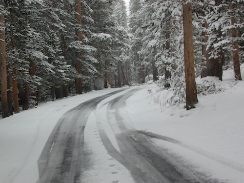
Road and canyon is CLOSED for winter snow approx. NOV-MAY
Peaks and passes surrounding Rock Creek Canyon, in the Eastern Sierra Nevada Mountains –
Red Mountain 11,472′ (elevation)
Mount Morgan 13,748′
Morgan Pass
Mt Huntington 12,405′
Mono Rock 11,554′
Mono Pass
Mt Starr 12,835′
Mt Mills 13,451′
Mt Abbott 13,704′
Round Valley Peak 11,943′
Hike or horseback ride to these alpine lakes from Rock Creek Rd trailheads –
Davis Lake
Hilton Creek Lakes
Patricia Lake
Golden Lake
Pioneer Basin Lakes
Trail Lakes
Summit Lake
Ruby Lake
Mills Lake
Gem Lakes
Treasure Lakes
Dade Lake
Upper Morgan Lake
Lower Morgan Lake
Chickenfoot Lake
Little Lakes
Box Lake
Heart Lake
Marsh Lake
Serene Lake
Eastern Brook Lakes
Tamarack Lake
Buck Lake
Francis Lake
Dorothy Lake
Kenneth Lake
San Diego Backcountry
600,000 acres of SoCal desert
BLOOM: mid-March thru May Anza Park elevations range from low to high. Lowest near eastern border (next to the Salton Sea) to the upper reaches of the western slopes @ 4000′. Wide, deep, sandy, long desert washes, native petroglphs, wind caves, slot canyons and split mountain. This uncrowded state park has the most acreages than all of the parks.
OPEN CAMPING
Camp in a developed campground, a small back country site or camp primitive on nearly any dirt road. Car camping to 4×4, this park has lots to offer folks wishing to really escape. No ground fires allowed, so bring your metal campfire bucket and large trash bag to carry out your ashes. The last thing you want is to scar these pristine white desert washes.
DESERT WILDFLOWERS
Steep rocky canyons on the Laguna mountain foothills can be challenging terrain, so bring good, sturdy hiking boots. Wildflowers can be abundant on certain years. Lower elevations sprout up first; Higher elevations along County Rd S-2 & S-22 bloom later in Spring. By June 1st most of the color is gone in and around Borrego Springs, so this is a real Winter and Spring vacation kinda spot. California desert wildflowers include primrose, barrel cactus, prickly pear, monkey flower, ocotillo & many more.
This is the largest State Park in California and “open car camping” is allowed on the back roads. (also referred to as primitive camping, free camping or 4×4 camping) One of the few places in Southern California that you can camp outside of a developed Campground and still have a campfire. You gotta bring a large metal bucket to have your campfire in – as ashes scar white sandy washes and ground fires are not allowed.
Mojave Reservoir @ Colorado River: AZ / NV / CA
@ the V, bottom of Nevada state = Arizona – Nevada – California, all merge together
The Colorado River travels through the southwest desert, splitting the Grand Canyon and further south, separating California from Arizona at the southern tip of Nevada. Agriculture lines the big river down to Baja, Sea of Cortez, Mexico.
Up near Las Vegas and down to Searchlight, NV
Above Hoover Dam is Lake Mead, sediment from Utah National Parks. Red dirt and silt shorelines. South of Hoover dam is a super deep rock gorge w/ hike-in hot springs. Beyond that, this beauty called Lake Mohave – with the super clear water, secluded coves and abundant fishing.
Lake Mohave: elevation 647′
Desert peaks in this region are around 2000-3000′ elevation. Mohave Lake is actually a wide section of the Colorado River, spanning the region from massive Black Canyon south to busy Laughlin w/ river casinos. This lake is long and skinny in spots with lots of shoreline cliffs, canyons and coves. Minimal vegetation, so please bring your own firewood and don’t chop down the few trees trying to survive. Summer temps exceed 100 degrees, so plan your visit for the winter time.
Lake Mohave Ranger Stations
Cottonwood Cove
Katherine Landing
boating, camping, fishing, hiking, hot springs, kayaking, off-road, picnics, viewpoints
El Dorado Canyon Road, main paved route can be accessed near California’s state border. North of Searchlight, Nevada – off main highway 95, on side route 165 to Nelson, NV
Secluded dirt roads up and down canyons near El Dorado Canyon Rd. Minimal vegetation, maximum open scenery and dark skies. Kayak rentals @ El Dorado Canyon.
desert badlands erosion
Ireteba Peaks Wilderness
4×4 camping routes: 15 day camping limit
Find your own route with many to choose from, drive the soft sandy washes (with a few boulders to dodge) and camp for free, right at the waters edge. Adventurers: Only for the self-contained campers. Some routes marked 4WD only, so pay attention to signs. AWD (all wheel drive) vehicles should fare well on the sandy roads; but standard passenger cars and vans will need to keep their speed up in the soft sand areas.
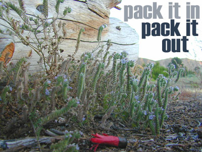
No garbage collection. Pack it in, pack it out.
No facilities, no fees. No buildings. No campfire rings, no picnic tables, very few vault toilets. Bring your shovel!
Driving off the roads is strictly prohibited. Primitive camp sites can be found both at numerous coves and also inland inside the canyons. The ridges get windy in the deserts, but are favorable for night sky views and self contained camper vans.
Always know the weather forecast, cuz flash floods are possible and these dirt roads will be impassible during big rain. This is the main drainage to the big river!
DRIVING TIPS
Most desert washes here are signed routes 4×4, but mini vans, AWD sport-wagons, trucks, SUVs, small RVs can all be found camping near Lake Mohave. That is – if you know how to ‘drive off road’, which is not fast, but not too slow either.
Avoid getting stuck in the deep sand: keep speed up, do not turn sharply and do not brake hard. Carry tow strap in case you need an emergency pull. Be nice to strangers and you may find help.
Campfires are allowed, but you need to bring firewood. Dogs are allowed. Party animals tend to trash these desert coves, so be warned that there is a fair amount of litter. Bring a black trash bag and take some out! This trash problem could get the area closed off to vehicles so keep that in mind.
The canyons here have giant power lines that cross @ Aztec Wash; they can easily be avoided.
4×4 recommended @ MOHAVE:
Eagle Wash Road #46 – popular spot
Montana Wash #45 – camping ok
Placer Wash #47 – no camping
The rangers don’t wanna be pulling your ass out of the sand, which is why they post the 4×4 signs. Don’t expect to find help without walking a few miles first, or waiting several hours.
desert wilderness
Several wilderness areas are located along the west side of this lake & river. Often dirt roads will parallel a portion of the wilderness boundary, providing excellent access to secluded coves and beaches. Emergency CALL boxes are placed in remote parts of these shores.
Ireteba Peaks Wilderness (northwest, next to El Dorado Canyon)
Nellis Wash Wilderness (western side)
Spirit Mountain Wilderness (southwest)
Bridge Canyon Wilderness (southwest, near Laughlin)
COTTONWOOD COVE
developed campground, boat launch, marina, lodging, hiking, picnic areas
LAUGHLIN, NV
Nevada, California and Arizona states join down in this part of the world. Katherine Landing, full service marina, slip rentals, lodging, city services and casinos.
Mojave Desert – This river-created lake is located on the Colorado River, in between Las Vegas, Nevada and Needles, California. The river water here is crystal clear, very swimmable and the fishing is decent. No paved boat ramps
nearby towns: (with elevation)
Avi Casino
Bullhead City, AZ (540′)
Laughlin, NV (535′)
Kingman, AZ (3340′)
Needles, CA
Nelson, NV (2954′) Nipton, CA (3042′) Oatman, AZ
Searchlight, NV (3470′)
Salmon Creek, Kern Plateau –
Sequoia National Forest
Looking to stay away from the masses camping at the Kern River?
Horse Meadow Campground can be found on the east side of the Kern River, up on the Kern Plateau. Up the infamous, steep and rugged Shermans Pass Road. How exciting!
Climb the hill slowly and cautiously, no guardrails. Up the grade, Shermans eastbound – out of the dryness of the Kern canyon. Find Cherry Hill Road, that is also the Big Meadow turn off: Forest Road# 22S12, a long, narrow dirt road leads from paved Shermans Pass Road, 10 miles out to this ideal campground. Far enough off the main road, so you won’t see much of a crowd out here.
Hunters, horse campers and hikers really like this spot. Mountain bikers are known to frequent the region as well. Forest, meadows, trails, creeks, nature, all around. Dome Land Wilderness is close by; Waterfalls hikes, swimming holes, viewpoints. Fishing, hunting, horseback trails. Dirt roads and single track trails all over – all within the vicinity of Big Meadow.
From the main Rd #22S12, the camp access road #23S08 will lead out to the NFS Campground – HORSE MEADOW. Located at higher elevation forests – 3000′ feet higher than the Kern River!
Nice forested, high country camp spots in a developed campground. The long, access road is worth it for all the scenery and seclusion. Vault toilets, piped water, maybe a small fee. Open summer into autumn, closes for winter months.
Horse Meadow Campground
• Elevation: 7600′
• Number of Sites: 41
• Vehicle Access: RV 23′ max
• Campsites Reservation: No
• Camp Fee: Yes
• Length of Stay: 14 Days
• Season: June – November
• Trailheads: Salmon Creek
Developed Campground @ Salmon Creek Trail #33E36. Hiking trailheads lead off to various destinations like, Salmon Creek Falls, Big Meadow, Cannel Meadows and Dome Lands.
SUMMERTIME: If you are coming in from Kennedy Meadows on the EAST (or the Mojave desert US 395) – first verify that the Sherman Pass is OPEN for through traffic. Ask road conditions with local rangers ahead of time. ANY amount of snow will close this whole paved route for the winter season, up until June sometimes.
Over 30 miles (one way) to the nearest general store for supplies. Pack ‘block ice’ in the cooler, instead of cubes.
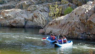
Kern River Valley is one of the all time favorite Sierra Nevada destinations for SoCal escapees. First, it is the southern most ‘big river’ action for the Sierra range. The drive up from Los Angeles is easy access; only a coupe of hours. California Highway 178 leads from Bakersfield up the mountain to Lake Isabella (exit at 155 for Kernville destinations). The 178 continues east past the rural communities of Onyx, Canebrake, Weldon, and then on to the Northern Mojave desert & US Highway 395
Second, Kern has an abundance of outdoor recreation, from fishing to boating, river rafting to kayaking, backpacking, mountain biking, rock climbing, horseback riding, hiking, camping, & soaking. Kernville is the “recreation headquarters” for the region, where you can find rafting outfitters, camping supplies and rental equipment.
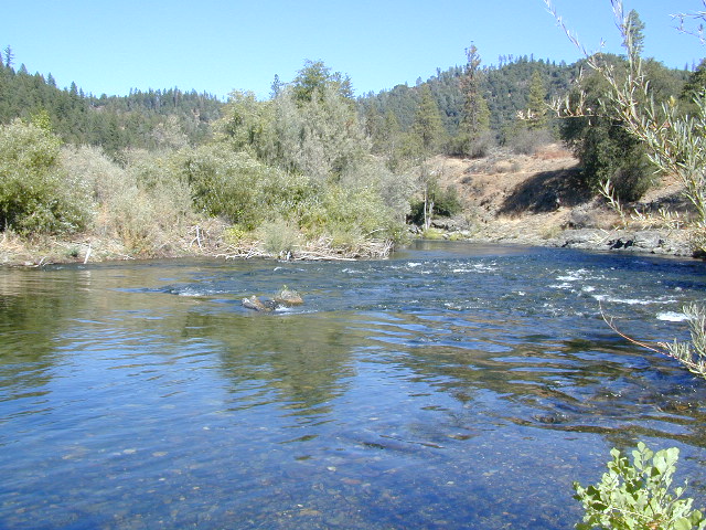
Third, the mountain scenery is very diverse – with the dry shores of Lake Isabella, the granite lined Kern River, or the ridges with towering cedar forests, plenty sugar pines, plus a few Sequoia groves; Tons of dirt back roads to explore, granite & gorges for the rock climbers, prime wilderness access & several primitive hot springs.
The whole area is encompassed by the Sequoia National Forestwith wilderness areas to the North & East. Giant Sequoia National Monument is located along the Western Divide Hwy in the northern portion of the National Forest.
Whether you’re an RVer wanting a developed campground near town, a fisherman needing a primitive site right on the river, or a backpacker seeking the high country, the Kern has a little bit of everything. High elevations beyond 8000′ ridge lines, or the lush Lower Kern under 2000′ with granite boulders lining, Kern has it. 4 wheelers will love the extensive network of dirt back roads, or maybe the OHV areas of Keysville. Lake Isabella has numerous oak lined campgrounds & boat rentals available too. Summer is not the best time to visit as the temperatures soar to 100 degrees & the city crowds come in full force to the Kern Valley. Springtime, the best season to visit runs from March to May, or Autumn cools for September to December.
Northern California river camping. Douglas City is hardly even a town much less a city. A post office and a general store is the majority of what makes up this riverfront locale.
Tucked away on the scenic Trinity River, this small campground is perfect for those wanting to explore the Trinity River, Trinity Lake or the Trinity Alps region. Region is well known for fishing, hiking, kayaking and rafting. A small beach allows for river access. Group picnic area, picnic tables, telephone, beach, paved loop road are just a few amenities.
From Douglas City, drive half mile west on Hwy 299 to Steiner Flat Road. Follow signs to the developed camp. Numerous dirt roads lead to river edge, so there are primitive camping options available along Steiner Flat Road for those seeking free overnight stays.
• Elevation: 1,500′
• Number of Sites: 20
• Camping Reservations: No
• Sites Available: First come, First serve
• Vehicle Accessibility: Vehicle limit 28 ft. max.
• Length of Stay: 14 Days
• Water: Piped; river nearby
• Toilet: Flush & Vault
• Season: Closed for winter, Nov-April
• Fee: Yes
• Operated By: Bureau of Land Management
• Closest Town: Douglas City, CA
Free, small campgrounds are abundant inside the Los Padres. Pinyon pine forest & a wide high desert wash, steep canyons and mountain wilderness. Kern County’s highest peak sits nearby @ Mount Pinos 8831′, with neighboring Mount Able 8286′ directly west of Pinos. Peak to Peak hike is a popular attraction for day hikers and backpackers alike.
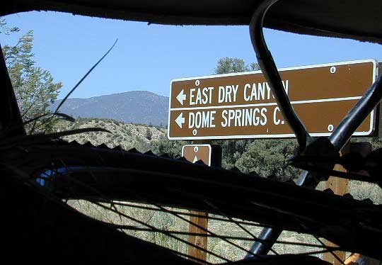
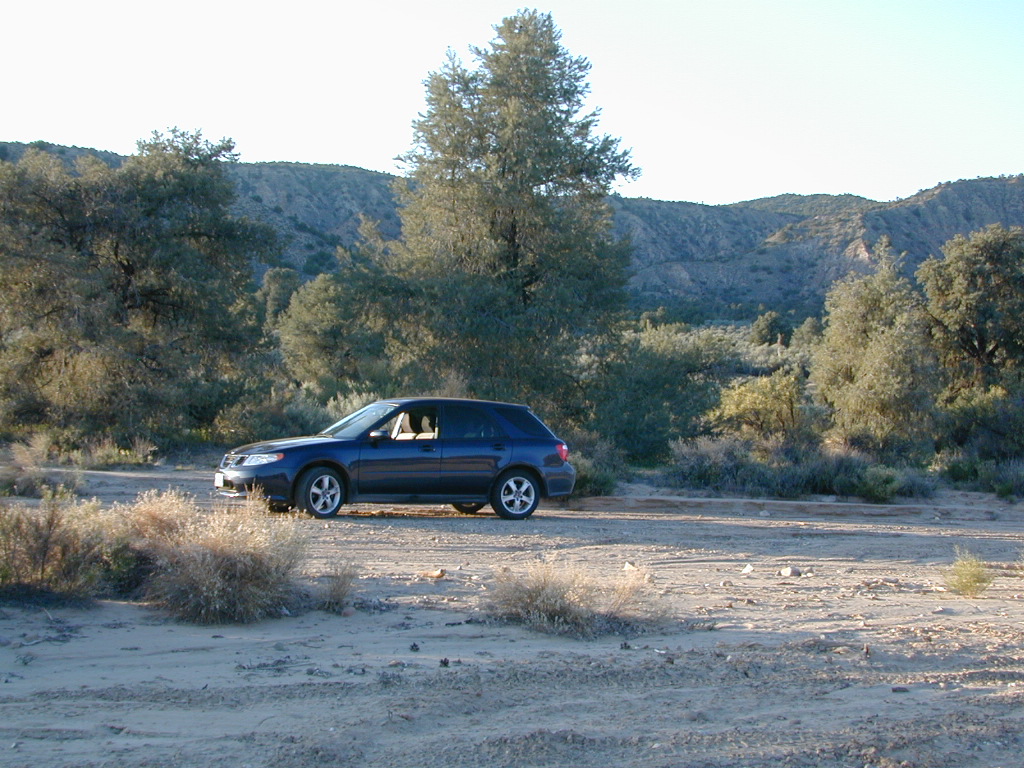
Lockwood Valley Camping
free campground / badlands terrain
When mountain winter temps set in (around the holiday season), camping overnight in the low lands might be more appealing. Domesprings is a perfect camp spot for car campers, off roaders, hunters or even mountain bikers. OHV trails, target shooting areas are abundant, as well as hiking and stargazing opportunities. The main wash is called Dry Canyon, which is nice when there has been some mild rain for minimal dust. No motor bike, vehicles or bicycles in the neighboring Chumash Wilderness, which borders this region on the north next to Mt Pinos.
Dome Springs – Dry Canyon main access road #8N40 can be sandy at times and 4×4 might be needed to reach camp during drier months. Snow or wet weather might also pose a problem with this road, so always check weather and call the rangers ahead of time to find out current road conditions. Most of the time you can get back here with a low rider passenger car.
• Elevation: 4,585′
• Number of Sites: 4
• Camping Reservations: No
• Sites Available: First come, First serve
• Vehicle Accessibility: small RVs
• Length of Stay: 14 Days
• Water: No Piped; seasonal creek iffy
• Toilet: Vault
• Season: Open all year
• Fee: No
• Operated By: National Forest Service
• Closest Town:Frazier Park, CA
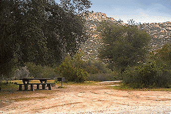
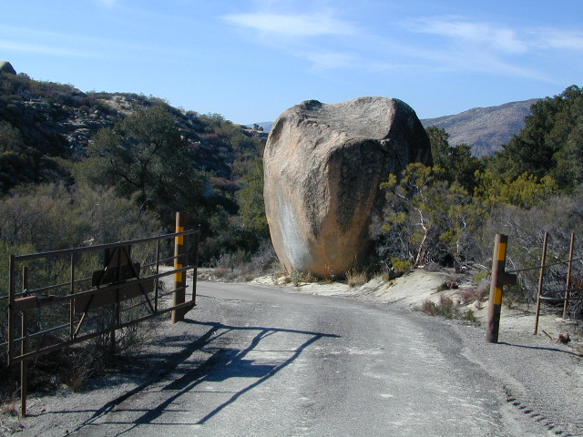
Indian Flat Campground is located on the seasonal San Luis Rey River in rural North San Diego County. From I-15 @ Temecula, CA travel eastbound on Highway 79. Look for the tiny turn off (on left side) for forest road #9N05, sorta near glider airport located west of Warner Springs. This poorly paved backcountry route (half dirt/mud at times) is also known as both Indian Flats Road or Lost Valley Road.
Graded dirt road (paved in some portions) travel is approximately 6.5 miles to campground, look for gate and turn off on the left side. When you see the giant boulder near the entrance, you’ll know you’ve made it to the right place.
Oak trees and a few pines, plenty shade, boulders and mountain scenery, this is a great small campground that is well away from everything in Southern California. Seasonal creek-sized river and boulder waterfall often dries up in late summer. This means a wet spring is the best time to visit this camp. Hiking, mountain biking trails and hammock spots. Pacific Crest Trail access.
• Elevation: 3,600′
• Number of Sites: 17
• Camping Reservations: None
• Sites Available: First come, First serve
• Vehicle Accessibility: Length 15′ max.
• Length of Stay: 14 Days
• Water: No Piped; Seasonal creek nearby
• Toilet: Vault
• Season: Closed for mud & snow during winter months
• Fee: Yes
• Operated By: National Forest Service
• Closest Town:Warner Springs, CA
Los Padres Campgrounds
Big Sur, Mount Pinos, Ojai, Santa Barbara, Santa Lucia
Los Padres National Forest campgrounds span the length of the California Central Coast, from the Monterey Bay to Los Angeles County. Choose a desired area:


 North of Ojai,


 Lake Mohave Ranger Stations