Tag Archives: coast

Seal Beach Holiday Parade

SBP 16

Seal Beach Christmas Parade


A ‘continuous motion’ holiday parade that highlights youth groups, sports groups, schools, businesses, first responders and other organizations from Seal Beach and surrounding coastal areas. Seal Beach is located in between Long Beach and Newport Beach on the Los Angeles coastline.

Annual event: December
Seal Beach, CA

sealbeachlions.org/christmas-parade

Seal Beach Holiday Parade, December 2009

Seal Beach Holiday Parade, December 2009

23S01 – Los Padres NF

Big Sur Dirt Roads

Los Padres National Forest Road #23S01

Willow Creek Road
Los Burros Road

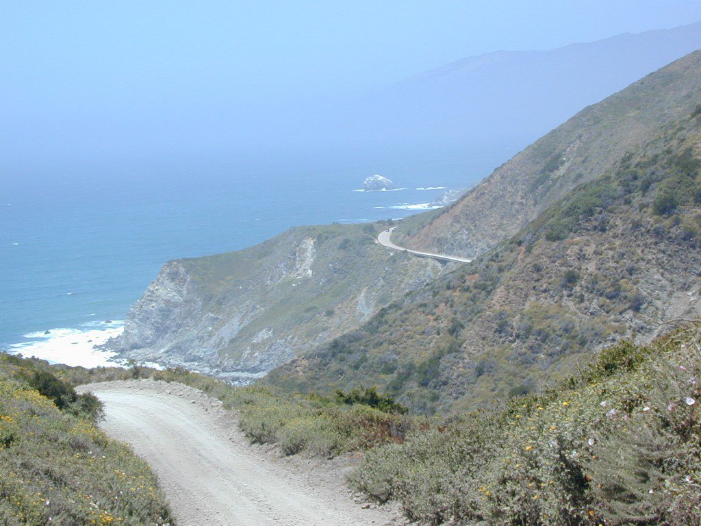
South Big Sur Coast Dirt Roads & super scenic US HWY 1 – North of San Simeon and Hearst Castle, north of Ragged Point and just past Gorda, CA a dirt shoulder, widens, a break in the bushes on the right side of the highway, a small wooden sign for the Yurt Resort called Treebones and the turn off to the back-country of Los Padres National Forest Road #23S01

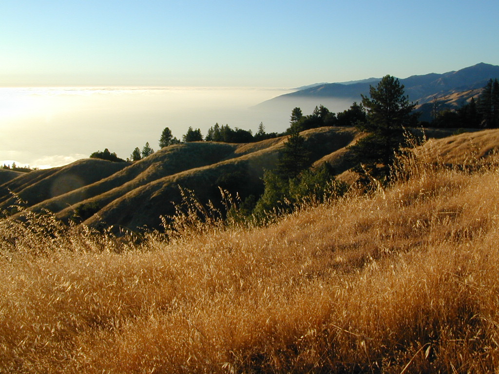
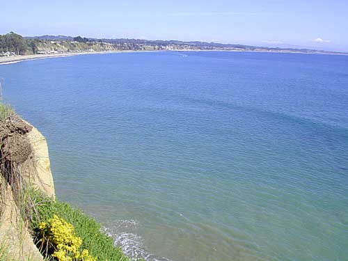
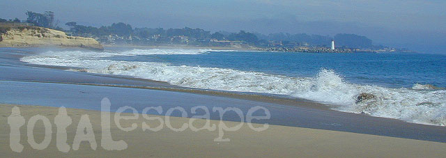
Willow Creek is a steep coastal canyon w/ Willow Creek Trail #5E08 in the creek below and the dirt road 1000′ above. Willow Creek Day Use Area, the Willow Creek bridge and Willow Creek beach w/ restrooms, picnic tables, and paved parking lot near the highway.

DIRT ROAD, high clearance is recommended, but not required. 4×4 may be needed in wet weather. Motorhomes, trucks w/ trailers and RV campers are not gonna like this rugged, narrow, steep, dirt road and are advised to stick to the pavement. Camper vans and SUVs are be better suited for this terrain.

  • Both Thomas Bros. Maps & Benchmark Map’s California Atlas has this route listed as Los Burros Road
  • Google Maps has this route named Will Creek Road
  • Yahoo Maps has this route as Willow Creek – Los Burros Road
  • Mapquest has this one listed as Los Burros Rd – Fort Hunter Liggett (which is a military base,  on the opposite side of the mountain range near US Hwy 101)


View Larger Map


Free Camping in Big Sur

Willow Creek Rd

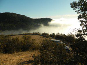
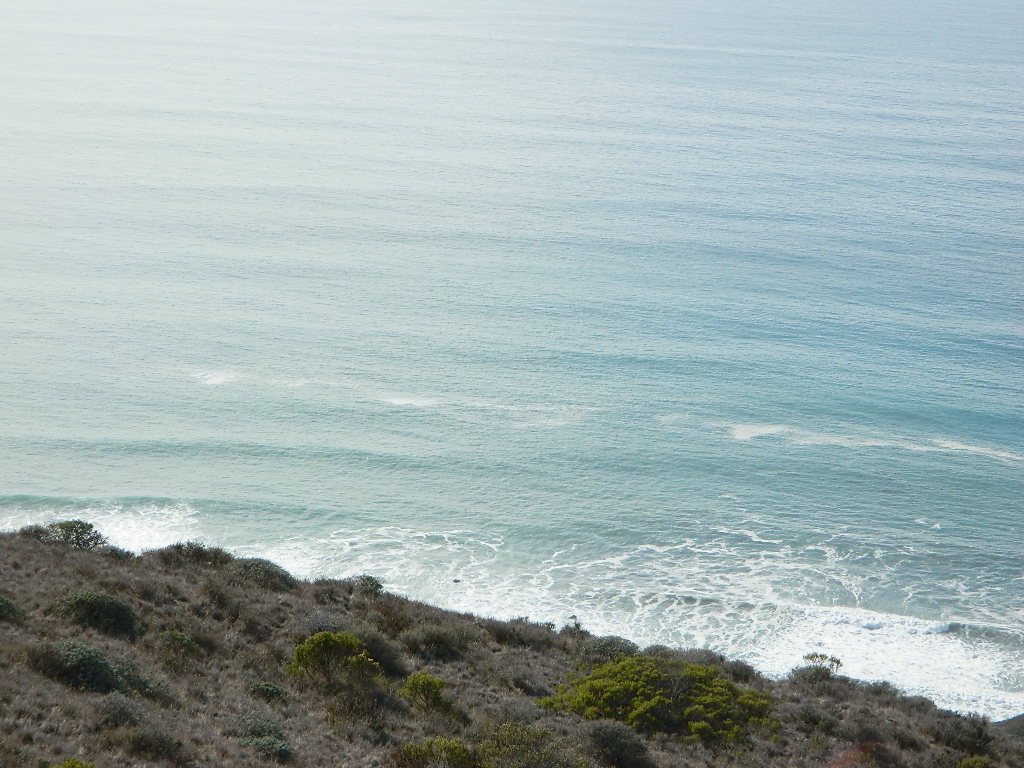
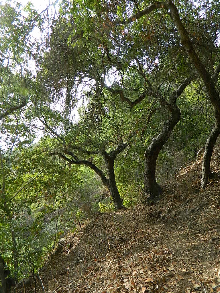
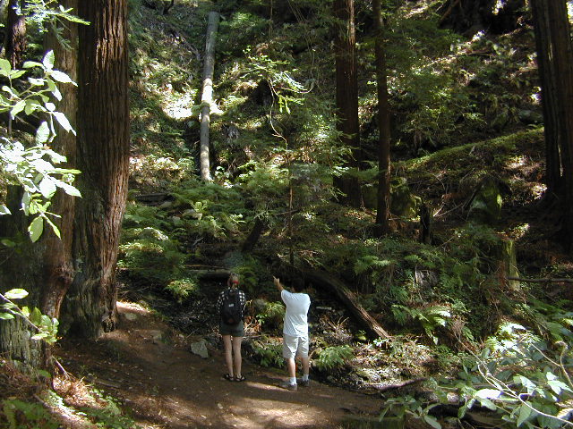
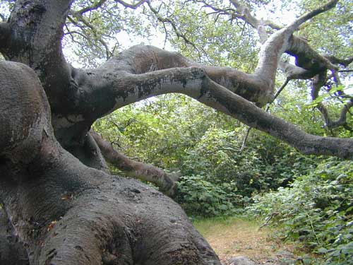
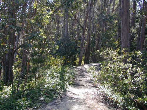
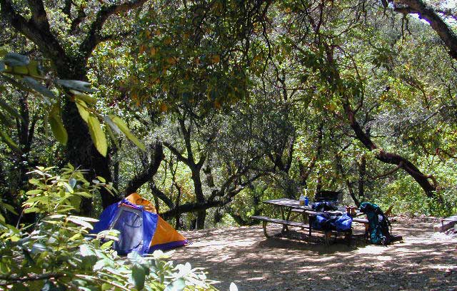
Several primitive camp sites can be found along this rugged dirt road, which climbs steeply and switchbacks thru redwoods, madrones, cedars, grass lands and oak hills. Sites within the first 3 miles  of this road offer the serene sounds of the ocean – waves, seals, sea lions as well as traffic on the busy highway. There are a few private properties back here in the boonies too, so read signs and don’t go exploring this region in the dark.

About 8 miles back on Willow Creek Rd is Alder Creek Campground – a small developed camp w/ only 2 camp sites and no piped water and no fees.

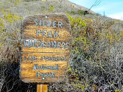
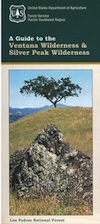
Prewitt Ridge  also has numerous ideal top-of-the-world, free camp sites, which do require a lot more dirt road driving and a very good backcountry map.

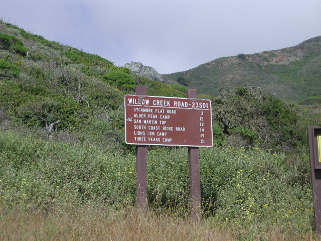
  • Sycamore Flat Road intersects @ 3 miles up
  • Alder Peak Camp is San Martin Top @ 12 miles up
  • South Coast Ridge Road is at the very top @ 14 miles
  • Lions Den Camp is 19 miles of dirt road driving
  • Three Peaks Camp is 21 miles way back there
Los Padres Monterey District Big Sur Map NatGeo

Pumpkin Festival @ Half Moon Bay

Pumpkin Festival

Half Moon Bay Pumpkin Fest

This Pumpkin Festival is the one in Half Moon Bay, up near San Francisco. Been running nearly 50 years. Traditional, wholesome, family fun outdoor weekend on the coast near the Bay Area. Plenty of Campgrounds and Lodging nearby for visitors.

Annual event; October

HALF MOON BAY CA

pumpkinfest.miramarevents.com

The Big One

PA181004

Pumpkin Festival

Klamath Salmon Festival

Yurok salmon festival, Klamath, CA

Northern California Salmon Festival

Yurok Salmon Festival

The Yurok Tribe hosts the annual Klamath Salmon Festival. Native American salmon barbeque plus Native American arts and crafts, Indian stick games, warrior contests, parade with Yurok drums and dancers.

Klamath Salmon Festival
Annual event: August
Held @ the Klamath Township,
Hwy 101 S, Klamath CA
707-444-0433
yuroktribe.org

Klamath tribes dam removal demo

Silver Peak Wilderness

Hiking the Southern Big Sur Coastline

faded public lands
Sun-bleached, wooden Los Padres sign – near Salmon Creek trailhead.

Silver Peak Wilderness, Big Sur Coast

Central California Coast

31,555 acres

8 miles South of Gorda, CA
along Pacific Coast Hwy 1
near Big Sur, CA
Los Padres National ForestBig Sur Wilderness Map

Backpacking and hiking trails on the Pacific Coast, steep terrain next to ocean. Coastal redwood canyons, oaks hills, great views. The neighboring Ventana Wilderness is located just north of Silver Peak hiking trails.

Southern Redwood Botanical Area

Silver Peak –3,590′ elevation
Alder Peak –3,744′

trailheads

  • Salmon Creek Trail #5E09
  • Hwy 1 @ connection Trail #5E10
  • Alder Creek Trail #5E09

mm

mile markers along Pacific Coast Highway 1
(Monterey County)

  • Cruickshank Trailhead – 6.5 mm
  • Soda Springs Trailhead – 3.8 mm
  • Buckeye Trailhead – 2.4 mm
  • Salmon Creek Trailhead – 2.2 mm

developed campgrounds nearby –

nearby towns –

Ocean View Hikes Big Sur


View Larger Map

Oak Foothills

Ventana Wilderness

ventana hikes

Central Coast California
Backpacking Big Sur

Ventana Wilderness is a 40 mile stretch of protected land located in the Santa Lucia Mountains on the Big Sur coastline in between the Monterey peninsula and the Nacimeinto-Fergusson Road #4004. Fort Hunter Liggett lies to the east side and the Pacific Ocean to the west. Ancient volcano peaks called “cones” line the pine ridges – Ventana Cone,  Ventana Double Cone, South Ventana Cone, Black Cone & Cone Peak.

240,026 acres
Cone Peak – 5155′ elevation
Los Padres National Forest
San Antoni River
Sykes Hot Springs
Tassajara Creek
Tassajara Hot Springs

campgrounds bordering area –

hiking trailheads –

  • Cone Peak
  • Escondido
  • China Camp
  • Arroyo Seco
  • Bottchers Gap

redwood hikes

nearby towns –

Central Coast Big Sur Maps

ventana map

Los Padres Forest Maps

NatGeo Big Sur Topographic Map

Pinnacles National Monument Map

Ventana Wilderness Topo Map

Smaller Silver Peak Wilderness (31,555 acres) is also featured on the same map, situated south of Ventana and north of the San Simeon Hearst Castle area.


Ventana Wilderness Alliance
Ventana Wildlife Society

Monterey Campgrounds

Monterey Bay Campgrounds

Monterey Beach Camping

The Monterey Bay of California is located south of the San Francisco peninsula, and north of the rugged Big Sur Central Coast. This is a popular region for tourism, coastal villages w/ shops and restaurants, parks and beaches, farms and farm stands.  With Santa Cruz mountains and redwoods as the backdrop, this coastline is also highly residential.

Camping along this coast is limited mostly to State Parks and few private RV park campgrounds. No primitive beach camping is allowed on State Beaches, no hike-in camp sites, no hidden cove tent sites, nor secret dirt roads with views over the Pacific. This is a very developed beach and bay, with the 4-lane freeway, main artery US Highway 101, bordering the entire shore.

If you are looking for free and a more rugged, scenic camp – head south to the Big Sur Coast, to find a dirt road camp on the ridge. The sweetest ocean view hike-in camp sites can be found to the north, in the Marin Headlands of Point Reyes, which can be found under Marin Camping.

blue links lead to State Park pages w/ camp reservations.camp

Monterey Area Campgrounds

(listed from south to north)

Monterey Pines RV Campground (Navy)

Monterey County Fairgrounds RV Park

Marina Dunes RV Park

Sunset State Beach State Parks
South Campground

Manresa State Beach State Parks
Uplands Campground

Seacliff RV Park

Seacliff State Beach Campground State Parks

New Brighton State Beach State Parks

Santa Vida RV Park, Santa Cruz, California

Costanoa Coastal Lodge & Campground, Pescadero

Pelican Point RV Park, Half Moon Bay

Half Moon State Beach State Parks
Francis Beach Campground

camping monterey

woods

seaside towns along coast at
Monterey Bay up to San Francisco –

(listed from south to north)

Los Padres Camping

Los Padres Campgrounds
Big Sur, Mount Pinos, Ojai, Santa Barbara, Santa Lucia

Forests

Los Padres National Forest campgrounds span the length of the California Central Coast, from the Monterey Bay to Los Angeles County. Choose a desired area:

Big Sur Campgrounds

Frazier Park Camping

Mount Pinos Campgrounds

Ojai Camping

Santa Barbara Camping

Santa Lucia Camping

Bottcher Gap Campground
Lush coastal campground is Bottchers Gap near Big Sur, CA

Los Padres National Forest

see also Los Padres Group Campgrounds

maps of the Los Padres regions –

Los Padres nearby towns & cities –

Pine Mountain Club from ridge