Tag Archives: granite

Silver Lake @ Carson

silkysilver

Silver Lake @ Carson Pass

(Alpine Co)

7250′ elev.
on Highway 88 near Carson Pass, California
El Dorado National Forest
near Kirkwood Ski Resort & the Bear River

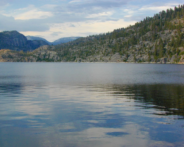
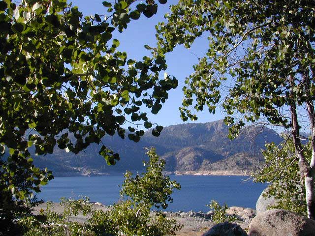
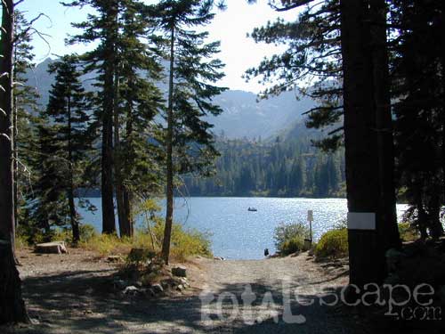
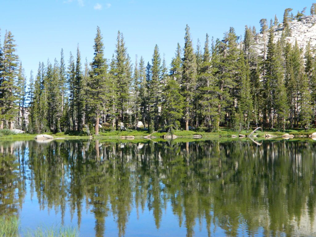
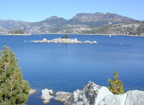
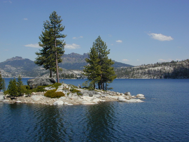
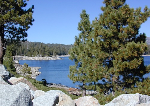
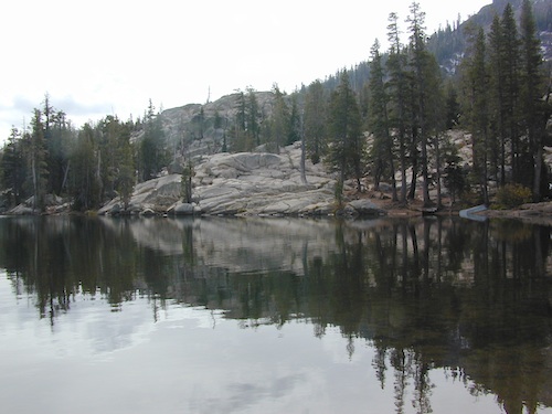
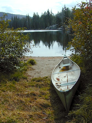
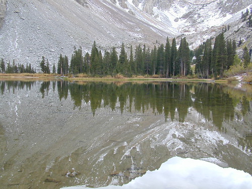
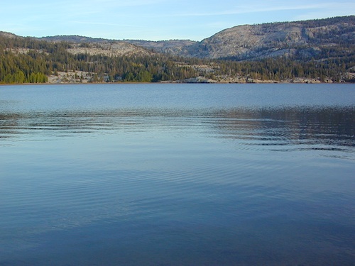
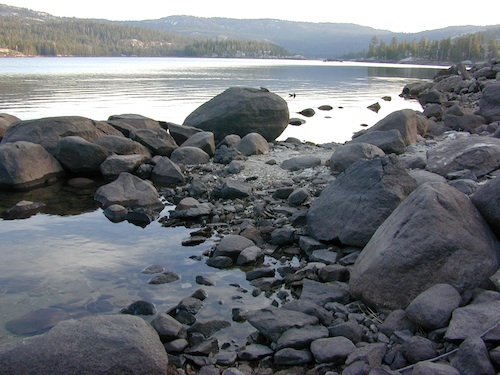
Large, granite, alpine lake in the Central Sierra Nevada Mountains. Abundant trout fishing, swimming, camping, boating, hiking, floating, kayaking, picnic sites, and high altitude backpacking trailheads. Shoreline fishing is just as good as by boat. Fishing boats can be rented at Kit Carson Lodge.
granitesilver

The high altitude location makes this a winter wonderland half the year w/ snow ski resorts nearby! It is an awesome summertime family vacation destination as well. Fishing is excellent through Autumn months. Campgrounds close up shop in October, generally when the snow starts. High Sierra – Deep snow pack means they will not reopen until May (at the earliest).

Carson is major Sierra Pass highway, but it closes for big snows, so always check CalTrans before you make the drive up the mountain. Carson Pass is California State Route 88, which connects the Gold Country (on the western slopes) to the South Lake Tahoe region (on the eastern border), near Nevada.

Check Current Highway Conditions for HWY 88
roads.dot.ca.gov
Cal Trans 800-427-7623

Silver Lake Day Use Areas

fishing lakes picnic grounds fishing lakes boat ramp

These areas listed below are operated by El Dorado Irrigation District and they do charge a day-use fee for many of the amenities provided. Boat Launch fee? Yep. Parking fee? Maybe. Picnic stop! How much? Eat fast!

  • Ferguson Point is located on the north shore of Silver Lake: 10 picnic tables & vault toilets.
  • Sandy Cove is on NW shore of Silver Lake: Wheel-chair access to lake edge, 5 picnic tables, piped water & vault toilets.
  • Oyster Creek Rest Area, up along Highway 88, 1 mile NE of Silver Lake: 10 picnic tables & vault toilets.
kaysresortsign

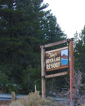
Historic Memories: Camp Minkalo, Camp Silverado & Kays Silver Lake Resort are all closed now.

Many small businesses come and go in the rural mountains of California. Throughout the decades, some do survive, but many change hands, change names, or have a difficult time ‘making it all work’ in the off-season. Always call ahead (real phone w/ real person) before you make a big drive to a remote location.

National Forest Campgrounds in this lake vicinity:

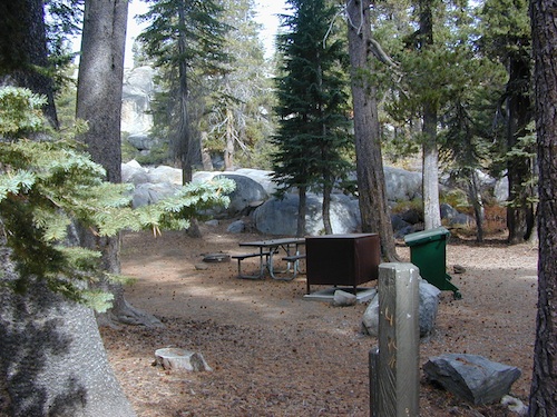
East Silver Lake Campground – 62 sites
West Silver Lake Campground – 42 sites
Kirkwood Lake Campground – 12 sites

campground RV campground

Silver Lake Campground NFS

• Elevation: 7200′
• Number of Sites: 62
• Vehicle Accessibility: RV 30′
• Campsite Reservations: Yes
• Camp Fee: Yes
• Toilet: Vault
• Length of Stay: 14 Days
• Season: June – October
• Trailheads: Hidden Lake, Sandy Cove

NFS
El Dorado National Forest
Amador Ranger District
26820 Silver Drive
Pioneer, CA 95666
209-295-4251
silver from highway

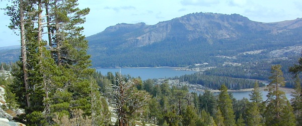
Older lodges, resorts, camps and cabins at Silver Lake were mainly built in the 1920s, while the oldest resort dates back to the mid 1800s. Wow, how cool is that! Much history in this mountain region w/ Kit Carson Emigrant Trail, all stories totally worth exploring.

Kit Carson Lodge
Rustic Silver Lake Cabins & Restaurant
kitcarsonlodge.com
209-258-8500

Historic Plasse’s Resort
One of the Oldest Camps in the USA
plassesresort.com
209-258-8814

Gold Miners

See all Silver Lakes in California

Wishon Reservoir

Lake Wishon – Sierra NF

Western Sierra Nevada Lake
Central Sierra California

lake wishon

East of Fresno, CA
East of Shaver Lake

EB from Fresno, Hwy 168 up to Shaver, w/ another 30+ miles on paved backroads
(Dinkey Creek Rd & then McKinley Grove Rd)
Way, way back, beyond Dinkey

You gotta really wanna BE at places like this. Magical High Sierra mountains – California’s finest. Sheer beauty surrounds this lake w/ granite domes, granite cliffs, granite trails, forests, peaks and plenty hiking, fishing, water and boating. It does take planning (way ahead) to make it out here, cuz the area is only accessible during summer months. Typical of high altitude lakes, snow buries them annually and the roads get closed off to the public (usually NOV-MAY is winter). Some backcountry routes become snowmobiling trails during winter, and the Sierra National Forest has plenty of great snomo action (if snow is deep).

Wishon Lake, California
elevation: 6600′

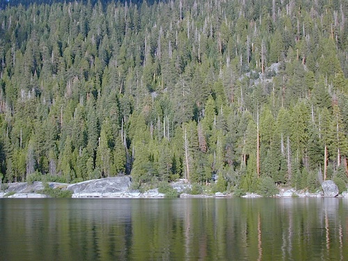
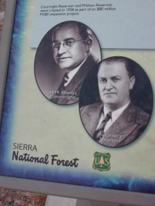
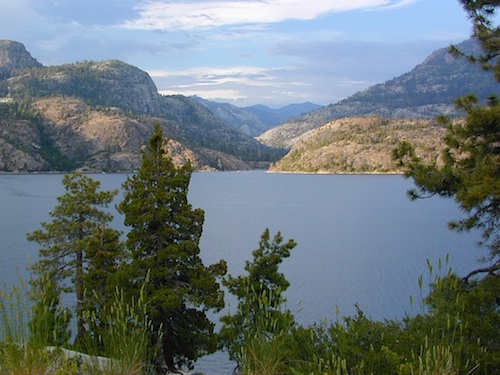
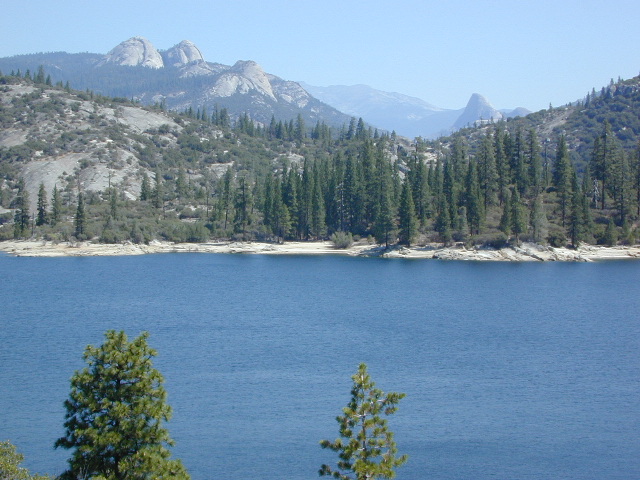
High Sierra Granite Reservoir with pines trees and rocky, granite shoreline. Not nearly as amazing as its cousin w/ the domes to the north, Courtright, Wishon has less granite & less wind, but more accessible backroads to explore, plus more car camping options. Both lakes are part of the Helms Creek hydro-electric project (dams) that make up the PG&E water infrastructure out in these parts – The Kings River Drainage System.

Backpacker trailheads, Woodchuck, Rancheria & Crown Valley all lead to dead end dirt roads – with nothing but solitude for miles & miles. Some might be passenger car accessible. Winter weather changes dirt road conditions (often).

The Kings River Geological Area is nearby, as well as both the John Muir Wilderness & Dinkey Lakes Wilderness.

Wishon Sierra Nevada

Large Reservoir with 8,000-10,000′ high sierra mountain peaks surrounding. Pine forests, views, fishing, camping, hiking in every direction, secluded dirt roads. Perfect high elevation trailheads, next to John Muir Wilderness. Great for backpackers!

All boating, but no waterski or jet ski.
One public boat ramp. Fishing boat rentals available.

WARNING: Water level changes daily.


lake area recreation:

Backpacking
Boating
Campground Camping
Dinkey Lakes Wilderness
Fishing
Hiking
Horse Pack Trips
John Muir Wilderness
Mountain Biking
Primitive Camping
Sierra National Forest
Snowmobiling the Sierras
Spanish Lake 4×4 Route

bridgewishon

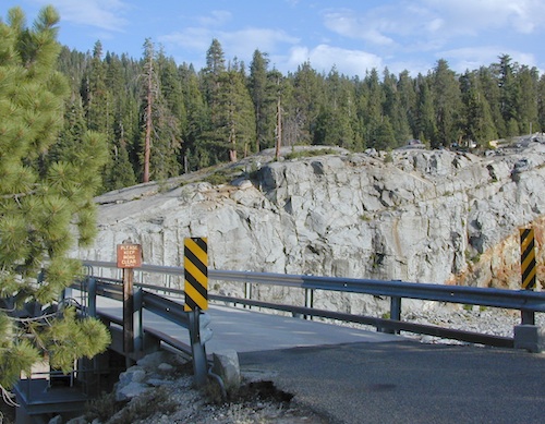
Wishon is a summer vacation paradise for trout fishing, hiking, backpacking and back road exploring.

CLOSED FOR WINTER: NOV-APRIL = Snow closes the road for winter. For all you hardcore campers and hikers, you must call ahead to see if roads are open. It is rural forest, well traveled, but snow storms will shut everything down out here (for many months). Although, in some mild winters you can drive as far as Dinkey Creek on pavement. Gates are locked beyond that.

Central Sierra Wishon Lake Camping

LilyPad Campground @ Wishon Lake

Upper Kings Group Campground (by reservation only)

helpful numbers:

High Sierra Rangers Office: 559-855-5355
Pineridge and Kings River Ranger Districts
29688 Auberry Road, Prather, CA 93651

Dinkey Creek Ranger Station
(June thru September)
559-841-3404

Wishon Village RV
66500 McKinley Grove Road, Shaver Lake, CA 93664
559-865-5361

Engineering

Other places nearby


Black Rock Lake
Sierra Forest Road #11S12
Courtright Lake
Dusy Ershim 4×4 Trail

Dinkey Creek Campground
Dorabelle Campground
Gigantea Campground
McKinley Sequoia Grove
Sawmill Campground (dirt road)

Free, primitive or open camping abundant on the dirt backroads in Sierra National Forest. 4 wheel drive is not required for most routes, but a high clearance rig would help. Some gravel roads are graded annually and suitable for passenger cars – during summer months and only for about the first mile or two, off of the main road (pavement). Mud and snow are common on backroads!

Aspens @ Wishon, Western Sierra
nearby towns:
Fresno, CA
Huntington Lake
Lakeshore
Pine Flat
Prather
Shaver Lake


Sierra National Forest Map
Dinkey Lakes Map
Dinkey Lakes Map
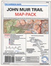
John Muir Wilderness Trail Maps Sierra Nevada Topo Map

Wilderness Wishon California

wish on

NOT TO BE CONFUSED WITH:
Wishon in Giant Sequoia & Wishon @ Bass Lake

There is another popular camp spot called Wishon Camp – on the Western Divide Highway, much further south in the Sequoia National Forest.

Wishon Campground on the Tule River in the Giant Sequoia National Monument. Just up from Springville, CA

And also, the Bass Lake Wishon; there is another WISHON Campground at popular Bass Lake, South of Yosemite NP.

Sardine Lake California

Sardine Lake California Camping

Lakes Basin California, Northern Sierra

Lakes Basin Recreation Area

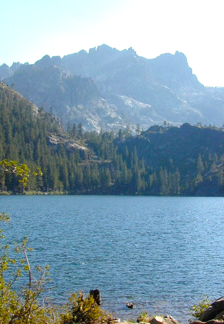
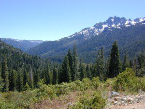
The granite spires of the Sierra Buttes (8591′) tower above both Upper & Lower Sardine, making for a glorious backdrop to these two lakes. This is a popular fishing lake with no swimming allowed. The water is so clear that at noon you can see to the bottom!fish

There are numerous, super-scenic, small lakes in this region and one trip here is not nearly enough. Total Escape rates this collection of small lakes up there w/ the ‘best hiking lakes’ in California. The Pacific Crest Trail runs through this awesome lakes area, which is located north of Truckee, east of Downieville.

backpacking
boating
camping
canoeing
fine dining
fishing
hiking
granite peaks
kayaking
mountain biking
off-roading
stargazing
waterfalls
wildflowers


snowmelt lake snowmelt lake snowmelt lake
high elevation means snow

Plumas Co Road #24 is the Gold Lake Road, also referred to as the Gold Lake Highway – which skirts the lakes, the buttes and connects Historic Gold Country Hwy 49 to Graeagle Golfing @ Hwy 89. SNOW CLOSES THIS ROAD, but the area remains open for winter recreation.camp

SARDINE LAKE ROAD, a paved turn off the main road. NFS Campground is located one mile from the shore at Lower Sardine. Sardine Lake Resort rents cabins and the restaurant serves dinners w/ lake view!

fishing lake Gold Country Lake hiking trailheads National Forest Service Developed Campground

Sardine Lake Campground

• Elevation: 5800′
• Number of Sites: 29
• Vehicle Accessibility: RV 22′
• Campsites Reservation: Yes
• Camp Fee: Yes
• Facilities: piped water, vault toilet
• Length of Stay: 14 Days
• Season: June – October
• Trailheads: Sierra Buttes & PCT

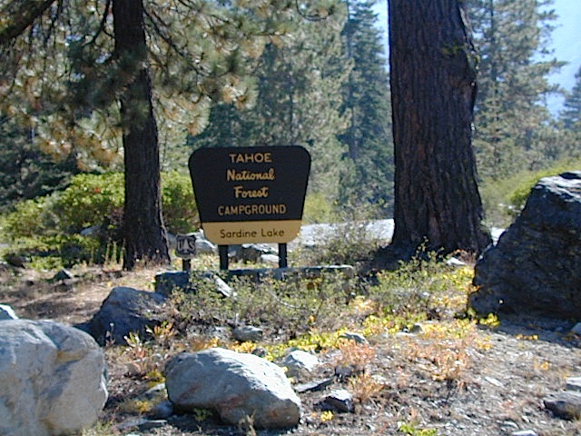
sardine campground sign

National Forest Service Rangers Quarters

Sardine Peak Lookout
SARDINE PEAK FIRE TOWER LOOKOUT (NFS)
Built in 1935, a three story enclosed tower with external stairs. 2019 – No longer available as an overnight rental. (elevation 8138′)

panoramic

Upper Sardine Lake California

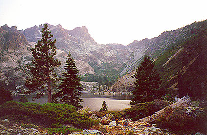
Upper Sardine Lake: Takes only a short hike to get to. This is a pure glacial bowl; the rock plunges straight into the water, no beach at all. Great fishing; ice-cold swimming.

local contacts for this lake:

Sardine Lake Resort
530-862-1196

Row boat rentals on Sardine Lakecanoe
530-862-1196

Canoes rentals on nearby Packer Lake
530-862-1221

Plumas County Visitors Bureau:
800-326-2247

Plumas National Forest Rangers:
530-862-1368

Sierra County Visitors Bureau:
800-200-4949ranger

nearby towns:
Downieville, CA
Graeagle, CA
Sierra City, CA

nearby lakes:
Gold Lake
Sand Pond
Packer Lake

maps of the region:
Lakes Basin Map USDA
NatGeo Sierra Buttes Map
Plumas National Forest Map
Tahoe National Forest Map

Mammoth Pool Reservoir

Mammoth Pool Lake, Sierra Nevada

San Joaquin River, Sierra National Forest

Mammoth Pool California

Awesome granite domes of the western Sierra, plus a scenic recreational lake that is only accessible half the year. Home to “Hells Half Acre” – Mammoth Pool Lake is one of the lesser known reservoirs in the western Sierra Nevada mountains. It’s kinda hard to get to although it is located on the border of Yosemite National Park. Area is totally surrounded by granite creeks, hiking trails, dirt roads and wilderness. This Mammoth Pool is an hours drive, way back behind Bass Lake (off Highway 41), and NOT located near Mammoth Lakes in the Eastern Sierra.

Camping just outside of Yosemite. Although the National Park boundary and trailheads are near by, accessing Yosemite Valley for day trips from this location will be quite tiresome and difficult, with long winding roads and over 2 hours drive one way. Better to camp near Bass Lake if you wanna be convenient to Yosemite NP.

Mammoth Pool
Sierra National Forest
3330′ elevation
123,000 acres

Sierra Vista Scenic Byway

(loop road, backcountry route closed in winter months)

Near the town of Oakhurst and Bass Lake California, get off the main highway and head over to the small town of North Fork. Take South Fork Road 225 (Italian Bar Rd) to Minarets Road (#81) also called Mammoth Road. Side trip paved Auberry Road (#222)  which skirts oak hills down to Redinger Lake Road. Hook up w/ Minarets Road (#81) that parallels the San Joaquin River on the forested ridge above, traveling 20 miles to  Numerous developed campgrounds and primitive camping sites off this route. Mammoth Pool is a signed right turn down Mammoth Pool Road, a steep road w/ a couple of campground near the lake shore and the only public boat launch is narrow, one at a time and it is not paved.

boatramp

The lake is closed to the public during May and the first half of June to allow migrating deer to swim across the reservoir. The reservoir is inaccessible following the first snowstorm, as the access road is not snowplowed.

rangerGrizzly Road, a paved route that leads deeper into the woods and connects over to BEASORE. Back on the main route (Road #81) on the far north end of the loop, a narrow, paved side route connects Clover Meadow Ranger Station and the impressive Granite Creek Campground. Plenty water and hiking trailheads that lead into Ansel Adams Wilderness and Yosemite National Park.

Back on the main route (Road #81) – the pavement becomes dirt in some sections and the route loops down to Beasore Road (#7), which traverses past meadows and dense forest, and heads back towards Bass Lake.Sierra Forest Map

backpacking, boating, camping
fishing, water ski, kayaking
sailing, swimming

backcountry side routes

NFS Campgrounds nearby –camp

hikers trailheadsMammoth Reservoir

  • Shake Flat
  • Logan Meadow
  • Hells Half Acre
  • South Fork
  • McCreary
  • Cassidy
  • Mammoth
  • Isberg
  • Fernandez
  • Norris
  • Jackass Lake

 towns nearby –


View Larger Map

Gold Lake California

lilgoldlake
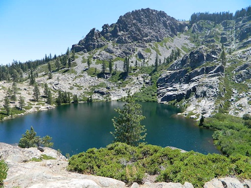
Hike-in only Gold Lake, Bucks Lake Wilderness.

California has more than one Gold Lake!

goldsign

Gold Lake, CA

(Sierra Co)
6409′ elev.

The biggest Gold Lake, California is the well-known one, along the Gold Lake Highway in the Lakes Basin Recreation Area. Plumas meets Tahoe National Forest. North of Gold Country Hwy 49, Downieville & the Yuba River. Right where the Sierra Nevada granite meets the volcanic lava rock of NorCal.

Packer Lake

Lakes Wilderness Map

Impressive jagged spires known as The Sierra Buttes (8591′) tower above the stunning lake scenery. This big Gold Lake is surrounded by a dozen smaller alpine lakes which make up the popular region called Lakes Basin. Easy access paved highway, which closes in winter for deep snow and winter recreation. The Gold Lake Highway is also referred to as Plumas County Road #S620

sierra buttes
the sierra buttes

Sardine Peak Fire Lookout lodgeranger rentals
NFS fire tower – no more overnight rentals!
overlooking the Sierra Buttes and the serene Lakes Basin, Yuba River, Northern Gold Country California

see CalPine Lookout near Sierraville, CA

driftwood

USFS

LAKES BASIN RECREATION AREA
Cabins, camping, lake fishing, backpacking, hiking, horseback riding, mountain biking, off-roading, snow-mobiling.

lakesbasinhikers

snowmo

California Lakes

mini gold lake

Mini Gold Lake

(Plumas Co)
6000′ elev.

Another smaller Gold Lake exist on the granite slopes in Bucks Lake Wilderness – E of Oroville & W of Quincy, CA.

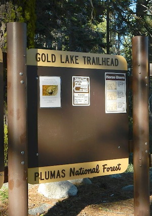
gold lake trailheadThis hidden gem is a hike-in only lake – and well worth the effort. A somewhat short hike, great ridge line views to the east, although the last half mile of this route is a doozie (moderately strenuous).
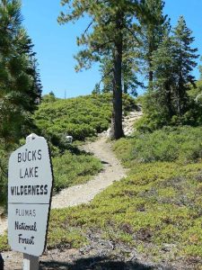
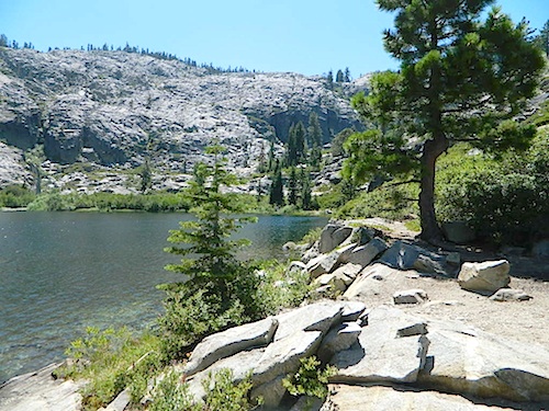
The main trailhead departs from Silver Lake and climbs a ridge line that heads over to the PCT (Pacific Crest Trail). An off-shoot trail goes another mile to the miniature Gold Lake, a granite bowl of sheer beauty. A great day hike for those wishing to see the backcountry. Pack your picnic lunch, camera, and make a whole darn day of it!

Swimming & skinning dipping seem quite natural at this alpine lake, since it is a pretty remote location (without a lot of visitors) and there is absolutely no swimming allowed at neighboring Silver Lake.

bucks trailhead

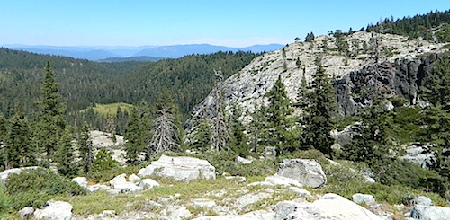
The steep, overgrown, rocky shoreline leads one to bush whack through old trails, only to be met by a rock slide. Many dead ends and obstacles to climb around, or over. Some way… maybe, or maybe not!

Boulder and rock scrambling is the key phrase to remember, once you reach this lake. Knees may be sore from climbing, up and over the boulder ledge surrounding the lake bowl.

goldshore

Bucks Lake Wilderness Map

A few primitive camp sites are scattered about on the edge of the lake for those backpacking in, but be warned – they can be very difficult to reach. Much more suitable campsites can be found scattered throughout the area.

Warning: there are no flat, lush meadows to lounge in up at the lake, so pick yourself a side route (on the walk in) to find real seclusion and privacy.

view to Quincy

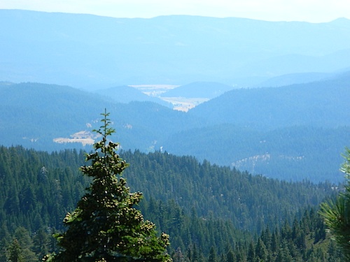
This mile-long-ridge hiking trail to mini Gold Lake has some amazing views down to the east side – Jacks Meadow right below; then Meadow Valley & Quincy off in the distant hills. RURAL CALIFORNIA – Plumas County from above.

jacks meadow
jacks meadow, way below

Sierra Nevada Lakes

High Sierra Gold Lakes in California

hike-in only lakes

hike

Golden Bear Lake
(Tulare Co)
12,000′ elev

High Sierra – Kings Canyon National Park
Center Basin / Center Peak 12,760′
PCT – Pacific Crest Trail
North of Mount Whitney
Eastern Sierra, Independence, CA

hike

Golden Trout Lake
(Inyo Co)
11,500′ elev

Trail #3306 from Onion Valley Campground
North of Mount Whitney
Eastern Sierra, Independence, CA

goldentroutlakecanyon
onion valley trail views
Eastern Sierra Lakes
Alpine Lake above Onion Valley, Eastern Sierra

Lakes Basin Recreation Area

Lakes Basin Area, California

Golden gems of California, a collection of alpine lakes on the north end of Historic Gold Country, North Yuba River, Northern Sierra Nevada

lake dunk
EAST of Downieville, CA

California’s Gold Lake and surrounding lakes; the granite spires of the Sierra Buttes and the creeks, waterfalls, headwaters of the Yuba River — total wild beauty. Steep, granite, river canyon from Downieville drive east on Highway 49 from Sierra City to Bassetts, a gasoline and market stop; they have a small hotel there too.

Historic Lodges

Take the left turn, north on to the Gold Lake Highway. The alpine and extremely scenic Lakes Basin Area consist of all small lakes in between Hwy 49 to Hwy 89, along GOLD LAKE HWY [Road S620] some maps read Road #24 or call this Gold Lake “Road” instead of highway. Snow closes in this route during winter months.

The impressive Lakes Basin Gold Lake Region is in the north part of Tahoe National Forest, on the border of Plumas National Forest. Plumas Eureka State Park is also nearby.

Hiking, Camping, Backpacking, Picnicking, Wildflowers, Stargazing, Fishing, Kayaking, XC Skiing, Snowmobiling

Lakes Basin Map

Lakes Basin Campground

California best lake destinations

lakes basin views

Lakes Basin Recreation Area

Sierra Buttes Map


Yosemite Topo

merceddownriver

Yosemite Topo Maps

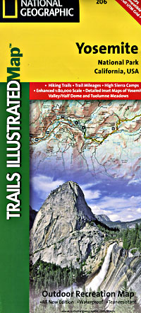
ti_yosemiteYosemite National Park, in California’s Sierra Nevada mountains, is the most visited of all the National Parks. Tourists, visitors and campers fill the main valley all year long, with the crowds peeking in mid summer. Autumn is gorgeous, winter is snowy, spring is glorious and summer is grand.

The park has numerous alpine lakes, granite domes, meadows, Sequoia groves and a snow ski resort. Backpacking is popular here, hiking all over, bike rentals w/ miles of paved trails. Plus, the best in big wall climbing. Waterfalls and granite cathedrals tower above the lush, glacier- carved valley. Mighty MERCED RIVER, right through the middle of granite and forests.

Storms of recent have rearranged the landscape inside the valley with a number camping facilities wiped out by the river. Yosemite lost half of the campsites, which dramatically reduced the amount of camping available inside the main valley. Older cabins at Yosemite Lodge are gone. Less camping, but more people means you should make camp reservations early as possible; or search for camping just outside the National Park boundary.

Sightseeing and hiking should be part of your visit to Yosemite Valley. Bring your raft for a float down the river. Stay away from the crowds and take the back roads, with our great selection of Yosemite backcountry maps.

We now have links to digital maps for download!

Topographic maps for Yosemite National Park – and the outlying regions:

Teneja Lake, Hwy 120. Yosemite National Park
Eastern Sierra Camping

Inyo National Forest

Sierra National Forest

Stanislaus National Forest

Yosemite Lakes

Yosemite Lodging

Yosemite National Park

Mariposa County CA
Ahwahnee
Bass Lake
Coarsegold
El Portal
Fish Camp
Groveland
Lee Vining
Mariposa
Midpines
Nipinnawasee
Oakhurst
Wawona
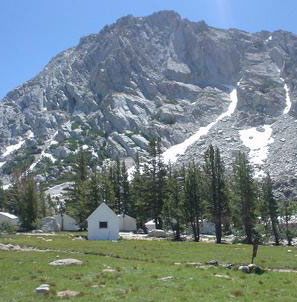
Vogelsang: High Sierra Camp

th_half_dome_d

Backpacking
Day Hikes
GRANITE TERRAIN
Topographic
Yosemite Trail Maps

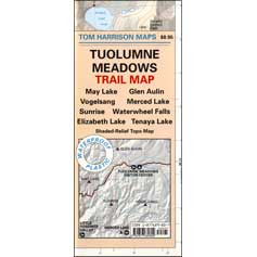
TuolumneMdws

Sunrise Lakes
Sunrise Lakes, Yosemite HSC Loop Hike


Lake Tahoe Campground

Indian Valley Campground
Indian Valley Campground, Tahoe National Forest

Lake Tahoe Campgrounds

Cabins

Tahoe Forest Campgrounds

sierra buttes California

Lake Tahoe California

Listed below are developed camp grounds and RV camps around Lake Tahoe, run by various agencies. Most require reservations and are only open half the year (or less).
Lake Tahoe campgrounds: blue links lead to camp info.

campground elev spots veg toilet water notes
Bayview Campground 6000′ 10 pines vault Emerald Bay
Camp Richardson Tahoe 6500′ 330 pines flush piped South Lake Tahoe
Campground by the Lake 6000′ 157 pines flush piped South Lake Tahoe
D.L. Bliss State Park 6000′ 168 pines flush piped Westshore, Lake Tahoe
Eagle Point Tahoe 6100′ 100 pines flush piped California State Park
Emerald Bay State Park 6000′ 16 pines flush piped South Lake Tahoe CA
Fallen Leaf Lake Campground 6737′ 205 pines flush piped South Lake Tahoe CA
General Creek Campground 6000′ 175 pines flush piped Westshore, Lake Tahoe
Kaspian Campground 5800′ 20 pines flush piped Westshore, Homewood CA
Lake Forest Campground 6300′ 21 pines flush piped Northshore, Tahoe Vista CA
Meeks Bay Campground 6000′ 17 pines flush piped Westshore, Tahoma CA
Mount Rose Campground 8500′ 24 pines flush piped in Nevada @ Tahoe
Nevada Beach Campground 6200′ 54 pines flush piped Nevada Lake Tahoe
Pope Beach Campground 6000′ 49 pines flush piped South Lake Tahoe CA
Sandy Beach Campground 6300′ 44 pines flush piped Northshore, Tahoe Vista
Sugar Pine Point SP 6200′ 30 pines flush piped Westshore, Tahoma CA
Tahoe Pines Campground 6000′ 49 pines flush piped Meyers California
Tahoe Valley RV Campground 6000′ 413 pines flush piped South Lake Tahoe CA
Tahoe Campground SRA 6200′ 16 pines flush piped West shore, Tahoe City
William Kent Park 6300′ 95 pines flush piped Westshore, Tahoe City
Zephyr Cove Campground 6200′ 170 pines flush piped boat rentals Tahoe NV

rangerAll Tahoe Campgrounds will charge a fee for day use or overnight stays; Many require advanced reservations. Nightly rates vary per park, but tend to be expensive in this region. Most campgrounds are closed during the winter due to the big snow. Check with the ranger districts listed here.

primitive camp spots
Sawmill Lake 4×4 Camp

camp RV camps NFS hikes fishing mountain biking camps river fishing

NFSlogo

Tahoe National Forest encompasses a large region of the Sierra Nevada mountains surrounding the north portion of Lake Tahoe. areas included – Donner Pass, American River, Yuba River, Northern Gold Country; Lakes Basin Recreation Area; Small lakes and reservoirs with excellent fishing, all surrounded by lush forests.

15milesto20

Campgrounds with mid (5000′) to high-elevation (8000′) locations close annually for winter snow. Many are open for a few short summer months.

Listed below are Tahoe Campgrounds located away from the Lake Tahoe Basin; Inside Tahoe National Forest  Smaller camps are on a first come, first serve basis. blue links lead to camp info.

campground elev. spots veg toilet water notes
Ahart Campground 5300′ 12 pines vault American River
Alpine Meadows 5900′ 25 pines vault Martis Creek
Bear Valley Campground 6600 10 pines vault piped OHV trails, Sierraville
Berger Campground 5900 7 pines vault lake Packer Lake, Lakes Basin
Big Reservoir Campground 4000 18 pines vault piped non motor lake, Foresthill
Boca Campground 5605′ 26 pines vault boat launch
Boca Rest Campground 5605′ 25 pines vault piped on Boca Reservoir
Boca Spring Campground 5800′ 17 pines vault piped horses
Bowman Lake 5585 7 pines vault lake Donner area
Boyington Mill Campground 5680′ 12 pines vault Boca Reservoir
Cal-Ida Campground 2000′ 21 pines vault piped Yuba River, Downieville
Canyon Creek Campground 6000′ 20 pines vault creek Donner area
Carlton Flat Campground 2200′ 21 pines vault piped Yuba River, Downieville
Carr Lake Campground 5900′ 5 pines vault lake Carr Feeley Lake
Chapman Creek Campground 6000′ 29 pines vault piped Yuba River
Chute Hill Campground 3400′ 30 pines flush piped Malakoff Diggins SP
Cold Creek Campground 5800′ 13 pines vault piped Sierraville
Cottonwood Campground 5600′ 24 pines vault piped Sierraville
Dark Day Campground 2200′ 16 oaks vault piped Bullards Bar Reservoir
Diablo Campground 5800′ 20 pines vault  Yuba River
Donner State Park Campground 5850′ 154 pines flush Donner Lake
East Meadow Campground 6100′ 46 pines flush piped Jackson Meadows Reservoir
Fiddle Creek Campground 2200′ 15 oaks vault piped Yuba River, Downieville
Findley Campground 6100′ 14 pines flush piped Jackson Mdws Res
Fir Top Campground 6100′ 12 pines vault flush Jackson Mdws Res
French Meadows Campground 5300′ 75 pines vault flush French Meadows Reservoir
Garden Point Campground 2000′ 19 variety vault fishing boats
Giant Gap Campground 3700′ 30 pines vault fishing boats
Goose Meadow Campground 5800′ 24 pines vault piped fish Donner
Grouse Ridge Campground 7400′ 9 pines vault Hwy 20
Hampshire Rocks Campground 5800′ 31 pines vault piped fishing camp
Independence Lake 6900′ 20 pines vault piped fishing
Indian Springs Campground 5600′ 35 pines vault piped fishing, Yuba River OHV
Indian Valley Campground 2200′ 17 pines vault piped Yuba River, Downieville
Jackson Creek Campground 5600′ 14 pines vault creek
Jackson Point Campground 6100′ 8 vault boat access Jackson Mdws Res
Lakeside Campground 5700′ 41 vault boat ramp Prosser Reservoir
Lake Spaulding Campground 5000′ 24 vault boat ramp PG&E Campground
Laiser Meadow Horse Camping 6200′ 11 vault piped High Sierra PCT access
Lewis Campground 5300′ 40 pines flush piped French Meadows Reservoir
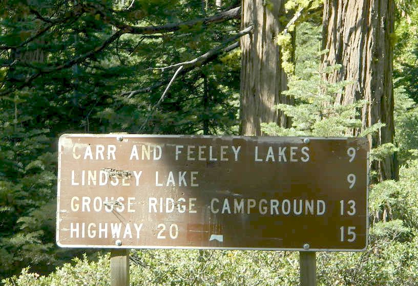
Lindsey Lake Campground 5900′ 7 vault lake
Lodgepole Camping 5800′ 18 vault Lake Valley Reservoir
Loganville Campground 6000′ 29 vault piped Yuba River, Sierra City
Logger Campground 6000′ 252 pines flush piped Stampede Reservoir
Long Ravine Campground 2300′ 28 pines flush piped Rollins Reservoir
Lower Little Truckee 6000′ 15 vault piped Truckee River fishing
Madrone Cove Campground 2000′ 11 none Bullards Bar Reservoir
Meadow Lake Campground 7200′ 15 vault Sierra fishing camp
Meadow Lake Shoreline 7200′ 10 vault High Sierra Nevada
Mumford Bar Campground 5300′ 5 vault Foresthill Road
North Fork Campground 4400′ 17 vault piped American River
Onion Valley Campground 2300′ 5 oaks vault Sierra fishing camp
Orchard Springs Campground 2300′ 15 oaks flush piped Rollins Reservoir, Colfax
Pack Saddle Campground 6000′ 15 pines vault pump Packer Lake
Lakes Basin
Parker Flat OHV Camping 3900′ 7 pines vault off roading trails
Pass Creek Campground 6100′ 30 pines flush piped Jackson Mdws Res
Peninsula Campground 2300′ 58 pines flush piped Rollins Reservoir
Pine Aire Campground 2700′ 75 pines flush piped South Yuba River Camp
Poppy Campground 5300′ 12 pines vault French Meadows Reservoir
Prosser Campground 5800′ 29 pines vault Prosser Res.
Ramshorn Campground 2600′ 16 pines vault piped Yuba River, Downieville
River Rest Campground 2700′ 105 pines flush piped South Yuba River Camp
Robinson Flat Campground 6800′ 5 pines vault well
Rocky Rest Campground 2300′ pines vault Yuba River, Downieville
Rucker Campground 5800′ 10 pines vault Rucker Lake fishing
Sagenhen Campground 6480′ 10 pines vault
Salmon Creek Campground 5800′ 32 pines vault fishing
Lakes Basin
Sardine Campground 5800′ 29 pines vault Sardine Lake Lakes Basin
Schoolhouse Campground 2200′ 56 oaks flush piped Bullards Bar Reservoir
Scott’s Flat Campground 3200′ 86 oaks flush piped Scotts Flat Reservoir
Shirttail Creek Campground 3700′ 30 pines vault Sugar Pine Reservoir
Sierra Campground 5600′ 16 pines vault Yuba River, Sierra City
Silver Creek Campground 5800′ 27 pines vault Truckee River fishing
Snag Lake Campground 6000′ 12 pines vault Gold Lake Lakes Basin
South Yuba Campground 2700′ 16 pines vault South Yuba River Camp
Sterling Lake Campground 6500′ 6 pines vault lake
Talbot Campground 5600′ 5 pines vault American River
Union Flat Campground 3400′ 11 pines vault piped Yuba River, Downieville
Upper Little Truckee Camp 6100′ 26 pines vault Truckee River fishing
Webber Lake Campground 6800′ 60 pines vault lake Sierra fishing
White Cloud Campground 4200′ 46 pines flush piped biking, Nevada City
White Rock Lake Camp 7800′ 8 pines none High Sierra Nevada
Wild Plum Campground 4400′ 47 pines vault piped waterfalls, Sierra City
Woodcamp Campground 6100′ 20 pines flush piped
Woodchuck Campground 6300′ 8 pines vault creek
Yuba Pass Campground 6700′ 12 pines vault piped Yuba Pass, Hwy 49
Loganville Campground
Loganville Campground on Hwy 49
Union Flat Campground
North Yuba River @ Union Flat Campground

Tahoe National Forest

Tahoe Topo Maps


Sierra NF – Road #9

sierra10S69

Sierra National Forest
Big Creek Road #9

aka. Rd #10S69

Connects Pine Flat Reservoir @ Lower Kings River, to upper elevation Sierra forests near Dinkey Creek Road. McKinley Grove of Sequoia

Sierra Road number 9 is a north turn off of Trimmer Springs Road. Marked as National Forest Rd #10S69, as well as just plain NINE. Big Crk. canyon is after the Maxson Road junction, and before the Balch Camp / Blackrock Reservoir turn off on #11S12. The area is known for abundant wildflowers in the early season.

dirt road climbs 25+ miles thru Sierra NF

sierra9

  • back road exploring
  • camping
  • fishing
  • hiking
  • hunting
  • kayaking
  • picnic areas
  • swimming
  • wildflowers
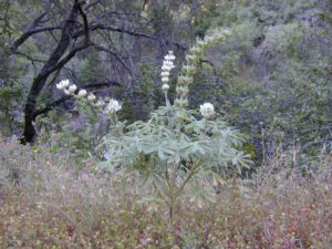
Tall White Lupine
Tall White Lupine

Big Creek Rd 9

A popular dirt road drive for the western Sierra – Pine Flat Lake region. A forested, south facing canyon in the Southern Sierra Nevada Mountains. Big Creek, wide, graded, dirt road w/ primitive camp sites. 4×4 could be needed in wetter months.

The higher you go on this route, the more pine trees you will experience. Winter weather can close this route. A campfire permit is required to camp along this road.

The lower part of the canyon has rock features, small waterfalls, swimming holes, picnic spots and sometimes cattle grazing. Several prime unmarked, primitive camp sites along this road – but few and far between. High clearance or 4WD may be needed, depending on road conditions.

sierra hiker

Soaproot Saddle Road is a not-so-obvious left fork (dirt, without signs) that leads steeply up away from main road. Climbs a steep hillside, way up above and along Rush Creek; continues for many miles. Less people back this way, if you are seeking seclusion. Few primitive camp sites on right side of road, near where the creek breaks away from road. Good for stargazing way back here. 4×4 may be needed. Road may or may not connect through to desired destination.

The mid-route climbs into pine forest and the dirt road switchbacks, steeply, with a few more camp sites available; usually found on short side roads off the main road.

sierra creek camps

At Sierra #9, a major junction w/ dirt road #10S69, called Dinkey Trimmer Road. This leads way off through the rugged terrain, many miles, over to the pavement at Dinkey Creek Jct – Campground, Trailhead and Dinkey Lakes Wilderness.

Big Creek will turn left (north), and follows the large Big Creek Canyon. Several steep miles climb up into the dense pine forest, following the creek the whole way. Several prime creekside camp sites fill up fast in this stretch. Great views, steep dirt roads. GPS waypoint these camp driveways – so you can find it next time, (first, before everyone) on Friday, Thursday before midnight.

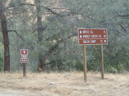
Peterson Mill Road is Rd #10S02, found on the left (west) side of Sierra #9. That westbound route becomes pavement half way back to Highway 168. This way is the quickest way from Fresno, out to the developed NFS Bretz Campground.

Sierra #9 Big Creek Road arrives in the densest of forests. Many camp sites and side routes to explore. Dark, upper elevations, snow lingers long in the shade. 4WD may be needed in wet areas. Mud is quite common MOST of the year in this spot, so know your vehicles capabilities before you get yourself stuck (or stranded). It’s a very long walk to any kinda civilization!
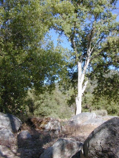
Hunters like to use these upper camps during hunting season. A camp fire permit is required, so bring your shovel and bucket; self-sufficient campers enjoy the back roads most often.
wild sierra flora

Bretz Campground NFS is up here on the main road, number nine. Clock it w/ dash trip meter; 15 miles from the road start @ Pine Flat Lake. Popular with OHV and 4×4 groups. Max RV or trailer length = 24′
Open all year long; No fee.

Sierra Forest Road #9 the far north end, enters Blue Canyon @ #10S18, but the Rd #9 route continues NE as Providence Creek Road. Eventually intersecting @ Dinkey Creek Rd w/ Rock Creek & Dinkey Dome closeby. Great granite 4×4 Trail @ Bald Mountain (elev. 7832′) overlooking Shaver Lake.

Jeepers on granite @ Bald Mtn, above Shaver Lake, CA

Kings River Camping

2 tone lupine

SIERRA MAP
sierra National Forest map

places nearby –
shaver lake map

Balch Camp (utility & NFS)
Black Rock Reservoir
Courtright Reservoir
Dinkey Creek
Huntington Lake
Lakeshore, CA
Pine Flat Lake
Shaver Lake, CA
Trimmer Springs
Wishon Reservoir

4S12 – Inyo NF

rockcreekroad

Rock Creek Road

Rock Creek Lake, Eastern Sierra, California

Inyo Forest Road #4S12
also known as Inyo Road 12, and also Rock Creek Rd.

Majestic mountain scenery. Popular paved route that leads from US 395 up to Rock Creek Lake, on the edge of granite wild lands; lake is situated above 9000′ elevation and the hiker trailheads are further up, beyond the lake at over 10,000 feet. Steep canyon, large canyon, rocky granite canyon, high elevation.

Super scenic drive, but open less than half the year, due to deep snow. Eastern Sierra Nevada mountains. Inyo National Forest

North of Bishop, CA
South of Mammoth, CA
SW of US Highway 395

hikes horse camp bike

backpacking
camping
fishing
hiking
horseback
trailheads
wilderness

A popular and favorite place for summer camping, fishing and hiking. Backpacking, horse trails, high elevation lakes, mountain passes, peaks, wilderness areas. RV campgrounds, tent camping, car camping. Mountain biking in vast canyon, near campgrounds and creek. No bikes in the Wilderness (up and above Rock Creek)

Autumn colors, aspen groves usually best in early October. Snow closure in winter months (Nov-May).

snowyautumn

elevation 7072′ @ Tom’s Place, CA (US Hwy 395)
elevation 9682′ @ Rock Creek Lake
elevation 10,272′ @ Trailhead Parking (end of road)

UP, UP, HIGHER & AROUND LAKE
One lane, paved route gets narrow, but keeps on climbing. Road #6S05 continues up – past Rock Creek Lake and ends at hiking trailheads, paved parking lot and a few picnic spots.

iris meadow
Iris Meadow Campground NFS

12 NFS Campgrounds in this region, starting with one at the highway, several along the way and the campgrounds at Rock Creek Lake.

No campfires are allowed in this canyon – outside of a developed campground. Not much in the way of primitive car camping options either, except for strapping on a backpack and heading into high elevation wilderness.

rockcreeklake

Rock Creek Lake

Rock Creek Campgrounds

Inyo National Forest
John Muir Wilderness

Trailheads along Rock Creek Road #4S12

  • Upper Hilton Lakes
  • Tamarack
  • Lakes Valley (Little Lakes)
  • JMT – John Muir Trail

Rock Creek NFS Hiking Trailheads (download PDF)

Eastern Sierra Maps:
Inyo National Forest Map USDA
John Muir Wilderness Maps
Mammoth Lakes Map by NatGeo
Mono Divide High Country Map


rock creek lake
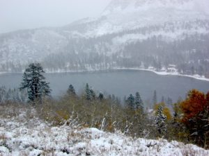
Rock Creek Lake, first snowfall (Autumn)


looking for another place called ROCK CREEK in California? (we are working on that)

6S05 – Inyo NF

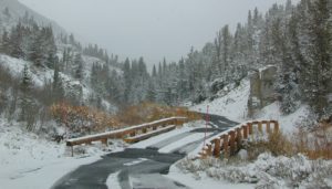
6S05bridge

Paved, one-lane extension of #4S12, Rock Creek Road.
Up above Rock Creek Lake, East Sierra Nevada, California

High elevation 10,272′ at roads end and parking lot

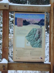
Little Lakes Valley Trailhead
Mono Pass
Morgan Pass
John Muir Trail (JMT)
Pacific Crest Trail (PCT)

Mosquito Flat Picnic Area

Restrooms, paved parking lot, nature trails, fishing creeks, horseback, wilderness trails.

hikes NFS camp horse camp

Mosquito Flat Walk-In Campground is intended for backpackers departing overnight into the backcountry the following day. Single night stay ONLY. Please camp down canyon if you plan to stay for more than one night. Bear lockers are provided at campgrounds for proper storage of food items, so use them!

No campfires are allowed outside of developed campgrounds. Day use does not require a permit. Wilderness permits are required for overnight trips into the John Muir Wilderness. Bear containers are required for backpackers. Permits for these trails are issued at Inyo National Forest ranger station in Mammoth, or the Eastern Sierra Visitors Center (ESIA) near Olancha.

littlelakesvalley

John Muir Wilderness (JMT) trails, Pacific Crest Trail (PCT), epic scenery, alpine lakes, high elevation. Eastern Sierra

Rock Creek NFS Hiking Trailheads (download PDF)

Rock Creek Pack Station provides wilderness pack trips on horseback, and day rides too.

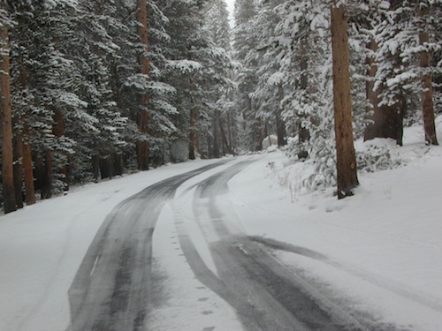
Road and canyon is CLOSED for winter snow approx. NOV-MAY

snowlane

Peaks and passes surrounding Rock Creek Canyon, in the Eastern Sierra Nevada Mountains –

Red Mountain 11,472′ (elevation)
Mount Morgan 13,748′
Morgan Pass
Mt Huntington 12,405′
Mono Rock 11,554′
Mono Pass
Mt Starr 12,835′
Mt Mills 13,451′
Mt Abbott 13,704′
Round Valley Peak 11,943′

Hike or horseback ride to these alpine lakes from Rock Creek Rd trailheads –

Davis Lake
Hilton Creek Lakes
Patricia Lake
Golden Lake
Pioneer Basin Lakes
Trail Lakes
Summit Lake
Ruby Lake
Mills Lake
Gem Lakes
Treasure Lakes
Dade Lake
Upper Morgan Lake
Lower Morgan Lake
Chickenfoot Lake
Little Lakes
Box Lake
Heart Lake
Marsh Lake
Serene Lake
Eastern Brook Lakes
Tamarack Lake
Buck Lake
Francis Lake
Dorothy Lake
Kenneth Lake

Spicer Reservoir

spicer terrain


Spicer Meadow Reservoir

Spicer Meadows, Spicer Reservoir, Rd #7N01
Spicer Lake, Stanislaus National Forest

lake elevation 6418′
227 surface acres

public boat ramp
hiking trail around lake
more lakes nearby

Ebbetts Pass Sierra Hwy 4

Ancient volcanic peaks mix with Sierra Nevada granite rock, pine forests and fresh, clear, clean mountain water! California, of course.

Stanislaus Forest Road #7N01 leads down from Highway 4 to this popular series of alpine lakes and reservoirs. Camping, fishing, hiking and mountain biking. Sailing, canoeing, kayaking, swimming, floating and fishing are also popular water activities.

Rules of the Reservoir:
10 mph speed limit on Western Arm.
No motorized boating in Eastern Arm.
Camp only in developed Campgrounds.

NFS
2 NFS Campgrounds at west end of lake:

  • Spicer Campground (60 sites)
  • Spicer Group Camp (75 people max)
  • Campgrounds only open June-September. Some campsites at the campground are wheelchair accessible.

    Additionally, Stanislaus River Campground w/ only 8 sites, is located just off the main access road #7N01, right near the river.

    spicer lake shore

    Spicer #7N01

    Numerous smaller lakes in the region make this a hot spot for summer vacations. Union and Utica Reservoirs (both with dirt road access) are good for kayaking and canoes, while power or sail boats prefer the larger Spicer Lake. Summit Lake and Elephant Rock Lake are perfect for quite picnics and day hikes. Trails (many unmarked) connect the lakes to each other. Area gets buried with snow in winter, so these roads are generally only open half the year.

    More reservoirs and lakes nearby:
    Highland Lakes
    Mosquito Lakes
    Lake Alpine, CA
    (all along Hwy 4)

    Stanislaus National Forest Map USDA
    Stanislaus National Forest Map USDA

    Nearby mountain towns:
    ARNOLD, CA
    BEAR VALLEY, CA
    Lake Alpine, CA

    Kirkwood Lake

    Kirkwood Lake Campground

    kirkwood granite

    Central Sierra Nevada mountains
    Kirkwood Lake is west of Kirkwood Ski Resort;
    west of Silver Lake @ Carson Pass Hwy 88

    Kirkwood, CA
    El Dorado National Forest

    Inside the granite maze of rock known as Caples Creek, you may find this small lake, just off the highway. Paved access camp ideal for quiet weekends – fish, hike, stargaze and relax. Snow is deep in these parts of the Sierra, so the campground closes annually for winter.


    No motor boats
    No RV or motorhomes
    No horse trailers

    Small Camping Lake

    Kirkwood Campground

    • Elevation: 7,600′
    • Number of Sites: 12
    • Vehicle Accessibility: No RVs
    • Campsites Reservation: No
    • Campsite Fee: Yes
    • Length of Stay: 14 Days
    • Season: June – October
    • hiking trailheads, fishing, swimming, kayaking, canoe, rock climbing

    Bears are active in this region, so use the metal bear boxes provided to store all food items.

    Canoe Lakes

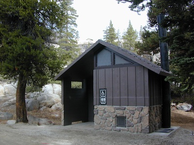
    Extra precautions should be taken with human waste around fragile eco systems, like lakes and meadows. Use the new bathroom, instead of the bushes (or granite crack).

    new toilets
    new toilets
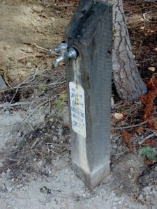
    pipe drinking water
    piped drinking water, a camp luxury

    Eastern Sierra Hiking

    Eastern Sierra Hiking Trails – Mammoth Hikes

    Autumn Bliss Hike

    Desert ghost towns to Sierra meadows & waterfalls, Inyo National Forest offers plenty of diversity for scenery. To list all the hikes in the Eastern Sierra would be obsurd, cuz there are so many trails. This side of the Sierra Nevada is all about hiking, fishing & camping.Inyo forest map

    No matter where you hike you will probably get a great view over the Owens Valley, Long Valley Caldera or Mono Lake. So that means most of those trails are hiking up a canyon, or a ridge line. Thousands of trails over this region require a good map to make the best decision for your hiking interest.

    US HWY 395: The Eastern Sierra is one of the premier hiking destinations of California. Featuring the granite crags of the HIgh Sierra peaks. Mount Whitney, the tallest peak is closest to Lone Pine. Southern Californians love Eastern Sierra destinations, cuz they can avoid Los Angeles Basin and stay outta traffic.

    Lone Pine Lake – Whitney Portal is a great, but crowded place for hiking. DO NOT ATTEMPT to hike to Mount Whitney in one day! Leave it to the seasoned pros. The first good stop up the Whitney Trail is gorgeous Lone Pine Lake, a great moderate day hike from there.

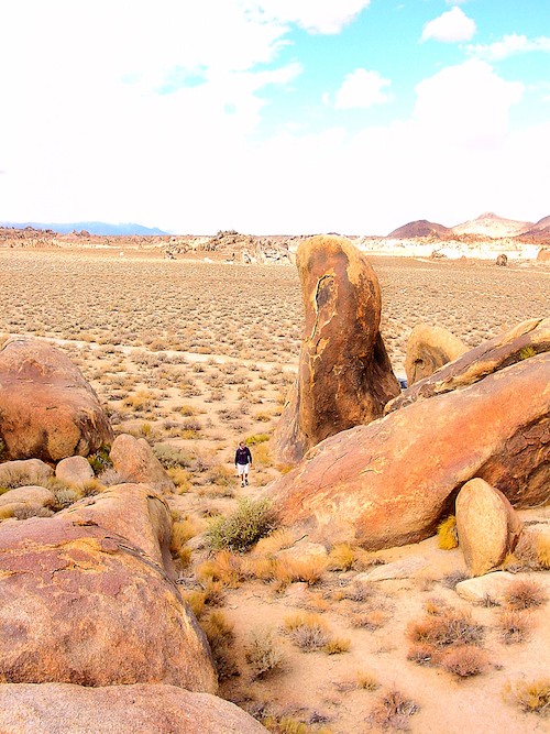
    Alabama Hills – just below Mt. Whitney and has a totally different landscape than the backdrop granite Sierras behind. Try some boulder hopping & explore the dirt roads. Bring your mountain bike too.

    Cottonwood Lakes (Pacific Crest Trail) – day hikes to alpine lakes. US 395 @ Lone Pine, W on Whitney Portal Rd. Left on Horseshoe Meadow Rd & continue up 19 mi. to the Horseshoe Meadow campground. Mostly a trail head camp, way, way up there. Open May – November

    Kearsarge Pass – from 9000′ Onion Valley you can access the incredible High Sierra & numerous alpine lakes. The elevation gain makes this a full days hike; rated strenuous. Or continue on w/ backpack into Kings Canyon National Park.

    Devils Postpile – back behind Mammoth Mountain, creeks, forest & cool geology awaits. Plenty hiking trails.

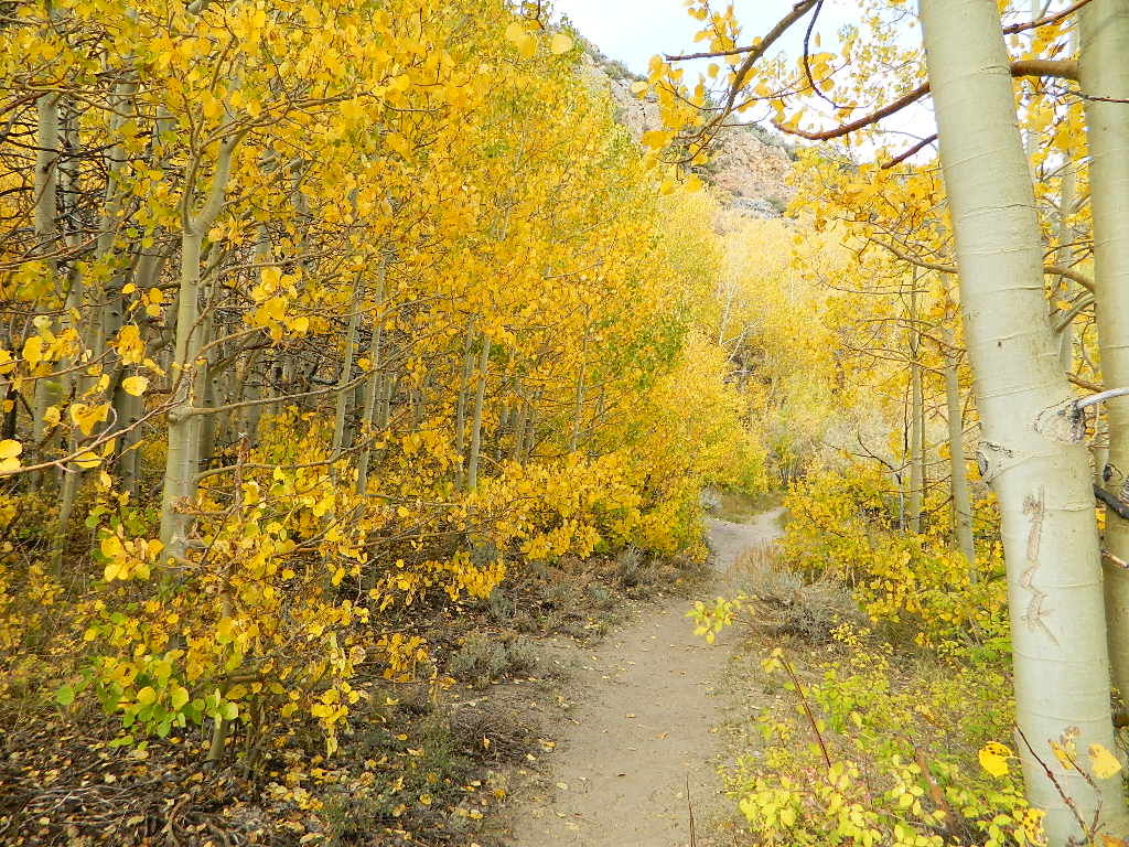
    FALL COLORS: Autumn is the best time to enjoy the gorgeous aspen groves, as they change colors w/ the onset of winter.

    Eastern Sierra Peaks

    Topo maps, wilderness hiking maps
    Equestrian trails, OHV maps –


    Sierra High Country Hikes
    Originally uploaded by danamight

    Trailhead @ Onion Valley leads up to impressive alpine lakes, Kearsarge Pass & Kings Canyon High Country.

    Eastern Sierra communities include:

    Alabama Hills
    Alabama Hills @ Lone Pine, CA

    El Dorado Campgrounds

    El Dorado Camping

    Kirkwood Lake
    Kirkwood Lake, California

    El Dorado National Forest
    Carson Pass Hwy 88, Ebbetts Pass Hwy 4, Gold Rush Country
    Sierra Nevada Mountains, Alpine Lakes

    campground elev spots veg toilet water notes
    Airport Flat Campground 5300′ 16 vault no Ice House Reservoir
    Azalea Cove Campground 4900′ 10 vault lake Union Valley Reservoir
    Big Meadows Campground 5300′ 54 pines flush piped handicap access
    Blue Lake Lower Camp 8100′ 16 vault piped PG&E; fish, boat, camp
    Blue Lake Dam Upper 8200′ 25 vault piped PG&E; fish, boat, camp
    Caples Lake Campground 7800′ 35 pines vault piped fishing lake
    Capps Crossing Campground 5200′ 12 pines vault piped gold panning
    China Flat Campground 4800′ 25 vault piped Silver Fork Rd
    Dru Barner Campground 3200′ 16 flush piped equestrian trails
    Gerle Creek Campground 5300′ 50 pines vault piped handicap access
    Fashoda Campground 4900′ 30 vault piped handicap access
    Hell Hole Campground 5200′ 10 vault piped walk-in
    Upper Hell Hole Campground 4600′ 15 vault lake Hell Hole Reservoir
    Ice House Reservoir Camp 5500′ 83 vault lake handicap access
    Jones Fork Campground 4900′ 10 vault lake Union Valley Reservoir
    Kirkwood Campground 7600′ 12 pines vault piped narrow road; fishing
    Lone Rock Campground 4800′ 5 vault lake Union Valley Reservoir
    Loon Lake Campground 6500′ 62 pines vault piped equestrian; group site too
    Lovers Leap Campground 5800′ 21 pines vault piped rock climbing
    Lumberyard Campground 6500′ 5 pines vault RV access
    Middle Creek Campground 8200′ 5 pines vault piped fishing creek
    Middle Fork Cosumnes River 6780′ 5 vault crk PG&E, swim, fish
    Mokelumne River Camp 3200′ 8 vault crk swim
    Moore Creek Campground 3200′ 8 vault crk swim
    Northshore Campground 6378′ 15 vault lake Loon Lake Campground
    Northwind Campground 5500′ 9 vault lake Ice House Reservoir
    Pardoes Point Campground 5900′ 10 pit no Bear River Reservoir Rd
    Pipi Campground 3900′ 51 pit no handicap access
    Sand Flat Campground 3900′ 29 pit no fishing
    Silver Fork Campground 5500′ 35 vault piped fishing
    Silver Lake Campground 7200′ 62 pines vault piped boating lake
    South Fork Campground 5200′ 17 vault piped fishing
    South Shore Campground 5900′ 22 vault piped Bear River Reservoir
    Strawberry Point Camp 5500′ 10 vault lake Ice House Reservoir
    Stumpy Meadows Campgr 4400′ 10 vault lake handicap access
    Sugar Pine Campground 6000′ 10 vault no boating
    Sunset Campground 4900′ 131 vault piped boating
    Wench Creek Campground 4900′ 100 vault crk boating
    Wentworth Springs Camp 6200′ 8 vault crk 4WD recommended
    West Point Campground 4875′ 8 vault lake Union Valley Reservoir
    White Azalea Campground 3500′ 6 vault crk Mokelumne River
    Wolf Creek Campground 8200′ 42 vault piped boating, fishing
    Woods Lake Campground 4900′ 25 vault pump handicap access
    Yellowjacket Campground 4900′ 40 vault piped boating, fishing

    see more about El Dorado National Forest

    waterfalls

    nearby towns –

    El Dorado Forest Maps –

    Ansel Adams Wilderness

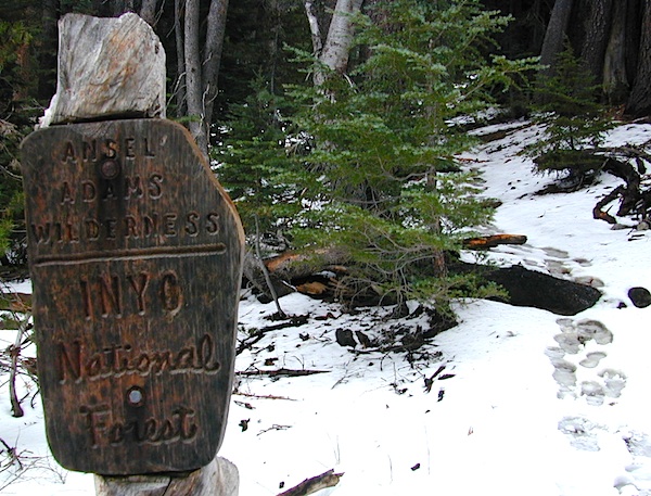
    anselwoodsign

    Alpine high country hiking, Sierra Nevada mountains, California

    Ansel Adams Wilderness Area

    Ansel Adams Trail Map, Tom Harrison
    Ansel Adams Map, Forest Service USDA
    Ansel Adams Map, NatGeo

    Ansel Adams Hiking Map
    The Ansel Adams Wilderness is an area in the Sierra Nevada of California. The wilderness is part of the Sierra and Inyo National Forests, in the Eastern Sierra portion of the range, overlooking Mono Lake. Yosemite EAST is what NatGeo likes to call it. The wilderness spans 231,533 acres with Yosemite National Park lies to the north and northwest, while the John Muir Wilderness lies to the south.

    The wilderness was established as part of the original Wilderness Act in 1964 as the Minarets Wilderness. The 109,500-acre Minarets Wilderness was created by enlarging and renaming the Mount Dana-Minarets Primitive Area.

    In 1984, after his death, the area was expanded and renamed in honor of Ansel Adams, well-known environmentalist and nature photographer who is famous for his black and white landscape photographs of the Sierra Nevada.

    Ansel Adams Wilderness Map

    outdoor recreation –

    • backpacking
    • camping
    • fishing
    • hiking
    • horseback
    • ice climbing
    • lakes
    • mountaineering
    • peaks
    • wildflowers

    surrounding park & forest lands –

    nearby towns –

    leeviningvalley
    lee vining canyon

    Ansel Adams Wiki
    Ansel Adams Hiking on Summit Post

    Day hikes or overnight backpacking trips require a Wilderness permit and can be obtained at the local ranger station. A good topo map will also prove invaluable on your hike. Access trailheads for Ansel Adams Wilderness from EAST and WESTERN sides of the Sierra Nevada range.

    Ansel Adams Trailheads from the west –

    Onion Springs Meadow trailhead, Vermillion @ Lake Edison (Sierra NF)

    Isberg trailhead & Mammoth trailhead @ Granite Creek Campground via Beasore Road, way up behind Bass Lake (Sierra NF)

    Isberg Pass trailhead from Yosemite National Park

    Ansel Adams Trailheads from the east –

    Bloody Canyon, Walker Lake trailhead, near Grant Lake on June Lake Loop (Inyo NF)

    Rush Creek / Fern Lake trailhead, near Silver Lake on June Lake Loop (Inyo NF)

    Agnew Meadows trailhead & Minaret Vista trailhead, Mammoth Lakes CA (Inyo NF)

    Devil’s Postpile trailhead, behind Mammoth Lakes CA (Inyo NF)

    Fern Lake Reflection
    Fern Lake, day hike from Hwy 158 (June Lake Loop)

    Northern Sierra Nevada

    Sierra Nevada North / Northern Sierra Nevada Mountains

    lakes basin views

    sierra buttes
    the sierra buttes

    Northern Gold Country, Yuba River

    Sierra granite rock meets volcanic rock at Lakes Basin & Lassen NP

    Some California maps consider Mount Lassen to be the top of the Sierra Nevada range, while other maps cut it off at Lakes Basin @ Sierra Buttes, much further south. Lassen Peak is actually part of the Cascade Range of mountains that go up the coast of the Pacific Northwest. Either way, we’ve included Lassen maps in this list.

    Tahoe National Forest Map

    South Yuba River Map

    Lake Basin Recreation Area
    Lake Basin Map
    Sierra Buttes Map
    Gold Lake, Graeagle, Sierra City

    Plumas Eureka State Park
    Plumas Eureka State Park Map
    Middle Fork Feather River Map
    Blairsden, Portola

    View East from Davis
    Crocker Mountain @ Lake Davis, California

    Plumas National Forest
    Plumas Forest Map
    Almanor, Crescent Mills, Greenville, Inskip, Paradise, Quincy, Portola

    Sierra Nevada

    Lassen National Forest
    Lassen Forest Map
    Burney, Chester, Fall River Mills, Paynes Creek

    lassen park

    Lassen National Park
    Lassen Park Maps
    Mineral, Old Station, Westwood

    laseen camps

    Yosemite Lakes

    yosemite camping lake
    Lakes in & around Yosemite

    These are picnic lakes, hiking lakes and camping lakes that are located inside Yosemite National Park or the surrounding areas bordering the granite wonderland.

    Tioga
    Tioga Tent Camping

    John Muir Wilderness

    John Muir Hiking / John Muir Map

    High Sierra Hiking

    California Wilderness Area Acres Topographical Maps
    John Muir Wilderness

    elevations: 4000′-14,496′

    584,000 John Muir Wilderness Maps
    Inyo National Forest

    JMT

    High Sierra Nevada / Eastern Sierra

    Rugged Sierra Nevada high country. The highest peaks in the Sierra Nevada mountains can be found inside this Wilderness. Many peaks are well above 13,000 feet. Granite, glaciated basins, big snow, alpine lakes, meadows, wildflowers, streams, creeks, cliffs, jagged peaks. Mount Whitney stands as the tallest mountain in the lower 48 states.

    John Muir Trail Maps
    – JMT Topo Map

    lacontedivide
    Le Conte Divide, Sierra Nevada California – 12,000′ elevation peaks

    Eastern access via steep granite hiking, off US Hwy 395 (Bishop, Independence, Lone Pine)
    Western access backpacking thru Kings Canyon National Park, Hwy 180
    or Sequoia National Park, Hwy 198 (Mineral King, Three Rivers)
    or Sierra National Forest, Hwy 168 (Lake Edison, Florence Lake, Courtright Reservoir)
    North access via backcountry Yosemite National Park, Hwy 120
    or Mammoth Area towns (Lee Vining, June Lake, Mammoth Lakes)

    Hundreds of miles of hiking trails, some of the highest peaks in the nation. Trails open to equestrian and foot traffic only. Trailhead quotas limit the amount of day hikers and backpackers that an access the Wilderness daily. Wilderness permit required: Inyo National Forest Permits

    Eastern Sierra Visitor Center
    Inyo Visitors Office

    JM Topo Trails

    USDA National Forest
    USFS, NPS, BLM

    NFS NPS

    Eastern Sierra Interagency Office
    US Hwy 395 @ SR 136
    Lone Pine, CA 93545
    760-876-6200

    JMT
    JOHN MUIR TRAIL- John Muir Wilderness

    nearby towns, parks & resorts:

    Aspendell
    Big Pine
    Bishop, CA
    Courtright Reservoir
    Florence Lake
    Independence, CA
    Kings Canyon National Park
    Lake Edison
    Lone Pine, CA
    Mammoth Lakes
    Olancha, CA
    Tom’s Place
    Wishon Reservoir
    Yosemite National Park

    www.flickr.com

    19S01 – Inyo NF

    south sierra ridges

    Walker Creek Road #19S01
    – Inyo National Forest

    Southern Slopes, Eastern Sierra Nevada

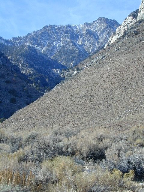
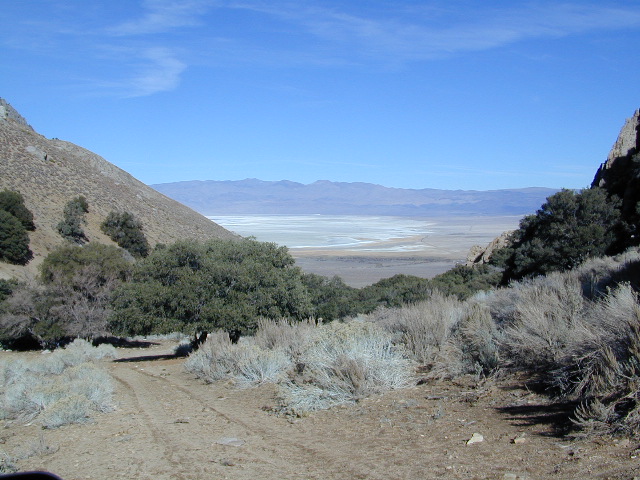
    Just south of Olancha, off US Hwy 395 is a dirt road that takes you 5 miles up to an oak canyon lined with rocks. There are several primitive camp sites along the Walker Creek. A high clearance vehicle may be needed in some sections, but 4×4 is not required. Small RVs might attempt this, but if the first mile frightens you, turn around while you’re ahead.

    Dirt Road near 395

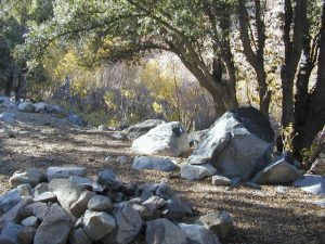
    This private, shaded, creek area is perfect for those traveling Highway 395, looking for a quick and free camp spot near Olancha, CA

    nice shady spots
    Shady picnic or camp spots above 4000′ elevation.

    some granite
    Hiking trails at the end of the road lead deep into the mountains. One on the right takes you to waterfalls. The trail on the left will take you to meet up with the Sage Flat Trail, which leads up to Olancha Pass, Summit Meadows & a small lake, in the South Sierra Wilderness. The Pacific Crest Trail runs the ridges here, just west of Monache Meadows, which is at 8000′ elevation, way above here – up on top. 

    First Camp

    US 395 highway – the dirt road turn off is very close to a gas station, and it maybe be signed, or not. The gas stop may be in business, or perhaps not. This is rural California, wide open desert and things come and go quickly.

    On a good topo map, located Olancha Creek and Summit Creek to the south. Walker Creek is the canyon in between those two, just so know where you are going and can visualize. This one is an easy-to-miss dirt road turn off – especially if you are going over 50 mph.