Fumaroles and Boiling Mudpots Hot Springs near Lassen Peak Volcano
South side of Mount Lassen, outside the National Park boundary several non-soakable hot springs exist:
Growler Hot Springs (private land)
Morgan Hot Springs (private land)
* Measured temperatures of these hot springs range from 126 to 207°F (52-97°C), so basically SCALDING HOT & dangerous
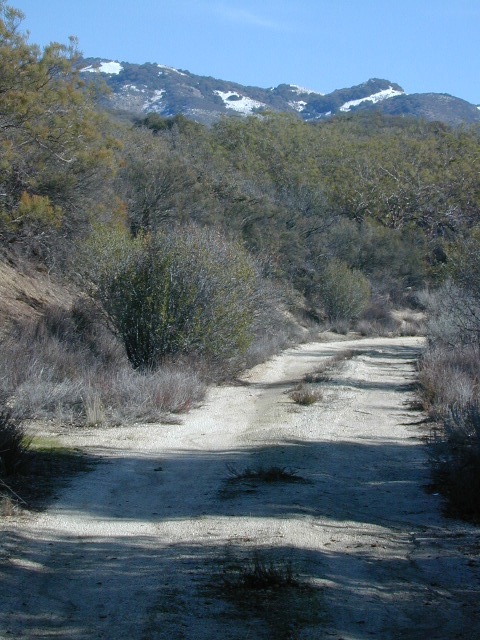
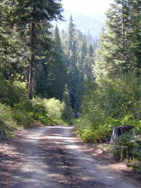
Little Hot Springs Valley (within the National Park boundary) is also not fit for public use either. Although it may be appealing as a sightseeing destination, (accessible by dirt road) it is far from soaking quality.
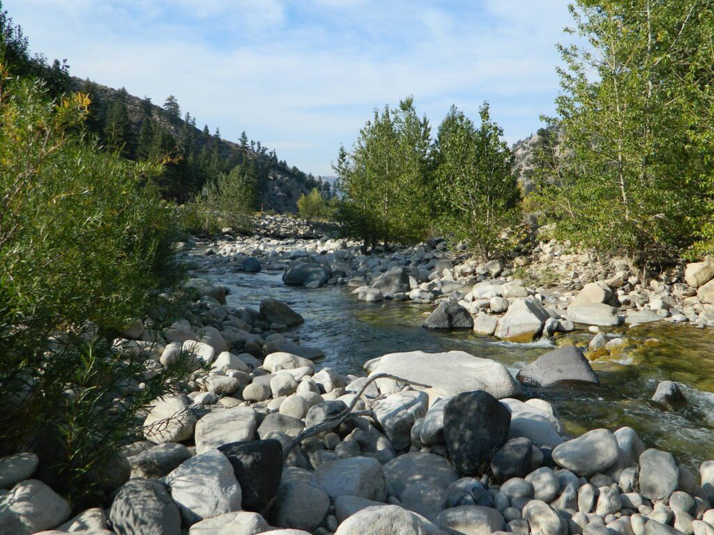
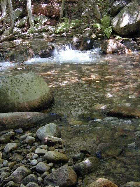
Hot Springs Creek flows south into Mill Creek
DixieFire 2021 ravaged California’s Volcanic National Park. Morgan Mountain lightning strike fire merged with the monster fire to the east. NPS fire crews and CalFire lit a back fire near the Visitors Center on Hwy 89 – to burn and meet the bigger oncoming fire. Winds from the north forced the giant wildfire from the peaks and down hill to Mill Creek and Child Meadows, where firefighters were able to control the leading edge of the fire.
the only real hot springs worth visiting around Lassen National Park
rumors have it that the resort may still be standing – after the fire!
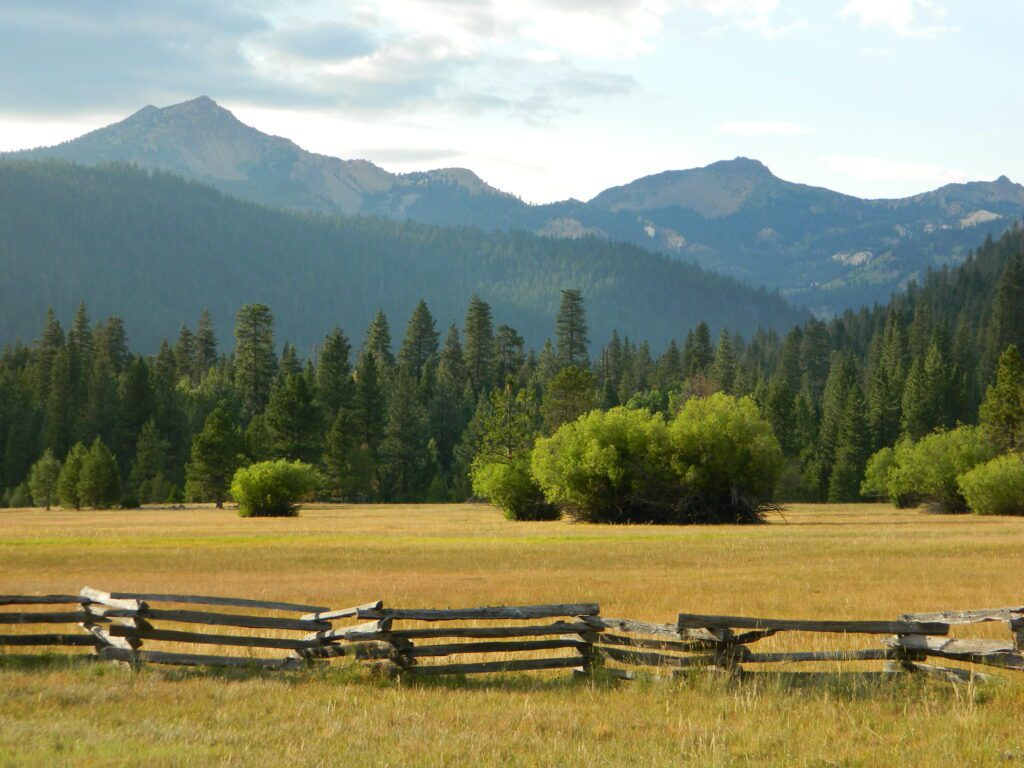
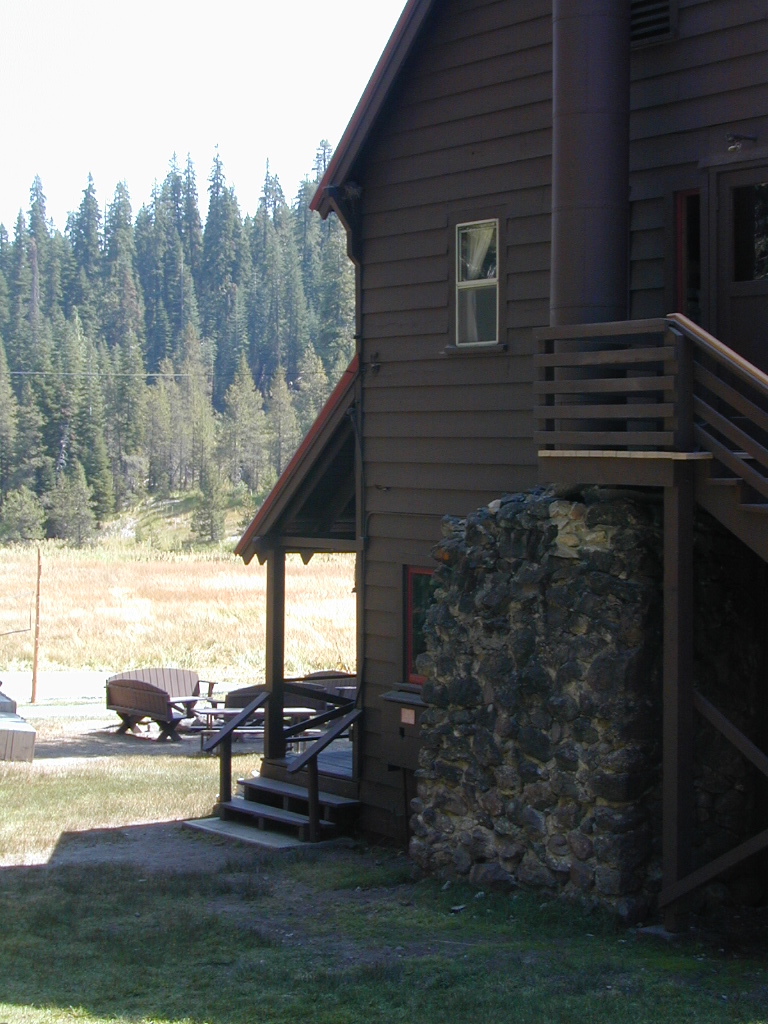
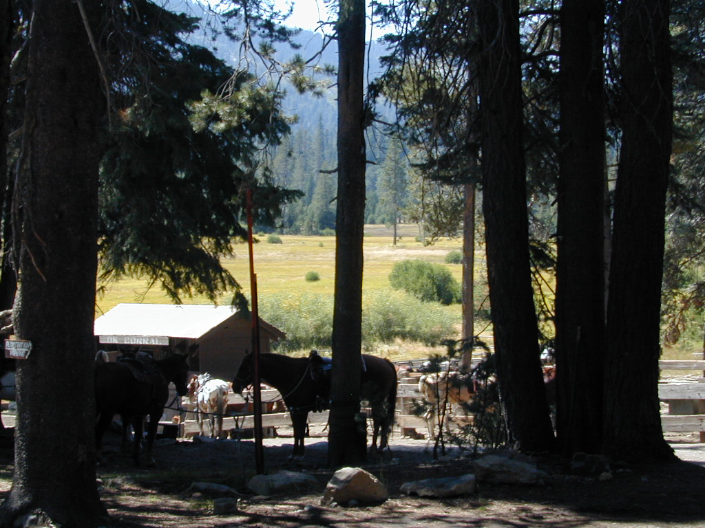
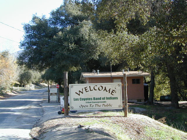
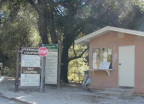
Built in 1900, this historic, rustic mountain meadow resort is accessible by dirt road through Warner Valley – north of Chester, CA. They have a swimming pool, naturally heated by the local hot springs. Plus rental horses, hiking trailheads and a developed campground nearby.
JULY 2021 – Drakesbad is CLOSED due to wildfire Dixie Fire
Great rural location, in-route to many destinations in Southern Cal. Temecula wine country, Warner Springs, Culp Valley, Anza Borrego Desert State Park, Borrego Springs.
Campground is a popular spot with locals, so note that some weekends can get rowdy. Ask about a more secluded camp site option if needed. There is plenty of primitive land out here.
Oak trees and boulder hills, dirt roads, near Hot Springs Mountain. North San Diego County.
Silver Lake Road #10
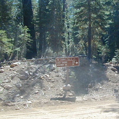
20 miles off Highway 89. Northbound, outside of Westwood @ Lake Almanor, take County Road A21 to County Road 110 (Silver Lake Rd)
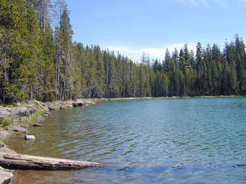
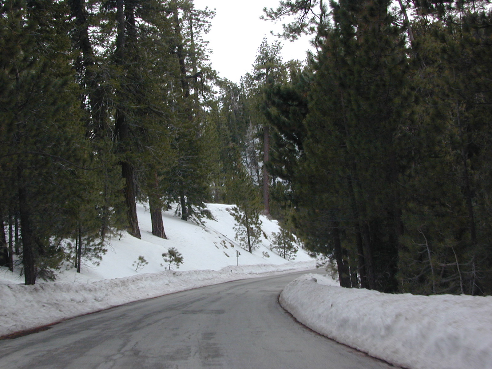
Dirt road boat ramp @ southern end of lake. Winter weather & snow closes this area annually, so this lake is mainly a summertime destination. Mid-week tends to be less popular for those seeking seclusion.
backpacking
fishing
camping
canoe
hiking
kayaking
Hiking trails lead to Caribou Lake, Emerald Lake, Betty Lake, Trail Lake, Shotoverin Lake & Caribou Wilderness.
Silver Bowl Campground NFS
• Elevation: 6400′
• Number of Sites: 18
• Vehicle Accessibility: small RV
• Campsites Reservation: No
• Camp Fee: Yes
• Toilet: Vault
• Water: piped/potable
• Length of Stay: 14 Days
• Season: May – October
• Trailheads: Caribou Wilderness
Lassen National Forest
Lassen National Forest
Almanor Ranger District
900 East Highway 36
Chester, CA 96020
530-258-2141
2 Silver Lake in East Lassen? Surely.
Only 12 miles apart. As the crow flies.
Largest is Silver Lake, south of Caribou Lake, Lassen National Forest. East of the National Park, accessible by vehicle. The popular one that is mentioned above.
Small Silver Lake at 6600′ elevation, is a hike-in only lake. Inside Lassen National Park, west of Snag Lake and the Fantastic Lava Beds.
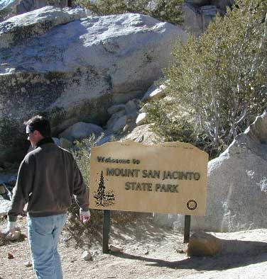
San Jacinto State Park Headquarters
25905 Highway 243
Idyllwild, CA 92549
Rangers & Wilderness Permits
951-659-2607
Mount San Jacinto State Park is surrounded by Wilderness area, the village of Idyllwild & the Palm Springs Tram station. Tahquitz Peak close to Idyllwild, is a rock climbing favorite.
Stone Creek Campground is located in the forest, along Highway 243. Elevation 5900′ w/ 50 camp sites & max RV = 24′
Idyllwild Campground is walking distance from town. North end of Idyllwild, CA. 33 camp sites & max RV = 24′
Blue Lake in Modoc National ForestHiking Lake w/ Loop Trail in far Northern California
Blue Lake
Modoc National Forest
When you really wanna get away from it all, take a week off and head up to Modoc – the top northeast corner of California, where the volcanic mountains line the Great Basin. The population is minimal, cattle are abundant and the campers few. Even in mid summer, this ideal lake campground rarely fills up.
Jess Valley Road leads east off US 395 @ Likely, CA – 16 miles back to this hidden gem.
Headwaters to the Pit River.
NFS Campground is shady, well managed, and spread out on the eastern slope w/ numerous paved loops. Tent campers, cross country cyclists, truck campers w/ canoes, SUV families, motorhomes with kayaks and kids.
Modoc Map
Blue Lake Campground NFS
• Elevation: 6,050′
• Number of Sites: 48
• Vehicle Accessibility: 32′ RV
• Camp Fee: Yes
• Campsite Reservation: No
• Water: Piped
• Length of Stay: 14 Days
• Season: May –October
• Trailhead: Lake Loop
• Boat Ramp: Yes
Group Camp Facilities (by reservation only)
Modoc NF Warner Ranger District
@ 530-279-6116
Lava Rock @ Blue Lake Loop, in Modoc County, CA
Blue Lake National Recreation Trail
Right next to camp: A pretty much perfect LAKE LOOP (1.5 mi) hiking trail is worth a serious stroll; footbridge, wildflowers, fishing spots, minimal hills, lava rocks, and awesome scenery. Plenty of wildlife can be seen, including butterflies and bald eagles. Trail is shaded by tall white fir and ponderosa pine trees. Trailhead is located at the Day Use parking lot, w/ paved boat ramp, dock, and picnic area.
back roads
boating
camping
canoeing
fishing
hiking
kayaking
mountain biking
picnicking
swimming
stargazing
wildflowers
wildlife
NOTE: not every CAMPSITE has a LAKE VIEW
Certain campsites are adjacent to the lake; some are set facing a meadow (Autumn w/ aspen groves), or the alpine forest w/ deer grazing. Perhaps an inner circle (interior) campsite, for those who like to be close to bathrooms and piped water. Large families will love the abundance of camp settings and accommodations.
Paved Loop Plenty of Vault Toilets Piped Water Recycles & Trash Service
Large Campsites can accommodate Motorhomes
no paved camp stall
no hook-ups
no dump station
no cell phone signal
popular lake camp for motorhomes
When driving a large RV back in here, be courteous of other campers. Nothing sucks more than driving a long distance to the boonies, to arrive at camp just before dark and annoying everyone else already there.
Those needing to drive the campground loops (more than twice) looking for the biggest, levelest, best camp site – and burning $10 in gasoline doing so, should consider walking in.
Park that beast (near boat ramp area, before the camp entrance). Get out and walk the hills and loops, BREATHE & relax – prior to a choosing camp site.
Unhitch any tow vehicles; use that to scout out your perfect spot, if you cannot hike it. Trailers and large motorhomes will find this place ideal, but getting the right camp, can make all the difference.
Paved Trail around Campground
The wildfire: BLUE FIRE burned this region in 2001, but it is lush and green again (2019). Northern California gets some real weather. Rain and snow, more than half the year. The campground closes annually due to snow.
Kayaking is best done in the morning, cuz wind picks up in the afternoon. Canoes can launch at boat ramp, or at shoreline from trails near campsite.
Hiking trails can be found all around lake and campground. Wilderness access can be found at South Warner trailheads within a short drive from the lake.
Cyclists also love this camp, as it is located near a major highway and is a perfect place to really relax, soak in the scenery and get some quiet-nights sleep.
South Warner Wilderness is close by, driving distance; accessible by graded dirt roads. Signage is decent.
Modoc Forest Road #64 is a through-route, across the lower South Warners – 40
miles connecting to east side of the mountain, at Eagleville, CA.
Dirt Roads are suitable for trucks w/ trailers. SUVs and rugged passenger cars are okay. Motorhomes are not advised on this route. Washboard conditions are typical. Winter closure on this route is common.
MODOC RD 64
Several miles away from Blue Lake, 2 rustic trailhead campgrounds are located back this way – East Creek Campground & Patterson Campground. Less than 10 camp sites each, equipped w/ horse stalls, vault toilets and maybe piped water. Trailhead parking for backpackers. No RVs!
Autumn colors w/ aspen groves. Open, large meadows and mature forests w/ wildfire scars. Cattle can be found grazing all around, many cattle crossing.
Minimal primitive camping options, along road sides. Campfire permits required. No camping within one mile of a developed campground.
Modoc is Cow CountryDay Trippin – Out exploring Modoc Road 64 (and cutting firewood)
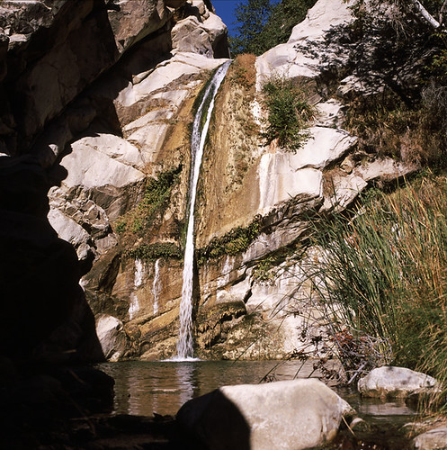
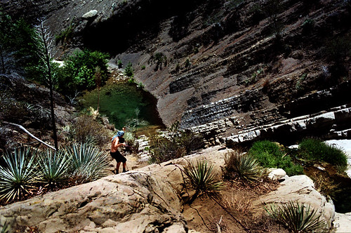
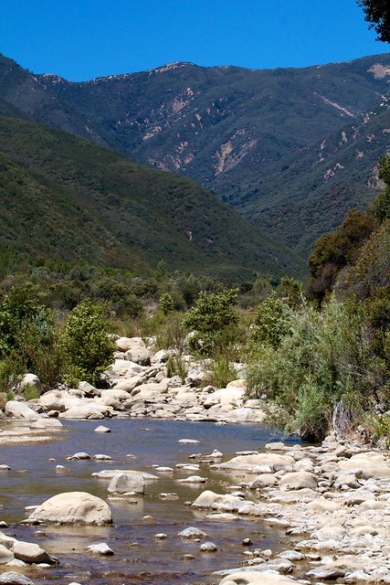
The coastal mountain range wilderness located approximately 12 miles north of Ojai, CA. Drive 5 miles N on Highway 33; left at the Matilija Canyon Road turn off.
Chaparral is the prevalent vegetation with poppies plentiful in springtime. Cottonwood, alder and maple trees dominate the canyon. One trail has trail campsites along it and follows 9 miles of the North Fork, gaining about 3,400′ feet in elevation as it makes a north-south journey, and leaving the Wilderness at a parking area on Cherry Creek Road. This road is open seasonally from Aug. 1 to Dec. 15
This whole area burnt in a recent wildfire and much of it may be closed off to the public.
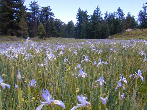
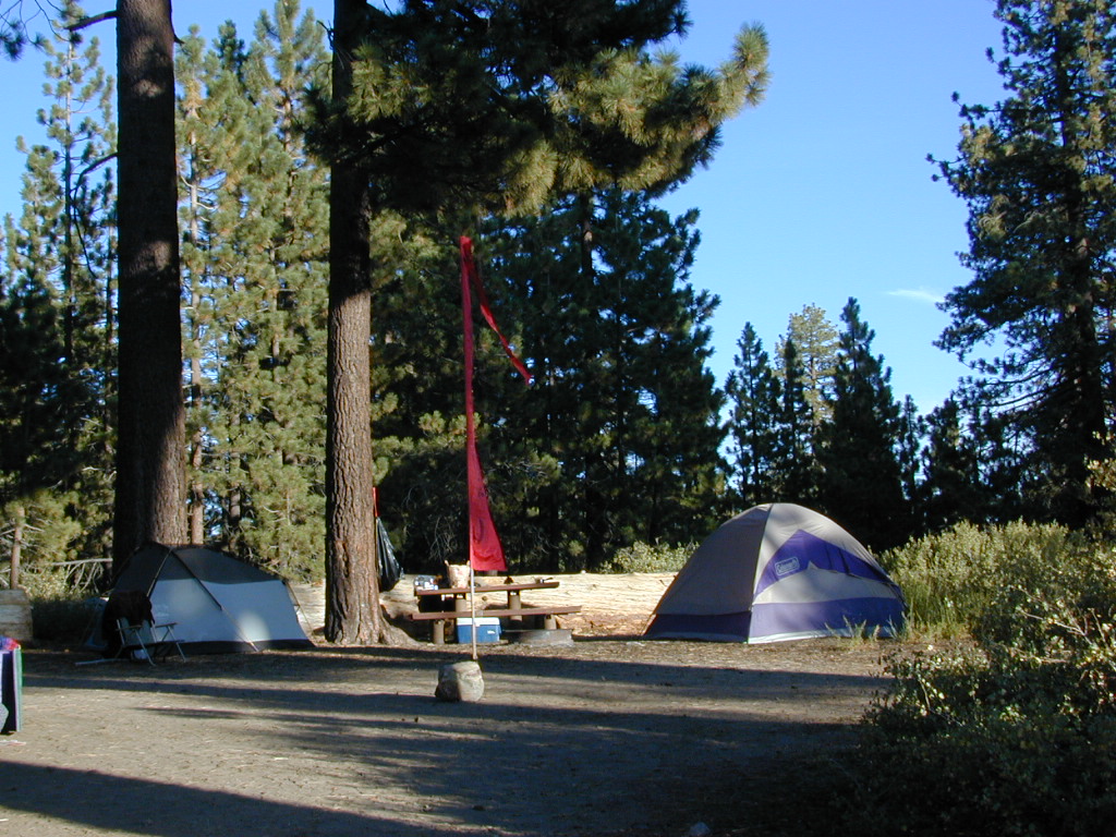
A little bit of high altitude, alpine forests in Southern Cal. Mount Pinos campgrounds are the ones on the way up to Mt Pinos 8831′ on the paved route to the top parking lot, Mount Pinos Road. Only 2 campgrounds take reservations & can be busy in summer months. Chula Vista Camp (at the top parking lot, short walk on trail) has an amazing wildflower meadow w/ group camp area. Drum circles are common on summer weekends.
backpacking
camping
hiking
mountain biking
sledding & snow play
stargazing
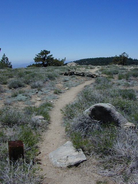
Mount Pinos parking lot is well known among RVers, astronomers & cross country skiers. If the 2 snow gates are open, you’ll find RVs camping out here until winter officially starts. The peak to peak trail from Mt Pinos to Mt Abel 8243′ starts at this parking area & trail head. Cool ski hut that no Forest Personnel every seems to be operating. Portable toilets available.
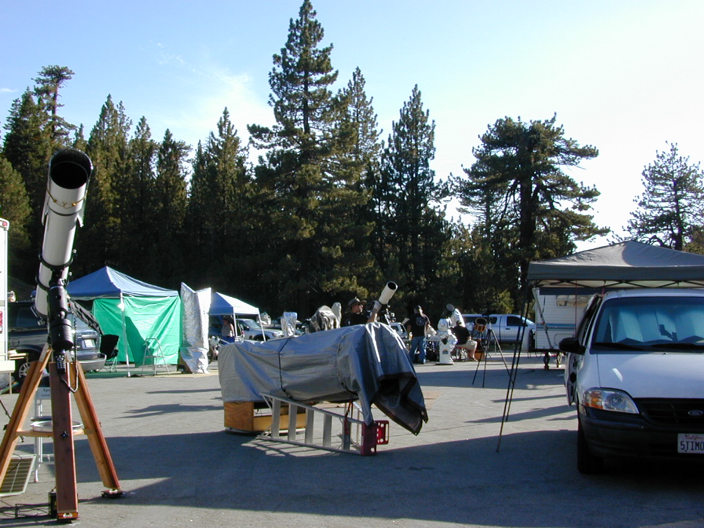
Pinos Star Party
In the mid-winter, snow is almost guaranteed up here. Families & sledders flock to this region for snow play causing major traffic jams & parking problems. On the busiest of weekends w/ a recent snow storm, you may find several miles of vehicles, backed up from Pinos to the freeway (causing 10 miles of traffic jam in the mountains). It is not uncommon to see CHP managing traffic flow on the weekend. Snow play areas are located at the top on Pinos, if the gates are open.
Mil Potreo Highway, on a good winter 2005
If not the “Y” – where Cuddy Valley meets Mil Potrero Hwy. is the main snow-play destination. This is a very busy intersection at all times of the year, as it is the main route entering Pine Mountain Club, located 5 miles to the west. Be considerate! Do not litter and please park OFF THE PAVEMENT; keep kiddies, sleds & BBQs out of the road ways.
The pinyon pine forests surrounding Mount Pinos Recreation Area is Los Padres National Forest, where there is every kinda camping imaginable.
Outdoor resort communities such as Pine Mountain Club & Lockwood Valley Road are close by and surround the highest mountain peak in Kern County. Mil Potrero Campground, developed NFS Campground, open during summer only.
Rugged backpacking, or back road motorcycle 4×4 camps – with maybe one camp fire ring (still intact). Windwolves Preserve, Quatal Canyon, Cerro Noroeste, Valle Vista, Lockwood & Cuyama Valley.
California fishing recreation ranges from sport-fishing, an open sea adventure, to solo casting in deep river canyons. Big Sierra Reservoirs near Gold Rush Country to High Country Alpine Lakes, the golden state has the water – and the outdoor recreation you crave.
Below is an alphabetical list of popular fishing destinations within California. Mountains to coastline, there are many maps to choose from.
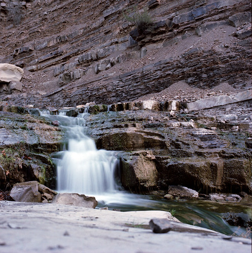
Located right on the middle north fork of the Tule River
Small developed campground on the back roads of Mountain Home State Forest. Campground closes seasonally, for winter snow.
Usually open: MAY-OCT
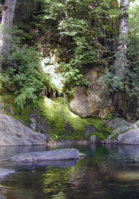
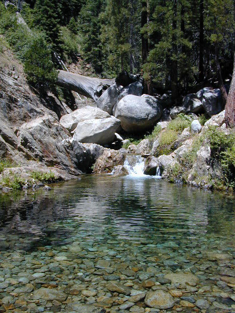
Swimming Holes on Tule River
MOSES GULCH CAMPGROUND
• Elevation: 5,500′
• Number of Sites: 10 walk-in camp sites
• Reservations: No
• Sites Available: First come, First serve
• Vehicle Accessibility: No RVs
• Length of Stay: 14 Days
• Water: River nearby
• Toilet: Vault
• Bear Boxes: Yes
• Trailheads: Tule River; Moses Mountain; Golden Trout
• Season: Closed for winter months
• Fee: Yes
• Operated By: National Forest Service
• Closest Town: Springville, California
tent camping on river
Motorhome RV campers beware; no hook-ups, no paved roads. This is a primitive style camp, way back on a dirt road – not suitable for large vehicles.
NOTE $ This used to be FREE CAMPING, but they recently started charging an overnight fee for this campground.
bike
camp
fish
hike
picnic
stargaze
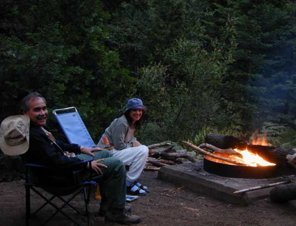
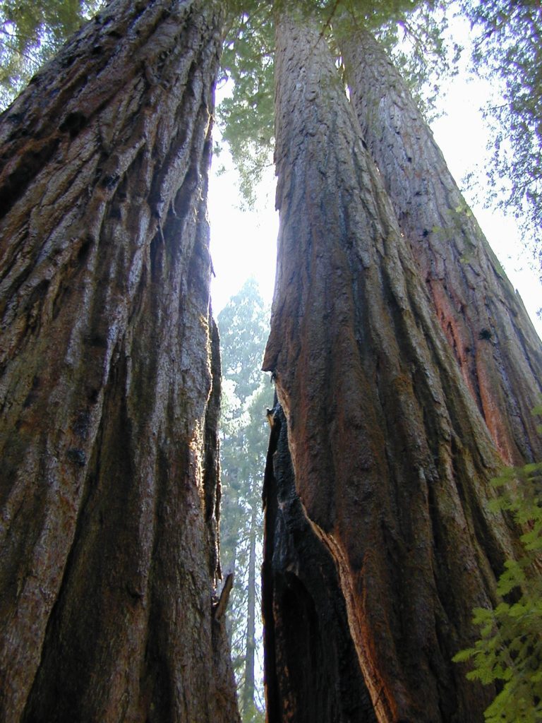
Golden Trout Wilderness is closeby. Plenty of hiking opportunities, great scenery and several Sequoia groves to visit. Mountain biking is allowed on the dirt roads. Single track trails may be overgrown or even off-limits, due to the fragile eco-system around Sequoia trees.
Tule River, north fork of the middle Tule
Both Moses Gulch and Hidden Falls are accessible via a long, narrow, paved mountain road; then a dirt road, leading 3 miles back to the remote reaches of the Wilderness edge.
western south sierra
North of Springville on Highway 190, turn left (north) on to J37, some call it Balch Park Road (Google Maps has it as Wagner Drive) and follow it up 3.5 miles to Bear Creek Road (#220). Drive 17.5 miles on curvy Bear Creek Road, turn right and follow signs to campground.
Located right on the middle north fork of the Tule River
Inside an unknown area called Mountain Home State Forest, this small campground has a few spots that fill up quickly on weekends and at anytime during in the summer months. Campground closes seasonally, for winter snow.
Usually open: MAY-OCT
HIDDEN FALLS CAMPGROUND
• Elevation: 6,150′
• Number of Sites: 8 walk-in camp sites
• Reservations: No
• Sites Available: First come, First serve
• Vehicle Accessibility: 20′ max.
• Length of Stay: 14 Days
• Water: River nearby
• Toilet: Vault
• Bear Boxes: Yes
• Season: Closed for winter
• Fee: Yes
• Operated By: National Forest Service
• Closest Town: Springville, California
tent camping on river
Motorhome RV campers beware; no hook-ups, no paved roads. This is a primitive style camp, way back on a dirt road – not suitable for large vehicles.
NOTE $ This used to be one of our favorite FREE spots, but they recently started charging an overnight fee for this campground.
Views from Camp
bike
camp
fish
hike
picnic
stargaze
Golden Trout Wilderness trailheads nearby. Plenty of hiking opportunities, great scenery and several Sequoia groves to visit.Mountain biking is allowed on the dirt roads. Single track trails may be overgrown or even off-limits, due to the fragile eco-system around Sequoia trees.
You may actually love this little camp so much, you won’t want to go anywhere else. How ’bout just chillin out: relaxing near the water. Shady swimming holes. Fishing in the Tule River.
Pack a picnic: Back road exploration is a great day trip, for there are many dirt roads weaving in and around this park, near the Giant Sequoia.
Tule River, North Fork
Hidden Falls is accessible via a long, narrow, paved mountain road; then a dirt road, leading 3 miles back to two very secluded campgrounds: this one & neighboring Moses Gulch Campground.
western south sierra
North of Springville on Highway 190, turn left (north) on to J37, some call it Balch Park Road (Google Maps has it as Wagner Drive) and follow it up 3.5 miles to Bear Creek Road (#220). Drive 17.5 miles on curvy Bear Creek Road, turn right and follow signs to campground.
Rock climbing, backpacking, fly fishing creeks, snowmobiling, you name it. No matter what kind of trail you seek in California, we have the maps to get you out there, this weekend. If you seek a week long adventure in the Sierra high country, or a weekend getaway destination you’ve never heard of, or a quick after work hike near your home town, we just might have it listed. And we probably have the waterproof, topographical map too.
DOGS & BIKES on TRAILS:
Dog friendly trails include almost anything within the CA National Forests. Remember that most National Parks & State Parks literally forbid dogs on hiking trails. Mountain bikes can access only certain trails in parks, but in the National Forests nearly every trail or dirt road is up for grabs.
OHV ROUTES:
Motorized vehicles, such as quads, ATVs, dirt bikes, Jeeps & 4x4s must stick to designated routes signed specifically for OHV (off highway vehicle) & you won’t be finding many of those inside National Parks & State Parks, so it’s best to look for BLM or NF lands. Many regular, forest, back roads close in winter due to heavy snow pack & thus become cross country ski, snowshoe or even snowmobiling trails. The best ones can be found in the Sierra Nevada mountains.
And if you ever get bored with “reading” text about trails, you can always search the visual database of amazing Cali scenery over at DanaMite’s flickr site
If you’ve had it with the traditions, the big meal prep, or just sick of the family. Maybe you are a solo traveler, or a new transplant to California and need to explore more. Take a holiday away – for once this time.
Camping for turkey day? What a concept.
California is the perfect place for camping, all year long!
Stick to the lower elevations, look for canyons, and seek seclusion
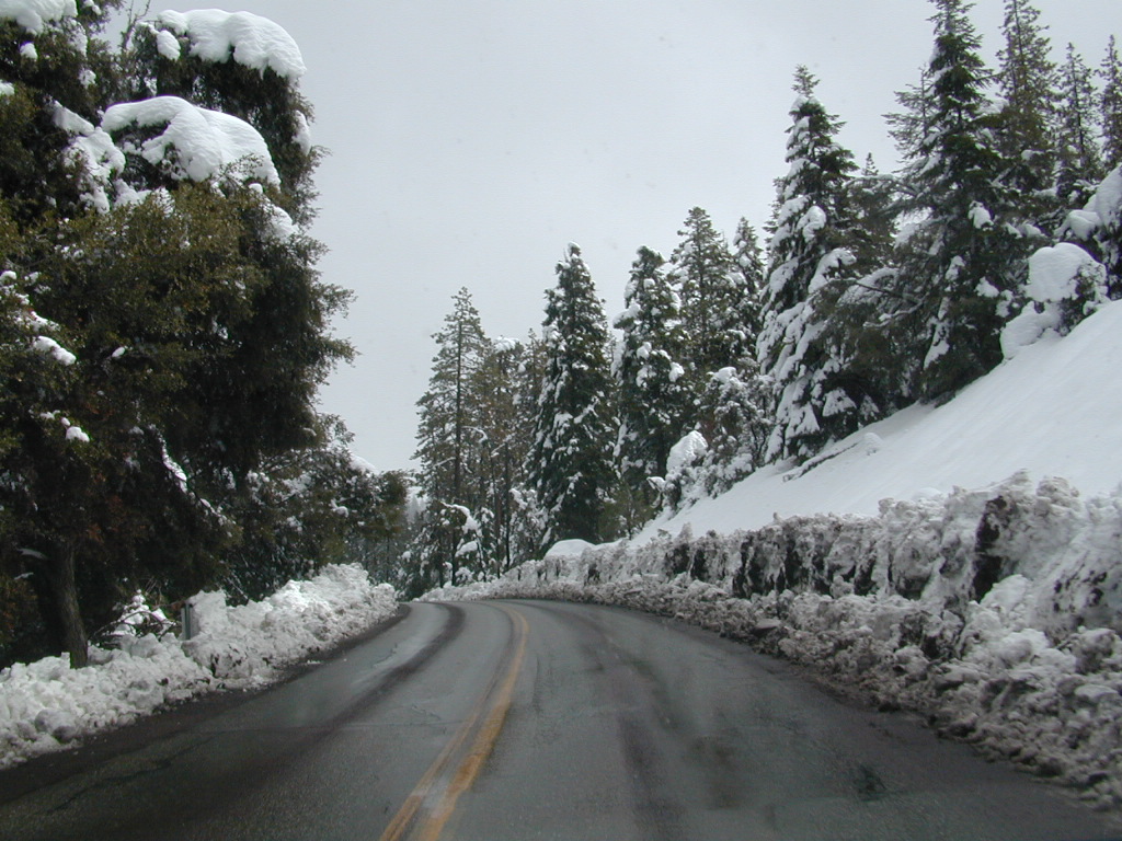
California mountains often have snow during November. Avoid camping in snow @ 4000-5000′ elevation and above; Freezing temps above 3000-4000′ elevation.
Deserts, coastal regions and foothills are top choices for late Autumn car camping. Always check the weather ahead of departure, and have a plan B as an alternative. NorCal will be much wetter than the rest of the state.
MEALS: Prepare dinner meals ahead of trip departure. Bake turkey days before your trip and create meals based around that. Make mash potatoes at home and don’t forget to bring the butter. Pack pre-baked turkey for sandwiches, plus other quick snacks & meals for on-the-go travel.
Non Traditional: Seafood Feast
Desert Camping is premium at this time of year. Luckily the eastern half of Southern Cal is desert. The lower the elevation, the better the temps will be overnight. Be prepared for wind when the ‘storm fronts’ approach, the winds do get a cranking! Dirt roads can become flowing washes during a good rainstorm, so know the weather forecast.
Coastal campgrounds may need advanced reservations. Be prepared for wet weather, especially up north. The redwoods groves are gorgeous anytime of year.
Gold County Reservoirs are prime areas for relaxing in nature, while everyone else is out shopping. Oak hills, rivers and canyons. RV campers love these large lakes; boating, fishing, mountain biking trails, kayak rentals, hiking near historic Gold Rush towns.
River Canyons of California are always beautiful destinations in the autumn months with fall leaves changing color. Many campgrounds can be found at lower elevation, river access areas.
California’s abundant Hot Springs are also top picks for holiday weekends.
Anza Borrego Desert State Park is always a nice, easy and relatively close get-away for any holiday. Open camping on the backroads (for free) makes it one of the most attractive camping options in all of SoCal. Many dirt roads are accessible for passenger cars, if extreme caution is used. Don’t plan on driving more than a few miles on dirt.
froaders
Masses of off roaders love to camp out, especially on Thanksgiving weekend. Wheel all day, eat, drink, bon fires every night and rumor has it ‘they roast their big bird outdoors – deep in a dirt pit’. Really?
El Centro, Glamis, Imperial Dunes, Ocotillo Wells, Truckhaven Hills, Johnson Valley. All popular off roading areas in Southern California, so consider yourself warned.
Mojave Desert, near US Hwy 395 Jawbone Canyon expect to see RVs, toy-boxes and families outside enjoying the weekend. OHV style. Often the group tries to create a round corral with their huge convoy of vehicles, to keep thru traffic to a minimum around “their camp”. Just stay well away from those gear-heads. In general, it is a very busy area around Mojave up to Hwy 178 during the holidays. Try high desert Horse Canyon instead.
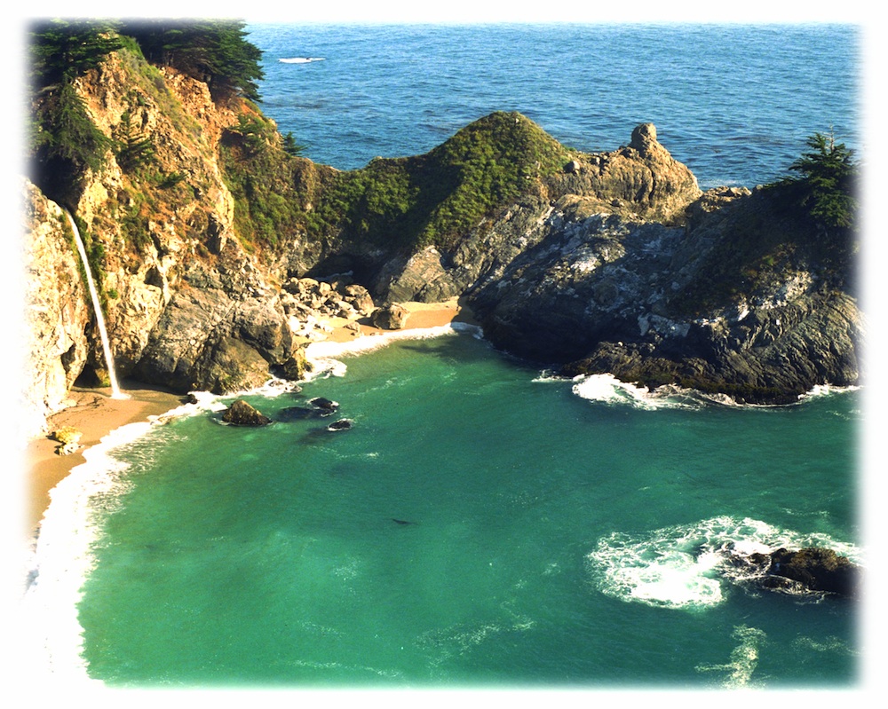
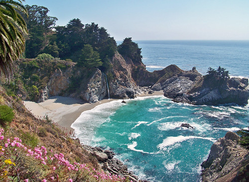
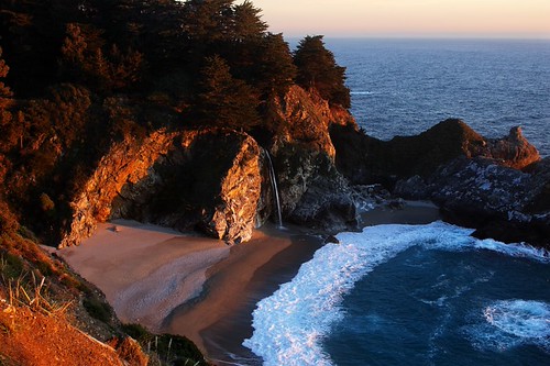
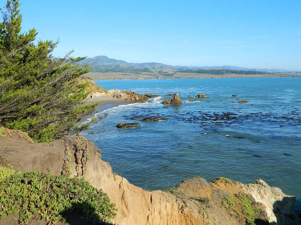
The super scenic Central Coast of California is home to numerous waterfalls, but this one on the Big Sur coast is, by far, the most well-known.
Since I camped out and slept on the cliff featured above, I thought I ought to create a post about it.
Julia Pfieffer Burns State Park is where the most photographed waterfall is located. The creek falls off of a cliff into a secluded cove, on a sandy beach just a few feet from the Pacific Ocean.
After visiting this place more than once, I knew I had to keep coming back. I even found this waterfall photo used as graphic marketing for Mexican Riveria cruises, by Costco.
But it’s not located in Mexico, nor Baja.
McWay is Big Sur!
One sunny autumn day, I called my camping pals to join me on our pre-planned camping trip to the majestic Big Sur coastline. Not just any camping spot or campground, but the two rare, hike-in campsites – located above McWay Falls. The camp reservations had been made months in advance and I was eager to leave the smog basin of L.A.
One by one, all my friends backed out of their commitment to camp that weekend. Too busy at work, a wedding or other plans interfered, home improvements, or the typical lame excuses that city folks always use not to travel locally.
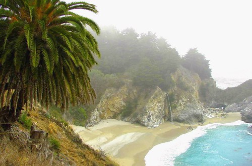
…only 2 camp sites exist here, perched on a forested cliff, overlooking a private sandy cove w/ a gorgeous waterfall
I thoroughly explained to them the spectacular scenery, the unique location, the advanced reservations and fees, and the carpooling options. But not one person could go, so I went anyway.
All alone; which may have been the start of me craving to camp solo (way back in 1995).
The California State Park system has named these as environmental camps, where you must haul your gear – a half mile, on foot, in order to reach these special campsites. Picnic tables and campfire rings are provided, along w/ one vault toilet. Although a real bathroom w/ flush toilets is within walking distance, over at the main paved parking lot.
INACCESSIBLE:
The picturesque sandy cove is off limits to all = campers, hikers and climbers. New fencing and signs warn visitors not to enter the small beach cove area. Sheer, steep cliffs w/ erosion are unstable and dangerous; and you may have a citation awaiting you, on your climb back up.
Accessing the cliff edges or private cove is dangerous and difficult, and totally off limits. If you wanna die trying, that’s up to you.
OVERNIGHT TIPS:
Reservations are needed to camp at this location. Contact California State Parks for booking this spot.
The ocean sounds of crashing waves on rocks is very, very loud. located just below (100 feet) the ideal camp sites. Bring ear plugs for sleeping.
Leave food and cooking to the tailgate. Parking in the paved, forested parking lot, and not transporting food, ice chest and cookware back and forth is the lazy way. Since I was camping alone and the parking lot was secluded and full of vegetation, I decided to try minimal food at camp. Worked well for me.
Blackberry bushes are abundant around parking lot.
PANCAKES ANYONE?
Danger looms around this State Park entrance, as Coast Highway 1 drivers tend to speed by at 55 mph, on a big shady curve. Be very careful crossing the road at this location and listen for traffic before you walk.
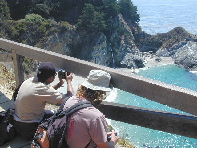
TRAILS & DAY VISITORS:
Swarms of tourists stop at this location, just to walk out, photograph and view this waterfall. Many pay top dollar (day use) to park and then stay less than an hour. The tunnel trail goes past a pelton wheel and then underneath the highway – skirting along the north shore of the cove. The State Park gate closes at sunset, so very few people will be found roaming around after sundown.
Just hiking around this park, plus the back and forth to camp and car will feel like you’ve walked many miles. There is a redwood canyon and creek hike located in the inland portion of the State Park. Mountain peaks here reach to about 3000′ elevation.
AUG 2020 UPDATE: WILDFIRES burning most of this State Park and Limekiln State Park. Not sure how the cove looks now, or if it was affected, but expect the hills to be black, up above the highway.
Julia Pfeiffer Burns State Park
52801 CA State Route 1, Big Sur, CA 93920 831-667-1112
If there is a single most popular image of Big Sur, it is probably of the 80 foot falls seen from this trail as McWay Creek cascades onto the sandy shore. hikinginbigsur.com/hikes_mcwayfalls.html
Even though I spent the warm weekend alone, camping on a waterfall cliff and hiking redwoods forests, I enjoyed myself and the seclusion. I did meet 2 surfers traveling in a vintage VW bus and they joined me for my tailgate dinner one evening. On the last night, the weather turned windy and a storm came in, so the next morning I was happy to leave. So, for all the camping pals that backed out at the last minute, this 2020 post is for you.
Merced Lake is one remote destination along the High Sierra Camp Loop, Yosemite Wilderness.
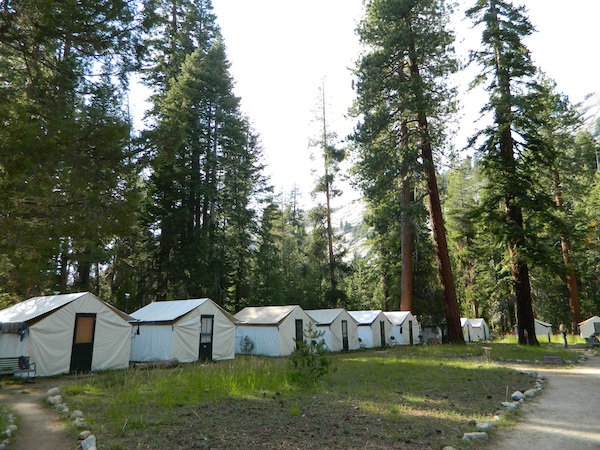
Tent Cabins & Yurt Rentals
around California
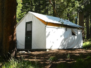
Tent cabins are made up of wooden floors, canvas walls & a canvas roof – a combination between a tent & a rustic cabin. Most have sleeping cots for beds; some have heaters, wood burning stoves or electrical outlets. A shared community bathroom is often close by.
Yurts are round versions of this same concept, with a wooden floor, real beds and usually nicer decor. Often these places request that you bring your own bed linens and towels, but each resort is different, so check the web links for detailed info.
Hike-in locations in the wilderness, rural river resorts or an easy drive to campground right off the freeway. These popular lodging accommodation are often marketed as GLAMPING, as in Glamour Camping – for the (luxury loving) princess who likes to try out nature – in a very controlled setting. Just watch out for mountain lions and bears.
Below are unique places in California that offer tent cabins, tree houses and yurt rentals.
Yosemite Lakes Resort
Cabins & Yurt Rentals
South Fork of the Tuolumne River
31191 Hardin Flat Rd
Groveland, CA
209-962-0121
800-533-1001 Western Sierra Nevada
Yosemite Pines RV Park
20450 Old Highway 120
Groveland, CA
209-962-7690 Western Sierra Nevada
HSC: HIGH SIERRA CAMP
Yosemite National Park Tent Cabins:
(advanced reservations required)
White Wolf Lodge
Backcountry wilderness area along Highway 120, Yosemite NP
ALLERGY NOTE: Most tent cabins are constructed out of heavy canvas material (fabric), which can mold when exposed to moisture (rain, fog, snow). Often they get dismantled, cleaned and stored properly over each winter season, sometimes not; All depends on weather, terrain difficulty and individual resort practices. If you suffer w/ allergies, moldy tent walls and dust mites can trigger asthma or other allergic reactions. If in doubt speak to the innkeeper or caretaker ahead of time.
San Simeon SP. Central Coast of California
Rent a Treehouse
Post Ranch Inn
Tree-House Rentals in California
Big Sur, CA Big Sur Coastline
Mountains of Northern California / NorCal Mountain
California sure has a lot of mountains. West Coast land is home to the tallest Sierra Nevada range, plus the Cascade range, which extends northwards to Canada. (Many of which have volcanic peaks.)
We break down all the mountainous regions in the north part of the state below w/ links, topo maps, lakes, rivers, wilderness, parks and forests. Small towns & cities are linked in red.
Sacramento River, above Lake Shasta
North Coast Mountains
Redwood forests and rivers are what make up most of the Northwest part of California, just below the Oregon coast. Logging and fishing are the big industries up here. Lumber mill towns and camps still exists today. Wilderness areas, dirt back roads, river kayaking, stream fishing, camping and real wild indians. Oh yeah, and Big Foot!
The landscape in more dramatic along the North Coast of California, as the steep rocky terrain tumbles into the sea w/ the San Andreas fault running parallel to the shore. Marine life, rocky shores w/ small towns. Del Norte County & Humboldt County. Wild rainy weather, at least half the year; fog and sun the other half.
The furthest north is Siskiyou County, which borders the state of Oregon. We have the Klamath River flowing south into California, with plenty of mountain peaks, forests and wilderness. Interstate 5, Highway 3 and Highway 96
Pacific Crest Trail passes through the area and backpacking is common (all year long). Notable spots – Klamath Knot and The Eddy’s. Prominent Mount Shasta is actually situated inside Siskiyou County, not Shasta.
Giant Mount Shasta is located inside Siskiyou County, and Shasta County & Trinity is everything located to the south of it. Interstate 5, Highway 3 and Highway 299. Recreational lakes, rivers and streams, and off roading trails.
Waterfalls, hot springs, mountain biking and stream fishing can be found within this region. Mining history and museums are primarily situated around Weaverville. Houseboats and boat rentals can be found on the big reservoirs. Whiskeytown was totally toasted in wildfire of 2018. Alpine lakes, granite spires, campgrounds and cavern tours, all located along the Interstate 5 corridor.
Beautiful park setting @ Lee Fong Park, in historic Weaverville, CATrinity River Camping, Douglas City, CA
Mendocino Mountains
Coastal mountains located above the Napa & Sonoma wine country. US 101 & Highway 20. Rivers, forests, wilderness and redwoods is the key terrain that make up the Mendocino County mountains.
There is a fair amount of off road trails and dirt roads located in and around Mendocino, so you can expect to see 4x4s, dirt bikes and toy haulers on the east side of the mountain range. The coastal side of the Mendo National Forest will have the rivers and redwood parks.
Northern Sierra Nevada mountains is where the granite rock of the Sierra meets to volcanic rock of Lassen Volcano. Butte County and Plumas County is the Feather River drainage, all flowing south from Mount Lassen.
Pacific Crest Trail is routed through Bucks Lake Wilderness and the Feather River Canyon, so backpacking is popular. Highway 70
Technically speaking, the Susan River is the top waterway of the Sierra Nevada mountains. Lassen County spans the distance from the Nevada state line, west to Plumas forest and the Feather Rivers (all 4 forks).
Lassen Peak is the middle of the National Park and the National Forest totally surrounds that. Numerous lakes, hiking trails, wilderness areas and dirt roads make up this huge forested area. Snow-mobiling is popular in winter months around the town of Chester.
The far northeast corner of the golden state is the remote cattle range lands of Modoc Country inside Modoc County. Drier than the rest of NorCal, the high desert sage brush meadows, a few lakes and pine forest mountains. Highway 299 & US 395
Gold Lake, Sardine Lake, Upper Sardine, Smith Lake, Packer Lake, Grass Lake, Sand Pond, Goose Lake, Snag Lake, Long Lake, Jamison Lake, Round Lake, Deer Lake, Tamarack Lakes, Young America Lake, Frazier Falls
California is the land of granite peaks. Rocky, exposed mountains that stick up out of the landscape for all to see. Southern Cal has a few of them, but most granite peaks in California are found in the Sierra Nevada.
US 395 Eastern Sierra impressive ridge lines are the highest and most photographed and Lake Tahoe has plenty of big granite surrounding it. The farther you go north, the less granite you will see – not because it isn’t there, mostly cuz it is just buried with tall dense forests.
lakes basin day hikers
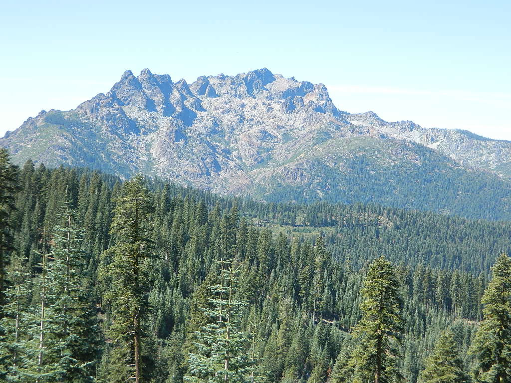
NORTH SIERRA – The Sierra Buttes are the impressive granite peaks located in between the North fork of Yuba River and Sardine Lake.
SE of Mount Lassen and NW of Lake Tahoe, at the tippy top of the historic gold country. Gold Lake Road #24 connects Gold Country Highway 49 to North of Tahoe Highway 89. Road #24 is often closed for winter snow, so most visitors enjoy this region in the summer months.
The infamous PCT (aka. Pacific Crest Trail) passes the peak and goes north through this basin of alpine lakes, so backpackers are often seen. Tent camping is very popular, as well as RV camping w/ numerous developed campgrounds and open camping as well. Some of the hard to reach primitive camp sites (next to lakes) can be accessed via 4×4 vehicle. Gotta have a good topo map.
Downieville is well known for the mountain biking trails, so this whole region is covered with amazing trails. Snowmobilers and cross country skiers love the area during a good winter snow and they can access this area from the north off Hwy 89.
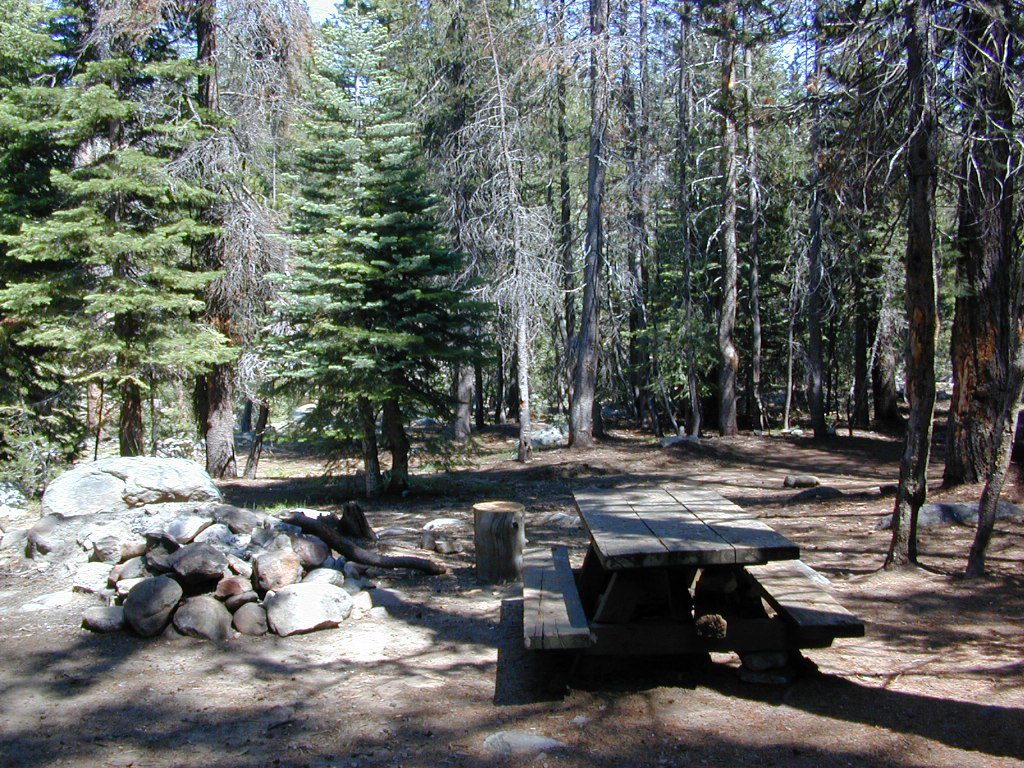
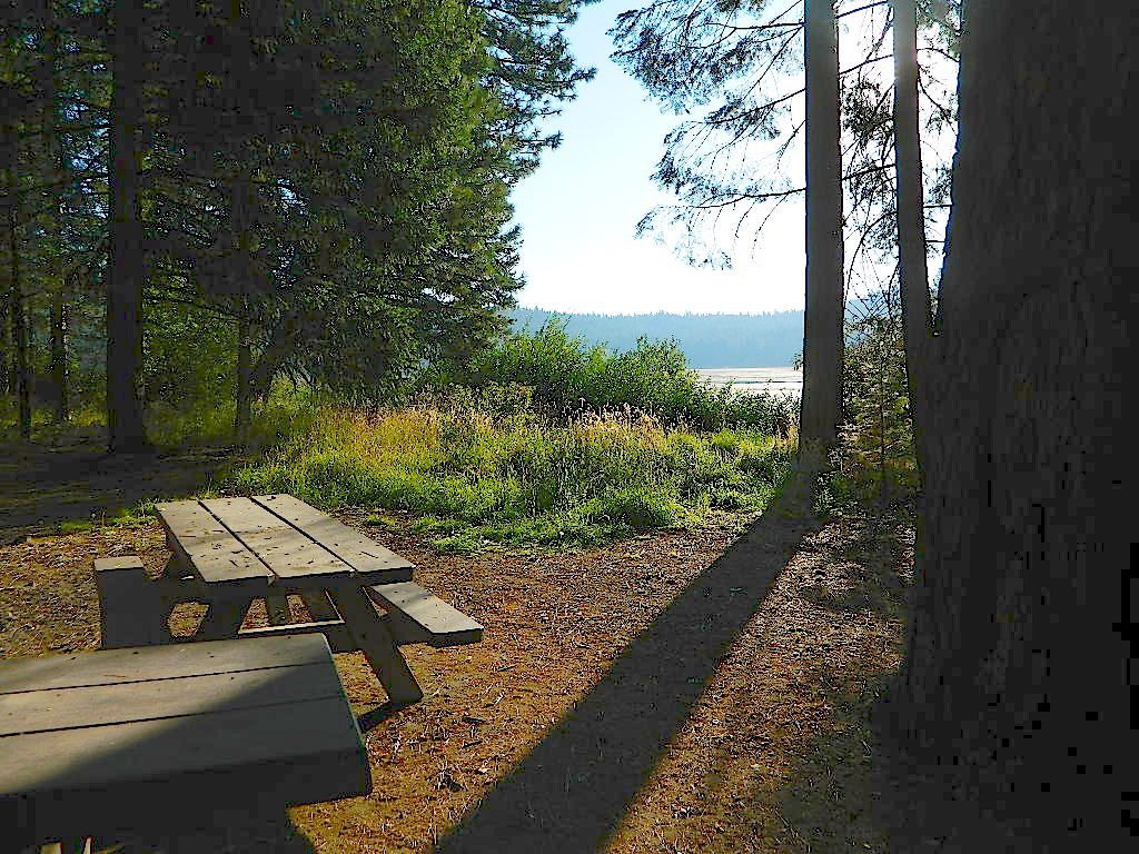
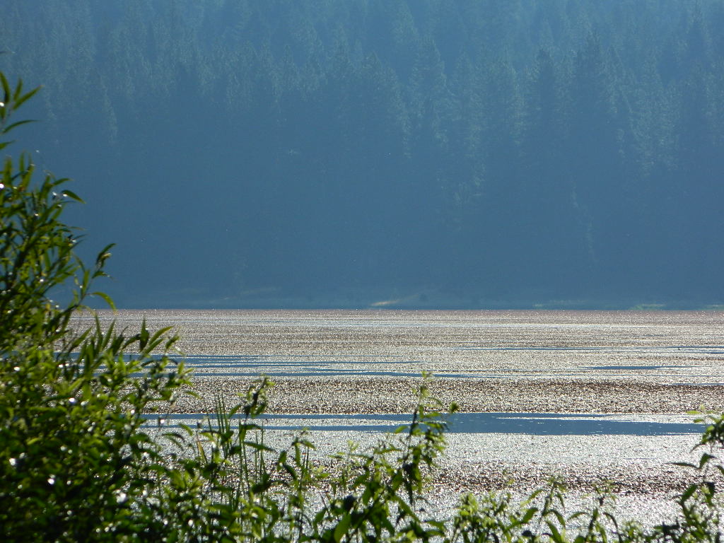
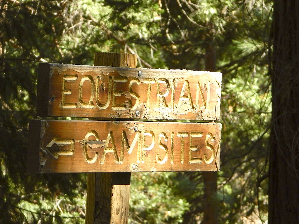
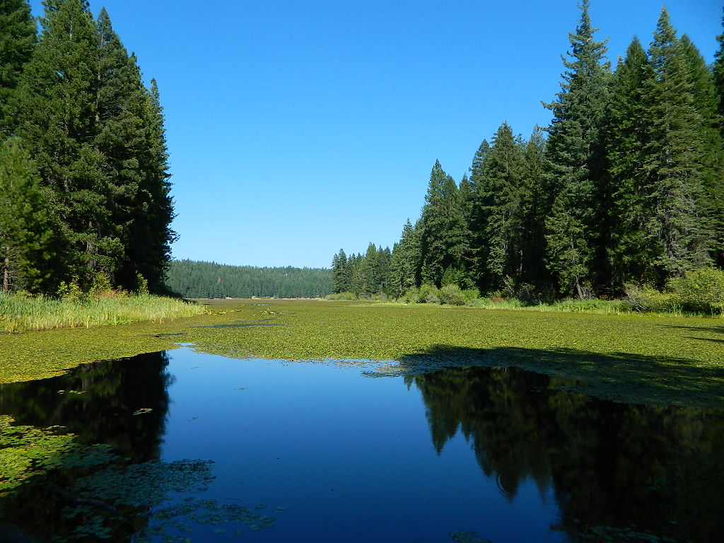
Don’t let the name frighten you, Snake Lake is a very scenic fishing lake – but you will NOT want to swim in it. Lily pads cover the water surface most of the year so it is considered “frog heaven” during the warmer months. NFS has been upgrading these camping facilities recently. Snake Lake Campground has new picnic tables, camp fire rings, bear boxes, vault toilet and expanded equestrian camps and corrals. No piped water, so bring your own. A bucket & shovel are always required for proper campfire maintenance.
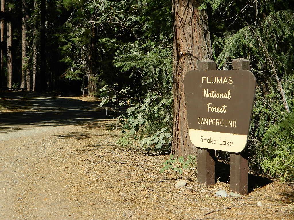
One of the best campgrounds in the region, Plumas National Forest and close to Quincy, CA. Paved road access means an easy 3 miles off the main road (Bucks Lake Road, aka Oroville-Quincy Highway, Oro Quincy Hwy). 7 miles west of the town of Quincy, the green, metal, one-lane bridge is easy to spot, but the small sign for “Snake Lake 3” is easy to miss, if driving 50 mph or faster. Turn off is located in between Quincy and Meadow Valley.
Equestrian camp sites, horse corrals, OHV trails, group picnic areas. Hiking, fishing, mountain biking, off roading, horseback trails, kayaking or canoe.
Snake Lake Campground NFS
• Elevation: 4200′
• Number of Sites: 17
• Vehicle Accessibility: small RV
• Campsites Reservation: No
• Camp Fee: Yes
• Length of Stay: 14 Days
• Season: May – October
• Trailheads: OHV, Horse & Winter Rec
This lake camp serves as a central hub for travelers, motorcyclists, campers, hikers, fishermen, off roaders and equestrians alike. Mountain biking & OHV trails go off in numerous directions and horseback trails are readily accessible. Winter Recreation Area means snowmobile trails too.
Another smaller lake, Smith Lake, is a short drive or short hike (on dirt road) further into the woods, with the Butterfly Valley Botanical Area neighboring it.
another Snake Lake?
Another SNAKE LAKE exist inside Plumas National Forest. The smaller Snake lake can be accessed by off-road trail Road#12E66, off the Gold Lake Highway; 4×4 is required to reach this one. West of Gold Lake in the Lakes Basin Recreation Area. The PCT is routed nearby one mile away.
Plumas Road #24N29, off Bucks Lake Road
East of Bucks Lake, California.
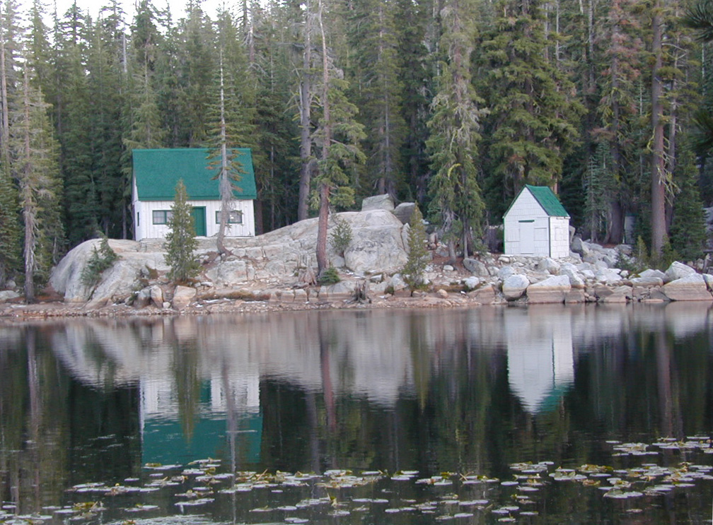
a six mile, one lane, dirt road is the only vehicle access into this high elevation, dammed reservoir, tucked back against the wilderness. Secluded lake campsites await, you’ll just need to get a little dusty first. The turn off, at a small brown sign reading “Silver Lake”, one which is very easy to miss – due to the amount of homes, cabins, fencing and driveways in the vicinity.
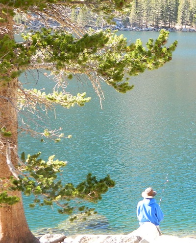
No swimming allowed at this Silver Lake, as it serves as a drinking water source for the neighborhoods below. Canoe & kayaking are allowed. Fishing is also popular at this location. Hiking trailheads at Silver Lake lead to the PCT (Pacific Crest Trail), Mount Pleasant, Spanish Peak and a small gem of a swimming hole, we call mini Gold Lake.
This small campground is actually set downhill from the rock earthen dam, which is something to ponder before/during a big earthquake. With sites 1-5 in a shady forest area and the others a bit closer to the lake, no campsite is too close to another. These are all well-spaced-out sites, providing decent privacy and minimal noise from neighboring campers. No campsites are located at the lake edge, as the rocky dam is a long structure and quite complex with water control measures.
All the campsites have new bear boxes for food storage, cuz ‘wilderness’ usually means black bears are roaming about. Deer tend to frequent campsites 1 & 2.
2020 update: overnight camping fees now charged at this campground
Silver Lake Campground NFS
• Elevation: 5800′
• Number of Sites: 9
• Vehicle Accessibility: RV 22′
• Campsite Reservations: No
• Camp Fee: Yes
• Toilet: Vault
• Water: No piped/potable
• Length of Stay: 14 Days
• Season: May – October
• Trailheads: PCT, Gold Lake, Rock Lake, Granite Gap, Bucks Lake Wilderness
As with most of the high elevation lakes in California, winter months can mean deep snow and dirt road closures. This campground is usually open through the end of October, but call head to the local rangers if in doubt.
Plumas National Forest
Mt. Hough Ranger District
39696 State Highway 70
Quincy, CA 95971
530-283-0555
Free Campgrounds in the Sierra Nevada Mountains, California
no charge camp, no fee camping, free campgrounds
No fee camping: Bare bones. California Sierra Campgrounds without the fee.
Developed BLM or NFS campgrounds, where you can still have a campfire. Vault toilets, panic tables and fire rings. Use bear boxes when provided for proper food storage.
secluded campgrounds
Below is a good long list of some favorite free developed campgrounds in the Sierras. Many will require dirt road driving, as most are located well of the highway. Perhaps the 12 mile rough road will thin out the crowds. Free overnight stay!
2020 update:this list is shrinking, as more California National Forests start charging for the smallest of campgrounds.
Pack in your drinking water and pack out your trash. Campfire permits are not required at developed campgrounds; but a bringing a water bucket and shovel is necessary for tending your campfire. Piped water is not always available, or perhaps, not in working order at these primitive style camps. Be prepared to rough it a little.


 Motorized vehicles, such as quads, ATVs, dirt bikes, Jeeps & 4x4s must stick to designated routes signed specifically for OHV (off highway vehicle) & you won’t be finding many of those inside National Parks & State Parks, so it’s best to look for BLM or NF lands. Many regular, forest, back roads close in winter due to heavy snow pack & thus become cross country ski, snowshoe or even snowmobiling trails. The best ones can be found in the Sierra Nevada mountains.


 Northern Sierra Nevada mountains is where the granite rock of the Sierra meets to volcanic rock of Lassen Volcano.
 Technically speaking, the Susan River is the top waterway of the Sierra Nevada mountains.


 Pack in your drinking water and pack out your trash. Campfire permits are not required at developed campgrounds; but a bringing a water bucket and shovel is necessary for tending your campfire. Piped water is not always available, or perhaps, not in working order at these primitive style camps. Be prepared to rough it a little.