Tag Archives: hiking

Desolation Wilderness

Desolation Wilderness Area

63,690 acres, a federally protected wilderness area located along the crest of the Sierra Nevada mountain range – in between Lake Tahoe and the Gold Country, on the western slopes. This is back country Tahoe @ tree-line, where big, bare granite rock of the High Sierra meets the snow melt in 80 alpine lakes; several streams; hiking, fishing horseback riding, and backpacking. Elevation range approx. 6000′ – 9,985′

El Dorado National Forest

916-573-2600

The Tahoe Rim Trail and Pacific Crest Trail pass through the wilderness.

Desolation Wilderness Map
(National Forest Service USDA)

Desolation Wilderness Topo Map
Desolation Trail Map
(Tom Harrison Maps)

List of Desolation Wilderness trailheads:

  • Loon Lake Trailhead
  • Buck Island Trailhead
  • Van Vleck Trailhead
  • Rockbound Trailhead
  • Twin Lakes Trailhead
  • Lyons Trailhead
  • Twin Bridges Trailhead
  • Ralston Trailhead
  • Echo Trailhead
  • Echo Lakes Trailhead
  • Glen Alpine Trailhead
  • Mount Tallac Trailhead
  • Bayview Trailhead
  • Eagle Falls Trailhead
  • Meeks Bay Trailhead
  • Horsetail Falls Trailhead

List of nearby towns:


View Larger Map

Agua Tibia Wilderness

Agua Tibia Wilderness Area

  • 15,900 acres
  • chaparral & oak at lower elevations
  • pine & fir forest at high elevations
  • elevations range 1,700′ – ­5,000′
  • 25 miles of trail
  • summer temperatures exceed 100°F
  • occasional snow in winter
  • best in winter through spring
  • wood fires prohibited
  • portable stoves permitted
  • water scarce
  • no overnight use of pack or saddle stock
  • groups limit – 15 people
  • visitor permits required
Agua Tibia lies right on the RIVERSIDE
& SAN DIEGO COUNTY border

Cleveland National Forest
Palomar Ranger District
1634 Black Canyon Road
Ramona, CA 92065
760-788-0250

Agua Tibia Map

Agua Tibia Trailhead

This is the trailhead for Agua Tibia Wilderness located at Dripping Springs Campground on Highway 79, near Temecula CA.

See more: Agua Tibia Mountain hike details

hiking SoCal

Angeles Campgrounds

Camping Los Angeles – Angeles Crest Camping

Angeles Crest Hwy CA 2

campground elev spots veg toilet water notes
Appletree Campground 6,200′ 8 pines vault piped Big Pines Hwy
Basin Campground 3,400′ 15 CLOSED
Bear Campground 5,200′ 15 vault no
Big Rock Campground 5,000′ 8 vault crk sm RV, 4WD
Blue Ridge Campground 8,000′ 8 pines vault no May-Nov, sm RV
Buckhorn Campground 6300′ 40 pines vault no May-Nov, sm RV
Cabin Flat Campground 5,300′ 12 vault no CLOSED
Cienaga Campground 2,100′ 12 oaks vault no May-Dec
Coldbrook Campground 3,350′ 22 vault piped sm RV
Cottonwood Campground 2,600′ 22 vault no
Guffy Campground 8,300′ 6 vault no May-Nov, 4WD
Horse Flats Campground 5,700′ 25 pines vault no April-Nov
Jackson Lake Campgr 6,100′ 8 pines vault summer May-Dec
Live Oak Campground 2,000′ 7 oak CLOSED
Manker Flats Campground 6,000′ 21 flush piped sm RV
Messenger Flats Camp 5,500′ 10 pines vault no Corrals, April-Nov
Millard Campground 1,900′ 5 oaks vault no Altadena, Chaney Trail
Monte Cristo Camp 3,600′ 19 oaks vault piped RV, Hwy 2, N3
Mount Pacifico 7,100′ 7 pines vault no May-Nov
Mountain Oak 6,200′ 17 oak flush piped May-Nov
Peavine Campground 6,100′ 4 vault piped Big Pines Hwy
Prospect Campground 2,100′ 22 CLOSED
Rocky Point Camp 3,400′ 3 vault summer
Sage Campground 3,400′ 4 vault no Cheseboro Rd
Sawmill Campground 5,200′ 8 vault no sm RV
Soledad Campground 2,000′ 6 CLOSED
South Fork 4,500′ 21 oaks vault no May-Nov, sm RV
Spring Camp 4,700′ 3 vault no Rincon-Shortcut Route
Spunky Campground 3,300′ 10 vault no
Streamside Campground 2,500′ 9 vault no poison oak
Sycamore Flats 4,200′ 11 vault summer sm RV
Upper Shake 4,400′ 18 vault no May-Dec.
Zuni Campground 1,700′ 10 vault no

Chilao Campground

tunnel angeles crest

nearby towns –

Angeles Maps – hiking, OHV & mountain biking –

Rock Climbing Southern California

Idyllwild Camp Granite

Rock Climbing in SoCal is limited to the awesome southern deserts with boulders, boulders & yep, more boulders. Joshua Tree is well known, but Mojave deserts boulders have much to offer, with less crowds. Meaning you’ll get more on exploring new routes, off the beaten path.

Bishop in the Eastern Sierra has the Buttermilks, but we wanna cover stuff further south for climbers. Numerous crags and peaks can be found in the mountain regions of San Diego. Many destinations are also great camp spots.

Good granite is hard to come by & big granite walls are non-existent down south. The most popular piece of Southern California granite among climbers is that of Tahquitz Peak in Idyllwild CA

Big Bear Lake

  • Bouldering @ various places
  • Idyllwild Rock Climbing

  • Tahquitz Peak in San Jacinto Wilderness: Tahquitz Peak Lookout stands at 8846′ elevation, towering above the pine village of touristy shops & cafes below. It’s a small slice of the Sierra Nevada (fabulous blue granite feeling) in SoCal & the rock climbers love it. Humber Park is at the base of the peak. The park is a family & tourist destination, especially during snow days. Paved parking lot is at the very top of the neighborhood, a well signed route. Follow the brown “Humber Park” signs. Hmmm, now is that ta-keets, ta-quits? Just ask a local – who grew up in Idyllwild.
  • Tahquitz Peak

    San Diego County climbing destinations:

    Army Rock
    Beirut
    Bonita
    Carlsbad Boulders
    Culp Valley
    Descanso Wall
    Dixon Lake
    El Cajon Mountain
    McCain Valley
    Mission Gorge
    Mt Everest
    Mt. Helix
    Mt. Woodson
    Otay Lakes
    Poway Crags
    Rock Mountain
    Santee Boulders
    Stonewall Peak
    Valley of the Moon

    For more on California rock climbing places, check out a few of our favorites resources:

    CA Rock Climbing Instruction

    Rock Climbing Ratings

    Rock Climbing Local Links

    California Rockclimbing.com

    Southern California rock climbing areas:

  • Idyllwild
  • Joshua Tree NP
  • Mojave NP
  • Southern California Maps that may be relevant:

    San Mateo Canyon Wilderness

    San Mateo Canyon Wilderness

    • 9,700 acres, South of Highway 74
    • hiking near Temecula, California
    • between Camp Pendleton & Lake Elsinore
    • moderate to steep terrain
    • vegetation chaparral on slopes
    • riparian vegetation in stream channels
    • oak woodland at lower elevations
    • accessible by several routes off Hwy 74
    • accessible by dirt roads
    • some access routes may be closed in wet weather
    • best times to visit are spring & fall
    • wood fires prohibited
    • portable stoves permitted
    • visitor permit required
    Cleveland National Forest
    Trabuco Ranger District
    1147 East Sixth Street
    Corona, CA 91719
    714-736-1811
    San Mateo Wilderness Map

    OC

    the OC: SoCal culture – beaches, surf, mountains

    Orange County. North of San Diego & south of L.A.

    surfergirl

    OC hikes

    A wonderful resource for Orange County outdoors is
    ocparks.com

    maps for local weekends, local hikes:

    oretga highway 74
    oretga highway 74

    Partington Cove Hike in Big Sur

    Big Sur – Partington Cove

    DSCN3026
    Go west to & visit the oceans edge or head east to explore a deep redwood canyon.big

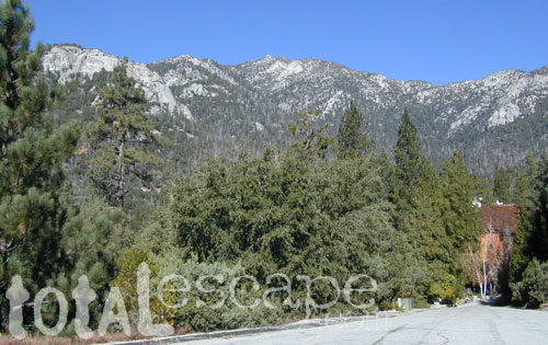
    Approx. 5 miles South of Big Sur State Park and just north of Julia Pfeiffer Burn State Park, this unmarked dirt turnout area on Highway 1 is a rare find. Rocky shorelines at the historic point, plus the scenic tree lined waterfall & cross the highway & head east for a shady Redwood canyon forest with plenty of backpacking options into the Big Sur back country of Los Padres National Forest. From bright sunny ocean view hillsides to dark shady forests.

    This portion of the highway cuts into a deep bend along the coast & has no markings to the paradise that lies within. A steep dirt fire road (down to the cove) with metal gate is your only clue. Dirt parking area on both sides of the road indicate that people have parked here before.

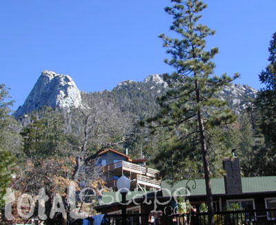
    This un-signed secluded hide-away has a variety of landscape & sites to see. You could easily kill 6-8 hours just in this canyon alone!! Definitely not a hurry through kind of place. Take your time, enjoy the view, tide pools, bring your swim suits & refresh in the creek. Carry a picnic eastbound into a shady creek-bed canyon & watch the sun dance through the towering pines above.
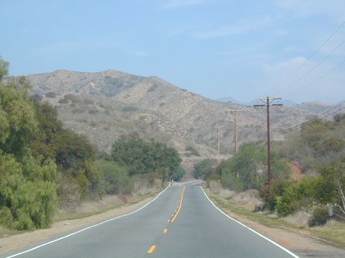
    Driving northbound on Highway 1, look for large hair-pin turn out in canyon area – approx. 3-5 mi. North of Julia Pfeiffer State Park in wide dirt areas along roadside. Located in between Julia State Park & Pfeiffer Big Sur State Park.

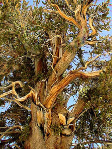
    Hike down the dusty wide gated fire road in dry brush chaparral. The view of Redwood trees, the royal blue ocean in front of you, the sounds of a water falling creek. The trail forks off in 3 directions:

    Right / Rock Beach – this a boulder lined cove where the clear fresh water stream meets the ocean. Small pools & waterfalls can be found just upstream .

    Bridge Crossing / Point – through a wooden tunnel to a cliff area with tide pools & wooden structure (an old boat launch?)

    Left / Up Stream – a forested canyon w/ a variety of trees; dead ends a few hundred yards up into the canyon

    DSCN3021Another option to this canyon is the East side:

    Hike up inland (away from ocean) into a densely forested creek area. Redwoods, waterfalls & boulders. Deer sightings are quite common in this area. Shady & dark this trail climbs gradually in elevation. One fork of the trail leads to an old Redwood Grove. A portion of the trail is closed 2.5 mi. up due to a landslide. But overall the is a perfect option for backpackers wanting a short hike.

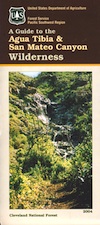
  • Los Padres Maps (USDA)
  • Big Sur Map (NatGeo)
  • Ventana Wilderness Map w/ Silver Peak
  • Pine Creek Wilderness

    Pine Creek Wilderness Area
    East of San Diego, California

    • 13,400 acres
    • gently sloping area
    • elevations range – 2,000′ ­ 4,000′
    • vegetation is chaparral & scrub
      oak
    • riparian & woodland vegetation in stream
      bottoms
    • Pine Creek & drain the area north to
      south
    • rainbow trout in Pine Creek
    • streams are dry for parts of the year
    • several trails provide access to area
    • wood fires prohibited
    • portable stoves permitted
    • groups limit – 15 people
    • visitor permit required
    Cleveland National Forest
    Descanso Ranger District
    3348 Alpine Boulevard
    Alpine, CA 91901
    619-445-6235

    Pine Creek Wilderness Map

    Eastern Sierra Mountains

    Eastern Sierra Mountains / Eastern Sierras California

    mount tom

    Wilderness seeker John Muir called the Eastern Sierra, the range of light. It’s desery & drastic. Tons of granite & wild-ness. The impressive, tallest peak in the lower 48, Mount Whitney towers at elevation 14888′ over the Owens River Valley. Death Valley meets mountains. Ancient volcanoes & fresh granite. Creeks are alive throughout summer. Alpine lake hikes & their wild flowers are incredible. Horseback trails, rentals, pack trips are very popular. Total Escape even list high country Inyo 4×4 routes, that overlook Bishop.

    Eastern Sierra forest & parks –
    Inyo National Forest
    Toiyabe National Forest – north (Carson)
    Toiyabe National Forest – south (Bridgeport)

    Ancient Bristlecone Pine Forest

    Ancient Bristlecones

    inyo maps

    Eastern Sierra maps & trails –

    Eastern Sierra towns –
    Aspendell, Big Pine, Bishop, Crowley Lake, June Lake, Lee Vining, Lone Pine, Mammoth, Olancha, Toms Place

    south lake bishop

    cottonwood lakes

    Mount Charleston Vegas

    Mt Charleston Las Vegas NV

    Mount Charleston Las Vegas NV

    Mount Charleston Resort
    Mount Charleston Resort

    Mt Charleston cabin rentals, vacation homes and 2 mountain lodges are located near the Spring Mountain Recreation Area, just outside of the Sin City limits. The tall alpine mountains behind RedRock SP, NW of Las Vegas, Nevada are virtually unknown by many non-locals. Great hiking, mountain biking, camping and waterfalls, plus a small seasonal ski and snowboard resort are some of the highlights. Imagine snowboarding Vegas!

    Mt Charleston Hikes
    Red Rock Canyon Map

    Las Vegas Forest Hikes

    Vegas means “the meadows”, but it sure seems more like desert these days. The forest is just up the hill, past the red rock and tract homes, well past the Joshua Trees. Conifer forests, snow and high elevation, less than an hours drive from the Vegas strip. Toiyabe – Humboldt NF is this public land managed by the US National Forest system. Toiyabe also covers Eastern Sierra slopes. Get California Toiyabe NF maps. Get the Nevada State Park map here!

    Camping Vegas

    Due to extreme dry conditions and wildfire danger no open camp fires are allowed from mid-April to mid-November in the Mount Charleston region. Several developed campgrounds, plus a primitive (dirt road) camp area off Lee Canyon. Cabin rentals are located at the Charleston Lodge.

    • Vegas trails
    • Hiking in Vegas
    • Mount Charleston skiing
    • Mt Charleston hikes