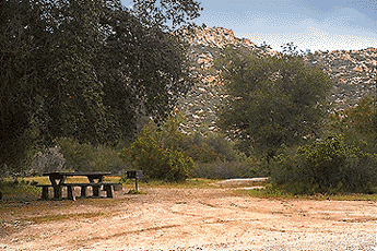
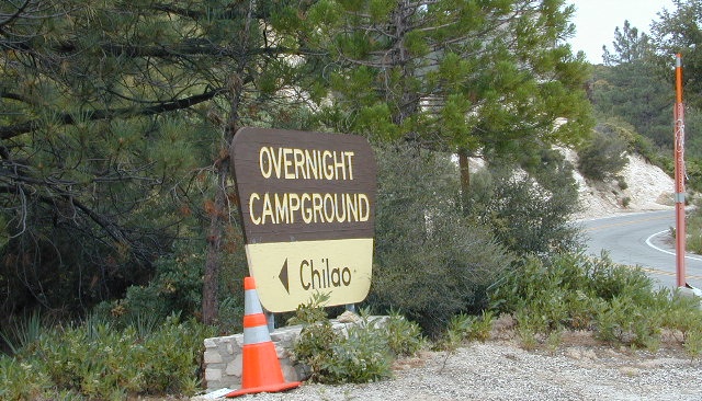
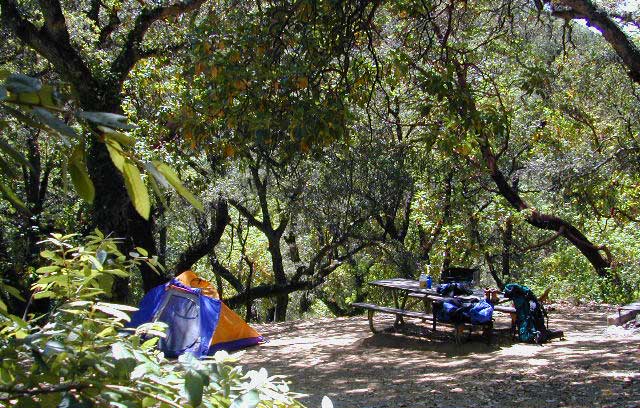
Indian Flat Campground is located on the seasonal San Luis Rey River in rural North San Diego County. From I-15 @ Temecula, CA travel eastbound on Highway 79. Look for the tiny turn off (on left side) for forest road #9N05, sorta near glider airport located west of Warner Springs. This poorly paved backcountry route (half dirt/mud at times) is also known as both Indian Flats Road or Lost Valley Road.
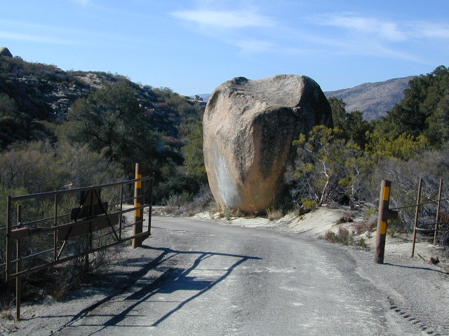
Graded dirt road (paved in some portions) travel is approximately 6.5 miles to campground, look for gate and turn off on the left side. When you see the giant boulder near the entrance, you’ll know you’ve made it to the right place.
Oak trees and a few pines, plenty shade, boulders and mountain scenery, this is a great small campground that is well away from everything in Southern California. Seasonal creek-sized river and boulder waterfall often dries up in late summer. This means a wet spring is the best time to visit this camp. Hiking, mountain biking trails and hammock spots. Pacific Crest Trail access.
• Elevation: 3,600′
• Number of Sites: 17
• Camping Reservations: None
• Sites Available: First come, First serve
• Vehicle Accessibility: Length 15′ max.
• Length of Stay: 14 Days
• Water: No Piped; Seasonal creek nearby
• Toilet: Vault
• Season: Closed for mud & snow during winter months
• Fee: Yes
• Operated By: National Forest Service
• Closest Town:Warner Springs, CA
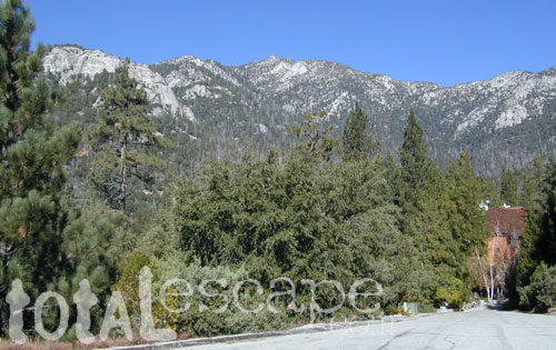
Located in the South Sierra Nevada mountains alongside the Southern Sierra Wilderness. Inside the remote rugged peaks of a deep, granite crevasse known as the Upper Kern River with ancient Sequoia forest to the west and to the eats, some of the tallest peaks in the Sierra range. This wild land area is home to the California golden trout and is the main water flow southward from the tallest peak in the lower 48 – Mount Whitney on the Eastern Sierra front.
Roads, campgrounds and trailheads surrounding Golden Trout Wilderness
Eastern Sierra –
Horseshoe Meadows Road (paved) leads up to high elevation meadows from the high deserts of Lone Pine, CA. Pacific Crest Trail (PCT) access; Mount Whitney and John Muir Wilderness are to the north. Equestrian corrals and horse trails. Camping is limited to a one night stay at any of the 3 campgrounds up here.
Fork of the Kern / Loyds Meadow Road #22S82 – This main paved road connects the Kern River (Sierra Hwy Road #99) to the lower elevation, granite slopes of the Western Divide, and the route dead ends at Jerky Meadow parking lot. Camp 1-6 are primitive camp areas located on dirt side roads and 4×4 might be required on some of them. Obtain a campfire permit from rangers in Kernville. Fishing, camping, waterfalls and swimming holes are popular in this region. The big developed camp along this road, is located 10 miles up, in a pine filled valley on Peppermint Creek on the west side of the street and is within the Giant Sequoia National Monument.
Lower Peppermint Campground: elevation 5300′ / 17 camp sites / open year round
Lloyd Meadows @ Sequoia Forest Road# 20S67 – is the Forks of the Kern Trailhead & the dirt road that accesses it, is very popular among equestrian campers.
Western Divide Highway –
Road #20S79 leads from Western Divide Hwy to Lewis trailhead.
Road #20S50 leads from Western Divide Hwy to 2 hiking trailheads.
Sequoia National Park, Three Rivers, CA –
South Fork Road leads up Kaweah River at Southfork trailhead.
Mineral King Road is only open seasonally, access to high country lakes and trailheads.
east side –
Cottonwood Trailhead (near Lone Pine)
Blackrock Trailhead (Monache Mdws)
south side –
Jerky Trailhead
Forks of the Kern Trailhead
Lewis Camp Trailhead (Western Divide)
Summit Trailhead (Western Divide)
Clicks Creek Trailhead (Western Divide)
Camp Wishon Trailhead (Western Divide)
west side –
South Fork Trailhead (Three Rivers) Atwell Mill Trailhead (Silver City)
Franklin Pass Trailhead (Mineral King)
Of course you are. That’s why half the population relocated to California, to endlessly search for summer vacation destinations in alpine bliss and stay overnight next to a secluded mountain lake. You’ll need to leave SoCal to find these beauties, but they are out there if you have the time to travel and spend a week enjoying one. Midweek, the fish are all yours. Check out our huge California Lake List.
MIRACLE HOT SPRINGS on Lower Kern River is now closed!
Hidden well by the dense vegetation, this multi-tub location provides a peaceful setting along the Kern River. Located on the Old Kern Canyon Road, (aka Old Kern Road) that parallels the main 4-laner Highway 178. The broken and dismantled tubs are inside a grouping of granite boulders, overlooking the Lower Kern River. NFS Campground is walking distance away. Week days you can have the place to yourself for picnics, river fishing and hiking. Mountain biking and hiking trails at Remington trailhead.
DanaMite’s Tip: This place has no operating hot pools unless you plan to physically dam up a tub with a few found rocks. Rangers do not like this practice. If you wanna camp at Hobo Campground you can walk over & hike around to check it out. Worth a look.
Camping available next door at Hobo Campground. A few primitive spots are located on the Old Kern Canyon Rd. Free car camping, and some sites big enough for level RV camping. See the rangers at the lake for Sequoia National Forest ranger and fire permit and check fire current restrictions.
Remington Hot Springs is only 2 miles down river, but it does require a short hike and it gets very busy on weekends!
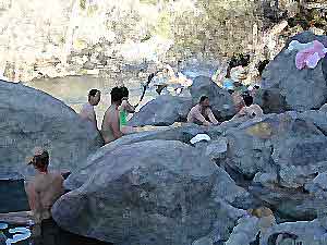
Several hot spring pools line this desert canyon on the SW side of Deep Creek. There are smaller hot tubs, as well a large warm tub that is big enough to swim in. The vegetation around the springs and main creek is fairly lush for this desert terrain. A variety of trees, including willows, plus small meadows and grasslands add to the visual balance of this land. Deep Creek is one of the popular Southern California hot springs due to its proximity to the big, urban areas.
East of Lake Arrowhead; South West of I-15 @ Hesperia & Victorville
option A: Bowen Ranch, 2 mile hike
Bowen Ranch parking area, pay a fee to the crazy man and have the shortest hike to springs. The word ‘ranch” is used to describe a small shack with some junker cars. No entry after 10PM and the man at this private property is not a friendly ranger, nor is he a pleasant person to deal with (which is why we list 2 other parking options).
Interstate 15, exit Bear Valley in Victorville. Go East on Bear Valley 10 miles to Central. Turn right on Central. Just beyond the top of the hill turn left on Ocotillo, which becomes a dirt road. Turn right on Bowen Ranch Road and continue until you get to Bowen Ranch. National Forest Trail #3W02 the Goat Trail (aka Bowen trail) is 2 miles, the steepest and shortest route into the desert creek canyon.
Bowen Ranch Trail, as seen from opposite side of canyon
option B: PCT Trail Route, 6 mile hike
Interstate 15, exit Hesperia & take Main St. @ Y veer left- Rock Springs Rd., right on Deep Creek Road and follow it up to Mojave River at the Saddle Dike Embankment. Park near the dam; Look for Pacific Crest Trail sign for hike up canyon to the hot springs.
option C: Bradford Ridge, 3 mile hike
Lake Arrowhead hike-in way via the Bradford Ridge Path. Take Highway 173 East, which becomes a wide graded dirt road heading toward the desert. From the shooting (rifle) range where the pavement ends, clock your trip meter on your vehicle 3 miles further down the road. Park at small pull out on the left side. Near the sign that says ‘Narrow Bridge’, where a gated old fire is directly across. Trail head was not marked. If you are into hiking, this option is for you. Narrow sandy ridge trails, single track. Bring flashlights for a successful hike out at night.
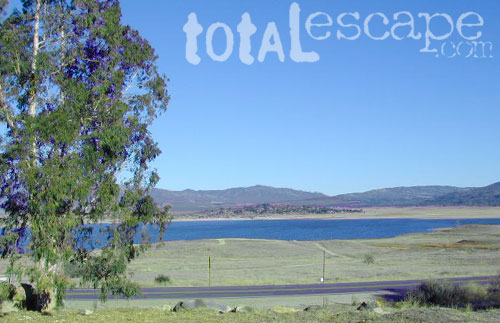
San Diego county has numerous recreational lakes, but only a few that allow overnight camping. Oak filled valleys and pine forests are nearby, but if you are seeking alpine lakes, surrounded by granite peaks and towering forests – then look to north for the Sierra Nevada mountains. Southern California landscape is nearly a desert terrain, with seasonal creeks and minimal rivers, so you won’t find lush greenery with natural lakes down here.
Rock Climbing in SoCal is limited to the awesome southern deserts with boulders, boulders & yep, more boulders. Joshua Tree is well known, but Mojave deserts boulders have much to offer, with less crowds. Meaning you’ll get more on exploring new routes, off the beaten path.
Bishop in the Eastern Sierra has the Buttermilks, but we wanna cover stuff further south for climbers. Numerous crags and peaks can be found in the mountain regions of San Diego. Many destinations are also great camp spots.
Good granite is hard to come by & big granite walls are non-existent down south. The most popular piece of Southern California granite among climbers is that of Tahquitz Peak in Idyllwild CA
Big Bear Lake
Bouldering @ various places
Idyllwild Rock Climbing
Tahquitz Peak in San Jacinto Wilderness: Tahquitz Peak Lookout stands at 8846′ elevation, towering above the pine village of touristy shops & cafes below. It’s a small slice of the Sierra Nevada (fabulous blue granite feeling) in SoCal & the rock climbers love it. Humber Park is at the base of the peak. The park is a family & tourist destination, especially during snow days. Paved parking lot is at the very top of the neighborhood, a well signed route. Follow the brown “Humber Park” signs. Hmmm, now is that ta-keets, ta-quits? Just ask a local – who grew up in Idyllwild.
San Diego County climbing destinations:
Army Rock
Beirut
Bonita
Carlsbad Boulders
Culp Valley
Descanso Wall
Dixon Lake
El Cajon Mountain
McCain Valley
Mission Gorge
Mt Everest
Mt. Helix
Mt. Woodson
Otay Lakes
Poway Crags
Rock Mountain
Santee Boulders
Stonewall Peak
Valley of the Moon
For more on California rock climbing places, check out a few of our favorites resources:
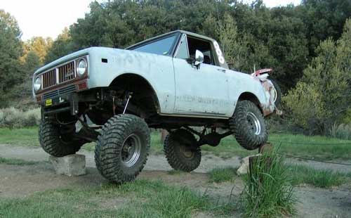
Rock Crawling has gained massive exposure in the two last decade with new suspensions, after market part for nicer rigs & of course, the main stream media. Red Bull, Skyjacker & other corporate sponsors have dug their hands into this new sport & the profits.
Crawlin’ is the off road hobby of wheelin’ well built rigs over the rocky terrain and obstacles, instead of around it. Sandstone walls, granite boulders of the High Sierra, hand made “rock gardens” in the Mojave, practice runs @ the local OHV parks.
Breaking things is the norm in this game. Expect this past time addiction to cost a bundle – on auto parts & on your free time. On the trail repairs are common, so go prepared w/ your tools, overnight gear & your crawling buddies (as back up).
From the adventure lands of Moab, Utah to the Mojave Desert of SoCal, rock crawling is not about speed, but all about the delicately chosen lines & slowness. The technique, the rigs & preferably no body damage. Just get rid of the body!
How slow can you go? How high can you handle?
Popular rock crawling areas around the Southwest U.S. –
Los Padres Campgrounds
Big Sur, Mount Pinos, Ojai, Santa Barbara, Santa Lucia
Los Padres National Forest campgrounds span the length of the California Central Coast, from the Monterey Bay to Los Angeles County. Choose a desired area:
From Santa Ysabel on Hwy. 78, drive E 6 mi, turn right on Pine Hills Rd.
1.50 mi., bear right on Eagle Peak Rd.
1.25 bear right again (signs point to Eagle Peak Ranch)
Drive 8 mi. (dirt & paved) to Saddleback, 4 way junction.
Park & hike the fire road downhill for 1.25 mi.
At the fork, bear left & continue into the Cedar Creek bed
Some rock scrambling down to the swimming hole
Hot Springs Mountain
5.5 miles RT/ strenuous (elevation gain/loss =1,250 feet)
Near Warner Springs, 10 miles northeast of Lake Henshaw; Off Highway 79
From Temecula Interstate 15, take Highway 79 East to Warner Springs
Drive up Los Coyotes’ Indian Reservations main road, past the intersection of Middle Fork Borrego Palm Canyon (6.1 miles past the entrance gate )
Turn left (west) and drive up the valley on a sandy road to reach a saddle above the valley 2.2 mi. farther
At Nelson’s Camp, on the left side of the road, Park at the camp
Begin hiking southwest up along a small tributary stream that flows north & west into Agua Caliente Creek.
Follow an old Jeep trail up, gaining more than 500 feet in just over a mile.
At the top, you’ll meet a better road that runs up the south slope to Hot Springs Mountain
Turn left (west) on this road and climb another 1.6 miles along the ridge line to the tower.
Pass through dense forests of black oak, Coulter pine and white fir, and across meadows dotted in late spring with wildflowers.
Lookout tower, dilapidated and seemingly on its last leg, sits on the west shoulder of the mountain.
Go a bit higher on the ridge by following a faint trail through thick brush and around boulders to the true summit. A flat concrete platform caps the summit block.
option – Seven-mile dirt road going up the mountain’s southern slope (drive, hike or mountain bike)