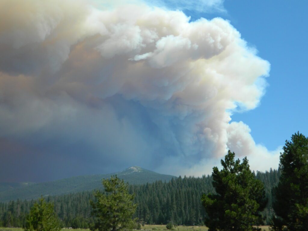
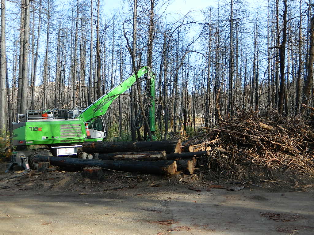
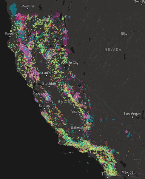
A list of recent wildfires in California, with counties and acres affected. Forest fires listed here are the ones that have affected public lands – like National Forests, National Parks, State Parks and BLM land.
On public lands you may see signs like –
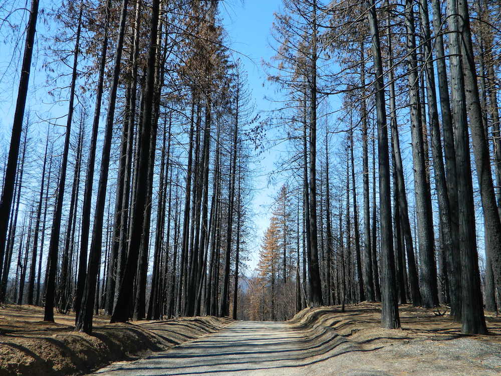
Warning: Entering a Burned Area Potential Hazards include:
LOOSE ROCKS
FALLING TREES + LIMBS
STUMP HOLES
FLASH FLOODING
DEBRIS FLOWS
>>> Entering a CLOSED FOREST with burn scar is a crime and can result in jail time. Check USFS forests web site for current closures.
Forest Fires listed below are alphabetical. Green & blue links to more data on these wildfires.
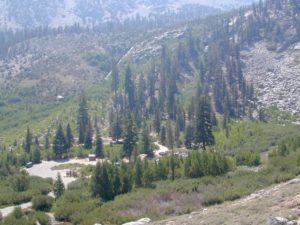
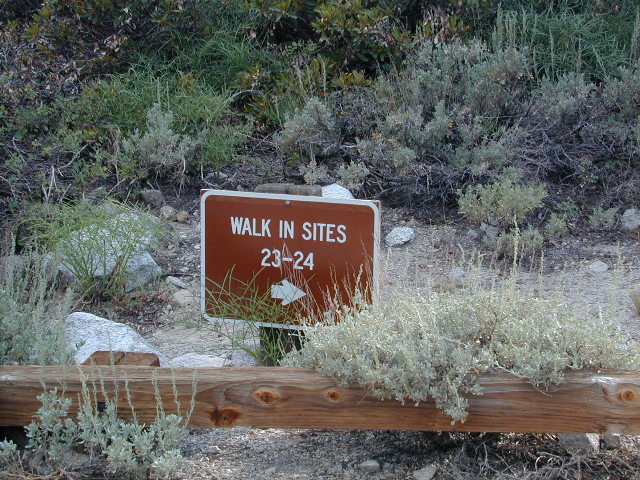
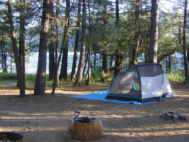
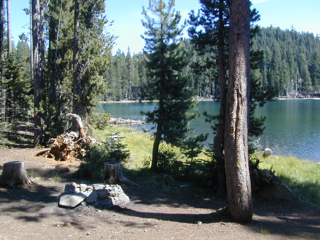
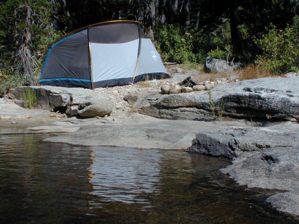
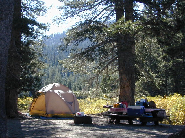
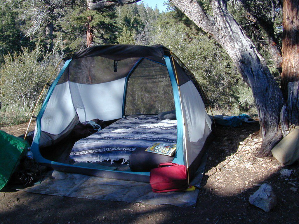
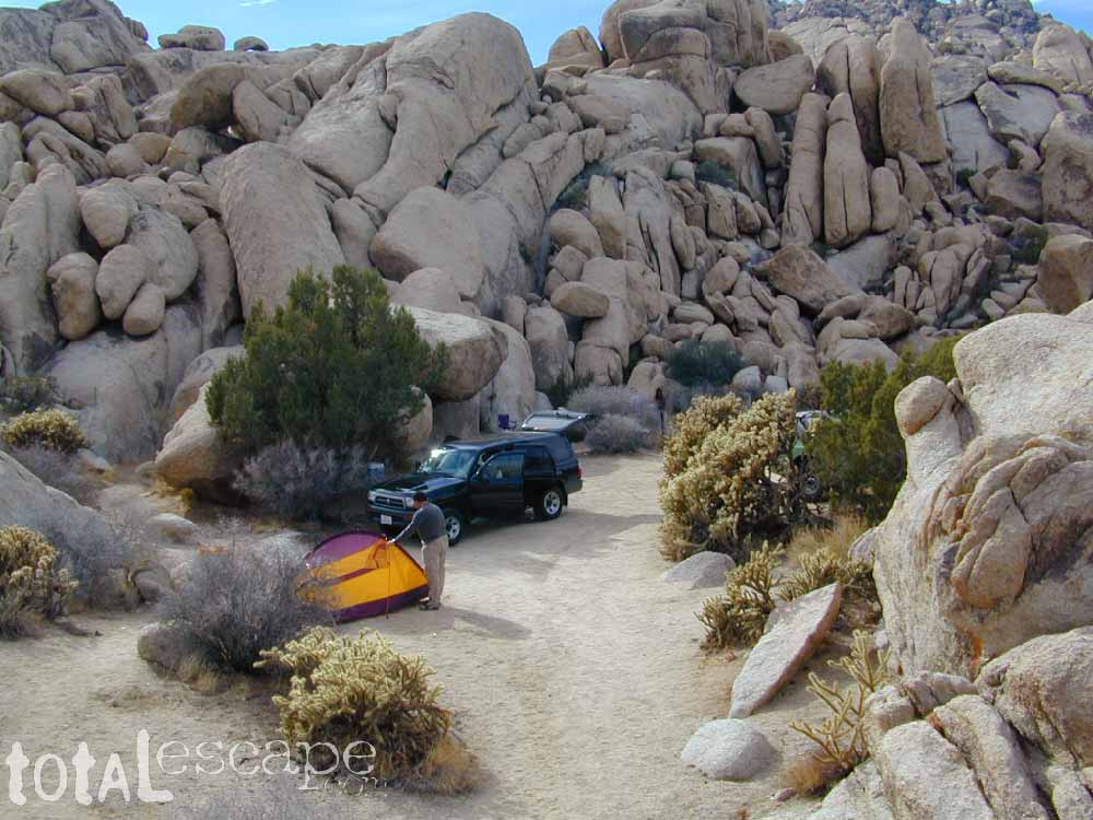
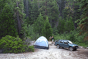
Below are developed campgrounds in California that have walk-in camp spots available. Vehicles are parked and you must carry your gear into the camp site (usually a short distance, but can be up to a half mile).
California Campgrounds with more than a 1-mile trek are not included in this list below. Areas such as – Catalina Island, Crystal Cove SP, Angel Island SP, Point Reyes National Seashore, indeed have many hike-to camps, but most are measured in miles (one way).
walk in campsites are perfect for –
people who wish not to see cars @ camp
people who prefer less noise while camping
physically fit folks, who want exercise
backpackers, who plan to hit the trails soon
avid hikers, who may be out day hiking
cyclists, just passing through
mountain bike campers
one nighters, travelers who only stay one night
late comers to the campground
(hint: these are usually the last campsites to fill up)
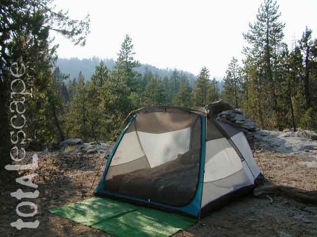
Walk in campsites are often located away from car campers & RVs. Some camp sites may have more privacy, tucked away in trees, while others have shared community area with fire pits and/or barbecues. All camp sites will have picnic tables and a some kinda toilet nearby. Bear boxes may be available for storing food properly. Sharing these food storage boxes with neighboring campers is common practice.
Campgrounds with walk-in sites range in elevation from sea level marshlands to high altitude alpine lakes. Most of these camps listed below are located inside developed campgrounds with overnight fees. Many are small campgrounds, while others are large hubs of activity. Some may be smaller campgrounds, with just a few camp sites. The most popular places can be reserved, with the links provided.
Many parks can also have day use fees, so know where you park and what time span is allowed. Ask the campground host if needing assistance. Some campgrounds lock their gates at sunset and do not permit entry at night. Others may not allow campers to check in anytime after sundown. Know their rules before you make reservations.
If you plan on not making camp reservations; make sure to have a plan B or C choice camp – in case your desired campground is already full. Many popular destinations can fill up fast (by noon in the summer).
Spacious Camp @ Aspen Grove Campground, Eagle Lake, CA
Niagra Creek Campground, OHV 4×4 trails, Stanislaus NF
North Battle Creek Reservoir, PG&E Camp, West of Lassen North Grove Campground, Calaveras Big Trees State Park
Southwest Walk-In Camp, 6700′ elev @ Lassen Volcanic NP Squaw Leap Campground, San Joaquin River, Auberry CA Stillwater Cove Regional Park, N of Fort Ross, Sonoma Coast
Table Mountain Group Camp, Bishop Creek Canyon, Inyo NF
Tahoe National Forest
Donner Area Camping Lakes
NFS 530-265-4531
Carr Lake Campground 10 miles north of Highway 20 6,700′ elev 5 walk-in campsites
Rucker Lake Campground 6 miles north of Highway 20 5,462′ elev 7 walk-in campsites
Sterling Lake Campground 9 miles north of Interstate 80 7,000′ elev 6 walk-in campsites
Toad Lake Walk In Camp, PCT @ Shasta National Forest Tuolumne Meadows Camp, Yosemite National Park
(reservations & wilderness permits required)
Walk in campgrounds are considered ‘tent camping‘, as opposed to ‘car camping‘, which is literally camping next to your vehicle. This type of hike-in camping may also be referred to as ‘trailhead camping‘, as many ideal hikes begin at these prime locations. Boat-in, bike-in or hike-in camp sites are also available at some of these locations.
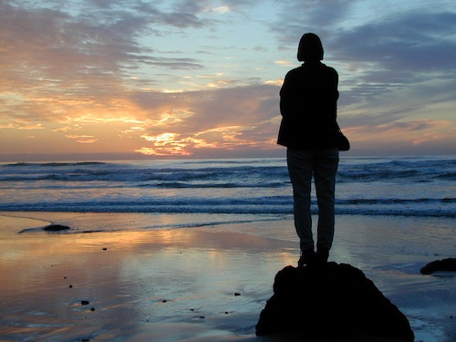
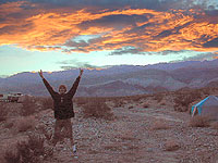
There once was a time when we connected more with nature. Before we closed ourselves off, behind the doors and windows, behind the computer screens, before the internet became part of daily life.
Overweight and obesity is now epidemic in America (as if you didn’t notice). Fast food feasting and soda pop, GMO-gut disorders – and yet we’re still frustrated or disappointed with life; Addicted to television, processed food, copious amounts of sugar, daily coffee, smoking, prescription drugs, and what else.
Wi-fi streaming, video games, always indoors, online, enjoying air conditioned cubes. Inactive physically, emotionally vacant, bored with our choices and always on social media.
Stop and think. Look what has happened to us.
Is this the life you envisioned?
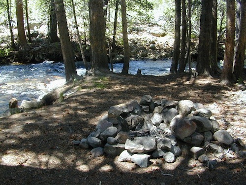
Cooking over a camp fire and real conversation are just a few examples of what we have lost in our modern world of technology, fantasy and face-time. Fresh air, wild flowers, alpine lakes, star filled skies and total silence – all still exist in certain areas, but you must know where to look. Birds and bees, wildlife is disappearing at extinction levels. Pollution, powerful corporations and politics.
Stop and look. See what has happened to earth.
Is this the world you envisioned?
Gone! Away, split, out of town. Off work, out of school, on vacation. Outdoors, always. Far, far away. Unplugged, out of range, vacant lands, big trees, open skies, clear views. California is the land of dreams. Opportunity, fantasy, education, agriculture, terrific terrain and epic scenery. Campfires, waterfalls and mountain meadows are waiting for you.
Taking time off of work – or your typical daily routine – is often rewarding physically as well as mentally. Imagine a week away in a gorgeous location, with minimal to do. Really relax, zone out, chill. Gaze at the water, nap in a hammock, find wildflowers, deer bones, or bear fur on a tree. Cook over the campfire, stargaze every night.
Running to a general store for ice will be your biggest task of the week.
Wilderness boundary, abundant dirt roads and freedom; cell phone calls dropped. Beyond the city limits. Well past the county line.
Roads do lead out of the matrix, if you desire to follow them. Concentrate on a new reality – and disconnect long enough to commune with nature. Find the free time to really relax and re-evaluate life. Explore other options, consider real life in the bigger picture. Hike, bike, walk, camp, birdwatch. Be outdoors, often!
Beat the Summer Heat and head to upper elevation Cool Forests
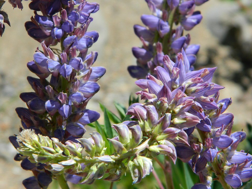
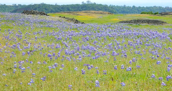
Curly Lupine @ Mill Creek, CA
Cheap Road Trips
Total Escape is your California planner. We’ve been doing this “region” for more than 30 years, always focusing on the back roads. Discover hidden secrets, meadows and unknown waterfalls. Find free campsites, canyons, rivers, creeks and new places to explore.
Rock climbing, backpacking, fly fishing creeks, snowmobiling, you name it. No matter what kind of trail you seek in California, we have the maps to get you out there, this weekend. If you seek a week long adventure in the Sierra high country, or a weekend getaway destination you’ve never heard of, or a quick after work hike near your home town, we just might have it listed. And we probably have the waterproof, topographical map too.
DOGS & BIKES on TRAILS:
Dog friendly trails include almost anything within the CA National Forests. Remember that most National Parks & State Parks literally forbid dogs on hiking trails. Mountain bikes can access only certain trails in parks, but in the National Forests nearly every trail or dirt road is up for grabs.
OHV ROUTES:
Motorized vehicles, such as quads, ATVs, dirt bikes, Jeeps & 4x4s must stick to designated routes signed specifically for OHV (off highway vehicle) & you won’t be finding many of those inside National Parks & State Parks, so it’s best to look for BLM or NF lands. Many regular, forest, back roads close in winter due to heavy snow pack & thus become cross country ski, snowshoe or even snowmobiling trails. The best ones can be found in the Sierra Nevada mountains.
And if you ever get bored with “reading” text about trails, you can always search the visual database of amazing Cali scenery over at DanaMite’s flickr site
If you’ve had it with the traditions, the big meal prep, or just sick of the family. Maybe you are a solo traveler, or a new transplant to California and need to explore more. Take a holiday away – for once this time.
Camping for turkey day? What a concept.
California is the perfect place for camping, all year long!
Stick to the lower elevations, look for canyons, and seek seclusion
California mountains often have snow during November. Avoid camping in snow @ 4000-5000′ elevation and above; Freezing temps above 3000-4000′ elevation.
Deserts, coastal regions and foothills are top choices for late Autumn car camping. Always check the weather ahead of departure, and have a plan B as an alternative. NorCal will be much wetter than the rest of the state.
MEALS: Prepare dinner meals ahead of trip departure. Bake turkey days before your trip and create meals based around that. Make mash potatoes at home and don’t forget to bring the butter. Pack pre-baked turkey for sandwiches, plus other quick snacks & meals for on-the-go travel.
Non Traditional: Seafood Feast
Desert Camping is premium at this time of year. Luckily the eastern half of Southern Cal is desert. The lower the elevation, the better the temps will be overnight. Be prepared for wind when the ‘storm fronts’ approach, the winds do get a cranking! Dirt roads can become flowing washes during a good rainstorm, so know the weather forecast.
Coastal campgrounds may need advanced reservations. Be prepared for wet weather, especially up north. The redwoods groves are gorgeous anytime of year.
Gold County Reservoirs are prime areas for relaxing in nature, while everyone else is out shopping. Oak hills, rivers and canyons. RV campers love these large lakes; boating, fishing, mountain biking trails, kayak rentals, hiking near historic Gold Rush towns.
River Canyons of California are always beautiful destinations in the autumn months with fall leaves changing color. Many campgrounds can be found at lower elevation, river access areas.
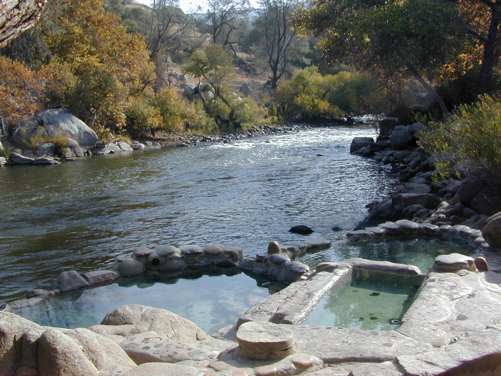
California’s abundant Hot Springs are also top picks for holiday weekends.
Anza Borrego Desert State Park is always a nice, easy and relatively close get-away for any holiday. Open camping on the backroads (for free) makes it one of the most attractive camping options in all of SoCal. Many dirt roads are accessible for passenger cars, if extreme caution is used. Don’t plan on driving more than a few miles on dirt.
froaders
Masses of off roaders love to camp out, especially on Thanksgiving weekend. Wheel all day, eat, drink, bon fires every night and rumor has it ‘they roast their big bird outdoors – deep in a dirt pit’. Really?
El Centro, Glamis, Imperial Dunes, Ocotillo Wells, Truckhaven Hills, Johnson Valley. All popular off roading areas in Southern California, so consider yourself warned.
Mojave Desert, near US Hwy 395 Jawbone Canyon expect to see RVs, toy-boxes and families outside enjoying the weekend. OHV style. Often the group tries to create a round corral with their huge convoy of vehicles, to keep thru traffic to a minimum around “their camp”. Just stay well away from those gear-heads. In general, it is a very busy area around Mojave up to Hwy 178 during the holidays. Try high desert Horse Canyon instead.
Merced Lake is one remote destination along the High Sierra Camp Loop, Yosemite Wilderness.
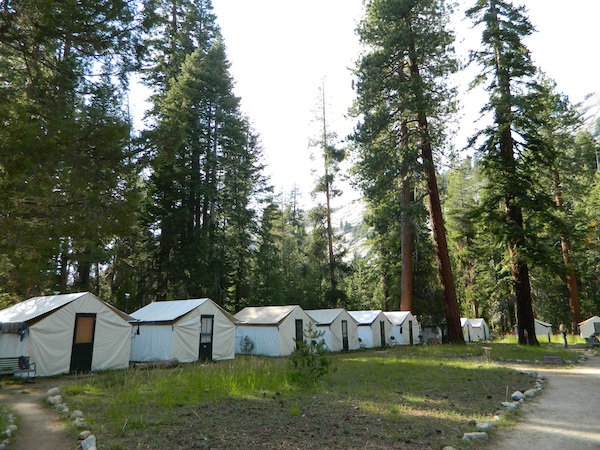
Tent Cabins & Yurt Rentals
around California
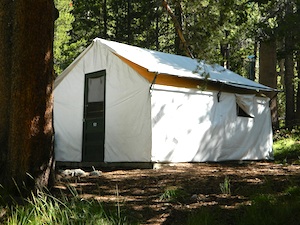
Tent cabins are made up of wooden floors, canvas walls & a canvas roof – a combination between a tent & a rustic cabin. Most have sleeping cots for beds; some have heaters, wood burning stoves or electrical outlets. A shared community bathroom is often close by.
Yurts are round versions of this same concept, with a wooden floor, real beds and usually nicer decor. Often these places request that you bring your own bed linens and towels, but each resort is different, so check the web links for detailed info.
Hike-in locations in the wilderness, rural river resorts or an easy drive to campground right off the freeway. These popular lodging accommodation are often marketed as GLAMPING, as in Glamour Camping – for the (luxury loving) princess who likes to try out nature – in a very controlled setting. Just watch out for mountain lions and bears.
Below are unique places in California that offer tent cabins, tree houses and yurt rentals.
Yosemite Lakes Resort
Cabins & Yurt Rentals
South Fork of the Tuolumne River
31191 Hardin Flat Rd
Groveland, CA
209-962-0121
800-533-1001 Western Sierra Nevada
Yosemite Pines RV Park
20450 Old Highway 120
Groveland, CA
209-962-7690 Western Sierra Nevada
HSC: HIGH SIERRA CAMP
Yosemite National Park Tent Cabins:
(advanced reservations required)
White Wolf Lodge
Backcountry wilderness area along Highway 120, Yosemite NP
ALLERGY NOTE: Most tent cabins are constructed out of heavy canvas material (fabric), which can mold when exposed to moisture (rain, fog, snow). Often they get dismantled, cleaned and stored properly over each winter season, sometimes not; All depends on weather, terrain difficulty and individual resort practices. If you suffer w/ allergies, moldy tent walls and dust mites can trigger asthma or other allergic reactions. If in doubt speak to the innkeeper or caretaker ahead of time.
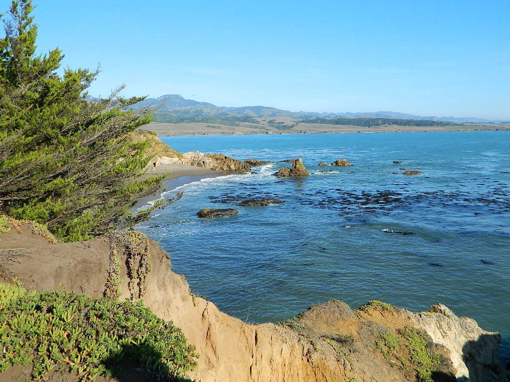
San Simeon SP. Central Coast of California
Rent a Treehouse
Post Ranch Inn
Tree-House Rentals in California
Big Sur, CA Big Sur Coastline
enjoying quality time alone is not weird, wrong, or unnatural, no matter how many strange looks you get from friends & envious co-workers
Stop waiting for someone to do things with. Quit thinking that your best friend or partner will one day magically suggest an outdoorsy road trip, or day hike, or mountain bike ride. YOU are the one who craves the wildness of the earth, the unexplored, the secluded. The time is now for you to start living the life you want, outdoors, in California – today!
maybe it’s time to leave the city, for good
If you’ve just about had it with the pressures of everyday stresses, the wifi city life and the busy pace of civilized society is starting to get to you. Get a clue fast – before you loose your marbles. It’s time for much needed rest and relaxation. Nature is the best place to relax and reconnect with yourself and mother nature.
A change in scenery. A fresh perspective. A real break from the norm. No shopping, no errands, no phones, no television, no computers, nobody around. No one, except you.
Unplug yourself from the hectic rat race and go exploring. Give yourself time to fully unwind: time to think, time to enjoy the outdoors and really find that special place of peace that comes only from earth. Yes, all by yourself.
VISION QUEST
Call it an annual primal ritual, or a first time experiment, traveling solo can be a blessing in disguise. Learning to be alone outdoors, become more aware of the physical world and enjoying yourself is an important key to a balanced life. Whether you seek a quick refresher course for the weekend or a full blown month long road trip, seeking a new comfortable destination and the art of basic relaxing is the main focus for this trip.
slow going
When you travel alone, it’s easy to take your own sweet time. Going slow is something we don’t usually do in our busy city lives. Time is so precious, so you may as well stretch that vacation out as long as possible. Savor the moments.
Take as long as you like for – photography, picnicking, hiking, stretching, yoga, cooking and stargazing. Firewood collection becomes the biggest chore of the day, and it could take hours. Walking from camp, every direction will lead to a new adventure. Driving back roads at 20 mph is luxurious. No one to be your back seat driver. Sleep in every day if you want. No pressures, no schedules, no big worries. Sunlight, food, heat, weather, cooking and cleaning. Sit back and learn to really relax. Enjoy a secluded camp site for a full week, and get to know the wildlife on a first name basis.
Follow the back roads to seclusion, or reserve several days at a unique campground. Imagine night after night of peaceful rest, with the sounds of nature surrounding you & the stars of the heavens dancing across the darkest skies.
Explore new terrain every day & move to a new camp every night. Or make it a “stay put” week-long meditation, in one spot. Whatever fits your needs. Either way, you’ll enjoy the solitude & the healing powers of nature. Answering to no one but yourself, you may feel guilty or kinda selfish the first few days, but this will fade as you learn to embrace the solo journey.
And it doesn’t hafta be all about roughin it either. While backpacking into the almighty wilds of the true wilderness has its good points – along with life threatening dangers possible every day, a simple quick weekend trip to a nearby small inn, fishing lodge, or a bed & breakfast could work for the pampered types. Choose something different and unique, yet know your own limitations (on comfort & on a physical level). Make sure your destination choice is surrounded by some nature and preferably wilderness.
Good California Maps are a must have! Don’t rely on digital cell service or count on online maps being readily available. The hard-copy versions are always the best back up plan. Old paper maps are the very best, cuz they can often show more hidden waterfalls, trails and old mines than the newer maps.
National Forest maps are best for getting and staying away from the tourist crowds. Visit Destinations to decide what kinda place you wanna explore this season.
which is why the golden state population always seems to be increasing, right? Helping you get away from your normal routine and the masses is what we do best here at Total Escape. Discover thousands of pages, photos and links on this site to create your very own unique retreat.
The mountains, deserts, coastal, rolling oak countryside & even urban escape inside city villages, are perfect starting points for planning your little escape.
Desert camping in autumn, winter and springtime months is perfect timing for any kinda soul searching, catching up on a good book, or just gazing out at the vast vistas. Meteor showers fall within the latter part of the year, so stargazing and camping is excellent with the new moon. Temps start to drop come September, so be warned. Mountain cabins drop to their off season rates after summer, but be prepared for chilly temps and get proper outdoor gear.
SAFETY TIPS: Give your schedule to someone. Any bit of info is helpful. A map or written itinerary given to a neighbor or close friend will help ensure your safety and timely return. Bring your cell phone, plenty maps, bear mace, a firearm and emergency supplies for additional security.
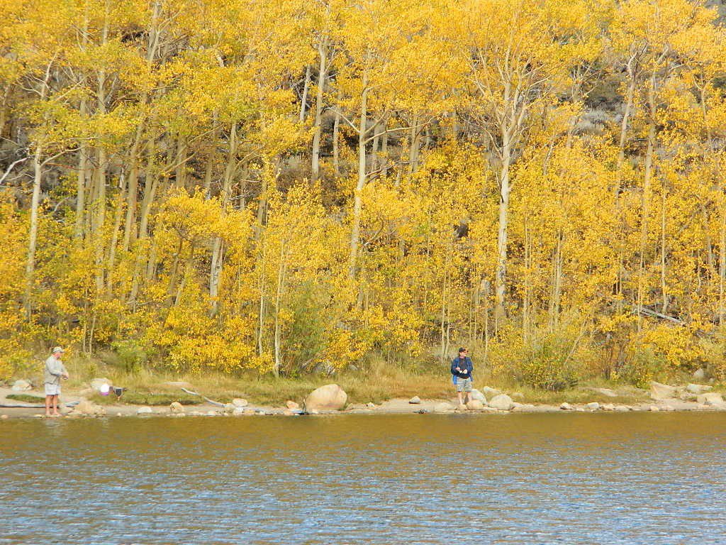
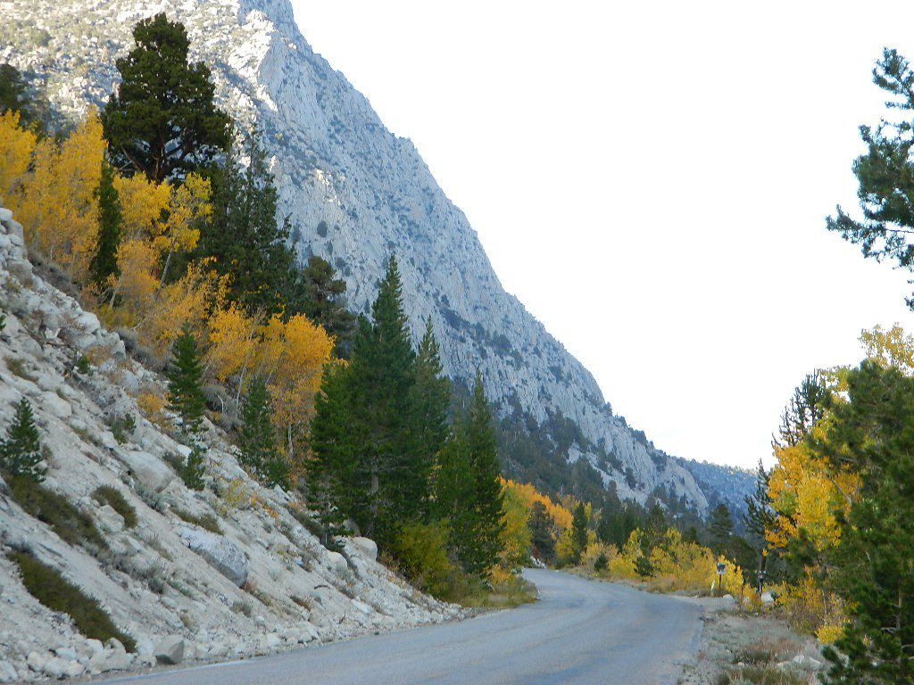
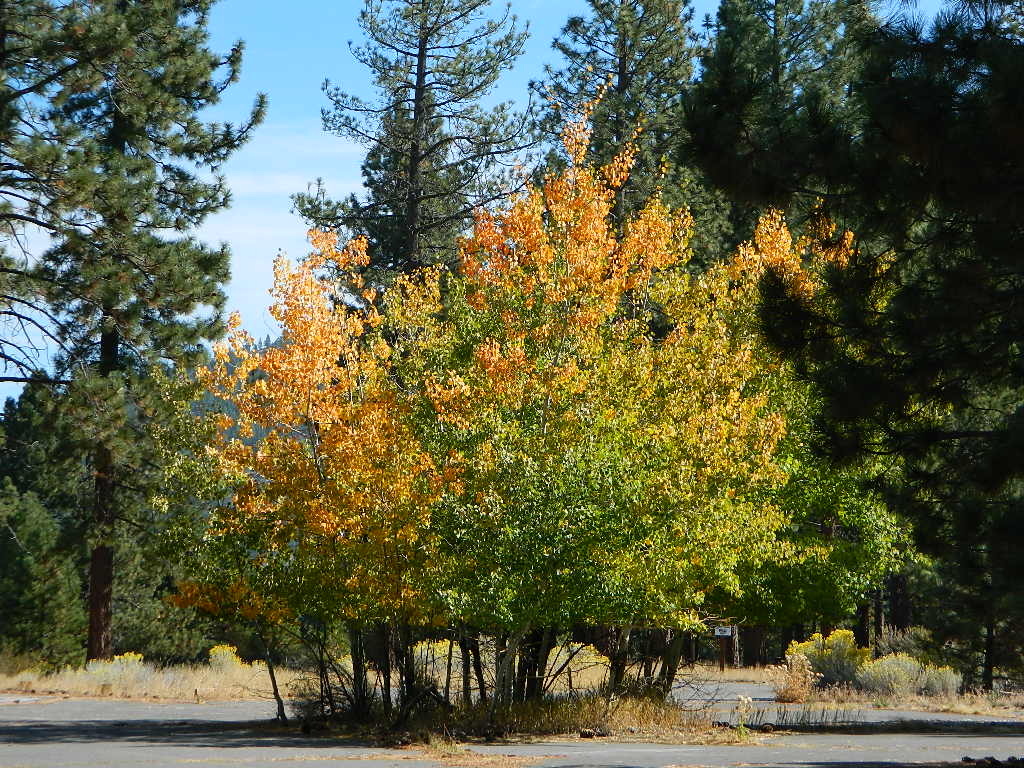
Amazing autumn colors can be found through OCTOBER and NOVEMBER in California, but you’ll need to leave the city in order to find the very best colors and scenic beauty. Fall season happens quickly (within weeks) in the high country and slower (months) in the lowlands. Plenty canyons and parks in the urban centers have hiking trails thru some nice trees, but nothing compares to the backroads, creeks and rivers of the big mountains.
Elevations, the higher the better, is where you’ll find the real displays of color. Aspen groves can be found along mountain slopes, creek canyons from 5000′-10,000′ in elevation. Cottonwood trees are found in the drier regions, in ranching areas and in desert canyons – up to about 6000′ elevation. Aspen trees start to turn yellow as soon as the chill of nights drop; if the temperature shift is subtle, the aspen leaves become more orange as the days go into the fall season. If an early snow or freeze happens, just one night, the glorious foliage becomes dead brown crispies dangling in the wind.
CAMP FIRE RESTRICTIONS are still be in place from the dry summer, and now comes the autumn winds. Any decent amount of rain can change the fire burn status, so make sure to check with the rangers for up-to-date fire info.
Best Autumn Campgrounds in California
Many of these campgrounds are located in or near aspen groves & are simply spectacular during the fall months. Some may be located near alder groves. Maple trees located along rivers turn golden between September and October.
Higher elevation (7000′-9000′) colors will change faster and earlier in the year (as soon as September), whereas the lower countryside may wait until late October.
Pack warmly, cuz the cooler temps at night (20-30 degrees) is what makes these awesome, little autumn leaves change colors. The change can happen very fast (in days). When the early season snows move in – usually a minimal dusting by October, fall colors can fade fast.
The North Sierra Nevada Mountains covers the region with Lake Tahoe and Donner Pass, and north Gold Country. River canyons with fall colors include American River,Yuba River, and the Feather River.
Aspen Group Campground
@ Jackson Meadows Reservoir
near Truckee, CA
Berry Creek, CA
Milsap Bar, Middle Fork of the Feather River
Bucks Lake, CA
Haskins Valley & Grizzly Creek Campground
Oro-Quincy Highway – Plumas NF
The Eastern slopes of the Sierra Nevada is the ‘place to be’ for Autumn Colors in California. The dramatic desert meets the tallest granite peaks. Every canyon is a different scene, many lakes lined with aspen groves, some have a creek with aspens.
Aspendell, CA
North Lake Campground
Lake Sabrina Road
Bishop Pass (high country hikes)
Lee Vining, CA
Lee Vining Canyon / Hwy 120
One of the biggest aspen grove canyons in the state of California.
NFS Campgrounds in Lee Vining Canyon: Big Bend, Aspen Grove, Boulder, Moraine, and Cattleguard Campground.
NFS Camps @ Yosemite’s EAST GATE (9000′ elev): Ellery Lake, Junction, Saddlebag Lake, and Sawmill Campground.
Impressive Rock Creek Road #4S12 in Rock Creek Canyon, one of the very best “Scenic Autumn Drives” in the whole Eastern Sierra. Numerous NFS Campgrounds on this road; many of which close for the season, just about the time then fall colors peak.
New to California? Never camped before? Haven’t been out in years? No idea of where to start? Total Escape is here to help with all your camping questions, local destinations and share tips; Introducing you to the big adventure in inexpensive vacationing, primarily outdoors. Find rural, remote locations, ranches, small towns, rivers, lakes, creeks, well away from the crowds. Get outta town more often for less money.
Bald Mountain (elev 9382′) Lookout in Sequoia National Forest
NFS Fire Lookout Towers
JULY 2019 – Many thanks goes to Pike County Lookout for initially spotting the #RockFire – in the Plumas National Forest, near Berry Creek, CA
Lookouts in the California National Forests
Ready to see far and wide – with wild terrain? Views for 100 miles out and the best scenery California has to offer. Be prepared to off road or hike to reach one of these destinations.
Below is a list of historic look out towers & cabins used for spotting wildfires. Some are located on steep granite peaks, ridge lines or dirt roads. 4WD may be recommended to reach some of these. Road conditions can change w/ harsh mountain weather, so be prepared to rough it. Thunderstorms are common on these mountain ridges.
Several of these places are cabins, some are stone houses, but most fire lookouts are basic metal towers – with high climbing staircases, so you must be in decent physical strength to haul your ass up this high.
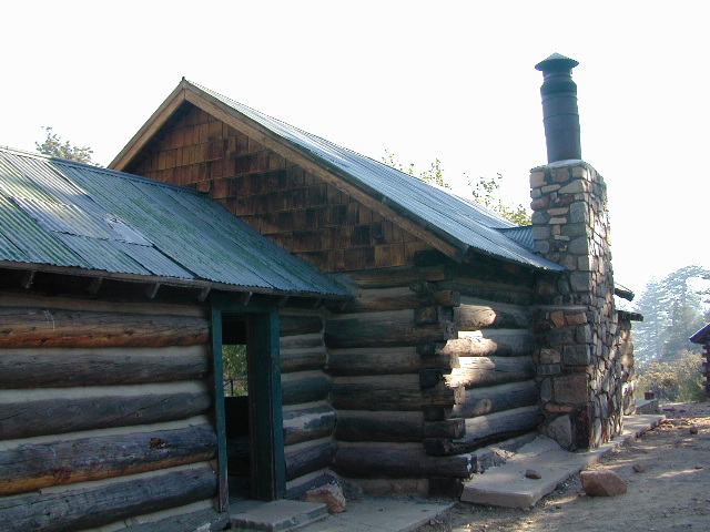
Cabins are also called guard stations, huts, bunkhouses. Most are located on mountain tops, but a few exist in desert regions. Some are refurbished & available for overnight rentals. Bare bones furnishings, so forget the frills. People come up here for the thrills. To be outside w/ epic views, way away from the urban grind & to feel on top-of-the-world.
See the full list of overnight accommodations on mountain peaks & ridges, some near meadows @ National Forest Cabin Rentals
Bald Mountain Lookout (no overnight stays) off of Sherman’s Pass Road #22S05, 4×4 may be needed.
Bald Mountain 9382′ elevation; in between the Kern Plateau & Kern River
Always check for local fire conditions at nearest ranger station, obtain a free campfire permit when camping outside of developed campgrounds, and always practice fire safety when visiting our public lands. You can be held liable for wildfires. Outta control campfire, cigarettes, idling vehicles on tall, dry grass. Be very cautious with fires on the often dry, west coast.
Golden gems of California, a collection of alpine lakes on the north end of Historic Gold Country, North Yuba River, Northern Sierra Nevada
EAST of Downieville, CA
California’s Gold Lake and surrounding lakes; the granite spires of the Sierra Buttes and the creeks, waterfalls, headwaters of the Yuba River — total wild beauty. Steep, granite, river canyon from Downieville drive east on Highway 49 from Sierra City to Bassetts, a gasoline and market stop; they have a small hotel there too.
Take the left turn, north on to the Gold Lake Highway. The alpine and extremely scenic Lakes Basin Area consist of all small lakes in between Hwy 49 to Hwy 89, along GOLD LAKE HWY [Road S620] some maps read Road #24 or call this Gold Lake “Road” instead of highway. Snow closes in this route during winter months.
Frazier Falls Trail
Length: 1 mile RT / Directions: Trail head is located on Old Gold Lake Road, about 5 miles from the Highway 89/Gold Lake Road intersection. Take the signed, narrow paved access road 4 miles to the trail head.
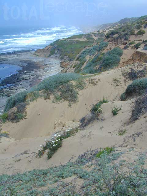
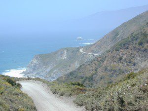
Camping right on the sand is possible in California, you just need to drive far enough to find it. Campground reservations are common (year round) on this stretch of coastline, since PISMO is a premier vacation spot for most of Central California.
blue links lead to State Park pages for camp reservations
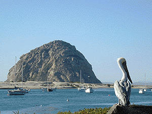
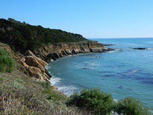
This camping page features all beach front camping options along the Central Coast, from Santa Barbara to Big Sur. State Parks, State Beaches, bay side marinas and rugged rural coast camps. We even list private campgrounds and RV parks, just so you have more choices.
USDA National Forests lies inland along the Central Coast of California, all the way from Ventura to Monterey. Numerous recreational lakes and back roads that lead to secluded small campgrounds. Primitive dispersed camping is allowed, but campfires are limited to local fire restrictions. The later part of the year means drier conditions and sometimes campfires are not allowed during wildfire season. Obtain a free campfire permit & check current conditions from the local ranger before venturing into the backcountry.
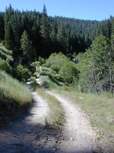
Before you can choose the ultimate place for your tent, you must decide where it is you wanna sleep OUTDOORS. What ultimate location? Your destination can play a huge factor in you getting a peaceful nights rest. And do you really need a campground? Or, are you ready to try to rough it, without the amenities? Best camping is off-the-beaten-path, and usually on the back roads. Trailhead camps, 4×4 camps, best view camps, creek camps; Dispersed camping, often called primitive camping. Focusing here on car camping, tent camping and backpacking routes.
Just choosing a flat tent spot isn’t good enough anymore. You crave the best camping experience and seek real nature, with minimal crowds. No annoying neighbors, no parking hassles, no traffic or cars passing by. We at Total Escape are here to help you get to your wilderness goals and experience nature like never before. Right here, right now and it doesn’t hafta cost you a dime.
California Camping Destination:
Let’s start with a terrain overview. California has it all – mountains, deserts, coastal, rolling oaks with rivers in the countryside, plus the infamous wine country and developed campgrounds within city limits. Desert camping in summer months should only be attempted by the experienced camper who loves 90+ temperatures. Mountain camping in winter can be freezing, so make sure you have the proper gear. Good maps are a must have and the readily available National Forest maps are your best avenue for getting and staying away from the masses. Visit our Destinations page to decide what kinda place you wanna ‘call home for the weekend’.
If you are the “I don’t care where I sleep kinda guy, as long as I can do/see this many things” all crammed into a 3-day holiday weekend, then you best do your research ahead of time. Get a good map, measure the mileage, plan picnic stops and sightseeing. Plan to set camp in a central location close to the main highway to call home-base, so you can be off exploring as much as possible.
Schedule in some “down time” or a full day for relaxing. Calculate driving distances and pad it w/ an extra hour. Maybe make a campground reservation if you are visiting a National Park or busy State Park. If you plan to wing it without reservation, always have plan B or plan C options already picked out. With millions of residents and tourists on the west coast, chances are you won’t be the only person wanting to do Big Sur, Yosemite or Point Reyes that particular weekend.
Helpful Hints
for a Good Nights Sleep @ the Camp Site
Bring a decent Sleeping Pad. Air Mattress with the inflator pumps will be the most luxury, without sleeping directly on the hard ground. Therm A Rest sleeping pads are another fine option, for those who like to travel light and still have air underneath them. Extra blankets, always.
Flat & Soft ground is the goal in choosing the best tent spot. Park your vehicles over the rocky slanted ground and keep the best flat areas for your camp site.
Do not pitch a tent in a meadow, no matter how inviting it looks. Wetlands and meadows are fragile ecosystems, an area that should be protected.
Look at the big trees above your sleeping spot and examine them. Do not place your tent near or underneath a dead tree or a dead limb. Trees do break and fall, especially if winds pick up. This could be a life or death choice, so remember to look up.
Bring abundant good tent stakes and USE them. Yellow plastic stakes are for soft cedar and sand. Thin aluminum stakes are for backpackers. Large steel nail stakes (some w/ plastic tips) are best stakes for all-around terrain.
Bring a mallet to pound stakes or use big rocks to hammer them. Gloves are also a good idea!
Never underestimate the use of a big tarp and some rope.
Guy lines help hold a tent in place when windy weather turns to big storm. If wind is in the forecast, then do this task before you head out on your day hike away from camp.
Make sure selected tent site is flat. Lay on the ground to check it out.
Place head of bedding up hill (if any slant can be noticed)
Tents should be at least 10 feet away from your campfire. At least 100 feet away from a creek or lakeshore.
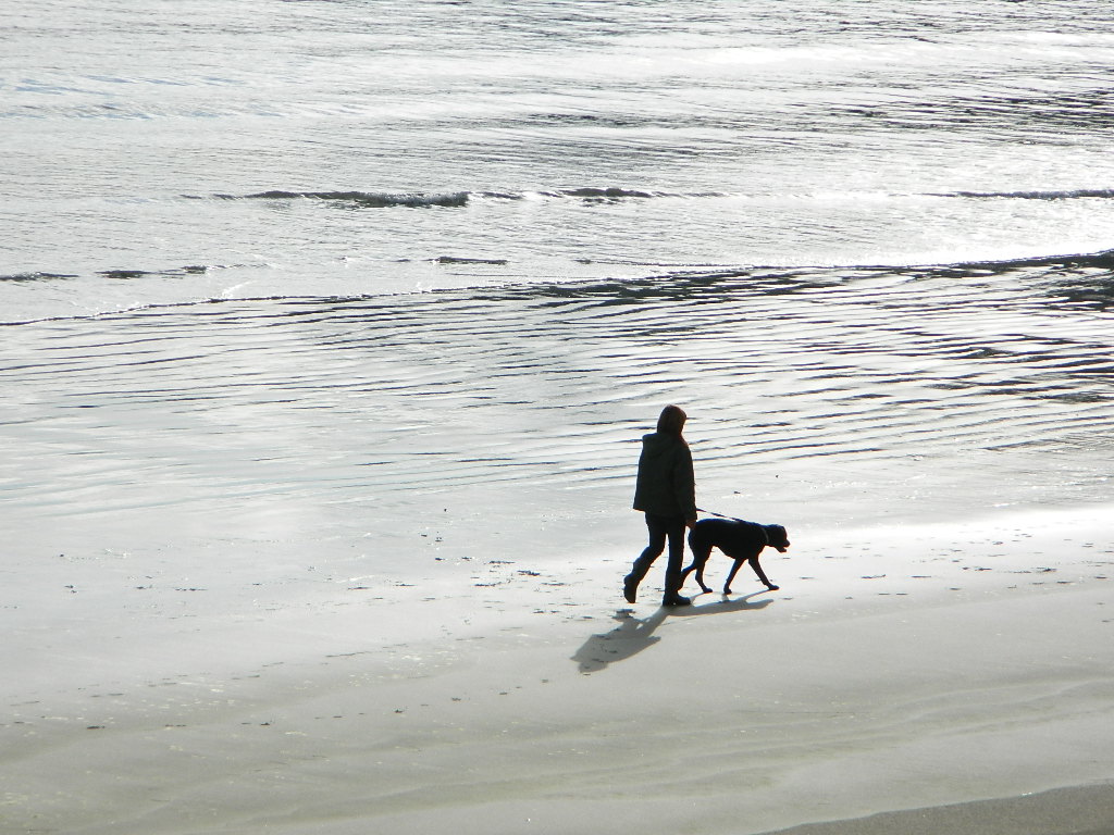
Beach camping at the ocean edge; Know the high tide mark; place tent accordingly.
Slot canyons are awesome, sandy, narrow washes, many with cliffs and caves. In the desert badlands these can become raging rivers w/ flash floods. When rain is heavy in the mountains many miles away, you could get flooded in the low lands. If you hear any thunder – RUN to high ground. Better off picking another camp site, than to die by a wall of water!
Shade in the Desert sounds like an oxymoron, unless you find a place with high cliffs, or slot canyons. Tamarisk trees and palm canyon locations are usually an oasis of RV tourists & travelers. Hot Springs are also busy spots. Pinyon pines, juniper and over-sized manzanita can be found in higher elevation deserts above 1000′. The prime desert camping season is generally October thru March, as April can easily soar close to 90 degrees high.
Some people swear by the open spaces and back road camping options, as they have more seclusion, plenty privacy and best off all, no campground fees. You might need a GPS and a high clearance SUV to reach some of these camp spots, but you will be blessed with a unique secret spot to call your own.
Campgrounds come in all styles these days: From small primitive camps on a creek to the luxurious RV resorts with laundry room and showers. And then there is everything in between. This web site Total Escape specializes in FREE camping on the back roads and the smallest of campgrounds.
Reservations are usually accepted at the most popular camp locations, many are wide open on weekdays and the majority of campsites overall are available on a first come, first serve basis.
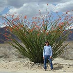
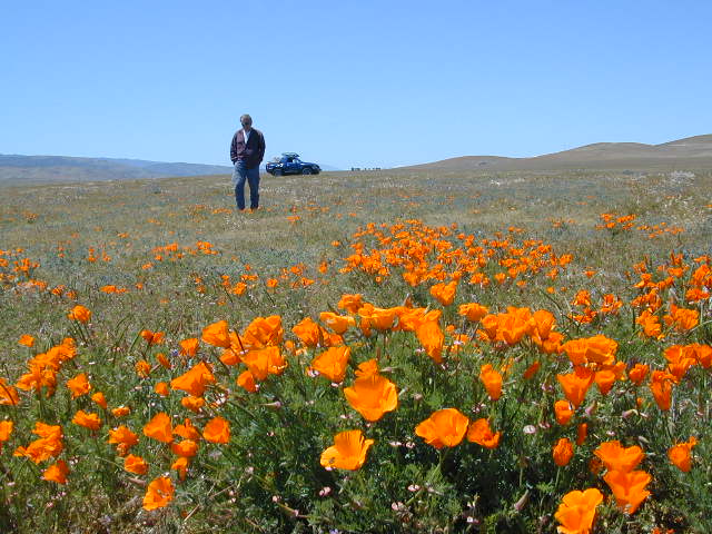
Wildflowers bloom all over California – from the desert in winter months, to the High Sierra in mid summer. Remember that the timing is everything, since most of these precious, delicate beauties only last a week or so. Out there alone, all day in the bright sunshine, whipping in the seasons strongest breezes. Flora!
The higher the elevation, the later the bloom.
Lower elevation deserts begin to show as early as February and higher elevation peaks thaw in May. Wilderness meadows and flowers can be found in the mountains in summer. Generally in California, Springtime – between MARCH and JUNE is the best viewing time.
San Diego Backcountry
600,000 acres of SoCal desert
BLOOM: February thru May Anza Park elevations range from low to high. Lowest near eastern border of park (next to the Salton Sea) to the upper reaches of the western slopes @ 4000′ of the Laguna mountains. Lower elevations sprout up first; Micro flowers, Easter-egg-color splendor in the dry washes. Higher elevations bloom later (along w/ areas on San Diego County Rd S-2, the Great Overland Stage Route)
Drive from Temecula to Warner Springs, and then proceed east – out to the Salton Sea via Back Road Highway #S22 (Montezuma Grade). A great route to take thru the Borrego State Park – for the full gamut in vegetation & altitude. Grapevine Canyon is an alternate off road route down a scenic canyon. Culp Valley has a small campground, plus lots of boulders and decent views to the Borrego Valley. Off the highway, on dirt, one-lane side roads lead to many primitive spots. Perfect for private picnics, stargazing or overnight camping.
Saline Valley Hot Springs
Saline Valley Warm Springs
NORTH Death Valley National Park, in a super remote desert valley located in the vast mountains in between Big Pine CA Route 168 & Death Valley (west) Highway 190.
Inyo National Forest: Inyo mountains are a towering range of high elevation desert peaks running in between Owens Valley and Saline Valley.
desert wilderness access: 4 dirt road routes lead into Saline Valley – 2 backcountry 4×4 trails from the upper reaches of the park and 2 main dirt roads. All routes require a high elevation pass, so snow is likely in winter months (Nov-May).
Wilderness routes road conditions can change often, seasonally with winter snows, mud and summer thunderstorms. The most popular access are the main routes (both long dirt roads, subject to snow and closure at any time) – the North Pass (Big Pine) and the South Pass (Panamint). Detailed directions on those further below. Both backcountry roads Steele Pass and Lippincott Road, originate from the northern, desolate areas of the National Park and both require 4 wheel drive, with a recommended locking differential. No developed campground facilities. Clothing optional my ass — nudity is the norm here.
Since the challenging drive in to this remote desert valley is so grueling and time consuming, plan to spend a minimum of 4 nights. Anything less is way too rushed to totally enjoy the experience. Best way to enjoy this place is a full week off of work, and as much firewood, food and ice as you can haul. Some folks spend weeks camping here. The NPS limits your camping stay to 30 days! If you plan on driving out to Lone Pine for camping supplies and returning the same day, you best leave at dawn – cuz the entire round trip ‘beer run’ will take 6 hours or more.
High clearance vehicle a must & 4 wheel drive is highly recommended in all this region. All wheel drive wagons and passenger cars have been known to bottom out, break down and pop tires out here in the harsh conditions, so a first challenge may be to obtain a dependable and capable off-road vehicle.
Topographic GPS & decent back road maps are highly advised. One way drive is easily 4 hours, from any paved highway. Pack like you’re gonna live out here, if need be. Warning: this is a very long off-road journey for any average camping trip. This isn’t a weekend kinda place. First timers beware – it’s a full day journey to travel here!
Air Strip? The fly in option is a dirt landing strip called ‘Chicken Strip’, but National Park Service has yet to closed it.
NORTH PASS to Saline Valley Road:
from Big Pine, take Hwy 168 N from Hwy 395, turn right onto Death Valley Road (some maps may have this one listed as Waucoba Springs Road or just Waucoba Road). Proceed on the main route to the hard to read entrance sign marking the Saline Valley Road, past a few old structures and down to the main valley. Winter snow can be deep, so carry chains. 4×4 is best to access this remote valley, AWD high clearance might make it and normal passenger cars, 2WD SUVs should be warned about weather and access to the real world. Many times all mountain passes are snowed in – people do get trapped at Saline and cannot get out for weeks. So take that into account when requesting days off of work for this epic journey.
SOUTH PASS to Saline Valley Road:
from Olancha, take Highway 190 E, turn N off Hwy. 190 to Saline Valley Rd. Rugged 50+ mi. of hard core dirt roads. 4×4 and high clearance a must. Winter months expect snow, springtime rock slides and summers torrential downpours cause overflowing creeks w/ impassable washouts. Grapevine Canyon can be a challenging drive, but with patience and skill you can be down on the main valley floor in about an hour and a half (if you’re lucky). Did I mention the dozen or more miles of heavy washboard road conditions, at the base of the alluvial fan of mountain rock? Newbies and first timers should attempt the North Pass.
———————-
Near the marsh, when you finally reach the sand dunes area, you know the turn off is close-by, so slow down and stop to read the landscape. Know that the hot springs are located above the sand dunes to the east slope of the red volcanic mountains. When you see the metal bat sign and the mass of palm trees in the lower grove, you know you’ve arrived.
You’ve only truly arrived, when your whole body is immersed in hot water looking up at the stars and you learn to relax again. Breathe the deepest you have all year.
CAUTION: Stopping for those vehicles distressed on the side of the road is also a common practice. Many people break down on this route, Jeeps slide off cliffs. Harsh landscapes, plus weather are unforgiving and people die, so realize that this camping trip is no walk in the park.
Saline Valley Road Conditions & discussions can be found on Saline Valley Talk, the Saline Valley Message Board forum.salinepreservation.org
Kern River Valley is one of the all time favorite Sierra Nevada destinations for SoCal escapees. First, it is the southern most ‘big river’ action for the Sierra range. The drive up from Los Angeles is easy access; only a coupe of hours. California Highway 178 leads from Bakersfield up the mountain to Lake Isabella (exit at 155 for Kernville destinations). The 178 continues east past the rural communities of Onyx, Canebrake, Weldon, and then on to the Northern Mojave desert & US Highway 395
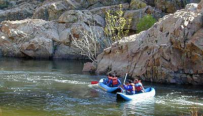
Second, Kern has an abundance of outdoor recreation, from fishing to boating, river rafting to kayaking, backpacking, mountain biking, rock climbing, horseback riding, hiking, camping, & soaking. Kernville is the “recreation headquarters” for the region, where you can find rafting outfitters, camping supplies and rental equipment.
Third, the mountain scenery is very diverse – with the dry shores of Lake Isabella, the granite lined Kern River, or the ridges with towering cedar forests, plenty sugar pines, plus a few Sequoia groves; Tons of dirt back roads to explore, granite & gorges for the rock climbers, prime wilderness access & several primitive hot springs.
The whole area is encompassed by the Sequoia National Forestwith wilderness areas to the North & East. Giant Sequoia National Monument is located along the Western Divide Hwy in the northern portion of the National Forest.
Whether you’re an RVer wanting a developed campground near town, a fisherman needing a primitive site right on the river, or a backpacker seeking the high country, the Kern has a little bit of everything. High elevations beyond 8000′ ridge lines, or the lush Lower Kern under 2000′ with granite boulders lining, Kern has it. 4 wheelers will love the extensive network of dirt back roads, or maybe the OHV areas of Keysville. Lake Isabella has numerous oak lined campgrounds & boat rentals available too. Summer is not the best time to visit as the temperatures soar to 100 degrees & the city crowds come in full force to the Kern Valley. Springtime, the best season to visit runs from March to May, or Autumn cools for September to December.
Up in the mountains behind Chico sits a rugged landscape of deep canyons lined with bizarre rock formations and roaring mountain creeks. Wilderness encompasses lower elevations – ranging from 1500′ – 3500′ – making this outdoor destination a winter haven, when the rest of the backcountry is covered in several feet of snow. One of the most historic wilderness areas in the state, as the aboriginal existence of the Native Americans came to an end in this area.
COHASSET ROAD climbs up the volcanic fin of Cohasset Ridge into the pine forests high above the valley floor. The paved road becomes dirt and the road name changes to Ponderosa Way (Lassen Road# 28N29). The Ishi Wilderness can also be accessed from the north side via Highway 32, near the Tehama State Game Refuge.
From Lake Isabella down to Bako, along Hwy 178, numerous natural hot springs can be found in this lower Kern river canyon. Old Kern Canyon Road has plenty of primitive spots to camp along the road, way above the Kern River. This Southern Sierra Nevada scenic route, a 20 mi winding narrow paved road, is the old highway that leads up to Bodfish CA.
At least a dozen dispersed camp sites can be found along the Old Kern Cyn Rd, some spots with views over canyon, some hidden & shady, many spots are level & large – suitable for RVs. No facilities, no fees, just a flat, dispersed site. Campfire permits are required for fires outside of developed Campgrounds & fire restrictions are often high, so no fires are allowed much of the year. Most of the gates on the Lower Kern are now locked & only accessible by Forest Service personnel, ranchers or local rafting companies with permits.
2 developed Lower Kern Campgrounds are located on the Old Kern Canyon Road, which parallels the 4 lane portion of the highway: Hobo Campground & Sandy Flat Campgrounds, if you really need a picnic table & bathroom. You can reserve camps by clicking the links.
Miracle Hot Springs – next to Hobo Campground. This hot tub park is closed for good. A few portable bathrooms, picnic tables & trash bins, the hiking trails clear; 2 shallow pools partially filled. Maybe enough room to soak your butt, but not fully submerse yourself. Someone really needs to renovate this place! Update 2012 – the signs for Miracle are now completely gone.
This one is by far the most popular now that Miracle is gone. The hike-in only access doesn’t deter people much and many choose to set camp overnight close by. The local authorities are always making the rounds to double check on the area – which is good for security and bad for the 2 AM party animals.
Democrat Hot Springs
private resort now open? Heck, I dunno. (2017, democrathotsprings.com is down. They might be trying to promote a River Festival held in May.)
The hotel and cottages were constructed to accommodate guests that came in stage coaches to dine and relax during the early 1900’s. Five springs on the property flow at 115 degrees into large soaking tubs and a swimming pool. Closed to the public for more than thirty years, the resort is once again ready to be brought to life for groups and private events only.
The hot springs listed below are Private Property, so don’t get caught – and don’t get shot:
Delonegha Hot Springs
Concrete tubs were built by homesteaders, later a hotel and boarding house were constructed. Stage coaches from the San Joaquin Valley took 2 days to get visitors to this area. The hotel closed in 1912, when more accessible areas of Democrat and Hobo were built. Remaining cement tubs run along a rock peninsula overlooking the Kern River; water temperatures average 112 degrees. This private property is fenced.
Scovern Hot Springs
Also known as the Hot Springs House. 1902 mud baths were being offered and the wooden tubs were replaced by galvanized tubs. A swimming pool and bath houses were added when the Scoverns bought the property in 1929. Bath house burned to the ground in 1971 and only a vacant lot remains. Steam can still be seen in the fields across from the springs, where water runs at 140 gallons a minute @ 115 degrees.


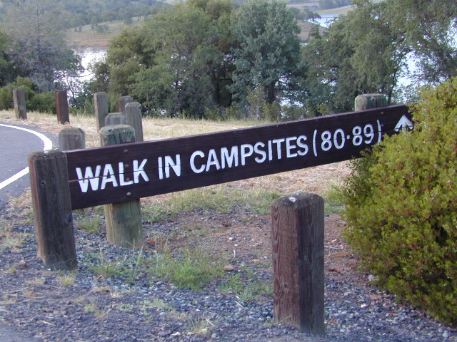
 Walk in campsites are often located away from car campers & RVs. Some camp sites may have more privacy, tucked away in trees, while others have shared community area with fire pits and/or barbecues. All camp sites will have picnic tables and a some kinda toilet nearby. Bear boxes may be available for storing food properly. Sharing these food storage boxes with neighboring campers is common practice.
 If you plan on not making camp reservations; make sure to have a plan B or C choice camp – in case your desired campground is already full. Many popular destinations can fill up fast (by noon in the summer).


 There once was a time when we connected more with nature. Before we closed ourselves off, behind the doors and windows, behind the computer screens, before the internet became part of daily life.
 smoking, prescription drugs, and what else.
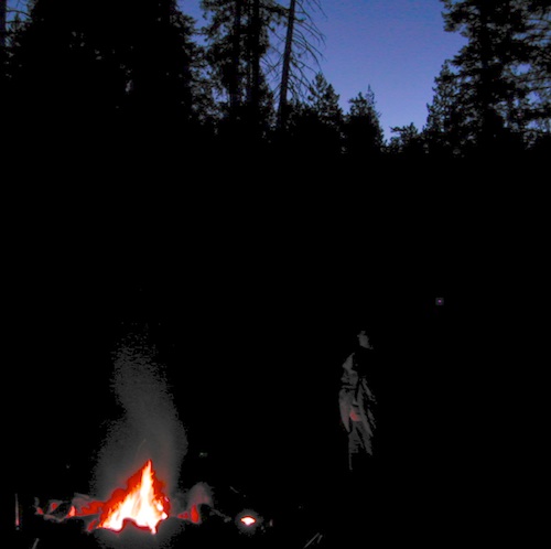
 Fresh air, wild flowers, alpine lakes, star filled skies and total silence – all still exist in certain areas, but you must know where to look. Birds and bees, wildlife is disappearing at extinction levels. Pollution, powerful corporations and politics.


 Motorized vehicles, such as quads, ATVs, dirt bikes, Jeeps & 4x4s must stick to designated routes signed specifically for OHV (off highway vehicle) & you won’t be finding many of those inside National Parks & State Parks, so it’s best to look for BLM or NF lands. Many regular, forest, back roads close in winter due to heavy snow pack & thus become cross country ski, snowshoe or even snowmobiling trails. The best ones can be found in the Sierra Nevada mountains.


 If you are the “I don’t care where I sleep kinda guy, as long as I can do/see this many things” all crammed into a 3-day holiday weekend, then you best do your research ahead of time. Get a good map, measure the mileage, plan picnic stops and sightseeing. Plan to set camp in a central location close to the main highway to call home-base, so you can be off exploring as much as possible.
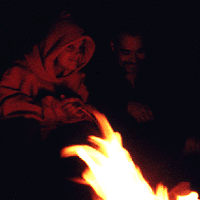


 Ishi Wilderness Map

