Tag Archives: NFS

Sawmill Lake Sierra

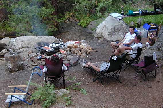
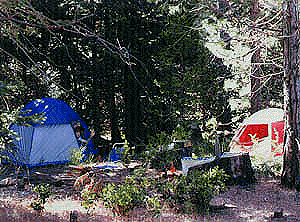
primitive camp spots

Sawmill Lake, California


N of Donner Pass, Sierra Nevada

elevation 5800′Canyon Creek connects Lake Faucherie, Sawmill Lake and Bowman Reservoir in the Sierra, Tahoe National Forest. 20+ miles of backroad travel, off I-80.

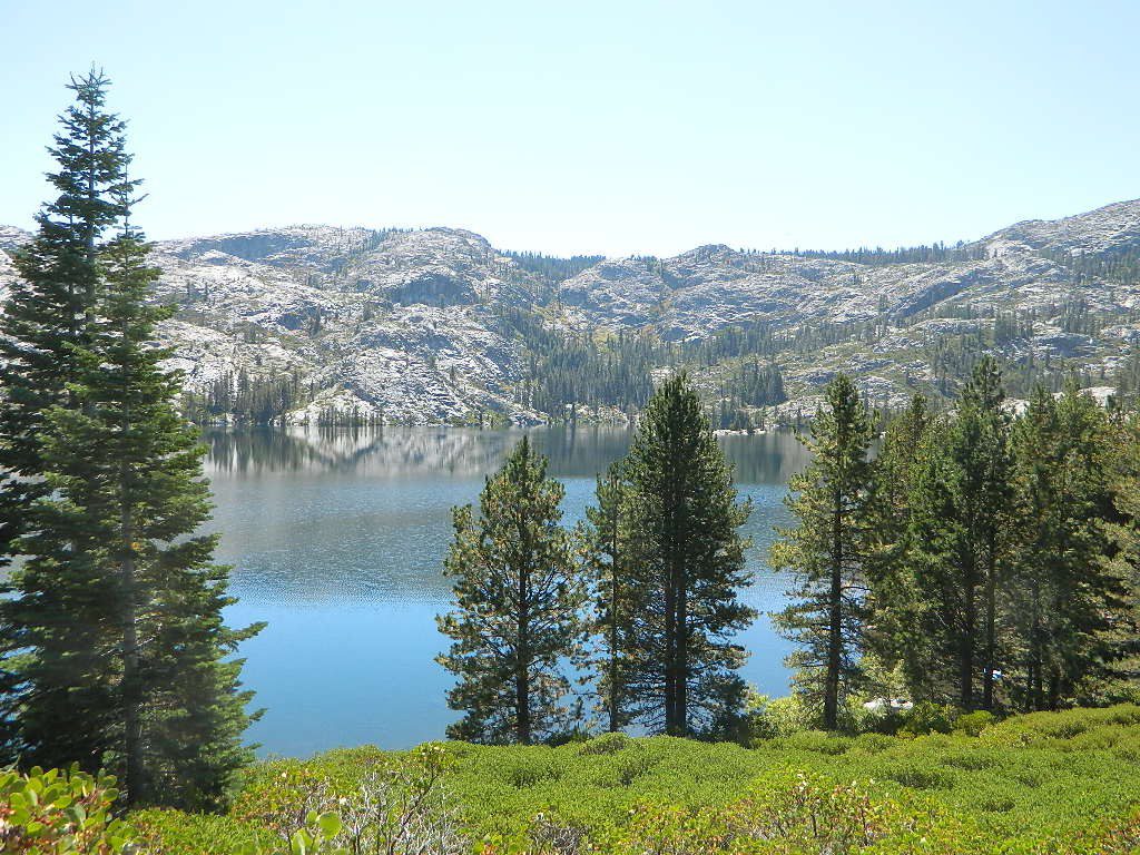
While many consider Faucherie to be the most beautiful scenic lake, Sawmill Lake just downstream a couple of miles is still quite attractive – with dense forests and a granite mountain backdrop. Sawmill is especially nice for those who like to primitive camp, ouside of developed campgrounds. Way off the interstate @ Hwy 20, tucked in way back behind Bowman Lake a few miles, you can find Sawmill Lake.
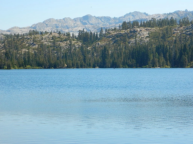
Sawmill Lake California

Fishing and camping, kayaking and canoeing are all popular recreation around this lake. A trailhead on the northend of the lake leads out to even more alpine lakes (a day hike “lake loop” or backpacking option). The Pacific Crest Trail is also routed nearby.

No motorized boats or watercraft allowed. No boat ramps, no pavement, no picnic tables, no bathrooms, no fees.

4×4 Lake
Fishing Lake
Free Camping Lake

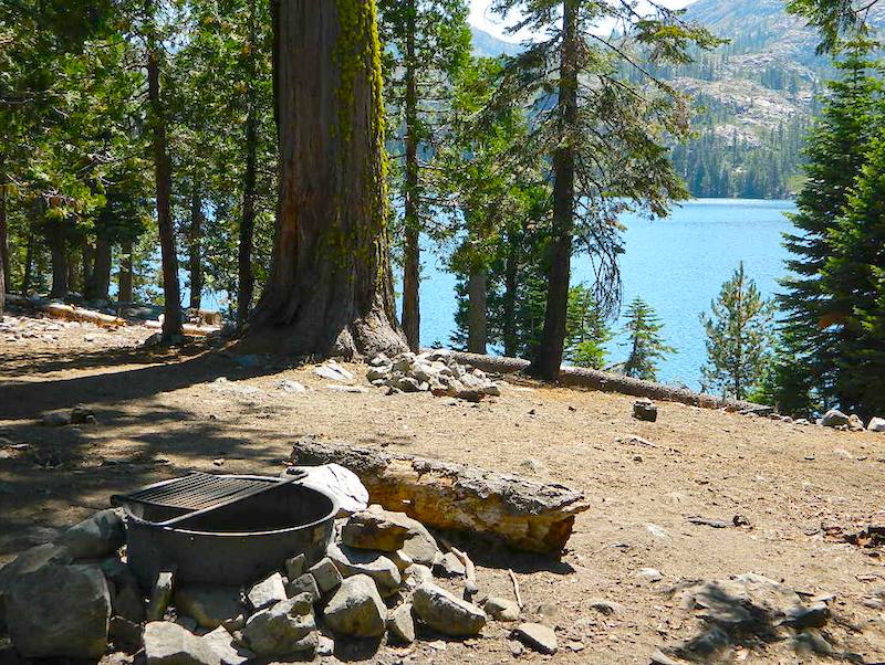
The north shoreline is abundant with dispersed campsites: metal fire rings and a clearing only; no picnic tables, no toilets. Self sufficient campers only. Campfire permits, a water bucket and a shovel are required. During extreme fire restrictions campfires may not be allowed. Check with local rangers for up to date info.

Tahoe National Forest
Truckee Ranger Station
530-587-3558

National Forest Lake & Forest Lake Fishing Kayak lake hiking lake

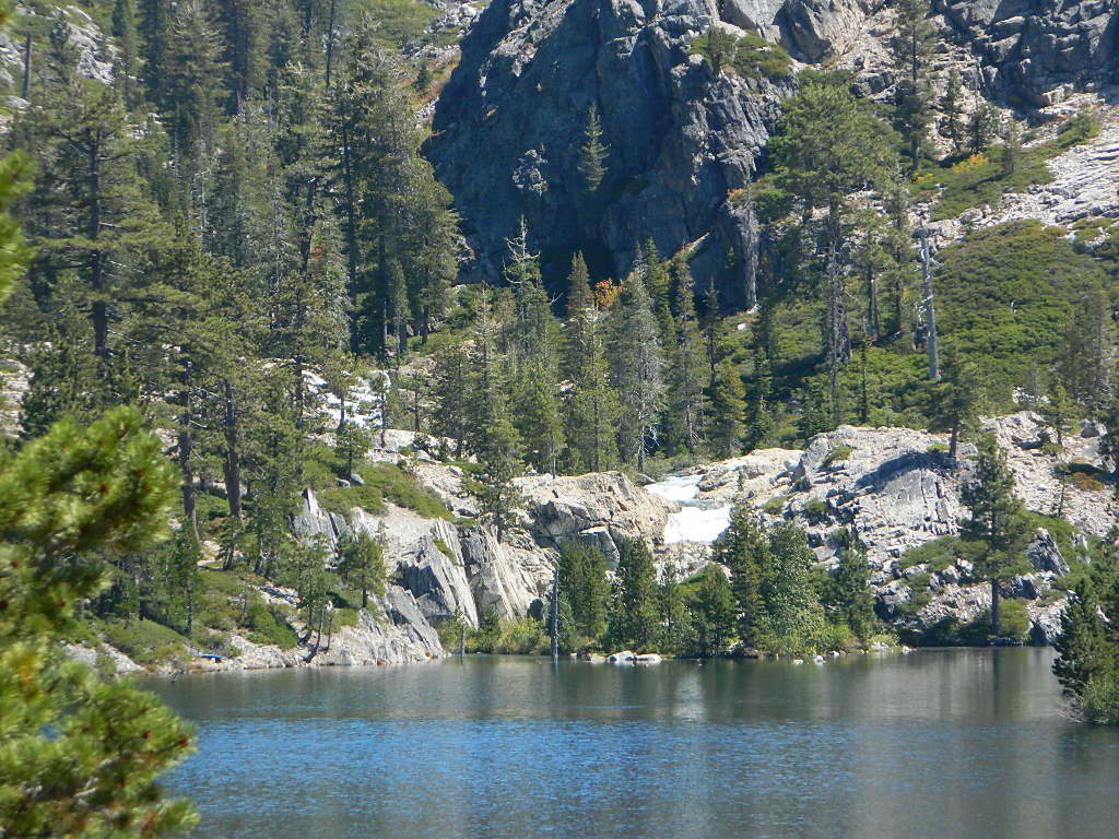
Most campsites are drive up and park, while others closer to the shoreline have only walk-in access. Hauling your gear down hill won’t seem unthinkable once you’ve seen the lakeside views. There is even a camp below the dam, next to the waterfall.
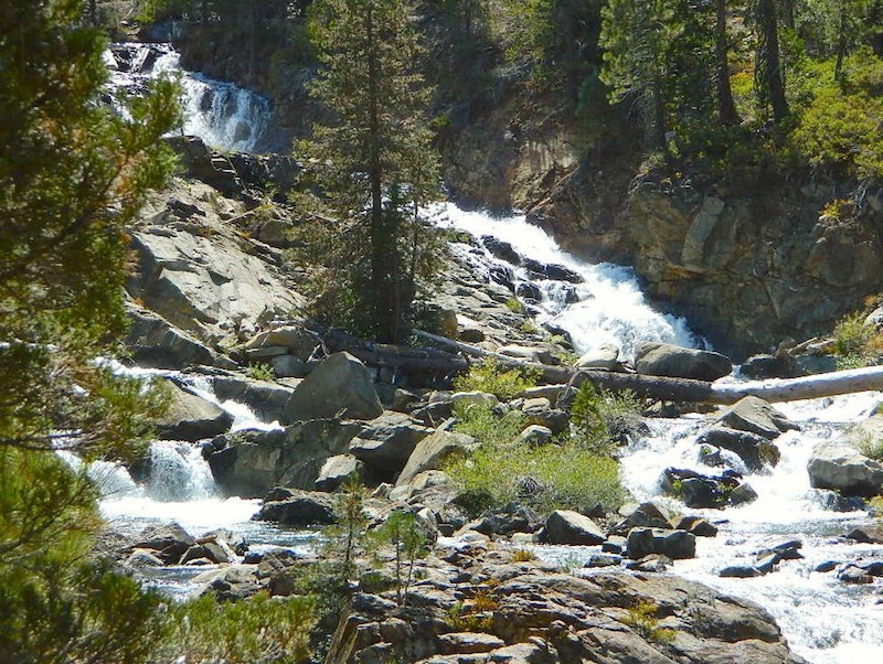
waterfallfromdam

The main access Road #843-037 is very rocky and 4x4s love to frequent the area. The backroads here are best suite for truck travel, high clearance vehicles, off-roaders and SUVs. No small RVs or trailers. Passenger cars are not recommended. The access roads around the lake and up to the lake are dusty and rugged. The road below the dam is quite rough w/ rocks.

For more driving details, please see entry on Canyon Creek Campground.
road at dam
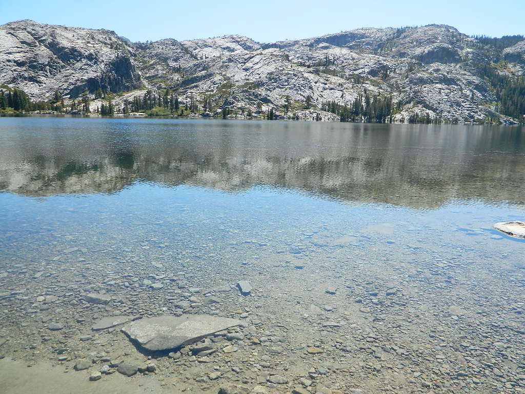
The water at Sawmill Lake is crystal clear snowmelt. The lakes around here are managed by Nevada Irrigation District, so this is why there are no engines allowed on the lake. This canyon area closes to public entry during winter months (NOV-APRIL), due to deep snow.
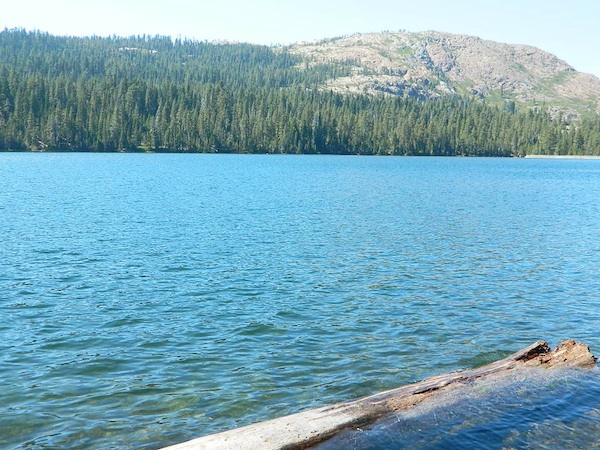
clear water

Faucherie Lake

Faucherie Kayak Camp

Faucherie Lake California

Lake Faucherie is set in spectacular scenery of granite mountains, with peaks and waterfalls all around. Many believe that you could only reach this kinda high elevation beauty by foot, with a backpack, but here it is – accessible by a very long, rough & rocky backroad.

No motorhomes, no camper trailers, no motorboats, no engine noises on the lake, no big families. Just well-deserved solitude, finally. Peace and quiet!

Perfect alpine lake for car-top boaters – those who carry their boats on top of a vehicle. But be warned very few ‘passenger cars’ make it back this far, due to the challenging roads.

BACKPACKING, CAMPING, CANOEING, FISHING, FLOATING, HIKING, KAYAKING, OFF-ROADING, SOAKING, STARGAZING, SWIMMING

No motorized boats or watercraft allowed. One public boat ramp; gravel parking area, vault toilets, gated entry for group campground. No more driving across dam (it is now gated).

NFS NFS NFS kayak camp hiking mountains NFS backroads snowmelt stars

Faucherie Lake Road – a spur road, off of the ‘843 Road’ leads up to both Sawmill & Faucherie Lakes, as well as the Canyon Creek Campground.

This primitive road forks off at Jackson Creek Campground, Tahoe NF, way, way back behind Bowman Lake. The rugged route is also known as Nevada County Rd #843-037. Conflicting numbers appear on USDA web site for this route, so don’t get confused.

The brown Forest Service signage is decent at Jackson Creek Campground – so if you get that far, you’re almost there. Sorta. Did I mention how crazy the road is? Any wet weather or snow will make this route “4×4 required”. This place is closed off about half the year, due to deep snow (NOV-MAY). Although on summer weekends, this area is busy for a remote high Sierra lakes region.

To reach this rugged Canyon Creek takes hours of driving with a good backcountry map and a reliable, high clearance rig. AWD Subies and mini SUVs beware, you’ll need a spotter on the bad sections of this road (or risk serious oil pan damage). Or perhaps maybe, we “shouldn’t be back on these kinda roads in that ‘lil sportwagon’ missy.”

See more details on driving directions for Canyon Creek Campground.

Crystal Clear Faucherie

Faucherie Lake Group Campground
(25 people maximum per site)

• Elevation: 6135′
• Number of Sites: 2
• Vehicle Access: High Clearance Vehicle, no trailers
• Campsites Reservation: Yes
• Camp Fee: Yes
• Season: June – October
• Trailheads: Faucherie Lake Falls, Five Lakes Basin, French Lake, Haystack Mountain

camp
Faucherie Group Camping

Campground Reservations:
Nevada Irrigation District
530-265-5302

incoming flow

Faucherie Falls – Six waterfalls above lake:
Upper Faucherie Lake Falls #1: 39.4257 N, 120.5616 W
Upper Faucherie Lake Falls #2: 39.4257 N, 120.5606 W
Upper Faucherie Lake Falls #3: 39.4262 N, 120.5568 W
Upper Faucherie Lake Falls #4: 39.4268 N, 120.5550 W
Upper Faucherie Lake Falls #5: 39.4270 N, 120.5544 W
Upper Faucherie Lake Falls #6: 39.4272 N, 120.5538 W
USGS Topo: English Mountain

Granite Faucherie

23S64 – Sequoia NF

Sequoia Creeks

Bear Meadow: Forest Rd# 23S64 – Packsaddle Creek, Sequoia National Forest

For the more adventurous & ones seeking some seclusion, Bear Meadow is located up the dirt road a bit from Thompson Camp Spring . From Forest Road #23S16 @ Thompson Camp Spring – continue straight on the dirt road #23S64, cross over the one lane wooden bridge; within a mile, turn left into a secluded creek side camping area. Note: Bears are common here (hence the name Bear Meadow)!

Packsaddle Creek runs thru this forest. Very primitive area with rutted dirt roads & sometimes overgrown; there are several campsites back in here for the ones who seek the wild. (Yes, bears & wild animals are very common way back here). If you continue on straight on the main dirt road Packsaddle Meadow also has camping spots & small corral. The last time we were out this way (2002-ish), the dirt road does not connect with highway to the west, as indicated on the map; due to landslide.

Sequoia National Forest

Sequoia National Forest MAP

Closest small towns are:

Sierra Creeks

Hiking Sequoia National Forest

Kern River Trails & Kernville Hiking

Sequoia National Forest Trails

Hiking Trails
Hundreds of trails meandering throughout this forest. Granite domes to huge Sequoia trees. Most secluded areas are found in the Eastern Section in the Dome Land Wilderness.

Dome Land Wilderness

Golden Trout Wilderness

South Sierra Wilderness

Sequoia Hiking Maps, Wilderness Maps, OHV Maps

Sequoia National Forest Hiking

lower kern river
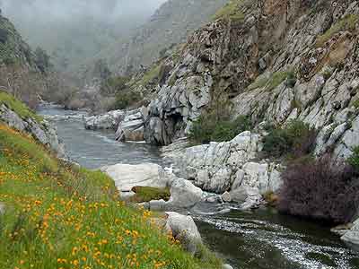
the lush Lower Kern River on a misty Spring day

Upper Kern Hiking

Lower Kern River Hikes

Sequoia National Forest & the Lower Sierra Nevada Mountains extend from the Tehachapi ranges to the Kings River Canyon; from the Great Central Valley to the Mojave desert.

Sequoia National Forest MAP

Dome Land Wilderness MAP

Golden Trout Wilderness MAPS

Kern River Valley communities include:

Sequoia Mountain communities include:

Lower Kern Camp

Central Coast California

Central Coast Mountains / Central Coast Cali

Within 40 miles from the Santa Barbara coast are mountains that reach near 9000′ elevation, the tallest in Kern County. Mount Pinos & Mt Able, as well as the Sespe, Dick Smith, San Rafael, Matilija & Chumash Wilderness Areas, make up this southern portion of Los Padres National Forest. There are plenty of tiny, primitive campgrounds that offer seclusion for RVs & car campers. 4×4 camps, OHV routes & parks, plus numerous Wilderness areas that will suit everyone’s need for the outdoors. A great drive for accessing this area is Hwy 33 North from Ojai.

Further up the coast is the northern section of Los Padres National Forest – which is the mountainous back drop to the magnificent Big Sur coastline. If you are seeking to camp near Big Sur without the fees of a developed Campground, these dirt road ridge lines may be your saving grace… if you don’t mind roughing it. Views over the ocean & coastline are even more spectacular than from Hwy 1, but campfire restriction can be tight in summer & fall months. There are plenty lodging opportunities, historic lodges, cabins or luxury RV parks, located in the small towns along the coast.
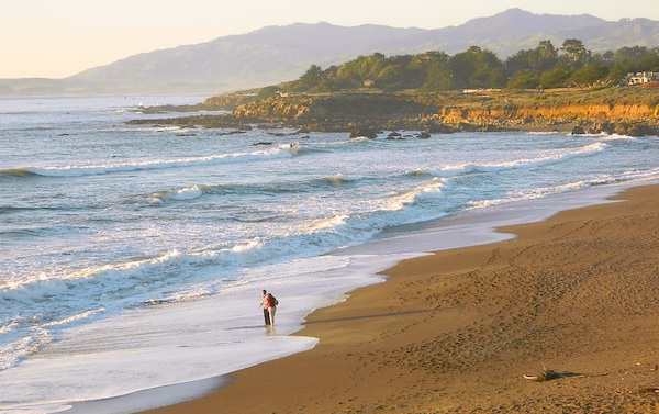
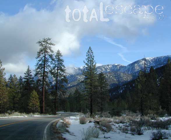
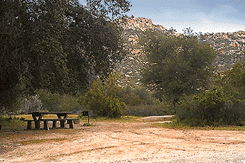
Both Los Padres forest north & south are open all year long for recreation & camping. Only one town in this region, Pine Mountain Club, gets considerable amounts of snow (roads may be impassable without chains, AWD or 4×4). Central Coast icon Big Sur with Hwy 1 is prone to mud & rock slides during heavy rains, so plan for alternate routes & check road conditions w/ CalTrans when traveling during inclement weather.

Central Coast forest & parks –

Los Padres National Forest
Andrew Molera State Park
Julia Pfieffer Burns State Park
Limekiln State Park
Pfieffer Big Sur State Park
San Simeon State Park

Moonstone Beach Cambria

Central Coast maps & trails –

Central Coast towns nearby –
Big Sur, Cambria, Frazier Park, Gorda, Gorman, Ojai, New Cuyama, Pine Mountain, San Simeon, Ventucopa

Milpotrero

Indian Flats Campground

Temecula Camping / Warner Springs Campground

San Diego Mountains – Cleveland National Forest

Indian Flats Campground

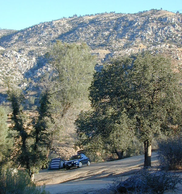
Indian Flat Campground is located on the seasonal San Luis Rey River in rural North San Diego County.  From I-15 @ Temecula, CA travel eastbound on Highway 79. Look for the tiny turn off  (on left side) for forest road #9N05, sorta near glider airport located west of Warner Springs. This poorly paved backcountry route (half dirt/mud at times) is also known as both Indian Flats Road or Lost Valley Road.

Graded dirt road (paved in some portions) travel is approximately 6.5 miles to campground, look for gate and turn off on the left side. When you see the giant boulder near the entrance, you’ll know you’ve made it to the right place.

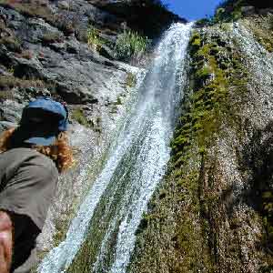
Oak trees and a few pines, plenty shade, boulders and mountain scenery, this is a great small campground that is well away from everything in Southern California.  Seasonal creek-sized river and boulder waterfall often dries up in late summer. This means a wet spring is the best time to visit this camp. Hiking, mountain biking trails and hammock spots. Pacific Crest Trail access.

Cleveland National Forest
Palomar Ranger District
760-788-0250

ClevelandMap_07

Elevation: 3,600′
Number of Sites: 17
Camping Reservations: None
Sites Available: First come, First serve
Vehicle Accessibility: Length 15′ max.
Length of Stay: 14 Days
Water: No Piped; Seasonal creek nearby
Toilet: Vault
Season: Closed for mud & snow during winter months
Fee: Yes
Operated By: National Forest Service
Closest Town: Warner Springs, CA

Indian Flat
Indian Flat Campground Entrance