dirt roads, creek, with peace and quiet (mid-week)
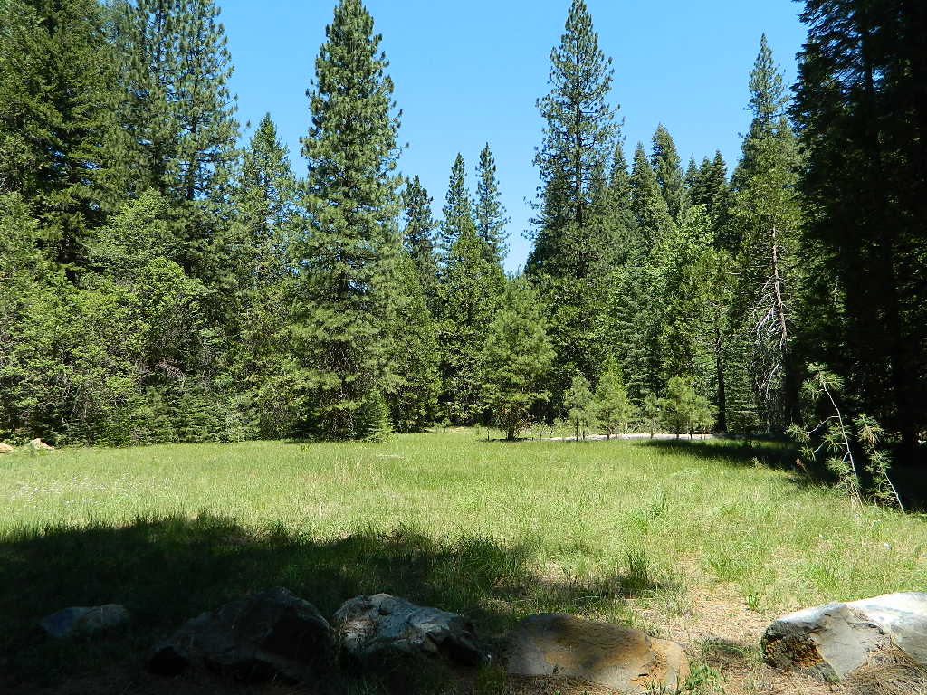
Meadow Camps
NOTE: OHV off roaders, quads, dirt bike use is somewhat common around here. The main dirt road cuts right through the middle of this campground, so passing traffic noise is possible. Choose the meadow side of camp, and get back off the road a bit – for more seclusion and a better night sleep.
The small creek-side meadow is also the proper stargazing area. Bring lawn chairs or blankets and watch for wet soggy spots. Don’t drive on the meadow! Keep campfire low when watching for meteors.
LOCALS TIP: If this small campground is full or not quite far enough, then keep on driving, deeper into the woods – to reach NFS Deanes Valley Campground
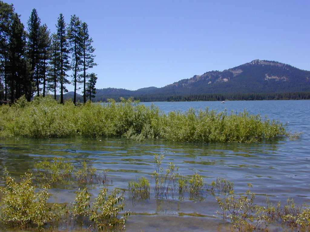
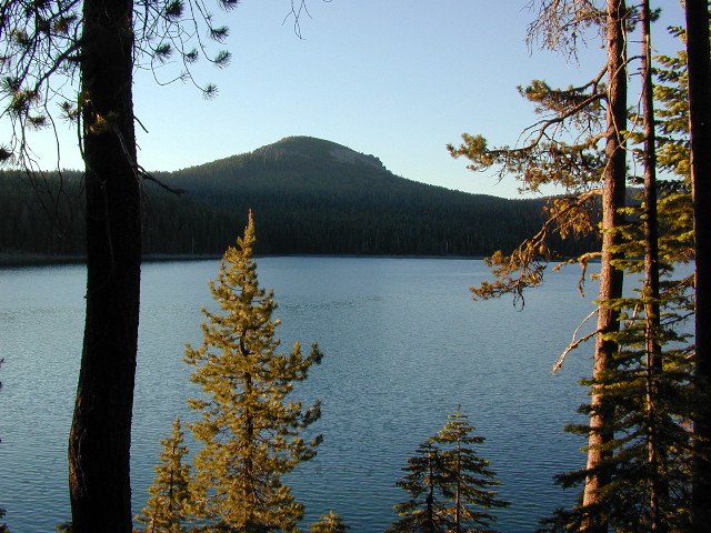
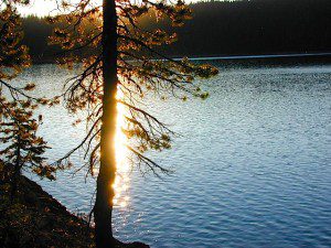
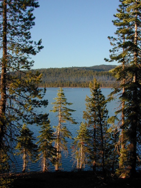
Lake Davis @ Plumas National Forest elevation 5886′
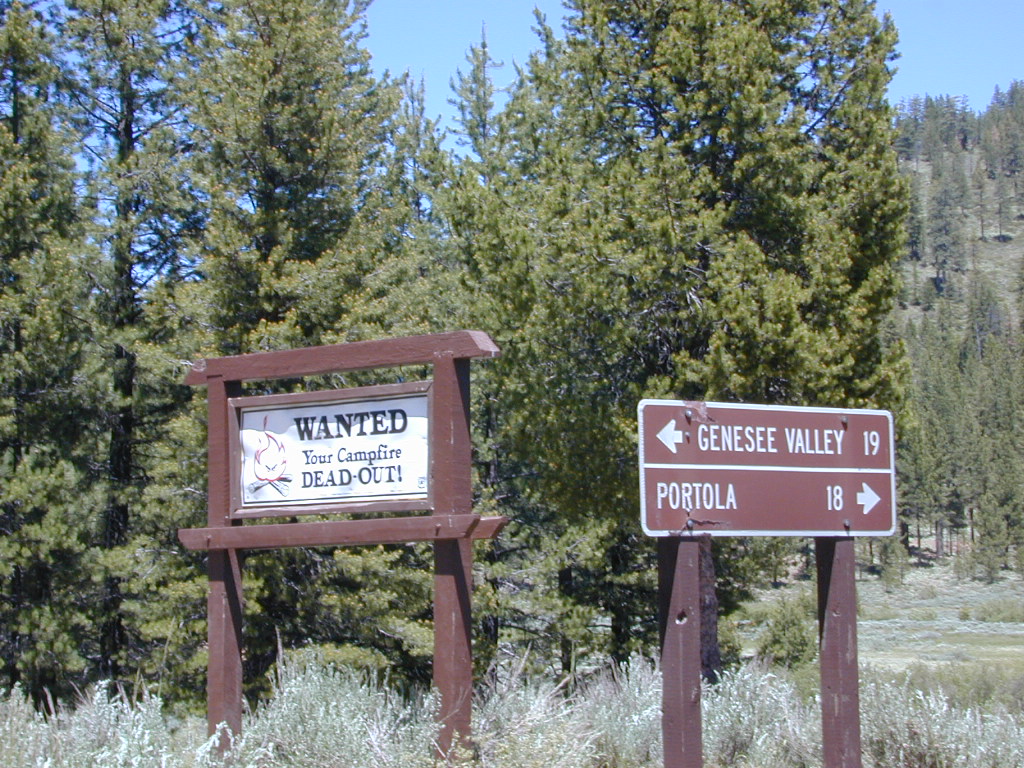
Three paved roads access Lake Davis which is located north of Highway 70. Residential areas exist on the south side of the lake, which is 7 miles north of Portola, CA
Grizzly Ridge (elev 7000′) is located on the westside of Lake Davis, East of Quincy, CA
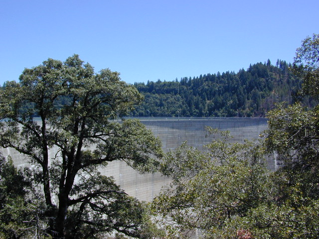
Beckwourth Taylorsville Road #112 (a dirt road) follows Little Grizzly Creek down from Genesee, and flows into this rural reservoir. Grizzly Valley Dam, also known as the Grizzly Creek Dam, reinforced the lake when it was built in 1967.
Crocker Mountain @ Lake Davis, California
Quiet Lake Davis
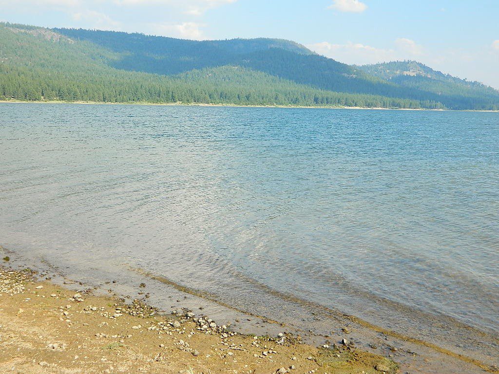
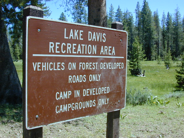
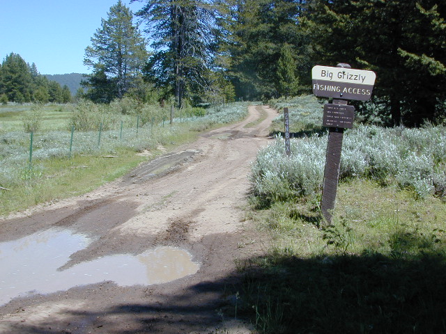
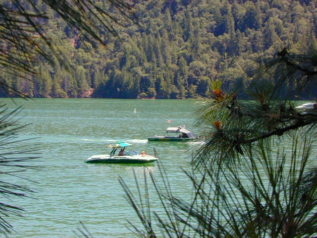
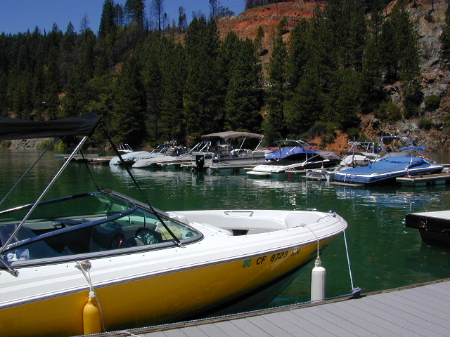
Lake Davis Recreation Area offers a wide variety of outdoor experiences for summer including: camping , picnicking, fishing, hunting, boating, mountain biking, swimming, and wildlife viewing. Waterskiing and jet skis are not permitted. In the winter, ice fishing, snowmobiling, and cross-country skiing are popular activities.
Frequent strong winds can cause the lake to become very hazardous for small craft. Boat Ramps at Camp Five, Honker Cove, Lightning Tree and Mallard Cove. Launching facilities have loading docks, paved ramps, parking and restrooms, and they all charge a fee.
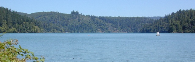
Relatively uncrowded lake in the Northern Sierra, this location is often overlooked by travelers for more the popular, larger lakes. Locals use this location for outdoor recreation. Plumas National Forest
bird watching
boating
camping
cycling
fishing
forests
hiking
horseback
kayaking
meadows
mountain biking
stargazing
wildflowers
wildlife viewing
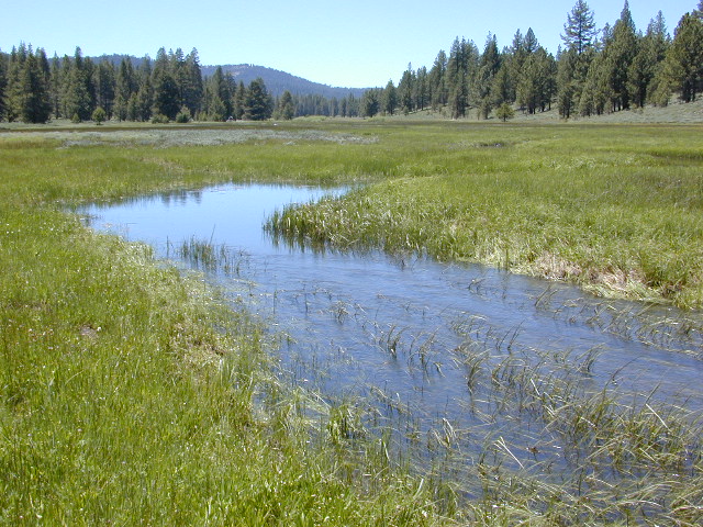
The developed campgrounds are located on the southern end of the lake. The backside of the lake is mostly made of up creeks, meadows, forests, dirt roads, wildflowers and abundant wild life.
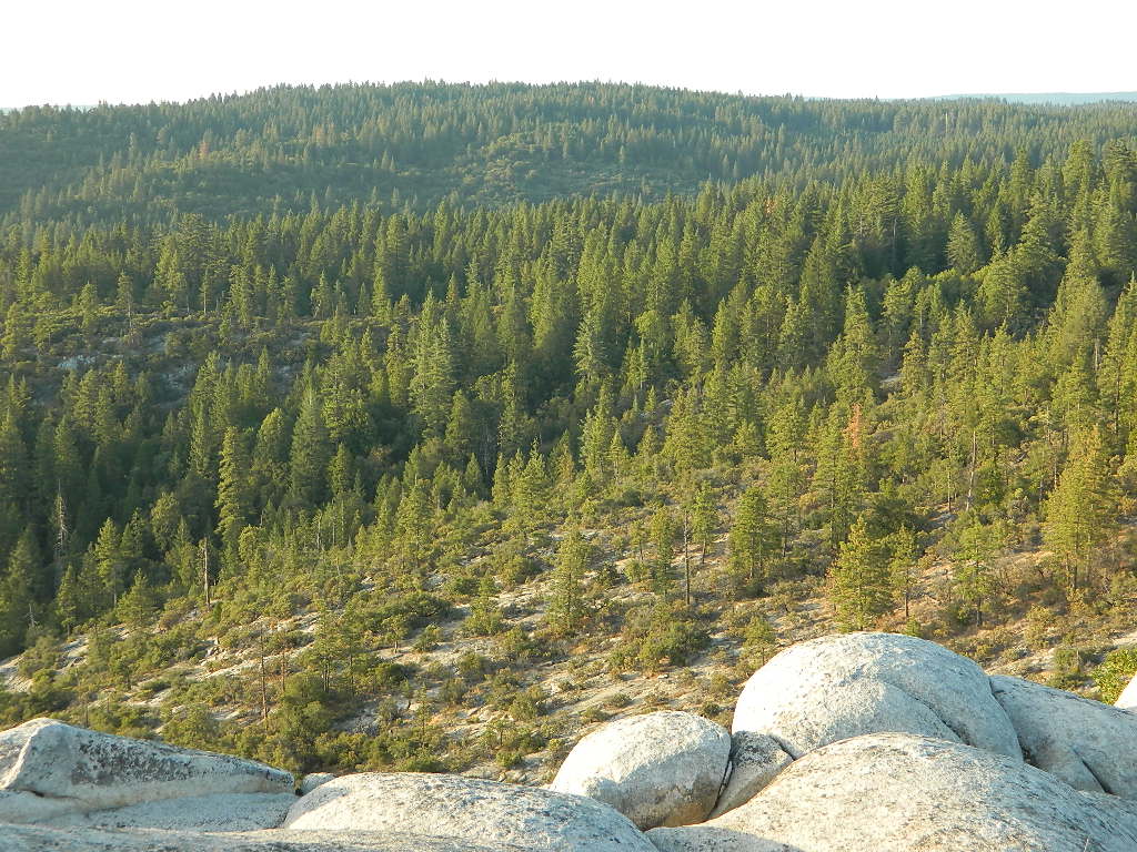
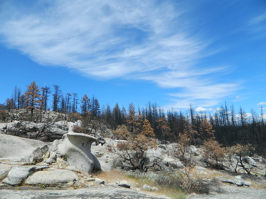
We used to have such a beautiful, lush and diverse forest in the Northern Sierra Nevada, but all that has changed with recent wildfires that have scorched millions of acres of National Forest land in the past few years.
An unbelievable amount of destruction has taken place with losses in wildlife, forest ecosystems, personal property, and human lives, as well as buildings of historic value.
Sadly, I find my California landscape photographs are now mere documentation of what beauty once was.
BULLARDS BAR Dark Day is a lakeside walk-in campground on a small reservoir, located deep in the Gold Country foothills. Flush toilets and hiking trails, kayak rentals and fishing.
West of Highway 49. Huge dam for hydro-electric power. Minimal roadways along the lake and steep canyons make for optimum hiking and boating. Floating and fishing. Relaxing in the mountains, with fresh water!
On most maps the official name of this lake may read New Bullards Bar Reservoir, or Lake Bullards Bar, but locals just call it simply – Bullards Bar!
Sierra Nevada Foothills. Yuba River, California.
Northern Gold Country, California
Near Camptonville, West off Hwy 49
in between Oroville and Nevada City, CA
Located not far from historic Downieville, Bullard’s Bar is an excellent base camp location for exploring the upper reaches of the Gold Country region. Old mining locations, museums, a covered bridge, various parks, Yuba River, Sierra Buttes, Lakes Basin. Grass Valley & Nevada City are also nearby. Mountain bike trails, river rafting and hiking all around.
roads around lake: Marysville Road (south of lake and east side w/ Hwy 49), Moonshine Road (south of lake), Oregon Hill Road (west side), Pendola Road (north side), and Forest Route #47 (dirt road on north side)
One of the few lakes in the Sierra Nevada that offer boat in camping at developed camp sites, and also to allow boaters primitive camping along the shoreline. No drinking water is available. No pit toilets, so a portable chemical toilet is always required. Plus, pack out all garbage.
No charge for DAY USE areas: parking or boat launch ramps
NOTE: Dark Day & Schoolhouse Campgrounds are the only car camping & RV accessible camping on this lake. These both have flush toilets and drinking water piped in. Hiking trails & boat launch nearby. Wheelchair accessible campsites are available.
CAMPS OPEN: APRIL – OCTOBER Campgrounds @ BullardsBar are usually open from April to October annually and all are closed for winter months.
Located 5 miles northwest of Dark Day Boat Ramp on the west side of the reservoir. Boat in only access. It is used as an over flow campground. There are campsites, but no bathrooms. Portable chemical toilet required. More info call Emerald Cove Marina at (530) 692-3200
Second Spillway – in the works?
Yuba Water Agency has just committed to building a $160 million second spillway at the New Bullards Bar Dam; beginning in 2021, with a completion date of 2025.
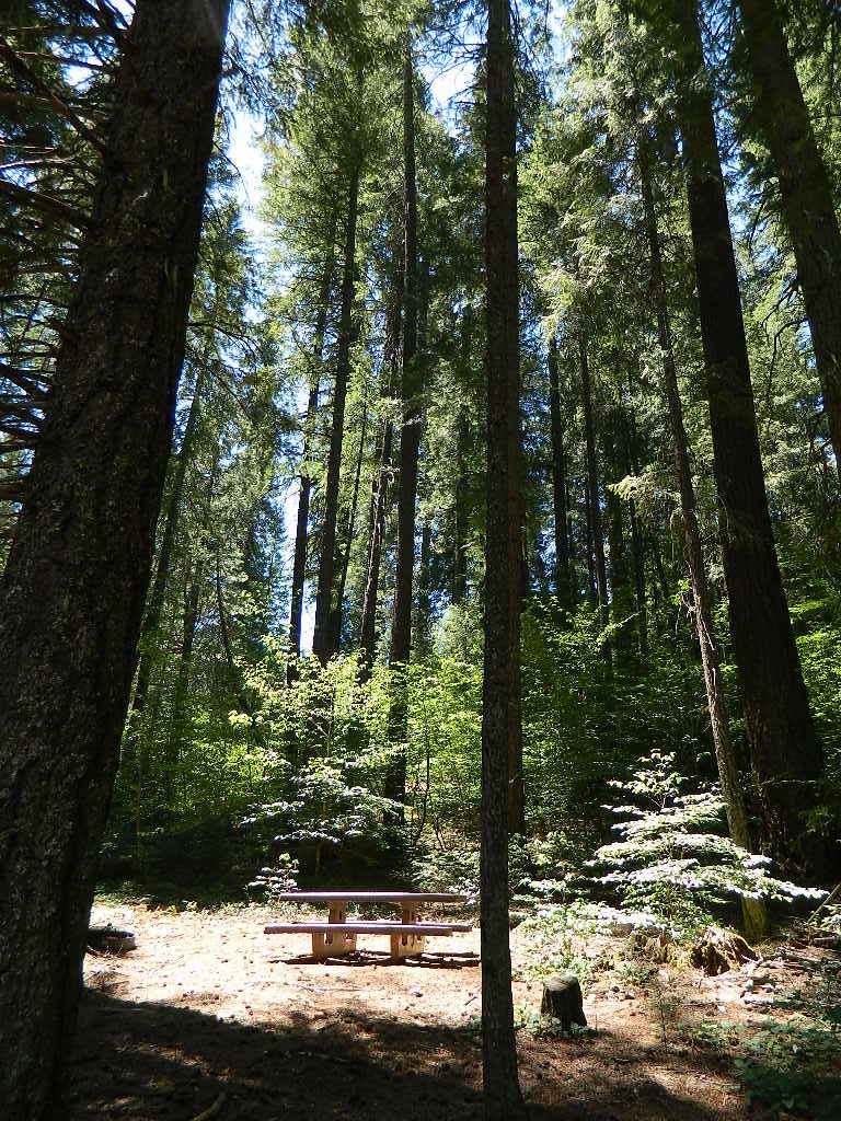
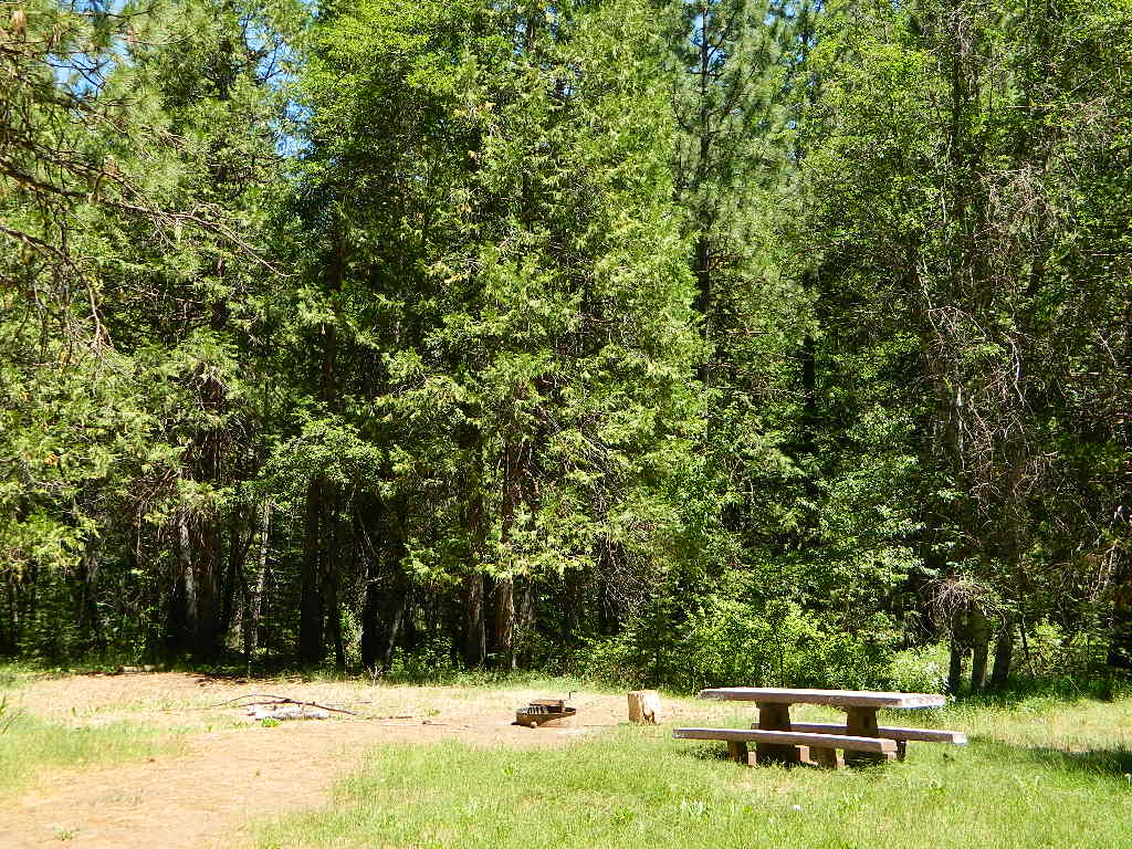
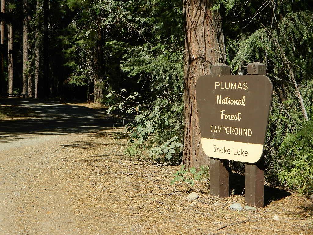
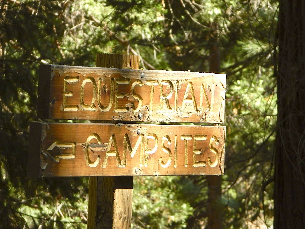
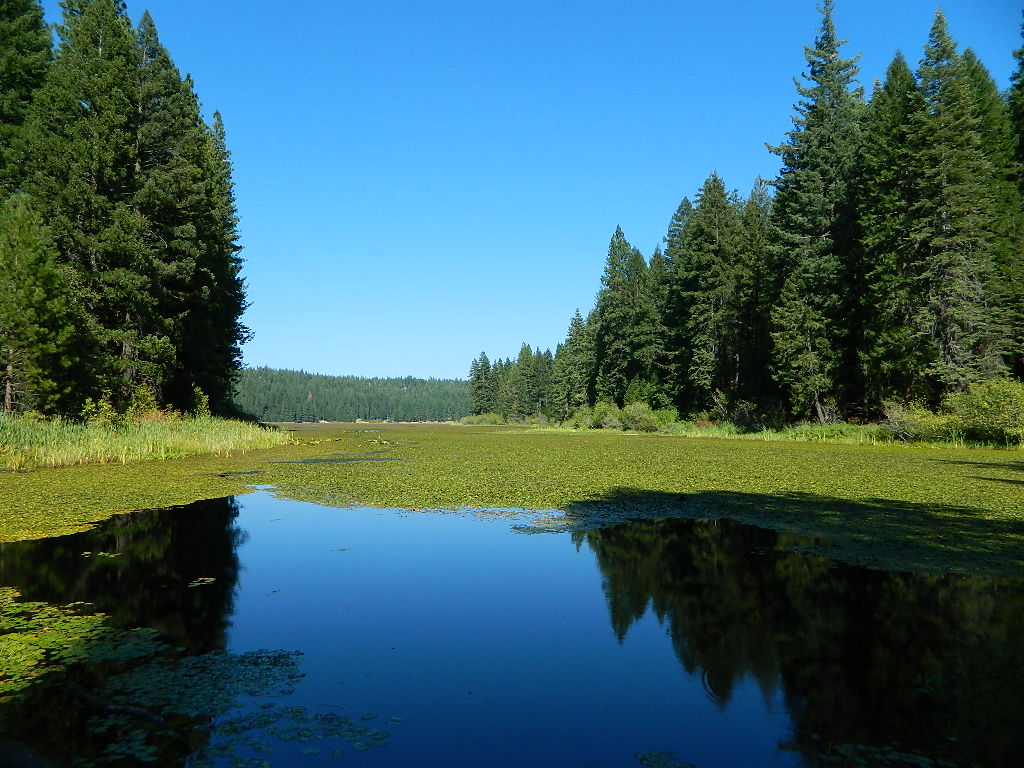
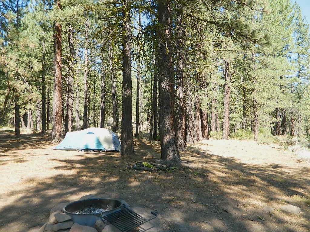
Don’t let the name frighten you, Snake Lake is a very scenic fishing lake – but you will NOT want to swim in it. Lily pads cover the water surface most of the year so it is considered “frog heaven” during the warmer months. NFS has been upgrading these camping facilities recently. Snake Lake Campground has new picnic tables, camp fire rings, bear boxes, vault toilet and expanded equestrian camps and corrals. No piped water, so bring your own. A bucket & shovel are always required for proper campfire maintenance.
One of the best campgrounds in the region, Plumas National Forest and close to Quincy, CA. Paved road access means an easy 3 miles off the main road (Bucks Lake Road, aka Oroville-Quincy Highway, Oro Quincy Hwy). 7 miles west of the town of Quincy, the green, metal, one-lane bridge is easy to spot, but the small sign for “Snake Lake 3” is easy to miss, if driving 50 mph or faster. Turn off is located in between Quincy and Meadow Valley.
Equestrian camp sites, horse corrals, OHV trails, group picnic areas. Hiking, fishing, mountain biking, off roading, horseback trails, kayaking or canoe.
Snake Lake Campground NFS
• Elevation: 4200′
• Number of Sites: 17
• Vehicle Accessibility: small RV
• Campsites Reservation: No
• Camp Fee: Yes
• Length of Stay: 14 Days
• Season: May – October
• Trailheads: OHV, Horse & Winter Rec
This lake camp serves as a central hub for travelers, motorcyclists, campers, hikers, fishermen, off roaders and equestrians alike. Mountain biking & OHV trails go off in numerous directions and horseback trails are readily accessible. Winter Recreation Area means snowmobile trails too.
Another smaller lake, Smith Lake, is a short drive or short hike (on dirt road) further into the woods, with the Butterfly Valley Botanical Area neighboring it.
another Snake Lake?
Another SNAKE LAKE exist inside Plumas National Forest. The smaller Snake lake can be accessed by off-road trail Road#12E66, off the Gold Lake Highway; 4×4 is required to reach this one. West of Gold Lake in the Lakes Basin Recreation Area. The PCT is routed nearby one mile away.
Seldom used, but often loved. This old camp used to be a California Conservation Corps (CCC) camp, during the construction of Lake Davis in 1966. Situated next to a big meadow w/ ancient lava flows up hill, the small campground hugs a wooded hillside above the freshly paved Beckwourth-Genesse Road #111
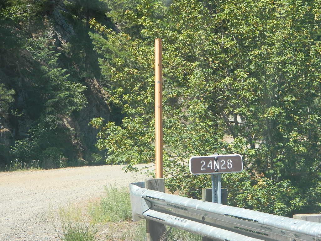
If choosing to enter camp from the lake side, take Crocker Mountain Rd. / Plumas Forest Rd #24N06, up from Grizzly Road #112.
The Lake Davis area is a north turn off Hwy 89, in between Beckwourth and Portola, CA
Access from the paved (east) side is via Beckwourth-Genesse Road #111. Adventurous camper trucks, or small RVs may attempt this dirt hillside campground, but roots and rocks and erosion are abundant in the upper portion of the camp, so be warned.
Off Roaders (dirt bikes, quads, 4x4s) like this rustic camp spot, cuz it’s not too far off the pavement – and they can drive their comfy campers w/ trailers en tow, and the big BBQ grill and easy-up shade.
Note: you cannot see Lake Davis from this side of the hill.
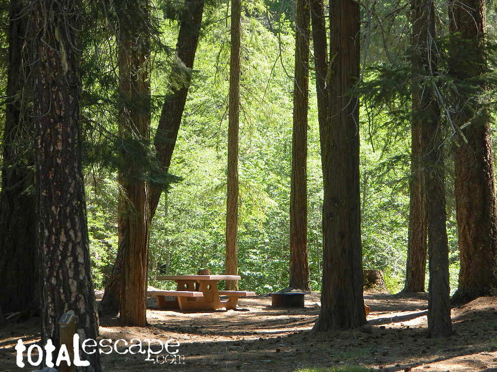
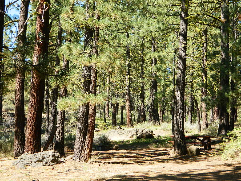
Autumn is nice here w/ aspen groves at nearby Crocker Guard Station. There are no aspen trees in the campground – only pines. This primitive campground is located on a forested, volcanic hillside facing east; Dirt road entry, vault toilet w/ minimal facilities. No paved campsite loop here!
Numerous unmarked foot trails lead out to the meadows edge, up lava ridges or into the forest behind the aspens. Crocker Guard Station is a very short walk; and available for rent from the NFS w/ reservation.
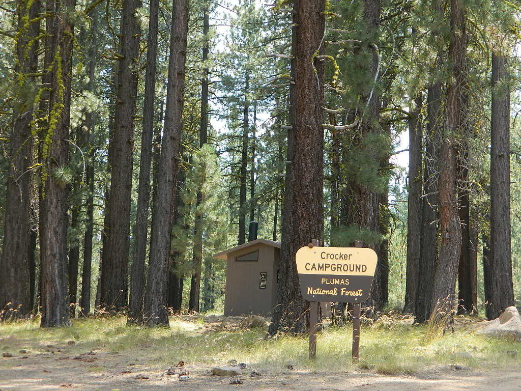
Crocker Campground NFS
• Elevation: 5600′
• Number of Sites: 10
• Vehicle Accessibility: Small RV
• Campsites Reservation: No
• Camp Fee: Yes
• Length of Stay: 14 Days
• Season: May – November
• Trailheads: Crocker Meadow Loop
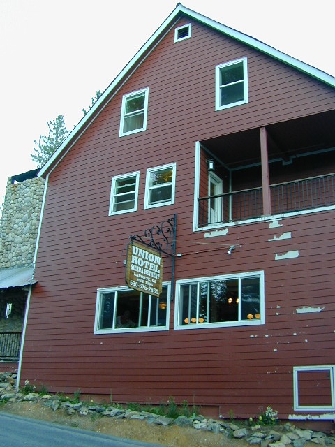
Crocker Guard Station
aka Crocker CCC Camp
Set back nicely off the main road, this stylish, historic, two story cabin – with wood siding and front porch – has meadows and aspen groves surrounding it. Paved road access from Beckwourth Genesee Road
CCC = the Civilian Conservation Corps is often mentioned when reading about this specific location.
Crocker Guard Station was built in 1912 as a home for Forest Service personnel, and was later staffed as a fire station until the 1980s. Now the building serves as a USFS Cabin Rental; which could also make a nice (small) wedding location. Very scenic location w/ aspen groves.
Crocker Mountain (7444′ elev) is popular for deer hunting, mountain biking, as well as off-road travel. Trails can be dusty and steep in summer, then snowy, slippery and muddy in wetter months. This Plumas mountain region does get some snow, so check the weather forecast.
Lake Davis is about 5 miles away from this small campground, to the west. From Crocker Camp to Lake Davis (the most direct way) is a one lane, graded dirt road – Plumas Forest Rd #24N06
The paved driving to the lake will be triple the distance – and you’ll need to go back to the highway.
Plumas National Forest Camping – Primitive Camp Sites
Spanish Creek, Quincy, CA
Plumas Forest Camping
North Sierra Nevada, Northern California
Listed below are primitive campgrounds w/ minimal facilities or open camping areas in Plumas National Forest. Plumas has excellent fishing as the big rivers & numerous creeks run thru this northern Sierra Nevada landscape. Open camping is allowed on almost any dirt road w/ a current campfire permit
Brady’s Camp
[on Pine Creek near Argentine Rock]
near Quincy, CA – east on Squirrel Creek Rd. & go 8 mi. to the campground. Elevation 7200′ / Open May – October
Bucks Lakehas numerous NFS Campgrounds and PCT access; Overall elevation 5000′ w/ abundant boating, fishing and hiking. Snow in winter closes roads. Cabins, marina, lodge, restaurants. Bucks Lake Wilderness, Gold Lake, Silver Lake
Deanes Valley Campground
[along Rock Creek] Hwy.70 Quincy, go 3.5 mi. west on Buck Lake Rd. Head south & 7 mi. to the campground. Elevation 4400′ / Open April – October
Backpacking trails w/ dirt road access. Above Chico, beyond Cohassett; on the border of Tehema Co. and Butte Co. (Lassen NF & Plumas NF)
Inskip, CA – Way up beyond the Ridge, well past Magalia and Stirling City – find dense forests, dirt roads and camping. Philbrook Reservoir w/ West Branch Campground NFS. Elevation 5546′
Ohio Valley – Seneca Road
[off Hwy 89 to southside] Primitive forest camping near Lake Almanor. ATV trails, hunting. Creeks and river camping closer to Seneca. High clearance or 4WD may be needed on these dirt back roads – depending on snow and mud. There is plenty dirt roads back here to explore.
Snake Lake
[good fishing area] Hwy.70 Quincy, go 5 mi. west on Buck Lake Rd. Head north & 5 mi. to the campground at the lake. Elevation 4200′ / Open April – October
Little Grass Valley Recreation Area
Plumas National Forest
Tucked way up in the Northern Sierra Nevada mountains, at the top edge of the California Gold Country, is this popular recreational lake in the forest above the busy Sacramento Valley.
Up on the mountain at 5000 feet above sea level, via La Porte Road (Plumas #120), a Sierra Nevada THRU-ROAD – one which closes for winter snow. The lake destination may be open, but the campgrounds are closed up seasonally. (NOV-APRIL)
Little Grass Valley Reservoir
Lake Statistics:
Elevation 5,100′ Surface Area 1,433 acres Shoreline 16 miles Capacity 93,101 acre-feet
With over 300+ camp sites available in 10 different campgrounds, Little Grass Valley has room for everyone. Reservations are recommended in summer months, although some camps are on a first-come basis.
Camper Trailers up to 40 feet can be accommodated in some of the camping units. 2 RV dump stations are available, near Tooms Boat Launch & Red Feather. Campgrounds have piped water, but no RV hookups.
Swim beaches provide excellent swimming and picnicking opportunities. The Lakeshore Trail (13 miles) winds around the entire lake, for hiking, horseback riding, and mountain biking.
Horse Camp
Little Beaver Campground
Red Feather Campground
Sly Creek Campground
Strawberry Campground
Wyandotte Campground
LaPorte, California – up the mountain
TRAVEL NOTE: The nearest town isn’t much of a “town” at all – so driving to get “anywhere w/ tourist services” from here is quite a chore. Gasoline is minimal on this mountain, if any. Plan to bring everything you will need for your outdoor vacation stay, cuz driving to Quincy, or down the hill to O-ville will take more than an hour (one way). Go prepared.
Golden gems of California, a collection of alpine lakes on the north end of Historic Gold Country, North Yuba River, Northern Sierra Nevada
EAST of Downieville, CA
California’s Gold Lake and surrounding lakes; the granite spires of the Sierra Buttes and the creeks, waterfalls, headwaters of the Yuba River — total wild beauty. Steep, granite, river canyon from Downieville drive east on Highway 49 from Sierra City to Bassetts, a gasoline and market stop; they have a small hotel there too.
Take the left turn, north on to the Gold Lake Highway. The alpine and extremely scenic Lakes Basin Area consist of all small lakes in between Hwy 49 to Hwy 89, along GOLD LAKE HWY [Road S620] some maps read Road #24 or call this Gold Lake “Road” instead of highway. Snow closes in this route during winter months.
Frazier Falls Trail
Length: 1 mile RT / Directions: Trail head is located on Old Gold Lake Road, about 5 miles from the Highway 89/Gold Lake Road intersection. Take the signed, narrow paved access road 4 miles to the trail head.