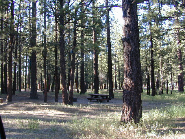
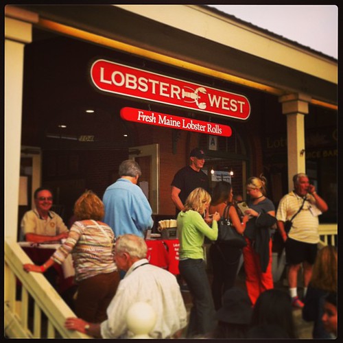
5 years running on the Central Coast. Held in downtown Paso Robles City Park, in north San Luis Obispo County.
Producers from all over California, Olive Oil Tasting, Culinary Row, Wine & Beer Tasting and now with lavender!
Now this event has been combined with the Lavender Festival (and moved to July)
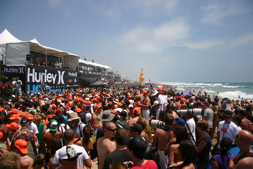
Huntington Beach host the annual surfing contest. Top surfers from around the world, a mix of action sports superstars of skate, BMX and freestyle motocross, as well as top musical talent – all combined in a festival atmosphere for a week-long youth cultural experience that will thrill and excite hundreds of thousands of spectators in beautiful Huntington Beach.
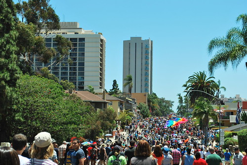
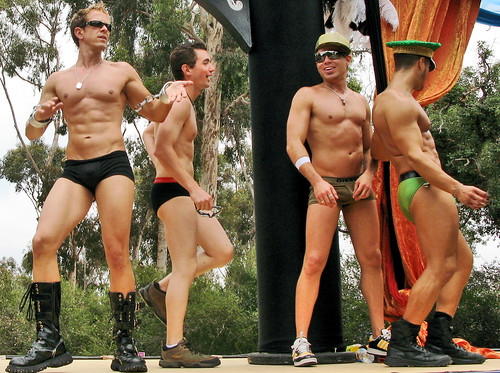
San Diego Hillcrest comes alive with festivities & a huge parade. Nearly every hot bod in town can be found walking the streets (shirt-less). Expect the largest crowd; like 300,000 people – all out enjoying the great summer weather in Southern California.
Join old-fashioned fun in the sun all weekend in the Shasta area! McCloud’s Main Street Parade, vendor’s booths, nightly dance w/live music, baseball tournament, children’s events, horseshoe tournament, logging competitions, food, family games.
Historic Gold Country meets the Sierra Nevada caves & caverns in Murphys Ranch. Mid summer celebrations include, Murphys Homecoming Days…. a 60-year-old event, combines an old-fashioned street faire with residents & folks that used to call this place home. Duck races too!
There are many gorgeous rivers in California that are perfect for camping and fishing, but none are located in Southern California. None! Yep, you read that right. If you think about it, the golden state is about half desert! The majority of our natural water in our state is coming from the north – so take this as a warning: you might need to drive a few hours to find your ideal river camp.
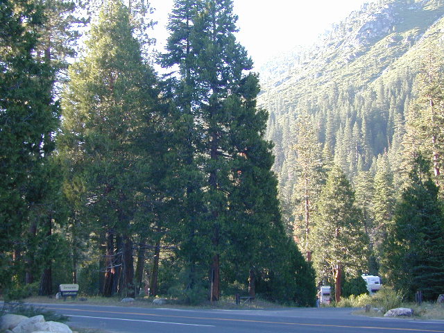
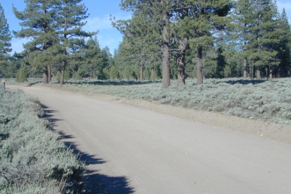
The easy-to-access waterways are found mostly along highways in the Sierra Nevada – or way up in NorCal. Deep granite gorges carved out by glaciers, surrounded by forested peaks is only half the appeal. High elevation lakes, waterfalls, big trees, abundant wildlife, and the alpine villages are all part of the Sierra Nevada experience. Raft, kayak, fly fish, hike, bike or just camp out next to a big, rushing, flowing river. Our selection of California maps will get you narrowed down to a specific region, so you can find that perfect river campground, or explore and discover the back roads – for the most seclusion.
KERN RIVER: The Kern River is one of the most popular of all the Sierra rivers due to its proximity to SoCal. Hurried, stressed-out, Angelinos (LA) can be at this destination in under 3 hours – which makes it a very busy place most months.
So, let it be told, that summer is not the best time to enjoy the Kern. If you do plan a summer outting, make sure you head for the Upper Kern (10+ mi N of Kernville & Lake Isabella) or the North Fork of the Kern (out in Monache Meadows) where 4×4 is often needed.
The Lower Kern River has only 2 developed campgrounds: Hobo (closed for damage 2019) andSandy Flat (open all year). Numerous primitive camp spots are available along Old Kern Canyon Rd, which parallels the Hwy 178 on the south side. None of which are located at the rivers edges. Remington Hot Springs is a popular spot for soaking. Fishing trails, mountain biking trails and hiking trails, all over. Fire danger is great in this area, so pay extra close attention to signs and fire restrictions.
Kern River above Lake Isabella and Kernville is a better choice for camping availability.
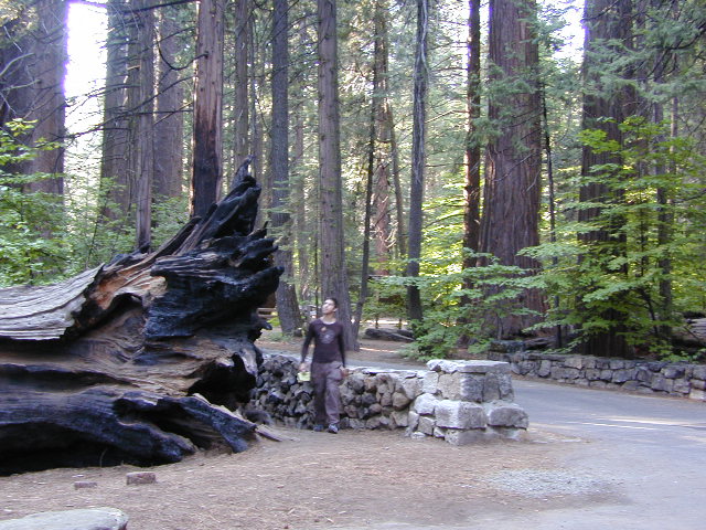
Everybody loves Yosemite! This is the most popular park in the whole state; maybe the whole nation.
The majority of campers want to stay “right on the river” when they visit Yosemite NP, but that is just plain old impossible, since reservations go fast and there is only so much room for everyone in this enclosed, narrow, precious valley.
This particular park has some major floods (1997 & 2005) that wiped out bridges, road ways; all the old wooden cabins (at Yosemite Lodge) are gone and only half of the campgrounds are still available. Yosemite has had 11 winter floods since 1916 that have caused substantial damage to property. That number is expected to increase, as winter precipitation is getting less predictable.
Reservations are taken for camping and cabins – far in advance; like one year. No joke!
3 Yosemite Campgrounds are located next to the Merced River (inside spectacular Yosemite Valley)
Way up in the Yosemite high country, which is only open a few months outta the year, the beautiful Tuolumne Meadows Campground is located next to lush meadows and the scenic Tuolumne River. All Yosemite campsites must be reserved well in advance, so visit links above – if you are serious about a Yosemite camping trip anytime soon.
MOKELUMNE RIVER: Way up the road, deep in the western Sierra, Gold Country. Small NFS campgrounds, right on the river; Access is long, narrow paved, switch-back road, not suitable for RVs or trailers.
STANISLAUS RIVER: The Sonora Pass, the fishing is very decent way back in this granite gorge. Highway 108 is only open a few months outta the year, due to deep snow & rock slides – so time is of the essence. Summer time is prime vacation weather up here. Several campgrounds are located right on the river, or on the major feeder streams. Or you can opt for secluded primitive camping on the back roads. Find Sonora camping in Stanislaus National Forest.
YUBA RIVER: The biggest play time river in the northern Gold Country, this runs along Hwy 49 near Downieville and also has a major South Fork for the best swimming holes and primitive camping in this region. Tubing, rafting, kayaking, fishing, camping, gold panning, you name it, Yuba has it. Look for more on the South Yuba Recreation Map, or the USDA issued Tahoe National Forest Map
FEATHER RIVER: Top fishing river in the Lassen to Oroville area. Chester and Lake Almanor in the upper reaches. High Bridge Campground is nice paved-camp-site camping; a forested spot where you can fish 2 rivers on the same day. A Plumas NF or Lassen NF map would be quite helpful for this region. Lower down the mountain, lower Feather Rivers which include all 4 forks which feed Lake Oroville – West Fork (Paradise, CA), North Fork, Middle Fork Feather, (Berry Creek, CA) and the South Fork (Lumpkin). Lots of waterways and creeks worth exploring in between Chico and the mountain town of Quincy.
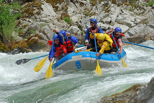
KINGS RIVER: This one particular river is the longest in the Sierra Nevada mountain range, pulling snow melt from the upper reaches of the High Country and Mount Whitney. The river area just to the West of the National Park, over to Pine Flat Reservoir, is all prime for outdoor recreation. Several river rafting companies work this stretch of river.
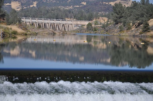
Lake Oroville Salmon Festival
Salmon Fest in O’ville
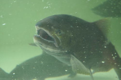
Feather River Fish Hatchery, Feather River Nature Center and Riverbend Park
On the Feather River between Historic Downtown Oroville and the Fish Hatchery, the town bursts with fish-flavored activities during the annual Salmon Festival. Friday night starts @ Feather River Nature Center for dinner & dance. Saturday brings on the fun, food, music and vendors on Main Street. Lots of great local info – salmon recipes, water/drought, fishing and environmental issues. Big pancake breakfast, a farmer’s market, live music, a craft fair, clowns, rides for the kids. Hatchery tours. The Bounty of Butte County will be located atop Myers Street, next to the Municipal Auditorium leading into Salmon Court. FREE to attend and tastes sold as desired. There will be food demonstrations, local food vendors, restaurant tastings and so much more.
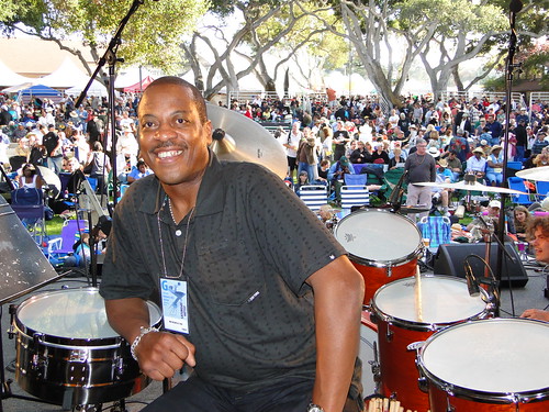
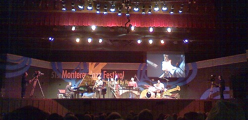
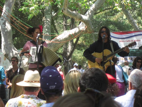
MJF stands for Monterey Jazz Festival: One of the most popular, well known, Jazz Festivals in California. This special one on the Monterey Bay has been going on near 60 years. And we’re not kidding on the popularity of this event.
Northern California Coast near the Humboldt Redwoods, this county fair has to be one of the oldest in the golden state – over 100 years running! The scenic Victorian Village of Ferndale hosts the annual Humboldt County Fair every August. Carnival rides, games, music, food, livestock & horse races too.
Pismo has loads of things to do in summer. Saint Anthony’s celebrates the cultural contribution of the area’s Portuguese descendants. Event held at 390 Bello St. Pismo Beach, CA
Blue Lake in Modoc National ForestHiking Lake w/ Loop Trail in far Northern California
Blue Lake
Modoc National Forest
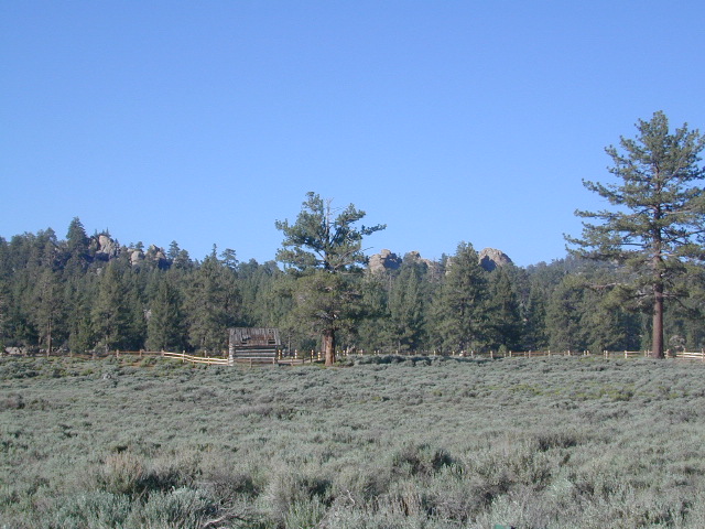
When you really wanna get away from it all, take a week off and head up to Modoc – the top northeast corner of California, where the volcanic mountains line the Great Basin. The population is minimal, cattle are abundant and the campers few. Even in mid summer, this ideal lake campground rarely fills up.
Jess Valley Road leads east off US 395 @ Likely, CA – 16 miles back to this hidden gem.
Headwaters to the Pit River.
NFS Campground is shady, well managed, and spread out on the eastern slope w/ numerous paved loops. Tent campers, cross country cyclists, truck campers w/ canoes, SUV families, motorhomes with kayaks and kids.
Modoc Map
Blue Lake Campground NFS
• Elevation: 6,050′
• Number of Sites: 48
• Vehicle Accessibility: 32′ RV
• Camp Fee: Yes
• Campsite Reservation: No
• Water: Piped
• Length of Stay: 14 Days
• Season: May –October
• Trailhead: Lake Loop
• Boat Ramp: Yes
Group Camp Facilities (by reservation only)
Modoc NF Warner Ranger District
@ 530-279-6116
Lava Rock @ Blue Lake Loop, in Modoc County, CA
Blue Lake National Recreation Trail
Right next to camp: A pretty much perfect LAKE LOOP (1.5 mi) hiking trail is worth a serious stroll; footbridge, wildflowers, fishing spots, minimal hills, lava rocks, and awesome scenery. Plenty of wildlife can be seen, including butterflies and bald eagles. Trail is shaded by tall white fir and ponderosa pine trees. Trailhead is located at the Day Use parking lot, w/ paved boat ramp, dock, and picnic area.
back roads
boating
camping
canoeing
fishing
hiking
kayaking
mountain biking
picnicking
swimming
stargazing
wildflowers
wildlife
NOTE: not every CAMPSITE has a LAKE VIEW
Certain campsites are adjacent to the lake; some are set facing a meadow (Autumn w/ aspen groves), or the alpine forest w/ deer grazing. Perhaps an inner circle (interior) campsite, for those who like to be close to bathrooms and piped water. Large families will love the abundance of camp settings and accommodations.
Paved Loop Plenty of Vault Toilets Piped Water Recycles & Trash Service
Large Campsites can accommodate Motorhomes
no paved camp stall
no hook-ups
no dump station
no cell phone signal
popular lake camp for motorhomes
When driving a large RV back in here, be courteous of other campers. Nothing sucks more than driving a long distance to the boonies, to arrive at camp just before dark and annoying everyone else already there.
Those needing to drive the campground loops (more than twice) looking for the biggest, levelest, best camp site – and burning $10 in gasoline doing so, should consider walking in.
Park that beast (near boat ramp area, before the camp entrance). Get out and walk the hills and loops, BREATHE & relax – prior to a choosing camp site.
Unhitch any tow vehicles; use that to scout out your perfect spot, if you cannot hike it. Trailers and large motorhomes will find this place ideal, but getting the right camp, can make all the difference.
Paved Trail around Campground
The wildfire: BLUE FIRE burned this region in 2001, but it is lush and green again (2019). Northern California gets some real weather. Rain and snow, more than half the year. The campground closes annually due to snow.
Kayaking is best done in the morning, cuz wind picks up in the afternoon. Canoes can launch at boat ramp, or at shoreline from trails near campsite.
Hiking trails can be found all around lake and campground. Wilderness access can be found at South Warner trailheads within a short drive from the lake.
Cyclists also love this camp, as it is located near a major highway and is a perfect place to really relax, soak in the scenery and get some quiet-nights sleep.
South Warner Wilderness is close by, driving distance; accessible by graded dirt roads. Signage is decent.
Modoc Forest Road #64 is a through-route, across the lower South Warners – 40
miles connecting to east side of the mountain, at Eagleville, CA.
Dirt Roads are suitable for trucks w/ trailers. SUVs and rugged passenger cars are okay. Motorhomes are not advised on this route. Washboard conditions are typical. Winter closure on this route is common.
MODOC RD 64
Several miles away from Blue Lake, 2 rustic trailhead campgrounds are located back this way – East Creek Campground & Patterson Campground. Less than 10 camp sites each, equipped w/ horse stalls, vault toilets and maybe piped water. Trailhead parking for backpackers. No RVs!
Autumn colors w/ aspen groves. Open, large meadows and mature forests w/ wildfire scars. Cattle can be found grazing all around, many cattle crossing.
Minimal primitive camping options, along road sides. Campfire permits required. No camping within one mile of a developed campground.
Modoc is Cow CountryDay Trippin – Out exploring Modoc Road 64 (and cutting firewood)
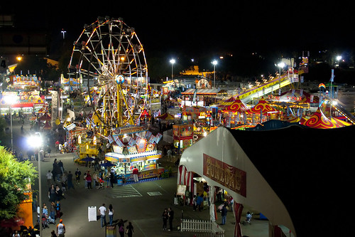
Nearly a million people attend the Orange County Fair & Expo, a 21 day event held in Costa Mesa. Various themes each year add to the uniqueness of this country fair.
Orange County Fair & Exposition Center
88 Fair Drive,
Costa Mesa, CA 92626
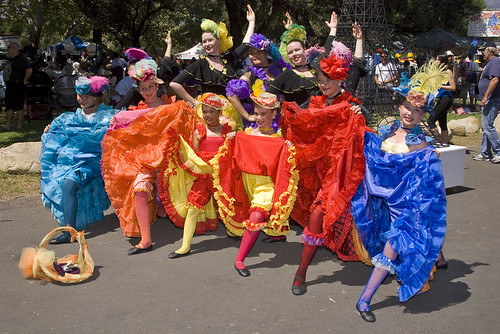
Annual Santa Barbara French Festival coincides with France’s Bastille Day Weekend. 40 acts on 3 stages. The Largest French Celebration in Western US. A great weekend for fabulous food, dancing, and a celebration of everything French.
PCH is Pacific Coast Highway 101 @ Encinitas CA features a summertime treat, a Taste of Main Street International Food Fair, where local restaurants & vendors offer food samplings to the general public. Food, wine and beer. One day event, usually held on a week day. 25 years running!
One of the most remote & biologically intact watersheds left inside California. The headwaters of the Salmon River flow from the Trinity Alps, Marble Mountains, and the Russian Wilderness Areas. 850,000 acres of Wilderness surrounding the Salmon River watershed.
You gotta know how to read a map if you wanna find this hidden gem. For those who love seclusion! This NorCal river region is a prime destination for true nature lovers: campers, hikers, fishermen, river rafters, river kayakers, mountain bikers, backpackers, birdwatchers and horse enthusiasts. Summer is the busiest time and of course, the best weather. The remainder of the year, you’ll basically have the place all to yourself. Winters can be wet and sloppy, so don’t get stuck in the mud. Cell phone reception is minimal in these densely forested backwoods.
Rafting, river beaches, kayak spots. Campground camping, RV camping, tent camping, primitive and wilderness too.
A significant part of the Klamath River’s watershed is in the Karuk Tribe’s Ancestral Territory. Karuk Indians have carefully managed their lands through an integrated continuum with the aquatic and terrestrial ecosystem functions for thousands of years. Salmon, or “Ama” in the Karuk language, was a major source of food and spiritual renewal.
Clear cool stream waters flow from snow melt at 10,000′ elevation, down to these pristine camps at under 4000′ on both sides of the Sierra. The further you drive up the mountain, the better it gets. Where the Eastern Sierra side tends to be more dramatic desert like with sage brush, the western range is much more lush with ferns & dense trees.
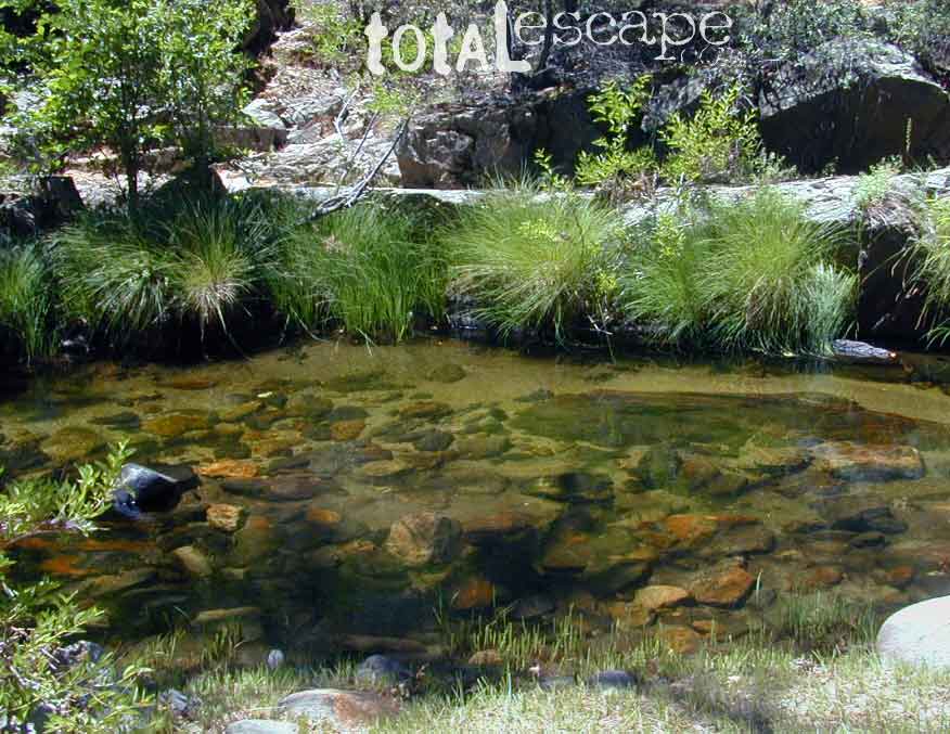
Everyone dreams of it. The perfect camp, along the creek. Maybe a waterfall or two, a shady hammock spot & plenty of trees, a flat tent spot, maybe a view. A big, sturdy, rock fire ring (without a bunch of broken glass in it).
This dreamy camp isn’t only in your imagination, nor is it at the local county campground a few miles from home. This kinda beauty & rare finds are out there, deep in the back woods, the mountains. You gotta know where to look & what to bring in order to have a good, easy, relaxing time.
These secluded sites really are around in your favorite forest, way back there. Best of all, they are free.
Having the opportunity to camp in your very own private, secluded spot, along dirt roads, outside of the annoying rules and fees of a developed campground is a privilege. Use these lands wisely and be a responsible camper. Camp eco-wise! Respecting the land, knowing some basics and following fire safety precautions is all mandatory. A topographic hiking map or a National Forest map is optional, but highly recommended.
Creek water can make an easy refrigerator if the cooler is full. Chill that bottle of wine, keep the watermelon cool .. just don’t forget about it. (cuz that kinda litter maybe a welcomed good surprise for the next camper.) Secure your wet creek valuables. Even a heavy watermelon can float! Put some rocks around items or tye them in a mesh bag, with rope, something to keep them from getting away in the swift water.
There is nothing that beats a good detailed forest map of where you are going. If you are the type of person who can never make a straight B-line for home on Sunday afternoon, and find yourself wandering just for the sake of wandering – then it’s best to have a larger state wide map like this beauty from Benchmark Maps.
If you are the kinda sport who can really rough it, you may learn to love it. After your first real back woods camping experience, the privacy, serenity and beauty of the land will inspire and relax you so much, that the drawback on the lack of toilet won’t bother you.
Make a new hobby of learning how to stay away from the crowds. The less cars you see at camp, the better. Learn to be immersed within nature and enjoy your space outside. Unwind, next to the creek in the shade, with a chair and read for hours, or bring the sketchbook, or just daydream as butterflies go floating by.
Remember to be camp clean, California is black bear country.
capable vehicle – SUV or Truck, high clearance is best. 4×4 is NOT required. AWD wagons should be more cautious when venturing out on the back roads. 2WD is fine for most graded dirt roads, but way out exploring dirt roads, deep mud and snow is quite possible.
destination – Pick a locale. A general area you wanna check out. Not a quickie overnight deal, but an enjoyable lazy multi-day camping trip.
exploration – Narrow down a canyon or river that you have always wanted to explore. The Sierra Nevada & NorCal is the place to concentrate your efforts, as SoCal is near desert climate w/ way too much development.
The more homework you do before hand, the better chances of finding that secret camp spot, especially on holiday weekends. Go ahead & call the forest rangers. Have your decent topo maps handy, along with pen and paper. That’s what they are there for. Have a list of questions on specific areas you want more info on. If you do the prep work well in advance, it makes a more enjoyable camp trip. Cuz you’ll be less worried about finding the ultimate places (before dark, or before the other guy does). With your new profound Wilderness Vision, you will have not only a plan B ready, but a plan C as well.
what to look for:
getting permits – If you really wanna camp like this, all secluded on the dirt back roads without the hordes of other campers nearby…. you’ll need a capable vehicle, a camp fire permit & the understanding of the concept “totally self sufficient campers”. This means bringing your own water, a bucket, a shovel, maybe some firewood, plus packing out all your own garbage, plus any litter left over by the last campers. It’s the least you can do, not having to make reservations. Visit the FireSafe page
it’s on your map – After you have a general area narrowed down, some place you always wanted to go, then it’s time to get your maps out & start reading them. Or at least staring at them – maybe over a meal, whenever you have free time to study it. Look for dirt roads, the further off the paved roads is not necessarily the better. Some of the best camp sites are within a few short miles from the pavement, so get them maps out & start visualizing.
gas up – Make sure you fuel your vehicle before you head into remote areas (like the ones we are mentioning). Maybe even an extra can of gasoline too, just in case.
the blue lines – You’ll know a decent road when you see it. When you start planning at home, you need to concentrate of what dirt roads are along what water sources. And will these streams be flowing at this time of year? Many are seasonal creeks & can dry up in summer. The most likely place to find great water flow is to look for the streams flowing directly into a major river or Lake/ Reservoir.
Are you willing to clean up your camp, before & after, leaving it pristine?
Yes indeed, it is free to camp outside of developed campgrounds.
On the eastern mountain slopes of Big Bear Lake, Holcomb Creek creates a forested sage valley – called Holcomb Valley, located only a few miles away from the big lake. A graded dirt road leads out to this pine forest & a prime campground area. Perfect location for picnics and sightseeing.
Although the developed campground is open all year long, please take into consideration that SNOW and mud is the norm for winter months.
Nice shady sites to beat the summer heat. Camp spots spaced out fairly well. Hikers parking lot is located at one end of the campground. Bears are well known in the region, so please lock all food in the provided metal bear lockers.
The epic Pacific Crest Trail runs right through the Holcomb Valley. Doble Trail Camp is out this way for PCT parking, next to Holcomb Valley Road #3N16 which encircles this whole forested area inside San Bernardino National Forest.
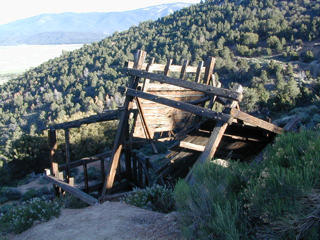
Holcomb Valley has a historic cabin to see. Numerous old mines exist around this area. Nearby Gold Mountain is a popular 4WD route.
The dirt back road leads east down to the high desert @ Highway 162. Down to Pioneertown and Yucca Valley, and eventually Joshua Tree National Park.


 Right next to camp: A pretty much perfect LAKE LOOP (1.5 mi) hiking trail is worth a serious stroll; footbridge, wildflowers, fishing spots, minimal hills, lava rocks, and awesome scenery. Plenty of wildlife can be seen, including butterflies and bald eagles. Trail is shaded by tall white fir and ponderosa pine trees. Trailhead is located at the Day Use parking lot, w/ paved boat ramp, dock, and picnic area.


 Holcomb Valley has a historic cabin to see. Numerous old mines exist around this area. Nearby Gold Mountain is a popular 4WD route.