In 1954, the Oakdale Saddle Club held its first professional rodeo, keeping the name the Oakdale Clover Round-Up. By, 1957 the name of the rodeo officially changed to the Oakdale Rodeo.
Barrel Racing, Rodeo Dance, Oakdale Rodeo Parade on Saturday morning. The parade features, a grand marshal, horses, local businesses, bands, classic cars.
Oakdale Saddle Club Rodeo Grounds 1624 East F Street Oakdale, CA 95361 209-847-4083
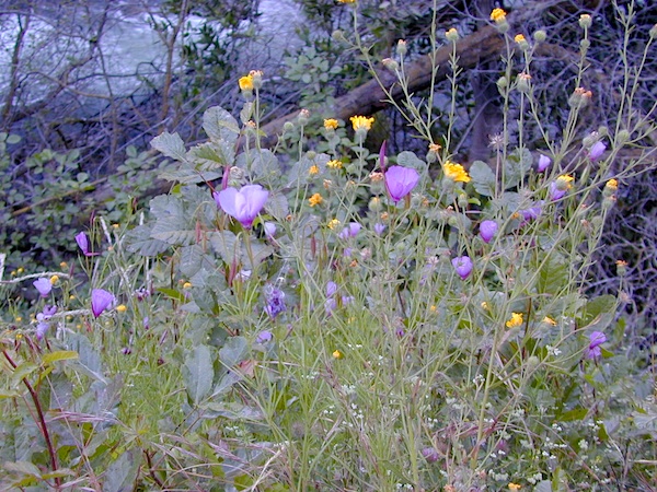
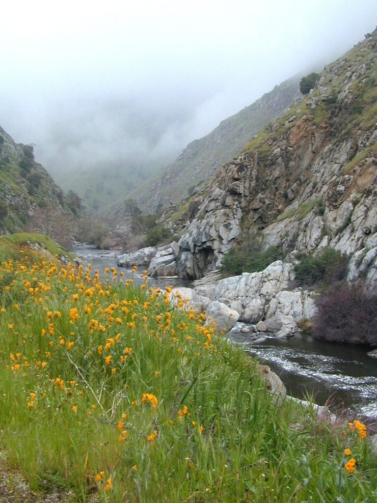
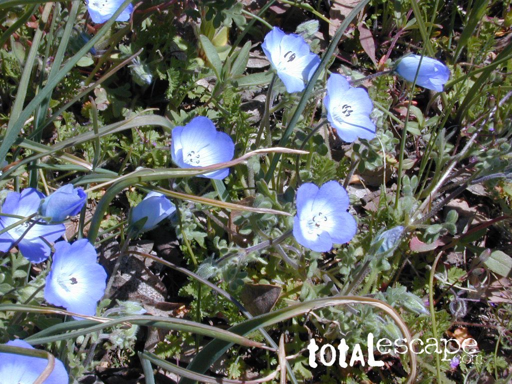
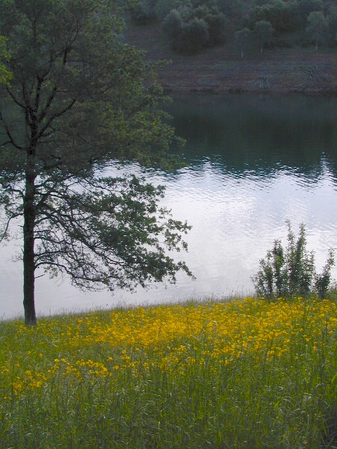
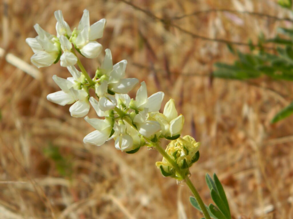
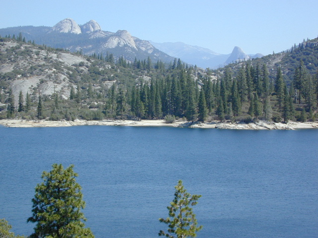
West facing canyons of the Sierra Nevada mountain range are prime spots for wild flora, especially in Springtime. Lots of rain means a great show can usually be found. Rivers exit the mountains and carve deep into the landscape. Lush green hills, oaks, boulders. Perfect picnic spots everywhere.
wildflowers bloom: March – July
make a whole day of it
Lower elevations bloom first in the year. Remember if the Central Valley is blooming fruit trees, the mountain foothills are starting up too. Mid-elevations, above 3000′ bloom in summer months, but below that – plenty of river canyons and reservoirs are superb locations to search for wild flowers.
High Sierra wildflowers start to bloom after the snow melt (and roads open) usually JUNE – JULY
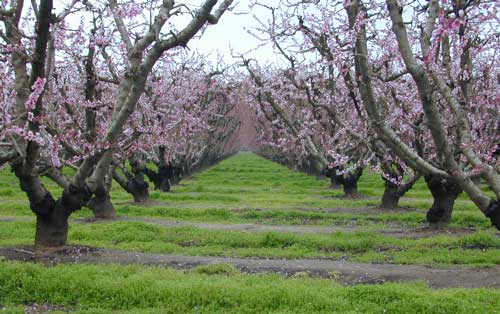
Orchards Blooming, San Joaquin Valley, California
The steep Eastern Sierra canyons near US 395, do have some wildflowers in Spring. Rocky, higher elevations bloom in mid-summer. And what Eastern Sierra may lack in wildflowers, they make up for in Autumn Colors (best in the state)
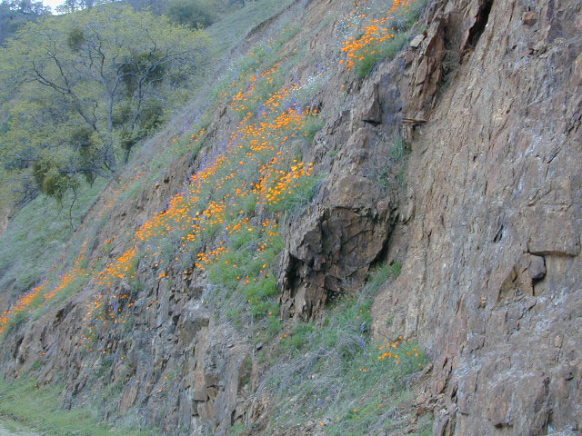
One of the premiere counties for wildflowers inside California. Kern offers amazing displays (blankets of flowers) along roadways, on hillsides, and in the numerous canyons.
Obvious I-5
Interstate 5 – from the Grapevine up past Tejon Ranch, and over to Gorman is epic blooms of poppy and lupine. Annually in April and only if the previous winter was wet or snowy. For safety sake, please exit the freeway to view the flowers!
The famous high desert Poppy Preserve is located off of I-5, east on Hwy 138, way before the town of Lancaster, CA
But all this mentioned above is not technically the Sierra Nevada mountains, so we will move on…
CALIENTE ROAD
Off of Hwy 58 west (below Tehachapi) Often called Caliente exit, or Caliente Creek Road – the Bodfish-Caliente Road is a narrow, paved, back road that connects Highway 58 to the Lake Isabella area.
Driving this countryside route is long and curvy, but there are numerous pull-outs and places to see wild flora. Plan for half a day to reach Hwy 178. Gold Pan Canyon and rolling oak hills. Dirt roads lead into National Forests, but watch for private property and no trespassing signs. NOTE: You may need to stop the car. Get out and walk around to find these little beauties.
Historic Havilah has an old schoolhouse and a museum.
LewisHillPreserve (559) 738-0211
Along N Plano Street. North of Porterville, CA
NOTE: Lewis Hill Preserve is not open to the public except for special tours and events.
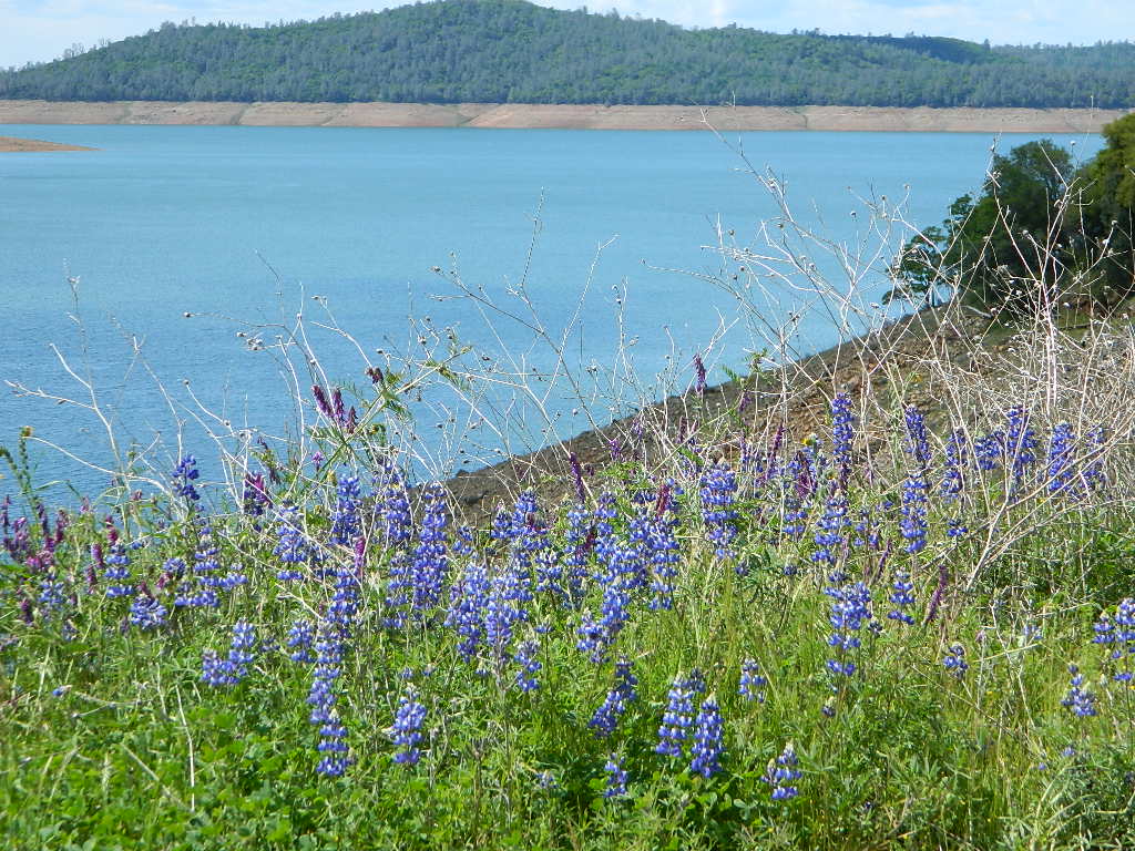
Lake Kaweah @ Three Rivers, CA
south of Sequoia National Park has wildflower displays along the lake shore, and with snow capped mountains in the background, it can make for excellent photos.
Sequoia Road J21 – HOMER RANCH Dirt back road on the north side of the Lake Kawaeah which connects to Sequoia National Park (the long way). Dry Creek Preserve, McKee Canyon, Ragle Canyon, Indian Canyon. Homer Ranch Preserve, open to the public weekends only, from November 1st – June 1st
Calif Gold Country
Foothills & River Canyons
American River Canyon – Hwy 49, South of Auburn, CA
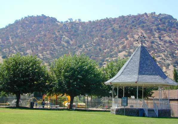
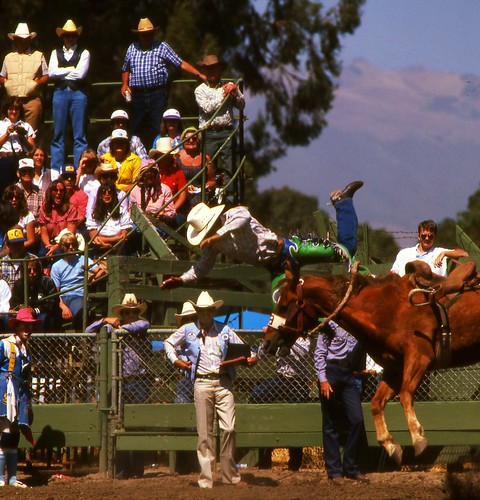
Annual rodeo running 65+ years in the western foothills of the Sierra Nevada mountains. Held before the heat of summer, during the spring. Slogan is the “Biggest Little Rodeo in the West”
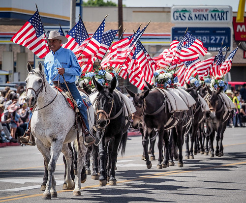
Bishop California host the infamous Mule Days Celebration. Always Memorial Day weekend . Mules compete in events. Part mule show, part test of skills, and part Wild West. Thursday night concert, featuring Country Music stars, the longest running non-motorized parade on Saturday morning, Steer roping and penning, and the Packer’s Scramble.
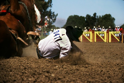
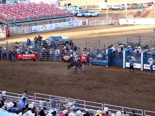
Salinas is home to the annual California Rodeo. Over 100 years on this event, a very popular family attraction in these parts. One of the top 20 professional rodeos in the United States and the largest rodeo show in California. Parade, concerts, horse show, motocross, carnival rides, games, food.
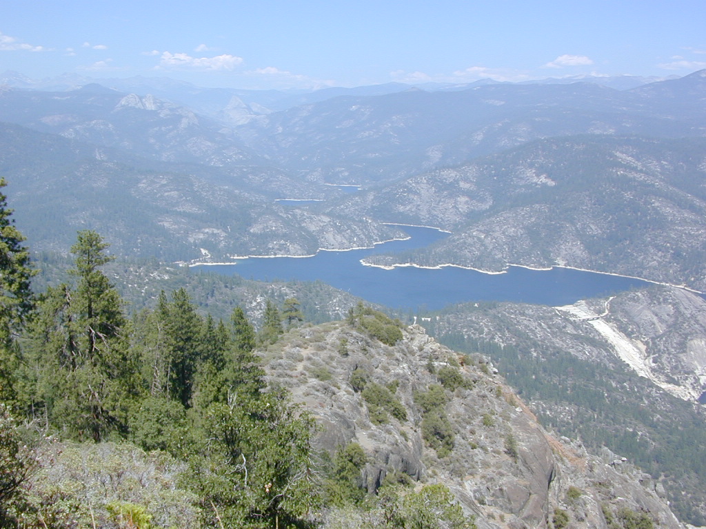
Awesome granite domes of the western Sierra, plus a scenic recreational lake that is only accessible half the year. Home to “Hells Half Acre” – Mammoth Pool Lake is one of the lesser known reservoirs in the western Sierra Nevada mountains. It’s kinda hard to get to although it is located on the border of Yosemite National Park. Area is totally surrounded by granite creeks, hiking trails, dirt roads and wilderness. This Mammoth Pool is an hours drive, way back behind Bass Lake (off Highway 41), and NOT located near Mammoth Lakes in the Eastern Sierra.
Camping just outside of Yosemite. Although the National Park boundary and trailheads are near by, accessing Yosemite Valley for day trips from this location will be quite tiresome and difficult, with long winding roads and over 2 hours drive one way. Better to camp near Bass Lake if you wanna be convenient to Yosemite NP.
(loop road, backcountry route closed in winter months)
Near the town of Oakhurst and Bass Lake California, get off the main highway and head over to the small town of North Fork. Take South Fork Road 225 (Italian Bar Rd) to Minarets Road (#81) also called Mammoth Road. Side trip paved Auberry Road (#222) which skirts oak hills down to Redinger Lake Road. Hook up w/ Minarets Road (#81) that parallels the San Joaquin River on the forested ridge above, traveling 20 miles to Numerous developed campgrounds and primitive camping sites off this route. Mammoth Pool is a signed right turn down Mammoth Pool Road, a steep road w/ a couple of campground near the lake shore and the only public boat launch is narrow, one at a time and it is not paved.
The lake is closed to the public during May and the first half of June to allow migrating deer to swim across the reservoir. The reservoir is inaccessible following the first snowstorm, as the access road is not snowplowed.
Grizzly Road, a paved route that leads deeper into the woods and connects over to BEASORE. Back on the main route (Road #81) on the far north end of the loop, a narrow, paved side route connects Clover Meadow Ranger Station and the impressive Granite Creek Campground. Plenty water and hiking trailheads that lead into Ansel Adams Wilderness and Yosemite National Park.
Back on the main route (Road #81) – the pavement becomes dirt in some sections and the route loops down to Beasore Road (#7), which traverses past meadows and dense forest, and heads back towards Bass Lake.
backpacking, boating, camping
fishing, water ski, kayaking
sailing, swimming


 Grizzly Road, a paved route that leads deeper into the woods and connects over to BEASORE. Back on the main route (Road #81) on the far north end of the loop, a narrow, paved side route connects Clover Meadow Ranger Station and the impressive Granite Creek Campground. Plenty water and hiking trailheads that lead into Ansel Adams Wilderness and Yosemite National Park.