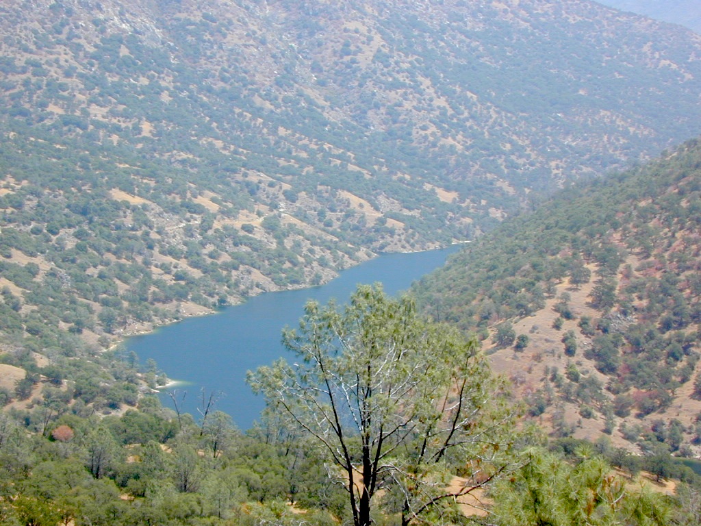
Tag Archives: wildflowers

Redinger Lake

redinger lake

Redinger Reservoir

south of Yosemite NP, Bass Lake, CA

dammed lake canyon NFS sierra river sierra mountains

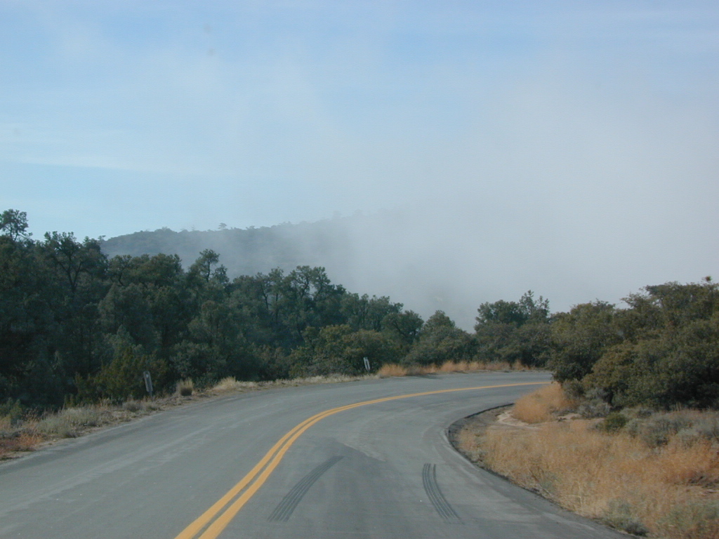
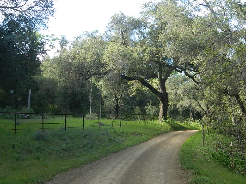
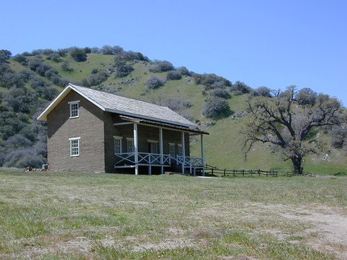
Officially this lake is actually a reservoir, located in the low lands of the Sierra foothills country. Narrow, winding back roads, a way outta the way kinda spot.

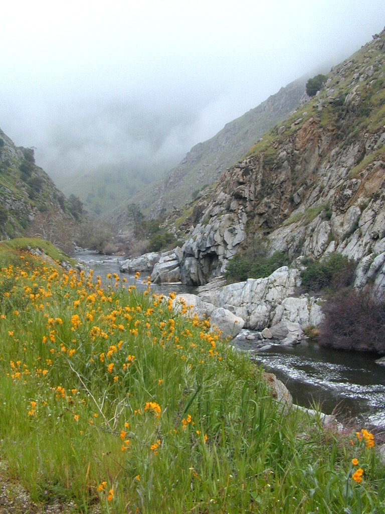
a long, narrow lake w/ steep hills, inside a tight canyon
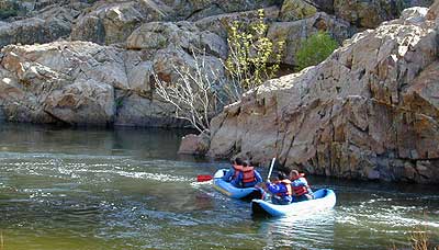
  • canoe
  • fishing
  • hiking
  • jetski
  • kayak
  • waterski

The San Joaquin River flows west, down from the highest granite peaks of the Sierra Nevada and into the Central Valley foothills. If you find your way off the main highway 41, exploring way back behind Bass Lake, CA – then you may consider this scenic loop to Redinger.

off the beaten path

Truthfully, this place is usually an afterthought, sorta near Yosemite National Park. Not exactly a top destination for tourists, but it is very accessible most anytime of the year due to low elevation.

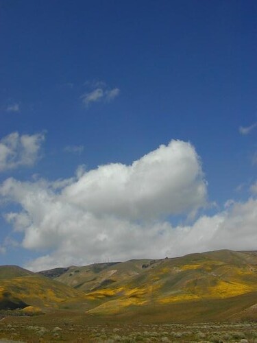
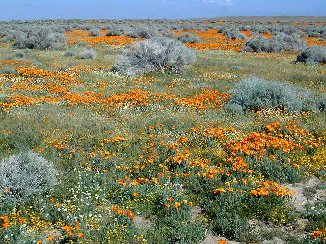
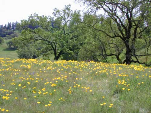
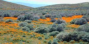
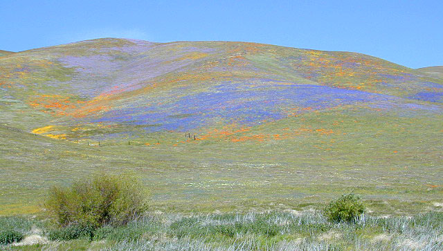
Spring wildflowers can be decent. Summers do get super hot here, so take that into consideration when planning your visit. Due to extreme wildfire danger, no campfires are allowed at any time.

redinger bridge

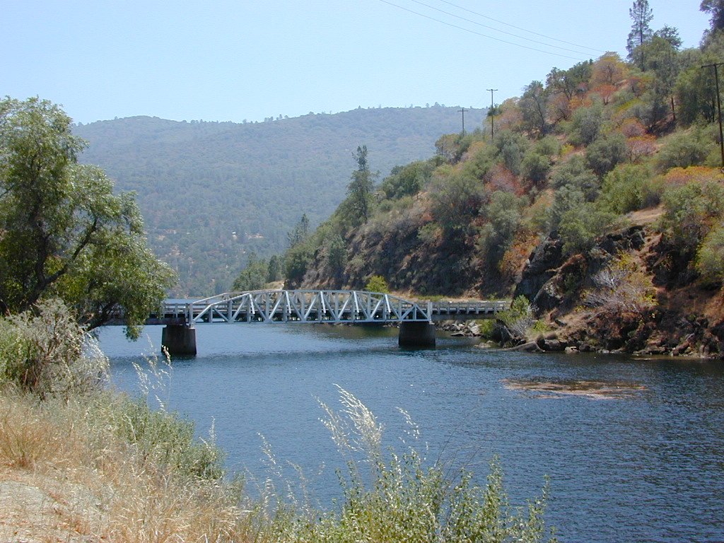
Lake, Reservoir, or a good wide section of the San Joaquin River w/ hydro-electric dam.

elev. 1000′

open camp no fires boating fish

public boat launch ramp
Camping is restricted to a large open area near the dam. No fee is charged. No campfires are permitted. Services limited, no drinking water or garbage pick-up available. Nearest town 7 miles away.

NORTH FORK, CA

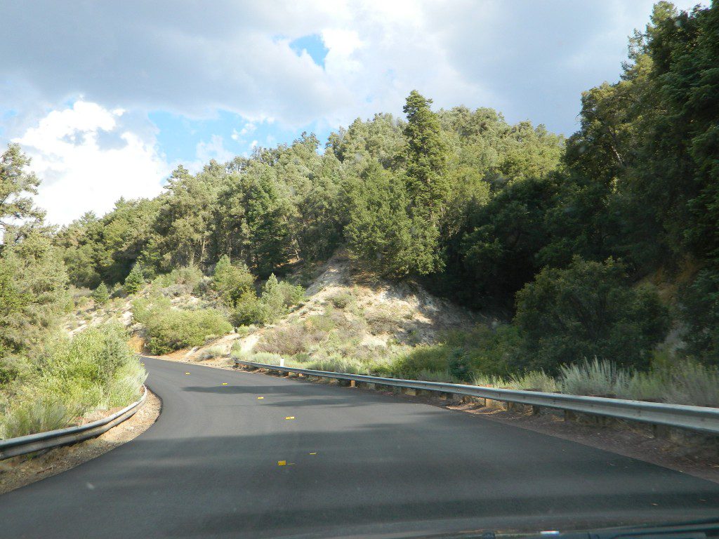
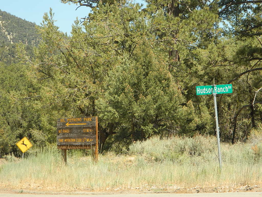
Redinger Lake Road (Rd# 235) can be found south of the town of North Fork, CA. The paved route down is long, steep and winding. At the bridge crossing, the road loops to Joe Basin Road, which connects to the small community of Auberry, CA

Way up river, a dozen plus miles, is the utterly beautiful Mammoth Pool, only accessible half the year.

A few miles down river from Redinger, around the horse shoe bend, another neighboring reservoir called Kerschoff Lake (elev 971′) has a developed campground.

campSmalley Cove Campground NFS

Contact:
Bass Lake Ranger StationNFS
559-877-2218

https://www.fs.usda.gov/


Poppy Stompers

California Golden Poppy

The official state flower of California is the POPPY

Spring usually means it’s warming up, to a great wildflower season in California. Time to get outdoors more! Hike, bike and picnic near the wildflowers and see some poppies.

poppy fields

California Golden Poppies can be found throughout the state, in small patches near the roadways, rolling hills behind vineyards, in high desert flats (where wind gets whipping) or even out near a ranch, with oak hills and fields of golden orange.

POPPIES can blanket hillsides, resulting in a show stopping event – which can be deadly on freeways? N of L.A. interstate 5 (the Grapevine) TEJON PASS (Lebec, Gorman, Junction 138) >> Please pull to nearest exit and stop the car. (It will be safest and well worth the 10 minute stretch break.)

Golden poppies can be found all over California. Flowers like lupine and owls clover can often be found nearby. Wildflowers may only last a few weeks, so go enjoy them while they last.

Bright yellow, gold, deep orange – or any shade in between!

best places to find poppies

NORTHERN CALIFORNIA

Table Mountain @ Cherokee Road
North of Oroville, CA

wine country

Wine Country NorCal

Alexander Valley Road

Railroad Tracks @ Santa Rosa, CA
Napa County
Sonoma County

Santa Rosa Tracks

CENTRAL CALIFORNIA

Kern County

Fort Tejon State Historic Park @ I-5
Cerro Noroeste Road & Klipstein Canyon
Carrizo Plain National Monument BLM
Kern River Canyon
S of Walker Basin @ Caliente Bodfish Rd
North of Tehachapi, CA

Santa Lucia Mountains
Rock Front Ranch
Schoolhouse Canyon
Cottonwood
Hwy 166, West of New Cuyama, CA

Figueroa Mountain Road
Los Padres National Forest
East of Santa Ynez, CA

Pine Flat Reservoir
@ Kings River, Sierra National Forest
East of Fresno, CA

East Bay San Francisco
The rural hills out east are the best places to find poppies in the Bay Area.

Mojave Desert Preserve
Providence Mountain SRA
Interstate 40
East of Barstow, CA

Central Coast California

Gold Country Hiking

Gold Country California

Auburn, CA
Central California Reservoirs
Located all around most rivers w/ dams (reservoirs) poppies can easily be found along highways, rural roads and on oak hillsides.


SOUTHERN CALIFORNIA

Boulder Creek Road (dirt)
Descanso to Julian, CA
San Diego Mountain Foothills

SoCal poppies

Lancaster Poppy: Antelope Valley Poppy Reserve

Poppy Hotline (661) 724-1180

Remember, stay on the trail!  Getting a picture of that one really nice poppy will crush all the plants along the way, and compact the ground leaving lifeless bare dirt for the next year or longer.  If someone else has started a trail, do not add to the damage.  Please be a responsible park visitor and leave the park as nice as you found it.

Or you can avoid the crowds & tour buses at the Poppy Park to head off on your own adventure. All along both sides of high desert Hwy 138 you can find fields of California Poppies, from the small town of Neenach, CA east to Hwy 14. Plus the hills of Gorman are usually full of color.

Gorman @ I-5
Gorman CA – Interstate 5 @ jct Hwy 138

Borrego Park

Anza Park / Borrego Park

purplmtns_i

East San Diego County, Borrego Springs CA

San Diego Backcountry
600,000 acres of SoCal desert
San Diego desert maps

BLOOM: mid-March thru May
Anza Park elevations range from low to high. Lowest near eastern border (next to the Salton Sea) to the upper reaches of the western slopes @ 4000′. Wide, deep, sandy, long desert washes, native petroglphs, wind caves, slot canyons and split mountain. This uncrowded state park has the most acreages than all of the parks.

OPEN CAMPING

Camp in a developed campground, a small back country site or camp primitive on nearly any dirt road. Car camping to 4×4, this park has lots to offer folks wishing to really escape. No ground fires allowed, so bring your metal campfire bucket and large trash bag to carry out your ashes. The last thing you want is to scar these pristine white desert washes.

DESERT WILDFLOWERS

Steep rocky canyons on the Laguna mountain foothills can be challenging terrain, so bring good, sturdy hiking boots. Wildflowers can be abundant on certain years. Lower elevations sprout up first; Higher elevations along County Rd S-2 & S-22 bloom later in Spring. By June 1st most of the color is gone in and around Borrego Springs, so this is a real Winter and Spring vacation kinda spot. California desert wildflowers include primrose, barrel cactus, prickly pear, monkey flower, ocotillo & many more.

ANZA BORREGO WILDFLOWERS

seaoflavendar

see also BORREGO SPRINGS

find you way easily with the Anza Borrego Desert Map

anza park

This is the largest State Park in California and “open car camping” is allowed on the back roads. (also referred to as primitive camping, free camping or 4×4 camping) One of the few places in Southern California that you can camp outside of a developed Campground and still have a campfire. You gotta bring a large metal bucket to have your campfire in – as ashes scar white sandy washes and ground fires are not allowed.

Borrego Camping

Anza Borrego Park / Anza Borrego Campgrounds

DSCN0034

California Highway 78 cuts across Southern California and right thru the middle of the largest State Park in the lower 48. Anza Borrego Desert State Park is a place that must be visited more than once to really take in all the beauty it has to offer. Free camping in Southern California is abundant here, if you are willing to follow the primitive camp fire rules of the park and you are comfortable camping away from developed campgrounds.

North-South: San Diego County Road S2 skirts the western border with Laguna Mountain towering above. It starts at Ocotillo @ Interstate 8 and heads Northwest to Lake Henshaw at Warner Springs.

East-West: a major route S22, connects Ranchita /Montezuma Valley to the Borrego Valley, and continues East to the Salton Seawhataview
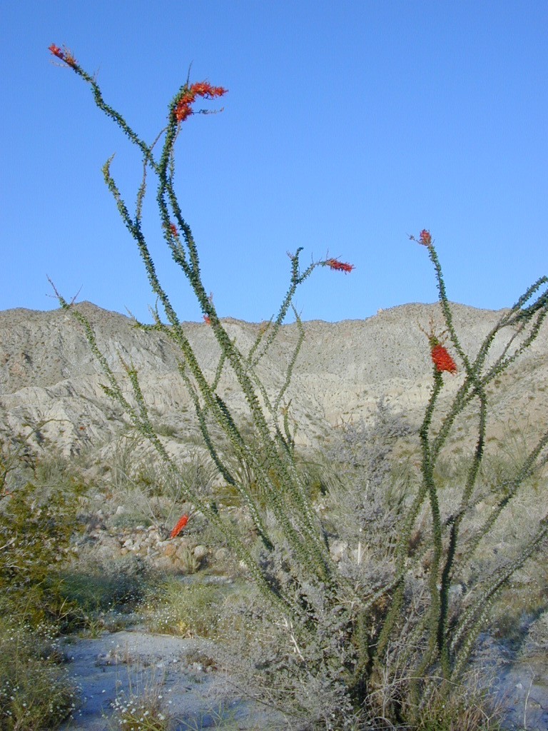
. The center of the parks is pretty much the town of Borrego Springs, where the State Parks visitors center is located. San Diego County Road S3 leads from Hwy 78 down the the town of Borrego Springs Valley.

developed campgrounds:

free camping: While the camping facilities listed above provide picnic tables and toilets, or more luxury camping… Total Escape thinks the best part of camping in Anza Borrego Desert is the vast amount of free, open camping available on most back roads. Hundreds of dirt roads lead off in all directions, so you can find the peace and solitude that few inside busy campgrounds ever experience.

  • Anza Borrego Desert Map
  • San Diego Backcountry Map
  • Many Anza desert routes are sandy washes, dirt roads, some for high clearance vehicles only, or 4WD in several canyons. Often there is no signs telling you need 4×4 to proceed. May only find out when its too late and you’re stuck.

    Have a good dirt road map with you and know your vehicles limitations. Passenger cars should be very cautious off road. Cell phone coverage is spotty out here in the most remote wilderness areas. oystercamp

    Anza Borrego Wildflowers


    Desert Wildflowers / Anza Borrego SP

    Anza Borrego Flowers / Borrego Springs CA

    Wild Flowers of Box Canyon, Mecca
    East San Diego County, Borrego Springs CA

    San Diego Backcountry
    600,000 acres of SoCal desert

    BLOOM: February thru MaySan Diego desert maps
    Anza Park elevations range from low to high. Lowest near eastern border of park (next to the Salton Sea) to the upper reaches of the western slopes @ 4000′ of the Laguna mountains. Lower elevations sprout up first; Micro flowers, Easter-egg-color splendor in the dry washes. Higher elevations bloom later (along w/ areas on San Diego County Rd S-2, the Great Overland Stage Route)

    Drive from Temecula to Warner Springs, and then proceed east – out to the Salton Sea via Back Road Highway #S22 (Montezuma Grade). A great route to take thru the Borrego State Park – for the full gamut in vegetation & altitude. Grapevine Canyon is an alternate off road route down a scenic canyon. Culp Valley has a small campground, plus lots of boulders and decent views to the Borrego Valley. Off the highway, on dirt, one-lane side roads lead to many primitive spots. Perfect for private picnics, stargazing or overnight camping.

    anza wildflowers include – Arizona Lupine, Barrel cacti, Brittlebush, California Primrose, Cheesebush, Creosote, Desert Chicory, Desert Apricot, Desert Hibiscus, Desert Lavender, Desert Pincushion, Fiesta Flower, Fishhook Cactus, Gold-Poppy, Ghost Flowers, Ground Cherry, Fagonia, Prickly Pear, Monkey Flower, Ocotillo, Rigid Fiddleneck, Rock Daisy, Sahara Mustard, Sand Verbena, Short-Wing Deerweed, Spanish Needles, Spectacle Pod, Trailing Windmills, Turpentine Broom, Whispering Bells, Wishbone Bush

    Anza Borrego Camping: Palm Canyon and RV Resortscamp


    BORREGO MAPS

    Wilderness Anza Borrego Map
    Wilderness Press Anza Borrego Map


    Hot Springs of the Southwest
    Hot Springs of the Southwest

    Anza Borrego Flora

    __________________________________________________

    Annual California Wildflower Reports


    anza flower links:

    Anza-Borrego National History Association
    Anza Borrego Desert
    Anza Borrego Desert State Park
    Borrego Campfire Restrictions
    Desert USA Reports

    blurflwr

    nearby towns:

    Borrego Valley Flora

    Horse Canyon

    Horse Canyon Mojave

    Horse Canyon California

    Southern Sierra / Mojave Road SC 65

    Mojave Desert meets the Sierra Nevada Mountains
    North Highway 14

    North of Mojave, CA
    North of Red Rock State Park
    North of Jawbone Canyon

    South of south of US Hwy 395, south of jct Hwy 178

    backroads BLM camping desert roads hiking PCT mountain bike jeep roads primitive camp

    elevation: 3000′-7000′

    Horse Canyon is a dirt road up a high desert canyon, with joshua trees and wash outs. 7000′ elevation pinyon pine ridges above w/ PCT.

    Most would say the see a whole-lotta-nothingness out here in these deserts…. when they zoom by at 70 mph on the blacktop highway.

    at Total Escape, we beg to differ.

    Solo Driver SUV

    Intersection on Hwy 14 @ SC 65, dirt route will travel west into the mountains. Initial desert road follows Little Dixie Wash, but veers north up to Horse Canyon and the higher forested ridges.

    Horse Cyn is a scenic, desert, dirt road that becomes a rugged 4×4 trail the higher it climbs in the canyon. The route traverses a ridge line and dead ends at the old cabin; No through route, no loop. The PCT continues on to the Walker Pass @ the 178.

    The lower Horse Canyon is area quite accessible by standard truck or SUV. High clearance is recommended out on these kinda roads. Vegetation is quite sparse at first, but improves with the miles traveled. Wildflowers can be awesome, usually April-June. Picnic spots everywhere; primitive camping sites can be found out here, off the main dirt road. Please reuse existing camp sites when possible.

    wheelin pals

    Passenger cars may attempt this, but should watch for unexpected deep dips and rocks, washed out in the road. (No tow service in the middle of nowhere). Road conditions do change with the seasons out in the boonies. Cell phone reception could be spotty back in the deepest of canyons.

    PCT
    PCT trail access: Pacific Crest Trail follows this ridge road for miles. They call this range the SCODIE Mountains; Old cabin at the end of the road.

    cabin mcivers

    Sage Canyon and Cow Heaven Canyon are both to the north, along with Freeman Canyon (CA SR 178). Bird Spring and Dove Spring Canyons are both to the south, along with the most popular regions of Red Rock State Park and the Jawbone OHV area.

    nearby towns:

    INYOKERN, CA
    LAKE ISABELLA, CA
    MOJAVE, CA
    RANDSBURG, CA
    RIDGECREST, CA

    joshuacanyons

    Long Valley Campground

    Secluded Camp Sites

    Long Valley Campground BLM

    Southern Sierra Nevada
    secluded camp, fishing & hiking trails
    (free campground, open all year long)

    South Fork of Kern River & DomeLand Wilderness

    20+ miles from the nearest paved road; a remote camp on Long Valley Loop Road, off Canebrake Road. Both are dirt roads: high clearance vehicle recommended!

    High Desert meets the Sierra Mountains

    Back in the dry pinyon hills east of Kernville, beyond Sherman’s Pass; high above the Mojave desert and north of Canebrake & Highway 178. Long dirt roads, remote campground w/ fishing & hiking trails. Wilderness access.

    hiking fishing trails horse trails back roads back roads sierra mountains

    Chimney Peak Back Country Byway
    Canebrake, California

    These dirt back roads listed above skirt the edge of Dome Land Wilderness & Sequoia National Forest winding through BLM Land bordering the Mojave. The byway networks recreation areas between Kennedy Meadows and Canebrake, east of Lake Isabella. Eastern Kern County, California.

    backpacking
    camping
    fishing
    hiking
    horseback trails
    mountain biking
    rock climbing
    stargazing
    wildflowers

    Trailheads Domeland

    People come way out here for the seclusion – the peace & the quiet. Mid-week you can have the whole place to yourself. Abundant hiking trails & fishing access. Into the Dome Land Wilderness you will find incredible scenery and diverse terrain – giant granite domes, waterfall canyons, and the South Fork of the Kern River (3 mi hike to river). PCTThe infamous Pacific Crest Trail passes close to Long Valley Campground, but Chimney Creek Campground is much closer to the PCT.

    BLM Camping

    Long Valley Campground

    • Elevation: 5200′
    • Number of Sites: 13
    • Vehicle Accessibility: High Clearance Vehicle
    • Facilities: picnic tables, fire rings, vault toilet
    • Campsites Reservation: No
    • Camp Fee: None
    • Length of Stay: 14 Days
    • Season: Open all year
    • Operated by: BLM
    • Trailheads: S. Fork Kern River & Domeland Wilderness

    Bureau of Land Management
    BLM Bakersfield Field Office
    661-391-6000
    Find a BLM page w/ map & info

    Recent Domeland Wild Fires:
    Manter Fire (2000)
    McNally Fire (2002)

    Long Valley Loop
    Long Valley Loop Road (2001)

    2016 NOTE: The part of the LOOP of Long Valley Loop Road that connects this campground to Kennedy Meadows (to the north) is CLOSED due to a huge washout. The Long Valley campground is accessible from the south side, from Hwy 178 @ Canebrake – and requires many miles of dirt road driving. High clearance vehicles are recommended; 4×4 needed in wet weather or snow.

    towns nearby:

    CANEBRAKE
    KENNEDY MEADOWS
    KERNVILLE
    LAKE ISABELLA
    MOJAVE

    High Desert Sagebrush
    High Desert Sagebrush & Dirt Roads
    Wildfire Burn
    Manter Wildfire Burn Area (2001)

    Turtle Mountain Road

    Turtle Mountain Rd

    Turtle Mountain Road
    BLM Road # NS477

    off U.S. Highway 95
    in between Needles & Blythe, California

    BLM: Bureau of Land Management – Desert Camping

    Several miles south of the town of Needles numerous desert washes cross the highway with dirt roads leading off into both directions. Turtle Mountain is just one dirt road to explore in this region, but there are many more unmarked, secluded roads. This region is perfect for “campers in-route” traveling who need a quick overnight camp spot (off the freeway).

    Turtle Mountain Road is a one lane dirt road that runs next to a wash, in between Turtle Mountain Wilderness and Stepladder Mountain Wilderness. Leading approx 12 miles from US Highway 95 to the northern edge of the desert wilderness. The Turtle Mountain route continues westward to meet Water Road with Old Woman Mountain Wilderness nearby. Sunflower Springs Road continues north to Essex @ Interstate 40

    BLM signage along US Hwy 95 is minimal. Look for vertical brown markers w/ reflectors, numbers or names. Driving slower than typical traffic, coast at 50 mph and keep your eyes peeled to the west side. Turtle Mountain Rd is marked at the pavement, but the marker is very small.

    Eastern California Desert Wildflowers

    Exploring the eastern side of Southern California, one can find the Colorado River and Arizona border region an excellent destination for winter camping. Springtime offers wildflower blooms, open camping and decent weather with sunny 70 degree days. Wildflowers and BLM beauty awaits those who venture off the paved routes.

    Pink Cactus Bloom

    Palo Verde trees line the washes and much vegetation can be seen throughout this remote region. Cacti include the cholla, ocotillo, barrel, beavertail, just to name a few. Wildflower blooms here are just as good as Anza Borrego Desert SP.

    MARCH & APRIL are both prime months for the desert bloom

    BLM Desert Camping

    Drive more than a mile from the highway if you plan to camp in peace and quiet, as the overnight truck traffic goes all hours.

    RV accessible camp spots are few and far in between. They can be found in large, level pullouts close to the main road, but you will be hearing traffic zoom by. Some dirt roads are in better shape than others; Seasonal storms in the low desert can wash out even paved roads. 4×4 may be needed in some areas.

    Open camping in this desert is free and there is plenty of room to spread out. Imagine not seeing anyone pass by your camp or drive down your road for days. Camping in a sandy wash may seem appealing, but you best know the weather forecast and if rain is at all predicted nearby, be prepared to break camp (in the middle of the night) before a flash flood hits.

    The Needles BLM Rangers Office is located on US Hwy 95, on the south edge of town and they can provide maps and more information. BLM California Deserts

    Needles BLM Office
    1303 S. US Hwy 95
    Needles, CA 92363
    760-326-7000

    Lake Havasu BLM Office
    2610 Sweetwater Avenue
    Lake Havasu City, AZ 86406
    928-505-1200

    Kern River Canyon

    Kern Spring Wildflowers

    Kern River Valley is one of the all time favorite Sierra Nevada destinations for SoCal escapees. First, it is the southern most ‘big river’ action for the Sierra range. The drive up from Los Angeles is easy access; only a coupe of hours. California Highway 178 leads from Bakersfield up the mountain to Lake Isabella (exit at 155 for Kernville destinations). The 178 continues east past the rural communities of Onyx, Canebrake, Weldon, and then on to the Northern Mojave desert & US Highway 395

    Second, Kern has an abundance of outdoor recreation, from fishing to boating, river rafting to kayaking, backpacking, mountain biking, rock climbing, horseback riding, hiking, camping, & soaking. Kernville is the “recreation headquarters” for the region, where you can find rafting outfitters, camping supplies and rental equipment.

    Kern Rafting

    Third, the mountain scenery is very diverse – with the dry shores of Lake Isabella, the granite lined Kern River, or the ridges with towering cedar forests, plenty sugar pines, plus a few Sequoia groves; Tons of dirt back roads to explore, granite & gorges for the rock climbers, prime wilderness access & several primitive hot springs.

    The whole area is encompassed by the Sequoia National Forest with wilderness areas to the North & East. Giant Sequoia National Monument is located along the Western Divide Hwy in the northern portion of the National Forest.

    campingFIND CAMPING along the Kern River

    camping Sequoia National ForestFIND ALL Campgrounds in the Kern River Canyon

    Kern River Valley communities include:

    Whether you’re an RVer wanting a developed campground near town, a fisherman needing a primitive site right on the river, or a backpacker seeking the high country, the Kern has a little bit of everything. High elevations beyond 8000′ ridge lines, or the lush Lower Kern under 2000′ with granite boulders lining, Kern has it. 4 wheelers will love the extensive network of dirt back roads, or maybe the OHV areas of Keysville. Lake Isabella has numerous oak lined campgrounds & boat rentals available too. Summer is not the best time to visit as the temperatures soar to 100 degrees & the city crowds come in full force to the Kern Valley. Springtime, the best season to visit runs from March to May, or Autumn cools for September to December.

  • SEQUOIA NATIONAL FOREST MAP
  • DOME LAND WILDERNESS MAP
  • GOLDEN TROUT WILDERNESS MAP
  • SOUTH SIERRA WILDERNESS MAP
  • KernWildflowers

    HoboCampground
    Hobo Campground in the Lower Kern Canyon

    Anza Borrego Desert Wildflowers

    Borrego Blooms

    Barrel Cactus Anza

    By far one of the best viewing areas for native California desert flora in the whole state. Autumn rain amounts determine the next year’s Spring bloom. If it rained real good all over SoCal before New Years Eve, chances are better for a favorable showing of color.

    Low elevations, washes, badlands, dry lake beds bloom first in February, followed by March for mid altitude canyons and mountains. Highest desert peaks may not bloom until May.

    Some of Total Escape favorite spots include:

    S-2 Great Stagecoach Route of 1849

    Anza Borrego Desert State Park
    Anza Ranger 760-767-5311

    Coyote Wash Blooms

    April is usually the best month for the wildflowers; it is also the prime time for Spring Break camping. Open car camping for free – all over this huge California State Park. The tourists typically head over to the town of Borrego Springs, to Borrego Palm Canyon and the visitors center; but the REAL wildflowers are along remote stretches of highway, and on the DIRT BACK ROADS. Many roads are passenger car accessible, for at least the first mile, so don’t think you must have a 4×4 vehicle for just simple exploring.

    Coyote Ocotillo Garden

    Cerro Noroeste Road

    Fresh Blacktop 2011

    Scenic Drive California: Cerro Noroeste

    Tejon Pass, Frazier Mountain, Tecuya, San Emigdio, Mount Pinos, Apache Saddle, Mount Abel, Quatal Canyon, BitterCreek, Klipstein Canyon

    Los Padres NF – Cerro Noroeste Road #9N05

    One of the best driving roads in Central California!

    Motorcycles love this route.

    Los Padres National Forest stretches from Ojai to Monterey, mostly along the California Central Coast. If you are traveling on Interstate 5 (atop the Grapevine, Tejon Pass) and you wanted to head westbound,  then you really want to take this scenic route.

    Exit Frazier Park Rd @ Lebec, on the top of the Grapevine (Interstate 5 N of jct Hwy 138). Proceed westbound thru the Frazier Park stop sign (5 mi), up the hill past the turn off for Lockwood Valley Road. Frazier Mountain Park Road now becomes Cuddy Valley Rd, continue up to pine trees. Turn right on Mil Potrero Highway & drive thru Pine Mountain Club (4-8 mi). Continuing past the golf course, heading up to Apache Saddle.

    Approximately 6000′ at a forested intersection is the ‘saddle’ with ranger station. The paved road is now considered Cerro Noroeste Road.

    A left turn will bring you up to Cerro Noroeste 8286′ elevation. (10 mi/closed in winter) This mountain peak is also known as Mount Abel.

    At the saddle, continuing straight (veering right) through the P&J forest (pinyon and juniper) to the gorgeous rolling hills, fog & cloudscape countryside of ..

    HUDSON RANCH ROAD

    WTF? Recently county authorities have renamed Cerro Noroeste Rd to Hudson Ranch Rd, which has many locals infuriated and of course, keeping visitors confused. There is a popular Hudson Ranch up near Napa Wine Country, but this is not named after that location. Rumor has it that one local family complained to Kern County about the difficulty of spelling ‘Cerro Noroeste’ for outsiders. Go figure! Want a local roadway name changed? Easier process than imagined – just file a suggestion w/ Kern County.

    HUDSON RANCH ROAD

    Bitter Creek Wildlife Area & Highway 166 (23 mi) are all out this way. Sports cars & motorcyclists love this route, so do hikers & hunters. Every weekend you can find hundreds of bikes cruising this scenic byway.

    Best Sunset Drives
    Numerous forest roads can be found out this way. Quatal Canyon #9N09 is a great side route to explore if you like long dirt roads, red dirt, lupine & pinyon pines. Chumash Wilderness backcountry access is way back in this super scenic canyon. Toad Spring Campground is a small site located near the top of the canyon, only half mile off the pavement.

    Forest Road #9N27 leads up to Caballo Campground & even further out to the steep ridge line, Marion Campground & Blue Ridge 4×4 trail. Across from the Apache Saddle Ranger Station, San Emigdio dirt road #9N34 climbs to 7400′ elevation and has a great viewpoint. Unsigned San Emigdio 4×4 trail starts at the viewpoint and heads east.

    Way out west on Cerro Noroeste Road is Valle Vista Campground, with new a outhouse. This small campground is perched on the edges of red cliffs overlooking the great Central Valley of California.

    Klipstein Canyon, a side route/short cut to Taft, offers decent wildflower displays in springtime. San Andreas faultline uplift is also evident on this detour. Road Closed barriers seem insignificant, as many drivers just skoot around them.

    CerroNoroeste

    nearby towns:

    Pine Mountain Club, CA
    Frazier Park, CA
    Ventucopa, CA
    Taft, CA
    New Cuyama, CA

    Old Kane Spring Road

    Kane Spring California

    Quartz Wash Anza

    Old Kane Spring Road parallels California SR Highway 78 a few miles from Ocotillo Wells, in east Anza Borrego Desert. A graded dirt road that can often gets sandy and you might need to keep you speed up certain soft spots. A few dead end canyons lead southward; hidden camp sites can be found out this way if you have the time to look. Harper Canyon, perhaps. See below for more on camp sites.

    San Diego Desert Map

    Anza Borrego Desert State Park Map

    San Diego Backcountry Map

    Spring Wildflowers can be quite spectacular out along this desert trail. Towering red-tipped ocotillo in some canyons serve as great backdrops to a perfect picnic lunch.

    Ocotillo California

    The Kane dirt route peels off the highway about a mile east of an area known as The Narrows. Marked on the highway as a small hiking trail, the highway curves at a narrow section of the canyon, as San Felipe Creek wash carves its way through the harsh landscape.

    primitive campThe best primitive camping in this area is actually west of The Narrows. You might need a high clearance vehicle to reach some spots and a good map with the creek/wash names. Make sure to look for these – Free Camping

    • Nolina Wash
    • Pinyon Wash
    • Quartz Vein Wash

    pinyonoco vcampoutpinyonwsh

    On the opposite the highway is Ocotillo Wells SVRA, where off road enthusiasts can get their kicks. Wind caves can be found in Butte Canyon, where the 4×4 trails abound. Kane Springs intersects Split Mountain Road. The Elephant Trees, Split Mountain and more wind caves are south of the railroad tracks.

    Anza Borrego Desert Map


    View Larger Map

    Garcia Wilderness

    Garcia Wilderness, Los Padres NF

    14,100 acres
    Garcia Peak – 3146′ elevation
    Los Padres National Forest
    Huasna River
    Pozo Creek

    himtncampgroundcampgrounds nearby –

    American Canyon Campground
    Hi Mountain Campground
    La Panza Campground
    Lake Lopez Campground
    Navajo Campground

    trailheads for Garcia Wilderness

    • Hi Mtn
    • Santa Lucia
    • Garcia OHV

    POZO ROAD is also known as

    • Pozo La Panza Rd
    • Hi Mountain Rd
    • Pozo Arroyo Grande Rd

    San Luis Obispo’s Los Padres Pozo Rd is a 4×4 route that accesses the Garcia Wilderness; the dirt route connects Lake Lopez to Pozo Saloon, out near Santa Margarita. Los Padres National Forest 

    Located inland from the Pismo Coast in south San Luis Obispo county.
    Garcia Peak OHV Route, off Pozo Road behind Lake Lopez, Arroyo Grande, CA

    • backpackingLupine on Pozo Rd
    • camping
    • hiking
    • mountain biking
    • off roading
    • waterfalls
    • wildflowers

    Steep lush coastal mountains, rugged, remote landscapes close to Central Coast San Luis Obispo.

    Garcia Ridge Road #30S18

    Garcia Ridge Trail #15E11

    Hi Mountain Road #30S11


    DSCN5297

    also nearby – Machesna Mountains Wilderness and Santa Lucia Wilderness

    Miracle Hot Springs

    MIRACLE HOT SPRINGS on Lower Kern River is now closed!

    Kern Soakers

    Hidden well by the dense vegetation, this multi-tub location provides a peaceful setting along the Kern River. Located on the Old Kern Canyon Road, (aka Old Kern Road) that parallels the main 4-laner Highway 178. The broken and dismantled tubs are inside a grouping of granite boulders, overlooking the Lower Kern River.  NFS Campground is walking distance away. Week days you can have the place to yourself for picnics, river fishing and hiking. Mountain biking and hiking trails at Remington trailhead.

    DanaMite’s Tip: This place has no operating hot pools unless you plan to physically dam up a tub with a few found rocks. Rangers do not like this practice. If you wanna camp at Hobo Campground you can walk over & hike around to check it out. Worth a look.

    Camping available next door at Hobo Campground. A few primitive spots are located on the Old Kern Canyon Rd. Free car camping, and some sites big enough for level RV camping. See the rangers at the Sequoia Mapslake for Sequoia National Forest ranger and fire permit and check fire current restrictions.

    Remington Hot Springs is only 2 miles down river, but it does require a short hike and it gets very busy on weekends!

    nearby towns:

    Bodfish, CA
    Kernville, CA
    Lake Isabella, CA
    Wofford Heights, CA
    Alta Sierra, CA

    Tejon California

    Tejon Pass / The Grapevine / Tejon Ranch

    tejon poppies

    Interstate 5 California (Kern & LA County)

    Tejon is the largest and oldest privately owned ranch land in California. It spans from the northern slopes of the great central valley to the tops of the oak sided mountains. The Tejon Pass 4144′ elevation, is Interstate 5. The golden state freeway zooms by connecting north Los Angeles to the Central Valley…. at 80mph. Watch for CHP near here. It’s easy to go down hill at 90 and not even realize it.

    The old portion of this mountain pass is known as the Historic Ridge Route, and many overgrown miles can still be traveled on the back road. Off road and motorbike trails join up with old sections of crumbling highway between Lake Castiac and Pyramid.  The artist Christo erected 1760 yellow umbrellas along these hillsides between Gorman and Tejon, back in 1991. Awesome wildflowers bloom throughout Tejon, Lebec to Gorman each spring from late March thru May.

    Angeles National Forest is on the east side of the freeway w/ Castiac Lake and Los PadresNational Forest is on the west side, with Pyramid Lake. Back roads camping and total seclusion is prime pickins in this region, if you have a decent map and are willing to drive a little

    Family campgrounds, RV astronomy sites, 4×4 camps on dirt roads, off road parks, walk in campground to alpine meadows, ridge line forest camps, backpacking, horsepacking, mountain biking, hiking. Numerous campgrounds can easily be found by driving 30 minutes from the “Frazier Park Mountain Road” exit off the freeway. Most folks aim for Mount Pinos, but the whole Los Padres forest is devine.

    The fort location was established by the U.S. Army in 1854 and was designed to protect Native Americans. Restored adobes and museum feature exhibits on military life and local history. They also hold living history events performed by volunteers in costume. The park has a number of 400 year-old valley oak trees. Mister Peter Lebeck was killed by a grizzly here and there is even a tree to prove it.

    Tejon photos

    Fort Tejon Uniforms

    Originally uploaded by danamight

    Tejon Industrial Complex: This is the first large scale development in a master planned laid out by the privately owned Tejon Ranch Corporation. Another trucker stop on the opposite side of the freeway is already underway. In-N-Out Burger, Starbucks, McDonalds, IKEA distribution center, gasoline @ the bottom of the Grapevine. 30 miles south of Bakersfield & just down the hill from Lebec.

    towns nearby –


    Angeles National Forest Map
    Angeles Forest Map
    Los Padres National Forest Map: South
    Los Padres Forest Map: South

    Gorman Gold

    Headed to Kern River ?

    KERN COUNTY RD 184 = LAVAL ROAD: Wheeler Ridge. This is your freeway exit northbound if you wanna bypass Bako city traffic, on the way to Lake Isabella & Kernville.

    Gas up in Lamont, it’s cheaper on the north end of town. Great little taco shops abound. Best bypass thru the farm belt to the Sierra Nevada.