

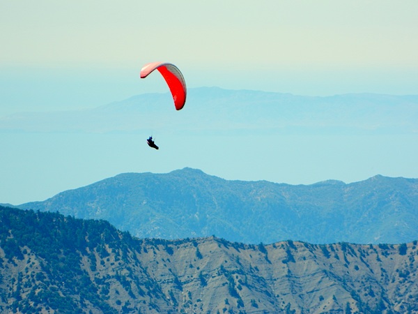
Paragliders and hang gliders launch from 'Pine Mountain' near Reyes Peak north of Ojai off Hwy 33. In the distance you can see the Channel Islands as the furthest range out. Los Padres National Forest & the Sespe Condor Wilderness is the backdrop for this quaint upscale village in the foothills. The coastal canyons are lined with orchards, flowers, homes and weekend spa retreats. Camping is abundant in the forest nearby, as well as hiking trails, mountain biking routes, dirt bike destinations, motorcycle roads and paragliding spots. The pleasant downtown street features many shops & restaurants. Highway 33's name comes from the year it was completed. Construction of the Maricopa Highway was finished in 1933.
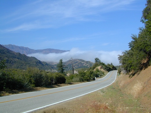
California SR 33 with Fog
ojai, California
 Country




recreation:

parks, forests, rivers & lakes:

ojai campgrounds
Wheeler Gorge Campground
Ojai Hwy 33 Camping
Holiday Group Camp
McGill Camp @ Mt. Pinos
McGrath State Beach
Emma Wood State Beach
Dennison Park
Camp Comfort

description:
Little Ojai has changed a lot in the last decade or so. More people, more traffic, more everything! Luckily it's easy to get away, as Hwy 33 leads to the gorgeous Los Padres National Forest. Cuyama Valley, Lockwood Valley & beyond.


local links:
Ojai Chamber of Commerce
206 N. Signal Street, Ojai, CA 93023
805-646-8126
https://www.ojaichamber.org/
Ojai Architects
Los Padres Forest Topo Atlas
Ojai Farmers Market
The Thacher School
Kayak Sespe Creek
The Ranch House Ojai
Farmer and the Cook
The MOB Shop
Ojai Winery List
Lake Casitas Fishing Map
Dick Smith Wilderness Map


Advertisement


Total Escape has been an AmazonAssociate for 20 years!
Earnings from purchases keeps this site alive.
Copyright © 1996-2026 Total Escape, totalescape.com / All Rights Reserved.
classic | lodge | recreation | destinations | journey | ads | sitemap | outside | maps | gear | mobile