Activities
| Camp | Camping
| Destinations | Mountains | CA National Forests
nf.stanislaus

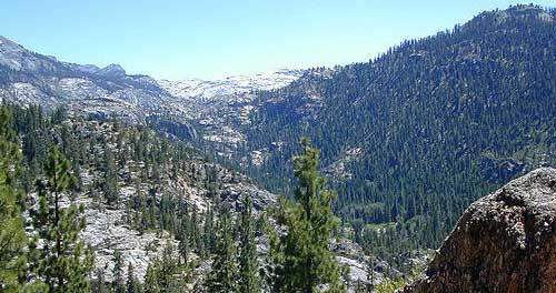
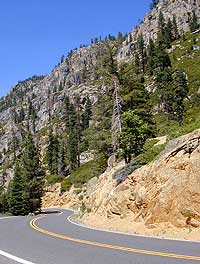 Hwy. 108, the Sonora Pass at 9624' elevation, is the second highest Sierra mountain pass (that's a paved road.). No wonder it's usually the first to close in Sept/Oct.due to early seasonal snow in the autumn months, but it is also usually the last to open, due to melting snow & falling rocks. (Large granite walls tend to do that.) Time is limited to warmer months for this spectacular drive, but worth every anticipated day.

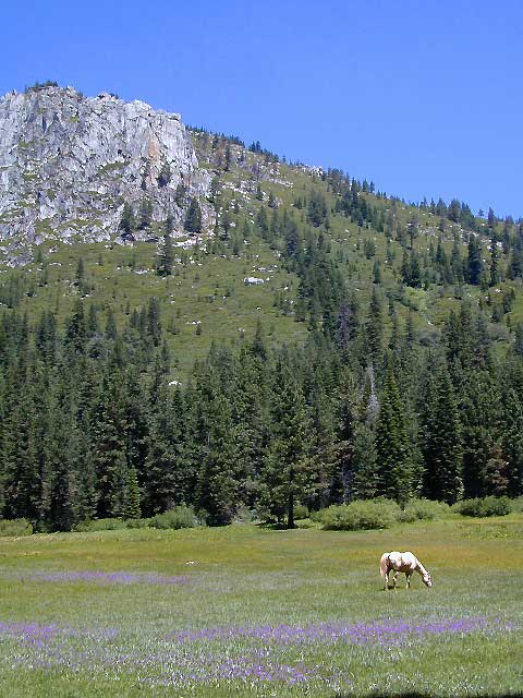
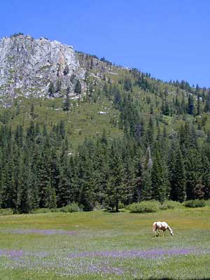
Carson Iceberg & Emigrant Wilderness lay on opposite sides of the highway. Backpackers really dig this region, as the terrain is extremely unique.

|

If your'e craving some mighty fine high Sierra scenery, but do not feel like dealing with the crowds at the nearby National Park, the Stanislaus National Forest is your best answer.
To the north, Hwy 4, Ebbetts Pass travels along the mountains into alpine views of lakes & granite.
 High elevation rural camping is a real favorite with hearty RVers in late summer. Always check the weather reports when traveling up in this area. Thunderstorms are frequent in summer, and winter storms can roll in earlier than expected. Be prepared to travel with snow chains for your tires in fall months. High elevation rural camping is a real favorite with hearty RVers in late summer. Always check the weather reports when traveling up in this area. Thunderstorms are frequent in summer, and winter storms can roll in earlier than expected. Be prepared to travel with snow chains for your tires in fall months.
|
|
Designated wilderness areas within the forest:
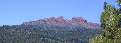
Volcanic activity remains in the Sierra Nevada.
|

Sonora Pass nearby towns:
|

 Backpacking Sonora Pass Backpacking Sonora Pass
Stanislaus Forest Headquarters
Sonora, CA
209-532-3671
|
Calaveras District
Hathaway Pines
209-795-1381
|
Groveland District
Groveland, CA
209-962-7825
|
Mi-Wok District
Mi-Wok Village, CA
209-586-3234
|
Summit District
Pinecrest, CA
209-965-3434
|
Stanislus National Forest
government web site
|
- fire permits are required
- backpacking info USDA
- permits are required for overnight backcountry camping
- check with the correct ranger district for all back country
camping restrictions
Trail head parking spots located at:
- Hermit Valley, elevation 7500' (Calaveras District)
[Grouse Creek, Mokelumne Wilderness hiking]
Arnold east on Hwy 4 for 29 mi. to Lake Alpine, go past the lake 10 mi. to the campground; open June - September
- County Line Trailheads & Wheats Meadow Trailheads, (Summit District)
off of Highway 108 & Clark Fork Road; Up behind Fence Creek Campground, take Forest Service Rd# 6N06
|
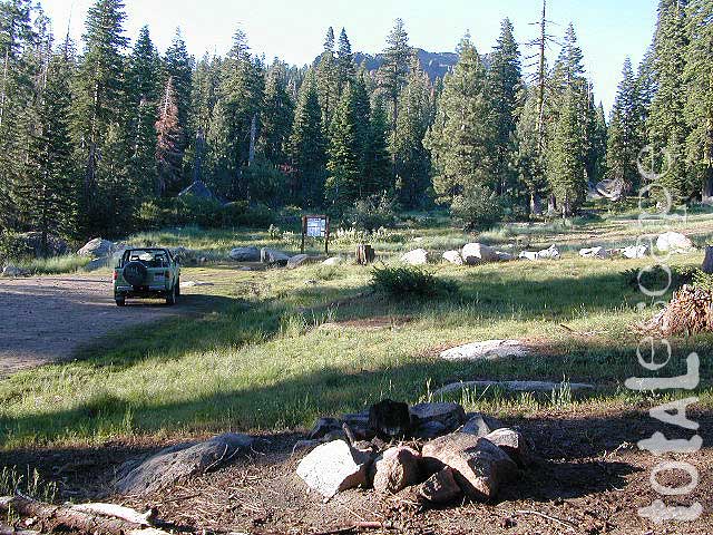
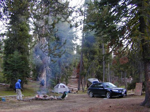
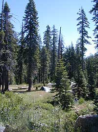
A view of one camp spot at the trailhead called "County Line", on the borders of Alpine & Tuolumne County California. A backpackers & hikers Trailhead for accessing the volcanic wonderlands of the Dardanelles & the Carson-Iceberg Wilderness. Decent cell phone coverage at this spot.
|
 Back Roads of Sonora Pass Back Roads of Sonora Pass
Fence Creek Road @ County Line Rd #6N06
Clark Fork, Stanislaus NF Rd #7N83
Spicer Meadow Road #7N01
Leavitt Lake Road w/ Waterfall E Sonora Pass
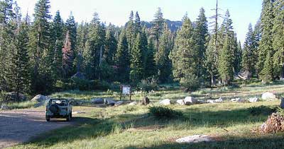
Stanislaus Camping:
Dispersed, Primitive Camping
Calaveras Ranger Distr. - Hwy. 4
more info: 209-795-1381
- Pacific Valley [on Pacific Creek]
- 7600' elevation, vault toilets
- Arnold CA, east on Hwy 4, 29 mi to Lake Alpine, go past the lake 8 mi. to the campground
- open July - September
- Hermit Valley [Grouse Creek, Mokelumne Wilderness, hiking]
- 7500' elevation, vault toilets
- Arnold east on Hwy.4 29 mi. to Lake Alpine, go past the lake 10.5 mi. to the campground.
- open June - September
-
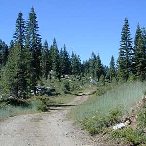
Hwy 108 & Clarks Fork - Up on the Hill
Forest Service Rd #6N06
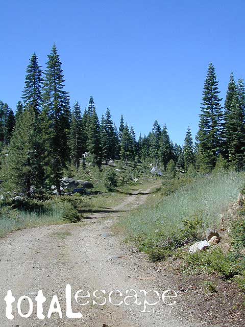
Up, way behind Fence Campground, the narrow dirt road winds it's way up to the backpackers trailheads of the Carson-Iceberg Wilderness & then dead ends at approx. 7 miles. Nice remote camp spots! Dispersed camping options are available along this route. RV's are not recommended on this washboard, curvy, winding road. The horse corral with nearby camping, is about 3-4 miles from Fence Campground. Trucks with trailers (horses, cattle or logging) frequent this road, so keep it slow. A smaller side road leads thru McCormic Meadow & Creek.
usually open May - October
Off-Roading 4x4 Camps
This Stanislaus region has 2 OHV Areas, which also have dispersed camping opportunities for the vehicle with 4-wheel drive. Find out more: Niagra Creek OHV & Crandall OHV
Hiking
Calaveras Ranger Distr. - Hwy. 4
more info: 209-795-1381
Stanislaus Forest offers 279 miles of hiking trails!
Most of these trails are at high elevation, above 6,000', and are accessible only during the summer and early fall months.
- Spicer Reservoir Area
- Lake Alpine Area
- Highway 4
- Highland Lakes Area
- Andresen Mine Trail
- Hamby Trail
- Indian Creek Trail
- Little Golden Forest Trail
- North Mountain Trail
- Preston Flat Trail
- Tuolumne River Canyon Trail
- Sugar Pine Rails
- Westside Railroad
- West Side Rails
- Beardsley Nature Trail (0.25 mile)
- Boulder Lake (4 miles)
- Burst Rock (1 mile)
- Camp Lake (3 miles)
- Catfish Lake (1 mile)
- Clark Fork Meadow (8 miles)
- Columns of the Giants (0.25 mile)
- Donnell Vista (0.25 mile)
- Eagle Creek (4 miles)
- Pinecrest Lake Loop (4 miles)
- Relief Reservoir (3 miles)
- Shadow of the Me-Wuk (0.25 mile)
- The Great Highway 108 Motorcar Tour
- Trail of the Ancient Dwarfs (0.5 mile)
- Trail of the Gargoyles (1.5 miles)
- Trail of the Survivors (0.25 mile)
- Eagle Creek
- Pinecrest Lake Loop
- Relief Reservoir
- Shadow of the Me-Wuk
- The Great Highway 108 Motorcar Tour
- Trail of the Ancient Dwarfs
- Trail of the Gargoyles
- Trail of the Survivors
|
|

|
Total Escape California Camping
Advertisement
|
|