
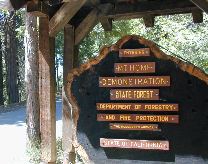
Mountain Home State Forest
Mountain Home Sequoias
2022 – THIS FOREST may be CLOSED,
due to the Castle Fire 2020
North of the Giant Sequoia , above the Western Divide Highway (CA 190) sits a little known Sequoia Park called Mountain Home. This lush forested area separates the Sequoia National Park (to the north) from the Giant Sequoia National Monument (to the south).
Mountain Home is just up the mountain from the West Sierra river town of Springville, CA

Western Sierra Nevada
In part of the vast Sequoia National Forest, lies a hidden gem of State Forest land worth visiting. Waterfalls, the Tule River, fishing ponds, campgrounds and easy access to Golden Trout Wilderness trails.
MHDSF
The official name of this forest: Mountain Home Demonstration State Forest is quite a mouth full, so most just call it “Mountain Home”. In short MHDSF is managed by Cal-Fire and the California State Park system.
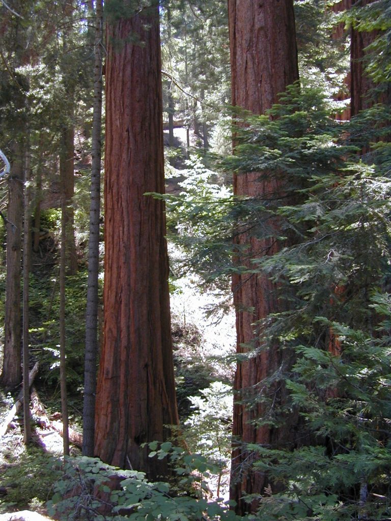
the Largest old growth Sequoias in the state!
Numerous awesome Campgrounds can be found near the Sequoia groves, the Tule River, hiking trailheads, fishing, waterfalls. Balch Park is the County Park, listed below.
-
- Sequoia Backpacking
- Sequoia Backroads
- Sequoia Campgrounds
- Sequoia Groves
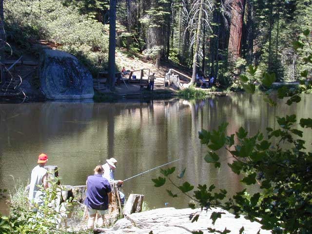
- Fishing Pond
- Hiking Trails
- Horseback Trails
- Mountain Biking
- Tule River
- Waterfalls
- Wilderness
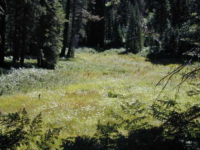
- Wildflowers
Balch Park Sequoia
located within the Mountain Home State Forest is a popular destination for the locals and families. Balch Park Campground is paved and RV accessible. 71 campsites, on first come basis.
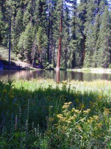
Meadows, mountain peaks, streams, waterfalls, huge granite rocks & cliffs are all over. Plus some secluded groves of Giant Sequoia trees. Mosquitos can be annoying in these parts, so bring the chemical warfare and the screen room tent.
Roads Open: May – October
Forest mountain roads close annually, due to winter snow
Area activities include:
Backpacking
Back Road Exploration
Campground Camping
Fishing
Hiking
Horseback Riding
Meadows
Mountain Biking
Picnic
Sequoia Groves
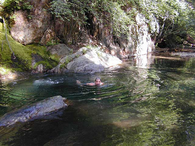
Swimming Holes
Tule River (North Fork)
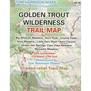
Golden Trout Wilderness
USDA Forest Service Map is highly advised for this area. There are many dirt roads & numerous trails. Minimal cell phone signal inside these dense forests and large granite river canyons. GPS even has trouble getting connected, due to the immense canopy of trees.
Mountain Home Backpacking
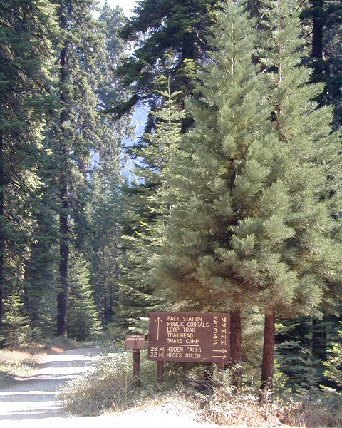
 Shake Camp – Best hiking trail access to Golden Trout Wilderness
In the backcountry, tent camping is allowed any place on soil 100 feet from trail or water. No camping on meadows. Ground fires are very allowed with fire permit. Use existing camp site when available. Check with the correct ranger district for all back country camping rules. Wilderness permits are needed for backpackers and horse packers staying overnight in the wilderness area.
Local Ranger Stations:
Sequoia USFS Headquarters
Porterville, CA
559-784-1500
Tule River Ranger District
Springville, CA
559-539-2607
Mountain Home Backroads
Dirt back roads are so narrow they cannot accommodate the large motorhome or RV traveler. Trucks pulling horse trailers are common, with very few options for a pull-out to pass.
This forested area is filled with old logging roads that lead to lush Sequoia groves & meadows. The whole network of forest roads back here either – loop back to each other, or deal end, often at a trailhead parking area. No roads connect through to any other portion of the Sierra range. Golden Trout Wilderness is a road-less area of the Southern Sierra Nevada.
Signs Not Reflective
The old skool, painted, wooden road signs do not READ well at night, so avoid arriving in the dark.
When it’s dark outside, it is best to STOP: Shut off the vehicle, get out and take a stretch break, find the north star; Get your bearing straight, look at the real map with a flashlight – before driving miles to an unknown destination, just to turn around.
Be very aware of the Forest Service signage, use your trip meter for clocking mileage. Have a good map on hand. See MAP ABOVE. It is very easy to get lost in this forest and you may end up driving for hours, maybe in circles. I swear this intersection looks familiar.
Mountain Home Campgrounds

Balch and Frazier are the two larger, developed campgrounds; all others are smaller camps w/ primitive facilities.
NOTE: all the Campgrounds in this forest now charge an overnight fee for camping. (Decades ago they were free, but not anymore.)
Balch Park Campground
Frazier Mill Campground
Hedrick Pond Camp
Hidden Falls Campground
Moses Gulch Campground
Shake Camp
| campground | elev. | spots | toilet | water | nearby | comments |
| Moses Gulch | 5500′ | 10 | pit | river | Tule River | no trailers |
| Hidden Falls | 6150′ | 8 | pit | river | Tule River | no trailers |
| Shake Camp | 6490′ | 11 | pit | piped | Golden Trout Wilderness |
backpack & horse trailhead |
| Hedrick Pond | 6200′ | 14 | vault | piped | fishing pond | RV ok; no hookups |
| Frazier Mill | 6150′ | 46 | pit | piped | Sequoia Grove | RV ok; no hookups |
| Balch Park | 6000′ | 71 | flush | piped | fishing pond | Tulare County Park |
Frasier Mill Campground is spelled w/ a Z (like Frazier)on many printed maps and inside some camping books, but the proper spelling (on a sign at the campground) is actually Frasier w/ an S. This camp is located at the site of an old lumber mill. Meadows, trailheads, picnic areas, parking.
Decent signage leads to smaller, secluded campgrounds and hiking trail heads. Dirt road driving will be required. See BACKROADS (above heading) for tips on back road driving and night time arrivals.
Plenty of trails for horses back in these parts, most of them lead to Golden Trout Wilderness. Watch out for oncoming vehicles with horse trailers!
No primitive camping outside of developed campgrounds. Due to fire dangers around these majestic Sequoia trees. You must camp within the designated campground, or HOOF IT into the the wilderness for backpacking.
Mountain Home Hiking
Numerous trails around each campground area will lead to the waters edge @ Tule River; into the Golden Trout Wilderness (for longer day hikes), along creeks w/ wildflowers, near lush meadows or through Giant Sequoia Groves.
Deer Ridge & Bogus Meadow Hike
Mountain Home Biking
Bikes are limited to existing paved and dirt roads; NO SINGLE TRACK trails for mountain bikers – due to the fragile, shallow roots of Sequoia groves, and the direct access to Wilderness. NO bikes in the Golden Trout Wild!
Nearby towns:
Camp Nelson, CA
Ponderosa, CA
Porterville, CA
Springville, CA