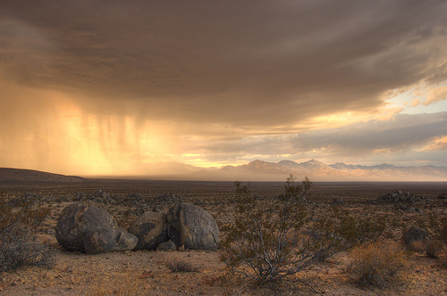
Nice and moody, Mojave storm capture by SandMan @ Flickr.

 by county
coastal
deserts
urban
mountains
countryside
snow towns
parks & forests
cali maps
by county
coastal
deserts
urban
mountains
countryside
snow towns
parks & forests
cali maps
ridgecrest, California
![]() Desert
Desert
![]()
recreation:
parks, forests, rivers & lakes:
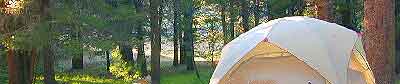
ridgecrest campgrounds
Spangler Hills OHV Camping
North Mojave BLM Camping
Lone Pine Campground
Whitney Portal Camping
Troy Meadow Campground
Kennedy Meadows Campground
Chimney Creek Campground BLM
Long Valley Campground BLM
BLM Office Ridgecrest
Ricardo Campground Redrock SP
Cottonwood Campground
description:
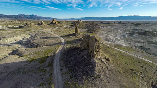
High desert region with views of the majestic Southern Sierras. It's not about the city of Ridgecrest, where you can get a new tire or oil change when needed, but all the great landscape that is located around it. Within an hours drive you can be in pine filled mountains of the Sierra Nevada, high sierra sage meadows, examine joshua trees up close, find an old mine & explore desert back roads everywhere. Or you can head into the lunar-scapes of Panamint Valley, Trona Pinnacles or even the depths of Death Valley National Park.
Ridgecrest Chamber of Commerce
128 E. California Ave, Ridgecrest, CA 93555
760-375-8331
https://www.ridgecrestchamber.com/
City of Ridgecrest CA
Inyokern Airport
Desert Indian Museum
Recycling Center
Pita Fresh
Cocina Caliente
Advertisement


Total Escape has been an AmazonAssociate for 20 years!
Earnings from purchases keeps this site alive.
Copyright © 1996-2024 Total Escape, totalescape.com / All Rights Reserved.
classic | lodge | recreation | destinations | journey | ads | sitemap | outside | maps | gear | mobile