

Mt Whitney Trail / Mount Whitney Map
 When the snow melts in the High Sierra, the rush is on! This is one of the most popular backpacking trips in the Eastern Sierra, as Mt Whitney is the highest peak (14505′ elevation) in the contiguous United States of America.
Day hikes to the summit should only be attempted if you are in excellent physical shape & used to high altitude hiking. There are so many folks trying to hike this sought-after peak in the warmer summer months (MAY-OCT) that the National Forest has put tight restrictions on these Mount Whitney trails. You must obtain a Wilderness hiking permit for this hike & that requires waiting in a long line of outdoor enthusiasts that also seek this prime destination.
The Lone Pine Ranger station holds an annual Whitney trail LOTTERY, where you must apply a year in advance & be granted a permit before you can set foot on this popular hiking route.
An alternate backpacking route to Mt Whitney is the southern ridge line from the Cottonwood Lakes trailhead, but you still must verify with local authorities for permits & Wilderness passes.
The Alabama Hills, between US Hwy 395 @ Lone Pine CA and the Whitney Portal offers camping and mountain biking trails with excellent views of Mount Whitney from below. A short drive up to the portal & you can stand in the waterfall mist & then do a day hike up to Lone Pine Lake.
Now that we have you salivating for this epic adventure, you can start your dreaming & real planning by ordering hiking topo maps of the region. Then after you have thoroughly reviewed the maps, the terrain (as well as your own physical condition), you can contact the Inyo National Forest / Lone Pine ranger office for more specifics on dates & details. This may take years of planning to make it happen.
- MOUNT WHITNEY High Country TRAIL MAP
- MOUNT WHITNEY ZONE MAP
- NatGeo Map for Mt Whitney
- Inyo National Forest Map
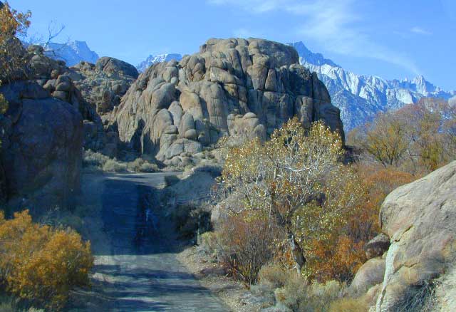
The Alabama Hills sit at the base of Mt Whitney, California
