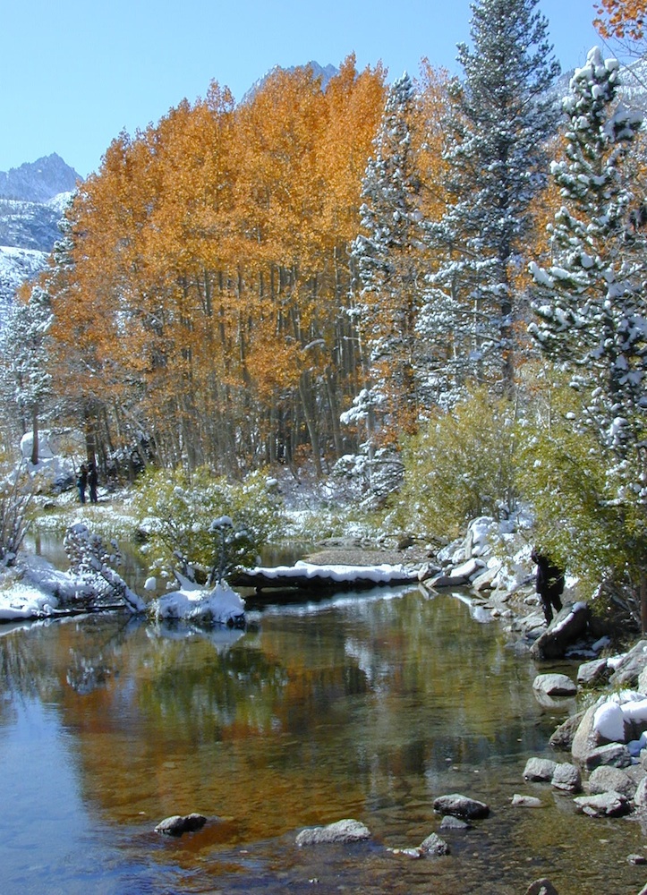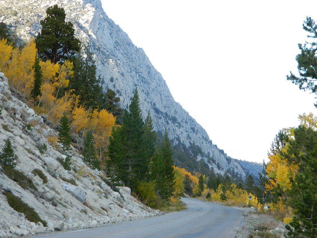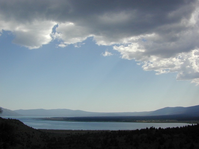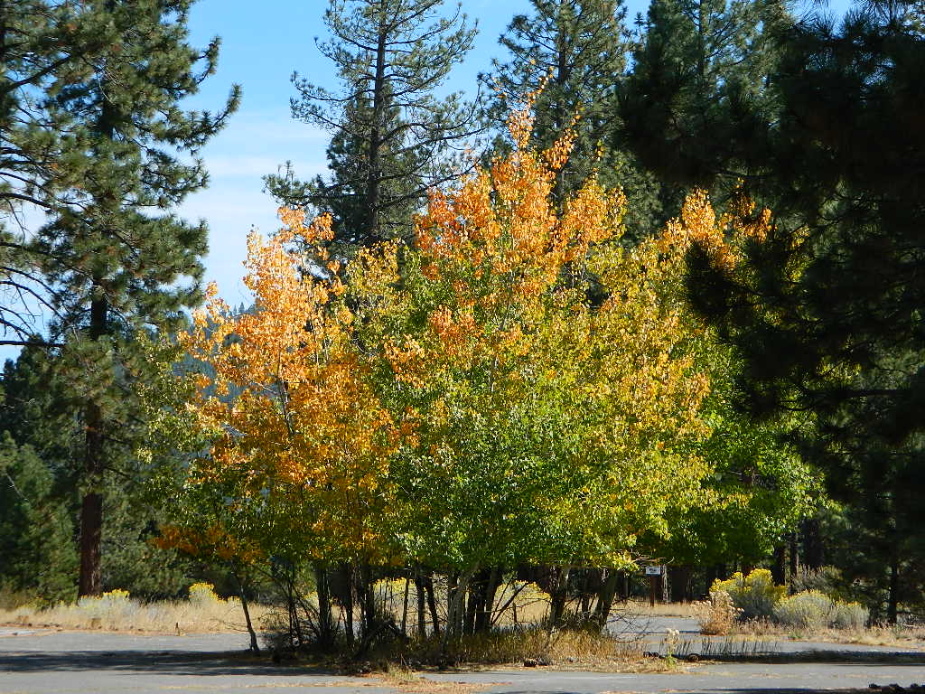
Tag Archives: Eastern Sierra

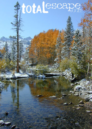
Rock Creek California

rockycreek

Rock Creek, CA
California Rock Creeks

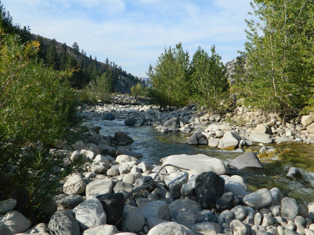
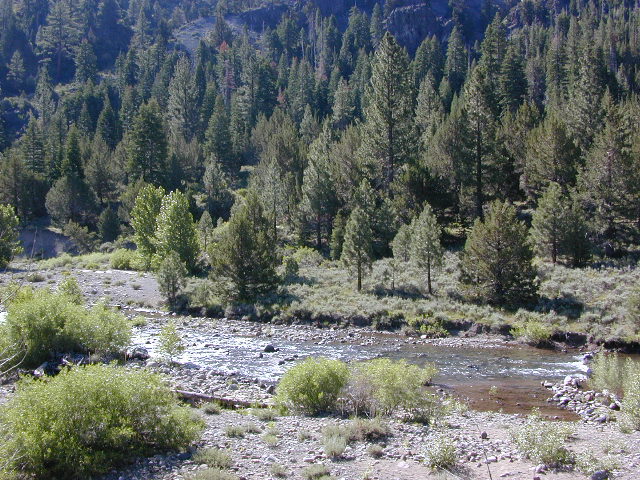
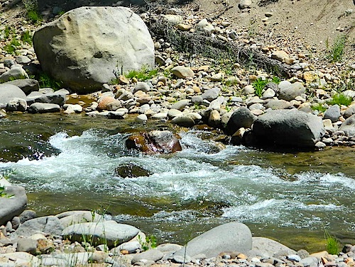
Due the nature of gravity, erosion and heavy rocks, creek beds tend to be rocky ravines near mountains – which collect rocks as they slide downhill. Creeks work as water drainage off the mountains. Inside California we have plenty of mountain ranges and plenty of movement, as the Pacific plate plows into North America, tectonically speaking.

How many Rock Creeks are inside the golden state of California? Heck, I dunno. Let’s try to find them all.
winterlodge

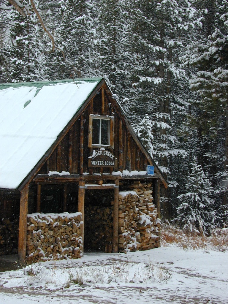
Probably the best known, is the one near Mammoth Lakes, CA

Eastern Sierra
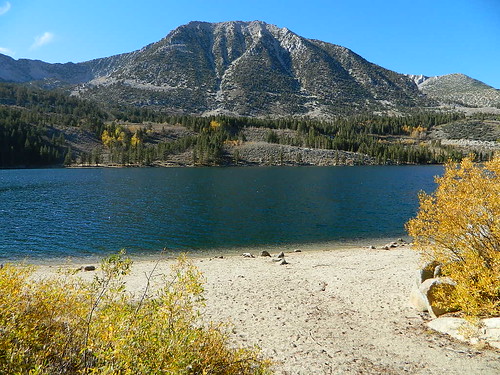
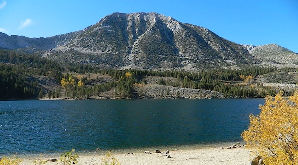
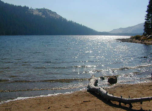
Small Beach at Rock Creek Lake

Rock Creek @ Mammoth

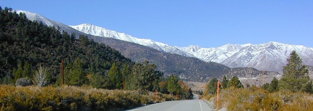
Rock Creek Road, Eastern Sierra
Inyo National Forest
Road #4S12
ROCK CREEK LAKE
NFS CAMPGROUND (9600′ elev w/ 66 sites)
GROUP CAMPGROUND (reservations required)
RESORTS
CABIN RENTALS
Road #6S05
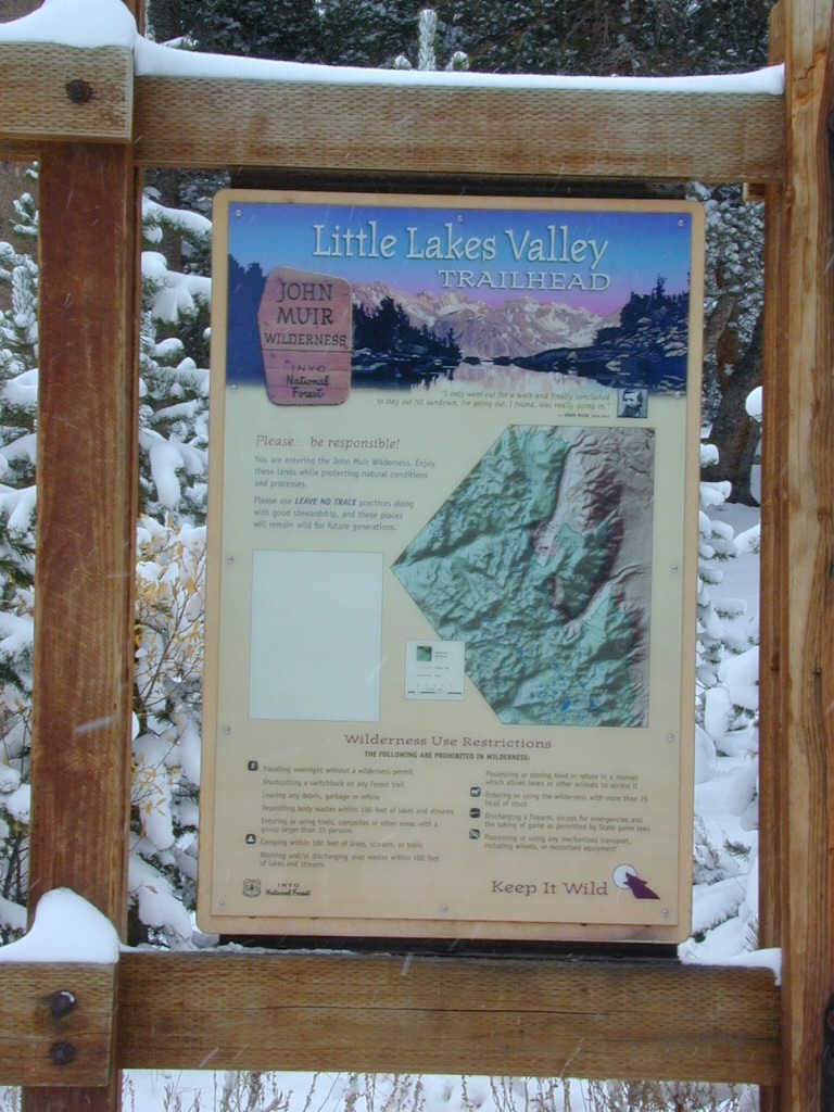
WILDERNESS TRAILHEADS – Mosquito Flat, Little Lakes Valley Trailhead, Mono Pass, Morgan Pass, John Muir Trail (JMT), Pacific Crest Trail (PCT)

US395

US 395 @ Rock Creek exit is Toms Place, CA
rockcreeklakeresort

fallflames
Eastern Sierra Rock Creek Rd
ruggedwalls
Rock Creek Canyon, Eastern Sierra

driftwood

Northern Sierra

camp

Plumas National Forest – west of QUINCY, CA
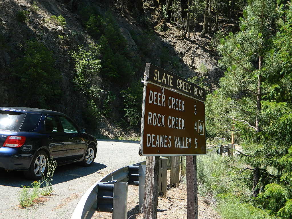
Dirt road campground

NFS Rock Creek Campground @ Plumas, located on a dirt road #24N28, off of paved Bucks Lake Road

NFSlogo

DIRT ROADS
MEADOW
CREEK

nearby WILDFIRE BURN SCAR

hiker

Feather River Canyon

Rock Creek, Highway 70
North fork Feather River

Large feeder creek from the north side of highway (California SR 70), in Plumas National Forest. Located in the popular railroad canyon known as the Feather River Canyon. Right here Rock Creek even has a reservoir.

Sugar Loaf Mountain elev 3553′ with Tobin Ridge line each side of Rock Creek as it descends the mountain tops. The junction where the creek meets the big river is just south of Bucks Creek Power Station @ STORRIE, CA. The overall location is half way in between OROVILLE, CA and QUINCY, CA

driftwood

Western Sierra

Off Road Gold Country, Sierra foothills

Rock Creek, Western Sierra4x4

Eldorado National Forest
HIKING & HORSEBACK
OHV TRAILS
4×4 CAMPS
Georgetown, CA
RUBICON TRAIL @ LOON LAKE
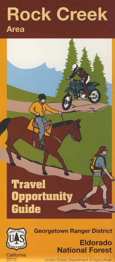
RockCreekOHV


driftwood

Southern Sierra

How can we forget creek camping & trail access south of Shaver?
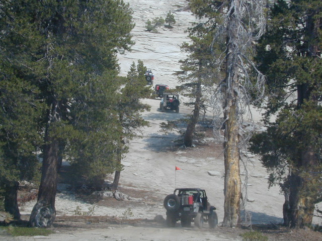
bald mtn
Jeepers on granite @ Bald Mountain, above Shaver Lake, CA

Shaver Lake, Sierra National Forest

Rock Creek Road, Southern Sierra
Dinkey Creek Area
Sierra National Forest
PRIMITIVE, DISPERSED CAMPING
4×4 TRAILS
BALD MOUNTAIN elev 7832′
DINKEY DOME elev 7697′
DUSY IRSHIM TRAIL
Shaver Lake, CA

driftwood

But wait, we have more California Campgrounds named Rock Creek
camp

Mammoth Reservoir
Mammoth Pool Reservoir

Rock Creek Campground – Mammoth Pool Reservoir, south of Yosemite National Park, behind Bass Lake, CA Sierra National Forest (18 camp sites)

Rock Creek Campground – US Hwy 101 NorCal Redwood forests, north of Leggett, CA. Camp located on the Eel River, in the Standish Hickey State Recreation Area. (36 camp sites)

Also the is a small ROCK LAKE located inside Lakes Basin Recreation Area, northern Gold Country @ Yuba River headwaters. Hike-in access only.
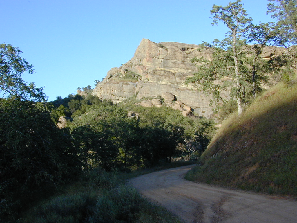
Rock Front OHV

Similarly named ROCK FRONT RANCH is 4×4 trails & 4WD camping area. Cool wind caves, super steep driving terrain (Granny low anyone?) and of course, wildflowers.

Los Padres National Forest 

Off Highway 166, east of the city of Santa Maria & US 101 – on the Central Coast of California. Way back there, at the edge of the forest, behind the wineries!


Rock Front Los Padres
Rock Front Ranch in Los Padres NF

dirtbikes


Eastern Sierra Lakes

Camping Lakes – Campground Lakes
Lake Eastern Sierra California

There is not enough room on this web site to list every single alpine lake in the majestic Eastern Sierra range, since there are hundreds, but we highlight a few of the hike-in accessible ones & the more popular camping lakes below.

DSCN0100

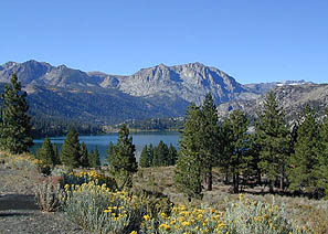
June Lake Loop is a paved, scenic drive highway that has multiple lakes with cabin rentals, camping, fishing, boat rentals. One of the best places to spend autumn looking for fall colors among the aspens.

DanaMite also knows a picture is worth 1000 words, so just click links for photos & enjoy!!!

convict lake Eastern SierraLone Pine Lakes include –

  • Diaz Lake (on US Hwy 395)
  • Cottonwood Lakes camping (hike in)
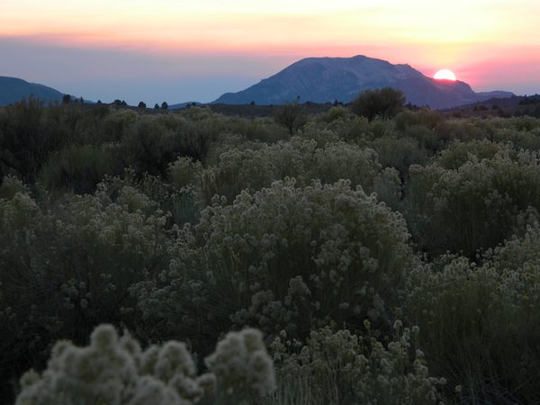
  • Lone Pine Lake (hike in)
Onion Valley camping
@ Independence, CA
Kearsarge Lakes include –

(all are hike-in lakes)


mountains

Bishop Lakes include – (Hwy 168)

ROCK CREEK CANYON
US 395

Paved road dead ends at over 9000′ elevation
Wilderness Access w/ Trailheads & Parking
NFS Campgrounds
Remote Cabin Resorts

hiker

LAKE CROWLEY CA

CONVICT LAKE CA

Mammoth Lakes include – (Hwy 203)

Walker Lake @ June Lake Loop
Walker Lake @ June Lake CA

June Lake Loop includes – (Hwy 158)

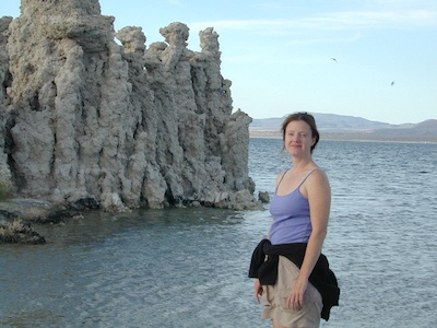
MONO LAKE CA

US 395 @ LEE VINING, CA
Yosemite NP [EAST ENTRANCE]
Tioga Pass Lakes include –
(Hwy 120)

califrepublic

LUNDY LAKE CA

Bridgeport, CA

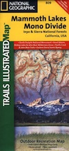
NatGeo Mammoth MapEastern Sierra topographic trail maps to lakes

Mono Maloy

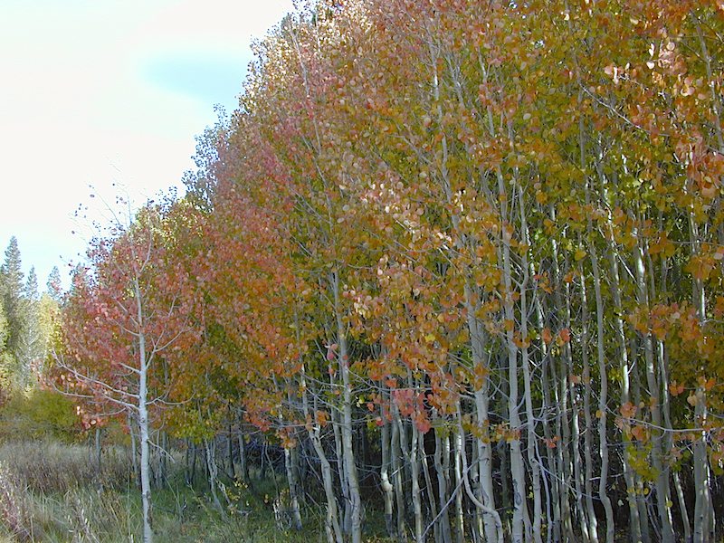
California Aspens

AspenGroves

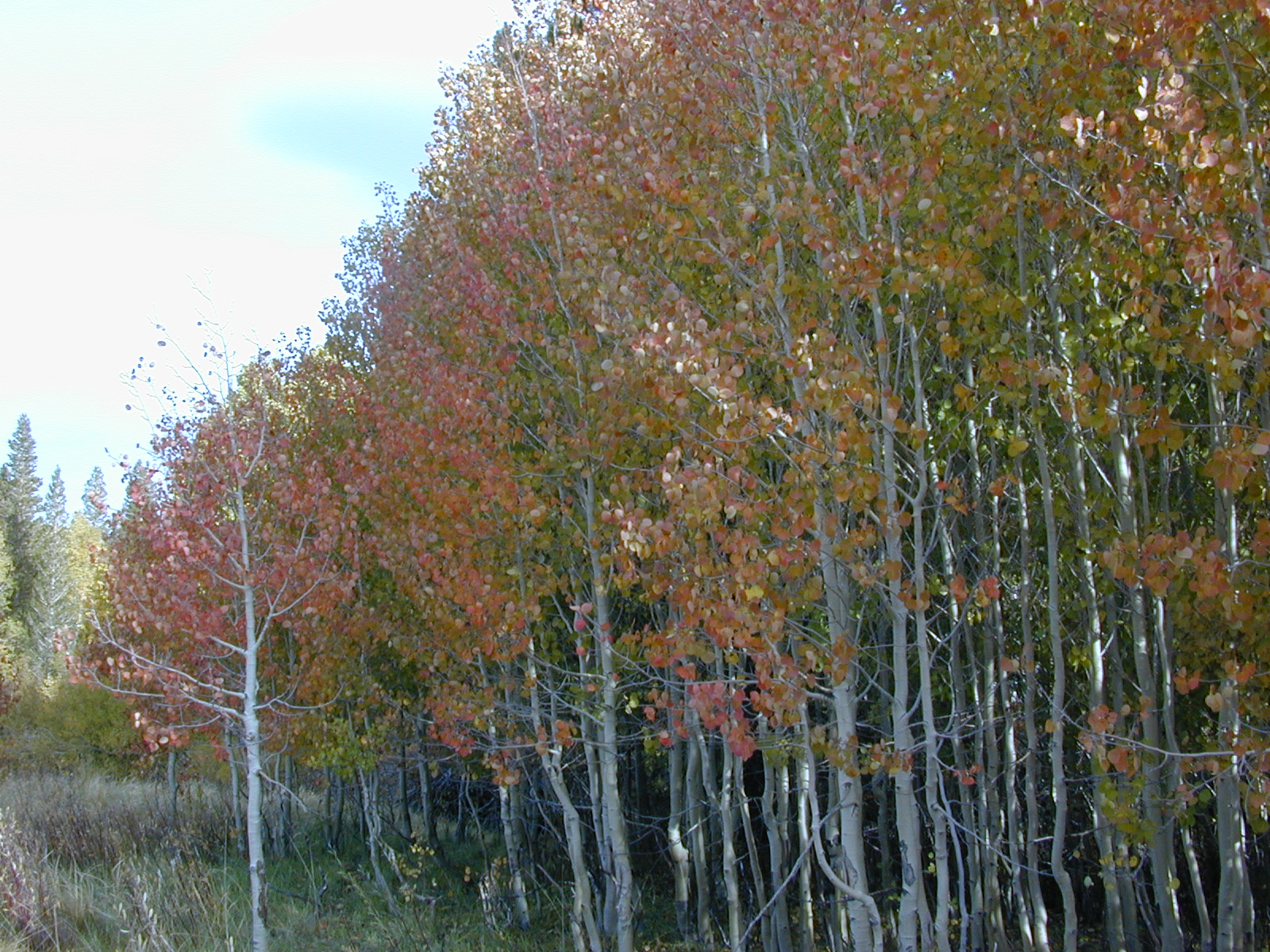
Aspen Groves are easy to recognize with their thick stands. White trunks with dark knots, slender, with oval shaped leaves. Growing in a network of roots, which are found lining creeks, alpine lakes, or spilling out from higher elevations, along  scenic canyons.

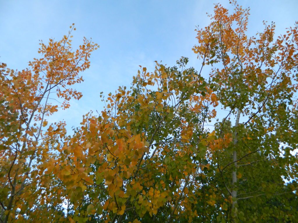
The unique round leaves which can turn spectacular colors in the fall season. The fluttering and flapping of the oval-shaped, thick, green leaf is a sure sign of summer. When breezes get cooler, Autumn is only a few weeks away and as quick as the cold comes in, what a short and special show they put on.

autumncabin
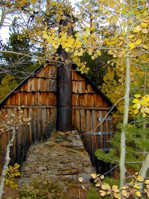
Green Creek historic cabin, on the Eastern Sierra

California Fall Colors

Aspen trees can be found at higher mountain elevations in California, usually above 4000′ – all the way up to about 10,000′ or higher, depending on the mountain range and local water flows. Groves have an extensive root systems underground, so they often withstand wildfires and can come back after the rest of the forest is gone.

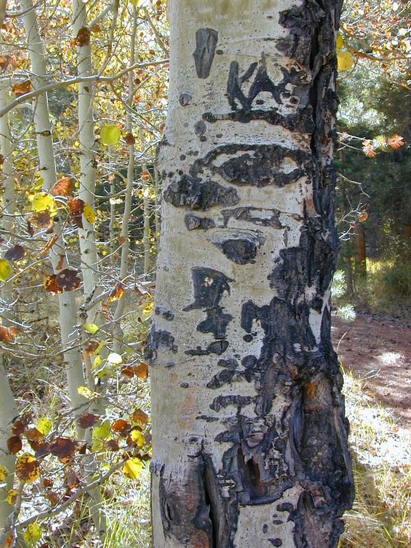
Beavers build dams in creeks around aspen trees, fishermen and campers love to camp next to aspens, and lovers carve their initials into their white bark. These trees do indeed take a beating, from all angles, winter weather included… so stop from cutting them!

carvings

fishing creeks mountain biking stargaze Picnic Camp Hiking horseback back roads mountains

  • BIKE
  • CAMP
  • FISH
  • HIKE
  • KAYAK
  • PICNIC

summer and autumn

These deciduous trees are naked half the year, typically from November to April, as winter buries them in snow and ice. Time is of the essence, limited to Summer and Autumn – to enjoy their shade and the beauty of the groves. Scenic meadows and fishing creeks are just an added bonus for searching out the aspen.

Aspens can be found in hidden canyons, primarily along the Eastern Sierra US Hwy 395 and surrounding mountain lakes. Some Sierra Passes have decent displays of color as well – like Carson Pass Hwy 88 and Yosemite’s Tioga Pass Hwy 120.

Below is a list of Total Escape’s favorite aspen areas of California

ASPENDELL
BAKER CREEK (4×4)
BIG PINE CANYON – NORTH FORK TRAIL

BISHOP CREEK
BLUE LAKES, CARSON PASS
BLUE LAKE, MODOC

CONVICT LAKE, US 395
COTTONWOOD CREEK @ ANCIENT BRISTLECONES
COYOTE FLAT (4×4)

CROCKER @ LAKE DAVIS
CROWLEY LAKE, US 395

DUNDERBERG MEADOW

EAGLE LAKE @
ASPEN GROVE CAMPGROUND

GREEN CREEK ROAD, US 395
HASKINS VALLEY @ BUCKS LAKE
HILTON CREEK, US 395
HOPE VALLEY
JUNE LAKE LOOP

LAKE SABRINA
LAKE TAHOE
LAUREL LAKES ROAD, US 395
LEE VINING CANYON
LUNDY LAKE, US 395

MAMMOTH LAKES, US 395

MCCLOUD CREEK @ ALGOMA
MCGEE CREEK, US 395

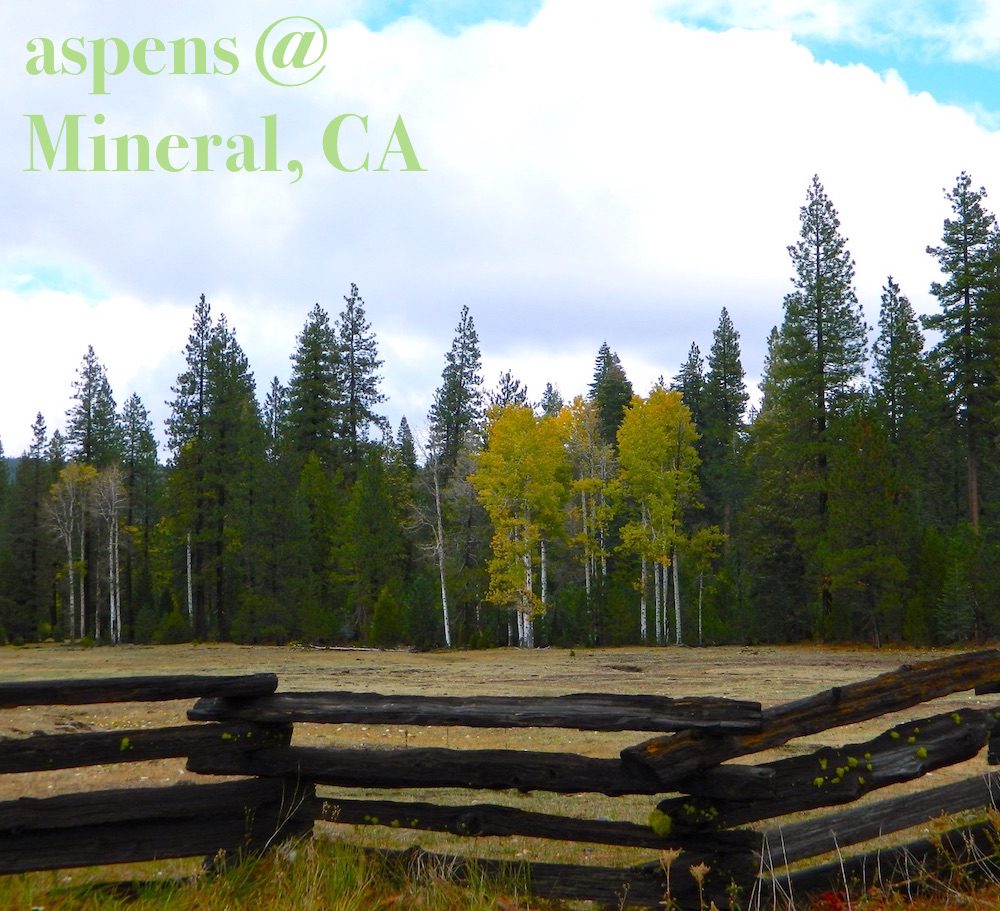
MILL CREEK to MINERAL, CA
HWY 172 LOOP aspensofmineral1000

MODOC NF @ BLUE LAKE
NORTH LAKE, ASPENDELL @ BISHOP

ONION VALLEY @ INDEPENDENCE
PARKER LAKE RD @ JUNE LAKE LOOP
PINE CREEK ROAD, BISHOP

PLUMAS-EUREKA STATE PARK
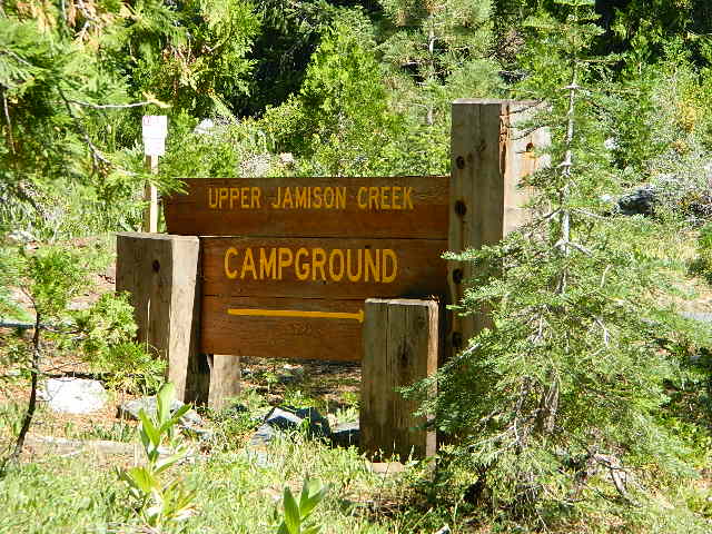
@ UPPER JAMISON CREEK CAMPGROUND

PLUMAS EUREKA

QUAKING ASPEN CAMP, GIANT SEQUOIA

RED’S MEADOW, MAMMOTH
ROCK CREEK ROAD @ US HWY 395

ROSS CAMPGROUND, PLUMAS NF

SPALDING, CA @ EAGLE LAKE

TOM’S PLACE, US 395
TWIN LAKES @ BRIDGEPORT
VIRGINIA LAKES, US 395

WISHON RESERVOIR

aspentips
Aspen Tips @ Eagle Lake California


aspenwall
Green Creek Camping

Autumn Camping in California


amigoaspens
Laurel Lake Road @ 9000′ – Eastern Sierra, California


aspensplit

Hill Top Hot Springs

Hilltop Hot Springs

hill top hot springs

High Desert: Hill Top
primitive hot springs

May also be known as Pulky’s Pool in hot springs books.

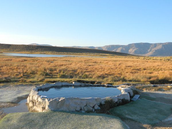
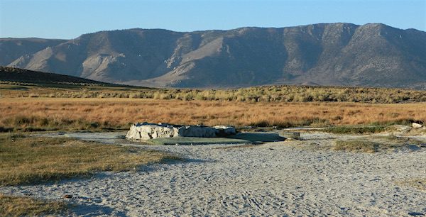
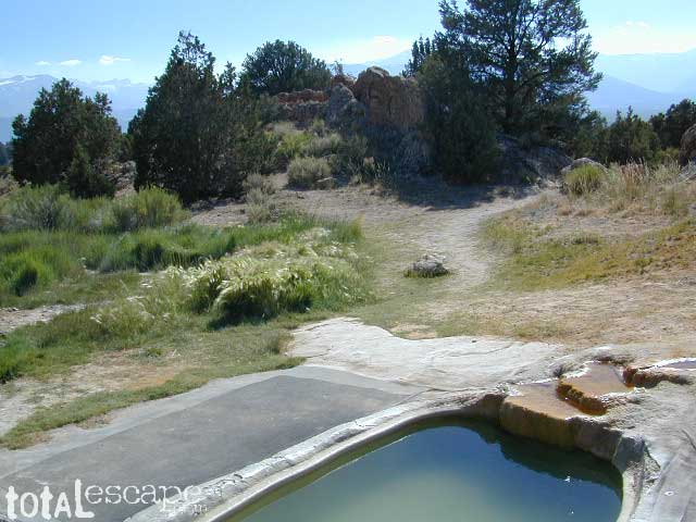
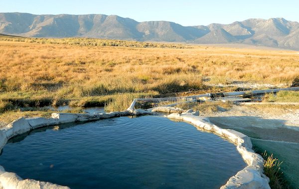
Hilltop is a new found favorite and one of the more scenic spots for a soaking tub in this region. Sitting out in the middle of a clearing, surrounded by marsh lands, this remote hot springs is a hike-in destination. No paved road, nor paved trail. The mountain and sky views from this tub are splendid, and if you time it perfect, you may have the place to yourself.

open all year
elevation:
6,900′

Located in the Long Valley Caldera, this area is managed by Bureau of Land Management

North of Bishop, CA
South of Mammoth Lakes, CA

marsh walk

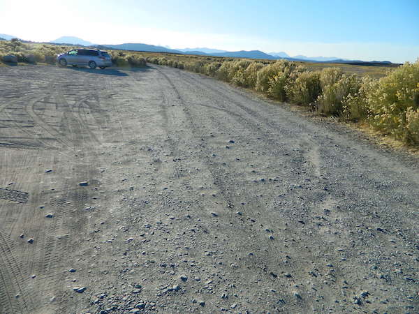
From US Highway 395 @  Benton Crossing Road – drive approximately 3 miles (passing dirt road Whitmore Tubs). Once you’ve crested a small hill, look for a gated dirt road on left, which leads a short ways, back through the sagebrush, to the parking area.

GPS coordinates: 37.6455, -118.8001 

The dirt parking lot is adequate enough to handle a dozen vehicles, and this place is so well known, that it gets a fair amount of traffic at any time of year.

Rumor has it that Hilltop is one of the most visited hot springs near Mammoth Mountain; probably due to the proximity to the paved road. Cars and trucks, camper vans and RVs will be coming and going at all hours of the day and night. So consider yourself warned!

high desert lot

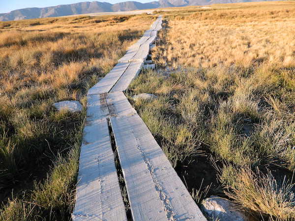
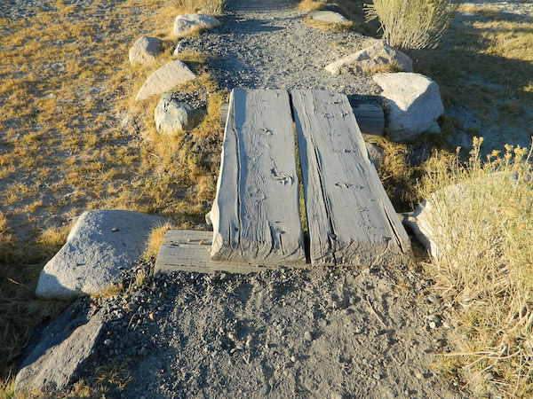
Gate and fence separate the parking from the trail, which leads a quarter mile (often over wooden plank boards) through alkali fields – out to the cement tub.

Only one, small makeshift bench next to the pool – and no tables, no seating, no facilities; Bring tarps, towels, ice chest and camp chairs (if you plan to stay a while).

empty hot pool

Plastic PVC pipes and control valve adjust water flow and temperature. If the valve is left ON (wide open) overnight, the small tub will be too hot to soak in the following morning.
camp

Camping options are pretty limited here. A small clearing for a tent, next to the parking lot; and one decent parking spot, large and private enough to call a camp site (at the dead end, past the parking).

The Eastern Sierra corridor of US Hwy 395 is far enough away that it cannot be heard from this spot.

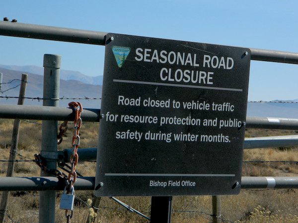
BLM gate at the paved road entrance reads: road is closed seasonally – assuming you can walk in during snowy winter months.

seasonal gate

Hilltop is one of several primitive hot springs in this immediate region. See Mammoth Hot Springs for more choices.

wildfire smoke 2020
Wildfire smoke in 2020 Creek Fire


Mammoth Hot Springs

secluded tub

Hot Springs near Mammoth

Eastern Sierra Destination:
June Lake and Mammoth Lakes, CA

The Eastern Sierra Nevada mountains run the length of US Highway 395, through most of the eastern side of California. Mammoth mountain is a volcano, so naturally hot springs come with the package. These hot tub destinations listed here are mostly part of the Long Valley Caldera, an ancient volcanic table land. North of Bishop and near the snow ski destination towns of June Lake and Mammoth, California in Mono County, California.

Hot Springs Dirt Road

(This region is not to be confused with Mammoth Hot Springs in Yellowstone National Park, nor the Mammoth Site in Hot Springs, South Dakota.)
Backroads Camping is allowed throughout Inyo National Forest, but there is private ranch lands mixed in w/ public lands. Respect property boundaries, and speed limits around gates and intersections.

Camp sites are not located next to the soaking tubs. A few may be within walking distance. Parking is often limited at these remote, public use hot pools. Total Escape TIP: Behind Lake Crowley: abundant, free camping – wide graded dirt roads (RV and passenger car suitable). Inyo National Forest Map is recommended.

Eastside of Highway 395

Casa Diablo Hot Springs near the Mammoth exit, is a location noted on most maps, but this seems to be the geothermal power plant for the region. If you are looking for hot springs tubs to soak in, you’ll need to get off the main drag for those beauties, way off the highway.

On to dirt roads

Hot Creek

Inyo Forest Road #3S45
Hot Creek Hatchery Road

(near Mammoth Airport)
Minimal dirt road driving. A very popular spot where hot springs are located within the big creek, so you can feel cold and hot water flowing by you. Scalding can occur near vents underwater, so use caution when wading. Large parking lot overlooks the soaking area and creek canyon. Swimsuits required.

Hot Creek Hot Springs: Hot Creek Geological Site

sierraminipano

Benton Crossing Road
leads east, around Lake Crowley, to the small town and camping resort and inn of Benton Hot Springs

Inyo Forest Road #2S84
Benton Crossing Road

This rural intersection at US Hwy 395 is known for the little green church on the corner. Turn east off the highway on to this road > BENTON CROSSING.

Pull over, get out and stretch. Look at your maps, get the GPS out and then start your exploring. First timers might be able to find a soaking tub within half an hour, if you don’t get lost. Or get stuck in a muddy spot, which is easy to do at night.

Hill Top Hot Springs
Latitude: 37.6642
Longitude: 118.7883
Elevation: 6873′
also known as – “Hilltop, Pulky’s Pool”

Willy’s Hot Spring
Latitude: 37.6591
Longitude: 118.8425
also known as – “Wild Willie’s, Crowley Springs”

trail to springs

Inyo Forest Road #2S07

Whitmore Tubs Road
a major graded dirt road that leads north off of the paved road, becomes Owens River Road and connects back to US 395 many miles to the north.

Several primitive hot tubs can be found on dirt roads in this region, which lead off the main paved road. At night these remote pools can be hard to find – with no signage, no street lights and pitch black darkness. Plus the mud bogs and grassy fields all around make the landscape difficult to navigate. If you plan a nighttime arrival, then plan to drive in slowly around the pools, have your GPS handy and look for steam in the air. Cut your headlights if you see other cars or people, and proceed slowly.

Be considerate of others and friendly. Do not litter. Do not crank up music. Wait for others to finish soaking and do not rush anybody. Give others space and privacy to get dressed.

Crab Cooker Hot Springs
Latitude: 37.6633
Longitude: -118.7995
Elevation: 6857′
also known as – “Fleur de Lys”

Shepard Hot Springs
Latitude: 37.6668
Longitude: -118.8025
Elevation: 6940′
also known as – “Shepard Springs”

Rock Tub Hot Springs
Latitude: 37.6474
Longitude: -118.8080
Elevation: 6990′
also known as – “The Rock Circle”

Little Hot Creek
Latitude: 37.6902
Longitude: -118.8424
Elevation: 7000′
Inyo Forest Road #3S138
high clearance vehicle required

showers

Whitmore Pool

Whitmore Hot Springs
904 Benton Crossing Road
Mono County Park w/ public swimming pool & day use fee
Phone: 760-935-4222
also known as – “Whitmore Tubs, Whitmore Springs”

Minarets at Mammoth
Minarets at Mammoth

The Backside

Inyo Forest Road #3S11
Minaret Summit Rd

This wilderness region is located the on the west side of Mammoth Mountain, accessible by the paved Minaret Summit Road, which closes due to deep snow and is generally only open during summer months.

Red’s Meadow Hot Springs

developed campground w/ wooden sheds for baths: showers & tubs.
near Devil’s Postpile National Monument
Latitude: 37.618
Longitude: 119.074
Elevation: 7000′
also known as – “Red’s Meadow Hot Showers”

Iva Bell Hot Springs
remote, wilderness; hike-in hot springs.
south of Mammoth & Rainbow Falls, via trail #2622
Latitude: 37.532
Longitude: 119.025
Elevation: 7400′
also known as – “Fish Creek Hot Springs”

califrepublic

see more primitive hot springs in California

see hot spring camps in California

see resort hot springs in California

Silver Lake California

Silver Lakes @ Bucks
Silver Lake, near Bucks Lake Wilderness

Numerous Silver Lakes, Creeks and other “silver” terrain can be found inside California. After the Gold Rush of 1849 in the western Sierra, Silver was discovered in Nevada shortly after (east of Sierra Nevada mountains). This page is an overview on all places with SILVER in the name, or places that have had a history of silver mining. California Counties are listed in parenthesis. Links below will lead to more detailed pages or campground reservations.

Silver Lake @ Lassen

(Lassen Co)

silver kayaker

Silver Lake @ Bucks

(Plumas Co)

silver88

Silver Lake @ Carson

(Alpine Co)

Silver Fork of the American River. Silver Fork Road connects US Highway 50 & Carson Pass Hwy 88. Silver Fork Campground & China Flat Campground (NFS) are both located on this remote, backcountry route, about 8 miles from US Hwy 50 campground

golden glow june

Silver Lake @ June

(Mono Co)

Autumn aspen groves ignite with color in October. Often, some of the best fall colors in the Eastern Sierra. Day trips w/ fishing. Hiking everywhere. Overnighters or backpackers could be greeted with snow at anytime in October or later. The June Lake Loop (SR 158) closes for snow annually!

California Lakes named Silver

Silver Lake @ Gold Lake

(Plumas Co)

Lakes Basin Recreation Area also has a hike-in Silver Lake, trailhead near Gold Lake on Gold Lake Highway

Silver Lake @ Gold

califrepublic

below are silver mining camps and other silver related destinations, plus some campgrounds


Bodie SHP (State Park) calsp
(Mono Co)
8375′ elev. US Hwy 395 near Bridgeport, CA. Infamous, high desert ghost town, now a California Historic State Park. Large gold mining camp w/ well-preserved, wooden, old town structures. Silver was discovered in nearby Aurora Canyon.  All dirt road access. No developed campground @ Bodie, so try nearby Green Creek Road instead. Or high desert, back road camping on Aurora Canyon Road over to Bridgeport Reservoir.

Cerro Gordo
(Inyo Co)
8500′ elev. Inyo mountains, West of Death Valley, east of US Hwy 395 @ Junction 136. Old mining camp rich in silver history. Someone might even live up there. Extreme remote location in rugged, high desert mountains. 4×4 is always required!

Silver City Sequoia NPS
(Tulare Co)
6935′ elev. cabin resort on Mineral King Road, in the South Sequoia National Park

Silver Creek Campground NFS campground
(Alpine Co)
Developed Campground south of Markleeville, Highway 4, Ebbett’s Pass, Central Sierra Nevada

Silver Creek Campground campground
(Placer Co)
Camp right on the Truckee River, and on busy Hwy 89. in between Truckee & Lake Tahoe, California

Silver Valley Campground & Silver Tip Campground (Alpine Co) are both located near Lake Alpine on Highway 4 Ebbetts Pass , Central Sierra

jacksonmdwsign

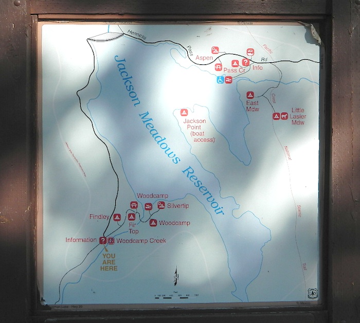
Silvertip is also a Group Camp at Jackson Meadow Reservoir (Sierra Co) off Hwy 89, North of Truckee, CA. Silvertip Group Campground, as with all group camping facilities, is by reservation only.

Silver Lake @ LA
(Los Angeles Co) a hip and popular, tree-lined neighborhood in Los Angeles, near Griffith Park.

Silver Lake
(San Bernardino Co)
Silver Dry Lake, a dry lakebed in the Mojave desert, near the Hollow Hills Wilderness, north of Baker, CA off I-15

Silver Lakes
(San Bernardino Co)
2430′ elev. a desert community southwest of Barstow, near Helendale, CA. Located on the Mojave River (which flows underground) in between Historic Route 66 & US Hwy 395. Attraction nearby – Exotic World, the Burlesque Hall of Fame.


silverstrand

Silver Strand State Beach State Park

(San Diego Co)
A sliver of sand makes up this narrow beach, barrier island for San Diego Bay. RV Camping, best in SD. South San Diego, Coronado Island campground

silverwood

Silverwood Lake SRA State Park

(San Bernardino Co)
State Recreation Area @ Cajon Pass I-15
in the San Berdu National Forest


lacontedivide

High Sierra, California

hike-in only

backpacking

Silver Pass Lake
Silver Divide & Silver Pass
(Fresno Co)
11,000′ elev

Located in between two 12,000′ peaks
near PCT – Pacific Crest Trail
John Muir Wilderness

backpacking

Silver Lake
(Tulare Co)
11,000′ elev

via Mineral King trailheads
Golden Trout Wilderness
South of Sequoia NP
Southern Sierra Nevada

Another Hike


Mule Days Celebration

Bishop Mule Days 2016-2

Bishop Mule Days

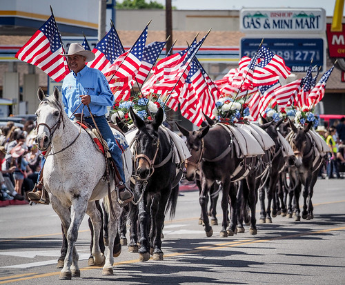
Eastern Sierra tradition dating back to 1969

Bishop California host the infamous Mule Days Celebration. Always Memorial Day weekend . Mules compete in events. Part mule show, part test of skills, and part Wild West. Thursday night concert, featuring Country Music stars, the longest running non-motorized parade on Saturday morning, Steer roping and penning, and the Packer’s Scramble.

Annual event; May
Memorial Day weekend
BISHOP CA

muledays.org

Bishop Mule Days 2016-11

Bishop Mule Days 2016-28

Mammoth Festival

Bluesapalooza

Mammoth Festival of Beers
& Bluesapalooza

Mammoth Lakes area has several festivals throughout the year; a few ski and snowboard competitions, as well as mountain bike races. Mammoth is the outdoor recreation hub of the Eastern Sierra.

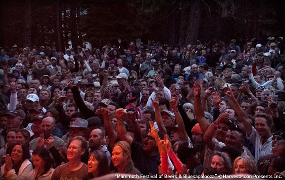
This summer mountain festival revolves around beer and live music, in the best spot to be in California’s 100+ degree hot weather – at 7000′ elevation, in the cool, pine forest (with refreshing lakes nearby).

Mammoth Blues Brews Fest

Annual event: AUGUST

MAMMOTH LAKES, CA

mammothbluesbrewsfest.com

Mammoth Lakes Film Festival

Mammoth

MLFF: Mammoth Lakes Film Festival
#mlfilmfest

A multi-day festival that screens independent features and shorts in the spectacular setting of Mammoth Lakes and the ruggedly beautiful Eastern Sierra. Traditionally held on Memorial Day weekend. There used to be a “Mammoth Mountain Film Festival”, but I guess this event replaces it.

Annual event: May
on Memorial Day weekend

Mammoth Lakes, CA

mammothlakesfilmfestival.com

6S17 – Inyo NF

pinecreekcanyon

Road #6S17 – Inyo National Forest
Pine Creek Road

Pine Creek Canyon Road
Pine Canyon Road

Inyo Forest Rd #6S17
North of Bishop, CA

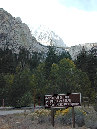
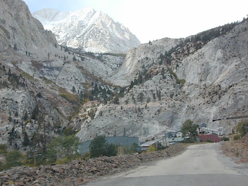
Paved route that dead ends at a huge, old tungsten mill. Impressive peaks and slopes, steep granite; spires and beehive shaped mountains. This region has a very ALPS FEELING, with an “Italy Pass” high above on the wilderness ridge lines.

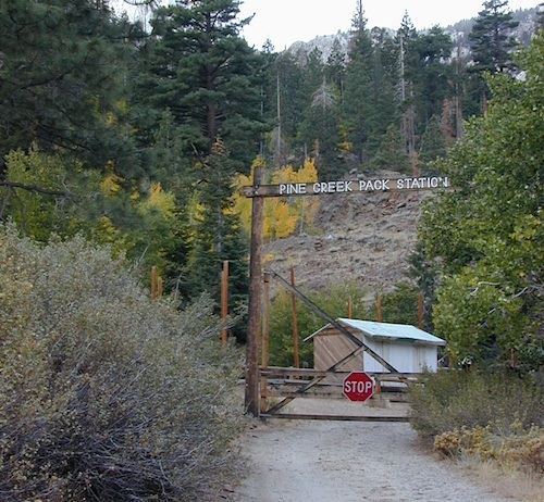
Pine Creek Road has minimal camping and maybe a half day worth of sightseeing (at most). A few creekside camp spots, only rock dirt road access. Campfire permits required. No facilities. No developed campgrounds. Hiking trails, wilderness access and a horse pack outfitter.

PINE CREEK PACK STATION
85 Pine Creek Road
Bishop, CA 93514
760-387-2797

pinecreektrail

NO developed NFS Campground exist up here, so don’t think about bringing that motorhome up this steep incline.

horseback

  • backpacking
  • day hiking
  • dispersed camping (minimal)
  • fly fishing
  • hiking trails
  • horse packing outfit
  • horse camping
  • rock climbing
  • wilderness access (highcountry)
  • horse trailer parking
  • trailhead parking

John Muir Wilderness
Pine Creek Pass
Italy Pass

pine creek pack station
Autumn colors and aspen groves can be found annually in October, before the first snow of the season.

tungstenmine

Historic Tungsten Mine near Bishop, CA
No public access.

1940s Pine Creek Mine was the largest source of tungsten in the US

mountains

Ranger Dave’s Blog about Pine Creek
windyscotty.wordpress.com/2009/10/31/pine-creek-canyon-2/

Impressive Canyons

hiker

Mount Tom (elev 13,652′)
Gable Lakes
Pine Lake (9942′)
Bear Creek Spire (13,713′)
Spire Lake
Scheelite Canyon
Lower Morgan Lake (10,708′)
Round Valley Peak (11,943′)
Round Valley
Rovana, CA

Rovana Shack

tungstenhills

maps of this region:

John Muir Trail Maps
Inyo National Forest Map USDA
Inyo National Forest Atlas


Benchmark Map US 395
Bishop Pass Trail Map

Mono Divide Highcountry Map
Mammoth Lakes Map NatGeo
Mammoth Highcountry Map

pinecreekTH
CLICK TO ENLARGE

Slopes of Sierra Nevada

Bald Rock California

decimated
Decimated forest at Bald Rock: Trail Closed 2020-2021
bigbaldrocks
Bald Rock, North Sierra Nevada Mountains

Big Bald Rock

elevation: 3350′

2021: CLOSED due to wildfire damage

Bald Rock Trailhead, Berry Creek, CA
Located above Lake Oroville and near the Middle Fork of the Feather River, this well known trailhead is a 1 mile (short, steep & sweet) climb on top of granite rocks – to a wonderful view over the North Sacramento Valley. Dirt parking lot w/ bathroom in a forested setting.  Can get muddy during winter. Seasonal creek runs along first part of the hiking trail. Locals like to party here at night. Families hike during daylight and sunset hour.  Trailhead sign is well marked on paved Bald Rock Road, about 6 miles from the Oro Quincy Highway.

see more info for this hike

digger pines

Bald Rock Country
Bald Rock Country


footed
Footed Rock @ Bald Rock, Berry Creek, CA

The granite dome hike (above) is often confused with a neighboring trail to the south, called Bald Rock Dome, located at the granite gorge of the Middle Feather River. A much longer hike w/ a canyon view, switchbacks, and longer dirt road access…..hiker

Dome Trail Hike

approx. elevation: 3200′

2021: CLOSED due to wildfire damage

Another dome hike in the same area as above, but on the other side of the pavement; gravel parking lot, and trailhead via dirt road; a right turn off Bald Rock Road (when going north). Near the residential forest of Berry Creek, CA

see more details

Plumas National Forest, above Lake Oroville, CA

The official map for Lake Oroville SRA has a granite dome marked as Little Bald Rock @ 3334′ elev. The USDA Plumas National Forest map has both a Little Bald Rock and a Bald Rock Dome (3509′) located on this side of Bald Rock Road.

As you can see listed below, giant granite domes or mountain peaks or river canyons often have the generic name of ‘bald rock’ There are also a heck of a lotta Bald Mountains inside the golden state.

camptruck

also, in the vicinity –

campBald Rock Canyon is downstream from the big waterfall, Feather Falls, on the Middle Fork of the Feather River; This stretch of wilderness waterway is called Feather Falls Scenic Area which includes, Milsap Bar Campground; Maybe be accessible, by 4×4 and steep foot trail – from the opposite side of the river. Off Lumpkin Road, which is off Forbestown Road (@ 162 above Lake Oroville) 2021: CLOSED due to wildfire damage

Bald Rock Peak (elev 7166′) a mountain peak near Chilcoot Campground and Frenchman Lake, N of Hwy 70 in East Plumas National Forest

Bald Mountain (5780′) off the Skyway, next to Stirling City, CA
Fire Lookout CDF, weather cam & antenna site

canoe

Little Grass Valley Reservoir has two Balds

pinetreeOn the north side of the lake is Grass Valley Bald Mountain (5906′ elev) in between Black Rock Creek and the northern shore.


The La Porte Bald Mountain Peak (5906′ elev) is located in dense forest, in Plumas National Forest; In between LGVR and the town of La Porte, CA 4959′

Area accessible via a long and curvy La Porte Road, which closes in winter on the north end (East Quincy). This Plumas County area is popular w/ snowmobiling due to the amount of snow they receive.

snowmo

Bald Mountain Range, due north of Truckee and Stampede Reservoir. Near the CA / NV border. Babbitt Peak @ 8790′ is the tallest peak within this range. Historical Henness Pass Road passes through this area.

fish

Bald Mountain OHV Staging Area, on Rock Creek Trails
inside Eldorado National Forest 

dirtbikes

Bald Mountain Peak @ Sugarloaf Ridge State Park
(2279′ elev) located in between Napa Valley and Sonoma Valley.

M22 Mendocino Forest, eastside
Forest Route #M22 is on Valentine Ridge, east of South Yolla Bolly (elev 8092′) and near Bald Rock Mountain (7762′). Road M-22 is also known as Bald Rock Road.
Mendocino National Forest – Two trailheads up this way are Ides Cove and Horsepacker. M22 wraps around south to Ball Rock @ 6663′ elevation, near Rocky Cabin Campground. Cold Springs Guard Station, Ball Mountain 6557′ and Whitlock Campground are on this route. Much this region has been burnt in recent wildfires of 2020 #ElkhornFire

driftwood

similarly named – BALD

Mount Baldy, Ranch Cucamonga Wilderness
San Gabriel Mountains, Los Angeles, CA

Popular, local snow ski destination for “the southland”; south of Pasadena, near Rancho Cucamonga, in the San Gabriel Mountains.’

snowski

Bald Mountain Road, also known as Inyo Forest Road #01S05, near Indiana Summit and the Mono Craters. East of the Eastern Sierra & US 395; south of Mono Lake, California.

Bald Mountain Road, near Bummerville, California.
Gold Country Sierra Forests, East of Hwy 49 @ Jackson, CA

Bald Mountain Road, rural ranches & residential;
and Bald Mountain Nursery in Browns Valley, near Marysville, CA


Bald Hills Rd
Bald Hills Road, Redwoods NP

Bald Hills Road, Northern California

Well- traveled, graded dirt road connecting the Redwood National Park to the Klamath River @ Hwy 96. Primitive camping, but check on fire restrictions. Must have camp fire permit.  Active logging roads on National Forest land, so weekdays could be busy: watch for equipment and big trucks.

pinetree

Kennedy Meadows from Bald
Kennedy Meadows from Bald Mountain Fire Lookout

Bald Mountain @ Shermans Pass
Kern Plateau; 4×4 access to reach Fire Lookout Tower
Sherman’s Pass Road# 22S05, near Dome Land Wilderness
Sequoia National Forest

NFSlogo

Bald Mountain 4×4 Trail
Western Sierra NF, overlooking Shaver Lake, CA

bald mtn
Jeepers on granite @ Bald Mtn, above Shaver Lake, CA

4x4

Fishing Maps California

owensfishing

California Fishing Maps & Destinations

California fishing recreation ranges from sport-fishing, an open sea adventure, to solo casting in deep river canyons. Big Sierra Reservoirs near Gold Rush Country to High Country Alpine Lakes, the golden state has the water – and the outdoor recreation you crave.

Below is an alphabetical list of popular fishing destinations within California. Mountains to coastline, there are many maps to choose from.

American River, California

gonzagadusk

Baja California Maps
Surf, Camp, Fish, Kayak, Dive
Sea of Cortez, Baja CA Mexico

Big Bear Trail Map
San Berdoo Mountains Map
San Bernardino National Forest Map USDA
San Bernardino National Forest
Big Bear Lake, Arrowhead & Idyllwild
SoCal Mountains

Lake Berryessa California
Wine Country Reservoir

Bishop Creek Eastern Sierra

Bishop Pass Trail Map
North Lake, Sabrina, South Lake
Bishop Creek, Eastern Sierra

Bucks Lake Wilderness Map
Bucks Lake Wilderness, Quincy CA
Bucks Lake Campgrounds
North Sierra Mountains

California Delta Maps

Carson Pass, Sierra Highway 88
Carson Iceberg Wilderness Map
Central Sierra Nevada Lakes & Rivers

Casitas Lake, Ventura County

Clear Lake, Wine Country California

Crystal Basin Sierra Nevada

Crystal Basin / Silver Fork Map
Central Sierra Nevada Mountains
Eldorado National Forest

El Dorado National Forest Map
Mokelumne, American River

Dinkey Lakes Wilderness Map
Tom Harrison Map
Sierra Hikes, Dinkey Creek

Golden Trout Wilderness Map
Upper Kern River, Southern Sierra

Green Creek Road
creek fishing, trailhead campgrounds
Bridgeport, CA Eastern Sierra

Hat Creek California 
Headwaters to the Pit River

Lake Havasu, California 

Hoover Wilderness Map
Hoover Wilderness
Bridgeport, CA Eastern Sierra

Hot Creek @ Mammoth Lakes, Eastern Sierra

Inyo National Forest Map
Mount Whitney, Owens River, High Sierra Lakes
Bishop, Crowley, Mammoth & June
Eastern Sierra Nevada Mountains

Kearsarge Pass Topo

Kearsarge Pass Trail Map
Rae Lakes Loop, High Sierra
Onion Valley, Eastern Sierra

Kings Canyon High Country Map
Kings Cyn National Park
Trails, Peaks, hike-in only Lakes

Klamath National Forest Map
Klamath River, NorCal
Hwy 96, Happy Camp, Hupa/Hoopa

Lakes Basin Recreation Area
Lakes Basin Map USDA
over a dozen small lakes, w/ trails, fishing
Gold Lake California
Sierra Buttes, North of Gold Country

Lake Isabella, Kern River

Lake Tahoe, Sierra Nevada Mountains

Lake Tahoe Map

Lake Tahoe Basin Map NatGeo

Tahoe Eastshore

Lassen Forest Map
Lassen National Forest &
Lassen National Park
Feather River, Lassen Lakes

Mammoth Map

Mammoth Lakes Map NatGeo
Mammoth Lakes CA
Mono Divide, High Sierra
June Lake, Eastern Sierra Recreation

Rush Creek

Lake Mead, Nevada

NatGeo Lake Mead Map

Lake Mohave, Nevada

Merced River Recreation Map NatGeo
Merced River & Tuolumne River
Yosemite Camping & Fishing
Gold Country, Western Sierra Rivers

Millerton Reservoir, West Sierra
Fresno, CA

Mineral King Trail Map
Southern Sequoia National Park
day hike to wilderness lakes

Owens River, Eastern Sierra

Plumas National Forest Map
Lake Almanor, Lake Oroville
Feather River (all 4 forks)

Piru Lake, California

Pit River Fishing Map 

Sacramento River, North State

Sequoia National Forest Map
Kern River, Lake Isabella
Kern Plateau, Kennedy Mdws

Shasta National Forest Map
Sacramento River, Lake Shasta
NorCal fishing, Mount Shasta

Sierra National Forest Map
San Joaquin River, Dinkey Creek
Dinkey Lakes Map
Kings River, Pine Flat Reservoir
Lake Edison, Florence
Shaver Lake Map, Huntington Lake
BlackRock, Courtright, Wishon

Stanislaus National Forest Map
Stanislaus National Forest
Sonora Pass, Dardalelle
Stanislaus River, Gold Country

sierra buttes

Tahoe National Forest:

Tahoe Sierra Buttes Map NatGeo
Sierra Buttes / Donner Pass
Lakes Basin Recreation Area

Tahoe Yuba Map NatGeo
American River, Yuba River
Gold Country California

Toiyabe National Forest:
Eastern Sierra Nevada Mts

Toiyabe Carson Map
Carson River, Markleeville
Eastern Sierra, South of Tahoe

Toiyabe Bridgeport Map
Walker River, Twin Lakes
Eastern Sierra, Yosemite East

walker river California
Walker River California

Walker River Fly Fishing Map

lakes

let’s not forget the ever expanding…

California Lake List

rocklakefishing

Mammoth Fishing


Stark Weather Lake

Originally uploaded by danamight

Mammoth Mountain Lakes / Eastern Sierra Fishing

Sure splendor for fishing, most of the time. Lake fishing, stream fishing, river fishing. Fishing the Eastern Sierra area, near Mammoth Lakes, California can be very rewarding. You may have read about places like these in the sports magazines, seen them on a television program, or imagined them in a fishing vacation day dream. Summers can be crowded, so pick a lake and camp carefully. Weather can change quickly, so come prepared. Autumn fishing w/ the golden aspens and less crowds is preferred.

fishing trip

Most of these Eastern Sierra lakes listed below are accessible by car, others by foot. Look at the photos, pick a destination and get a good map of the area, so you can explore everything around too.

Mammoth Lakes Area

Mammoth Area Lakes – Mammoth City

Mammoth Area Creeks –

Mammoth Area Rivers –

  • Owens River (high desert valley)
  • San Joaquin River (high country)

junelake

June Lake Loop
Eastern Sierra, US 395 @ Hwy 158

June Area Lakes –

June Loop Creeks –

Mammoth Maps

inyo maps
Inyo National Forest Map

Ansel Adams Wilderness Maps
Devils Postpile Map
Mammoth High Country Map
Mono Divide Trail Map
Mammoth Mono Map NatGeo

other Eastern Sierra maps –

Bishop Pass Trail Maps
Hoover Wilderness Trail Map
John Muir Wilderness Maps
Mono Lake Map
Palisades Trail Maps

horseback overnight trips
Abundant Horse Packers in Eastern Sierra, California

Rent Camping Gear

Camp Gear Rental / Camping Equipment Rental /

Outdoor Equipment Rentals

Backpacks

recreational equipment

California Camping Rentals: Outdoor gear rentals in California are more common in big cities with large retailers and harder to find in specific, small towns on the back roads. Plan ahead trying to rent gear. Recreation destinations such as Joshua Tree, Mammoth & Bishop might have rental shops, but finding a rental store in an unfamiliar area could be ‘just chancing it’.

Be sure, before you go.

DanaMite has revised this handy list for your wilderness vacation planning, recreational equipment and rental needs.

2020 UPDATE: Recently deleted 4 shops on this page, so don’t be surprised if more gear rental shops vanish.

RENTAL SHOPS specific to California

major retail chain:

REI rents gearREI rents gear!

hiker

independent rental shops in small town Cali:

(listed from south to north)

Stone Equipment Rental (Bishop) 760-873-7907
MammothGear.com (Mammoth Lakes)
Yosemite Equipment Rentals (Yosemite Valley)
Sierra Nevada Adventure Company (Gold Country)
MountainSportsChico.com (Chico)
TheFifthSeason.com (Shasta)
Humboldt State Rentals (Arcata)

camp

California gear rentals

RENTAL SHOPS online

There are many reason people rent gear. Tourists or vacationers passing through, wanting to experience a non-hotel night outdoors; Beginner backpackers wanting to try out equipment before committing to a big purchase; College students on an impromptu road trip; Novice cross country snow skiers;  Doggy now packs in his own food & water too.

A new concept now being delivered is online gear rental, from camping to fly fishing. Seriously. They can ship you quality rental gear, and you can use it, test it, review it, all hands-on, out in the field. These 2 players in the West both ship nationwide. Imagine what else the web will rent in the future?

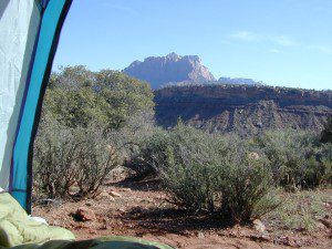
viewfromtent

Eastern Sierra Camping

tallpeaktower

Inyo Forest Campgrounds – Eastern Sierra Campgrounds

areas include: Lone Pine, Mount Whitney, Independence, Onion Valley, Ancient Bristlecone Pines, Big Pine, Bishop [Hwy 168], High Sierra, Owens River, Lake Crowley, Rock Creek, Mammoth Lakes [Hwy 203], June Lake Loop [Hwy 158], Lee Vining & East Yosemite National Park [Hwy 120]. Camping on Eastern Sierra Highway 395

Eastern Sierra recreation – backpacking, horse packing, day hiking, creek fishing, mountain biking, mountaineering, rock climbing

Listed below are Inyo National Forest campgrounds, County Parks, BLM public camps for outdoor recreation. Many campgrounds are closed for winter months. Blue links lead to more camp information. Boldface links to detailed information & photos on campground.

campground elev spots veg toilet water notes
Agnew Meadows 8400′ 21 pines chem piped Mammoth; Jun-Sept
Baker Creek Campground 4100′ 40 cottn vault no Big Pine, BLM; RV 30′
Big Bend Campground 7800′ 17 pines vault piped Lee Vining, April-Oct
Big Meadow 8600′ 11 pines flush piped Rock Creek; May-Oct
Big Pine Creek 9000′ 30 pines vault piped W of Big Pine; May-Oct
Big Trees Campground 7500′ 9 pines flush piped W of Bishop ; April-Sept
Bishop Park Group Camp 8400′ 20 pines flush piped No RVs;
Bishop Creek
Crowley Lake Camp 6800′ 47 sage vault piped BLM Camp; Apr-Oct
East Fork Campground 9000′ 133 aspens flush piped fishing camp Rock Creek
Ellery Lake Campground 9500′ 12 pines flush piped E Yosemite; June-Oct
Forks Campground 7800′ 8 pines flush piped W of Bishop,; April-Oct
Four Jefferey 8100′ 106 pines vault piped W of Bishop; April-Oct
Glacier View Campground 4000′ 40 cttnwd flush piped Big Pine, CA; open all yr
Goodale Creek 4000′ 43 cttnwd vault no BLM Camp; April-Nov
Grandview Campground 8600′ 26 pinyon vault no Ancient Bristlecone Pines
Grays Meadow 6000′ 52 pines flush piped W of Independence
Gull Lake Campground 7600′ 11 aspens flush piped June Loop; April-Nov
Hartley Springs 8400′ 20 pines vault no Glass Creek, June-Oct
Horseshoe Meadow 10,000′ 10 pines vault piped 1 day limit; horses; More
Horton Creek 4975′ 49 pines vault piped BLM Bishop; May-Oct
Independence Creek 4000′ 25 cottn vault no Independence, BLM; RV 30′
Intake Campground 7500′ 8 pines flush piped W of Bishop; April-Oct
Iris Meadow Campgr 8300′ 14 pines flush piped W of Bishop; May-Oct
June Lake Campground 7600′ 22 pines flush piped fishing/hiking
Junction Campground 9600′ 13 pines vault lake E Yosemite; June-Oct
Lake George Campground 9000 16 pines flush piped fish, June-Sept
Lone Pine Campground 5500′ 43 pinyon vault piped W of Hwy 395
McGee Creek 7600′ 26 aspen flush piped Tom’s Place, Hwy 395
New Shady Rest 7800′ 94 pines flush piped Mammoth, in town
North Lake Campground 9500′ 11 pines vault piped W of Bishop; June-Oct
Oh Ridge Campground 6000′ 148 pines flush piped June Lake
Old Shady Rest Camp 7800′ 51 pines flush piped Hwy 203, Mammoth
Onion Valley Campground 9000′ 15 aspen vault piped High Sierra access
Palisade Campground 8600′ 5 aspen flush piped Rock Creek; May-Oct
Pine City Campground 8900′ 10 pines flush piped Lake Mary, June-Sept
Pine Grove Campgr 9300′ 11 pines flush piped May-Oct
Pleasant Valley Res. 4500′ 75 sage vault piped BLM, US 395; open all yr
Pumice Flat 7700′ 17 – flush piped June-Sept
Reversed Creek Campground 7600′ 17 aspen flush piped June Loop; May-Oct
Rock Creek Lake 7600′ 25 aspen flush piped Tom’s Place; May-Oct
Sabrina Campground 9000′ 18 pines vault piped W of Bishop; May-Oct
Saddlebag Lake 10,000′ 20 pines vault piped highest camp; June-Oct
Sherwin Creek Camp 7600′ 87 pines flush piped Mammoth Lakes
Taboose Creek 3900′ 55 shade vault stream Big Pine;
open all yr
Tinemaha Creek 4400′ 55 shade vault stream Independence, Inyo Co Park
Tioga Lake Campgr 9700′ 13 pines vault piped fish Yosemite, June-Oct
Tuff Campground 7000′ 34 pines flush piped Rock Creek; RV 22′
Tuttle Creek 5120′ 83 sage vault seasonal Lone Pine; open all yr
Upper Pine Grove 9400′ 8 pines – piped May-Oct
Upper Sage Flat 7600′ 21 pines vault piped W Big Pine; April-Oct
Whitney Portal Camp 9000′ 44 pines flush piped Trailhead; May-Oct
Whitney Trailhead 9000′ 10 pines vault piped Trailhead; May-Oct

sunsetgrandview

see Group Campgrounds in Inyo National Forest, Eastern Sierra

8

Eastern Sierra Vacation, see also –

Topo maps, wilderness hiking maps, fishing maps
Equestrian trails, 4×4 routes, OHV maps –

Twin LakesEastern Sierra communities include:

Dogs in Lake

Autumn Camping California

Autumn Lakeside

RV camping Tent Camp Fishing Hiking

Amazing autumn colors can be found through OCTOBER and NOVEMBER in California, but you’ll need to leave the city in order to find the very best colors and scenic beauty. Fall season happens quickly (within weeks) in the high country and slower (months) in the lowlands. Plenty canyons and parks in the urban centers have hiking trails thru some nice trees, but nothing compares to the backroads, creeks and rivers of the big mountains.

Elevations, the higher the better, is where you’ll find the real displays of color. Aspen groves can be found along mountain slopes, creek canyons from 5000′-10,000′ in elevation. Cottonwood trees are found in the drier regions, in ranching areas and in desert canyons – up to about 6000′ elevation. Aspen trees start to turn yellow as soon as the chill of nights drop; if the temperature shift is subtle, the aspen leaves become more orange as the days go into the fall season. If an early snow or freeze happens, just one night, the glorious foliage becomes dead brown crispies dangling in the wind.

campfire
CAMP FIRE RESTRICTIONS are still be in place from the dry summer, and now comes the autumn winds. Any decent amount of rain can change the fire burn status, so make sure to check with the rangers for up-to-date fire info.

Best Autumn Campgrounds in California  

Many of these campgrounds are located in or near aspen groves & are simply spectacular during the fall months. Some may be located near alder groves. Maple trees located along rivers turn golden between September and October. 

Higher elevation (7000′-9000′) colors will change faster and earlier in the year (as soon as September), whereas the lower countryside may wait until late October. 

Pack warmly, cuz the cooler temps at night (20-30 degrees) is what makes these awesome, little autumn leaves change colors. The change can happen very fast (in days). When the early season snows move in – usually a minimal dusting by October, fall colors can fade fast.

Southern California

Tent Camp

has minimal fall colors.

Big Bear Lake, CA
Lake Arrowhead, CA

Ojai Camping – Wheeler Gorge
Sespe Hot Springs (hike-in access only)

Camping

Southern and Central Sierra

have a few aspen groves and several cottonwood canyons.

Aspen Hollow Campground NFSNFSlogo
Giant Sequoia @ Hume Lake, CA
near Kings Canyon NP

Big Meadows Campground NFS
Stanislaus National Forest
Arnold, CA

Dinkey Creek Campground NFS
Sierra National Forest
Shaver Lake, CA

Kern River Canyon

Ponderosa, CA
Quaking Aspen Campground Tent Camp
Quaking Aspen CabinTent Camp
Giant Sequoia National Monumentcamp

Wishon Reservoir
Lily Pad Campground
Sierra National Forest

Yosemite National Park
Tuolumne Meadows, Hwy 120
Yosemite Valley Campgrounds

Kirkwood, CA
Blue Lakes Road
Carson Pass CA Highway 88

Camping

Northern Sierra

The North Sierra Nevada Mountains covers the region with Lake Tahoe and Donner Pass, and north Gold Country. River canyons with fall colors include American River, Yuba River, and the Feather River.

Aspen Group Campground
@ Jackson Meadows Reservoir
near Truckee, CA

Berry Creek, CA
Milsap Bar, Middle Fork of the Feather River

Bucks Lake, CA
Haskins Valley & Grizzly Creek Campground
Oro-Quincy Highway – Plumas NF

Downieville, CA
Yuba River Campgroundsshowers

Grover Hot Springs State Park  

Hope Valley, CA
Hope Valley Campground Tent Camp

Lake Tahoe

Camping

Autumn Bliss Hike

Eastern Sierra

The Eastern slopes of the Sierra Nevada is the ‘place to be’ for Autumn Colors in California. The dramatic desert meets the tallest granite peaks. Every canyon is a different scene, many lakes lined with aspen groves, some have a creek with aspens.

Aspendell, CA
North Lake Campground
Lake Sabrina Road
Bishop Pass (high country hikes)

sabrina creeking

Bishop, CA
Bishop Creek, Hwy 168
Ancient Bristlecone Pine Forest – both Silver Canyon and
Cottonwood Creek have aspen trees. (both are 4×4 roads)

Bridgeport, CA
Green Creek Road w/ signage for
Dunderburg Meadow
Twin Lakes
Hoover Wilderness (high country hikes)

Independence, CA
Onion Valley CampgroundTent Camp
Kearsarge Pass (high country hikes)

June Lake, CalifoniaTent Camp
June Lake Loop #1S63 / CA Highway 158

Lee Vining, CA
Lee Vining Canyon / Hwy 120
One of the biggest aspen grove canyons in the state of California.
NFS campgrounds
NFS Campgrounds in Lee Vining Canyon: Big Bend, Aspen Grove, Boulder, Moraine, and Cattleguard Campground.
NFS Camps @ Yosemite’s EAST GATE (9000′ elev): Ellery Lake, Junction, Saddlebag Lake, and Sawmill Campground.

Lundy Lake
Virginia Lakes
Trumbull CampgroundTent Camp

Lone Pine, CA
Alabama Hills has a few cottonwoods.
Whitney Portal has some alder trees and a few aspens.hiker

Mammoth Lakes, CA
Red’s Meadow Campground
Devils Postpile NM
Laurel Lakes Road (rough dirt road)
Convict Lake

Tom’s Place, CA
McGee Creek Campground Tent Camp

Rockcreek Road
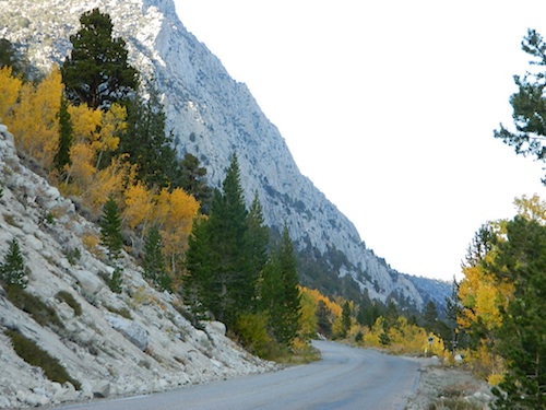
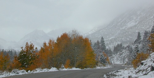
Impressive Rock Creek Road #4S12 in Rock Creek Canyon, one of the very best “Scenic Autumn Drives” in the whole Eastern Sierra. Numerous NFS Campgrounds on this road; many of which close for the season, just about the time then fall colors peak.

Rock Creek Lake Campground @ 9600′ elev Tent Camp

Iris Meadow Campground @ 8600′ elev

iris meadow
Iris Meadow on Rock Creek Rd

Camping

Northern California

The “North State” primarily has the big river canyons, most of which have fall colors. Eel River, Klamath, Yuba River, Feather Rivers.

Blue Lake Campground
South Warner Mountains
Modoc National Forest

South Warner Mountains
Road 64 Modoc NF

Eagle Lake
Aspen Grove Campground (walk-in camp sites)
Susanville, CA

Large Eagle Lake, N of Susanville, CA

Sundial Bridge, over Sacramento River
River RV Parks
Redding, CA

Weaverville, CA

Mount Shasta, CA
(downtown of Mt. Shasta City)

McBride Springs Campground
(slopes of Mount Shasta)

Lake Siskiyou
Beach Camp Resort & RV Park

4239 W. A. Barr Rd
Mount Shasta CA
530 926-2610

McCloud, CA
McCloud Falls,  South of Mount Shasta

Algoma Campground
McCloud Creek, South of Mount Shasta

MacArthur-Burney Falls State Park
Dusty Campground

Lassen Volcanic National Park
Lassen National Forest
Lassen Camping
Lassen Lakes

Susanville, CA
Bizz Johnson Trail
Roxie Peconom Campground

Siskiyou Autumn Colors
(still to come)

eagle aspens
Paved over aspen groves @ South Eagle Lake, CA


Lundy Lake California

Lunar Lundy Lake

Eastern Sierra
Lundy Lake

Lundy Canyon is located at the very northern boundaries of the Inyo National Forest, bordering the Humboldt Toiyabe National Forest & Virginia Lakes. Mill Creek flows down Lundy Canyon from the Sierra Nevada; Lundy is a small lake in a deep, rugged canyon with wilderness trailheads, East of Yosemite National Park.

Lundy Lake
West of Mono Lake, California
US 395
Lee Vining, CA

elevation: 7800′
Seasonal access, closed for winter

backpack, camp, canoe, fish, hike, kayak
aspen groves, autumn colors
wildflowers, waterfalls


Frozen Edge

camp

Lundy Campgrounds

  • Lundy Canyon Campground
    Mono County Dept of Public Works
    760-932-5440
    36 camp sites w/ picnic tables, fire-rings & bear boxes
  • Lundy Lake Resort
    Bait, tackle, general store, fishing lake, boat ramp.
    626-309-0415
    21 camp sites, 8 cabins, 3 camp huts, 5 RV camp sites

camping

National ForestsThere is not any NFS Campgrounds in this Lundy Canyon, but plenty can be found nearby at Lee Vining Canyon, at junction US 395 & Hwy 120.

Mono Lake also has camping at the county park. And free camping (boondocking) can be found – all up and down US 395

Lakes Canyon Trailhead

hikerLakes Canyon Trailhead

Backpackers & Horse Packer Trains have excellent access to the Hoover Wilderness in the High Sierras. Plus this prime Lundy Canyon location is situated at the back door of Yosemite NP.

Mono County Tourism
800-845-7922

Reflections

Lundy Area Maps:
Hoover Wilderness Trail Map (Tom Harrison)
Inyo National Forest Map (USDA)
Yosemite High Country Map (Tom Harrison)


View Larger Map

Links for Lundy Canyon:

Lundy Lake Road
Lundy Lake Rd, the paved road up climbs the steep canyon to an elevation of over 7500′

Kongsberg, California

Historic Town Site: Kongsberg, Eastern Sierra, California

Silver Mountain City

Historic Jail
Remains of City Jail @ Kongsberg, CA

Located on the lightly forested slopes of the Carson River. About 7 miles east of Ebbett’s Pass, Highway 4 (CA SR 4)

Silver Boom Town in 1866
population 3000

Founded as Kongsberg in the late 1850’s by Scandinavian mining prospectors, the town name was later changed to Silver Mountain City. This wild, remote locale was the county seat for Alpine County from 1864 to 1875. The mining camp town was abandoned by 1886.

Nearby Towns:
Markleeville, CA

kongsberg_town

This canyon stretch of SR 4 highway has limited primitive camping options along the water. Flat dirt clearings and maybe a rock fire ring. No facilities, no bathrooms.

Silver Creek runs parallel to the highway and meets East fork of Carson River. Google Maps has this named Alpine State Hwy (which is closed in winter)

Drive less than 55 mph to take in all the scenery, slower if you want to find a decent place to stop. Look for easy pull-offs on dirt, a few trails, parking spots, picnic trees, some favorite fishing spots. Campfire permits are needed for dispersed camping.

Carson River
Carson River SR 4

Humboldt-Toiyabe National Forest

NFS Campgrounds nearby :

  • Silver Creek Campground @ 6800′ elev.
    NFS developed camp w/ fee (open June-Sept)
  • Centerville Flat Campground @ 5900′ elev.
    undeveloped sites. Silver Creek meets East fork of Carson River

pctPacific Crest Trail access –
PCT trail crosses highway near Ebbetts Pass

Silver Lake @ June

June Lake Loop

Silver Lake @ June Lake Loop

(Mono Co)

7700′ elev. Hwy 158, Backside of June Lake Loop, north of Mammoth.

Prime hiking and fishing destination of the Eastern Sierra, California. With impressive Carson Peak (10,909′) towering as a granite backdrop for the lake, every day out here is super scenic. Unless, of course, blizzard white-out conditions occur – which is possible during winter.

fishOctober-November, Autumn colors – at this particular location – tend to be fantastic, with aspen groves encompassing the lake, nearby streams and steep canyons.

fish: Reverse Creek, Rush Creek, Silver Lake, Grant Lake, Gem Lake, Gull Lake, June Lake

golden glow june

Winter weather & deep snow can close the paved highway loop, so know road conditions and weather forecast before you go. This beautiful Silver Lake is within walking distance of two lodges – Whispering Pines & Double Eagle Resort, so if rain or snow is predicted make your reservations.

  • aspen groves
  • autumn colors
  • backpacking
  • camping
  • canoeing
  • fishing lake
  • hiking trails
  • horseback trails
  • kayaking
  • mountaineering
  • picnic grounds
  • RV camp

Rental Boats

Ansel Adams Wildernesshiker
Inyo National Forest
June Lake, CA

This gorgeous, 80 acre alpine lake is a popular campground for fishing, picnicking, hiking, summer and autumn camping. Accommodates tent camping and RVs. Boat ramp, grocery store, coin-op laundry – all nearby. Camp closes for snow annually.

Silver Lake Campground NFS campground

• Elevation: 7600′
• Number of Sites: 28
• Vehicle Accessibility: RV 20′
• Campsites Reservation: Yes
• Camp Fee: Yes
• Toilets: Flush
• Water: Piped/Potable
• Length of Stay: 14 Days
• Season: April – October

NFS
Inyo National Forest
Mono Lake Ranger Station
North US Hwy 395
Lee Vining, CA 93541
760-647-3044

lets go fishing

stars

See all Silver Lakes in California

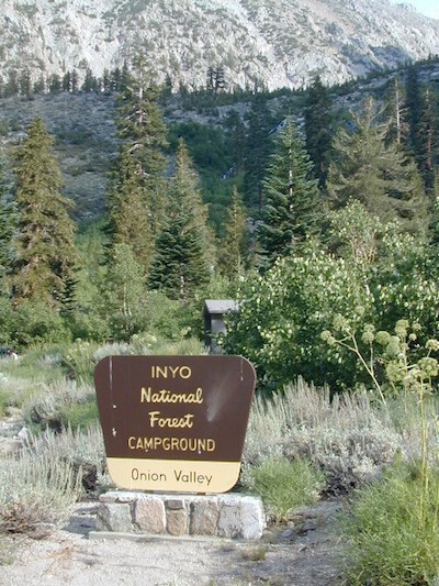
Onion Valley Campground

whiteVWcamper

Spectacular Small Campground located inside a granite bowl above 9000′ elevation, on the edge of the granite, near the John Muir Wilderness trails.camp

Inyo National Forest near Independence, CA
Eastern Sierra California

One of the best high elevation trailhead camp for backpackers in the Sierra.

High Sierra Lake Hikes

Onion Valley Campground

Onion Valley CA

  • Elevation: 9,200′
  • Number of Sites: 29
  • Vehicle Accessibility: no RVs
  • Camp Fee: Yes
  • Campsites Reservation: Yes
  • Toilet: Vault
  • Water: Piped
  • Length of Stay: 14 Days
  • Season: June – Sept
  • Trailhead Parking

Inyo National Forest hiker
Mount Whitney Ranger District
760-876-6200

Trailhead parking & camping for these High Sierra destinations –

onionsign

wild mountain onions?

High elevation NFS campground, located in a huge granite valley w/ waterfalls, wildflowers and aspen groves. The setting is breathtaking and the high altitude valley is nothing less than grand.

The views (east to the Owens valley) are from the paved road up, or from the hiking trails leading up outta camp. Gotta hike up (on foot) to see the views! Any visitor that does not hike, will be missing out on the best features of this destination. Plan to spend more than one day at Onion Valley.

ONLY OPEN for summer months! This small, developed campground closes annually.  Big winters and deep snow is the norm w/ elevation this high.

 walk-in camp sites

tent campas well as car camping sites.

  • picnic tables
  • fire rings
  • vault toilets
  • piped water
  • bear boxes

ONION VALLEY ROAD
access via Independence, CA

The paved road is long and very winding; sheer cliffs, steep drop offs, hairpin curves, minimal guard rails. RV motorhomes are not allowed on this route, due to the steepness of the terrain and the narrow roadway. conradkid2001

  • backpacking
  • camp
  • hiking
  • horse pack trips
  • lake fishing
  • mountaineering
  • rock climbing


horsepacks hiking Mountains

Rae Lakes Loop Map
Topo Hiking Map

HIKING LAKES in the Sierra

goldentroutlakecanyon
Golden Trout Lake Canyon

Gilbert Lake @ Kearsarge

see Onion Valley photos from –
Onion Valley Autumn 2008
Onion Valley Summer 2002

Group Campgrounds Eastern Sierra

agnewmdws

Group Campgrounds in the Inyo National Forest camping

These group camping facilities are available by advanced reservation only; open for summer and usually closed during winter months .

campground elev spots veg toilet water notes
Agnew Meadow Horse Camp 8400′ 4 pines chem piped Group & Equestrian
Mammoth
Aspen Group 8100′ 4 aspen flush piped Rock Creek
Big Pine Canyon Group 7600′ 1 pines vault piped W of Big Pine; May-Oct
Bishop Park Group 7500′ 21 oaks flush piped Group Camping; May-Oct
Fossil Group Camp 7220′ 11 pines vault no Hwy 168; E of Big Pine
Juniper Group Camp 7000′ 5 juniper vault piped Hwy 168; E of Big Pine
Obsidian Flat Group 6000′ 50 pines vault no Group Camp Mammoth
Pumice Flat Group 7700′ 17 pines flush piped June-Sept; Mammoth
Rock Creek Lake Group 7600′ 1 aspen flush piped Group Camping; May-Oct

RESERVATIONS REQUIRED

Call ranger station to reserve.
Inyo National Forest
351 Pacu Lane #200
Bishop, CA 93514
760-873-2400

see developed tent & RV Campgrounds – Inyo National Forest

rockcreekcliffs

Obsidian near Hwy 395 & Mammoth
Eastern Sierra Obsidian Dome – near US Hwy 395 & Mammoth Lakes, CA

Eastern Sierra maps –

Topo maps, wilderness hiking maps, fishing maps
Equestrian trails, 4×4 routes, OHV maps –

lake mary

southforkbishop

Bishop Creek near Aspendell, CA

McGee Creek Campground

McGee Shade

NFSlogo

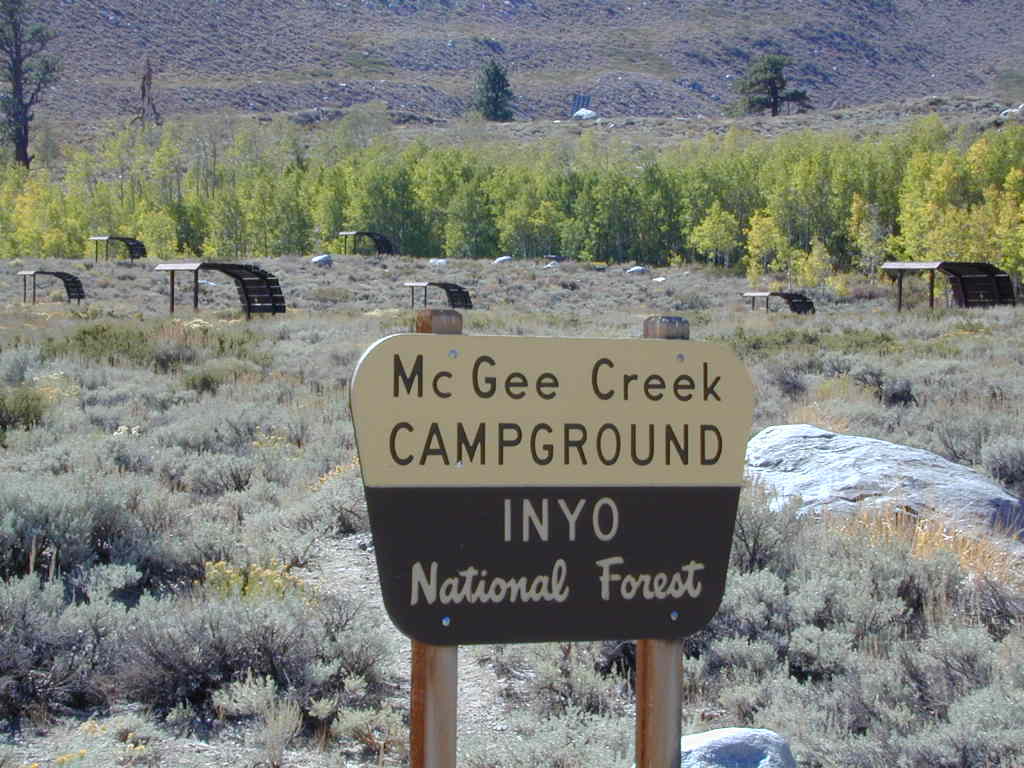
McGee Creek Campground NFS

near Crowley Lake, CA
Inyo National Forest Campground, Eastern Sierra Nevadacamp

• Elevation: 7600′
• Number of Sites: 28
• Vehicle Accessibility: RV 22′
• Camp Fee: Yes
• Campsites Reservation: Yes
• Length of Stay: 14 Days
• Season: May – September
• Trailheads: McGee Creek, John Muir Wilderness

mcgee camp sign

Mc GEE CREEK CAMP is located –
8 miles north of Mammoth Lakes exit
4 miles from Lake Crowley
2 miles from McGee Creek Canyon trailhead

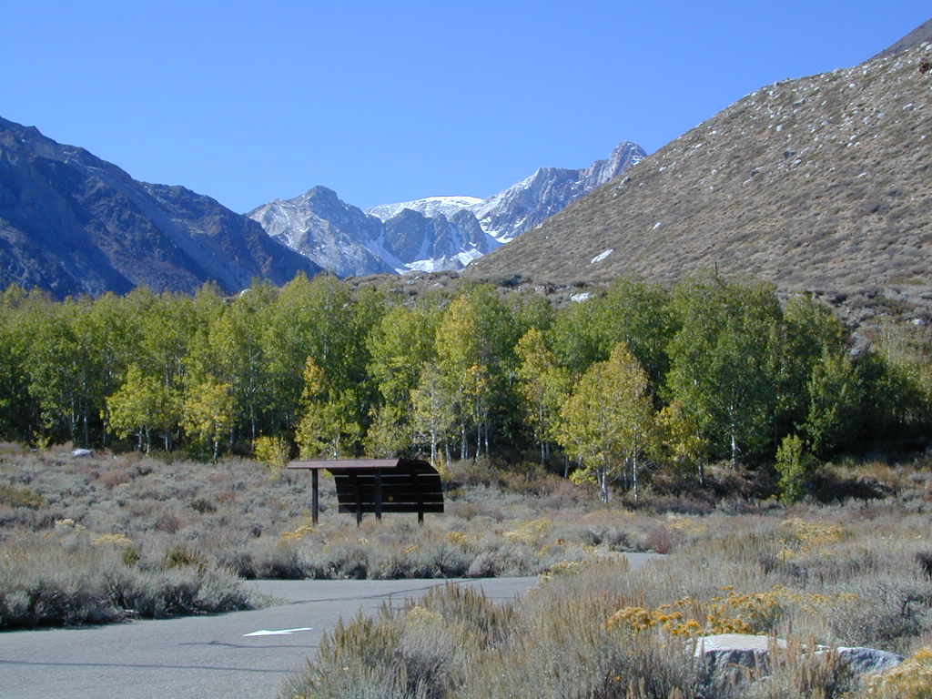
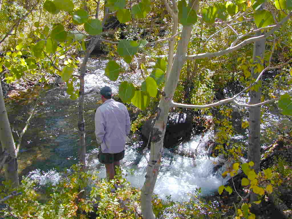
Aspen trees line McGee Creek that flows down from the Eastern Sierra peaks. Autumn is short and sweet, when the fall colors come and go – usually within a week or two. First snow fall of the season is generally in October and the camp closes for the winter season.

Located about a mile away from Highway US 395 in the wide open high desert. Sage meadows w/ minimal trees at camp. USFS has built shade structures for each camp site, so your time here is not spent in direct sunlight. Summer can get hot  and it can also be quite windy at this location.

  • backpacking
  • camping
  • fishing
  • hiking
  • mountain biking

mcgee creek

more McGee?

Closer to US 395 highway, there is a McGee Creek Lodge & Restaurant, right along the frontage road (Crowley Lake Drive).

And also, a more commercial camp called McGee Creek RV Park & Campground at the junction of McGee Creek Road.

Rock Creek Campground

rockintable
Rock Creek Lake 9600′ elev, Eastern Sierra

Numerous places named Rock Creek exist inside California. This particular Rock Creek page is specific to Camping and Campgrounds!

This compilation of “Rock Creeks” is to help with the confusing lists of similarly named camps and locations (which are many, inside California).

Lakes, rivers, canyons, campgrounds, 4×4 routes and wilderness trailheads. 

Eastern Sierra Campgrounds

List begins with the most well known –

Rock Creek Lake @ Inyo National Forest

Autumn Rock Creek
Rock Creek is a top destination for Autumn Colors in OCTOBER

NFS Campgrounds on Rock Creek Road listed below:

NFSlogo12 NFS Campgrounds are located around Eastern Sierra Rock Creek Canyon. Elevations range from 7000′ at the highway, to over 10,000′ at a trailhead parking lot at the road’s end. Most of these developed campgrounds listed are only open a few months outta the year, due to winter snow closures (NOV-APRIL). On occasion, snow can still be on the roads until MAY.

Tuff Campground ( @ frwy US 395)camp

French Campground (7500′ elev w/ 86 sites)
Holiday Campground (7500′ elev w/ 35 sites)

Aspen Group Campground (8100′ elev)

iris meadow
Iris Meadow Campground NFS

Iris Meadow Campground (8600′ elev w/ 14 sites) NFS
Big Meadow Campground (8600′ elev w/ 11 sites)
Palisade Group Campground (8600′ elev w/ 5 sites)
East Fork Campground (9000′ elev w/ 133 sites)
Pine Grove Campground (9300′ elev w/ 11 sites)

rockcreeklake

Rock Creek Lake Campground (9600′ elev w/ 66 sites) NFS

Rock Creek Lake Group Campground (by reservation) NFS

Mosquito Flat Walk-In Campground (trailhead camp) hikerSome maps may have this one listed as Little Lakes Campground, but that is just the official trailhead name.

Backpackers and horseback riders frequent this Eastern Sierra canyon a lot of the year. Many high country trails lead out to Sierra peaks, alpine lakes and sheer wilderness. Download PDF Map of this canyons hiking trails.

eastern sierra snowline
eastern sierra

More Rock Creek Camps

Rock Creek Campground – Mammoth Pool Reservoir, south of Yosemite National Park, behind Bass Lake, CA inside the Sierra National Forest (18 camp sites)

Rock Creek Campground – US Hwy 101 NorCal Redwood forests, north of Leggett, CA. Camp located on the Eel River, in the Standish Hickey State Recreation Area. (36 camp sites)

Rock Creek Loop Road – Dinkeycamptruck
Sierra Forest Road #9S09, off of paved Dinkey Creek Road. Excellent primitive camping along creek; 4×4 trailheads, as well as hiking & horseback trails. Small RVs okay. Dispersed camp sites, no facilities. Fire permits are required. Near Shaver Lake, CA inside the Sierra National Forest

Similarly named –

ROCK LAKE is located inside Lakes Basin Recreation Area, northern Gold Country @ Yuba River headwaters. Hike-in access only.4x4

And if you want some Central Coast wheelin – 4×4 camping and trails, see the ROCK FRONT RANCH on California Hwy 166, on the way to New Cuyama, CA

lower rock creek road
Lower Rock Creek Road, off US hwy 395

We will continue to add any more Rock Creeks to this page (as we find and photograph them). Stay tuned for more of the very best camping in California.


Green Creek Road

Mono County Wildlife Area
Mono County Wildlife Area, Green Creek Road- off Hwy 395, near Bodie

Green Creek California

Eastern Sierra

S of Bridgeport, CA
MONO – Road #142NFS

Toiyabe National Forest
Bridgeport Ranger District

If you are thinking about fishing or camping the Eastern Sierra, North of Bishop & you are not up for the crowds at Mammoth or June Lakes, then try the Bridgeport area, north on Hwy 395. Rural ranch lands along main road, Bodie ghost town turn off across the highway and Virginia Creek Settlement are also nearby

Green Creek is a 11 mile long dirt road in the lush Eastern Sierra the northern portion. The wide, graded dirt road is signed and dead ends at a Toiyabe National Forest campground called Green Creek Campground. The drive up can be washboard bumpy in some parts, but that doesn’t stop the hundreds of adventurous motorhomes that make this trek annually. This place features some of the best prime Sierra back roads camping options for RVs.

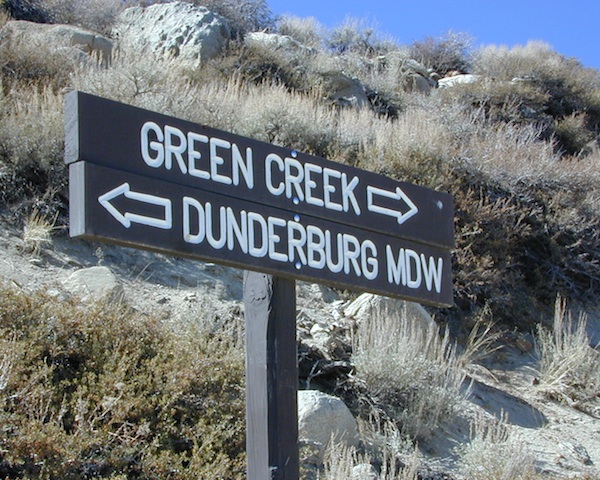
Another dirt route, Dunderberg Meadow Road peels off to the left. Dunderberg departs  off Green Creek a couple of miles from the highway and well maintained. This route leads to meadows, aspens, picture perfect scenery and much more seclusion. Passenger car accessible, wide graded dirt roads to wilderness edges. Two-track one lane trails lead to meadow edges and more creeks. Very impressive views of the Sierra peaks over here on this side. Meadows are sensitive areas, wonderful for picnics and you should always minimize impact.

State Park California

Green Creek Wildlife Area
Mono County, California

Aspen Grove Camping for RVs

  • alpine lakes
  • backpacking
  • bird watching
  • camping
  • creeks
  • day hikes
  • fishing
  • hiking
  • horseback
  • hunting
  • mountain biking
  • wildlife
  • wilderness

Plain old passenger cars can easily make this route deep into the Eastern Sierra aspen canyon. Graded dirt and4x4 could be needed winter months. Backpackers can enjoy easy access to the Hoover Wilderness trailheads. There is plenty semi-primitive camping spots along the way, right on the creek, for free…. so no need to sleep in your vehicle upon arrival.

Autumn Aspen Groves: fall colors peak in October, which is usually when the first snows for the winter season start. November – usually the freeze gets them and lifeless brown leaves dangle, until the Sierra Nevada wind gust blow real good.

camp

Green Creek Camping

DIRT ROAD CAMPING

  • alpine lakes
  • backpacking
  • car camping
  • day hikes
  • fishing camping
  • meadows
  • RV camping
  • tent camping

Hoover Wilderness

Dispersed, primitive camp spots along this main dirt road are on a first come basis. You’ll need a fire permit. Many flat camps are set along the creek in aspen groves, some pines, others have  cubby hole privacy. Large granite valley, big creek, bird, scenery and nature everywhere.  Some folks spend weeks camping out here in the warm weather months. Fishing is a big attraction.

Old Cabin in autumn leaves, up near the top of the dirt road deep in the aspen grovesNFS

Green Creek Campground USFS
7500 elevation
11 camp sites
fee, open May – October
trailhead parking nearby

hiking trails lead to

hikes

TOPOGRAPHIC MAPS:

Aspen Camp

28E201 – Inyo NF

trailsdown

Road #28E201 – Inyo National Forest
also known as Inyo Road #4S86

Laurel Lakes Road
Inyo National Forest
Eastern Sierra, California

Southeast of Mammoth Lakes, CA
West of Crowley Lake, CA

Steep, rocky, gravel road, way up above (and behind) Convict Lake. 4WD may be needed during wet or snowy weather. High clearance is always advised. Locked GATE at the bottom means the NFS rangers have closed the route (seasonally) for deep snow, rock slides, avalanches, or other erosion hazards.

Laurel Canyon, US Hwy 395
Laurel Creek
Laurel Lakes

amigoaspens
Laurel Lake Road, Eastern Sierra

Find more INYO BACK ROADS

  • backpacking
  • camping
  • fishing
  • hiking
  • horseback
  • lakes
  • mountaineering

GenevieveLake

Trailhead to Lake Genevieve (pictured above), hike lake loop, snowy peaks.
NOTE: No easy access to the PCT (Pacific Crest Trail)

Laurel Mountain (elev 11,818′)
Bloody Mtn. (12,544′)

oldestrocks

gnarlyrocks
CLICK TO ENLARGE

Geologic:

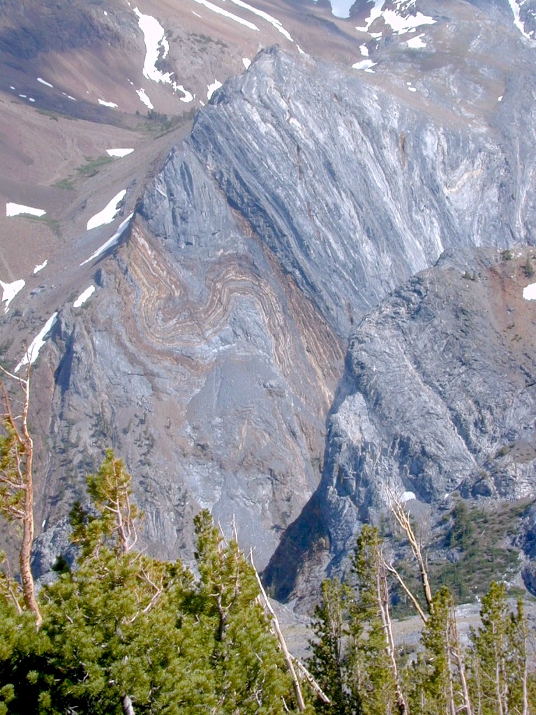
Oldest, exposed rock in the Sierra Nevada mountains range. Buckling granite w/ volcanic rocks. Evidence of glacial activity including, terminal, lateral, and recessional moraines, glacial striations and polish, erratic boulders, and of course the numerous lakes. see more

Volcanic Eastern Sierra
Volcanic hikes in the Eastern Sierra

Inyo Forest Roads

Baker Creek
Baker Creek, Inyo NF

Eastern Sierra Nevada – Inyo Mountains
Inyo Forest Back Roads – Mammoth Off Road

Off Road near US Highway 395. Yep, Olancha has some OHV (off-road) areas near the dunes, but this web site is dedicated to the real deal, the scenery, the trail heads, the hot springs, great secluded camping & of course, back road exploring.

You will need a Inyo National Forest map to discover these back roads. These are minimally traveled routes, un-maintained, sometimes washed out, eroded & maybe even creek crossings (without a bridge). Some gravel two-lane routes, some one lane roads leading deep into dead end canyons.

A few popular routes are paved, but most of these listed are indeed dirt roads. Some may require high clearance vehicle, or even 4×4. Know your vehicles limitations & be prepared to turn back when the road worsens. Cuz more often than not, it’s a sign of what more difficult terrain is to come.

coyote creek route

Watch out for live stock – they are dumber than they look.

Owenyo Rd – Wanna parallel the highway (395) on dirt; Sure, it’s a long bumpy route – from Hwy 136 @ Dolomite to Bend City @ Mazourka Cyn.

Road# 13S05 – Mazourka Canyon Rd – leads up to some old mining camps & way behind Mazourka Peak (9410′) deep into the Inyo mountains. It’s all desert on this side, but these canyons have pinyons & more vegetation than you would imagine. Road# 9S15 & 9S14 circle Andrews Mountain (9460′) then join back up w/ Death Valley Rd (the North Pass into Saline Valley).

Ancient Bristlecone Pine Forest has some great dirt roads surrounding it. After you are finished with all the touristy sights & you don’t wanna spend the rest of the day in the visitors center or back at camp, try Cottonwood Canyon – full of aspens, camp sites & fishing, not cottonwood trees. 4×4 is required. Crooked Creek has boulders, boulders & more boulders. Plus some amazing camp sites with open sky views. Silver Canyon is for high clearance only, 2WD okay. This will lead you down to Laws Railroad Museum on Hwy 6, on the back side of Bishop, CA

Benton Crossing Rd (green church @ 395)
This wide road leads out to multiple dirt roads that peel off in every direction. Many Eastern Sierra Hot Springs can be found out here – on the east side of the highway. No hot spring resorts, no facilities, no clothing & very primitive.

Bishop 4×4 route Coyote Flat
Coyote Wash leads up to Coyote Flat & out to Coyote Lake. This a a spectacular high altitude plateau overlooks the Owens Valley & requires 4 wheel drive just to get up there. Pinyons, junipers, aspens, wildflower meadows, old mines, & yes, lakes at 11,000′ elevation. Views of the High Sierra & South Lake.

Buttermilk Road – This dirt road is north turn off of Hwy 168, W of Bishop, CA. “The Buttermilks” are a popular spot among rock climbers. A great place for indian petroglyphs too!

Road# 9S21 – Glacier Lodge Road – Paved road. Creek exploring & fishing. Plenty Campgrounds. W of Big Pine CA

Horseshoe Meadows Rd – Paved route with great views over Owens dry lake bed; access via Lone Pine CA; A nice day trip to meadows & High Sierra scenery. Picnic & day hike!

McMurray Meadows Rd – south off of Glacier Lodge Rd (#9S21) just W of Big Pine CA. You can find ancient cinder cone volcanoes & cave-like lava tubes in between this long dirt road & the highway.

monacheMonache Meadows is a high elevation meadow that takes some time & determination to get to. This area is part of the Inyo National Forest, but can be accessed by either: backpacking thru the high Sierra’s or driving a high clearance vehicle thru Sequoia NF # 22S05 Sherman Pass Road, behind the Black Rock Ranger Station & Troy Meadows Campground. High clearance is needed, 4×4 maybe. Great camping sites near Olancha Peak trailhead. The area is surrounded by Golden Trout Wilderness & South Sierra Wilderness. From US Highway 395 to Kennedy Mdws & then Monache is a full day of exploring, so you may as well stay the night up there. But bring warm gear, a campfire permit & a capable vehicle.

Manzanar Routes – Back behind Manzanar Camp there are miles of dirt roads to explore. Many creeks side camp sites can be found even with a passenger car. Small trees & sage brush. Secluded camping (for free) is possible in the Eastern Sierra.

Mono Craters (Rd# 1N11) – the youngest mountain range on the continent. Just south of Mono Lake, this route skirts the pumice cones & climbs over the Aeolian Buttes, before it meets back up with Hwy 395.

Walker Creek Rd #19S01 – Oaks & creek. South of Olancha CA, look for turn off & follow dirt road up into the tight canyon.

Fish Slough Road (Rd #3V01) – open, high-desert area near volcanic tablelands. Find Indian Petroglyphs. N of Bishop, CA

keough hot tubInyo Road# 6S16 – Pine Creek Road – Creek exploring & fishing. NW of Bishop behind Rovana, also known as Round Valley, CA

Road# 4S02 – Owens Gorge Road – N of Bishop behind Lake Crowley. Camping w/ boulders & pines. Good open sky views for stargazing.

Road# 4S86 (Inyo Rd #28E201) – Laurel Lakes Road – Camp in aspens @ Laurel lakes, high elevation; access to alpine lake trailheads; SE of Mammoth Lakes, CA

Road# 2S05 – Deadman Creek – Creek fishing in forest. N of Mammoth

Road# 2S07 – Owens River Road – Pine forest, near hot springs; no facilities. N of Mammoth

Road# 1S63 – June Lake Loop is CA SR 158 (Hwy 158) paved main route, which is often closed for winter months, due to deep snow.

Road# 1N17 North of June Lake Loop; dirt road access to Parker Lakes & Walker Lake trailheads; Side canyon routes offer (unmarked) picnic areas and fishing spots; few primitive camping options.

Road# 1S25A Parker Lakes Road– Aspen & pine forest, near creeks; E of Grant Lake / N of June Lake

Road# 1S23 Walker Lake Road – Pine forest route to Walker Lake; E of Grant Lake / N of June Lake

Impressive Canyons

4S12 – Inyo NF

rockcreekroad

Rock Creek Road

Rock Creek Lake, Eastern Sierra, California

Inyo Forest Road #4S12
also known as Inyo Road 12, and also Rock Creek Rd.

Majestic mountain scenery. Popular paved route that leads from US 395 up to Rock Creek Lake, on the edge of granite wild lands; lake is situated above 9000′ elevation and the hiker trailheads are further up, beyond the lake at over 10,000 feet. Steep canyon, large canyon, rocky granite canyon, high elevation.

Super scenic drive, but open less than half the year, due to deep snow. Eastern Sierra Nevada mountains. Inyo National Forest

North of Bishop, CA
South of Mammoth, CA
SW of US Highway 395

hikes horse camp bike

backpacking
camping
fishing
hiking
horseback
trailheads
wilderness

A popular and favorite place for summer camping, fishing and hiking. Backpacking, horse trails, high elevation lakes, mountain passes, peaks, wilderness areas. RV campgrounds, tent camping, car camping. Mountain biking in vast canyon, near campgrounds and creek. No bikes in the Wilderness (up and above Rock Creek)

Autumn colors, aspen groves usually best in early October. Snow closure in winter months (Nov-May).

snowyautumn

elevation 7072′ @ Tom’s Place, CA (US Hwy 395)
elevation 9682′ @ Rock Creek Lake
elevation 10,272′ @ Trailhead Parking (end of road)

UP, UP, HIGHER & AROUND LAKE
One lane, paved route gets narrow, but keeps on climbing. Road #6S05 continues up – past Rock Creek Lake and ends at hiking trailheads, paved parking lot and a few picnic spots.

iris meadow
Iris Meadow Campground NFS

12 NFS Campgrounds in this region, starting with one at the highway, several along the way and the campgrounds at Rock Creek Lake.

No campfires are allowed in this canyon – outside of a developed campground. Not much in the way of primitive car camping options either, except for strapping on a backpack and heading into high elevation wilderness.

rockcreeklake

Rock Creek Lake

Rock Creek Campgrounds

Inyo National Forest
John Muir Wilderness

Trailheads along Rock Creek Road #4S12

  • Upper Hilton Lakes
  • Tamarack
  • Lakes Valley (Little Lakes)
  • JMT – John Muir Trail

Rock Creek NFS Hiking Trailheads (download PDF)

Eastern Sierra Maps:
Inyo National Forest Map USDA
John Muir Wilderness Maps
Mammoth Lakes Map by NatGeo
Mono Divide High Country Map


rock creek lake
Rock Creek Lake, first snowfall (Autumn)


looking for another place called ROCK CREEK in California? (we are working on that)

6S05 – Inyo NF

6S05bridge

Paved, one-lane extension of #4S12, Rock Creek Road.
Up above Rock Creek Lake, East Sierra Nevada, California

High elevation 10,272′ at roads end and parking lot

Little Lakes Valley Trailhead
Mono Pass
Morgan Pass
John Muir Trail (JMT)
Pacific Crest Trail (PCT)

Mosquito Flat Picnic Area

Restrooms, paved parking lot, nature trails, fishing creeks, horseback, wilderness trails.

hikes NFS camp horse camp

Mosquito Flat Walk-In Campground is intended for backpackers departing overnight into the backcountry the following day. Single night stay ONLY. Please camp down canyon if you plan to stay for more than one night. Bear lockers are provided at campgrounds for proper storage of food items, so use them!

No campfires are allowed outside of developed campgrounds. Day use does not require a permit. Wilderness permits are required for overnight trips into the John Muir Wilderness. Bear containers are required for backpackers. Permits for these trails are issued at Inyo National Forest ranger station in Mammoth, or the Eastern Sierra Visitors Center (ESIA) near Olancha.

littlelakesvalley

John Muir Wilderness (JMT) trails, Pacific Crest Trail (PCT), epic scenery, alpine lakes, high elevation. Eastern Sierra

Rock Creek NFS Hiking Trailheads (download PDF)

Rock Creek Pack Station provides wilderness pack trips on horseback, and day rides too.

Road and canyon is CLOSED for winter snow approx. NOV-MAY

snowlane

Peaks and passes surrounding Rock Creek Canyon, in the Eastern Sierra Nevada Mountains –

Red Mountain 11,472′ (elevation)
Mount Morgan 13,748′
Morgan Pass
Mt Huntington 12,405′
Mono Rock 11,554′
Mono Pass
Mt Starr 12,835′
Mt Mills 13,451′
Mt Abbott 13,704′
Round Valley Peak 11,943′

Hike or horseback ride to these alpine lakes from Rock Creek Rd trailheads –

Davis Lake
Hilton Creek Lakes
Patricia Lake
Golden Lake
Pioneer Basin Lakes
Trail Lakes
Summit Lake
Ruby Lake
Mills Lake
Gem Lakes
Treasure Lakes
Dade Lake
Upper Morgan Lake
Lower Morgan Lake
Chickenfoot Lake
Little Lakes
Box Lake
Heart Lake
Marsh Lake
Serene Lake
Eastern Brook Lakes
Tamarack Lake
Buck Lake
Francis Lake
Dorothy Lake
Kenneth Lake

1N17 – Inyo NF

1N17

Road #1N17 – Inyo National Forest

Highway 158 @ Grant Lake, North June Lake Loop

Forest Road 1N17 is a major graded dirt road that connects June Lake Loop to the Lee Vining junction, the back way. West side of US 395; south of Hwy 120.

At north end of Grant Lake, slow down and look for the signed intersection. Sage brush hills and big drainage, with towering granite peaks above.

This well-traveled, wide dirt road leads along the base of the mountain range on BLM land, skirting the National Forest. Several side routes head up into numerous canyons, which are part of Inyo NF. Suitable for SUV, passenger cars, camper van and small RVs. Easy access off US Highway 395 and June Lake Loop #1S63

side routes off #1N17 –

Parker Lakes Road #1S25A
Sawmill Canyon #1S24
Bloody Canyon #1S23
Walker Lake Trailhead
Bohler Canyon #1S19
Gibbs Trailhead #1S106

walkertrail

Several hike-in only lakes, creek camping, some seclusion. Great picnic areas, trail head access, short or long hikes. National Forest lands. Backpacking, day hiking and primitive camps, some deep in the aspens. Autumn here can be gorgeous, and these are all prime summer time camp sites, for free. Make sure to get your campfire permit ahead of time, at ranger station in Mammoth. Wilderness permits may also be required for overnight camping in this canyon, so check with the NFS rangers on that issue.

towns nearby:
June Lake, CA
Lee Vining, CA
Mammoth Lakes, CA
Mono Lake, CA

Ansel Adams Wilderness
Inyo National Forest

Certain areas back here can be muddy in springtime, other major routes can even be over whelmed with water when creeks swell. Summer thunderstorms are common. One lane bridges should always be driven with caution, especially on dirt roads. Always be extra slow when driving thru water at creek crossings.

area maps:
Inyo National Forest USDA
Ansel Adams Wilderness Maps
Mammoth Lakes Map by NatGeo

summerstorm

1S63 – Inyo NF

junelakeloop

June Lake Loop – Hwy 158

also known as Road #1S63 – Inyo NF
and as California State Route 158
CA SR 158, or just Highway 158

Eastern Sierra Nevada

The quieter side of outdoor life can be found around June Lake. Fishing, camping, cabins, lodging, several lakes and one ski resort. When the busy-ness and crowds of Mammoth Mountain annoy, it is time to look elsewhere for your Eastern Sierra vacation.

June Lake is the neighboring community to the north, just a few miles from Mammoth, off US 395. The paved loop highway (158) is a wondrous scenic drive and awesome for outdoor recreation; but is subject to winter closures during NOV-MAY.

backpacking
boating
camping
fishing
hiking
horseback
snow ski

Autumn colors on this highway attract a fair amount of annual visitors. Book campgrounds or lodging (in summertime) for late September to early October for the best timing on fall foliage. First snow of the season usually arrives sometime in October.

grantcontrast
lake and creeks near the loop –

June Lake
Gull Lake
Silver Lake
Grant Lake

Rush Creek
Reverse Creek
Walker Creek

fernlake

Fern Lake – hike-in

walkerlake

Walker Lake – hike-in

Inyo Forest Road #1N17 is a dirt road, off the main highway. Route leads north from Grant Lake over to Lee Vining junction @ CA 120. Numerous side routes up into scenic canyons, most of which are well signed. Perfect exploring for day hikers, creek fishing, small lakes and primitive camping spots.

Parker Lakes
Walker Lake

Inyo National Forest
Ansel Adams Wilderness

June Lake, CA

nearby towns:
Lee Vining, CA
Mammoth Lakes, CA

area maps:
Inyo National Forest USDA
Ansel Adams Wilderness Maps
Mammoth Lakes Map by NatGeo

Eastern Sierra Hiking

Eastern Sierra Hiking Trails – Mammoth Hikes

Autumn Bliss Hike

Desert ghost towns to Sierra meadows & waterfalls, Inyo National Forest offers plenty of diversity for scenery. To list all the hikes in the Eastern Sierra would be obsurd, cuz there are so many trails. This side of the Sierra Nevada is all about hiking, fishing & camping.Inyo forest map

No matter where you hike you will probably get a great view over the Owens Valley, Long Valley Caldera or Mono Lake. So that means most of those trails are hiking up a canyon, or a ridge line. Thousands of trails over this region require a good map to make the best decision for your hiking interest.

US HWY 395: The Eastern Sierra is one of the premier hiking destinations of California. Featuring the granite crags of the HIgh Sierra peaks. Mount Whitney, the tallest peak is closest to Lone Pine. Southern Californians love Eastern Sierra destinations, cuz they can avoid Los Angeles Basin and stay outta traffic.

Lone Pine Lake – Whitney Portal is a great, but crowded place for hiking. DO NOT ATTEMPT to hike to Mount Whitney in one day! Leave it to the seasoned pros. The first good stop up the Whitney Trail is gorgeous Lone Pine Lake, a great moderate day hike from there.

Alabama Hills – just below Mt. Whitney and has a totally different landscape than the backdrop granite Sierras behind. Try some boulder hopping & explore the dirt roads. Bring your mountain bike too.

Cottonwood Lakes (Pacific Crest Trail) – day hikes to alpine lakes. US 395 @ Lone Pine, W on Whitney Portal Rd. Left on Horseshoe Meadow Rd & continue up 19 mi. to the Horseshoe Meadow campground. Mostly a trail head camp, way, way up there. Open May – November

Kearsarge Pass – from 9000′ Onion Valley you can access the incredible High Sierra & numerous alpine lakes. The elevation gain makes this a full days hike; rated strenuous. Or continue on w/ backpack into Kings Canyon National Park.

Devils Postpile – back behind Mammoth Mountain, creeks, forest & cool geology awaits. Plenty hiking trails.

FALL COLORS: Autumn is the best time to enjoy the gorgeous aspen groves, as they change colors w/ the onset of winter.

Eastern Sierra Peaks

Topo maps, wilderness hiking maps
Equestrian trails, OHV maps –


Sierra High Country Hikes
Originally uploaded by danamight

Trailhead @ Onion Valley leads up to impressive alpine lakes, Kearsarge Pass & Kings Canyon High Country.

Eastern Sierra communities include:

Alabama Hills
Alabama Hills @ Lone Pine, CA

Ansel Adams Wilderness

anselwoodsign

Alpine high country hiking, Sierra Nevada mountains, California

Ansel Adams Wilderness Area

Ansel Adams Trail Map, Tom Harrison
Ansel Adams Map, Forest Service USDA
Ansel Adams Map, NatGeo

Ansel Adams Hiking Map
The Ansel Adams Wilderness is an area in the Sierra Nevada of California. The wilderness is part of the Sierra and Inyo National Forests, in the Eastern Sierra portion of the range, overlooking Mono Lake. Yosemite EAST is what NatGeo likes to call it. The wilderness spans 231,533 acres with Yosemite National Park lies to the north and northwest, while the John Muir Wilderness lies to the south.

The wilderness was established as part of the original Wilderness Act in 1964 as the Minarets Wilderness. The 109,500-acre Minarets Wilderness was created by enlarging and renaming the Mount Dana-Minarets Primitive Area.

In 1984, after his death, the area was expanded and renamed in honor of Ansel Adams, well-known environmentalist and nature photographer who is famous for his black and white landscape photographs of the Sierra Nevada.

Ansel Adams Wilderness Map

outdoor recreation –

  • backpacking
  • camping
  • fishing
  • hiking
  • horseback
  • ice climbing
  • lakes
  • mountaineering
  • peaks
  • wildflowers

surrounding park & forest lands –

nearby towns –

leeviningvalley
lee vining canyon

Ansel Adams Wiki
Ansel Adams Hiking on Summit Post

Day hikes or overnight backpacking trips require a Wilderness permit and can be obtained at the local ranger station. A good topo map will also prove invaluable on your hike. Access trailheads for Ansel Adams Wilderness from EAST and WESTERN sides of the Sierra Nevada range.

Ansel Adams Trailheads from the west –

Onion Springs Meadow trailhead, Vermillion @ Lake Edison (Sierra NF)

Isberg trailhead & Mammoth trailhead @ Granite Creek Campground via Beasore Road, way up behind Bass Lake (Sierra NF)

Isberg Pass trailhead from Yosemite National Park

Ansel Adams Trailheads from the east –

Bloody Canyon, Walker Lake trailhead, near Grant Lake on June Lake Loop (Inyo NF)

Rush Creek / Fern Lake trailhead, near Silver Lake on June Lake Loop (Inyo NF)

Agnew Meadows trailhead & Minaret Vista trailhead, Mammoth Lakes CA (Inyo NF)

Devil’s Postpile trailhead, behind Mammoth Lakes CA (Inyo NF)

Fern Lake Reflection
Fern Lake, day hike from Hwy 158 (June Lake Loop)

Travertine Hot Springs

Eastern Sierra Hot Springs

Travertine Hot Pools, Toiyabe National Forest

Travertine Tubs

Inyo MapSouth of Bridgeport, California
just off US Highway 395

Also known on some maps as Travertine ACEC.

Take the road next to the Ranger Station (South of Bridgeport, along Hwy 395); Drive up the hill and past the rock quarry. Bear right & look for dirt parking lot. Two pools, short walk, no shade, wonderful views of the Sierra Nevada mountains.

Popular with local commuters and travelers, with easy access off the highway. Great spot for views westward w/ sunset picnic and soak.

Dirt Road with Views

campNo overnight camping allowed at Travertine hot springs (posted signs)

Plenty of great, free, camping nearby:
Primitive or developed Campgrounds.

Views to Bridgeport Valley

Hoover Wilderness Trails

parks, lakes and forests nearby:

nearby towns:

Travertine Rock

Mono Lake California

The Great Basin meets California, at the Eastern Sierra Nevada Mountains

Navy Beach, Mono Lake

Mono Lake


elevation: 6383′
Eastern California
US Hwy 395 @ CA SR 120

East of Yosemite NP
Lee Vining, CA

Mono Lake

Rumor has it this lake basin could be the ancient super volcano of the region. MonoLake is located on the north end of the Long Valley Caldera, a volcanic ridge which stretches down to Bishop and parallels Mammoth Mountain & US 395.

Huge shallow lake with a very turbulent history. Signs and plaques throughout the lake shore give info on ancient history of the lake, the wildlife, and regional detail. Majestic views of the Sierra Mountains, with sparse vegetation, lunar type landscape. Eerie with storm clouds; Beware of bad weather. Kayakers love this lake too!

Sierra Nevada backdrop

Canoeing
Hiking
Hot Springs
Kayaking
Picnic
Primitive Hot Springs
Stargazing
Volcanic Landscape

Mono Lake Camping

Camping is closeby, but not located on the fragile lakeshore.
open camping
Dispersed camping (FREE) is allowed in Mono Basin National Forest Scenic Area, the region that surrounds the Tufa State Natural Reserve. Campfire permits are required. Contact the park listed below for all the details on the camping policy.

campgrounds
Camps include National Forest Campgrounds in Lee Vining Canyon (8 miles), June Lake Loop (15 mi), Lundy Lake (12 mi). Private RV parks can be found in nearby Lee Vining and further south, at Lake Crowley.

[PDF download]
Camping In The Mono Basin
by LeeVining.com

Inyo National Forest USDA
Camping Mono Lake Ranger District

local links:

Mono Lake Tufa State Natural Reserve
California State Park
760-647-6331

Mono County Tourism
MonoCounty.org

760-924-3699

Mono Lake Committee
MonoLake.org

Bookstore @ 3rd, Lee Vining
760-647-6595

Tufa Towers

nearby interests:

Yosemite National Park
Inyo National Forest
Toiyabe National Forest
Benton Hot Springs
Bodie Ghost Town
Convict Lake
Mono Craters – Panum Crater & Crater Mountain
Long Valley Caldera
Lundy Lake
California Aspen Groves
Autumn Colors Camping

Long Valley Craters Mono Lake
Long Valley Caldera Craters near Mono Lake

regional maps:

Tom Harrison Mono Lake Map

NatGeo Mammoth Lakes & Mono Map

Inyo National Forest USDA Map

Ansel Adams Wilderness Maps

nearby towns w/ lodging:

Benton Hot Springs
Bridgeport, CA
Lee Vining, CA
June Lake, CA
Mammoth Lakes, CA


View Larger Map

Bureau of Land Management

free desert washes

California BLM

desert figure blythe
Giant figures INTAGLIOS, on desert floor, near Blythe, CA

Camping while traveling. The east-west corridors across the California deserts are well traveled routes. If you plan to camp, get to know areas managed by the California Bureau of Land Management.

All BLM Offices in California BLM CA

  • 4×4
  • Back Roads
  • Car Camping
  • Canyons
  • Deserts
  • Dirt Bike Trails
  • Dunes
  • Hiking
  • Historic Sites
  • Hot Springs
  • Intagios
  • Mountain Bike
  • Off Road
  • Palm Canyons
  • Petroglyhs
  • River Camps
  • RV Camping
  • Slot Canyons
  • Tent Camping
  • Wildflowers

ocotilloBLM

BLM lands in California are often known as the ‘free camping’ option. freeway close campingNo charge camp sites, convenient, in-route locations, many areas along major highways or interstates. Campfire permits are always required for any open fires, BBQs and campfires.

BLM Field Offices in California located in neighboring towns can provide maps, information and campfire permits. 

giantcholla

DESERT WILDFLOWERS can be found annually, February – April in most of these areas. Springtime blooms draw the crowds, but few visitors actually camp out overnight.

When searching out premium camp sites – drive slower than 50 mph & look for the brown recreation signs. Since people like to drive fast in the desert, make sure to put your hazard lights or blinkers on, so traffic knows you are slow poking. Typically dirt roads are only marked with small, thin reflectors, maybe numbers or letters, if you’re lucky.

Traffic noise will be minimal if you camp away from the main drag at least ONE mile or more. Motorhomes may not have the luxury to travel that distance; they often prefer to stay in large, level, flat pull outs, right near the pavement.

If daring to venture more than 2 miles from the pavement, be prepared for rough conditions. 4WD drive may be needed in certain spots, or in the wettest of weather. Wind is always a factor in desert regions, so keep that in mind. Deep sandy washes, tow strap anyone? No facilities, no services, no toilet. Spotty cell phone coverage. Basically – the boonies!

BOONDOCKING
is the latest phrase for “open, free camping”

Palo Verde Washes


SEEKING QUIET CANYONS? stay away from the off-roaders. They usually congregate in dunes and specified OHV areas. Trails and dirt roads are for multi-purpose use, so a variety of recreation can be had. Many people use these public lands, so leave them clean and better than you found it. Boulder coves, palm gardens, primitive hot springs. There are plenty of hidden camp spots within the vast desert region of SoCal.

Several BLM lands are near Wilderness Areas. Camping is allowed close by, mountain biking & hiking are usually abundant. Off roading prohibited within Wilderness boundaries.

hikes tent camping 4x4

URLs within the official BLM site keep changing, which is why we are rebuilding our BLM pages. So you can find what you need, easily.

ca.blm.gov
blm.gov/ca

www.blm.gov/ca
https://www.blm.gov/california

road BLM

John Muir Trail Map

John Muir Wilderness Maps

Sierra Nevada California / Inyo National Forest & Sierra National Forest

topo detailsTom Harrison John Muir Map Pack

This one is the most detailed, easy to read map available for this popular High Sierra region. The maps are compact size 8.5″ x 11″, waterproof & tear resistant, easy to store in a backpack. The pack contains 13 individual sheet maps of the John Muir Wilderness.

JMT Maps

Buy JOHN MUIR MAPS on Total Escape!


USGS National Forest Service John Muir Wilderness Map

The Forest Service edition of topo maps for the John Muir Wilderness, including the Sequoia-Kings Canyon Wilderness as well. Old fashioned paper maps, large, folded, 2 pieces in one envelope.

Area maps surrounding the John Muir Wilderness:

john muir

Yosemite Lakes

yosemite camping lake
Lakes in & around Yosemite

These are picnic lakes, hiking lakes and camping lakes that are located inside Yosemite National Park or the surrounding areas bordering the granite wonderland.

Tioga
Tioga Tent Camping

John Muir Wilderness

John Muir Hiking / John Muir Map

High Sierra Hiking

California Wilderness Area Acres Topographical Maps
John Muir Wilderness

elevations: 4000′-14,496′

584,000 John Muir Wilderness Maps
Inyo National Forest

JMT

High Sierra Nevada / Eastern Sierra

Rugged Sierra Nevada high country. The highest peaks in the Sierra Nevada mountains can be found inside this Wilderness. Many peaks are well above 13,000 feet. Granite, glaciated basins, big snow, alpine lakes, meadows, wildflowers, streams, creeks, cliffs, jagged peaks. Mount Whitney stands as the tallest mountain in the lower 48 states.

John Muir Trail Maps
– JMT Topo Map

lacontedivide
Le Conte Divide, Sierra Nevada California – 12,000′ elevation peaks

Eastern access via steep granite hiking, off US Hwy 395 (Bishop, Independence, Lone Pine)
Western access backpacking thru Kings Canyon National Park, Hwy 180
or Sequoia National Park, Hwy 198 (Mineral King, Three Rivers)
or Sierra National Forest, Hwy 168 (Lake Edison, Florence Lake, Courtright Reservoir)
North access via backcountry Yosemite National Park, Hwy 120
or Mammoth Area towns (Lee Vining, June Lake, Mammoth Lakes)

Hundreds of miles of hiking trails, some of the highest peaks in the nation. Trails open to equestrian and foot traffic only. Trailhead quotas limit the amount of day hikers and backpackers that an access the Wilderness daily. Wilderness permit required: Inyo National Forest Permits

Eastern Sierra Visitor Center
Inyo Visitors Office

JM Topo Trails

USDA National Forest
USFS, NPS, BLM

NFS NPS

Eastern Sierra Interagency Office
US Hwy 395 @ SR 136
Lone Pine, CA 93545
760-876-6200

JMT
JOHN MUIR TRAIL- John Muir Wilderness

nearby towns, parks & resorts:

Aspendell
Big Pine
Bishop, CA
Courtright Reservoir
Florence Lake
Independence, CA
Kings Canyon National Park
Lake Edison
Lone Pine, CA
Mammoth Lakes
Olancha, CA
Tom’s Place
Wishon Reservoir
Yosemite National Park

www.flickr.com

Hiking Mount Whitney

Mt Whitney Trail / Mount Whitney Map

mt whitney mapWhen the snow melts in the High Sierra, the rush is on! This is one of the most popular backpacking trips in the Eastern Sierra, as Mt Whitney is the highest peak (14505′ elevation) in the contiguous United States of America.

Day hikes to the summit should only be attempted if you are in excellent physical shape & used to high altitude hiking. There are so many folks trying to hike this sought-after peak in the warmer summer months (MAY-OCT) that the National Forest has put tight restrictions on these Mount Whitney trails. You must obtain a Wilderness hiking permit for this hike & that requires waiting in a long line of outdoor enthusiasts that also seek this prime destination.

The Lone Pine Ranger station holds an annual Whitney trail LOTTERY, where you must apply a year in advance & be granted a permit before you can set foot on this popular hiking route.

An alternate backpacking route to Mt Whitney is the southern ridge line from the Cottonwood Lakes trailhead, but you still must verify with local authorities for permits & Wilderness passes.

The Alabama Hills, between US Hwy 395 @ Lone Pine CA and the Whitney Portal offers camping and mountain biking trails with excellent views of Mount Whitney from below. A short drive up to the portal & you can stand in the waterfall mist & then do a day hike up to Lone Pine Lake.

Now that we have you salivating for this epic adventure, you can start your dreaming & real planning by ordering hiking topo maps of the region. Then after you have thoroughly reviewed the maps, the terrain (as well as your own physical condition), you can contact the Inyo National Forest / Lone Pine ranger office for more specifics on dates & details. This may take years of planning to make it happen.

lone pine roads

The Alabama Hills sit at the base of Mt Whitney, California

Camping Inyo

Primitive Camping Inyo National Forest – Eastern Sierra Car Camping

395 Sign

The mighty US Highway 395 runs from the Mojave Desert north through the eastern side of California, where the state line of Nevada meets. Mount Whitney and the tallest peaks run on the western range @ 14,000’+ the highest in elevation.

The Inyo Mountain range sits @ 11,000′ to the east side of the Sierra Nevada. Major elevations but little vegetation, when compared to it’s neighboring Sierra range. The Inyos lay in the rain shadow of the taller western mountains – but still get snow. Plenty of primitive SUV camping on the dirt roads throughout this desert area north of Death Valley.

camp sitesA more forested part of the Inyo National Forest is the Eastern Sierra region. Encompassing Mount Whitney & Mammoth Mountain area, plus the entire Hwy 395 corridor. This side of the Inyo National Forest is quite different that the desert range of Inyo.

Eastern Sierra back roads lead all over the place & may require 4WD. A high clearance 2WD can still get you to some awesome viewpoints & scenery. No picnic tables or toilets are available out in the boonies, but plenty of seclusion & vast open space wilderness. INYO Forest Service Map is highly advised for this area. There are many dirt roads for dispersed primitive camping w/ no fees. See the Camping Checklist to make sure you’ll have what you need.

Open (free) Camping along Hwy 395

Monache Meadows – This high elevation (8000′) south Sierra Meadow is accessible by 4WD truck or SUV. Near Kennedy Meadows CA

Walker Creek Rd – quick camp in the lowlands; an easy in route camping near oaks & creek. Southside of Olancha CA, look for turn off & follow dirt road up into the tight canyon. No RVs whatsoever.

Fish Slough Road – open desert camping w/ popular bouldering & rock climbing areas; near Indian Petroglyphs. N of Bishop, CA

Road# 6S16 – Pine Creek Road – Camp on creek, no facilities. NW of Bishop behind Rovana.

Lower Rock Creek Road – signed turn off US Hwy 395. Only a couple good camp spots tucked away in the trees. Small creek, very overgrown, traffic noise minimal. Nearby Round Valley @ Sherwin Pass had a big wildfire in wintertime (dry) FEB 2015!

crowley camps

Road# 4S02 – Owens Gorge Road – N of Bishop behind Lake Crowley. Free RV camping w/ boulders & pines

Road# 4S86 – Laurel Lakes Road – Camp in aspens @ small lakes, high elevation; no facilities. SE of Mammoth

Road# 2S05 – Deadman Creek – Camp in pine forest on creek; no facilities. N of Mammoth

Road# 2S07 – Owens River Road – Camp in pine forest, near hot springs; no facilities. N of Mammoth

Parker Lake Road – Camp along aspen creeks or in pine forest, near lakes; no facilities. E of Grant Lake on June Lake Loop (Hwy 158)

Coyote Flat 4×4 Bishop – just west of Bishop CA is a 4 wheel drive paradise, Coyote Creek – This steep dirt road is quite a climb. A true off-roaders dream of open space, great views, large meadows, & alpine lakes. Great primitive camping along creeks, in pine or aspen forest or near small secluded lakes. Real remote Sierra high country, usually only reached by backpackers, is accessible to those who dare to venture off the beaten path of Highway 395.

At the golf course keep your eyes peeled — from the highway take Schober Ln. / Underwood Ln. due west through a residential neighborhood to the backside of the town. Find the electrical power station to the left at the base of the hills. Veer onto the slightly paved /dirt road to the right of the station & continue straight up the sandy wash. 4×4 is recommended, since the lowest gears are needed for the careful climb. The road will begin to get steep & gain in elevation fast. The area up here changes with the mileage: passing pinyon pines on cliffs, topping off to high meadows & aspen lined creeks, finally reaching large towering pines & small alpine lakes with snow melt still visible. Basically TREE LINE. This region is most likely open only half the year, due to its high elevation of 8000’+ and winter snow.

  • BISHOP PASS TRAIL MAP
  • INYO Forest Service Map
  • PALISADES TRAIL MAP
  • WHITNEY MAPS
  • Hoover Wilderness

    Dunderberg Meadow

     Dunderberg Peak capped with snow about half the year @ 12,374′ elevation. Dunderberg Meadow is a side route off Green Creek Rd. Upper Summer Meadow Rd is another side route off Green Creek Rd.

    Eastern Sierra Hoover Wilderness

    East Yosemite National Park

    48,601 acres
    10 miles South of Bridgeport, CA
    Toiyabe National Forest Autumn Eastern Sierrasand Inyo National Forest

    Hoover Wilderness spans  the mountain ranges from Sonora Pass to Tioga Pass, with high elevation peaks ranging from 10,000 to over 12,000′ elevation. Emigrant Wilderness lies to the west of Hoover, with Yosemite National Park & Inyo National Forest to the south.

    • Twenty Lakes Basin
    • Virginia Pass
    • Virginia Lakes Basin
    • Lundy Pass
    • Bond Pass
    • Hoover Lakes
    • Return Creek
    • Little Walker River
    • West Walker River
    • Matterhorn Peak – 12,264′ elev

    towns nearby –

    Aspen groves in the Eastern Sierra are some of the best autumn colors in the whole state. Fall car camping includes nighttime temps in the teens w/ fishing and hunting nearby.

    PCT trails, Eastern SierraPacific Crest Trail passes partially through Hoover Wilderness inside  Yosemite National Park.

    Hoover trails are not all dirt road access, but most are. There are 2 major trail heads along Highway 120 inside Yosemite NP, which lead north to Hoover.

    Hoover trailheads –

    California SR Highway 120 (Yosemite NP):

    off US Highway 395:Hoover Trail Map

    Twin Lakes area:

    • Robinson Creek
    • Horse Creek
    • Cattle Creek
    • Tamarack Lake
    • Buckeye

    Little Walker River area:

    • Bort Canyon
    • Emma Lake
    • Molybdenite Creek

    California SR Highway 108 (Sonora Pass):

    hoover wilderness map

    Green Creek Road is a signed dirt road on US Highway 395, near Virginia Creek Settlement and across from the Bodie ghost town turn off. Green Creek Campground  (a developed NFS campground) also has trailhead parking for Hoover hiking trails. Primitive free camp site can be found all along this major graded dirt road.

    Many developed campgrounds in the surrounding areas – Saddlebag, Lundy, Virginia, Green Creek, Twin Lakes, Buckeye, Obsidian. Off Sonora Pass, Levitt Lake usually gets the most snow depth around and is only acessible in summer months. Super remote primitive camping for those with a high clearance vehicle.
    FRee Camping Green Creek


    Keough Hot Springs

    Keough Hot Ditch
    HWY 395. Bishop. First Keough visit w/ Ted, 1990
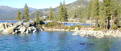
    Keough Hot Springs

    Keough Hot Tubs, Eastern Sierra

    Keough Hot Ditch

    7 miles North of Big Pine & 7 miles South of Bishop;
    on the west side of Hwy. 395

    Keough California is comprised of two soaking spots – a small resort and the primitive tubs below. An Eastern Sierra rustic Hot Springs Resort w/ campground, tent cabins rentals and nice landscaping. Big, clean hot pools at the top of the road. Entrance fees, trees and vegetation, next to the mountains. Seniors and families frequent this place. Swimsuits are required.
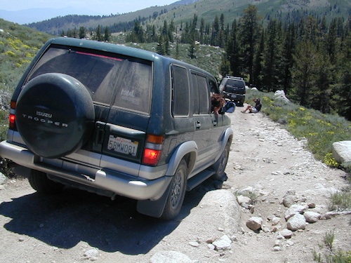
    Keough’s Hot Springs Resort
    800 Keough Hot Springs Road
    Bishop, CA 93514
    760-872-4670

    Keough Hot Springs

    The Ditch

    Below the resort and above the highway, are some primitive, free hot pools that require dirt road driving. Public nudity is common. Open 24/7 w/ several brush lined pools on the eastern slopes of the Sierra Nevada Mountains overlooking the high desert of the Owens Valley. Quite impressive for being just off the highway. Buzzing, huge powerlines overhead are one of the only drawbacks of this soak spot. This place can get crowded at certain times.

    Posted: No overnight camping allowed at these lower hot springs.

    Soaking at Sunrise

    US Highway 395:
    Look for the turn off in between Bishop and Big Pine, California. Take the Keough Hot Springs Road up hill until the second dirt road, turn right and the primitive hot springs will be on the left, just beyond the cold stream crossing. Sometimes a high clearance might be needed. Cars should park and walk the if unsure of the terrain. Do not park right next to the soaking tub, as the ground is too weak and vehicles have been known to slide in, unexpectedly. No kidding!

    Plenty great camping all around the Eastern Sierra region. For campsites with cooler temps, higher elevation, pine trees & creeks: Head for the Glacier Lodge Rd – Inyo Road #9S21, West outta Big Pine.
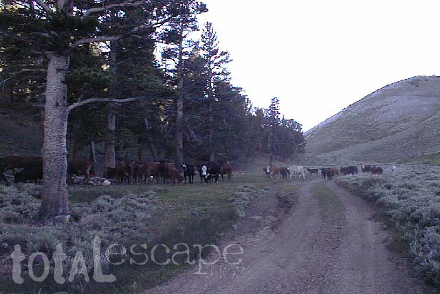
    Adventurous 4x4s can try super remote Coyote Flat, a super high elevation pinyon plateau that overlooks Bishop. Also Highway 168 W outta Bishop will lead to primitive camping areas like The Buttermilks, a rock climbing area. Further up the hill is alpine lake and creek camping in aspen groves.

    Many developed Campgrounds in the region.


    View Keough Hot Springs in a larger map
    also nearby:

    Inyo Forest Maps

    Eastern Sierra Mountains

    Eastern Sierra Mountains / Eastern Sierras California

    mount tom

    Wilderness seeker John Muir called the Eastern Sierra, the range of light. It’s desery & drastic. Tons of granite & wild-ness. The impressive, tallest peak in the lower 48, Mount Whitney towers at elevation 14888′ over the Owens River Valley. Death Valley meets mountains. Ancient volcanoes & fresh granite. Creeks are alive throughout summer. Alpine lake hikes & their wild flowers are incredible. Horseback trails, rentals, pack trips are very popular. Total Escape even list high country Inyo 4×4 routes, that overlook Bishop.

    Eastern Sierra forest & parks –
    Inyo National Forest
    Toiyabe National Forest – north (Carson)
    Toiyabe National Forest – south (Bridgeport)

    Ancient Bristlecone Pine Forest

    Ancient Bristlecones

    inyo maps

    Eastern Sierra maps & trails –

    Eastern Sierra towns –
    Aspendell, Big Pine, Bishop, Crowley Lake, June Lake, Lee Vining, Lone Pine, Mammoth, Olancha, Toms Place

    south lake bishop

    cottonwood lakes

    Tuttle Creek Campground

    Tuttle Way

    There she sits, above Lone Pine California, right next to the High Sierra. Above the Alabama Hills….. at the base of Whitney, on an alluvial fan overlooking the Owens Valley & US Hwy 395.

    Tuttle Creek Campground is perfect stop for RVers traveling the Eastern Sierra, beginner mountain bikers needing to explore & test their skills, or the avid backpackers waiting to acclimate & get a good nights rest in reasonable temperatures, before attempting the tallest Mount Whitney.

    Tuttle Creek is a BLM Campground w/ picnic tables, fire rings or BBQs. Awesome creek camping at the base of Mount Whitney. Hear the water rushing over the boulders; soothing for bedtime or stargazing. The fishing is decent. Wildflowers like indian paintbrush & lupine can be found here in spring and summer, in the high desert sage lands of the Eastern Sierra.

    • Elevation: 5120′
    • Number of Sites: 85
    • Vehicle Accessibility: RVs okay
    • Camp Fee: No
    • Campsites Reservation: No
    • Length of Stay: 14 Days
    • Season: March – October
    • Trailheads: John Muir Wilderness

    From Lone Pine CA, head West 3 miles on Whitney Portal Rd, turn LEFT on Horseshoe Meadow Road, within 2 miles, turn right on a dirt road that leads to the campground.

    Tuttle Creek flows past campground; No drinking water.
    Pit toilets; Some shade.

    BLM Lone Pine
    760-872-4881

    LONE PINE CA

    HINT: On the dirt back roads, on the slopes of the Eastern Sierra, between Lone Pine & Bishop, you can find & fishing holes & primitive camps (free camping) on any numerous of creeks; some you can park so close that you don’t have to leave your vehicle to fish. You may need a high clearance vehicle to reach some.