Central Sierra Nevada Mountains, California
Mokelumne Wilderness Area
 Mokelumne Map
Mokelumne (pronounced moo-ka-la-mi)
Backpacking, Camping, Fishing, Hiking, Kayaking Mokelumne River / Mokelumne Fishing / Mokelumne Trail / Mokelumne Wilderness Topographic Map
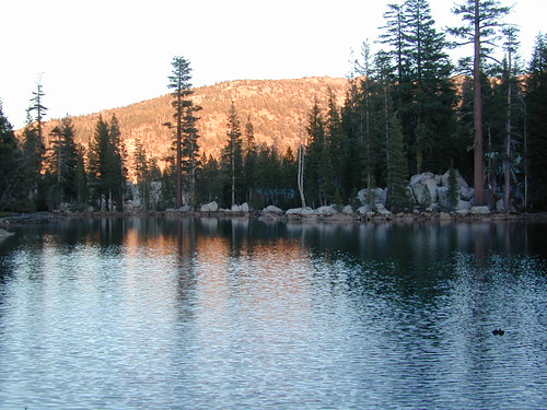
Vast alpine ranges located in the middle of the Sierra Nevada, between Highway 88 (Carson Pass) & Highway 4 (Ebbetts Pass). The Mokelumne Wilderness is a 105,165-acre federally designated wilderness area located 70 miles east of Sacramento, California. It is within the boundaries of three national forests: Stanislaus, Eldorado and Toiyabe. First protected under the Wilderness Act of 1964, the Mokelumne’s borders were expanded under the California Wilderness Act of 1984 with the addition of 55,000 acres. The wilderness takes its name from the Mokelumne River, which was named after a Mi-wok Indian village located on the riverbank in California’s Central Valley.
The wilderness encompasses an area of the Sierra Nevada mountain range between Ebbetts Pass to Carson Pass. There are two sections separated by the Blue Lakes Road and an Off-Road Vehicle corridor. Elevations range from 4,000′ to 10,381′. The highest point is Round Top 10,364′, a remnant volcano from which the wilderness area’s volcanic soils are derived from and is located on the east side of the Sierra crest.
recreation –
- backpacking
- camping
- creeks
- fishing
- hiking
- ice climbing
- kayaking
- lakes
- mountaineering
- rivers
- wildflowers
surrounding forest lands –
National Forest & Wilderness Permits –
USDA Stanislaus
Lake Tahoe Basin Management
More Mokelumne Wilderness Info & Links –
sierrawild.gov/wilderness/mokelumne
summitpost.org/mokelumne-wilderness
Mokelumne Wiki
Mokelumne River