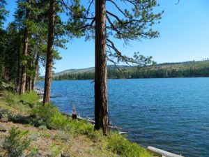
Blue Lakes
Hwy 88 @ Carson Pass
South of Tahoe

Blue Lake Campgrounds
highest lake campgrounds in the vicinity
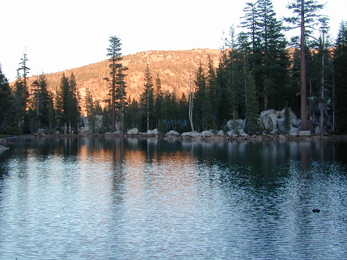
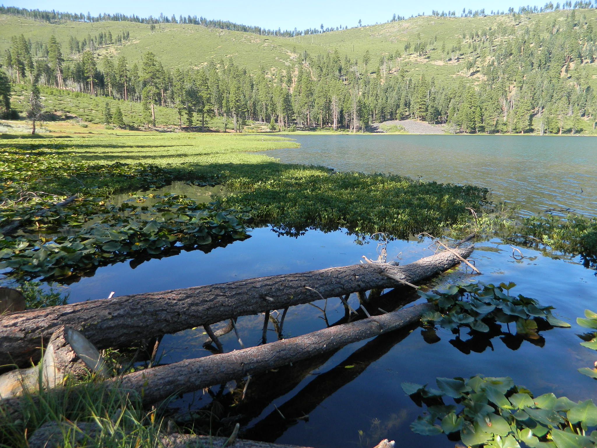
Eldorado National Forest in Amador Ranger District; a forest south of Lake Tahoe in the central portion of the Sierra Nevada mountain range. This set of scenic, alpine lakes sits in between both Eldorado, Toiyabe National Forests and the Mokelumne Wilderness. But please take note that the Blue Lake facilities are owned and operated by utility company PG&E
No Reservations.
most camp sites are available first-come, first-serve
RV limitations: 30 feet
69 miles east of Jackson, CA on Highway 88 and then another 12 miles south on Blue Lakes Road. This area is close to Hope Valley, south of Lake Tahoe, CA
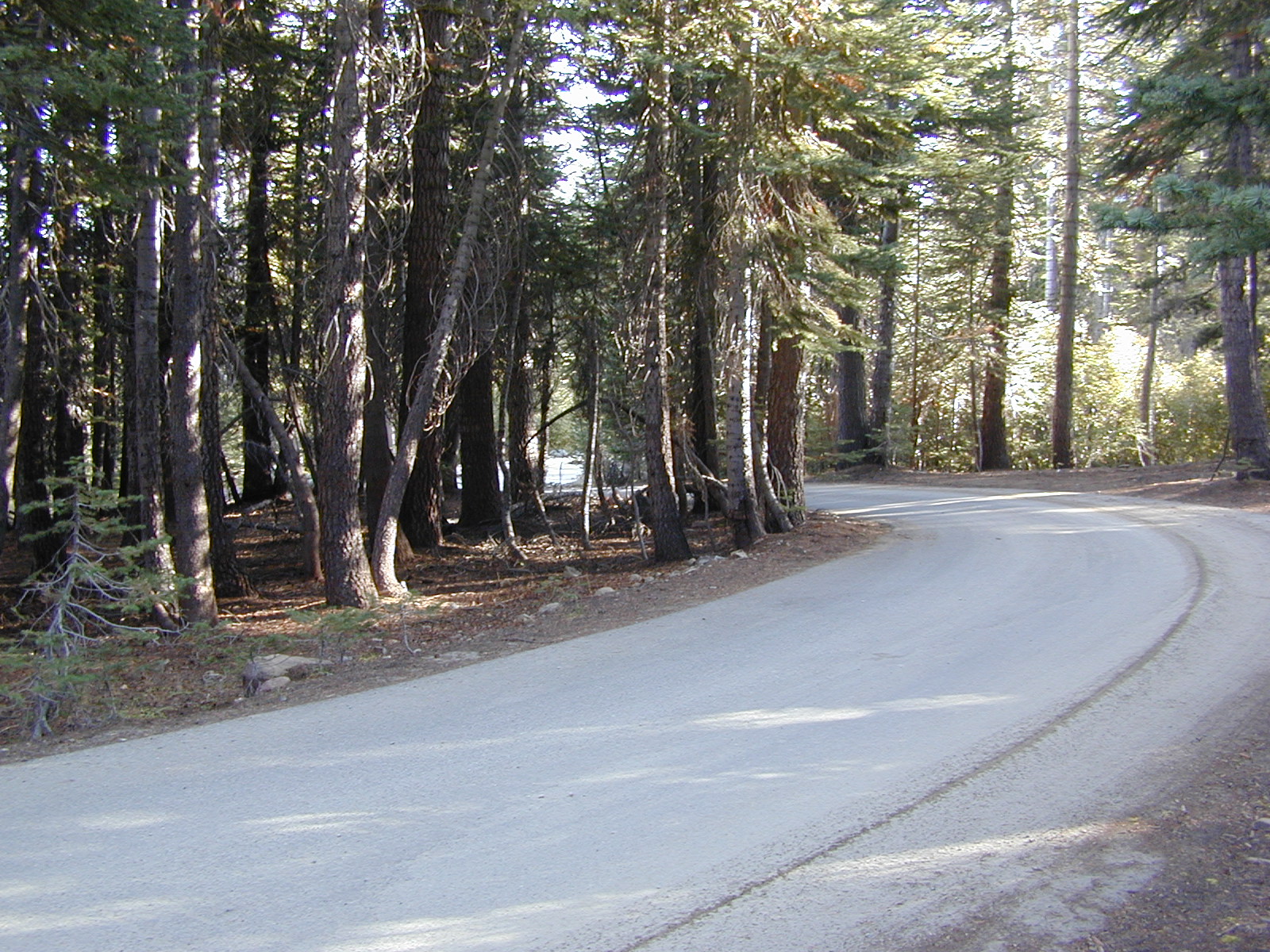
Blue Lakes consist of several developed campgrounds. Blue Lakes Rd# 13 is a well signed, paved road off Hwy 88, just east of Carson Pass (8560′ elev). The route is closed during winter snow, while it serves as a winter recreation area. The main paved road becomes dirt near the campgrounds. A dirt road continues past the lakes and south to Deer Creek and meets w/ Hwy 4 near Ebbett’s Pass.

RV campers, fishing folks, hikers, kayakers and disabled travelers like this lake camp area due to the easy access, paved parking and campground amenities. Handicapped camp sites are also prime lake front locations.
Group Campgrounds are reservable. Picnic Areas, Group Sites and campfire rings. Piped water, bear boxes and vault toilets. No RV hookups, no dump station, no showers. Unimproved boat ramps are available at Upper and Lower Blue Lakes.
Lower Blue Lake Campground
elev. 8055′
camp sites: 16
Blue Lake Dam
camp sites: 25
Middle Creek Campground
camp sites: 5
Upper Blue Lake Campground
elev. 8136′
camp sites: 32
Overflow Camp
camp sites: 34
![]() Backpackers and day hikers: Sierra trailheads out here lead south into the Mokelumne Wilderness Area. The infamous Pacific Crest Trail also passes thru this high elevation region: PCT access @ Carson Pass, Upper Lake & Tamarack Lake
Backpackers and day hikers: Sierra trailheads out here lead south into the Mokelumne Wilderness Area. The infamous Pacific Crest Trail also passes thru this high elevation region: PCT access @ Carson Pass, Upper Lake & Tamarack Lake
recreation –
- backpacking
- boating (non-motorized)
- camping
- fishing
- hiking
- horseback
- kayaking
local topographic maps:
- El Dorado National Forest Map
- Toiyabe National Forest Map
- Mokelumne Wilderness Map
- Lake Tahoe Basin Recreation Map
- Tahoe Rim Trail Map
- NatGeo Map – Carson Iceberg, Emigrant, Mokelumne
nearby towns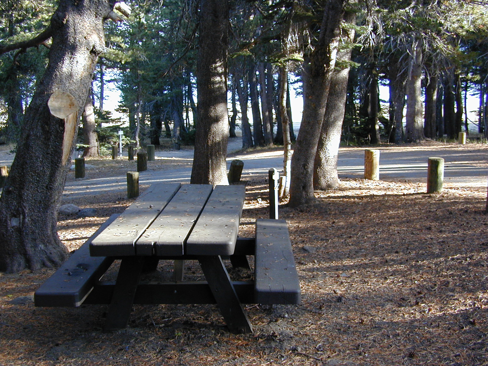
![]()
another blue lake?
Yep, there is more than one Blue Lake in California
Modoc Blue Lake
BLUE LAKE CAMPGROUND
NorCal region of the South Warner Wilderness in Modoc National Forest. That’s way out near Alturas. Likely, CA is the turn off US 395. Northeast California, real seclusion.
EASTBOUND Paved Road #64 is Jess Valley, which leads along the Pit River, cool volcanic cliffs, and up to forested Blue Lake Campground, elevation 6051′

Donner Blue Lake
DONNER PASS – Sierra Nevada
Interstate 80
BLUE LAKE CAMPGROUND
i80 Donner Pass, near Truckee, CA; a PGE Campground w/ 4×4 access and hike-in only. First come, first serve. No tables or restrooms, elevation 5900′


Lake County – Blue Lakes
THE LODGE AT BLUE LAKES
Mendocino Lake Country
Highway 20, East of US101
Lake side resort w/ boat rentals and fishing, near Upper Lake, CA
elevation 1357′
A small resort w/ hotel suites and a lakeside setting w/ abundant nature. Two small lakes, kinda close to the highway. Non motorized boats only, kayaks, paddle boards, canoe, swimming, birdwatching, bike paths and fishing. Wedding venue next to lake. Wineries, restaurants, and a casino nearby.

Humboldt County: Blue Lake, CA
Blue Lake, California 95525
Historic lumber town, located East of Arcata along the Mad River. Accessible via Highway 299

 Mokelumne Map