Tag Archives: peaks

National Forest Cabins

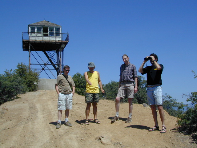
California Fire Lookouts for Rent
US Forest Service Cabins
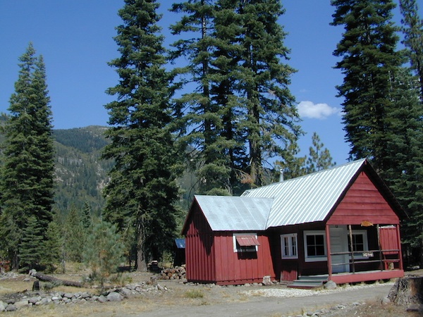
red cabin

NFSlogo
Rent a secluded cabin with an amazing view, a historic tower for wildfire spotting, or a USFS guard station – hidden deep inside USDA California National Forests. Several of these NFS lookouts have been closed recently, so the ones listed below have links to status and reservation information.

Dirt road access is common to reach these remote locations. Some require stair climbing, or steep access hikes. Winter months are usually snowy, inaccessible and sometimes dangerous for these high country locations. Access roads suffer from closures due to rock slides or landslides. Check with the locals ranger station for current conditions.

A few of these rentals are open all year long – in the southern part of the golden state.

El Dorado National Forest USFS

Harvey West Cabin
4,720′ elev. on Silverfork American River, Gold Rush

Loon Lake Chalet
6375′ elev. near Georgetown, Gold Country California

Robbs Peak Lookout
Robb’s Hut / Robbs Cabin
6686′ elev near Placerville, Gold Country California

Sly Guard Cabin
Sly Park @ Jenkinson Lake, near Placerville, Gold Country California

Van Vleck Bunkhouse
6549′ elev. near Georgetown, Gold Country California
download PDF info sheet

Lassen National Forest USFS

McCarthy Point Lookout
overlooking Mill Creek Canyon and Ishi Wilderness
ranger & info 530-258-2141

Mendocino National Forest USFS

Pine Mountain Lookout
>>>> Renovated & ReOPENS soon! April 2020
4400′ elev.  over looking Eel River wilderness
ranger & info 707-275-2361

Plumas National Forest USFS

Crocker Guard Station
5700′ elev. near Meadow on back road
Lake Davis Loop, way out behind Portola, California
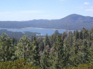
 

Big Bear Lake 2002
Big Bear Lake, Southern California

San Bernardino National Forest USFS

Coon Creek Cabin
Actually this one is a reservable group campground – next to a set of historic cabins. Big Bear Area Group Camp Site. Heart Bar Rd #1N02 near Angeles Oaks, CA

Morton Peak Fire Lookout
(no longer available overnight stays 2019)
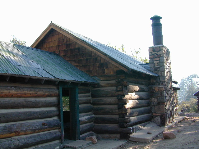
Coon Cabin
Coon Cabin – Southern Cal

Sequoia National Forest USFS

Big Meadows Cabin
Big Meadows Guard Station
off Big Meadows Rd #14S11
7600′ elevation; located in between Sequoia NP & Kings Canyon NP

Camp 4 ½ Cabin
1100′ elevation; Lower Kings River
near Pine Flat Lake, CA

Grouse Valley Cabins
3 cabins near lakes; Giant Sequoia National Monument, Western Divide
4800′ elev.

Mountain Home Guard Station
Mountain Home State Forest, Sequoia Groves
6000′ elev. near Springville, CA

Needles Fire Lookout
(destroyed in structure fire 2011)
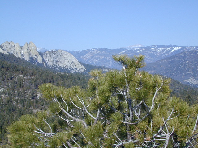
the needles
View of The Needles, from Dome Rock on Western Divide Highway (CLICK TO ENLARGE)

Oak Flat Lookout
Oak Flat Cabin Rental
4900′ elevation; Kern River canyon near Lake Isabella

Poso Guard Station Cabin Rental
open all year round, 4500′ elev. near Kernville, CA

Quaking Aspen Cabin Rental
Giant Sequoia National Monument, Western Divide Highway near Ponderosa, CA

Wishon Cabin Rental
Tule River, Giant Sequoia National Monument; open all year round. 4000′ elev. near Camp Nelson, CA

Shasta/Trinity National Forests USFS

Forest Glen Guard Station
near Trinity River & Forest Glen, CA

Frog Meadow Guard Station
7760′ elev. near Lake Isabella, CA

Girard Ridge Lookout
Historic Fire Lookout Tower
4809′ elev. near Dunsmuir, CA

Hirz Mountain Lookout Tower
Hirz Mtn. Fire Watch Tower Rental
overlooking Shasta Lake, CA
(currently closed for repairs 2019)

Harris Springs Guard Station
near McCloud, CA

Little Mount Hoffman Lookout
Mt. Hoffman Rental
7000′ elev. near McCloud, CA

Post Creek Guard Station
near Hayfork & Platina, CA


Sierra National Forest USFS

Camp Four and a half Cabin
Camp 4 ½ Cabin Rental
Lower Kings River, open all year round
1100′ elev. near Pine Flat Reservoir


Six Rivers National Forest USFS

Bear Basin Butte Cabin & Fire Lookout
elevation 5300′ in Six Rivers NF / Smith River NRA
(road damage & access issues 2017)

Tahoe National Forest USFS

Calpine Lookout Cabin Rental
near Sierraville, CA

Sardine Peak Fire Lookout
overlooking the Sierra Buttes and serene Lakes Basin, Yuba Rivers, North Gold Country CA
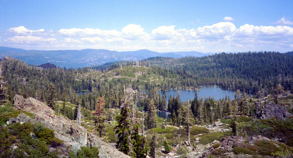
lakes basin views


Trinity Alps Wilderness

NorCal Mountains – Trinity Alps Wilderness

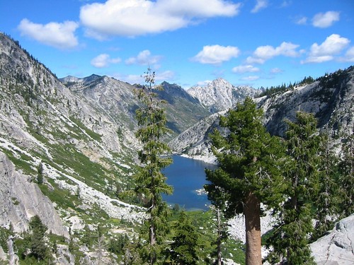
Sapphire Lake -- Suicide Ridge -- Trinity Alps

525,627 acres

North of Weaverville & Lewiston, about 10 miles
West of Trinity Lake & Redding, CA
Headwaters of the Trinity River & the Salmon River

Shasta-Trinity National Forest

Thompson Peak – 9002′ elevation
Trinity Mountain – 6094′
Granite Peak – 8091′

Trinity is NorCal’s jewel of alpine lakes and granite peaks – many above 8000′ elevation, about 40 miles inland from the ocean. Trinity is located in between the infamous redwood coast and the I-5 corridor. Rivers, creeks, lakes, and trails into the high elevations regions, bqckpackers and equestrian campers alike.

trinityalps_lgHiking trailheads are accessed from all sides -On the east side you have Trinity Lake & Trinity River w/ Highway 3 running lengthwise in a north-south direction. Hwy 299 runs east-west along the south side of the wilderness. Klamath River Hwy 96 lies on the west side of the wilderness. Salmon River, Scott Mountains and Cecilville are north of the alps.

Both the small Russian Wilderness & the larger Marble Mountain Wilderness are located to the north of Trinity Alps, along with rural towns near the Scott Mountains and the Salmon River. Castle Crags Wilderness is to the eastern side, near Interstate 5.

towns nearby –

camp

Campgrounds near Trinity Alps Wilderness

hike

Trinity Alps Trailheads

lake

Waterfalls & Lakes near Trinity

NFS


View Larger Map

The mountainous area is quite unique, as exposed granite mountain peaks and alpine lakes are pretty rare in the coastal Cascade ranges. The only other spot in California that has an 8000′ peak nearing the coast is just north of Los Angeles – Los Padres’s Mount Abel & Mount Pinos peaks, both over 8000′ in elevation.

TRINITY ALPS TOPO MAP

camp

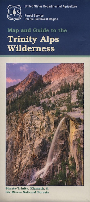
The USDA map for Trinity Alps Wilderness was outta print for nearly 2 years and it has recently been updated and reprinted. New edition released in 2013 and now available at the Total Escape map store. Printed on waterproof map paper and updated in 2012.

7S02 – San Berdu NF

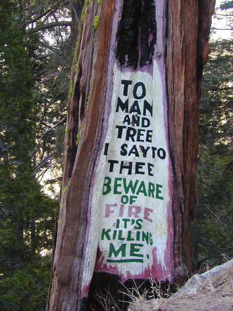
Fire Safe Trees

Toro Peak
Forest Road# 7S02

Santa Rosa Truck Trail
San Bernardino National Forest

South of Palm Desert, CA
Southeast of Idyllwild, CA
SE of Lake Hemet
Graded dirt road – southbound, off Palms to Pines Hwy 74

7S02 up hill

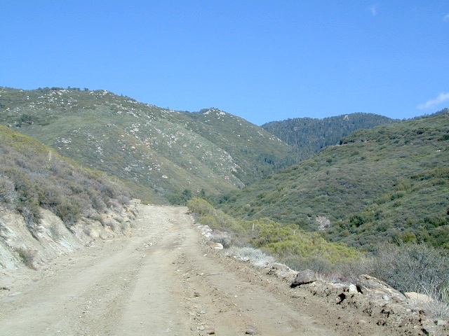
Road conditions on dirt roads change with the weather and the seasons. This route can be rocky and uneven in spots. One lane road, on a big hill w/ minimal pullouts. Snow is possible, during winter & springtime. This route often closed during winter months – or for rock slides. Trailers and RVs are not recommended on this dirt road, although small motorhome campers can try.

ROUTE CURRENTLY CLOSED? find out on USDA web site link

Elevation approx 6000′ @ HWY
w / route continuing up to Toro Peak @ 8740′NFS

NFS local camp sites: 

  • Santa Rosa Campground
  • Santa Rosa Springs Campground
  • Toro Campground

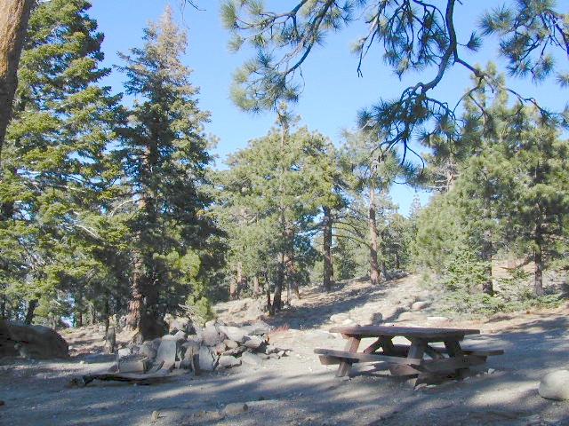
Bare bones, primitive camp sites. Tables, fire rings. Must have a campfire permit for this region. Vault toilets? None.

toro_campsite

Did I mention the wind yet? Tall trees do block a majority of the wind, but some areas get whipping – so choose your tent site wisely. And stake it down well, before that quick day hike. Since this is a mountain ridge line, expect thunderstorms, wind and possibly light snow.

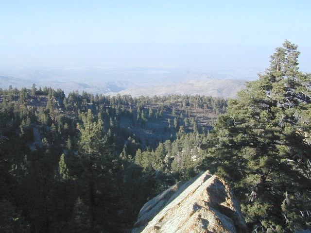
The big, famous Palm Canyon in Palm Springs starts below. The impressive desert canyon trails lead up to highway 74. Continue on foot uphill, southbound, cross the pavement, and end up in this Toro Peak region. Small campgrounds, few people, great views over the desert. Pick a smog free weekend (with wind) for best Coachella Valley views.

San Berdu Idyllwild SoCal

Santa Rosa Wilderness

Snow Mountain Wilderness

Snow Mtn Wilderness

Mendocino Forest, Lake Pillsbury

North of Wine Country, east of US Hwy 101

2018 (Mendo Complex Wildfire) Ranch Fire
burnt most of this area

Located in the coastal mountain range north of Clear Lake and west of Stonyford, California; in between I-5 and US 101
On the southern half of the Mendocino National Forest.

snow mountains

60,076 acres
East Snow Mountain Peak – 7056′ elevation
West Snow Mountain Peak – 7038′ elevation
Lake Pillsbury – 1818′ elevation
Mendocino National Forest
Eel River
Elk Creek
Cold Creek
Anderson Creek
Corbin Creek
Sheet Iron State Game Refuge

  • backpacking
  • camping
  • hang gliding
  • horseback trails
  • off roading
  • paragliding
  • snowboarding
  • snow shoeing

Snow Mountains MapWilderness permits and campfire permits are required. Check local rangers for up to date weather conditions, road closures, parking and trail conditions.

Dirt Roads M10 and M3 are the major routes around this mountain area. Route M10 is also known as 43A on some older maps. Several 4×4 trails skirt the wilderness boundary near the tallest peaks, so you may see some OHV use in this region when hiking.

ranger stations
NFS

EAST SIDE

National Forest Office
Grindstone Ranger District
Willows, CA
530-934-3316

Stonyford Work Center
530-963-3128

WEST SIDE

Upper Lake Ranger
707-275-2361

Covelo Ranger District
707-983-6118

NFS campgrounds nearby
camping

EAST SIDE

    • North Fork Campground (Road# 18N03)
    • South Fork Campground (Road M10)
    • Fouts Campground (M10)

4x4 trails

  • Grey Pine Campground (M10)
  • Mill Creek Campground (M10)
  • Dixie Glade Campground (M10)

WEST SIDE

  • Lower Nye Campground (Road M3)
  • West Crockett Campground (M3)
  • Upper Nye Camp (M3)
  • Windy Point Campground (M3)

hiking trailheads
hiking

  • Bloody Rock (Road M6)
  • Crooked Tree (Road M3)
  • North Ridge (M3)
  • Windy Point (M3)
  • Upper Nye (M3)
  • Bear Wallow (Road# 18N06)
  • Trout Creek (@ Fouts Springs)
  • Dixie Glade (Road M10)
  • Summit Spring (M10)

2017: a large landslide has closed the dirt road route in between Lake Pillsbury & Alder Springs, CA. Road M6 closed indefinitely.

off road routes nearby


View Larger Map

Silver Lake California

Silver Lakes @ Bucks
Silver Lake, near Bucks Lake Wilderness

Numerous Silver Lakes, Creeks and other “silver” terrain can be found inside California. After the Gold Rush of 1849 in the western Sierra, Silver was discovered in Nevada shortly after (east of Sierra Nevada mountains). This page is an overview on all places with SILVER in the name, or places that have had a history of silver mining. California Counties are listed in parenthesis. Links below will lead to more detailed pages or campground reservations.

Silver Lake @ Lassen

(Lassen Co)

silver kayaker

Silver Lake @ Bucks

(Plumas Co)

silver88

Silver Lake @ Carson

(Alpine Co)

Silver Fork of the American River. Silver Fork Road connects US Highway 50 & Carson Pass Hwy 88. Silver Fork Campground & China Flat Campground (NFS) are both located on this remote, backcountry route, about 8 miles from US Hwy 50 campground

golden glow june

Silver Lake @ June

(Mono Co)

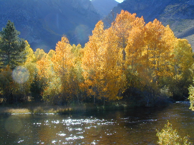
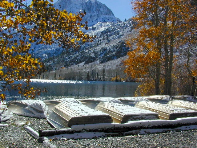
Autumn aspen groves ignite with color in October. Often, some of the best fall colors in the Eastern Sierra. Day trips w/ fishing. Hiking everywhere. Overnighters or backpackers could be greeted with snow at anytime in October or later. The June Lake Loop (SR 158) closes for snow annually!

California Lakes named Silver

Silver Lake @ Gold Lake

(Plumas Co)

Lakes Basin Recreation Area also has a hike-in Silver Lake, trailhead near Gold Lake on Gold Lake Highway

Silver Lake @ Gold

califrepublic

below are silver mining camps and other silver related destinations, plus some campgrounds


Bodie SHP (State Park) calsp
(Mono Co)
8375′ elev. US Hwy 395 near Bridgeport, CA. Infamous, high desert ghost town, now a California Historic State Park. Large gold mining camp w/ well-preserved, wooden, old town structures. Silver was discovered in nearby Aurora Canyon.  All dirt road access. No developed campground @ Bodie, so try nearby Green Creek Road instead. Or high desert, back road camping on Aurora Canyon Road over to Bridgeport Reservoir.

Cerro Gordo
(Inyo Co)
8500′ elev. Inyo mountains, West of Death Valley, east of US Hwy 395 @ Junction 136. Old mining camp rich in silver history. Someone might even live up there. Extreme remote location in rugged, high desert mountains. 4×4 is always required!

Silver City Sequoia NPS
(Tulare Co)
6935′ elev. cabin resort on Mineral King Road, in the South Sequoia National Park

Silver Creek Campground NFS campground
(Alpine Co)
Developed Campground south of Markleeville, Highway 4, Ebbett’s Pass, Central Sierra Nevada

Silver Creek Campground campground
(Placer Co)
Camp right on the Truckee River, and on busy Hwy 89. in between Truckee & Lake Tahoe, California

Silver Valley Campground & Silver Tip Campground (Alpine Co) are both located near Lake Alpine on Highway 4 Ebbetts Pass , Central Sierra

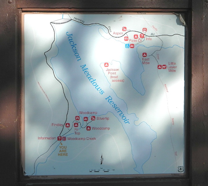
jacksonmdwsign

Silvertip is also a Group Camp at Jackson Meadow Reservoir (Sierra Co) off Hwy 89, North of Truckee, CA. Silvertip Group Campground, as with all group camping facilities, is by reservation only.

Silver Lake @ LA
(Los Angeles Co) a hip and popular, tree-lined neighborhood in Los Angeles, near Griffith Park.

Silver Lake
(San Bernardino Co)
Silver Dry Lake, a dry lakebed in the Mojave desert, near the Hollow Hills Wilderness, north of Baker, CA off I-15

Silver Lakes
(San Bernardino Co)
2430′ elev. a desert community southwest of Barstow, near Helendale, CA. Located on the Mojave River (which flows underground) in between Historic Route 66 & US Hwy 395. Attraction nearby – Exotic World, the Burlesque Hall of Fame.


silverstrand

Silver Strand State Beach State Park

(San Diego Co)
A sliver of sand makes up this narrow beach, barrier island for San Diego Bay. RV Camping, best in SD. South San Diego, Coronado Island campground

silverwood

Silverwood Lake SRA State Park

(San Bernardino Co)
State Recreation Area @ Cajon Pass I-15
in the San Berdu National Forest


lacontedivide

High Sierra, California

hike-in only

backpacking

Silver Pass Lake
Silver Divide & Silver Pass
(Fresno Co)
11,000′ elev

Located in between two 12,000′ peaks
near PCT – Pacific Crest Trail
John Muir Wilderness

backpacking

Silver Lake
(Tulare Co)
11,000′ elev

via Mineral King trailheads
Golden Trout Wilderness
South of Sequoia NP
Southern Sierra Nevada

Another Hike


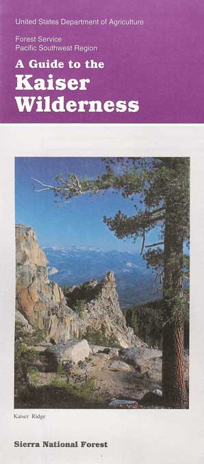
Kaiser Wilderness

China Peak Hiking
Hiking near China Peak – summer 2002

22,700 acres
Kaiser Pass Road
Sierra National Forest

2020 wildfire: CREEK FIRE
has burnt the majority of this wilderness, roads, trails, lake shores and most campgrounds

Central Sierra Nevada Mountains/ Kaiser Pass & Kaiser Peak / Highway 168

One of the best cell phone coverage areas for any California Wilderness location, this central Sierra region is located south of Yosemite National Park and known primarily for Shaver Lake.

California Hwy 168, along with Dinkey Creek Road (southward) and Kaiser Pass Road (northward) leads off in all splintered directions to secluded campsites, rivers, creeks, lakes, developed campgrounds and amazing forest scenery. Off road trails and hiking trails, everywhere back here! But it is best to have several good maps for cross reference.

This Sierra National Forest region includes all hydroelectric dams and lakes surrounding Shaver and Huntington Lake, including Florence Lake, Ward Lake, Edison Lake, Mammoth Pool, Courtright Reservoir and Wishon Reservoir.

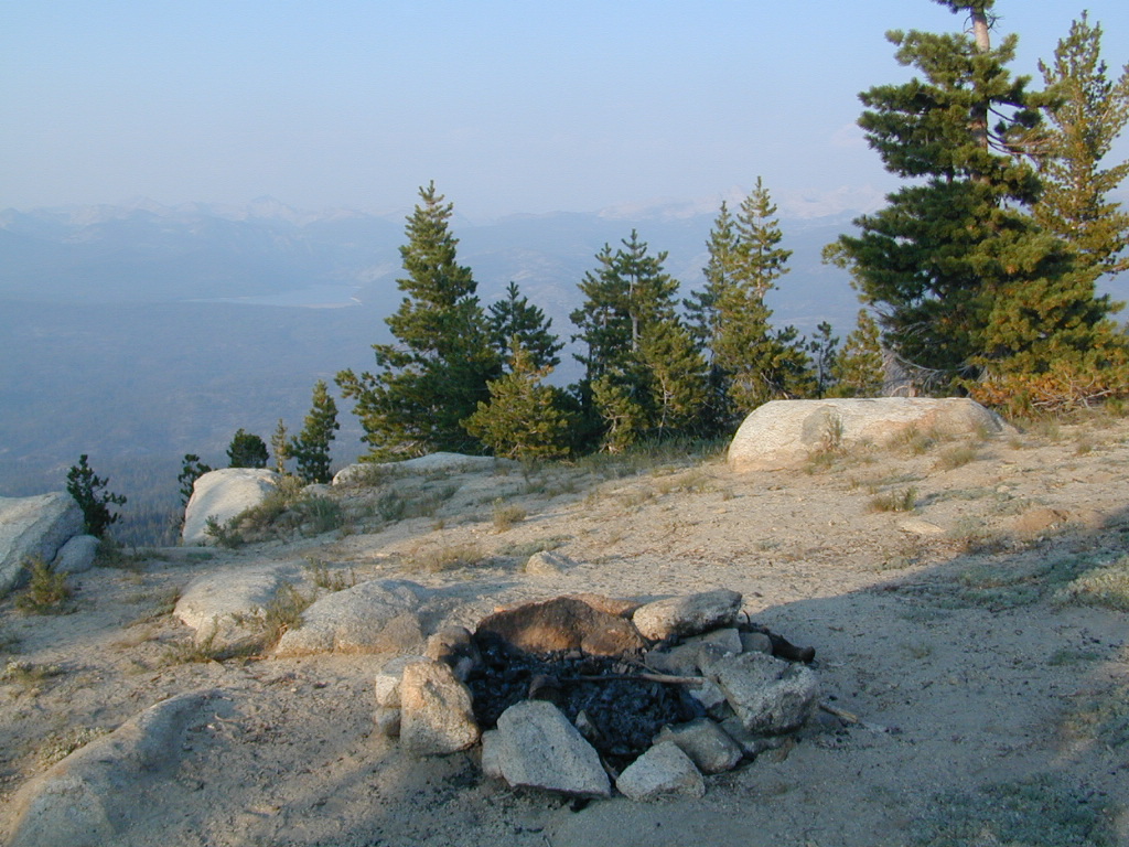
Dusy Ershim Trail 4×4 travels past Kaiser Peak and the cell phone towers. Several primitive camp sites with views on ridge. Numerous developed NFS Campgrounds out this way along Kaiser Pass Road.

Trailheads for horseback, hiking, backpackers, mountaineers, rock climbers. Snowmobiles love this amazing route when the snow is deep; some west coast winters can be better than others. Know before you go!

Kaiser Wilderness are granite mountain peaks, near Huntington Lake & the China Peak ski resort, formerly called Sierra Summit Ski;  One lane narrow backcountry paved roads: Kaiser Pass Road 80 (east of Huntington Lake) and Stump Springs Road 5 is West Kaiser (west of Huntington Lake)

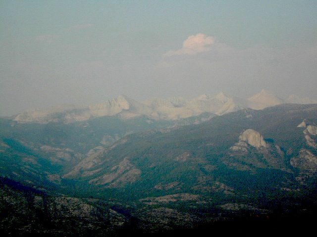
Views in 2002
Sierra Views in 2002
WhiteFir Camp
White Fir Campsite
China Peak Hike Map
China Peak Hike w/ Map

hiker

Sierra National Forest

Kaiser Pass Road, elevation 9184′

25 mph – pothole paved, barely maintained one lane road, 20+ miles. Kaiser Pass is closed in winter months, but accessible by snow-mobile.

snowmo

recreation –
sierra National Forest map

  • backpacking
  • camping
  • creeks
  • cross country ski
  • fishing
  • hiking
  • lakes
  • mountain biking
  • mountaineering
  • picnicking
  • rock climbing
  • rivers
  • snow mobiling
  • snow skiing

Sierra Topo Maps

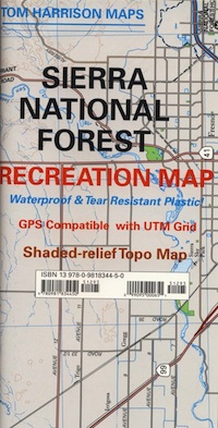
Sierra Map Tom Harrison
Sierra NF Map USDA
Kaiser Wilderness Map
Ansel Adams Wilderness USDA
Ansel Adams Trail Map
Dinkey Lakes Wilderness USDA
Dinkey Lakes Trail Map
John Muir Trail Maps
Mono Divide High Country
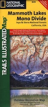
NatGeo Mono / Mammoth Map

surrounding wilderness and forest lands –

Ansel Adams Wilderness
Dinkey Lakes Wilderness
Inyo National Forest
John Muir Wilderness
Kings Canyon NP
Sierra National Forest
Yosemite National Park

National Forest & Wilderness Permits –

USDA Sierra NF

More Kaiser Wilderness Info & Links –

sierrawild.gov/wilderness/kaiser
summitpost.org/kaiser-peak
Kaiser Wilderness Wiki
San Joaquin River
Don’t Tell Anyone Campsites
Mono Hot Springs

kaiserpass
View from Kaiser Pass Trail – Huntington Lake in far back left


Silver Lake @ Lassen

Lassen Camp Site

AUG 2021

both lakes listed below CLOSED, due to wildfire 

Lassen Volcanic National Park is CLOSED also.

Silver Lake @ Lassen

(Lassen Co)

6400′ elev. inside Lassen National Forest
East of Lassen National Park

Silver Lake Road #10
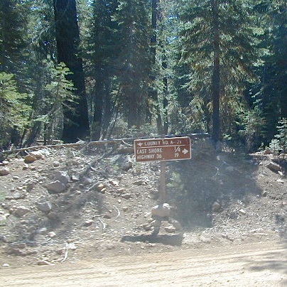
20 miles off Highway 89. Northbound, outside of Westwood @ Lake Almanor, take County Road A21 to County Road 110 (Silver Lake Rd)

a21sign

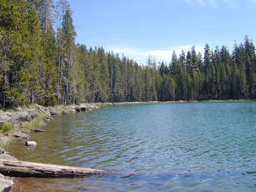
Dirt road boat ramp @ southern end of lake. Winter weather & snow closes this area annually, so this lake is mainly a summertime destination. Mid-week tends to be less popular for those seeking seclusion.

  • backpacking
  • fishing
  • camping
  • canoe
  • hiking
  • kayaking

Hiking trails lead to Caribou Lake, Emerald Lake, Betty Lake, Trail Lake, Shotoverin Lake & Caribou Wilderness.

campground

Silver Bowl Campground NFS

• Elevation: 6400′
• Number of Sites: 18
• Vehicle Accessibility: small RV
• Campsites Reservation: No
• Camp Fee: Yes
• Toilet: Vault
• Water: piped/potable
• Length of Stay: 14 Days
• Season: May – October
• Trailheads: Caribou Wilderness

Lassen National Forest
Almanor Ranger District
900 East Highway 36
Chester, CA 96020
530-258-2141

silverlassen

2 Silver Lake in East Lassen? Surely.

Only 12 miles apart. As the crow flies.

Largest is Silver Lake, south of Caribou Lake, Lassen National Forest. East of the National Park, accessible by vehicle. The popular one that is mentioned above.

camp

Small Silver Lake at 6600′ elevation, is a hike-in only lake. Inside Lassen National Park, west of Snag Lake and the Fantastic Lava Beds.

hiker

See all Silver Lakes in California

San Jacinto Camping

jacinto campground

Mt San Jacinto State Park & Idyllwild Campgrounds

San Jacinto State Park Headquarters
25905 Highway 243
Idyllwild, CA 92549

Rangers & Wilderness Permits
951-659-2607

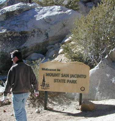
Mount San Jacinto State Park is surrounded by Wilderness area, the village of Idyllwild & the Palm Springs Tram station. Tahquitz Peak close to Idyllwild, is a rock climbing favorite.

Stone Creek Campground is located in the forest, along Highway 243. Elevation 5900′ w/ 50 camp sites & max RV = 24′

Idyllwild Campground is walking distance from town. North end of Idyllwild, CA. 33 camp sites & max RV = 24′

San Jacinto State Park
takes campground reservations!

For more Idylwild Camping options see –

San Bernardino Campgrounds & Yellow Post Sites

Topo trail maps, wilderness hiking maps –

nearby towns:

Mount Pinos Recreation

Mount Pinos Camping

Mt Pinos Campgrounds – Los Padres Camping

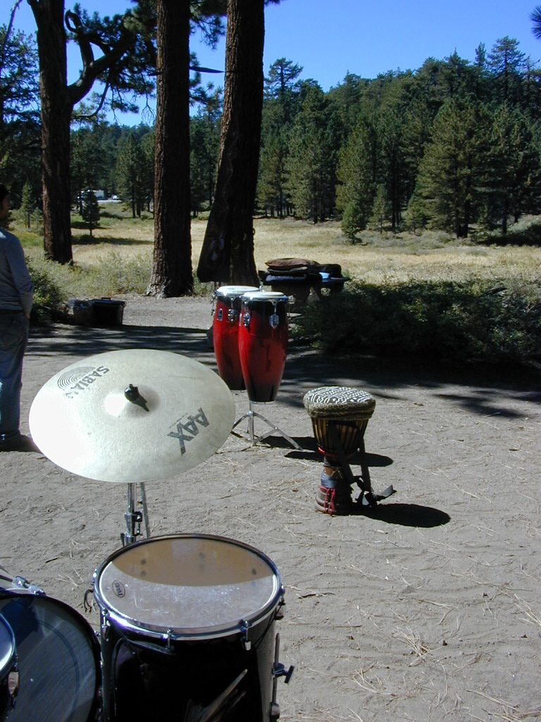
A little bit of high altitude, alpine forests in Southern Cal. Mount Pinos campgrounds are the ones on the way up to Mt Pinos 8831′ on the paved route to the top parking lot, Mount Pinos Road. Only 2 campgrounds take reservations & can be busy in summer months. Chula Vista Camp (at the top parking lot, short walk on trail) has an amazing wildflower meadow w/ group camp area. Drum circles are common on summer weekends.

  • backpacking
  • camping
  • hiking
  • mountain biking
  • sledding & snow play
  • stargazing

Drum Circle Camp

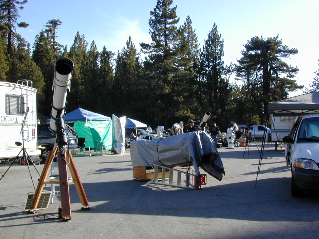
Mount Pinos parking lot is well known among RVers, astronomers & cross country skiers. If the 2 snow gates are open, you’ll find RVs camping out here until winter officially starts. The peak to peak trail from Mt Pinos to Mt Abel 8243′ starts at this parking area & trail head. Cool ski hut that no Forest Personnel every seems to be operating. Portable toilets available.

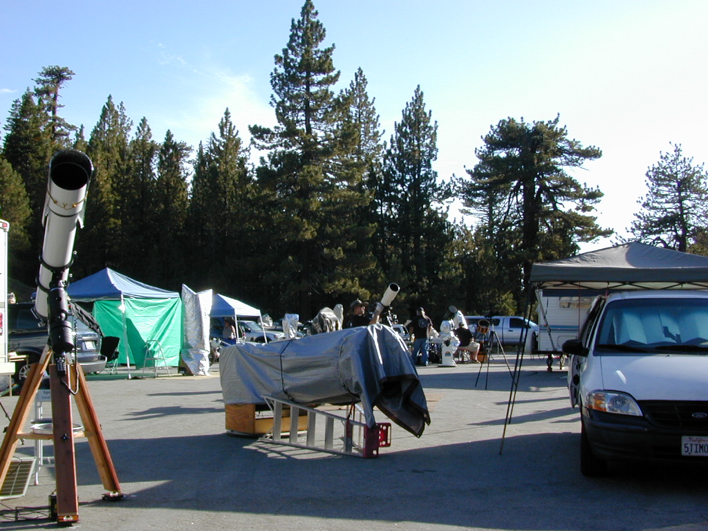
Pinos Star Party
Pinos Star Party

In the mid-winter, snow is almost guaranteed up here. Families & sledders flock to this region for snow play causing major traffic jams & parking problems. On the busiest of weekends w/ a recent snow storm, you may find several miles of vehicles, backed up from Pinos to the freeway (causing 10 miles of traffic jam in the mountains). It is not uncommon to see CHP managing traffic flow on the weekend. Snow play areas are located at the top on Pinos, if the gates are open.

deepsnowhwy
Mil Potreo Highway, on a good winter 2005

If not the “Y” – where Cuddy Valley meets Mil Potrero Hwy. is the main snow-play destination. This is a very busy intersection at all times of the year, as it is the main route entering Pine Mountain Club, located 5 miles to the west. Be considerate! Do not litter and please park OFF THE PAVEMENT; keep kiddies, sleds & BBQs out of the road ways.

PMC 2005 snow
PMC 2005 epic snow
campground elev spots veg toilet water notes
Chula Vista Campground 8300′ 12 pines vault no walk-in sites & RV lot
McGill Campground 7500′ 50 pines vault seasonal closed in winter
Mount Pinos Campground 7800′ 19 pine vault seasonal closed in winter
Trails on Pinos
Trails on Pinos

The pinyon pine forests surrounding Mount Pinos Recreation Area is Los Padres National Forest, where there is every kinda camping imaginable.

Outdoor resort communities such as Pine Mountain Club & Lockwood Valley Road are close by and surround the highest mountain peak in Kern County. Mil Potrero Campground, developed NFS Campground, open during summer only.

Rugged backpacking, or back road motorcycle 4×4 camps – with maybe one camp fire ring (still intact). Windwolves Preserve, Quatal Canyon, Cerro Noroeste, Valle Vista, Lockwood & Cuyama Valley.

NFSlogo

Group Camping Sites in Los Padres Forest

Winter Snows
Winter Snows – Gates Close

map of the regions –

Sierras from Pinos
Sierra Nevada Mountains, as seen from Pinos Road

nearby towns –

DSCN0036


Moses Gulch Campground

road5 moses
Narrow Dirt Roads lead way back to Moses Gulch.


2021 – THIS CAMPGROUND IS CLOSED indefinitely,
due to the Castle Fire 2020

Moses Gulch Campground
Middle North Fork of Tule River

Northside of Western Divide Highway 190, near Springville, CA

Mountain Home State Forest
559-539-2321 summer
559-539-2855 winter

Located right on the middle north fork of the Tule River

Small developed campground on the back roads of Mountain Home State Forest. Campground closes seasonally, for winter snow.

Usually open: MAY-OCT

tuleday
Swimming Holes on Tule River

MOSES GULCH CAMPGROUND camping

• Elevation: 5,500′
• Number of Sites: 10 walk-in camp sites
• Reservations: No
• Sites Available: First come, First serve
• Vehicle Accessibility: No RVs
• Length of Stay: 14 Days
• Water: River nearby
• Toilet: Vault
• Bear Boxes: Yes
• Trailheads: Tule River; Moses Mountain; Golden Trout
• Season: Closed for winter months
• Fee: Yes
• Operated By: National Forest Service
• Closest Town: Springville, California

tent camping on river

Motorhome RV campers beware; no hook-ups, no paved roads. This is a primitive style camp, way back on a dirt road – not suitable for large vehicles.

NOTE $ This used to be FREE CAMPING, but they recently started charging an overnight fee for this campground.

spot6 moses

  • hikerbike
  • camp
  • fish
  • hike
  • picnic
  • stargaze

Golden Trout Wilderness is closeby. Plenty of hiking opportunities, great scenery and several Sequoia groves to visit. Mountain biking is allowed on the dirt roads. Single track trails may be overgrown or even off-limits, due to the fragile eco-system around Sequoia trees.

tule middle northfork
Tule River,  north fork of the middle Tule

SEQUOIA_mapBoth Moses Gulch and Hidden Falls are accessible via a long, narrow, paved mountain road; then a dirt road, leading 3 miles back to the remote reaches of the Wilderness edge.

western south sierra

North of Springville on Highway 190, turn left (north) on to J37, some call it Balch Park Road (Google Maps has it as Wagner Drive) and follow it up 3.5 miles to Bear Creek Road (#220). Drive 17.5 miles on curvy Bear Creek Road, turn right and follow signs to campground.

Groves
Hike Sequoia Groves


Northern California Mountains

Mountains of Northern California / NorCal Mountain

California sure has a lot of mountains. West Coast land is home to the tallest Sierra Nevada range, plus the Cascade range, which extends northwards to Canada. (Many of which have volcanic peaks.)

We break down all the mountainous regions in the north part of the state below w/ links, topo maps, lakes, rivers, wilderness, parks and forests. Small towns & cities are linked in red.

sacramento river
Sacramento River, above Lake Shasta

North Coast Mountains

canoeRedwood forests and rivers are what make up most of the Northwest part of California, just below the Oregon coast. Logging and fishing are the big industries up here. Lumber mill towns and camps still exists today. Wilderness areas, dirt back roads, river kayaking, stream fishing, camping and real wild indians. Oh yeah, and Big Foot!

The landscape in more dramatic along the North Coast of California, as the steep rocky terrain tumbles into the sea w/ the San Andreas fault running parallel to the shore. Marine life, rocky shores w/ small towns. Del Norte County & Humboldt County. Wild rainy weather, at least half the year; fog and sun the other half.

Six River National Forest

California towns near Redwoods & Mountains:

NorCal California

the North State

fishThe furthest north is Siskiyou County, which borders the state of Oregon. We have the Klamath River flowing south into California, with plenty of mountain peaks, forests and wilderness. Interstate 5, Highway 3 and Highway 96

Pacific Crest Trail passes through the area and backpacking is common (all year long). Notable spots – Klamath Knot and The Eddy’s. Prominent Mount Shasta is actually situated inside Siskiyou County, not Shasta.

Klamath National Forest

California towns near Klamath Mountains:

NorCal California

shasta

Shasta Trinity Mountains

Giant Mount Shasta is located inside Siskiyou County, and Shasta County & Trinity is everything located to the south of it. Interstate 5, Highway 3 and Highway 299. Recreational lakes, rivers and streams, and off roading trails.hiker

Waterfalls, hot springs, mountain biking and stream fishing can be found within this region. Mining history and museums are primarily situated around Weaverville. Houseboats and boat rentals can be found on the big reservoirs. Whiskeytown was totally toasted in wildfire of 2018. Alpine lakes, granite spires, campgrounds and cavern tours, all located along the Interstate 5 corridor.

Shasta Trinity National Forest

California towns near Trinity Alps & Shasta Forest:

Lee Fong Park
Beautiful park setting @ Lee Fong Park, in historic Weaverville, CA
River Beach Campground
Trinity River Camping, Douglas City, CA

Mendocino Mountains

dirtbikesCoastal mountains located above the Napa & Sonoma wine country. US 101 & Highway 20. Rivers, forests, wilderness and redwoods is the key terrain that make up the Mendocino County mountains.

There is a fair amount of off road trails and dirt roads located in and around Mendocino, so you can expect to see 4x4s, dirt bikes and toy haulers on the east side of the mountain range. The coastal side of the Mendo National Forest will have the rivers and redwood parks.

Mendocino National Forest

California towns near Mendocino Mountains:

Spring Fouts Mendo
Fouts Springs Camping OHV

Plumas Mountains

pctNorthern Sierra Nevada mountains is where the granite rock of the Sierra meets to volcanic rock of Lassen Volcano.  Butte County and Plumas County is the Feather River drainage, all flowing south from Mount Lassen.

Pacific Crest Trail is routed through Bucks Lake Wilderness and the Feather River Canyon, so backpacking is popular. Highway 70

Plumas National Forest

California towns around the Plumas Mountains:

goldshore
Mini Gold Lake, near Silver Lake @ Bucks

Lassen Mountains

snowmoTechnically speaking, the Susan River is the top waterway of the Sierra Nevada mountains. Lassen County spans the distance from the Nevada state line, west to Plumas forest and the Feather Rivers (all 4 forks).

Lassen Peak is the middle of the National Park and the National Forest totally surrounds that. Numerous lakes, hiking trails, wilderness areas and dirt roads make up this huge forested area. Snow-mobiling is popular in winter months around the town of Chester.

Lassen National Forest

California towns around the Lassen Mountains:

nlassen
Camping N Lassen

Northeast California

The far northeast corner of the golden state is the remote cattle range lands of Modoc Country inside Modoc County. Drier than the rest of NorCal, the high desert sage brush meadows, a few lakes and pine forest mountains. Highway 299 & US 395

Modoc National Forest

California towns near Modoc Mountains:

mill creek falls
Mill Creek Falls in Modoc

Sierra Buttes California

sierra buttes

The Sierra Buttes

elevation: 8591′

Northern Gold Country California at the headwaters to the Yuba River

Lakes Basin Recreation Area
Tahoe National Forest
near Plumas Eureka State Park

Gold Lake, Sardine Lake, Upper Sardine, Smith Lake, Packer Lake, Grass Lake, Sand Pond, Goose Lake, Snag Lake, Long Lake, Jamison Lake, Round Lake, Deer Lake, Tamarack Lakes, Young America Lake, Frazier Falls

Sierra Buttes

California is the land of granite peaks. Rocky, exposed mountains that stick up out of the landscape for all to see. Southern Cal has a few of them, but most granite peaks in California are found in the Sierra Nevada.

US 395 Eastern Sierra impressive ridge lines are the highest and most photographed and Lake Tahoe has plenty of big granite surrounding it. The farther you go north, the less granite you will see – not because it isn’t there, mostly cuz it is just buried with tall dense forests.

lakesbasinhikers
lakes basin day hikers

NORTH SIERRA – The Sierra Buttes are the impressive granite peaks located in between the North fork of Yuba River and Sardine Lake.

SE of Mount Lassen and NW of Lake Tahoe, at the tippy top of the historic gold country. Gold Lake Road #24 connects Gold Country Highway 49 to North of Tahoe Highway 89. Road #24 is often closed for winter snow, so most visitors enjoy this region in the summer months.hiker

Sierra Buttes Fire Lookout Hike

The infamous PCT (aka. Pacific Crest Trail) passes the peak and goes north through this basin of alpine lakes, so backpackers are often seen. Tent camping is very popular, as well as RV camping w/ numerous developed campgrounds and open camping as well.  Some of the hard to reach primitive camp sites (next to lakes) can be accessed via 4×4 vehicle. Gotta have a good topo map.

Downieville is well known for the mountain biking trails, so this whole region is covered with amazing trails. Snowmobilers and cross country skiers love the area during a good winter snow and they can access this area from the north off Hwy 89.


View Larger Map

Sardine Lake

hiking, biking, backpacking, camping, fishing, kayaking, cross country, & snowmobiling

campsite snag lake
Snag Lake (free) Camping on Gold Lake Highway

lakes basin views

Sierra Buttes Map Tahoe National Forest

Marble Mountain Wilderness

Marble Mountain Wilderness
Northern California

241,744 acres

Klamath River
Klamath National Forest

Craggy granite peaks, abundant meadows, big streams, w/ 89 lakes are the main highlights of this wild land area in Northern California.

Marble Mountain itself, a stark, red-and-gray marbled peak. Most of the peaks exceed 6,000 feet in height, with Boulder Peak being the highest at 8299 feet. Long recognized for its wild value, this region became a Primitive area in 1931, a Wilderness in 1953, and a part of the NWPS in 1964. Numerous trails provide excellent and extensive access to the Wilderness, and human use is rated as moderate.

Majority of the lakes are tranquil gems set in rocky settings. At least one-third of the wilderness is cloaked in a great variety of trees, dominated by Tanbark oak, madrone, and Douglas fir populate lower elevations, with whitebark pine, foxtail pine, and mountain hemlock higher up in altitude.

pct

Alpine meadows and bare rock in the highest elevations. Bear, deer, and many other species of wildlife are plentiful.  The Pacific Crest Trail crosses the entire Wilderness for 32 miles north-south, and accesses many other trails. Most of the trails offer relatively easy travel for people and horses, and excellent campsites are to be had along the way. Nearby guest ranches offer pack trips and accommodations during summer season.

NorCal weather = Rain and snow is common for more than half the year, so winter access could be muddy, snowy, rainy, windy and cold. Kayakers, anglers and hunters may not mind the inclement weather, but most of the hikers, backpackers and horse like the warmer months.

Marble Mountain Wilderness USDA link

NFSlogoSalmon & Scott Rivers Ranger District
Fort Jones, CA
530-468-5351

hiker

nearest towns –


Cliff Lake Backpacking Trip, Marble Mountain Wilderness, California, Aug 2007

Sky High Basin 05

Summit Lake


Marble Mountains

Kelbaker Road

signage

Kelbaker Road, Mojave NP

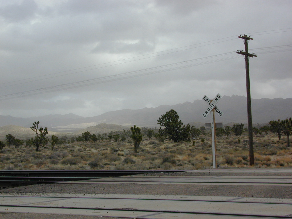
Kelbaker Road is one of the well-traveled back roads in the Mojave Desert connecting two major Eastern California routes of Interstate system. The I-40 to the south and the I-15 to the north, spanning 50 miles from one to the other.

Kelbaker Rd continues south to T up w/ historic Route 66 near Amboy, CA. Gasoline is very iffy in Amboy, so remember gas up in Barstow.

This region is super scenic portion of Kelbaker Road, which cuts thru the western edge of Mojave National Preserve. The Kelbaker pavement reaches to an elevation of 4024′ at Granite Pass, about 6 miles north of the exit @ interstate 40. Boulder outcroppings, bare mountain peaks, secluded cove camp sites w/ dirt roads, and old mines all over. Joshua tree forest and pinyon pine forest encircle the Mid Hills region.

4x4Some roads are suitable for passenger cars, but many are NOT. Dirt slides, erosion gullies, wash outs and rocks are common on these roads, so drive slow and pay attention. Have a spotter get out and take a look at the road conditions. Have a stroll, in the dark w/ the flashlights.

Or risk bottoming out, getting stuck in a deep rut. RVs should be very cautious. Daylight arrival is usually key for getting a perfect camp site, unless of course, you had it way-pointed on the GPS. Bingo! But the torrential thunderstorms, rearranged the valley since then, so use your brains.

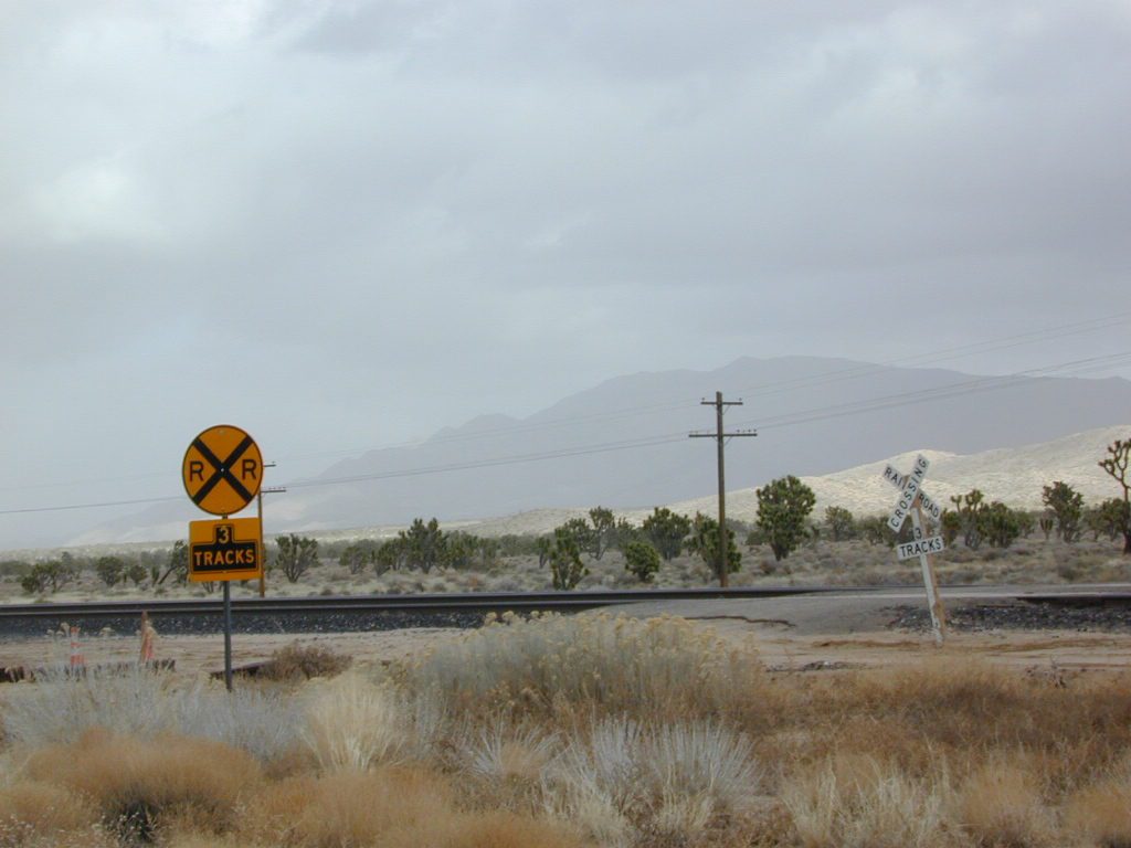
There are private property ranches, active railroad tracks & BLM lands along the Kelbaker route. Some of the boundaries of NPS have been extended, so best to bring a decent topo map.

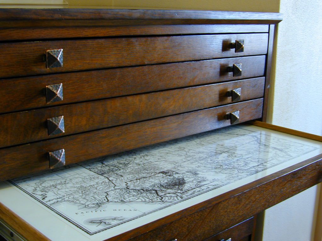
map file case

MOJAVE DESERT
topo maps

Free camping is abundant in this desert region, but it’s all primitive w/ no facilities and all are on dirt roads when your turn off Kelbaker. Some of the best camping areas are around 4000 feet (above sea level), so serious wind and even snow is quite possible in the winter months. Go prepared w/ plenty firewood.

Historic Mojave Trail (aka Mojave Road) is out this way. Dirt bikes, off roaders love this trail that connects the Colorado River @ Avi Casino to Afton Canyon near Barstow.

wildflowerWILDFLOWERS – joshua tree, yucca, barrel cactus
Higher elevation deserts bloom in late Spring, generally March thru May. Perfect rainfall timing in the autumn, can determine wild blooms and flora months later. Providence Mountains SRA can be a good location for wildflower viewing.

depot desert

Kelso, CA

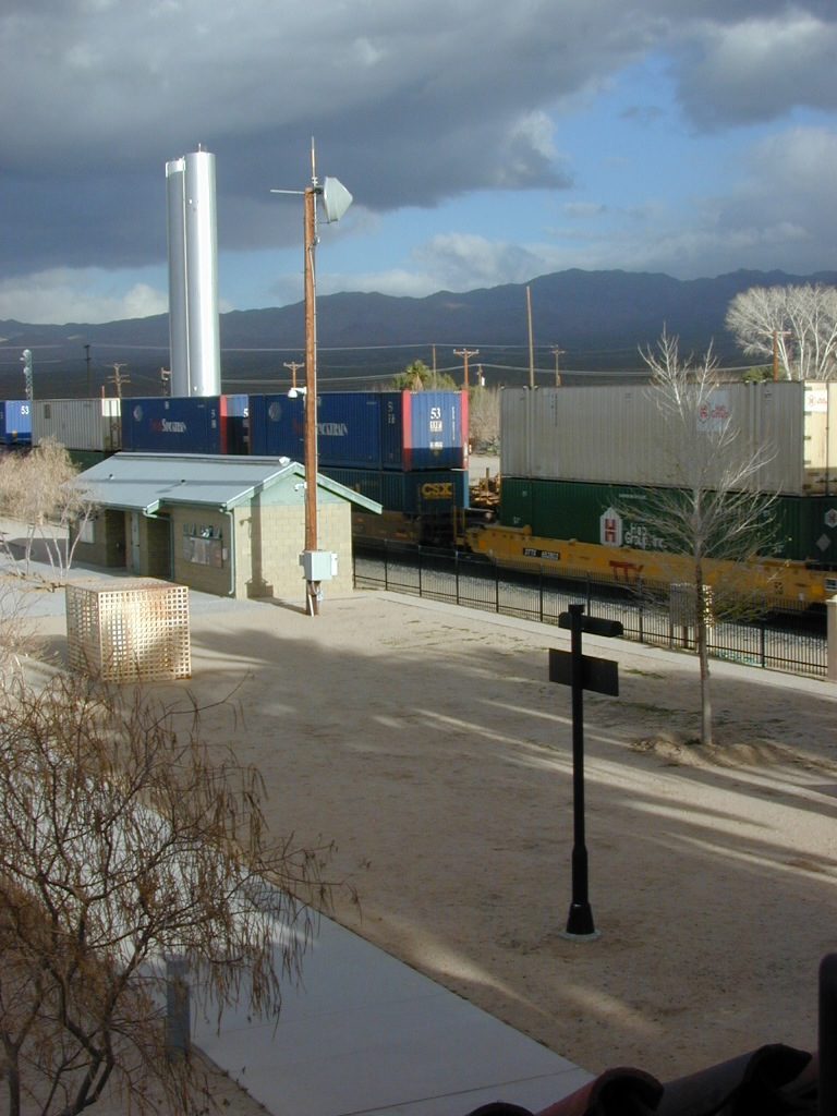
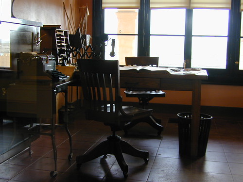
Kelso Depot:  historic spot, centered around the old train depot, which has been restored and has become the new visitors center and museum. Totally worth a 2 hour stop and HIKING/WALKING stretch break. The road heads north from Kelso and the name changes to: Kelbaker-Cima Road

train

Cima, CA

mojave dirt roadsCima Store, 20 miles to the north is one of the few businesses in this region. Post Office next door, maybe. Cima Road connects to I-15 in approximately 15 miles north. Kelbaker Road splits again and it heads up to I-15 @ Baker, CA

See more in this Mojave area —

Kelbaker Rd
Kelbaker Road and Railroad Tracks
Hole in the Rock
Hole in the Rock, Mojave NP
Mojave Scenery
Mojave Mid Hills boulder peaks

The Office

The Renovated Kelso Depot

Eastern Sierra Camping

tallpeaktower

Inyo Forest Campgrounds – Eastern Sierra Campgrounds

areas include: Lone Pine, Mount Whitney, Independence, Onion Valley, Ancient Bristlecone Pines, Big Pine, Bishop [Hwy 168], High Sierra, Owens River, Lake Crowley, Rock Creek, Mammoth Lakes [Hwy 203], June Lake Loop [Hwy 158], Lee Vining & East Yosemite National Park [Hwy 120]. Camping on Eastern Sierra Highway 395

Eastern Sierra recreation – backpacking, horse packing, day hiking, creek fishing, mountain biking, mountaineering, rock climbing

Listed below are Inyo National Forest campgrounds, County Parks, BLM public camps for outdoor recreation. Many campgrounds are closed for winter months. Blue links lead to more camp information. Boldface links to detailed information & photos on campground.

campground elev spots veg toilet water notes
Agnew Meadows 8400′ 21 pines chem piped Mammoth; Jun-Sept
Baker Creek Campground 4100′ 40 cottn vault no Big Pine, BLM; RV 30′
Big Bend Campground 7800′ 17 pines vault piped Lee Vining, April-Oct
Big Meadow 8600′ 11 pines flush piped Rock Creek; May-Oct
Big Pine Creek 9000′ 30 pines vault piped W of Big Pine; May-Oct
Big Trees Campground 7500′ 9 pines flush piped W of Bishop ; April-Sept
Bishop Park Group Camp 8400′ 20 pines flush piped No RVs;
Bishop Creek
Crowley Lake Camp 6800′ 47 sage vault piped BLM Camp; Apr-Oct
East Fork Campground 9000′ 133 aspens flush piped fishing camp Rock Creek
Ellery Lake Campground 9500′ 12 pines flush piped E Yosemite; June-Oct
Forks Campground 7800′ 8 pines flush piped W of Bishop,; April-Oct
Four Jefferey 8100′ 106 pines vault piped W of Bishop; April-Oct
Glacier View Campground 4000′ 40 cttnwd flush piped Big Pine, CA; open all yr
Goodale Creek 4000′ 43 cttnwd vault no BLM Camp; April-Nov
Grandview Campground 8600′ 26 pinyon vault no Ancient Bristlecone Pines
Grays Meadow 6000′ 52 pines flush piped W of Independence
Gull Lake Campground 7600′ 11 aspens flush piped June Loop; April-Nov
Hartley Springs 8400′ 20 pines vault no Glass Creek, June-Oct
Horseshoe Meadow 10,000′ 10 pines vault piped 1 day limit; horses; More
Horton Creek 4975′ 49 pines vault piped BLM Bishop; May-Oct
Independence Creek 4000′ 25 cottn vault no Independence, BLM; RV 30′
Intake Campground 7500′ 8 pines flush piped W of Bishop; April-Oct
Iris Meadow Campgr 8300′ 14 pines flush piped W of Bishop; May-Oct
June Lake Campground 7600′ 22 pines flush piped fishing/hiking
Junction Campground 9600′ 13 pines vault lake E Yosemite; June-Oct
Lake George Campground 9000 16 pines flush piped fish, June-Sept
Lone Pine Campground 5500′ 43 pinyon vault piped W of Hwy 395
McGee Creek 7600′ 26 aspen flush piped Tom’s Place, Hwy 395
New Shady Rest 7800′ 94 pines flush piped Mammoth, in town
North Lake Campground 9500′ 11 pines vault piped W of Bishop; June-Oct
Oh Ridge Campground 6000′ 148 pines flush piped June Lake
Old Shady Rest Camp 7800′ 51 pines flush piped Hwy 203, Mammoth
Onion Valley Campground 9000′ 15 aspen vault piped High Sierra access
Palisade Campground 8600′ 5 aspen flush piped Rock Creek; May-Oct
Pine City Campground 8900′ 10 pines flush piped Lake Mary, June-Sept
Pine Grove Campgr 9300′ 11 pines flush piped May-Oct
Pleasant Valley Res. 4500′ 75 sage vault piped BLM, US 395; open all yr
Pumice Flat 7700′ 17 – flush piped June-Sept
Reversed Creek Campground 7600′ 17 aspen flush piped June Loop; May-Oct
Rock Creek Lake 7600′ 25 aspen flush piped Tom’s Place; May-Oct
Sabrina Campground 9000′ 18 pines vault piped W of Bishop; May-Oct
Saddlebag Lake 10,000′ 20 pines vault piped highest camp; June-Oct
Sherwin Creek Camp 7600′ 87 pines flush piped Mammoth Lakes
Taboose Creek 3900′ 55 shade vault stream Big Pine;
open all yr
Tinemaha Creek 4400′ 55 shade vault stream Independence, Inyo Co Park
Tioga Lake Campgr 9700′ 13 pines vault piped fish Yosemite, June-Oct
Tuff Campground 7000′ 34 pines flush piped Rock Creek; RV 22′
Tuttle Creek 5120′ 83 sage vault seasonal Lone Pine; open all yr
Upper Pine Grove 9400′ 8 pines – piped May-Oct
Upper Sage Flat 7600′ 21 pines vault piped W Big Pine; April-Oct
Whitney Portal Camp 9000′ 44 pines flush piped Trailhead; May-Oct
Whitney Trailhead 9000′ 10 pines vault piped Trailhead; May-Oct

sunsetgrandview

see Group Campgrounds in Inyo National Forest, Eastern Sierra

8

Eastern Sierra Vacation, see also –

Topo maps, wilderness hiking maps, fishing maps
Equestrian trails, 4×4 routes, OHV maps –

Twin LakesEastern Sierra communities include:

Dogs in Lake

7N01 – Stanislaus NF

Spicer Meadow Reservoir & more lakes: Paved Forest Rd #7N01

Spicer, Utica & Union Reservoirs, Central Sierra, Stanislaus National Forest

summit lake

Stanislaus National Forest
North Fork of the Stanislaus River
Highland Creek
Carson Iceberg Wilderness Area
Spicer Meadow Reservoir (6418′ elev)
Union Reservoir (6850′ elev)
Utica Reservoir

Spicer Meadow Reservoir can also be found on various publications, listed as Spicer Meadows, Spicer Mdws, Spicer Lake and Spicer Reservoir.

tent camping

Ebbett’s Pass is California State Route (SR 4) Highway 4, which cuts thru the middle of the Sierra Nevada mountains (east-west). Wilderness peaks and rivers surround this whole region. Deep snow pack is common, so much of this region is off-limits half the year (or more). Always check with local rangers by phone before venturing out, as winter conditions can keep these roads closed late into the year.

Topo Maps of this Region:

Stanislaus National Forest Map USDA
Carson Iceberg Wilderness Map USDA
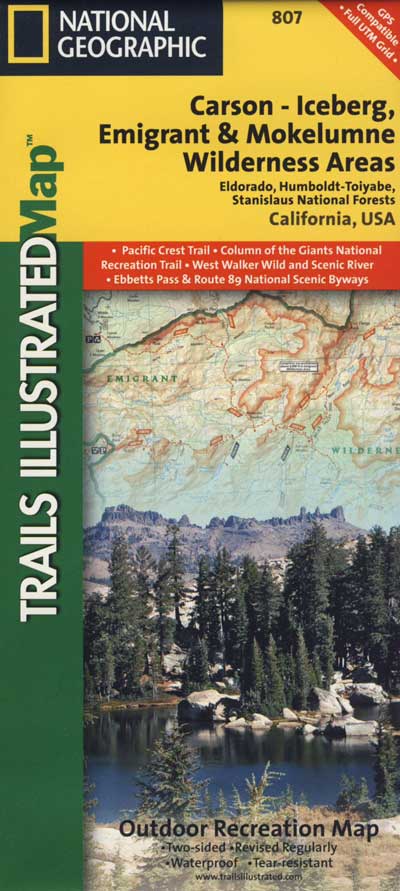
Carson, Emigrant, Mokelumne Map NatGeo
Sierra Nevada Topo Map

Wilderness Maps

N of Arnold, California; Continue up SR 4. Passing Calaveras Big Trees State Park & Camp Connell; After Big Meadow Campground, take the paved right turn for Spicer Meadow; This is forest road 7N01. Meandering thru a forest and descending in elevation, road will dead end at Spicer Reservoir.

7N01, the main paved mountain road, is located on the south side of the highway. The highway turn off reads ‘Spicer Reservoir’. Suitable for travel w/ RVs and trucks with boat trailers. Quite curvy, scenic and about 7 miles long. There are developed campgrounds in the vicinity.

The dirt side roads off the pavement can be narrow, muddy, rocky and overgrown, so be cautious when exploring. Choosing a dispersed camp site should be done during daylight hours, and will require a campfire permit ahead of time. Use an existing camp site whenever possible, instead of creating new ones.

freespice

Several man-made reservoirs attract outdoor seekers, mountain bikers, campers, canoes and fishermen. Kayakers tend to love Union and Utica, but power boats and sail boats prefer Spicer Lake.

hiker

Volcanic features mix with Sierra granite in this part of the forest, and geologic formations make for interesting hikes. Mountain biking is common around these lakes, as well as day hiking and backpacking.

Spicer Lake

NFSlogo

NFS Campgrounds in the region:

  • Stanislaus River Campground
  • Spicer Campground
  • Spicer Group Camp

Campgrounds only open June-September. Some campsites at the campground are wheelchair accessible. Boat ramp located near campgrounds.

camp

outdoor recreation:
backpacking
boating
bouldering
camping
canoeing
fishing
floating
granite
hiking
kayaking
mountain biking
lakes
sailing
swimming
trails
wildflowers

wildflower

Left fork turn off, Dirt Road #7N05 leads out to Utica & Union Reservoirs. Granite rock, alpines lakes w/ forests surrounding. No motorized boats allowed on those two lakes. Very popular among the stand up paddlers (SUP), all kayaks and canoes.

canoeNo developed campgrounds back that way either. No flush toilets, nor paved roads. No flat RV spots; only primitive style camping. These 2 scenic lakes get crowded during summer weekends, so opt for a mid-week stay if possible.

Another dirt road treks steeply up the hill from Union Reservoir to Lake Alpine (at the highway). That primitive truck trail is actually a (somewhat designated, but not well-signed) 4×4 route and suitable for high clearance vehicles only.

car camping lakes

Spur Road #7N29Y is another small dirt road which leads a couple miles into the forest, over to overgrown trailheads and primitive camping options. Ideal for accessing all the lakes (on foot) from this prime location. A camp fire permit is required. No water, no bathrooms, no facilities, no garbage services.

Pack it in, pack it out.

  • Elephant Rock Lake
  • Summit Lake (7068′ elev)

elephant rock

Closest small towns are:

ARNOLD
BEAR VALLEY
LAKE ALPINE, CA

lake camps

7N01 – Los Padres NF
There is another USFS Road in California named 7N01, but that one is a 4×4 OHV access route @ Dutchman Campground, located in South Central California; the southern part of Los Padres National Forest. We have mention of it on the page for Frazier Park Camping.

4x4

Silver Lake @ June

June Lake Loop

Silver Lake @ June Lake Loop

(Mono Co)

7700′ elev. Hwy 158, Backside of June Lake Loop, north of Mammoth.

Prime hiking and fishing destination of the Eastern Sierra, California. With impressive Carson Peak (10,909′) towering as a granite backdrop for the lake, every day out here is super scenic. Unless, of course, blizzard white-out conditions occur – which is possible during winter.

fishOctober-November, Autumn colors – at this particular location – tend to be fantastic, with aspen groves encompassing the lake, nearby streams and steep canyons.

fish: Reverse Creek, Rush Creek, Silver Lake, Grant Lake, Gem Lake, Gull Lake, June Lake

golden glow june

Winter weather & deep snow can close the paved highway loop, so know road conditions and weather forecast before you go. This beautiful Silver Lake is within walking distance of two lodges – Whispering Pines & Double Eagle Resort, so if rain or snow is predicted make your reservations.

  • aspen groves
  • autumn colors
  • backpacking
  • camping
  • canoeing
  • fishing lake
  • hiking trails
  • horseback trails
  • kayaking
  • mountaineering
  • picnic grounds
  • RV camp

Rental Boats

Ansel Adams Wildernesshiker
Inyo National Forest
June Lake, CA

This gorgeous, 80 acre alpine lake is a popular campground for fishing, picnicking, hiking, summer and autumn camping. Accommodates tent camping and RVs. Boat ramp, grocery store, coin-op laundry – all nearby. Camp closes for snow annually.

Silver Lake Campground NFS campground

• Elevation: 7600′
• Number of Sites: 28
• Vehicle Accessibility: RV 20′
• Campsites Reservation: Yes
• Camp Fee: Yes
• Toilets: Flush
• Water: Piped/Potable
• Length of Stay: 14 Days
• Season: April – October

NFS
Inyo National Forest
Mono Lake Ranger Station
North US Hwy 395
Lee Vining, CA 93541
760-647-3044

lets go fishing

stars

See all Silver Lakes in California

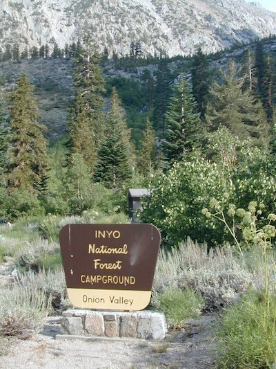
Onion Valley Campground

whiteVWcamper

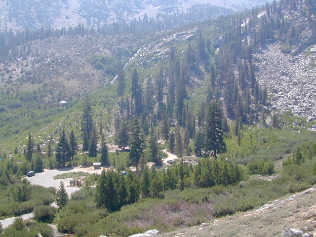
Spectacular Small Campground located inside a granite bowl above 9000′ elevation, on the edge of the granite, near the John Muir Wilderness trails.camp

Inyo National Forest near Independence, CA
Eastern Sierra California

One of the best high elevation trailhead camp for backpackers in the Sierra.

High Sierra Lake Hikes

Onion Valley Campground

Onion Valley CA

  • Elevation: 9,200′
  • Number of Sites: 29
  • Vehicle Accessibility: no RVs
  • Camp Fee: Yes
  • Campsites Reservation: Yes
  • Toilet: Vault
  • Water: Piped
  • Length of Stay: 14 Days
  • Season: June – Sept
  • Trailhead Parking

Inyo National Forest hiker
Mount Whitney Ranger District
760-876-6200

Trailhead parking & camping for these High Sierra destinations –

onionsign

wild mountain onions?

High elevation NFS campground, located in a huge granite valley w/ waterfalls, wildflowers and aspen groves. The setting is breathtaking and the high altitude valley is nothing less than grand.

The views (east to the Owens valley) are from the paved road up, or from the hiking trails leading up outta camp. Gotta hike up (on foot) to see the views! Any visitor that does not hike, will be missing out on the best features of this destination. Plan to spend more than one day at Onion Valley.

ONLY OPEN for summer months! This small, developed campground closes annually.  Big winters and deep snow is the norm w/ elevation this high.

 walk-in camp sites

tent campas well as car camping sites.

  • picnic tables
  • fire rings
  • vault toilets
  • piped water
  • bear boxes

ONION VALLEY ROAD
access via Independence, CA

The paved road is long and very winding; sheer cliffs, steep drop offs, hairpin curves, minimal guard rails. RV motorhomes are not allowed on this route, due to the steepness of the terrain and the narrow roadway. conradkid2001

  • backpacking
  • camp
  • hiking
  • horse pack trips
  • lake fishing
  • mountaineering
  • rock climbing


horsepacks hiking Mountains

Rae Lakes Loop Map
Topo Hiking Map

HIKING LAKES in the Sierra

goldentroutlakecanyon
Golden Trout Lake Canyon

Gilbert Lake @ Kearsarge

see Onion Valley photos from –
Onion Valley Autumn 2008
Onion Valley Summer 2002

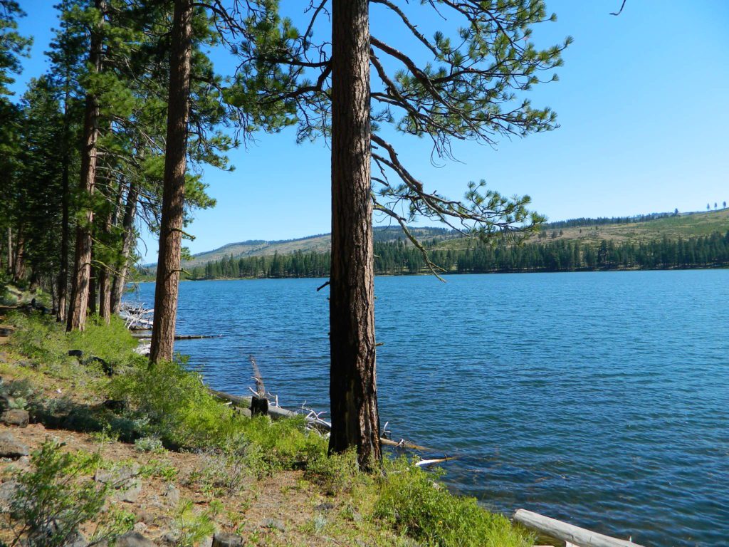
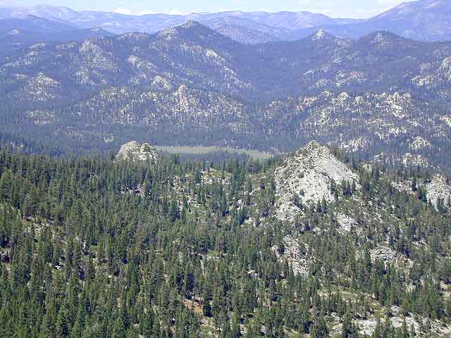
South Warner Wilderness

Warner Mountains
Modoc Country
Northeast California

Road 64

Wide open spaces, mountains, rivers and ranch lands. The very last of the unexplored high country of California. Rural and rustic regions are full of forested mountain ranges with sage brush meadows lying below. Valleys are high elevation deserts with a base terrain sitting above 4000′; Peaks @ 8000′ above sea level.

South Warner Wilderness

70,000 acres
80 miles N of Susanville, CA
Modoc National Forest
NFS

South Warner Wilderness is in the southern portion of the Warner Mountains, a north south positioned range, located in the top corner of the golden state. Surprise Valley lies to the east, bordering the Nevada state line and Alturas w/ US Hwy 395 on the west side.

California SR 299
Hwy 299, the only paved thoroughfare cuts right through the middle of the Warner Mountains. Paved Parker Creek Road #56 climbs up Parker Creek from Alturas, accessing camping, hiking, dirt back roads and wilderness trailheads. Warner Mountains State Game Refuge is north of the wilderness area.

One dirt route skirts the wilderness boundary – West Warner Road #5, which leads from Parker Creek due south to Jess Valley Rd #64. Blue Lake Road, Patterson Mill and Road #39N15 are nearest to East Creek. Winter driving tips from NFS.

butterfly

  • backpacking
  • camping
  • creeks
  • fishing
  • hiking
  • horseback riding
  • hot springs
  • lakes
  • waterfalls
  • wildflowers
  • wildlife

South Warner Lakes & Reservoirs lake

  • Clear Lake
  • Patterson Lake
  • Porter Reservoir (elev 6682′)
  • West Valley Reservoir (elev 4761′)
  • Blue Lake
  • Sworinger Reservoir (elev 5868′)

South Warner Trailheads hikes

  • Summit North Trailhead (Road #31)
  • Pine Creek Trailhead (Road #5)
  • Mill Creek Trailhead (Road #40N24)
  • Clear Lake Trailhead (Road #5)
  • Summit South Trailhead (Road #64)

mill creek falls modoc

South Warner Campgrounds camp

All these campgrounds listed can be accessed by a vehicle, most by narrow back roads (some dirt). If you prefer to drive on paved roads only, then you’ll need to choose Blue Lake or Mill Creek Falls. Deep snow closes forest roads and campgrounds are generally only open a few months per year, from May to October.

South Warner Mountain Peaks

  • Squaw Peak (elev 8646′)
  • Warren Peak (elev 9710′)
  • Dusenbury Peak (elev 9710′)
  • Eagle Peak (elev 9892′)
  • Cole Peak (elev 8970′)
  • Emerson Peak (elev 8989′)
  • Hat Mountain (elev 8737′)
  • Red Rock Mountain (elev 8518′)

south warner mountains map

Wilderness permits can be obtained at local ranger station: NFS
Modoc National Forest
225 West 8th Street
Alturas, CA 96101
530-233-5811

Blue Lake Modoc
Blue Lake Modoc

nearby towns –

California Fire Lookout

Dome Land from Bald Mtn, KERN
Bald Mountain (elev 9382′) Lookout in Sequoia National Forest

NFS Fire Lookout Towers

JULY 2019 – Many thanks goes to Pike County Lookout for initially spotting the #RockFire – in the Plumas National Forest, near Berry Creek, CA

Lookouts in the California National Forests

Ready to see far and wide – with wild terrain? Views for 100 miles out and the best scenery California has to offer. Be prepared to off road or hike to reach one of these destinations.

Below is a list of historic look out towers & cabins used for spotting wildfires. Some are located on steep granite peaks, ridge lines or dirt roads. 4WD may be recommended to reach some of these. Road conditions can change w/ harsh mountain weather, so be prepared to rough it. Thunderstorms are common on these mountain ridges.

Several of these places are cabins, some are stone houses, but most fire lookouts are basic metal towers – with high climbing staircases, so you must be in decent physical strength to haul your ass up this high.

rangers cabin mountains hikers vacation

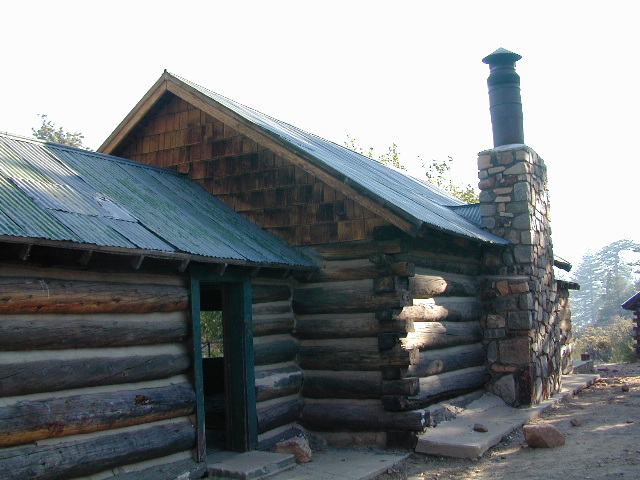
Cabins are also called guard stations, huts, bunkhouses. Most are located on mountain tops, but a few exist in desert regions. Some are refurbished & available for overnight rentals. Bare bones furnishings, so forget the frills. People come up here for the thrills. To be outside w/ epic views, way away from the urban grind & to feel on top-of-the-world.

Coon Creek Cabin


NFSlogoSee the full list of overnight accommodations on mountain peaks & ridges, some near meadows @ National Forest Cabin Rentals

El Dorado National Forest USFS

Robbs Peak Lookout
Robb’s Hut / Robbs Cabin
6686′ elev near Placerville, Gold Country California

Cuyama Peak
Cuyama Lookout is a rough road up. Off Hwy 33, Los Padres NF

Los Padres National Forest

4x4Cuyama Peak Lookout Tower (pictured above) off Hwy 166 & via Santa Barbara Cyn, 4×4 recommended. Sorta near jct w/ Hwy 33

Big Bear Lake 2002
Big Bear Lake, Southern California

San Bernardino National Forest USFS

Butler Peak Fire Lookout
elev. 8537′ (no overnight stays)
located in between Green Valley Lake and Fawnskin

Morton Peak Fire Lookout
(no longer available for overnight stays 2019)

Strawberry Peak Fire Lookout
(no overnight stays)
above Rimforest, off Bear Springs Road, N of Hwy 18

Tahquitz Peak Fire Lookout
elev. 8846′ (no overnight stays)
highest lookout in the San Bernardino NF

hiker

Sequoia National Forest USFS

Bald Mountain Lookout (no overnight stays)
off of Sherman’s Pass Road #22S05, 4×4 may be needed.
Bald Mountain 9382′ elevation; in between the Kern Plateau & Kern Riverranger

Big Meadows Cabin
Big Meadows Guard Station
off Big Meadows Rd #14S11
7600′ elevation; located in between Sequoia NP & Kings Canyon NP

Mountain Home Guard Station
Mountain Home State Forest, Sequoia Groves
6000′ elev. near Springville, CA

Needles Fire Lookout
(destroyed in structure fire 2011)

Poso Guard Station Cabin Rental
open all year round 4500′ elev. near Kernville, CA

pinetree

Sierra National Forest USFS

Camp Four and a half Cabin
Camp 4 ½ Cabin Rental
Lower Kings River, open all year round
1100′ elev. near Pine Flat Reservoir


Six Rivers National Forest USFS

Bear Basin Butte Cabin & Fire Lookout
elevation 5300′ in Six Rivers NF / Smith River NRA
(road damage & access issues 2017)

4x4

Tahoe National Forest USFS

Calpine Lookout Cabin Rental
near Sierraville, CA

Pike County Lookout (no overnight stays)
near Challenge, CA & New Bullards Bar Reservoir

Sardine Peak Fire Lookout
overlooking the Sierra Buttes and serene Lakes Basin, Yuba Rivers, North Gold Country CA

lakes basin views

BEWARE:
California is the land of wildfires!

campfireAlways check for local fire conditions at nearest ranger station, obtain a free campfire permit when camping outside of developed campgrounds, and always practice fire safety when visiting our public lands. You can be held liable for wildfires. Outta control campfire, cigarettes, idling vehicles on tall, dry grass. Be very cautious with fires on the often dry, west coast.

see also –  National Forest Cabin Rentals

Mount Pinos

Mt. Pinos

Sierra Views from Pinos
Originally uploaded by danamight

Mount Pinos Recreation Area

The Mt Pinos Recreation Area is located on the border of Southern and Central California, inside Los Padres National Forest. After passing Frazier Park, the winding, paved, mountain road starts atop Cuddy Valley and is approximately 12 miles from Interstate 5 @ Tejon Pass. The 8831′ peak is the tallest in Kern County and is a popular spot for both summer and winter recreation: cross country skiing, snow shoeing, backpacking, hiking, mountain biking. The snow gates often close during heavy snow.

Mount Pinos Road starts atop Cuddy Valley Rd, at the “Y” – where it intersects with Mil Potrero Highway, which heads out to Pine Mountain Club, California.

One mile up the Mount Pinos route, you will find McGill trailhead on the right side (it is popular w/ mountain bikers) and then the first snow gate at Burbank Rd. Another 4 miles up hill, you come to the only set of dirt roads accessible on this range. A left turn will take you winding thru pine forest to the valley below. 4×4 is not required, but a National Forest map could be very handy. Unfortunately all the private properties at the bottom have locked gates & no thru access to Cuddy Valley is allowed. Although it is an awesome drive to just go exploring in the woods, there is no way out (once you get down the hill), so you must return the same way you came.

Back on the main route, shortly after the dirt roads is McGill Campground on the right side & another snow gate. In another mile and a half you will reach Mt Pinos Campground on the left side; the entrance is easy to miss. From here you are less than 2 miles from the end of the main road.

Mountain Bike, Hike, Backpack, Camp, XC Ski, Snow Sled

Darkest Skies for Stargazing in Southern California

The huge paved parking lot is the dead end (2 miles from the peak of Pinos) – very popular with astronomers, mountain bikers, plus the families and snow sledders in winter (if the gates are open). A National Ski Patrol’s Nordic Base, the only building you will see up this way. At 8300′ elevation, the large parking area is perfect overnight spot for amateur astronomers, so be considerate when visiting night. New moon (no moon) weekends APR-OCT are optimal viewing months. In busy summer months you can often find motorhome campers all set up with expensive equipment tracking the heavens all night long. Please be respectful of their hobby & eyes; Turn off headlights when you approach the parking area at night.

hiker

There is also a hike-in, freebie camp ground called Chula Vista; an easy quarter mile walk from the parking lot to 12 camp sites & a pit toilet. Mountain bikes dig this area too. A large meadow here blooms with wild irises in summer, only sometimes.


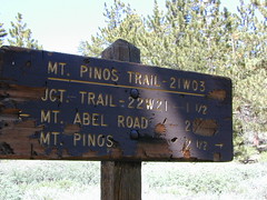
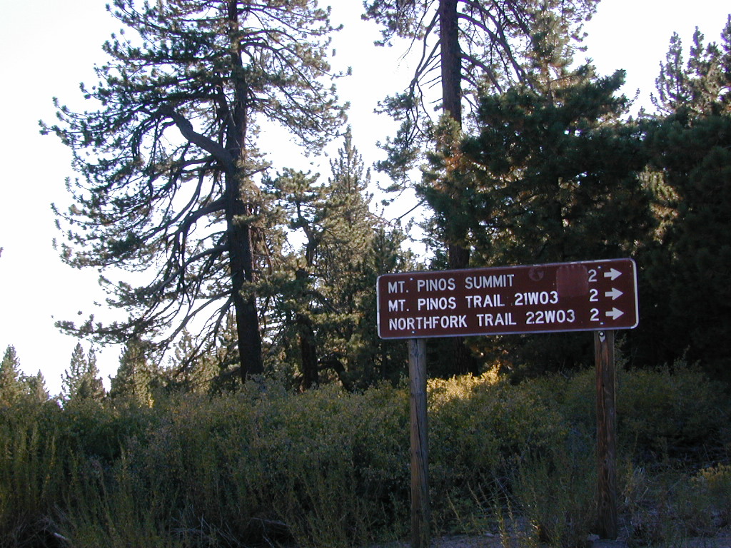
Trail 21W03 Mt Pinos

Originally uploaded by danamight

ROAD CONDITIONS to Mount Pinos, call the rangers 661-245-3731

Pinos – Peak to Peak Hike

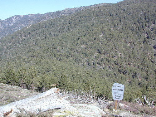
The trailhead for Pinos Summit starts at this parking lot. It is a 2 mile moderate, but steep hike on an old fire road. The neighboring peak to the west is called Mount Abel @ 8286′ elevation (aka Cerro Noroeste). The infamous peak to peak hike along the ridge line from Mt Pinos to Mt Abel is 6.5 miles one way – and very popular in summer months. This hike requires 4-6 hours & a car shuttle should be arranged in advance. The Chumash Wilderness sits between Mount Pinos and the tiny community of Pine Mountain, which can be seen below on many places along the hike.

camp

There are 3 developed campgrounds in the Mount Pinos Recreation Area:

McGill Campground accepts reservations online. Campgrounds are often closed during winter months, due to snow. (Oct-April)

DARK NIGHT SKIES: Amateur Astronomers unite!

thebigboys
Pinos star gazers out in force
summitsign
Hiking Trails to Mount Pinos, California


drummersout
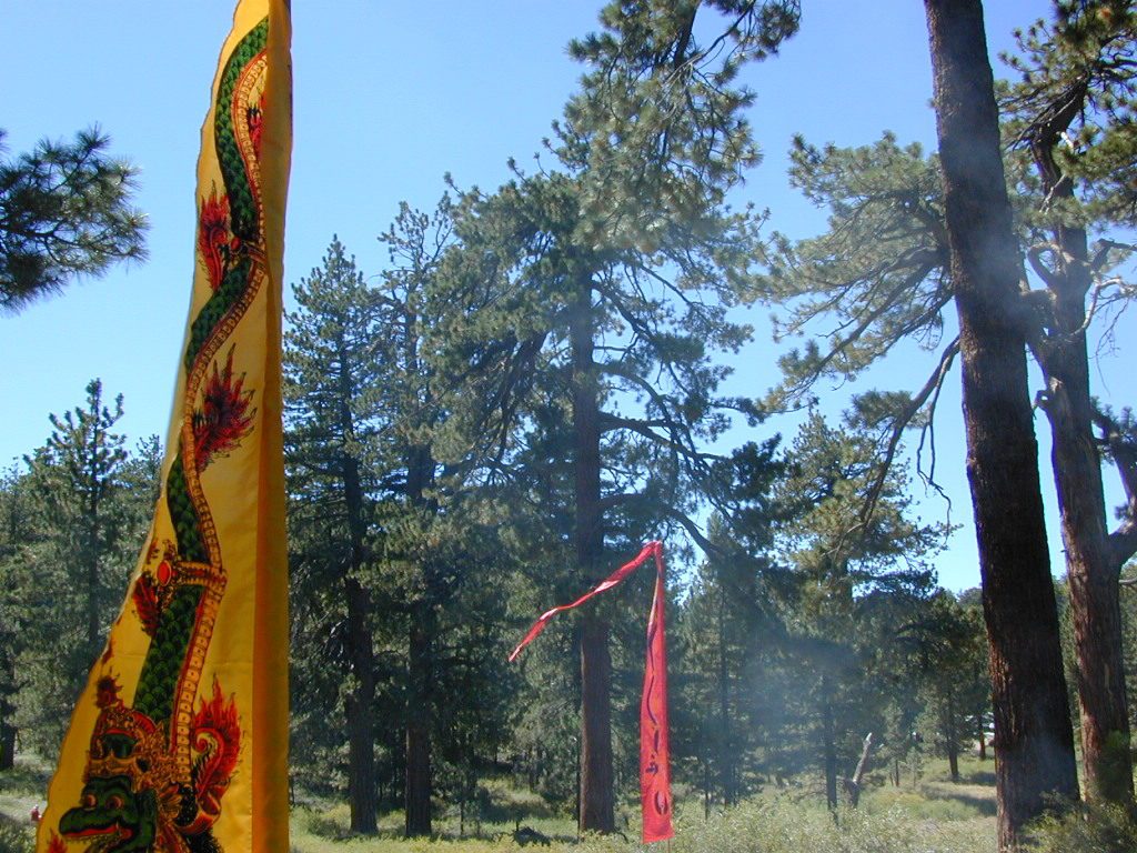
Drummers Solstice Campout

flagspinos

LOS PADRES MAPS:

Los Padres National Forest Map

Los Padres Forest Topo Atlas

NatGeo Los Padres East Map 

Sespe Wilderness Trail Map

Dick Smith Wilderness Map

NEAREST TOWNS:

Chumash Wilderness
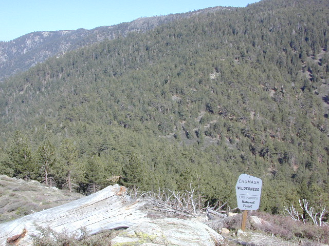
Mt Abel trailhead looking East to the Mount Pinos range. Pine Mountain Club, and the Sierra Nevada mountains can both be seen from this vantage point

see the neighboring mountain peak, Mount Abel

Camp O Alto @ Cerro Noroeste

Lakes Basin Recreation Area

Lakes Basin Area, California

Golden gems of California, a collection of alpine lakes on the north end of Historic Gold Country, North Yuba River, Northern Sierra Nevada

lake dunk
EAST of Downieville, CA

California’s Gold Lake and surrounding lakes; the granite spires of the Sierra Buttes and the creeks, waterfalls, headwaters of the Yuba River — total wild beauty. Steep, granite, river canyon from Downieville drive east on Highway 49 from Sierra City to Bassetts, a gasoline and market stop; they have a small hotel there too.

Historic Lodges

Take the left turn, north on to the Gold Lake Highway. The alpine and extremely scenic Lakes Basin Area consist of all small lakes in between Hwy 49 to Hwy 89, along GOLD LAKE HWY [Road S620] some maps read Road #24 or call this Gold Lake “Road” instead of highway. Snow closes in this route during winter months.

The impressive Lakes Basin Gold Lake Region is in the north part of Tahoe National Forest, on the border of Plumas National Forest. Plumas Eureka State Park is also nearby.

Hiking, Camping, Backpacking, Picnicking, Wildflowers, Stargazing, Fishing, Kayaking, XC Skiing, Snowmobiling

Lakes Basin Map

Lakes Basin Campground

California best lake destinations

lakes basin views

Lakes Basin Recreation Area

Sierra Buttes Map


California Mountain Maps

The Mountains of California

Camping El Dorado NF, on the Consumnes River

If you know you wanna head up in elevation, higher altitudes – to the pine forests of California, but have no clue where to start, this page may be very helpful in determining your ultimate destination. We have hundreds of pages on adventures & locations throughout the golden state. We sell all California maps for outdoor recreation, hiking topos to off road routes.

Wanna camp under the stars this weekend – and avoid the crowds too? You will need a good back road map to find this awesome camp site, guaranteed. Need a hammock spot, small swimming hole & total seclusion? Or how about a large family camp w/ Sequoia grove nearby? Total Escape has something for every ones budget & lifestyle. See below for an extensive breakdown of California mountain regions.

#1
SoCal mountains have tighter restrictions on campfires, larger number of people camping in a smaller amount of space, minimal primitive camping options in the forests, more fees to access these lands.

#2
The Sierra Nevada mountains are the prime outdoor destination for many in the Central California region. High elevations w/ granite slabs to lower country reservoirs & riverside oak flats. Folks come from all over the world to visit parks and lakes within this mountain range. Indeed, 4 National Parks call the Sierras home: Lassen, Yosemite, Kings Canyon and Sequoia NP – not to mention the 10 National Forest and 15+ Wilderness Areas.

#3
You want big water? Cabins next to a prime fishing river or camping near lakes, creeks with dense forests, then you will have to drive to the mid Sierra or even NorCal to find ’em.

Wilderness maps

California Mountain Regions Defined –
find the details on specific region for California mountains

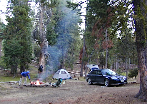
saabaru_forest
Mountain Home Sequoias

epic finds

Find little known parks, camps and forests within our vast California BACK ROADS data base. Below is a small sampling of our picturesque mountain pages, where you can find the best seclusion: hiking, camping, fishing, mountain biking trails, rivers, creeks and peaks.

NFSlogo

Sierra Buttes
The Sierra Buttes, Northern Sierra near Gold Lake

sierra National Forest map

Outdoor Recreation Maps of California:

inyohighroad
Inyo high roads, of the Eastern Sierra


California Topo Maps

topo linesCalifornia Terrain

Topographical maps feature the terrain of a wilderness or hiking area, through colored shading & thin contour lines to represent elevations. Park boundaries, trail routes, trail heads & campgrounds are noted, as well as major landmarks like lakes, rivers, creeks, meadows, peaks, canyons, hot springs, waterfalls & all roads (dirt or paved).

Backpackers & hikers must rely on such maps for planning & trekking their journey. Hard copy, printed, waterproof maps are top choice, but topo maps now come in digital format for download as well. DanaMite has recently started including these digital map links within the Total Escape Map Shop – totalescape.net/shop/

Here in California we are lucky to have so much public land available to us for enjoyment. Numerous map vendors make maps for nearly all of the regions across California.

Affiliate Button

QUADS: 7.5 minute topographic quadrangle maps, available from the USGS, can be found online w/ Avenza Maps (often for free) and also, direct from the government site https://www.usgs.gov/products/maps/topo-maps

A while back, the NFS offered handy books of these sought-after topo maps. They were compiled into booklet form called an ATLAS, with sturdy covers & a spiral bound. Overall size is close to 9″x12″ & they are much easier to handle than the individual paper maps. Look for Forest Topo Atlases

List of topo maps available for California:

wilderness maps CA kings canyon
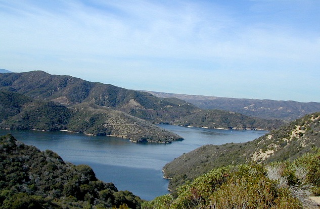
conradkid
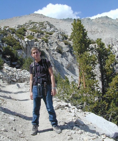
Hiking the High Sierra @ 12,000 feet above sea level

28E201 – Inyo NF

trailsdown

Road #28E201 – Inyo National Forest
also known as Inyo Road #4S86

Laurel Lakes Road
Inyo National Forest
Eastern Sierra, California

Southeast of Mammoth Lakes, CA
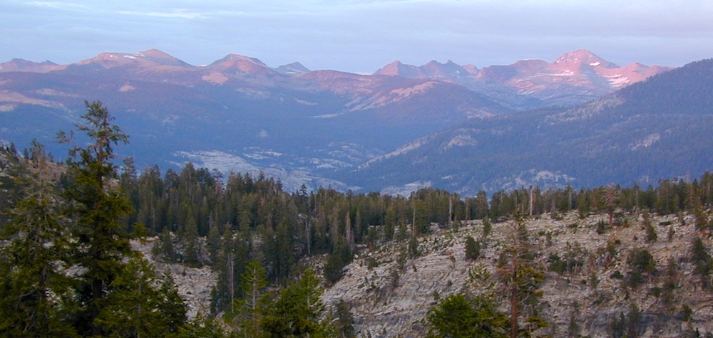
West of Crowley Lake, CA

Steep, rocky, gravel road, way up above (and behind) Convict Lake. 4WD may be needed during wet or snowy weather. High clearance is always advised. Locked GATE at the bottom means the NFS rangers have closed the route (seasonally) for deep snow, rock slides, avalanches, or other erosion hazards.

Laurel Canyon, US Hwy 395
Laurel Creek
Laurel Lakes

amigoaspens
Laurel Lake Road, Eastern Sierra

Find more INYO BACK ROADS

  • backpacking
  • camping
  • fishing
  • hiking
  • horseback
  • lakes
  • mountaineering

GenevieveLake

Trailhead to Lake Genevieve (pictured above), hike lake loop, snowy peaks.
NOTE: No easy access to the PCT (Pacific Crest Trail)

Laurel Mountain (elev 11,818′)
Bloody Mtn. (12,544′)

oldestrocks

gnarlyrocks
CLICK TO ENLARGE

Geologic:

Oldest, exposed rock in the Sierra Nevada mountains range. Buckling granite w/ volcanic rocks. Evidence of glacial activity including, terminal, lateral, and recessional moraines, glacial striations and polish, erratic boulders, and of course the numerous lakes. see more

Volcanic Eastern Sierra
Volcanic hikes in the Eastern Sierra

Inyo Forest Roads

Baker Creek
Baker Creek, Inyo NF

Eastern Sierra Nevada – Inyo Mountains
Inyo Forest Back Roads – Mammoth Off Road

Off Road near US Highway 395. Yep, Olancha has some OHV (off-road) areas near the dunes, but this web site is dedicated to the real deal, the scenery, the trail heads, the hot springs, great secluded camping & of course, back road exploring.

You will need a Inyo National Forest map to discover these back roads. These are minimally traveled routes, un-maintained, sometimes washed out, eroded & maybe even creek crossings (without a bridge). Some gravel two-lane routes, some one lane roads leading deep into dead end canyons.

A few popular routes are paved, but most of these listed are indeed dirt roads. Some may require high clearance vehicle, or even 4×4. Know your vehicles limitations & be prepared to turn back when the road worsens. Cuz more often than not, it’s a sign of what more difficult terrain is to come.

coyote creek route

Watch out for live stock – they are dumber than they look.

Owenyo Rd – Wanna parallel the highway (395) on dirt; Sure, it’s a long bumpy route – from Hwy 136 @ Dolomite to Bend City @ Mazourka Cyn.

Road# 13S05 – Mazourka Canyon Rd – leads up to some old mining camps & way behind Mazourka Peak (9410′) deep into the Inyo mountains. It’s all desert on this side, but these canyons have pinyons & more vegetation than you would imagine. Road# 9S15 & 9S14 circle Andrews Mountain (9460′) then join back up w/ Death Valley Rd (the North Pass into Saline Valley).

Ancient Bristlecone Pine Forest has some great dirt roads surrounding it. After you are finished with all the touristy sights & you don’t wanna spend the rest of the day in the visitors center or back at camp, try Cottonwood Canyon – full of aspens, camp sites & fishing, not cottonwood trees. 4×4 is required. Crooked Creek has boulders, boulders & more boulders. Plus some amazing camp sites with open sky views. Silver Canyon is for high clearance only, 2WD okay. This will lead you down to Laws Railroad Museum on Hwy 6, on the back side of Bishop, CA

Benton Crossing Rd (green church @ 395)
This wide road leads out to multiple dirt roads that peel off in every direction. Many Eastern Sierra Hot Springs can be found out here – on the east side of the highway. No hot spring resorts, no facilities, no clothing & very primitive.

Bishop 4×4 route Coyote Flat
Coyote Wash leads up to Coyote Flat & out to Coyote Lake. This a a spectacular high altitude plateau overlooks the Owens Valley & requires 4 wheel drive just to get up there. Pinyons, junipers, aspens, wildflower meadows, old mines, & yes, lakes at 11,000′ elevation. Views of the High Sierra & South Lake.

Buttermilk Road – This dirt road is north turn off of Hwy 168, W of Bishop, CA. “The Buttermilks” are a popular spot among rock climbers. A great place for indian petroglyphs too!

Road# 9S21 – Glacier Lodge Road – Paved road. Creek exploring & fishing. Plenty Campgrounds. W of Big Pine CA

Horseshoe Meadows Rd – Paved route with great views over Owens dry lake bed; access via Lone Pine CA; A nice day trip to meadows & High Sierra scenery. Picnic & day hike!

McMurray Meadows Rd – south off of Glacier Lodge Rd (#9S21) just W of Big Pine CA. You can find ancient cinder cone volcanoes & cave-like lava tubes in between this long dirt road & the highway.

monacheMonache Meadows is a high elevation meadow that takes some time & determination to get to. This area is part of the Inyo National Forest, but can be accessed by either: backpacking thru the high Sierra’s or driving a high clearance vehicle thru Sequoia NF # 22S05 Sherman Pass Road, behind the Black Rock Ranger Station & Troy Meadows Campground. High clearance is needed, 4×4 maybe. Great camping sites near Olancha Peak trailhead. The area is surrounded by Golden Trout Wilderness & South Sierra Wilderness. From US Highway 395 to Kennedy Mdws & then Monache is a full day of exploring, so you may as well stay the night up there. But bring warm gear, a campfire permit & a capable vehicle.

Manzanar Routes – Back behind Manzanar Camp there are miles of dirt roads to explore. Many creeks side camp sites can be found even with a passenger car. Small trees & sage brush. Secluded camping (for free) is possible in the Eastern Sierra.

Mono Craters (Rd# 1N11) – the youngest mountain range on the continent. Just south of Mono Lake, this route skirts the pumice cones & climbs over the Aeolian Buttes, before it meets back up with Hwy 395.

Walker Creek Rd #19S01 – Oaks & creek. South of Olancha CA, look for turn off & follow dirt road up into the tight canyon.

Fish Slough Road (Rd #3V01) – open, high-desert area near volcanic tablelands. Find Indian Petroglyphs. N of Bishop, CA

keough hot tubInyo Road# 6S16 – Pine Creek Road – Creek exploring & fishing. NW of Bishop behind Rovana, also known as Round Valley, CA

Road# 4S02 – Owens Gorge Road – N of Bishop behind Lake Crowley. Camping w/ boulders & pines. Good open sky views for stargazing.

Road# 4S86 (Inyo Rd #28E201) – Laurel Lakes Road – Camp in aspens @ Laurel lakes, high elevation; access to alpine lake trailheads; SE of Mammoth Lakes, CA

Road# 2S05 – Deadman Creek – Creek fishing in forest. N of Mammoth

Road# 2S07 – Owens River Road – Pine forest, near hot springs; no facilities. N of Mammoth

Road# 1S63 – June Lake Loop is CA SR 158 (Hwy 158) paved main route, which is often closed for winter months, due to deep snow.

Road# 1N17 North of June Lake Loop; dirt road access to Parker Lakes & Walker Lake trailheads; Side canyon routes offer (unmarked) picnic areas and fishing spots; few primitive camping options.

Road# 1S25A Parker Lakes Road– Aspen & pine forest, near creeks; E of Grant Lake / N of June Lake

Road# 1S23 Walker Lake Road – Pine forest route to Walker Lake; E of Grant Lake / N of June Lake

Impressive Canyons

Eastern Sierra Hiking

Eastern Sierra Hiking Trails – Mammoth Hikes

Autumn Bliss Hike

Desert ghost towns to Sierra meadows & waterfalls, Inyo National Forest offers plenty of diversity for scenery. To list all the hikes in the Eastern Sierra would be obsurd, cuz there are so many trails. This side of the Sierra Nevada is all about hiking, fishing & camping.Inyo forest map

No matter where you hike you will probably get a great view over the Owens Valley, Long Valley Caldera or Mono Lake. So that means most of those trails are hiking up a canyon, or a ridge line. Thousands of trails over this region require a good map to make the best decision for your hiking interest.

US HWY 395: The Eastern Sierra is one of the premier hiking destinations of California. Featuring the granite crags of the HIgh Sierra peaks. Mount Whitney, the tallest peak is closest to Lone Pine. Southern Californians love Eastern Sierra destinations, cuz they can avoid Los Angeles Basin and stay outta traffic.

Lone Pine Lake – Whitney Portal is a great, but crowded place for hiking. DO NOT ATTEMPT to hike to Mount Whitney in one day! Leave it to the seasoned pros. The first good stop up the Whitney Trail is gorgeous Lone Pine Lake, a great moderate day hike from there.

Alabama Hills – just below Mt. Whitney and has a totally different landscape than the backdrop granite Sierras behind. Try some boulder hopping & explore the dirt roads. Bring your mountain bike too.

Cottonwood Lakes (Pacific Crest Trail) – day hikes to alpine lakes. US 395 @ Lone Pine, W on Whitney Portal Rd. Left on Horseshoe Meadow Rd & continue up 19 mi. to the Horseshoe Meadow campground. Mostly a trail head camp, way, way up there. Open May – November

Kearsarge Pass – from 9000′ Onion Valley you can access the incredible High Sierra & numerous alpine lakes. The elevation gain makes this a full days hike; rated strenuous. Or continue on w/ backpack into Kings Canyon National Park.

Devils Postpile – back behind Mammoth Mountain, creeks, forest & cool geology awaits. Plenty hiking trails.

FALL COLORS: Autumn is the best time to enjoy the gorgeous aspen groves, as they change colors w/ the onset of winter.

Eastern Sierra Peaks

Topo maps, wilderness hiking maps
Equestrian trails, OHV maps –


Sierra High Country Hikes
Originally uploaded by danamight

Trailhead @ Onion Valley leads up to impressive alpine lakes, Kearsarge Pass & Kings Canyon High Country.

Eastern Sierra communities include:
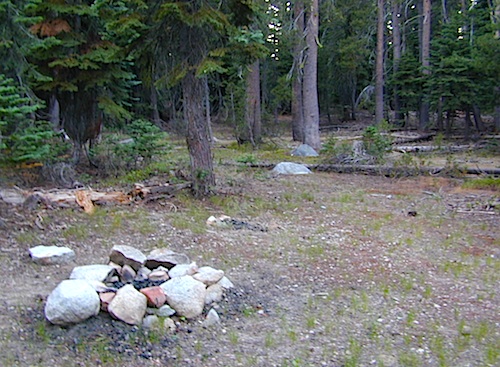
Alabama Hills
Alabama Hills @ Lone Pine, CA

El Dorado Campgrounds

El Dorado Camping

Kirkwood Lake
Kirkwood Lake, California

El Dorado National Forest
Carson Pass Hwy 88, Ebbetts Pass Hwy 4, Gold Rush Country
Sierra Nevada Mountains, Alpine Lakes

campground elev spots veg toilet water notes
Airport Flat Campground 5300′ 16 – vault no Ice House Reservoir
Azalea Cove Campground 4900′ 10 – vault lake Union Valley Reservoir
Big Meadows Campground 5300′ 54 pines flush piped handicap access
Blue Lake Lower Camp 8100′ 16 – vault piped PG&E; fish, boat, camp
Blue Lake Dam Upper 8200′ 25 – vault piped PG&E; fish, boat, camp
Caples Lake Campground 7800′ 35 pines vault piped fishing lake
Capps Crossing Campground 5200′ 12 pines vault piped gold panning
China Flat Campground 4800′ 25 – vault piped Silver Fork Rd
Dru Barner Campground 3200′ 16 – flush piped equestrian trails
Gerle Creek Campground 5300′ 50 pines vault piped handicap access
Fashoda Campground 4900′ 30 – vault piped handicap access
Hell Hole Campground 5200′ 10 – vault piped walk-in
Upper Hell Hole Campground 4600′ 15 – vault lake Hell Hole Reservoir
Ice House Reservoir Camp 5500′ 83 – vault lake handicap access
Jones Fork Campground 4900′ 10 – vault lake Union Valley Reservoir
Kirkwood Campground 7600′ 12 pines vault piped narrow road; fishing
Lone Rock Campground 4800′ 5 – vault lake Union Valley Reservoir
Loon Lake Campground 6500′ 62 pines vault piped equestrian; group site too
Lovers Leap Campground 5800′ 21 pines vault piped rock climbing
Lumberyard Campground 6500′ 5 pines vault – RV access
Middle Creek Campground 8200′ 5 pines vault piped fishing creek
Middle Fork Cosumnes River 6780′ 5 – vault crk PG&E, swim, fish
Mokelumne River Camp 3200′ 8 – vault crk swim
Moore Creek Campground 3200′ 8 – vault crk swim
Northshore Campground 6378′ 15 – vault lake Loon Lake Campground
Northwind Campground 5500′ 9 – vault lake Ice House Reservoir
Pardoes Point Campground 5900′ 10 – pit no Bear River Reservoir Rd
Pipi Campground 3900′ 51 – pit no handicap access
Sand Flat Campground 3900′ 29 – pit no fishing
Silver Fork Campground 5500′ 35 – vault piped fishing
Silver Lake Campground 7200′ 62 pines vault piped boating lake
South Fork Campground 5200′ 17 – vault piped fishing
South Shore Campground 5900′ 22 – vault piped Bear River Reservoir
Strawberry Point Camp 5500′ 10 – vault lake Ice House Reservoir
Stumpy Meadows Campgr 4400′ 10 – vault lake handicap access
Sugar Pine Campground 6000′ 10 – vault no boating
Sunset Campground 4900′ 131 – vault piped boating
Wench Creek Campground 4900′ 100 – vault crk boating
Wentworth Springs Camp 6200′ 8 – vault crk 4WD recommended
West Point Campground 4875′ 8 – vault lake Union Valley Reservoir
White Azalea Campground 3500′ 6 – vault crk Mokelumne River
Wolf Creek Campground 8200′ 42 – vault piped boating, fishing
Woods Lake Campground 4900′ 25 – vault pump handicap access
Yellowjacket Campground 4900′ 40 – vault piped boating, fishing

see more about El Dorado National Forest

waterfalls

nearby towns –

El Dorado Forest Maps –

Ansel Adams Wilderness

anselwoodsign

Alpine high country hiking, Sierra Nevada mountains, California

Ansel Adams Wilderness Area

Ansel Adams Trail Map, Tom Harrison
Ansel Adams Map, Forest Service USDA
Ansel Adams Map, NatGeo

Ansel Adams Hiking Map
The Ansel Adams Wilderness is an area in the Sierra Nevada of California. The wilderness is part of the Sierra and Inyo National Forests, in the Eastern Sierra portion of the range, overlooking Mono Lake. Yosemite EAST is what NatGeo likes to call it. The wilderness spans 231,533 acres with Yosemite National Park lies to the north and northwest, while the John Muir Wilderness lies to the south.

The wilderness was established as part of the original Wilderness Act in 1964 as the Minarets Wilderness. The 109,500-acre Minarets Wilderness was created by enlarging and renaming the Mount Dana-Minarets Primitive Area.

In 1984, after his death, the area was expanded and renamed in honor of Ansel Adams, well-known environmentalist and nature photographer who is famous for his black and white landscape photographs of the Sierra Nevada.

Ansel Adams Wilderness Map

outdoor recreation –

  • backpacking
  • camping
  • fishing
  • hiking
  • horseback
  • ice climbing
  • lakes
  • mountaineering
  • peaks
  • wildflowers

surrounding park & forest lands –

nearby towns –

leeviningvalley
lee vining canyon

Ansel Adams Wiki
Ansel Adams Hiking on Summit Post

Day hikes or overnight backpacking trips require a Wilderness permit and can be obtained at the local ranger station. A good topo map will also prove invaluable on your hike. Access trailheads for Ansel Adams Wilderness from EAST and WESTERN sides of the Sierra Nevada range.

Ansel Adams Trailheads from the west –

Onion Springs Meadow trailhead, Vermillion @ Lake Edison (Sierra NF)

Isberg trailhead & Mammoth trailhead @ Granite Creek Campground via Beasore Road, way up behind Bass Lake (Sierra NF)

Isberg Pass trailhead from Yosemite National Park

Ansel Adams Trailheads from the east –

Bloody Canyon, Walker Lake trailhead, near Grant Lake on June Lake Loop (Inyo NF)

Rush Creek / Fern Lake trailhead, near Silver Lake on June Lake Loop (Inyo NF)

Agnew Meadows trailhead & Minaret Vista trailhead, Mammoth Lakes CA (Inyo NF)

Devil’s Postpile trailhead, behind Mammoth Lakes CA (Inyo NF)

Fern Lake Reflection
Fern Lake, day hike from Hwy 158 (June Lake Loop)

Dinkey Creek

Dinkey Creek, California

dinky what?

Dinkey Creek California
Dinkey Creek really ain’t all that small is it?

Dinkey Creek elevation 5700′

Dinkey is a major feeder creek originating with high altitude lakes in the Wilderness above, flowing down to the Kings River. Dinkey Creek has a seasonal large campground and a general store that is open during the summer months. Campground Reservation are common since this is a well-known destination of the Western Sierra.

in the mountains above Fresno

Located deep in the Sierra National Forest, 15 miles south of Hwy 168 @ Shaver Lake, via a very long, winding, paved road. Not suitable for large motorhomes.

Dinkey Creek Road becomes McKinley Grove Road @ intersection of historic, wooden Dinkey Creek Bridge. McKinley Grove Rd  leads further south, past Sequoia trees, numerous other NFS campgrounds and on to the 2 big reservoir lakes (Wishon & Courtright). The Dinkey Road is usually only open during warmer months (MAY-OCT), snow & weather permitting.

Dinkey Creek Store

A very popular place for summer vacations, fishing, hiking and picnicking. The day use area near the historic wooden bridge has numerous dirt parking lots, trails, picnic tables and pit toilets. Excellent place for exploring on foot with the family, or creek fishing from the boulders.

mountains backroad horseback trails picnic fishing mountain bike camps hikesnight skiesNFS

wooden bridge
Historic Dinkey Creek Bridge

Dinkey Creek Campground RV camping

  • Elevation: 5,700′
  • Number of Sites: 128
  • Water: piped
  • Toilets: flush
  • Amenities: showers, horse corrals
  • Vehicle Accessibility: 30′ max RV
  • Campsites Reservation: Yes
  • Length of Stay: 14 Days
  • Season: May – September
  • Trailheads: Dinkey Lakes Wilderness

Mckinley Grove intersection

hikesDinkey Lakes Wilderness 

Dinkey Lakes Wildernesstopo mapsDinkey Lake Trail Map


Back roads are abundant around Dinkey, leading higher up to large, granite reservoirs (with more camping options) and numerous forest dirt roads zig-zag across the mountain terrain wherever possible.

Dusy Ershim Trail is a famous Sierra 4×4 route that connects Courtright Lake to the Kaiser Pass. Granite everywhere, slow-go rock crawling, skirting in between two Wilderness Areas.

Sierra Forest Road #11S12, is a dirt road that leads downhill, past the North Fork of Kings River, from high elevations near Dinkey to the Black Rock Reservoir and meeting up with Kings River near Pine Flat. An excellent loop trip for those wanting to experience dispersed camping on the back roads, but a high-clearance vehicle is required. This road is gated and closed for winter, so call ahead to the rangers, to see if it is open before you make the journey.

Wilderness Wishon California
Wilderness Wishon

This whole Western Sierra is home to major hydroelectric dams that create a water supply for farms and cities located in the Central Valley below.

nearby lakes –


Map California Baja

Secret Beaches
Secret Beaches of Baja

2003 Baja Map

Baja Topo Map

Topographic Maps of California Baja
Baja California Almanac

BAJA MEXICO MAP

The mysterious topographic map maker, Landon Crumpton, is gone. Although his Baja Almanac book of the Mexican peninsula is still as popular as ever.

bajaalmaac

The Total Escape crew has been using this amazing topo map for Baja Mexico since our the very first excursions in 1990. Click below to read more about the famous, hard-to-find Baja Almanac publication.

  • Baja California Almanac
  • Topographic Map Book of Baja California

  • National Geographic Baja Maps
  • NatGeo Baja California Mexico Maps

    Baja California Maps

  • Find more Baja Maps
  • Obscure Books & Maps, AAA Maps of Baja

    Baja Snack

    John Muir Wilderness

    John Muir Hiking / John Muir Map

    High Sierra Hiking

    California Wilderness Area Acres Topographical Maps
    John Muir Wilderness

    elevations: 4000′-14,496′

    584,000 John Muir Wilderness Maps
    Inyo National Forest

    JMT

    High Sierra Nevada / Eastern Sierra

    Rugged Sierra Nevada high country. The highest peaks in the Sierra Nevada mountains can be found inside this Wilderness. Many peaks are well above 13,000 feet. Granite, glaciated basins, big snow, alpine lakes, meadows, wildflowers, streams, creeks, cliffs, jagged peaks. Mount Whitney stands as the tallest mountain in the lower 48 states.

    John Muir Trail Maps
    – JMT Topo Map

    lacontedivide
    Le Conte Divide, Sierra Nevada California – 12,000′ elevation peaks

    Eastern access via steep granite hiking, off US Hwy 395 (Bishop, Independence, Lone Pine)
    Western access backpacking thru Kings Canyon National Park, Hwy 180
    or Sequoia National Park, Hwy 198 (Mineral King, Three Rivers)
    or Sierra National Forest, Hwy 168 (Lake Edison, Florence Lake, Courtright Reservoir)
    North access via backcountry Yosemite National Park, Hwy 120
    or Mammoth Area towns (Lee Vining, June Lake, Mammoth Lakes)

    Hundreds of miles of hiking trails, some of the highest peaks in the nation. Trails open to equestrian and foot traffic only. Trailhead quotas limit the amount of day hikers and backpackers that an access the Wilderness daily. Wilderness permit required: Inyo National Forest Permits

    Eastern Sierra Visitor Center
    Inyo Visitors Office

    JM Topo Trails

    USDA National Forest
    USFS, NPS, BLM

    NFS NPS

    Eastern Sierra Interagency Office
    US Hwy 395 @ SR 136
    Lone Pine, CA 93545
    760-876-6200

    JMT
    JOHN MUIR TRAIL- John Muir Wilderness

    nearby towns, parks & resorts:

    Aspendell
    Big Pine
    Bishop, CA
    Courtright Reservoir
    Florence Lake
    Independence, CA
    Kings Canyon National Park
    Lake Edison
    Lone Pine, CA
    Mammoth Lakes
    Olancha, CA
    Tom’s Place
    Wishon Reservoir
    Yosemite National Park

    www.flickr.com

    19S01 – Inyo NF

    south sierra ridges

    Walker Creek Road #19S01
    – Inyo National Forest

    Southern Slopes, Eastern Sierra Nevada

    Just south of Olancha, off US Hwy 395 is a dirt road that takes you 5 miles up to an oak canyon lined with rocks. There are several primitive camp sites along the Walker Creek. A high clearance vehicle may be needed in some sections, but 4×4 is not required. Small RVs might attempt this, but if the first mile frightens you, turn around while you’re ahead.

    Dirt Road near 395

    This private, shaded, creek area is perfect for those traveling Highway 395, looking for a quick and free camp spot near Olancha, CA

    nice shady spots
    Shady picnic or camp spots above 4000′ elevation.

    some granite
    Hiking trails at the end of the road lead deep into the mountains. One on the right takes you to waterfalls. The trail on the left will take you to meet up with the Sage Flat Trail, which leads up to Olancha Pass, Summit Meadows & a small lake, in the South Sierra Wilderness. The Pacific Crest Trail runs the ridges here, just west of Monache Meadows, which is at 8000′ elevation, way above here – up on top. 

    First Camp

    US 395 highway – the dirt road turn off is very close to a gas station, and it maybe be signed, or not. The gas stop may be in business, or perhaps not. This is rural California, wide open desert and things come and go quickly.

    On a good topo map, located Olancha Creek and Summit Creek to the south. Walker Creek is the canyon in between those two, just so know where you are going and can visualize. This one is an easy-to-miss dirt road turn off – especially if you are going over 50 mph.

    Chimney Creek Campground

    campmap

    Chimney Creek Campground
    BLM Kern / Mojave

    High mountain desert camp is mislabeled on some maps as “Chimney Peak Campground” or “Chimney Rock Campground”. Pinyon pine forest on Chimney Creek, near hiking trailheads, wildflowers and Chimney Peak Wilderness. Southern Sierra ridge near Mojave Desert and California SR 178.

    peakpinyons

    Canebrake Road is a graded dirt road that makes up part of Chimney Peak Back Country Byway. This rural route is a major graded dirt road located north of Highway 178 – which connects Canebrake to Long Valley up near Kennedy Meadows. Pacific Crest Trail passes next to this campground in the Southern Sierra mountains. The campground turn off is way east of Lake Isabella Hwy 178 is (near Walker Pass & PCT) and follow dirt road north to Kennedy Meadows in the far eastern reaches of Sequoia National Forest

    Chimney Peak BLM
    • Elevation: 5,700′
    • Number of Sites: 32
    • Camping Reservations: No
    • Sites Available: First come, First serve
    • Vehicle Accessibility: RV limit 28′ max
    • Length of Stay: 14 Days
    • Water: Piped (April – Sept)
    • Toilet: Vault
    • Season: Open all year
    • Fee: No
    • Operated By: BLM
    • Closest Town: Lake Isabella, CA

    Bureau of Land Management
    BLM Bakersfield Ranger Station
    661-391-6000

    Lamont Peak
    Lamont Peak – elev 7510′

    nearby destinations –
    Camp Kern Backroads

    Chimney Peak Wilderness
    Lamont Peak
    Long Valley Campground
    Dome Land Wilderness
    Owens Peak Wilderness
    Jawbone Canyon
    Sequoia National Forest
    Sacatar Trail Wilderness
    Kiavah Wilderness
    Kennedy Meadows
    Lake Isabella
    Kern River
    Monache Meadows


    View Chimney Creek Campground in a larger map

    Trinity Alps Camping

    Trinity Alps Wilderness Campgrounds

    Northern California Camping
    Shasta Trinity National Forest

    Trinity Alps Wilderness

    camp


    • backpacking
    • camping
    • fishing spots
    • floating
    • hiking
    • hunting
    • kayaking
    • mountain biking
    • off-roading
    • soaking
    • swimming holes
    • tubing
    • stargazing

    trinitydetail

    campgrounds near Trinity trailheads –

    camping Highway 3
    (California State Route 3):

    • Horse Flat Campground, near Eagle Creek trailhead
    • Eagle Creek Campground @ Hwy, near Stoddard Lake & Eagle Creek trailhead
    • Goldfield Campground, near Boulder Creek trailhead
    • Big Flat Campground (via Coffee Creek Road #104)
    • Preacher Meadow Campground @ Hwy, near Swift Creek trailhead

    camping Highway 299
    (California State Route 299):

    • Ripstein Campground, near Canyon Creek trailhead
    • Hobo Gulch Campground, on Road #34N07
    • Hayden Flat Campground, near Big French Creek & Green Mountain
    • Denny Campground, near Jim Jam Ridge, East Fork & New River; Way out west
    • Groves Prairie Campground, near Grizzly Camp trailheadtrinityalps_lg
    • Happy Camp Campground, near Grizzly Camp trailhead

    camping Highway 96
    (California State Route 96):

    • Tish Tang Campground, near Tish Tang trailhead
    • Box Campground, near Red Cap Lake, Bear Hole & Mill Creek Lake
    • Klamath Riverside Campground @ Hwy, near Salmon Summit

    camping Salmon River (Cecilville Road #1C02):

    trinitysign
    Trinity Scenic Byway (CA SR 3)

    NorCal Topographic Maps – Trinity Map

    Shasta Trinity National Forest Map

    Pacific Crest Trail Map #6 (Shasta Cascades)

    Trinity Alps Wilderness Map

    outdoor destinations also nearby –


    View Larger Map

    Campground Lakes

    RV California / Campground Lakes / Camping Lake

    RV lake Camping

    Wanna vacation near a lake this season? So does everyone else in California.

    “Mountains” & “lakes” are the top camping destinations sought by most web surfers. Be prepared to search for your ultimate lake side camp. Summertime is prime time at all water sources, so make your reservations, or better yet – find a secluded lake all to yourself. (4×4 may be required).

    boating marina camping RV Camp boating

    Lakes area recreation & camping sites in California

    granite domes


    Sierra Nevada Lakes

    Kern River Canyon

    Kern Spring Wildflowers

    Kern River Valley is one of the all time favorite Sierra Nevada destinations for SoCal escapees. First, it is the southern most ‘big river’ action for the Sierra range. The drive up from Los Angeles is easy access; only a coupe of hours. California Highway 178 leads from Bakersfield up the mountain to Lake Isabella (exit at 155 for Kernville destinations). The 178 continues east past the rural communities of Onyx, Canebrake, Weldon, and then on to the Northern Mojave desert & US Highway 395

    Second, Kern has an abundance of outdoor recreation, from fishing to boating, river rafting to kayaking, backpacking, mountain biking, rock climbing, horseback riding, hiking, camping, & soaking. Kernville is the “recreation headquarters” for the region, where you can find rafting outfitters, camping supplies and rental equipment.

    Kern Rafting

    Third, the mountain scenery is very diverse – with the dry shores of Lake Isabella, the granite lined Kern River, or the ridges with towering cedar forests, plenty sugar pines, plus a few Sequoia groves; Tons of dirt back roads to explore, granite & gorges for the rock climbers, prime wilderness access & several primitive hot springs.

    The whole area is encompassed by the Sequoia National Forest with wilderness areas to the North & East. Giant Sequoia National Monument is located along the Western Divide Hwy in the northern portion of the National Forest.

    campingFIND CAMPING along the Kern River

    camping Sequoia National ForestFIND ALL Campgrounds in the Kern River Canyon

    Kern River Valley communities include:

    Whether you’re an RVer wanting a developed campground near town, a fisherman needing a primitive site right on the river, or a backpacker seeking the high country, the Kern has a little bit of everything. High elevations beyond 8000′ ridge lines, or the lush Lower Kern under 2000′ with granite boulders lining, Kern has it. 4 wheelers will love the extensive network of dirt back roads, or maybe the OHV areas of Keysville. Lake Isabella has numerous oak lined campgrounds & boat rentals available too. Summer is not the best time to visit as the temperatures soar to 100 degrees & the city crowds come in full force to the Kern Valley. Springtime, the best season to visit runs from March to May, or Autumn cools for September to December.

  • SEQUOIA NATIONAL FOREST MAP
  • DOME LAND WILDERNESS MAP
  • GOLDEN TROUT WILDERNESS MAP
  • SOUTH SIERRA WILDERNESS MAP
  • KernWildflowers

    HoboCampground
    Hobo Campground in the Lower Kern Canyon

    Anza Borrego Desert Wildflowers

    Borrego Blooms

    Barrel Cactus Anza

    By far one of the best viewing areas for native California desert flora in the whole state. Autumn rain amounts determine the next year’s Spring bloom. If it rained real good all over SoCal before New Years Eve, chances are better for a favorable showing of color.

    Low elevations, washes, badlands, dry lake beds bloom first in February, followed by March for mid altitude canyons and mountains. Highest desert peaks may not bloom until May.

    Some of Total Escape favorite spots include:

    S-2 Great Stagecoach Route of 1849

    Anza Borrego Desert State Park
    Anza Ranger 760-767-5311

    Coyote Wash Blooms

    April is usually the best month for the wildflowers; it is also the prime time for Spring Break camping. Open car camping for free – all over this huge California State Park. The tourists typically head over to the town of Borrego Springs, to Borrego Palm Canyon and the visitors center; but the REAL wildflowers are along remote stretches of highway, and on the DIRT BACK ROADS. Many roads are passenger car accessible, for at least the first mile, so don’t think you must have a 4×4 vehicle for just simple exploring.

    Coyote Ocotillo Garden

    Central Coast California

    Central Coast Mountains / Central Coast Cali

    Within 40 miles from the Santa Barbara coast are mountains that reach near 9000′ elevation, the tallest in Kern County. Mount Pinos & Mt Able, as well as the Sespe, Dick Smith, San Rafael, Matilija & Chumash Wilderness Areas, make up this southern portion of Los Padres National Forest. There are plenty of tiny, primitive campgrounds that offer seclusion for RVs & car campers. 4×4 camps, OHV routes & parks, plus numerous Wilderness areas that will suit everyone’s need for the outdoors. A great drive for accessing this area is Hwy 33 North from Ojai.

    Further up the coast is the northern section of Los Padres National Forest – which is the mountainous back drop to the magnificent Big Sur coastline. If you are seeking to camp near Big Sur without the fees of a developed Campground, these dirt road ridge lines may be your saving grace… if you don’t mind roughing it. Views over the ocean & coastline are even more spectacular than from Hwy 1, but campfire restriction can be tight in summer & fall months. There are plenty lodging opportunities, historic lodges, cabins or luxury RV parks, located in the small towns along the coast.
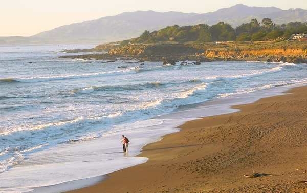
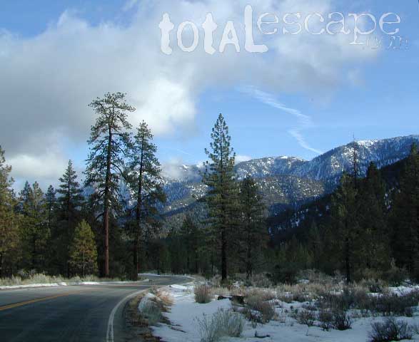
    Both Los Padres forest north & south are open all year long for recreation & camping. Only one town in this region, Pine Mountain Club, gets considerable amounts of snow (roads may be impassable without chains, AWD or 4×4). Central Coast icon Big Sur with Hwy 1 is prone to mud & rock slides during heavy rains, so plan for alternate routes & check road conditions w/ CalTrans when traveling during inclement weather.

    Central Coast forest & parks –

    Los Padres National Forest
    Andrew Molera State Park
    Julia Pfieffer Burns State Park
    Limekiln State Park
    Pfieffer Big Sur State Park
    San Simeon State Park

    Moonstone Beach Cambria

    Central Coast maps & trails –

    Central Coast towns nearby –
    Big Sur, Cambria, Frazier Park, Gorda, Gorman, Ojai, New Cuyama, Pine Mountain, San Simeon, Ventucopa

    Milpotrero

    Castle Crags Wilderness

    NorCal Hiking
    Castle Crags State Park
    CastleCrags Wilderness

    12,232 acres
    Northern California Mountains
    South of Dunsmuir, CA
    Interstate 5
    exit #724 – Castella

    backpacking, camping, creek fishing, hiking, mountaineering, lakes, rock climbing, snowshoeing, swimming, waterfalls

    About an hour north of Redding, you can see those impressive peaks off to the left above the lush forest. Way up off the west side of I-5, lies a hiking paradise of scenic lakes, waterfalls and wildflowers. Opposite the freeway from Mount Shasta; Just south of Lake Siskiyou.castle crags

    Castle Crags Wilderness neighbors the Castle Crags State Park, which is surrounded by Shasta-Trinity National Forest. This area is named for 6,000′ tall glacier-polished peaks and pointed crags. Due to their relatively low elevation, year-round recreation, hiking, backpacking, and rock climbing are popular spring through fall. Snowshoeing near Castle Lake is excellent.

    Castle Crags State Park
    530-235-2684

    Castle Crags State Park Campground
    76 developed campsites
    6 environmental campsites

    Max Camper Length: 27′
    Max Trailer Length: 21′

    28 miles of hiking trails (2.7 mi access trail to Castle Crags Wilderness)
    The Pacific Crest Trail also passes through the park.
    Dogs not allowed on park trails.

    Shasta-Trinity National Forest
    Mount Shasta Ranger District
    204 West Alma
    Mt. Shasta, CA 96067
    530-926-4511

    Climbing at the Crags:
    the Cosmic Wall & beyond

    regional history: The northwest area contains the largest glacial cirque, Castle Lake, which is near where the Modoc War’s 1855 Battle of Castle Crags took place. Now a historical landmark, the battle was fought on a ridge saddle between the lake and what is known as Battle Rock. The Wintu tribe inhabited the area, they called the crags the Abode of the Devil and the Spanish explorers called it Castle del Diablo (Castle of the Devil.) read more on wiki

    nearby towns –


    View Larger Map

    Chumash Wilderness

    Chumash Wilderness
    Los Padres National Forest

    38,150 acres
    Mount Pinos – 8831′ elevation
    Cerro Noroeste – 8286′ elevation
    Los Padres National Forest

    Terrain consists of high mountain peaks, badlands of Quatal Canyon Wash & Lockwood Valley; Steep slopes of forests, rock outcroppings, sparse forest areas, on border of Kern County & Ventura County. This area is sacred to the native California Chumash tribe.

    Quatal Canyon Rd #9N09

    DSCN0042Mount Pinos, Mount Abel, Cerro Noroeste, Westside Park, Hudson Ranch Road, Mil Potrero Highway, Lockwood Valley Road, East Dry Canyon, Apache Canyon, Cuyama River

    campgrounds nearby –

    The Peak to Peak Hike is a 7 mile, high elevation, ridge line day hike that traversed 2 of the tallest peaks in Kern County – Mt Pinos (elevation 8831′) and Mt Abel (8286′). Day hikes, equestrian trails, backpacking, mountain biking areas nearby. Steep, granite, chaparral, lightly forested w/ ponderosa and Jeffrey pines. From this ridge trail you have a 360 degree view over the entire region. The cabin community of Pine Mountain Club is to the north side (and IF the skies are really clear, you can see the Sierra Nevada mountain range too); Lockwood Valley & Ozena Valley are located to the south; Cuyama Valley to the west and the Tejon Pass w/ Frazier Park to the east.

    Off road use 4×4, dirt bikes, ATVs, and quads are common in Quatal Canyon, Apache Canyon, East Dry Canyon leading up to the wilderness edge. Rangers will ticket if they find you on the Chumash side of Quatal wash. The secluded yet inviting, wide, white sandy washes are just too tempting for some bad boys.

    Chumash trailheads are located –

    • about a mile before Camp-O-Alto Campground (Mount Abel)
    • along lower end of Quatal Canyon Wash (OHV areas parallel)

    nearby towns –


    DSCN0060


    View Chumash Wilderness Area in a larger map

    Dome Land Wilderness

    Southern Sierra Nevada Mountain / Domeland / Dome Lands
    Kern Plateau, Sequoia National Forest

    Dome Land Wilderness

    130,081 acres

    55 miles of trails (hiking & horseback)

    Located at the southern end of the Kern Plateau about 20 miles east of Kernville, granite domes give this area its name. Domeland Wilderness is a unique geologic area with semi-arid to arid mountainous regions. Elevations ranging from 3,000′ to 9,730′ – it is surrounded by National Forest, where the Sierra mountains meet the North Mojave Desert. The Wilderness is the southernmost habitat for the Golden Trout. The South Fork of the Kern and tributary streams attract many fishermen. Vegetation is mostly mixed conifer and piñon (pinyon pine).

    The Domeland Wilderness is located at the southern end of the Kern Plateau. This land was first protected by the Wilderness Act of 1964 as a 62,695 acre wilderness and was later expanded to 130,081 acres in 1984 to include the delicate transition ecosystems that meet to the east, south, and north of the original wilderness. These new additions, now jointly managed by the Bureau of Land Management and Sequoia National Forest, are rugged and dry.

    Though it is considered within the Sierra range, the Domeland Wilderness includes the overlap of several ecosystems to form unique plant and animal communities. The banks of the South Fork of the Kern River offer important riparian habitats of cottonwoods and meadows which stand in sharp contrast against the characteristic smooth domes and bold granite outcroppings. Domes that range from the size of a cottage to football fields across and spear-like jagged spires can be found in the Domeland. This range is one of the driest in the Sierra with the semi-arid mountains of the north and east crumbling into desert.

    Notable Wildfires: Dome Fire 1996. Manter Fire in 2000.

    Dome Land trailhead locations:

    East side access near Rockhouse Meadow and at the Long Valley Campground (BLM). Access is via Nine Mile Canyon Road (J41) from US Highway 395 or Chimney Peak Road (graded dirt road) via State Highway 178 , the main route that passes Lake Isabella.

    West side trailheads are at Big Meadow and Taylor Meadow. Two trails from Big Meadow can be reached from Kernville via Tulare County Road M99, Sherman Pass, and Cherry Hill Roads. Leading to Manter Meadow, the upper Big Meadow Trail is a rugged hike while the lower Big Meadow Trail follows more gentle terrain. The trail from Taylor Meadow (southeast of Big Meadow) also leads to Manter Meadow. North side access is available from the Blackrock/ Sherman Pass Road via the Dark Canyon and Woodpecker trails.

    dome land mapManter Meadow is popular along with other camp sites located at Little Manter Meadow, Woodpecker Meadow, Rockhouse Meadow, and in the Bartolas Country at the south end of the Wilderness.

    Dome Land Wilderness Map USDA


    surrounding lands & forests –

    Sequoia National Forest
    Ridgecrest Desert BLM

    nearby towns –

    National Forest & Wilderness Permits –

    USDA Sequoia NF

    More Dome Land Wilderness Info & Links –

    sierrawild.gov/wilderness/domeland
    summitpost.org/domeland-wilderness
    Dome Land Wiki

    Mokelumne Wilderness

    Central Sierra Nevada Mountains, California

    Mokelumne Wilderness Area

    topo mapsMokelumne Map

    Mokelumne (pronounced moo-ka-la-mi)
    Backpacking, Camping, Fishing, Hiking, Kayaking Mokelumne River / Mokelumne Fishing / Mokelumne Trail / Mokelumne Wilderness Topographic Map

    Vast alpine ranges located in the middle of the Sierra Nevada, between Highway 88 (Carson Pass) & Highway 4 (Ebbetts Pass). The Mokelumne Wilderness is a 105,165-acre federally designated wilderness area located 70 miles east of Sacramento, California. It is within the boundaries of three national forests: Stanislaus, Eldorado and Toiyabe. First protected under the Wilderness Act of 1964, the Mokelumne’s borders were expanded under the California Wilderness Act of 1984 with the addition of 55,000 acres. The wilderness takes its name from the Mokelumne River, which was named after a Mi-wok Indian village located on the riverbank in California’s Central Valley.

    The wilderness encompasses an area of the Sierra Nevada mountain range between Ebbetts Pass to Carson Pass. There are two sections separated by the Blue Lakes Road and an Off-Road Vehicle corridor. Elevations range from 4,000′ to 10,381′. The highest point is Round Top 10,364′, a remnant volcano from which the wilderness area’s volcanic soils are derived from and is located on the east side of the Sierra crest.

    recreation –

    • backpacking
    • camping
    • creeks
    • fishing
    • hiking
    • ice climbing
    • kayaking
    • lakes
    • mountaineering
    • rivers
    • wildflowers

    surrounding forest lands –

    National Forest & Wilderness Permits –

    USDA Stanislaus
    Lake Tahoe Basin Management

    More Mokelumne Wilderness Info & Links –

    sierrawild.gov/wilderness/mokelumne
    summitpost.org/mokelumne-wilderness
    Mokelumne Wiki
    Mokelumne River

    Sunset at Mosquito Lakes

    Guadalupe Canyon Hot Springs

    Guadalupe Canyon Baja Hot Springs

    Canon de Guadalupe

    Baja Hot Springs Camping Resort


    Baja California Hot Tub

    40 miles SW of Mexicali – Laguna Salada off Mexican Highway 2

    Guadalupe Canyon Oasis
    Palm Canyon Hot Spring Camping Resort
    619-639-7597


    Off road destination, palm canyon in Baja California Norte
    East of San Diego
    SW of El Centro / Mexicali

    Imagine a palm oasis canyon in a remote area of the Baja desert; Cool springs that feed the lush landscape with huge boulders & cliff diving waterfalls. With each campsite featuring it’s very own custom hot springs tub. This place was a paradise 20 years ago, but is now over-developed w/ large groups, parties and camping families. If you can handle the 30+ miles of unimproved dirt roads, this spot is worth a visit mid-week. Winter months are prime time to visit the desert. Temperatures are moderate, days are pleasant & midweek has minimal tourists. Avoid holiday weekends as crowds a can get rowdy and disrupt the peaceful setting. Summer is triple digit heat for months. This canyon is hard to reach and inside a third world country, but well worth the distant journey.

    Baja MapsPlenty of great hiking and petroglyph canyons, cool pools and waterfalls, granite boulders, soothing warm waters & gorgeous desert scenery. Summers are usually roasting out here, so plan your vacation accordingly. Palalpas (built for shade) add to the charm & unique look. Each campsite is unique & has a different lay out. Reservations are recommended.

    A family run set of campgrounds within a steep palm canyon. Hot Springs are piped to individual pools at each campsite for a maximum of privacy. A cold creek runs through the canyon as well, feeding the palm grove below & waterfalls way up canyon. A desert oasis set upon the slopes of the Sierra Juarez Mountains in Baja.

    getting there is a journey –

    Recommended high clearance vehicle, sport utility vehicle, or truck. The last 35 miles of the trip is through rough & rugged sandy roads.

    nearest towns –

    Guided tours to Guadalupe Canyon can be booked thru Baja Trek. We are no longer offering Baja California trips with Total Escape Adventures

    Baja hot spring photos from Total Escape Adventures trips –
    FEB 2000
    NOV 2000
    APR 2001
    NOV 2001
    NOV 2002

    Lazy Afternoon in Baja

    Pool Reflections 5

    Mount Charleston Vegas

    Mt Charleston Las Vegas NV

    Mount Charleston Las Vegas NV

    Mount Charleston Resort
    Mount Charleston Resort

    Mt Charleston cabin rentals, vacation homes and 2 mountain lodges are located near the Spring Mountain Recreation Area, just outside of the Sin City limits. The tall alpine mountains behind RedRock SP, NW of Las Vegas, Nevada are virtually unknown by many non-locals. Great hiking, mountain biking, camping and waterfalls, plus a small seasonal ski and snowboard resort are some of the highlights. Imagine snowboarding Vegas!

    Mt Charleston Hikes
    Red Rock Canyon Map

    Las Vegas Forest Hikes

    Vegas means “the meadows”, but it sure seems more like desert these days. The forest is just up the hill, past the red rock and tract homes, well past the Joshua Trees. Conifer forests, snow and high elevation, less than an hours drive from the Vegas strip. Toiyabe – Humboldt NF is this public land managed by the US National Forest system. Toiyabe also covers Eastern Sierra slopes. Get California Toiyabe NF maps. Get the Nevada State Park map here!

    Camping Vegas

    Due to extreme dry conditions and wildfire danger no open camp fires are allowed from mid-April to mid-November in the Mount Charleston region. Several developed campgrounds, plus a primitive (dirt road) camp area off Lee Canyon. Cabin rentals are located at the Charleston Lodge.

    • Vegas trails
    • Hiking in Vegas
    • Mount Charleston skiing
    • Mt Charleston hikes