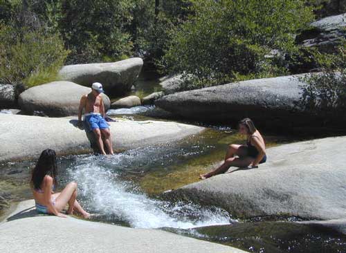
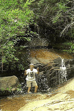
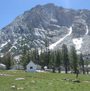
Sierra Nevada Waterfalls – Sequoia Regions
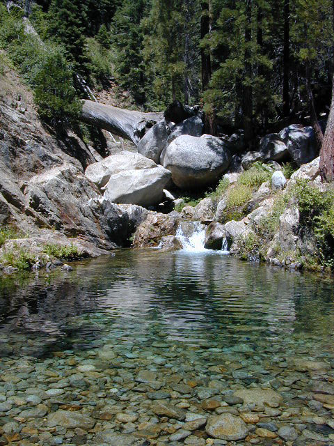

Sierra Nevada Waterfalls – Sequoia Regions
Redwood Park San Francisco & Point Reyes
The closest redwood trees to the city of San Francisco are those of the Point Reyes Peninsula. Samuel P Taylor State Park, Mount Tamalpais State Park & the Muir Woods National Monument all have coastal redwood groves.
nearby redwood lodging can be found in –
If you are looking for the Redwood Forest near Santa Cruz & Highway 9 start here.
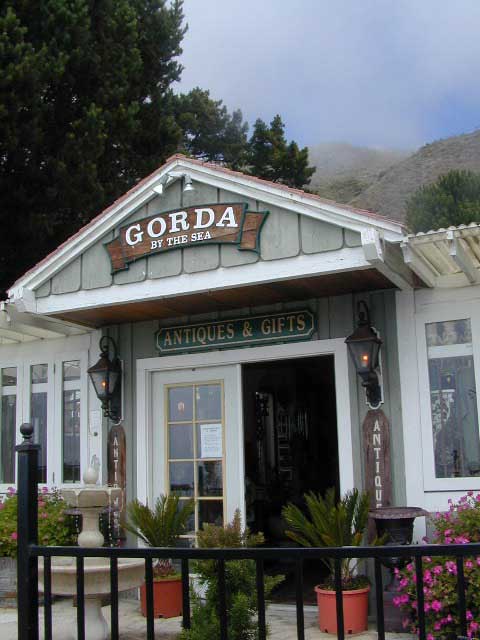
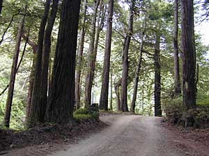 Big Sur Redwood Cabins & Riverside Cabins Big Sur
Do you have visions of cabins perched on rugged cliffs, along the Central Coast? Well, sorry to say, there are none for rent. Those are all private homes.
Most vacation cottages are secluded & tucked back, deep inside a redwood forest canyon nearby. Campground cabins in Big Sur span from yurt rentals on the cliffs, to rustic one room rentals in the fern forest.
The Pfieffer Big Sur State Park has cabins available, several other coast resorts offer stream side cottages, plus Ventana has a luxury Campground inside a redwood grove.
self guided redwoods tour on Big Sur back roads
 Yurt Rental, Tent Cabins & Outdoor Resorts in California
Extremely developed public or private campgrounds will often have rental cabins for guests. Most all are large single rooms to share w/ sleeping cots. The miniature log cabin craze has spread from RV parks to County Parks, to private fishing campgrounds. Many have laundry, showers, cafes, store & are downright outdoor resorts.
These California adventures are sometimes temporary seasonal cottages, that hafta be removed in winter due to heavy snow, like Yosemite. The coastal redwood forests seem to be popular places for these pseudo camping accommodations year round.
These off-the-ground accommodations come in various setting like high country granite, rugged coastlines or dense fern filled forests. The access road or driveway to such camp resorts are likely to be dirt, so be prepared to rough it a little.
Campgrounds Cabins in California, 3 varieties –
Maybe a historic Sierra grand lodge? Or your own private cottage, next to a big river?
If your searching for more luxury or accommodations, then try California Cabin Rentals here.
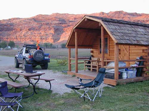
All over Moab & most of southern Utah, mini log cabins are common.
California Scenic Drives – Canyon Roads CA
Canyon roads are plentiful in California. From the lush coastal hillsides w/ mansions to the lunar like box canyons & slot canyons of the desert. We dig the back roads as much as you do, so get ready to explore this weekend. (GPS data is later dude!)
What is the difference between a canyon & a valley?
I can recall that canyons are tighter, smaller cracks in the terrain, most likely in lower elevations & rugged hillsides. Steeper walls, lots of rocks, some vegetation. A major desert wash, a creek or seasonal stream usually runs parallel to the paved road.
Many canyon roads in California have been paved for urban development or for a major through-route access. These provide great quick “day trips” from the city.
Valleys are larger open areas surrounded by mountains. Since the majority of Southern Cal is desert climate, you won’t be seeing many fern canyons or big open alpine meadows. Manzanita & sage brush meadows are the norm, for elevated valleys & mountains, such as the National Forest.
Los Angeles County is a popular place to explore canyons for a “mind-unwind drive” or the half day picnic trip, away from work.
California Scenic Drives listed below….
UNPAVED Canyon Roads –
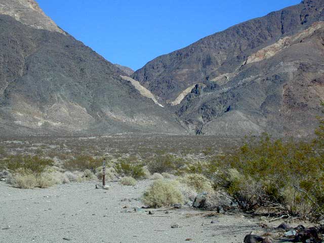
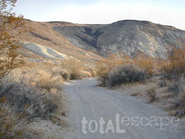
Goler Wash (aka Goler Canyon) in Panamint Valley. Barker Ranch is up that way.
 The North Mojave Desert is a sightseeing wonderland. These odd formations are inside the Trona Pinnacles, off of Hwy East of Ridgecrest CA.
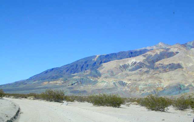
Trona Road is a red paved route that runs from Red Mountain @ Highway 395 east to the town of Trona, California, then thru Panamint Valley & on to the western borders of Death Valley National Park.
Spangler Hills OHV Area is a popular off -roaders camp & a huge network of dirt roads can be found to the west of Trona Pinnacles. The access road to the bizarre dry lake is # miles long & graded dirt w/rocks. Passenger cars can handle it, but not recommended in rainy weather.
Allegator painted rocks, old mining claims, dirt trails everywhere & a chemical plant in Trona. Keep driving north to connect with Death Valley National Park. Wildrose Canyon, Panamint Valley & Ballarat ghost town are worth it.
If you are seeking dirt roads in California, then congratulations. You have made it to the web site of your dreams, Total Escape. We love the back roads as much as you do, maybe even more. Honest!
This entire 3000 page web site is a decade long dedication to the rural places in California, the trails, the canyons, the caves, the wildflowers, the scenery & even the old abandon mines. We have OHV maps, forest road maps, most regions, every trail map you might want. DanaMite has been researching these routes & documenting for years. And the GPS data is still to come!
Since SoCal is majority desert, you won’t be finding many lush fern meadows, dense forests or huge waterfalls. There are a few Southern California National Forest that may have pine & oak trees, a creek half the year & great camping. SoCal has the desert back roads & there are literally thousands of them. Grab a map, get your rig tuned up & start exploring. Right here right now.
SoCal regions for exploring Back Roads –

This joshua tree drive is located in Round Valley
On forest road# 2N02 in San Berdu NF; W of Big Bear City.
Picacho SRA, Picacho State Park & Picacho Camping
Right on the Colorado River, this is a very nice desert park & campground. Most camp sites are large, some fairly private, & most lined with large Tamarisk trees or plenty of natural vegetation. Other camps back up against red rock walls w/ sky views.
Old volcanic peaks surround this large park on the Colorado River – at the border of Arizona. Winter camping is great here. Hunters, fisherman & RVers alike, all know the best kept secret.. Picacho State Recreation Area on the Colorado River is prime spot for outdoor recreation & camping. Canoe, kayak, fish, hunt, mountain bike, hike & off road.
3 hour drive from San Diego on I-8 E. Take the 20 mile access road north from Winterhaven @ Yuma AZ . The desert road to Picacho Campground is paved only a few miles. Last 18 miles is a graded dirt road that is passable for cars & motorhomes. In the summer months thunderstorms can cause flash flooding in the washes, making sections of the road impassable. Check rain forecast before traveling.
nearby cities:
Los Padres National Forest; Kings Campground
4000′ elevation w/ 6 campsites
Near Hungry Valley OHV Park, back near Piru Creek, this is a little used Campground tucked out here in the pinyons.
this campground is CLOSED Indefinitely, as per USDA National Forest
Los Padres National Forest: Ozena Campground
3000′ elevation w/ 10 campsites
Near Sheideck & Reyes Creek. Ozena Camp is on Lockwood Valley Road, just east of Hwy 33
Ironwood: Forest Road# 3N97 – San Bernardino National Forest
Ironwood Group Campground in the Fawnskin / Big Bear Lake Area. Camp by reservation only.
 Thomas Mountain: Forest Road #6S13 – San Bernardino National Forest
Camping 6 miles south of Idyllwild CA. Off of Highway 74 (the Palms to Pines Hwy) Thomas Mountain has a dirt road that follows a 5000′ pine ridge line, overlooking the pond of Lake Hemet. This route has several secluded, yellow post camp spots. High clearance or even 4×4 may be needed much of the year, due to rain & snow.
2 Camp areas –
Boulder Basin Rd: Forest Road #4S01 – San Bernardino National Forest
9 miles N of Idyllwild on Hwy.243, right turn onto Forest Service Rd. #4S01. It’s Idyllwild camping on the back roads. Boulder Basin is compact dirt route around 6500′ elevation, perfect for the SUV, truck or Jeep who wants to stay outta the Campgrounds. Fire restrictions are sometimes tough, so check with the rangers on backcountry campfires. Boulder Basin has pinyon pines, boulders, & a few camp sites. Out in the Banning / Idyllwild portion of San Bernardino NF. 909-866-3437
Good mountain biking, bouldering & back road exploration. Some secluded spots.
 Fawnskin Camping; Forest Road #3N14 – San Bernardino National Forest
The best Big Bear camping is the back roads with the Yellow Post Sites. From the center of town in Fawnskin, head up the big hill, the graded wide dirt road, right behind the fire station; Forest Service Rd# 3N14 leads straight up to tall pines, pinyon forest & manzanita. You can find plenty primitive spots to camp in. Look for the yellow post sites.
Along this route is also 2 popular Big Bear Campgrounds
Another dirt road #3N16 crosses this road & runs the length of the ridge. Great region for SUV forest exploring – for the first timer. Big OHV area, so be prepared for an occasional motorcycle or quad screaming by. You can find the best seclusion, on dead end routes, near old mines.
This North Big Bear Lake forest area was affected by wild fires in 1999.
Shirley Meadows: Forest Road# 25S15 – Sequoia National Forest
This route is paved from the small cabin community of Alta Sierra to the Shirley Meaows Ski Resort. Cross country skiing is popular out here. The road turns to dirt & continues on to become Rancheria Road, heading south thru the Greenhorn Mountains, towards the Kern River.
[ photos to come ]
Alder Creek & Alder Creek Campground with 13 camp sites @ 3900′, can be accessed via side route# 25S04. The 6000′ mountain range is lined with smaller spur dirt roads, some leading to old lumber mills. Evans Flat Campground @ 6100′ elevation has 20 camp spots, is approx. 5 miles from Shirley Mdws. Road#25S15 is marked as Kern County Rd# 465 as is decends into the agricultural valley east of Bakersfield.
Black Rock: Forest Service Rd# 21S03 – Sequoia National Forest
N of Troy Meadows; Paved road leads deep into forests & meadows to Black Road Campground, at the very edge of Golden Trout Wilderness. Big equestrian area with pack stations & corral areas. Plenty smaller dirt roads on both sides of main paved road.
Osa Meadows, Lion Meadows, Little Horse Meadows & Beach Meadows are all quiet areas to the west side. OHV area to the south of this near Black Rock Ranger Station.
Monache Meadows is NE of this area.
Powell Meadow: Forest Service Road# 21S36 – Sequoia National Forest
This paved route peels off of Road# 21S03, N of Troy Meadow. Smith Meadows is on the east side of the road & Powell Meadow is just N of that. The road becomes dirt within a few miles near 9000′ Granite Knob.
There is plenty primitive camping back in these woods, so come prepared to rough it. Creekside camp sites are common. This is a great meadow area for equestrian campers with horses.
The trailhead for Monache Meadows takes off to the north & is signed “Jeep Road”; High clearance vehicle is required, but 4 wheel drive may be needed on one steep section past Bull Meadow. Read more on Monache Meadow.
https://totalescape.com/active/campstuff/CAMPGR/INYONF/monache.html
Dillonwood Grove: Forest Service Road# 19S09 – Tule River, Sequoia National Forest
Jack Flat primitive camp area; Pine Creek, Jenny Creek & Backbone Creek; Dirt road access to creekside camps, via Balch Park Dr, off of Rd# 276, after passing County Rd# J37. Next to Blue Ridge & Mountain Home State Forest. NFS or topo map is highly recommended. High clearance vehicles.
Dillionwood Sequoia Grove is located at the end of this route, on private land, but can accessed by hiking trail. NO camping on private land.
https://totalescape.com/active/campstuff/NF/seqnf.html
https://totalescape.com/active/campstuff/SF/mtnhome.html
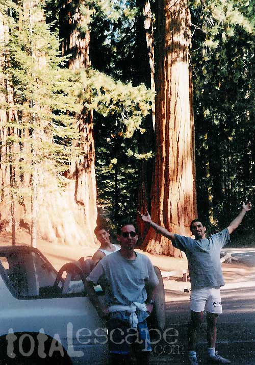
California is lucky enough to have plenty great scenery, so you best get outside & enjoy it. It’ll do ya some good! The giant Sequoia trees are located in the Sierra Nevada & the towering Redwoods are along the coast. The oldest trees are the Ancient Bristlecone Pines, higher elevations in the Eastern portion of California.
Check out the extensive list from Total Escape.
BIG, OLD, TALL TREES
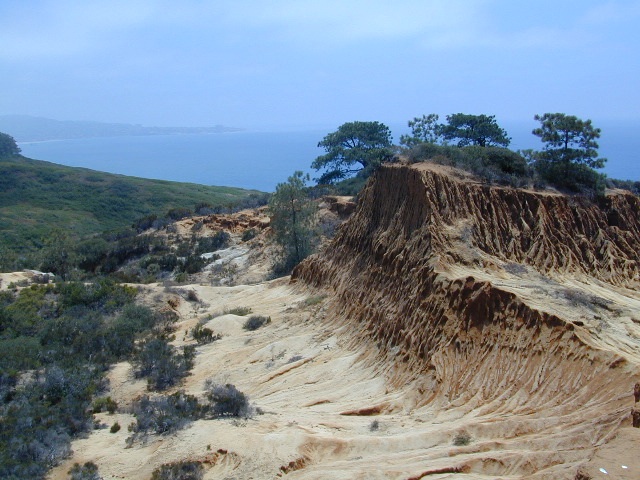
Torrey Pines State Reserve is in San Diego County – just south of Del Mar CA. Easy access from I-5 & perfect for hikers seeking exercise – instead of sitting in traffic on the freeway. The point you see in the distance is La Jolla.
Ocean, cliffs, pines, beaches & sunny San Diego weather.
What could be better for an after work stroll?
There are numerous pine forest groves, with hiking trails leading down the cliffs to tide pools & beautiful beaches. You could easily spend a whole day exploring this coastal park. There is a Visitor Center, guided nature walks & paved parking lots. The lagoon region has a train track running through the valley east of it – and the tracks meet the coast nearby. The rocky beach to the north is very popular with surfers & there is even surfing contest held here annually. Plenty parking along this stretch too. If you wanna avoid the park fees, you can park along PCH (Pacific Coast Highway) & walk the beach to the south. The cliffs make for seclusion & many sunbathers love this area.
On occasion, if the conditions are right, the San Diego RED TIDE will appear, which can only be seen at night. The kelp beds glow with sparkles of green & blue light (not red) w/ the phytoplankton …..as the waves come crashing toward the shoreline. More info on red tides on Wikipedia