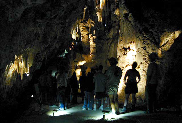
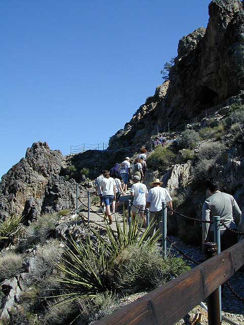
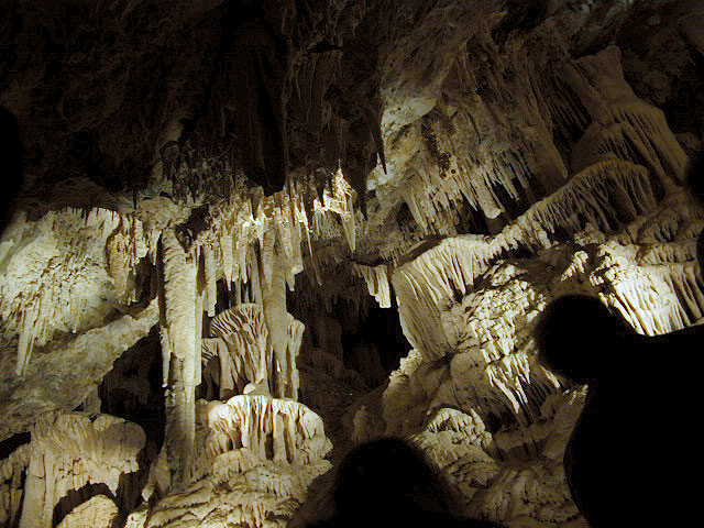
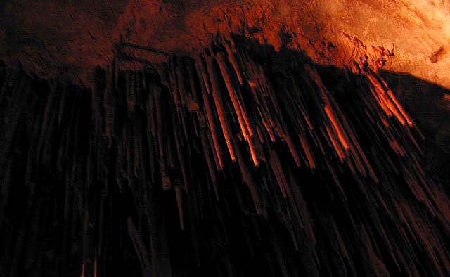
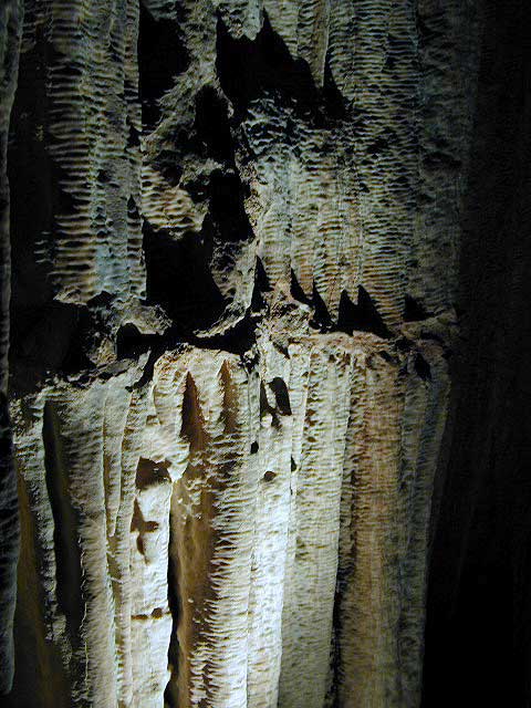
Limestone cave with public tours; entry into Mitchell Caverns is by guided tour only. Wear sturdy shoes, bring water and be prepared for a decent hike.
Due to summer heat, this desert park closed for the months of JULY & AUGUST
cave tour reservations:
760-928-2586 (by phone on Mondays 8am-5pm)
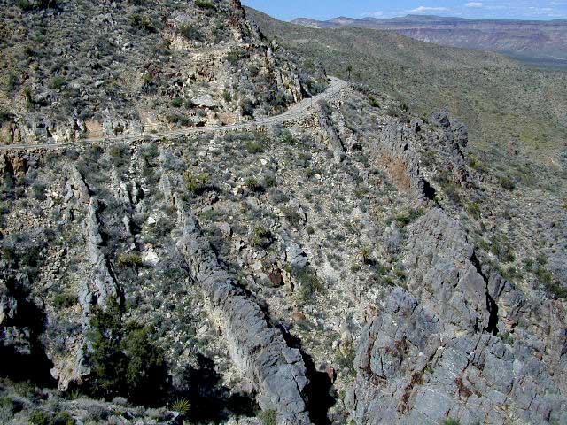
Mojave Desert National Preserve Interstate 40 East, exit Essex & take Goffs Rd. down to town. Take right on Essex Rd. going North & continue to Providence Mountain State Recreation Area.
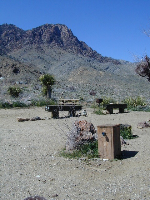
Providence Mountain Campground now open JAN 2023
Campground at Providence SRA
camp reservations:
760-928-2586
Check in time is 2pm, check out time is 12pm
Maximum 2 vehicles and 8 people per campsite
Quiet time is 10pm-6am, generators off 8pm-8am
The front gate will close at 9pm. If you expect to arrive after 9pm, call the park office for the gate combination.
Water is scarce at the park. Bring your own water for drinking, washing, and cooking. There is no trash service at the park. Pack it in and Pack it out.
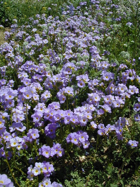
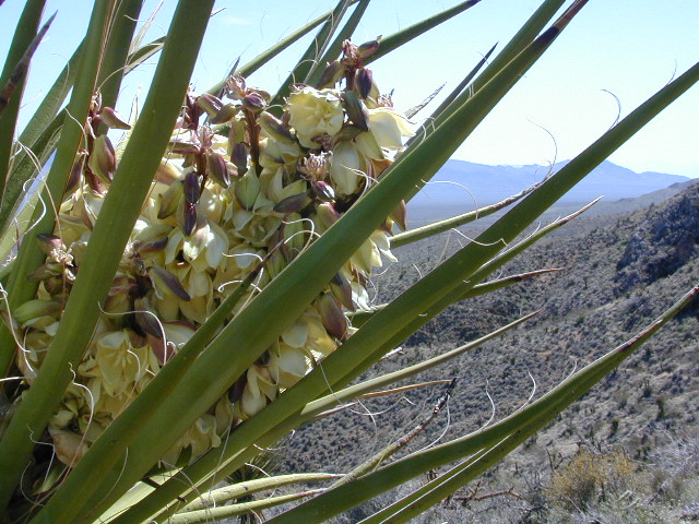
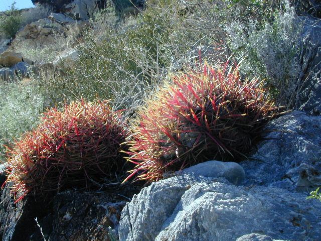
Mojave Desert Wildflowers bloom in early spring. Amazing amount of flora surrounds the park campground: golden poppies, lupine, baby blue eyes, yucca, and barrel cactus (just to name a few)
If there is one way to get the Total Escape crew outta California, it will be with the enticing red rock landscapes of Utah. The amazing spanse of colorful desert is enough to inspire any nature lover down to their soul.
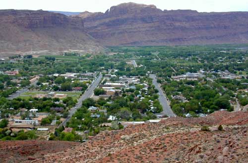
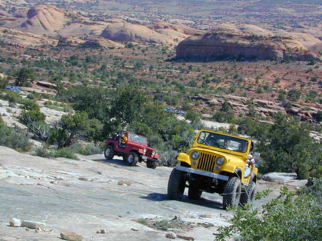
Moab, Utah was a sleepy little, rural town until about the 1980’s when the Jeeps took over. Numerous, annual off road events, plus the rise of mountain biking, new hotel development in town, and sheer “word of mouth” made Moab what it is today – a bustling, busy, tourist village with restaurants, brewery, and lodging.
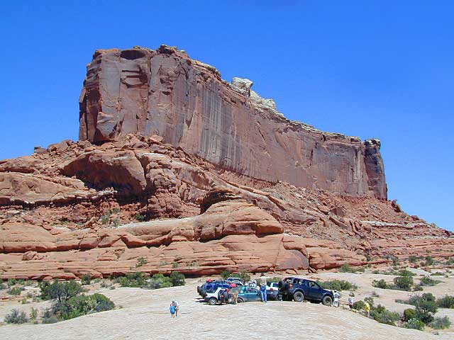
Off Road Mecca of Moab UT
Desert
terrain: high desert canyons and mountain peaks
elevation: 4000′ population: 5,253
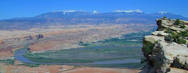
terrain: High elevation red rock desert paradise. A deep river valley surrounded by snow capped peaks & red rock grandure.
location:
South Eastern Utah
Grand County
south of Interstate 70 on Hwy. 191
description: This locale has boomed in the last few decades with a determined focus on outdoor activities. The town is a recreation mecca set in the vast beautiful desert of southwestern Utah.
Amazingly scenic spot set in red rock landscapes along rivers – with abundant outdoor recreation around every corner. Snow capped mountains are a scenic backdrop for more than half the year.
Tourism & outdoor recreation is very popular in this region, as well as retirees, relaxing and really nice rigs. But the Mormons & ranchers are still out there, so pay attention to private property signs.
Snow is common October – April
There is plenty land for solitude, just make sure to keep the peace. Don’t be honking at any cattle in the roadway. Stressed out city folks will soon be put in their place out in these parts. It is best to plan a full week vacation to thoroughly enjoy this awesome red rock location.
Try this adventure: Drive from Saint George to Moab — on almost all dirt roads! No traffic lights for 5 full days. Weaving in & out of all the National Park & National Forest lands is an experience of a lifetime. Plenty of great dispersed camping – everywhere.
May through October is the best months to try this road trip, but be aware that there is a monsoon season here: Thunderstorms and flash floods are possible late summer into autumn.
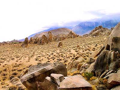
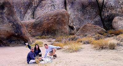
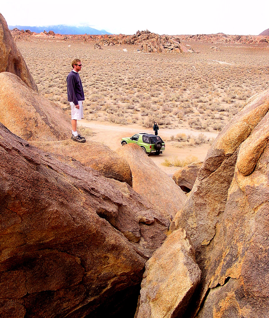
A nice surprise for visitors to Mount Whitney region when they happen upon the Alabama Hills. The cool boulder field lies at the base of the eastern Sierra Nevada mountain range – next to the town of Lone Pine, on the way up to Whitney Portal.
The infamous area features a drive named “Movie Road” – with historical spots for filming old westerns & cowboy movies. Plenty of television commercials & videos have been filmed here as well. Relatively close to Los Angeles and SoCal.
high desert: elevation 5354′
From the Mojave desert, take Hwy.395 North to the small town of Lone Pine . At the only traffic light in town; turn left up Mt Whitney Portal Road; continue up to boulders. MOVIE ROAD, right turn to start exploring. Mant graded dirt roads and areas to park vehicles.
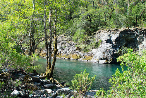
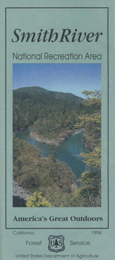
One of the least known rivers in the Golden State, the Smith is designated as a Wild and Scenic River. This could be one of the wildest and cleanest rivers in the world.
Located in the Pacific Northwest, this area typically sees the most rainfall of any California region. Smith waters flow from the Klamath mountains of Oregon, to cross into California with state line near O’Brien.
Smith is the only major, un-dammed river inside California and it contains the most original, ancient forest ecosystem than any other waterway in the state.
colorful blue-green
Smith River water often appears emerald green or on clear, sunny days, a turquoise blue color. This is because of the rare green serpentine rocks below that cast their brilliant color.
River Classification & Mileage:
Wild — 78.0 miles
Scenic — 31.0 miles
Recreational — 216.4 miles
Total — 325.4 miles
Beginning up in Oregon….
The Smith River, its three major forks and dozens of side creeks drain a beautiful, rugged terrain of the Pacific Northwest, flowing southwest from the Klamath Mountains to the Pacific Ocean. Nearing the coast, the river makes an abrupt turn north to meet the sea.
The NRA encompasses more than 450-square-miles of densely forested mountains, pristine botanical areas, remote wilderness landscapes, high-mountain lakes and steep, rocky canyons. The river is an important stream for fish, with towering trees along its banks provide shaded conditions necessary for cold-water species.
A couple of campgrounds in this area are open year round, but the others close down for winter. Rainy season normally runs from October through April with an average annual rainfall over 90 inches. Summers are dry and warm, with high temperatures between 80-100°F. Contact the NRA Headquarters at the Gasquet Ranger Station for current weather forecast/conditions.
backpacking
camping
cliff jumping
fishing
hiking
kayaking
mountain biking
paddle boarding
redwood forests
river rafting
snorkeling
swimming holes
tubing
wildlife
wildflowers
In 1990, the portions of the Smith River on the Six Rivers National Forest were re-designated to create the Smith River National Recreation Area. More than 300 miles of the Smith River drainage are designated wild and scenic, making it one of the most complete river systems in the nation. The emerald-green Smith River flows freely and naturally, without a single dam for its entire length (and the only major river in California to hold this status).
RAPIDS & FLOATS
Winter rains provide the whitewater conditions so avidly sought by kayakers. The Smith River abounds with Class IV and V rapids on all three forks and has many miles of steep creeking waters. Its miles of whitewater require a fairly high degree of technical skills by the boater.
Just past the confluence of the Middle Fork and South Fork, the river leaves the NRA and flows past giant redwoods. Great summer floating in Class I and II waters through here.
Once the three forks join to form the mainstem, the land levels out, and the last 16 miles to the ocean present less demanding conditions, Class I-II in medium flows.
6.5 MB download
20 page river PDF guide w/ trailheads mileage and information, navigable runs detailed, campgrounds, picnic sites, fire lookout tower, plus cabin rental


 May through October is the best months to try this road trip, but be aware that there is a monsoon season here: Thunderstorms and flash floods are possible late summer into autumn.