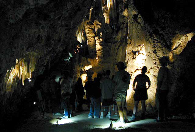
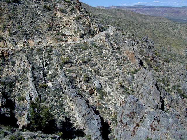
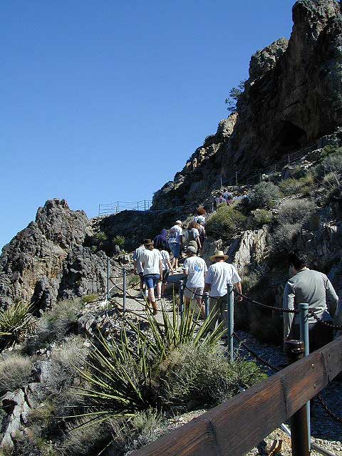
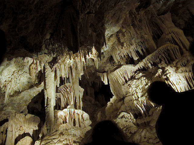
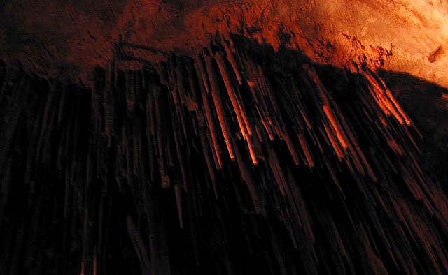
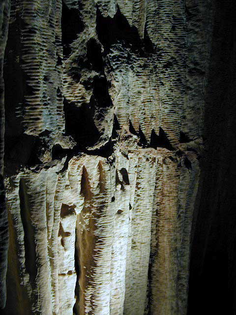
Limestone cave with public tours; entry into Mitchell Caverns is by guided tour only. Wear sturdy shoes, bring water and be prepared for a decent hike.
Due to summer heat, this desert park closed for the months of JULY & AUGUST
cave tour reservations:
760-928-2586 (by phone on Mondays 8am-5pm)
Mojave Desert National Preserve Interstate 40 East, exit Essex & take Goffs Rd. down to town. Take right on Essex Rd. going North & continue to Providence Mountain State Recreation Area.
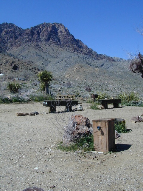
Providence Mountain Campground now open JAN 2023
Campground at Providence SRA
camp reservations:
760-928-2586
Check in time is 2pm, check out time is 12pm
Maximum 2 vehicles and 8 people per campsite
Quiet time is 10pm-6am, generators off 8pm-8am
The front gate will close at 9pm. If you expect to arrive after 9pm, call the park office for the gate combination.
Water is scarce at the park. Bring your own water for drinking, washing, and cooking. There is no trash service at the park. Pack it in and Pack it out.
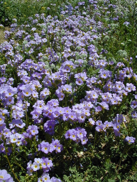
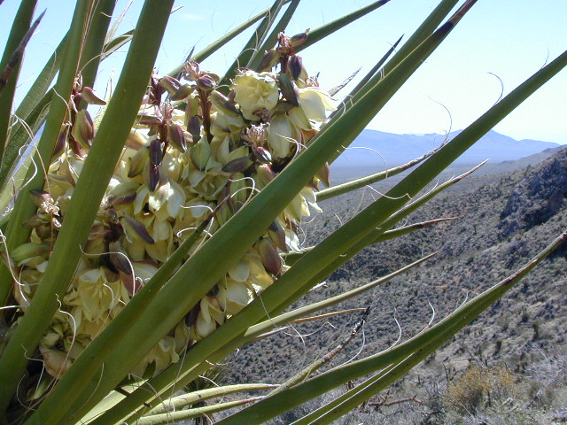
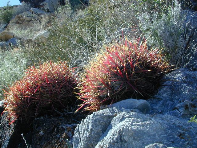
Mojave Desert Wildflowers bloom in early spring. Amazing amount of flora surrounds the park campground: golden poppies, lupine, baby blue eyes, yucca, and barrel cactus (just to name a few)
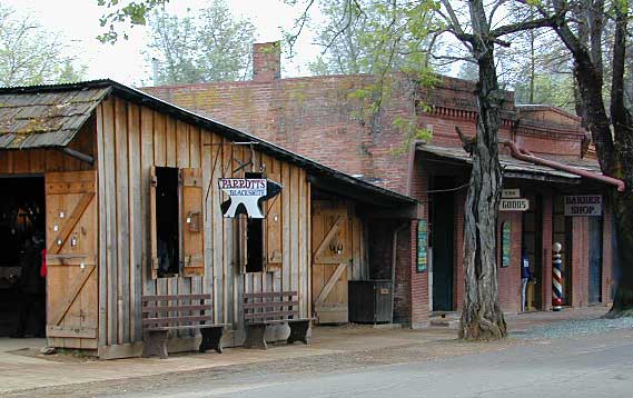
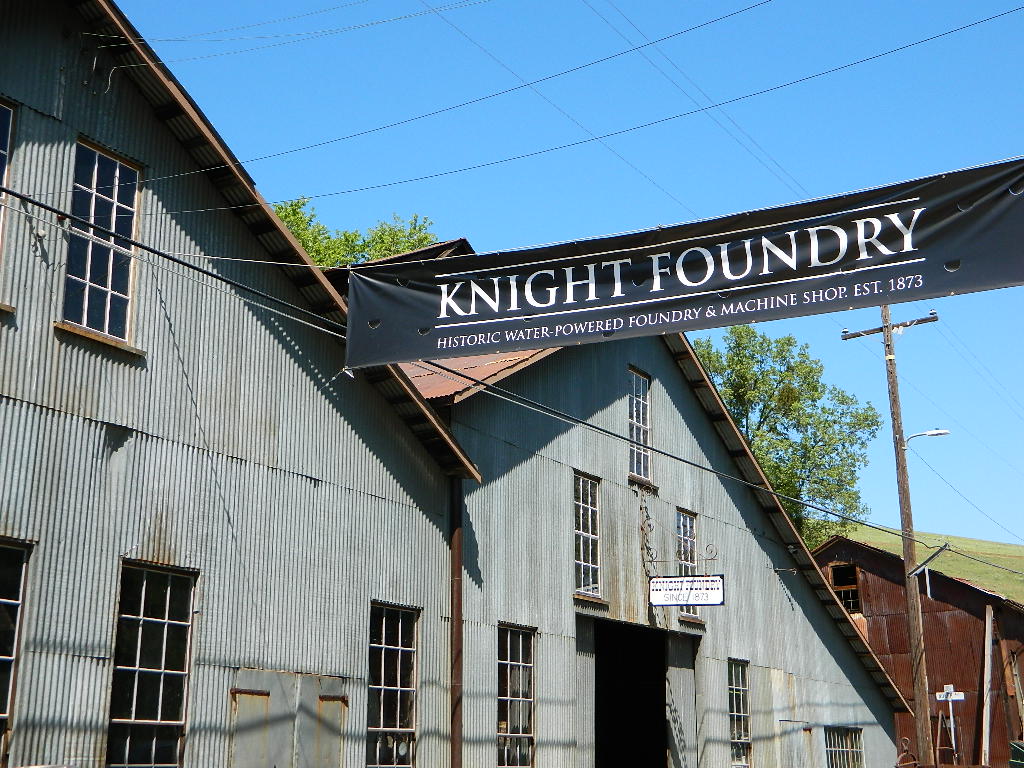
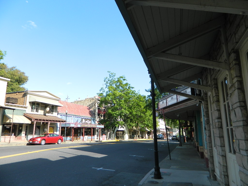
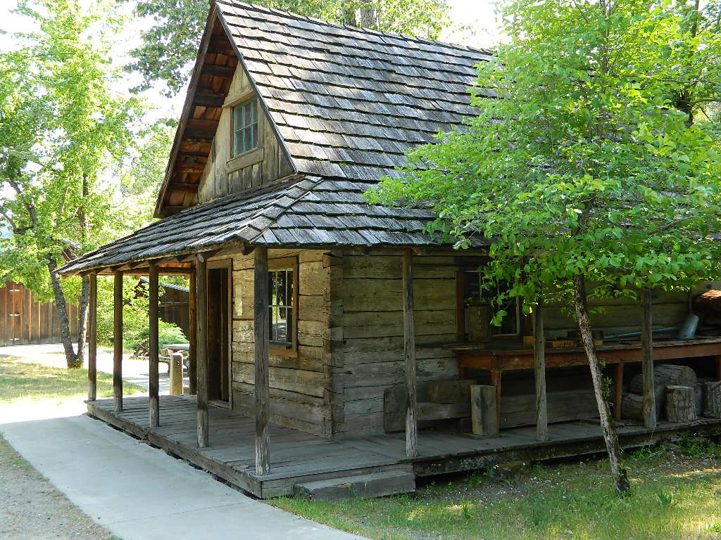
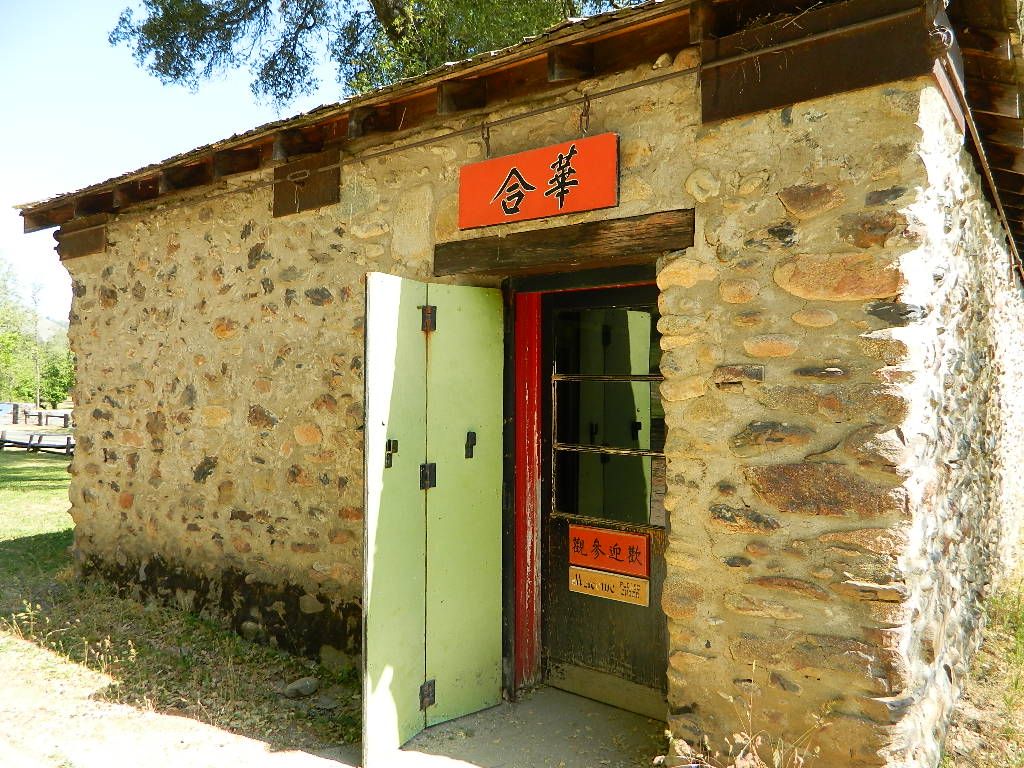
In 1945 California made this large mining camp a State Park in order to preserve the typical Gold Rush town, an example of one of the most colorful eras in American history. Today visitors can take a step back in time to experience life in Gold Rush era of the 1850’s and 60’s in California.
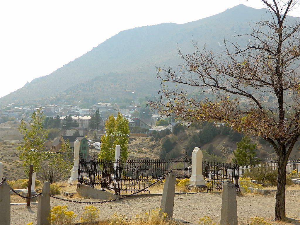
Empire Mine State Historic Park is a state-protected mine and park in the Sierra Nevada mountains in Grass Valley, California, U.S. The Empire Mine is on the National Register of Historic Places, a federal Historic District, and a California Historical Landmark
Out of all the mining techniques, hydraulic mining is the most destructive to the land. Canons spray the hillsides with water, forcably washing the soil away to expose rock and gold deposits underneath. The abundant runoff produced clogged stream beds, dead vegetation and debris flows into the major rivers. Orchard towns in the valley were inundated with rocks and floods which destroyed homes, crops and businesses. Levees were built around the farming communities, but the protection was no match for the amount of mine tailings washing down river. Eventually legislation was passed to ban the hydro-blasting mining practice and these were the first environmental laws on the books in California.
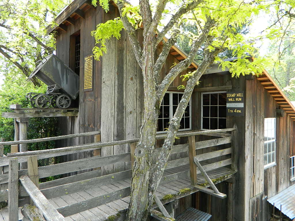
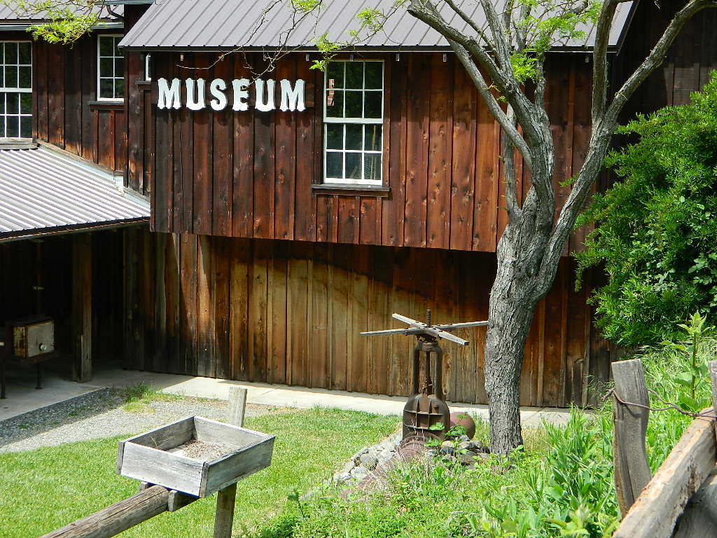
Originally constructed as the miner’s bunkhouse, the museum now serves as a visitor center. Inside, displays depict the natural and cultural history of the park. Outside and across the street from the museum is the historic mining area, where the Mohawk Stamp Mill, Bushman five-stamp mill, stable, mine office, historic miner’s residence and the blacksmith shop depict life in gold rush-era California.
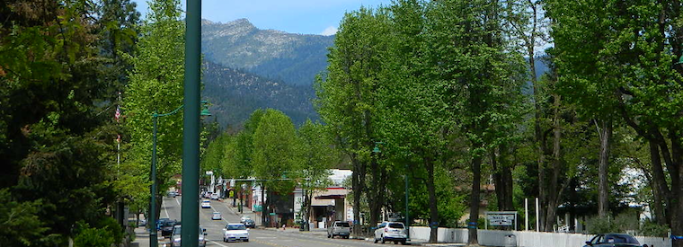
The oak lined foothills of the (American South Fork) river valley and Coloma proper is dedicated to preservation, parks, tourism, camping and lodging. The highway runs over a mile of State Park fronted land. Picnic tables, parks, historic buildings, mine history, museums, campgrounds, and river rafting.
Mining activity in the North State of California is way less than the Central Gold Country regions. While mining tourism and western themed downtowns cannot be found up here, historic hotels, cattle ranching, wide open views and unlimited dirt roads can. New beer breweries are popping up and also, the Pacific Crest Trail (PCT) is routed nearby!
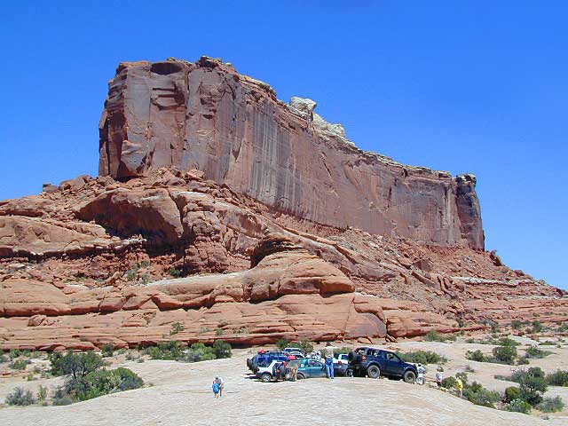
If there is one way to get the Total Escape crew outta California, it will be with the enticing red rock landscapes of Utah. The amazing spanse of colorful desert is enough to inspire any nature lover down to their soul.
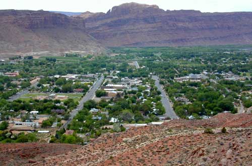
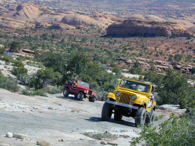
Moab, Utah was a sleepy little, rural town until about the 1980’s when the Jeeps took over. Numerous, annual off road events, plus the rise of mountain biking, new hotel development in town, and sheer “word of mouth” made Moab what it is today – a bustling, busy, tourist village with restaurants, brewery, and lodging.
Off Road Mecca of Moab UT
Desert
terrain: high desert canyons and mountain peaks
elevation: 4000′ population: 5,253
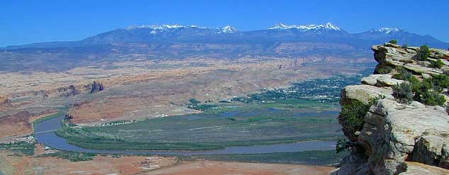
terrain: High elevation red rock desert paradise. A deep river valley surrounded by snow capped peaks & red rock grandure.
location:
South Eastern Utah
Grand County
south of Interstate 70 on Hwy. 191
description: This locale has boomed in the last few decades with a determined focus on outdoor activities. The town is a recreation mecca set in the vast beautiful desert of southwestern Utah.
Amazingly scenic spot set in red rock landscapes along rivers – with abundant outdoor recreation around every corner. Snow capped mountains are a scenic backdrop for more than half the year.
Tourism & outdoor recreation is very popular in this region, as well as retirees, relaxing and really nice rigs. But the Mormons & ranchers are still out there, so pay attention to private property signs.
Snow is common October – April
There is plenty land for solitude, just make sure to keep the peace. Don’t be honking at any cattle in the roadway. Stressed out city folks will soon be put in their place out in these parts. It is best to plan a full week vacation to thoroughly enjoy this awesome red rock location.
Try this adventure: Drive from Saint George to Moab — on almost all dirt roads! No traffic lights for 5 full days. Weaving in & out of all the National Park & National Forest lands is an experience of a lifetime. Plenty of great dispersed camping – everywhere.
May through October is the best months to try this road trip, but be aware that there is a monsoon season here: Thunderstorms and flash floods are possible late summer into autumn.
(Not to be confused w/ Panamint Springs, CA which is NW, along the main Highway 190 on the west side of DVNP
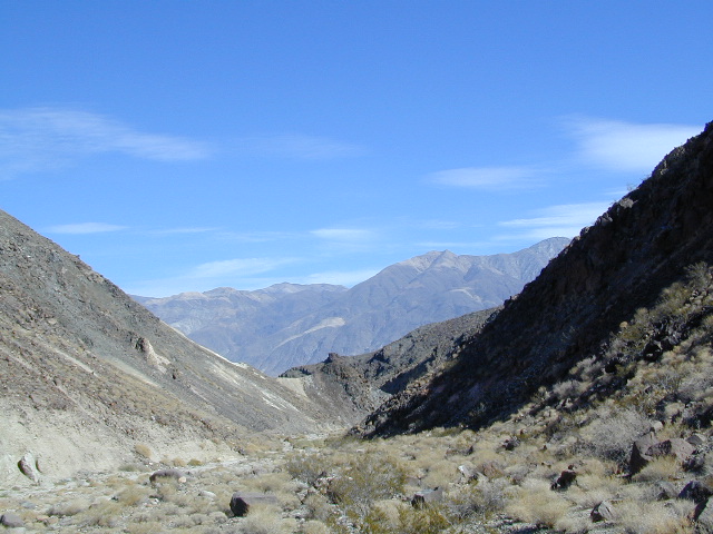
Panamint Valley, Death Valley NP
Inyo County, NE of Ridgecrest
East of Hwy 395, south of Hwy 190
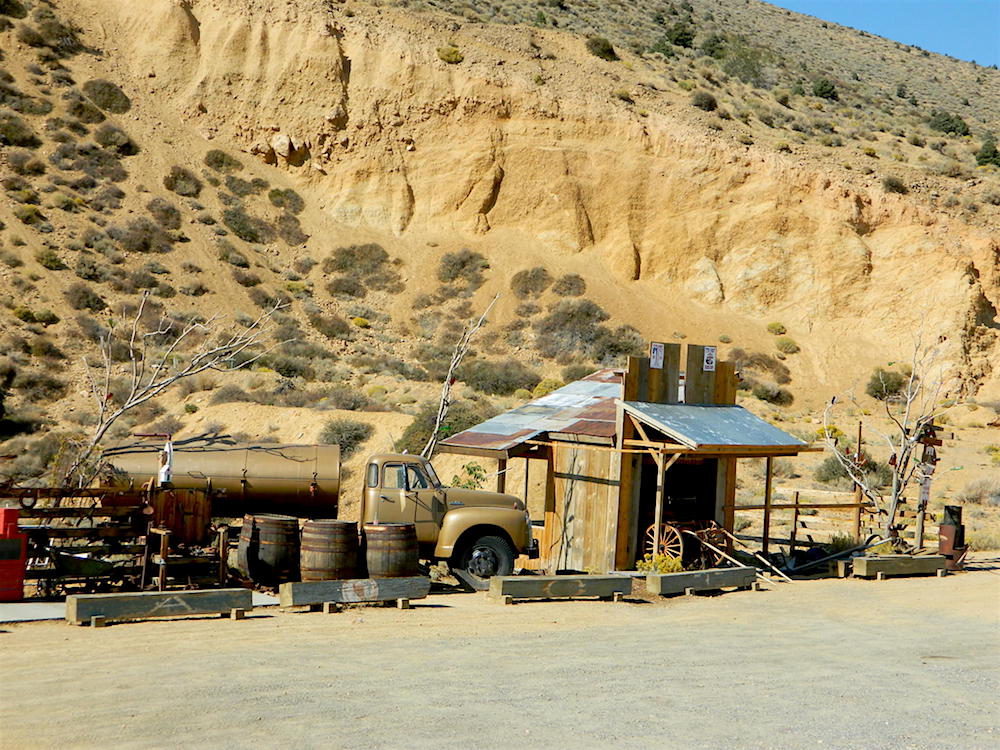
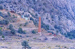
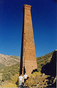
Hard to reach ghost town / abandoned mining camp on the mountainous edge of Death Valley National Park. Access via dirt road and steep trail, off the paved Trona Wildrose Road. Panamint Valley, west of Death Valley
best time to visit:November – April
Triple digit heat is common in the warmer months, so spring, autumn and winter time is best for this region, but beware of winter storms.
Snow is common on the peaks, and at higher elevations (like this place) during winter (DEC-APRIL). If you see trees on the terrain – joshua trees or pinyon pines, that indicates that snow falls here often enough. Snow is possible around Death Valley, down to 3000′ elev. during coldest of winter storms.
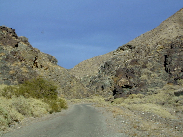
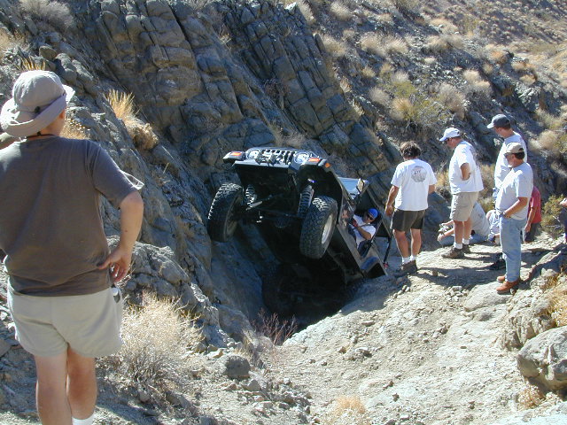
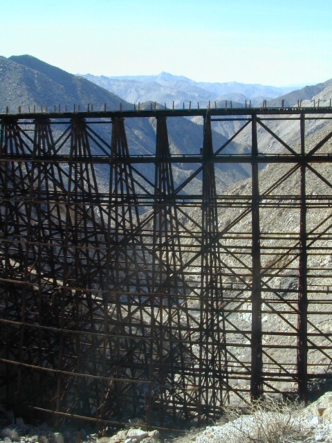
Surprise Canyon Wilderness BLM– Desert mountains, steep rocky terrain w/ peaks and very few trees. Surprise Canyon can become a waterfall, during heavy desert rains. The canyon is the only access up to reach this hidden town
NO MORE 4×4 Hike or backpack up Surprise Canyon No longer 4WD accessible .Gotta hike it on foot now. So get that fat ass outta the rig for some elevated heart rate (real exercise).
This desert destination used to be a very popular off-road trail, where Jeeps would wench and crawl up the narrow, rocky passage; but all that changed with a wilderness designation (1994) and no longer are machines allowed in this specific canyon area. No vehicles (engines) and no mountain bikes. No wheeled anything.
Off-roading and free-wheelin is still allowed and abundant in neighboring canyons of Nadeau Road & Panamint Valley – Pleasant Canyon, South Park Canyon, Jailhouse Canyon, Goler Wash, Isham Canyon
Ballarat ghost town has a camper bathroom w/ showers and a fee to go along with that. Panamint Springs has a small motel and a big restaurant, plus a large campground (across the highway) which can accommodate tents, camper trailers and RVs.
Death Valley National Park boundary means developed campgrounds are a few miles away up Wildrose Canyon.
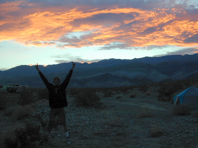
Boon-docking, dispersed, FREE, open camping is allowed almost anywhere in Panamint Valley and the neighboring desert canyons. Campfire permits are required and are available at BLM office in Ridgecrest. There is no firewood, nor wood collecting around these parts, so bring your own.
Nadeau Road has abundant flat spots for RVs; Well stocked 4x4s can find secluded camping further up the canyons, but must be a self-sufficient camper and bring water, plenty of ice, extra gasoline, food and firewood.
Locating a ‘real bed’ near this remote desert region will require some driving. The closest option in Panamint Springs, which only has a few rooms. The next closest, would be Stovepipe Wells inside the National Park.


 May through October is the best months to try this road trip, but be aware that there is a monsoon season here: Thunderstorms and flash floods are possible late summer into autumn.

 Death Valley National Park boundary means developed campgrounds are a few miles away up Wildrose Canyon.