Tag Archives: Panamint Valley

Death Valley Charcoal Kilns

Wildrose Charcoal Kilns – Death Valley

the 10 kilns are large
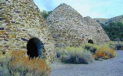
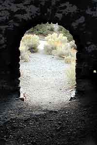
The acoustics are really cool inside these historic stone structures. Spending some time at this place humming, drumming & singing. Stand right in the center floor space for the best sound.

one window & one door

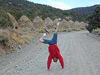
The western ranges of Death Valley National Park offer some interesting sites & hikes. This canyon called Wildrose is higher in elevation, a lot cooler than the valley floor, plus it does get pretty dang windy.


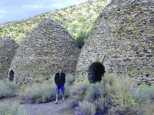
These bee-hive shaped kilns were used in the 1800’s for making charcoal, that was used in nearby mining operations. Standing 30′ high & 30′ around, these kilns were only used for a very short time (in the mining heyday) & are some of the best preserved charcoal kilns in the country.

wildrose rd
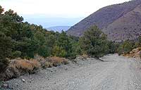
The Wildrose Charcoal kilns are located on the western side of Death Valley National Park. Access the Wildrose Canyon Road from Panamint Valley or from Death Valley Highway 190, take the Emigrant Canyon to Wildrose Canyon Rd up to the historic kilns. Last 3 mi of this road is unpaved and not recommended for RVs or trailers.


View Larger Map

Death Valley National Park Map

Nearby Panamint Valley is for serious off-roaders: Stone Canyon, Barker Ranch, Goler Wash.

Death Valley Campgrounds – Wildrose, ThorndikeMahogany Flat.
A popular day hike nearby is Telescope Peak, from Mahogany Flat campground, a 14 miles RT hike that leads to the mountain towering over Death Valley at over 11,000′.

FACTOID: Telescope Peak is the only place that you can see both the lowest point & the highest point in the continental USA.

no camping inside

wildone

Mahogany Flat Campground

Mahogany Flat – Death Valley National Park

mahgsign

If you want trees in your Death Valley visit, than this is it. Mahogany Flats Campground is located in a juniper forest on a ridge line of the Panamint Mountains. Often windy camp sites with the highest elevation campground in the area. If you seek to get away from the desert heat, this may be the best option. Spectacular views to the east, over the Death Valley basin. Access to hiking, backpacking, off roading, mountaineering opportunities. A great place to escape summer heat, but be warned of thunderstorms. Picnic table, fire ring, pit toilets – maintained with NPS.

  • Elevation: 8,133′
  • Number of Sites: 10
  • Vehicle Accessibility: High Clearance, recommended. No RVs or trailers. 4×4 needed in heavy rain or snow.
  • Campsites Reservation: No
  • Length of Stay: 30 Days
  • Season: March – November
  • Trailheads: Telescope Peak & Tuber Canyon

greatspot_iDirections:

From Stovepipe Wells, follow Highway 190 W to Emigrant Canyon. Turn left on Wildrose Road and follow it thru the tight rocky canyon, climbing in elevation the whole way.

Passing Wildrose Campground where the pavement ends, past charcoal kilns, climbing in elevation past the pinyon pines at Thorndike Campground, up, up, way up Mahogany Flat Road.

From Panamint Valley, take Wildrose Road up. Turn right to Mahogany Flat Rd and proceed on the dirt road to the top.

View Larger Map

The Telescope Peak mountain range is the only place in the lower 48, where you can see both the tallest peak (Mt Whitney) and the lowest point (Badwater Death Valley).

Death Valley MAPS –

Death Valley Park – NatGeo
Death Valley Topo Map – Tom Harrison

Nearby attractions:

Death Valley National Park
Panamint Valley
Ballarat Ghost Town
Skidoo Town Site
Charcoal Kilns
Telescope Peak
Tuber Canyon
Tucki Mine

DSCN0053

telescopehike