Category Archives: Historic Site

Carrizo Gorge Goat Trestle

,Carizzo Gorge

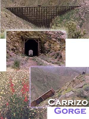
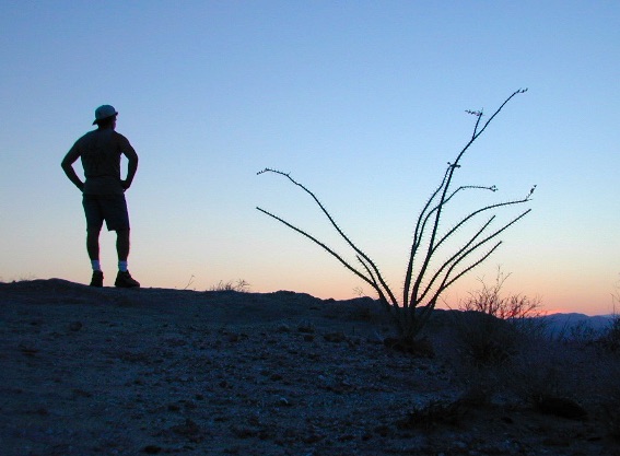
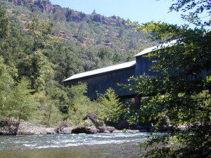
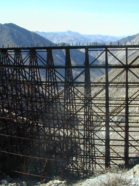
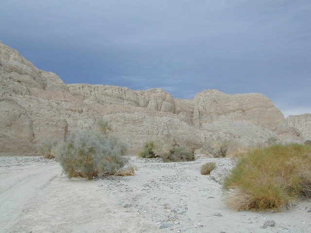
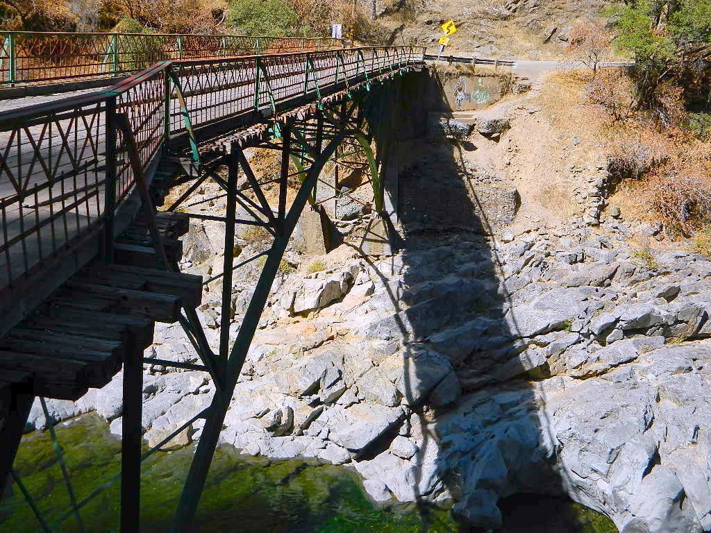
Carrizo Gorge Goat Trestle – via Mortero Wash. Near the south end of Anza Borrego State Park is the infamous ‘goat trestle’, one of the largest wooden rail road trestles in the US.

giant trestle desert

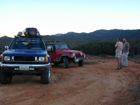
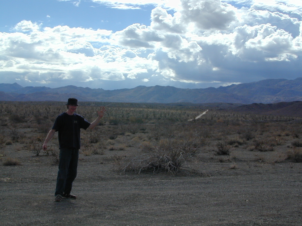
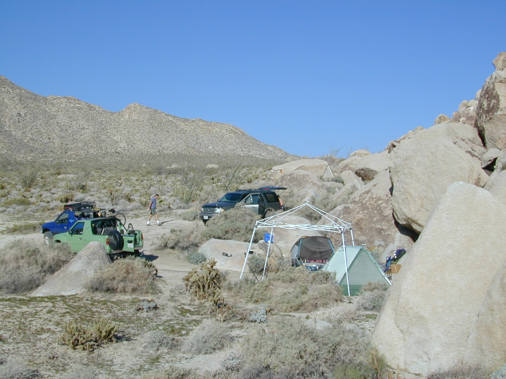
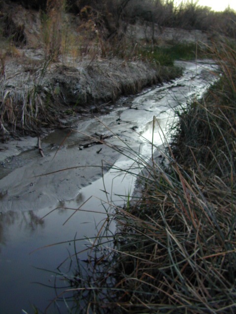
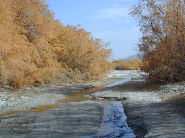
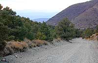
This hike can be reached by driving N on San Diego County Road S2 (from I-8) into Anza Borrego Desert State Park. Near the park boundary keep your eyes peeled for Mortero Canyon Rd (signed) on the left side. This is a sandy, one-lane, dirt road, accessible by passenger car, that leads out to the train tracks & then past to the Mortero Big Boulder campsites. Park at rail road tracks near water tank & start hike from here.

NOTE: Do not be alarmed if you happen to see NUDE hikers coming from the opposite end of this railway, where a nudist resort is located along Interstate 8, called De Anza Springs.

hike bike primitive camp sites

Carrizo Gorge Trestle
Railroad Tunnels, near Anza Borrego Desert

rail road history

San Diego & Arizona Eastern Railroad ­ SD&A/SD&AE

Ground was broken on September 7, 1907 by San Diego’s Mayor, John Forward and the construction of the 140 mile route was completed on November 15, 1919. The first through train was the called the “Golden Spike Limited”, named after the $286 golden spike, which John D Speckels drove into the ground near tunnel #8.

  • The Goat Canyon Trestle was built in 1932 to re-route tracks due to a landslide.
  • Passenger Cars Ran until 1951.
  • The route through Carriso Gorge was closed temporarily by Tropical Storm Kathleen in September of 1976.
  • And was reopened 1981, and then closed again by recurring storms.
  • Kyle Railways ran freight cars until mid 1984.

train

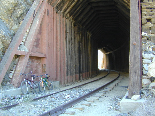
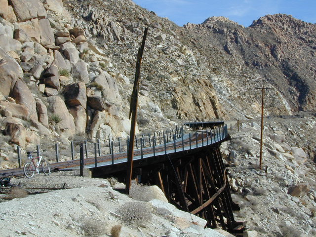
The Carriso Gorge section has fallen into disrepair with two trestles being burned and the collapse of two tunnels as the result of fires. The trestles have been rebuilt and one of the tunnels has been repaired – however,  this scenic section of track is used mostly by hikers and mountain bikers.

Goat Trestle Anza Borrego Desert

Other Facts: Derailed cars are from 1984 and were filled with bags of cement. Laborers were brought in to unload the cement but the cars were left. The Goat Canyon Trestle is 185″ tall and 600″ long. During its use it was the tallest wooden structure in daily use. Hence, this trestle was designated a Historic Civil Engineering Landmark in 1986. Carrizo means “reed grass” in Spanish. Total cost of construction was $18 million.

In 1979 the SD & AE west of Plaster City was sold to the Metropolitan Transit Development Board for $18.1 million. SD&A was said to stand for “Slow, Dirty and Aggravating” generally because of the high temperatures, smoke and open windowed trains cars.

South end of Anza Borrego State Park
Dispersed camping
Dispersed camping (for free) in the Boulders

califrepublic

see more
RailRoads & Historic Train Towns in California

National Forest Cabins

California Fire Lookouts for Rent
US Forest Service Cabins

red cabin

NFSlogo
Rent a secluded cabin with an amazing view, a historic tower for wildfire spotting, or a USFS guard station – hidden deep inside USDA California National Forests. Several of these NFS lookouts have been closed recently, so the ones listed below have links to status and reservation information.

Dirt road access is common to reach these remote locations. Some require stair climbing, or steep access hikes. Winter months are usually snowy, inaccessible and sometimes dangerous for these high country locations. Access roads suffer from closures due to rock slides or landslides. Check with the locals ranger station for current conditions.

A few of these rentals are open all year long – in the southern part of the golden state.

El Dorado National Forest USFS

Harvey West Cabin
4,720′ elev. on Silverfork American River, Gold Rush

Loon Lake Chalet
6375′ elev. near Georgetown, Gold Country California

Robbs Peak Lookout
Robb’s Hut / Robbs Cabin
6686′ elev near Placerville, Gold Country California

Sly Guard Cabin
Sly Park @ Jenkinson Lake, near Placerville, Gold Country California

Van Vleck Bunkhouse
6549′ elev. near Georgetown, Gold Country California
download PDF info sheet

Lassen National Forest USFS

McCarthy Point Lookout
overlooking Mill Creek Canyon and Ishi Wilderness
ranger & info 530-258-2141

Mendocino National Forest USFS

Pine Mountain Lookout
>>>> Renovated & ReOPENS soon! April 2020
4400′ elev.  over looking Eel River wilderness
ranger & info 707-275-2361

Plumas National Forest USFS

Crocker Guard Station
5700′ elev. near Meadow on back road
Lake Davis Loop, way out behind Portola, California


Big Bear Lake 2002
Big Bear Lake, Southern California

San Bernardino National Forest USFS

Coon Creek Cabin
Actually this one is a reservable group campground – next to a set of historic cabins. Big Bear Area Group Camp Site. Heart Bar Rd #1N02 near Angeles Oaks, CA

Morton Peak Fire Lookout
(no longer available overnight stays 2019)

Coon Cabin
Coon Cabin – Southern Cal

Sequoia National Forest USFS

Big Meadows Cabin
Big Meadows Guard Station
off Big Meadows Rd #14S11
7600′ elevation; located in between Sequoia NP & Kings Canyon NP

Camp 4 ½ Cabin
1100′ elevation; Lower Kings River
near Pine Flat Lake, CA

Grouse Valley Cabins
3 cabins near lakes; Giant Sequoia National Monument, Western Divide
4800′ elev.

Mountain Home Guard Station
Mountain Home State Forest, Sequoia Groves
6000′ elev. near Springville, CA

Needles Fire Lookout
(destroyed in structure fire 2011)

the needles
View of The Needles, from Dome Rock on Western Divide Highway (CLICK TO ENLARGE)

Oak Flat Lookout
Oak Flat Cabin Rental
4900′ elevation; Kern River canyon near Lake Isabella

Poso Guard Station Cabin Rental
open all year round4500′ elev. near Kernville, CA

Quaking Aspen Cabin Rental
Giant Sequoia National Monument, Western Divide Highway near Ponderosa, CA

Wishon Cabin Rental
Tule River, Giant Sequoia National Monument; open all year round. 4000′ elev. near Camp Nelson, CA

Shasta/Trinity National Forests USFS

Forest Glen Guard Station
near Trinity River & Forest Glen, CA

Frog Meadow Guard Station
7760′ elev. near Lake Isabella, CA

Girard Ridge Lookout
Historic Fire Lookout Tower
4809′ elev. near Dunsmuir, CA

Hirz Mountain Lookout Tower
Hirz Mtn. Fire Watch Tower Rental
overlooking Shasta Lake, CA
(currently closed for repairs 2019)

Harris Springs Guard Station
near McCloud, CA

Little Mount Hoffman Lookout
Mt. Hoffman Rental
7000′ elev. near McCloud, CA

Post Creek Guard Station
near Hayfork & Platina, CA


Sierra National Forest USFS

Camp Four and a half Cabin
Camp 4 ½ Cabin Rental
Lower Kings River, open all year round
1100′ elev. near Pine Flat Reservoir


Six Rivers National Forest USFS

Bear Basin Butte Cabin & Fire Lookout
elevation 5300′ in Six Rivers NF / Smith River NRA
(road damage & access issues 2017)

Tahoe National Forest USFS

Calpine Lookout Cabin Rental
near Sierraville, CA

Sardine Peak Fire Lookout
overlooking the Sierra Buttes and serene Lakes Basin, Yuba Rivers, North Gold Country CA

lakes basin views


Gold Rush Days

gold country grange

Gold Rush Days
California Gold Country

Numerous locations hold historic themed street fairs, parades and festivals in the foothills of the Sierra Nevada.

Gold Country Events

this list is only a partial list, and more will be added soon

Amador County Fair

Arnold Independence Day Parade

Calaveras County Fair

Calaveras Grape Stomp

Coloma Gold Rush Live

Coloma Lotus Celebration

Gold Country Fair

Grass Valley Cornish Christmas

Mark Twain Wild West Fest

Mariposa County Fair

Murphys Homecoming & Duck Races

Nevada City Constitution Day Parade

Old Auburn Country Christmas

Wagon Train Hangtown Days

NOTE: The Gold Rush Days in Old Town Sacramento is now called “Waterfront Days Old Sacramento

califrepublic

Gold Country Historic Parks

bluewagon

Gold Country Cities & Towns

58 counties
58 Counties in Calif

JB Ranch Water Wagon 1

Gold Rush Daze 6

Gold Country Rivers

listed alphabetically

Gold Country Forests

listed from north to south

Plumas National Forest
Tahoe National Forest
Eldorado National Forest
Stanislaus National Forest
Calaveras Big Trees State Park
Sierra National Forest

Covered Wagon with 2 Horses 1

Vallecito – Anza Borrego

Vallecito Park, San Diego Desert

Anza Borrego Desert

Great Overland Stagecoach Route of 1849

East San Diego County Road S2 winds thru the lower passes & washes of Anza Borrego Desert State Park. On the edge of the State Park boundary Vallecito is a small campground & park, but it was a stage coach route in the 1800’s.

California Historic Marker #304

Vallecito

VALLECITO STAGE STOP – A 1934 reconstruction of Vallecito Stage Station (originally built in 1852) on the eastern slopes of the mountains in the high desert. A super important stop on the first official transcontinental route, serving ‘The Jackass Mail‘, the Butterfield Overland Stage Line, and the southern emigrant caravans.

backpacking, birdwatching, camping, cycling, hiking, mountain biking, off roading, stargazing, wildflowers

camp


Vallecito Campground
elev. 1555′
camp sites: 44
overnight fee
first come, first serve
reservations accepted
Campfire pits, picnic tables, bathrooms, & historic buildings; 22 sites are tents only. RV 40′ limit; Additional 8 equestrian campsites w/ corrals. No RV hookups, no dump station. No piped water. No gasoline, no store, no amenities. No firewood, no collecting of firewood. No shade trees, just tall desert brush. Arrive adequately prepared for real desert roughin it.

RV

Vallecito Stage Station County Park
760-765-1188
37349 Great Southern Overland Stage Route
County Road S2 @ mile marker 34.7
About 3.5 mi NW of Agua Caliente Hot Springs

Closed during the hottest months of summer: JUNE-AUG. Open seasonally: Labor Day weekend through the fall, winter and spring, up until the last week in May. 

camptruck

see also – Oriflamme Canyon / Mason Valley Truck Trail

muck to stagecoachA neighboring and very rural stage coach stop is further down a long wash, to the south east. Getting there usually requires 4×4, since you must ford a muddy desert wash w/ creek & deep holes. There are no signs out in this sandy desert wash, so you best have a good map and a compass.

The Old Carrizo Stage Station site is accessible by 4 different dirt roads (desert washes) way off the paved highway. None of these are well signed at the highway: Vallecito Creek, Willow Creek near Mountain Palm Springs, Carrizo Creek near Bow Willow, and Canyon sin Nombre.

Agua Caliente, Bow Willow Campground, Canebrake, Sweeney Pass,  the badlands overlook, mud caves and slot canyons are all located south of Vallecito. California SR 78 and Blair Valley are north of Vallecito.

Vallecito Creek

San Diego Desert MapVallecito is located at the apex of the gap in the Carrizo Badlands created by Carrizo Creek and its wash in its lower reach, to which Vallecito Creek is a tributary. Once a seasonal village of the native Kumeyaay people, on a trail across the desert from the Colorado River, this oasis, became a crucial stopping place for Spanish and then Mexican travelers to recover from the desert crossing between Sonora and New Mexico to California. The non native settlement of the site began in 1850, as a camp with a one room sod warehouse as the U.S. Army Depot Vallecito for the supply of Fort Yuma. It was later increased in size and became a store, a stage station, and a ranch house. read more on wiki

find maps for this desert region –

Anza Borrego Desert Map

San Diego Backcountry Map

Cleveland National Forest Atlas

dark skies anza

califrepublic

Another Vallecito, California?

Yep! Small community of about 400 folks in the western Sierra Nevada  foothills. Gold Rush Country, mining region. Up off the Historic 49 and it used to be called Murphy’s Old Diggings.

see Gold Country Maps

Grange Hall, now California Guilds

gold country grange

Why are most California Granges now called Guild Halls?

Simply, it’s FOOD politics.

Corporate food power versus local food production: organic, GMOs, bees, pesticide drift and a host of other issues. In 2011, all hell broke loose with the historic Grange Halls – newly elected officials, and the national goals versus the local community interests.

The following year California was voting to label GMO foods, a proposition which educated millions of eaters and chemical corporations spent gazillions opposing the bill, but it was only narrowly defeated. The National Grange was standing on the opposite side from the California State Grange on this important food issue. This may be when the chasm began to widen.

nongmo

Hippies, yuppies, left coast thinkers. Fruits, flakes and nuts! Tree huggers, eco-terrorist. Damn liberals. Food and California.

wyandotte

Remember that half of California voters knew about genetically engineered ingredients a decade ago. Many of them made diet decisions based on new information readily available. Maybe they sometimes exercise outdoors, and dig this web site. Others choose to ignore the food topic and ingredients listed. Call it denial. Call it an obesity epidemic.

Although the labeling law did not pass, many companies begin putting NON-GMO labels on the front of the food packages anyway. Health food manufacturers, now major brands, especially food produced inside California.

old building

SLOW FOOD

The local food movements in cities and in rural communities started growing, prior to the year 2000; Grange membership began increasing (for the first time since the 1950s) as young farmers and organic farmers took a new interests in “creating community” and finding a cleaner, greener way to the future of food.

Now we have farmers markets and CSA’s (community supported agriculture programs) all over the nation. Fresh food deliveries on a weekly basis. Awareness has only been accelerating on the food topic – with organic food sales rising steadily over the past few decades.

Raised Garden Bed
Grow Your Own Food
growingreens
Growing Your Greens

more articles & resources –

The State of the Grange

West Coast Grange Wars: A Reborn Farmers’ Movement Takes on Corporate Agriculture

The California State Grange backed 2012’s Proposition 37, which mandated labeling of genetically modified foods….

The National Grange suspended the California State Grange’s charter in September 2012, and revoked it in May 2013

We are anti-pesticide, anti-fracking but we are for food sovereignty. The National Grange is dynamically opposed to all of those. They are pro-GMO, pro-pesticides, pro-big farming as opposed to small and local farms. Politically there is a dynamic difference.

Food Movies: Food Documentaries, GMO Movie, Farm Documentary Films

Country Christmas Festival

Old Town Country Christmas 2006

Old Town Auburn Christmas Festival

Old Town Auburn’s Country Christmas Festival

From 5-9pm the whole community is invited to share in the holiday fun. Crafters and artists will have their wares on sale for that special one-of-a-kind Christmas gift. Great food and entertainment, pictures with Santa. Shops and restaurants open. Holiday Open House in all the old town village shops!

Annual event; December – multiple days
(2 different Saturday nights)

Old Town Auburn
Auburn, CA
530-888-1585

oldtownauburnca.com


Auburn California


Auburn California

December Nights, Balboa Park

December Nights-Balboa Park, San Diego

Balboa Park Christmas Lights
December Nights in Balboa Park, San Diego

Balboa Park December Nights
Southern California’s premier holiday festival

“Christmas on the Prado” is now called December Nights

40 years running; Friday and Saturday night in early December

The event brings families and friends together to spread holiday joy, learn more about the cultural value of Balboa Park and kick-off the “most wonderful time of the year.”

Participating Balboa Park museums open their doors free of charge from 5-9 pm both evenings and more than 350,000 visitors are expected to experience the joy of San Diego’s largest free community festival. Those who attend will participate in a truly multicultural experience, enjoying food, music and entertainment from around the world.

Revelers can watch top-notch musical and dance performances, enjoy delicious and diverse food choices and help spread a heavy dose of holiday cheer.

Well-known traditions include food from around the globe at the International Christmas Festival at the House of Pacific Relations Cottages; the annual Santa Lucia Procession at the Plaza de California; unique gift shopping at the museum stores and with the artisans of Spanish Village; and musical and dance presentations from the San Diego Junior Theatre, San Diego Civic Youth Ballet, Del Cerro Baptist’s Christmas Story Tree, and more.

Annual event; multiple nights
San Diego, CA
619-239-0512

fleetscience.org/events/balboa-park-december-nights

balboaparkconservancy.org/project/december-nights

December Nights at Balboa Park

Cornish Christmas

Untitled

Grass Valley’s Cornish Christmas

Gold Country California

Recapture the spirit of Christmas past amid the charming surroundings of historic downtown Grass Valley California during the annual Cornish Christmas Celebration.

Began in 1967 as a way to preserve Grass Valley’s Cornish heritage and holiday traditions, Cornish Christmas remains one of our most popular events. Mill and West Main Streets are closed to motorized traffic and filled with the sights and sounds of an old fashioned Christmas; carolers, jugglers, musicians, the Grass Valley Cornish Carol Choir, Tommyknocker Cloggers and of course, Santa Claus.

Handmade arts and craft from artists throughout California are displayed on our historic downtown Grass Valley streets. Delicious food and drink can be purchased from a number of Grass Valley restaurants and specialty food vendors. Retail stores are open for your holiday purchases as well.

Annual event; November-December
Grass Valley, CA

downtowngrassvalley.com/gvda-events/cornish-christmas

20101125 Chestnuts Roasting on an Open Fire

Murphys Homecoming

Murphys Ranch

Murphys Homecoming & Duck Races

Historic Gold Country meets the Sierra Nevada caves & caverns in Murphys Ranch. Mid summer celebrations include, Murphys Homecoming Days…. a  60-year-old event, combines an old-fashioned street faire with residents & folks that used to call this place home. Duck races too!

Annual event; July
209-728-8471
209-728-8183

Murphys CA

visitmurphys.com/events

Constitution Day

Constitution Day Parade & Celebration

Nevada City’s Constitution Day Parade has been a local tradition since 1967 and is reported to be the oldest and largest Constitution observance in western America.

A parade, Revolutionary War Days Reenactment in Pioneer Park, the Gold Country Duck Race on Deer Creek and a free outdoor big band concert in the downtown historic district of Nevada City, Gold Country California. This place is known for its classic small town spirit and unique events, with a population of 3000, Nevada City swells to 10,000 or more on Constitution Day. Shuttle, Noon to 6pm

Annual event: September
530-265-2692

Nevada City, CA

nevadacitychamber.com/nevada-city-events/constitution-day-parade

815A6847 Muskets at the Ready

Centerville, California

Centerville is a popular place name inside California

Carson River
Carson River CA SR 4

Centerville Flat Campground
Alpine Co.

@ California State Route 4 (Hwy 4 east Ebbetts Pass). Silver Creek meets the east fork of Carson River in the majestic Eastern Sierra, W of US Hwy 395.

Humboldt-Toiyabe National Forest
Centerville Flat Dispersed Campground NFS
Open all year, no fee, vault toilet
Latitude : 38.631372
Longitude : -119.723082

Historic Centerville wiki

driftwood

Centerville Beach
Humboldt Co.

Centerville Beach County Park

4000 Centerville Road
Ferndale, CA
Contact: 707-445-7651

North Coast California,  Humboldt County – This long steep coastline was the place of a historic event in 1860s, a ship wreck off the coast. In heavy seas, the ship beached 20 miles below the mouth of Humboldt Bay, near the village of Centerville. https://en.wikipedia.org/wiki/Centerville_Beach_Cross

ferndaletourism
Ferndale has tourism.

Northern Cal

Ferndale, CA – has dining, accommodations, local business, and maybe an RV park. Mostly residential. Rural farmlands, forests, and remote. Wild, windy, rugged coastline.

Shops in downtown Ferndale, CA

driftwood

Centerville, CA
Butte Co.

In between Chico and the volcanic ridge (called Paradise), is the historic Centerville Road, which leads to oak lined canyon of the small community of Centerville. Mostly rural residential w/ a museum, schoolhouse, creek, covered bridge, maybe a winery, orchards and a oak canyon.

CAMPFIRE, Butte County – This particular area has been scared by the wildfires of 2018, so expect some back roads to be closed. Landslides and tree falls are quite common after a wildfire, especially on narrow mountain roads. Nearby Paradise got destroyed, but they are rebuilding. rebuildparadise.org

Honey Run Bridge

BELOVED BRIDGE

Located along Honey Run Road. Chico’s historic Honey Run bridge, was built in 1887, reconstructed in the late 60’s,  and recently destroyed by wildfire in late 2018. Honey Run Road intersects w/ Centerville Road further up the canyon.

2020: Reconstruction on a new bridge is already underway.
Honey Run Covered Bridge Association

driftwood

Centerville Road
Modoc County Rd #54

Southwest Alturas, CA

A major backroad (paved connector) in Modoc; connecting South Alturas @ US 395 to Canby @ Highway 299

a whole lotta nuthin’

Rural residential w/ farmlands and cattle grazing. California Pines (POA), Donovan Reservoir and the Pit River is along this route called Centerville. Portions of zoom on GoogleMaps has this Centerville Road listed as N West Street

dirtbikes

Modoc National Wildlife Refuge is @ US Highway 395

cowtown
Alturas, northeast California – is cattle country.


driftwood

100103 - San Joaquin Valley - Sanger/Reedley area

Centerville, CA
Fresno Co

Rural, residential farm community along Highway 180
E of Fresno, CA

W of Sequoia & Kings Canyon National Park

Kings Red Rafters
Kings River – Red Rafters + Kayaker

canoe

hiker


Your Public Lands

west coast public land

Access to wild land, open spaces, parks, forests, lakes, mountain peaks, public land – USDA National Forests, National Parks, State Parks, BLM. There is more public land available in the west half of the U.S., than anywhere else in the nation. This is one of the top reasons people relocate to the West Coast.

California’s Public Lands for Recreation

Federal lands, government managed parks, USDA National Forests, National Parks, National Wildlife Refuge, BLM, State Parks, State Forests, County Parks, Regional Open Spaces

containfire

Campfire Restrictions in California

Sierra Rivers

State Park / National Park / National Forest / BLM / SHP / SVRA / OHV
what’s the difference?
a simple explanation of your public lands & what you can expect to do on them

National Forest Campground
NPS

California National Parks – most National Parks are so crowded you can’t even enjoy the experience in the summer time. Try the off-season times for your best stay. Neighboring National Forests are a much better bet for abundant space, privacy & less taxing on the wallet for fees. These popular (NPS) parks are subject to federal budget cuts and closures.

NF boundary

NFS

California National Forests – protected wilderness areas throughout state are surrounded by National Forests (NFS), and most National Parks (NPS) are surrounded by National Forests. Tons of small campgrounds & primitive spots for real seclusion. Get a free fire permit & camp almost anywhere you want. Use that SUV exploring the many dirt backroads & find that perfect camp spot (for free).

California State Parks

California State Parks – local California parks with a lot to offer the day hikers, picnicking family, tent camper or RV camper. From warm dry deserts soaking in a hot springs to the foggy coastal redwoods, these state run parks encompass a large section of California terrain. These parks are subject to state budget cuts and closures.

BLMBLM: Bureau of Land Management – mostly desert regions on the east side of California. A few coastal redwoods, some river canyons in the Sierra Nevada, many off road areas (OHV) in various mountain ranges. These federal lands are open spaces, generally a free for all on recreation.  Allowable = off roading, target shooting, open camping, campfires, bonfires. Geared toward OHV use, RVs and hunting.

Fire Safe Spot

All California Parks & Forests

hikes

California Lakes List

lake

California Topo Maps

topo maps

rangers

California Terrain & Destinations

  • Coastal California – Southern California beach camping is crowded & sparse, because of developed cities. Central Coast & Northern California offer many more choices in this category.
  • California Mountains – pine forest, mixed oaks & a variety of vegetation. Water sources such as lakes, stream & waterfalls make this choice the perfect camping spots. Granite peaks, high elevations wilderness areas throughout state & surrounded National Parks. Plenty backpacking options & dirt road primitive spots for the ultimate in privacy.
  • Countryside in California – coastal hills or mountain foothills. These rolling hillsides offer small creeks, oak trees & plenty of wide open spaces. Lakes & Reservoirs are located within these regions. Most campgrounds are fairly close driving distance to towns or cities. Wine country or gold country, California has it.
  • California Deserts – perfect for every season except summer, these vast spaces will humble just about anyone. Primitive camping galore & designated areas for real off-roading.
  • City CA / Urban Villages – not the best for really getting away from crowds, but can be an excellent opportunity to visit a city without spending big bucks on lodging. Or could just be a perfect one-nighter for getting familiar with camping. Most campsites are located in the foothill area behind suburbs, in county parks or even coastal.
  • California A to Z: Small Towns – 700 and counting; extensive list of destinations, focusing primarily on the back roads and outdoor recreation hubs
  • California by County – Find every county on Cali, and which towns are located inside of them

Yosemite Lake View Camp Sites

Death Valley Charcoal Kilns

Wildrose Charcoal Kilns – Death Valley

the 10 kilns are large
The acoustics are really cool inside these historic stone structures. Spending some time at this place humming, drumming & singing. Stand right in the center floor space for the best sound.

one window & one door

The western ranges of Death Valley National Park offer some interesting sites & hikes. This canyon called Wildrose is higher in elevation, a lot cooler than the valley floor, plus it does get pretty dang windy.


These bee-hive shaped kilns were used in the 1800’s for making charcoal, that was used in nearby mining operations. Standing 30′ high & 30′ around, these kilns were only used for a very short time (in the mining heyday) & are some of the best preserved charcoal kilns in the country.

wildrose rd
The Wildrose Charcoal kilns are located on the western side of Death Valley National Park. Access the Wildrose Canyon Road from Panamint Valley or from Death Valley Highway 190, take the Emigrant Canyon to Wildrose Canyon Rd up to the historic kilns. Last 3 mi of this road is unpaved and not recommended for RVs or trailers.


View Larger Map

Death Valley National Park Map

Nearby Panamint Valley is for serious off-roaders: Stone Canyon, Barker Ranch, Goler Wash.

Death Valley Campgrounds – Wildrose, ThorndikeMahogany Flat.
A popular day hike nearby is Telescope Peak, from Mahogany Flat campground, a 14 miles RT hike that leads to the mountain towering over Death Valley at over 11,000′.

FACTOID: Telescope Peak is the only place that you can see both the lowest point & the highest point in the continental USA.

no camping inside

wildone

California Parks List

California Parks and Recreation

State Parks, State Forests, State Recreation Area, National Parks, National Monuments, National Forests – What is the Difference?

public lands

Forest, Park, Reserve, Monument, Recreation Area, BLM, Nature Preserve… arghh!

Don’t let all the park and forest names confuse you. It is all California and it is your public land! No bikes on trails, No gathering wood, No dogs here, No camping there; Now what?

Below is our overview graph for all California parks and forests – the basic concepts & the rules broken down for anyone to understand. Permits may be needed in certain areas. Only the government officials understand the true nature of all the ridiculous red tape.

CA Wilderness Areas California Wilderness Back country lands very protected from roads and human impact. Off limits to vehicles & mountain bikes. Only accessible by backpacking, hiking or horseback. Endangered species; Hard to reach terrains in the High Sierra. Overnight visits may require a wilderness permit.
CA National Parks California
National Parks – NPS: National Park Service
Federal lands are national parks, preserves & monuments; highly regarded as some of the most scenic in world & protected.  Very popular places and crowds often in summer. Limited use areas for camping & recreation. No mountain biking on trails. No dogs on trails. Try off-season. Drive thru entrance fees.
NM: California
National Monument
Located within the National Park System & more specific to a region. Historic buildings, geological features and deserts ruins qualify. Some National Monuments become National Parks. Many locations have entrance fees.
NRA: National Recreation Area Located within the National Park System & somewhat specific to a waterways, coastlines, lakes and reservoirs. Some locations have entrance fees.
NSA:
National Scenic Area National Seashore
Located within the National Park System & is basically scenic area worth preserving. Usually no entrance fees.
California National Parks
California USFS:
CA National Forests
USDA Forest Service
Areas of forest lands throughout state; some surround the National Parks. 18 national forests make up 20 million acres of federal land. Multiple use areas: snow skiing, mining, grazing, off-roading. OHV & SVRA Tons of small campgrounds, recreation & primitive spots for real seclusion. Best bet for finding a spot away from the crowds. Get a free fire permit & camp on back roads. No entrance fees, some parking or day use fees; SoCal requires an Adventure Pass.
California State Parks
California SP:
California State Parks
California Department of Parks & Recreation manages more than 260 parks. These smaller parks are located near cities with historical parks, as well as remote wild state land & coastal beaches. Entrance fees, day use, picnic and some have campgrounds. State Parks charge fees for day use, parking and overnight camping.
California SF: California State Forest California Demonstration Forests, areas to be protected. Redwoods & Sequoia Groves; fragile eco-systems. Handle with care. May charge entrance fee or day use fee.
California SRA:
State Recreation Areas
California Department of Parks and Recreation. Lakes, Reservoirs, Rivers. Many have boat rentals and active marina. Recreation lakes charge entrance, day use, parking or boat launch fees.
California OHV & SVRA: Off Hwy Vehicle Area and State Vehicle Recreation Areas Off Roading folks and dirt bikes can have their fun wheelin. Lands set aside for OHV use; dune buggies, quads & 4×4 enthusiasts. Most in desert regions; forest lands. Developed campgrounds large enough to accommodate RVs and trailers. Fees may apply in these off-road areas for day use or camping.
California County Parks Desert hot springs, oak foothills and campgrounds, local hills w/ hikes, parks close to urban regions. Back roads & rural land protected from freeways & development. May require parking or entrance fees. Find these listed on the California A-Z town pages
City Parks in California Urban Parks & Recreation, inside the city limits. Usually no entrance fees. Find these on California A-Z town pages
blm camps
BLM: public lands Bureau of Land Management All public lands that do not fall into the above categories. Little to no fees for day use, recreation or overnight camping. Plenty of desert & off roading areas. Some forest lands, certain lakes. Small campgrounds or open camping allowed. Fees may apply in developed campgrounds. Camp overnight almost anywhere out here for free, with a ranger issued camp fire permit.

califrepublic


Sequoia – which one?
Sequoia National Park
Sequoia National Forest
Giant Sequoia National Monument

Imagine that the Southern Sierra mountains is home to 3 different public parks named Sequoia. Yep, it’s true. Sequoia National Park, Sequoia National Forest, and Giant Sequoia National Monument. Other parks that have Sequoia groves are – Mountain Home State Forest, Calaveras Big Trees State Park, as well as Yosemite National Park.

As far as the Coastal Redwoods, most are included under State Parks. Find these parks on the Central Coast Big Sur and Santa Cruz mountains, plus Marin County, and all along the north coast US Hwy 101 from Mendocino to the Oregon border. Numerous redwoods parks are located along rivers.

we break it all down here on
Big, Tall, Old Trees

The super scenic Big Sur coastline is home to Julia Pfieffer Burns State Park and to the similarly named Pfieffer Big Sur State Park. Leave it to park personnel, state officials or the non-locals to create such a confusing naming system within our most-visited state.

hiker

Park Maps & Topos  topo maps

National Forest Atlas
National Forest Maps
National Park Maps
State Park Maps
BLM Maps

Lava Blue Lake
Lava Rock @ Blue Lake in Modoc County
holcombcamp
Holcomb Valley Camp, Big Bear Lake, CA
Wilderness with Horses Sierra Ski Maps Camping California Wilderness Rangers Snow Ski Topo Maps Mountain Biking Maps
Wilderness Hikes Wilderness Hiking Maps Wilderness Topo Maps Sierra Fishing Maps Sierra Topo Maps California Hiking Maps
holeinthegroundsign
Lassen Camping near a creek in Northern California

California Outdoor Recreation:
All parks, forests, preserves, monuments, public lands, lakes, rivers, wilderness, historical sites and museums can be found listed separately on our super duper local A-Z town pages

fout springs
Fout Springs, near Stonyford, Northern California

dirtbikes

California Yuba

Yuba River

Yuba California

Yuba county, city and river are located in the upper Sierra Nevada, north Gold Country. Only a few small towns around here, but lotsa National Forest land and gorgeous granite rock. Yuba City is well known for its orchards, agriculture and diverse population. Yuba River is a recreation hot spot most of the year – spanning from the foothill canyons up to higher elevation alpine lakes. Camping, kayaking, fishing, camping, hiking, swimming holes & waterfalls.

Yuba River Downieville

California Yuba County

Yuba River, Sierra Nevada 

towns near the Yuba River:
Yuba City, California
Marysville, CA
North San Juan
Nevada City, California
Downieville, California
Sierra City, California
Truckee, California
Washington, CA
North Bloomfield
Bassetts

mountains

SUMMER = River Recreation

Most of us want to dunk ourselves in a cool mountain stream when the temperatures get beyond 100 degrees, which is summer months in Central California. Big rivers, like the Yuba are popular spots for all kinds of outdoor recreation and they really draw the crowds. Find your own piece of solitude by getting a good topo map of the region and exploring well away from the main road.

pinetree

This Yuba River gold country region of the Sierra Nevada mountains, is only about an hour drive up the hill from Sacramento; obviously, the further you drive the better it gets. Tons of one lane and dirt roads to explore. Fishing and camping almost everywhere.

Tahoe National Forest

California’s Yuba River headwaters start high in the mountains of the North Sierra. Northern Gold Rush Country.

NORTH FORK of the YUBA

Lakes Basin Recreation Area
Sierra Buttes
Gold Lake
Bassetts
Sierra City, CA
Downieville, CA

New Bullards Bar Reservoir
Nevada City, CA

Loganville
Loganville Campground
Indian Valley Campground
Indian Valley Campground, Tahoe National Forest

Several NFS Campgrounds, line the North Yuba River right along the Highway 49, between Bassetts and North San Juan, CA

  • Wild Plum Campground
  • Loganville Campground
  • Union Flat Campground
  • Cannon Point Campground
  • Ramshorn Campground
  • Rock Rest Campground
  • Indian Valley Campground
  • Fiddle Creek Campground

fish

MIDDLE FORK of the YUBA

This water comes from the rugged and remote Henness Pass area. The long, dirt, historic route Road 293 which connects  Reno, NV to the old mining camps along Highway 49 @ Camptonville, south of Downieville.

The Oregon covered bridge and the Bridgeport covered bridge run along this fork of the river. There is another State Park down @ Bridgeport; although bridge may be in reconstruction 2020.

A nice place to dip into the this fork of the river – is right off main Highway 49 on Moonshine Road, a secondary road that leads over to Bullards Bar Lake. Minimal parking spots and a steep hike down to the river; and you may have the whole place to yourself (on a weekday morning.)

Bridgeport Sign

middle yuba

hiker

SOUTH FORK of the YUBA

Donner Pass in the Truckee region, North side of Interstate 80. Snowmelt becomes creeks, around alpine lakes like Spaulding, Bowman, which all flow west. Graniteville & Washington, CA

edwards crossing
Edwards Crossing  from 1898

A very popular State Park for South Yuba is located along Hwy 49, north of Nevada City, CA. Many backpacking trails, mountain biking trails and day hiking trails, plus several old bridges (crossings), built before 1900 still exist and in use. Bureau of Land Management has the quietest and cheapest developed campground around these parts, accessible only by dirt road (North Bloomfield Road).

South Yuba River Map

yuba river map
Northern Gold Country: Yuba River Recreation Map

camp

NFS

Few National Forest Campgrounds are located on the South Fork. Many scenic, small lakes exist up in these higher altitudes, where the best camping is. Granite peaks, numerous creeks, forests and gravel roads.

bowmanbig
Big Bowman Lake

BEAR RIVER, Lake Faucherie, Sawmill Lake and Bowman Lake are all part of this Yuba watershed, along with about a dozen other lakes. Rugged granite gravel rock rocks will lead deep into these areas. 4WD or high clearance vehicle may be needed to reach these destinations.

The whole region gets buried DEEP feet in snow, so access is usually limited to summer and autumn only.

snow

faucherie

Kongsberg, California

Historic Town Site: Kongsberg, Eastern Sierra, California

Silver Mountain City

Historic Jail
Remains of City Jail @ Kongsberg, CA

Located on the lightly forested slopes of the Carson River. About 7 miles east of Ebbett’s Pass, Highway 4 (CA SR 4)

Silver Boom Town in 1866
population 3000

Founded as Kongsberg in the late 1850’s by Scandinavian mining prospectors, the town name was later changed to Silver Mountain City. This wild, remote locale was the county seat for Alpine County from 1864 to 1875. The mining camp town was abandoned by 1886.

Nearby Towns:
Markleeville, CA

kongsberg_town

This canyon stretch of SR 4 highway has limited primitive camping options along the water. Flat dirt clearings and maybe a rock fire ring. No facilities, no bathrooms.

Silver Creek runs parallel to the highway and meets East fork of Carson River. Google Maps has this named Alpine State Hwy (which is closed in winter)

Drive less than 55 mph to take in all the scenery, slower if you want to find a decent place to stop. Look for easy pull-offs on dirt, a few trails, parking spots, picnic trees, some favorite fishing spots. Campfire permits are needed for dispersed camping.

Carson River
Carson River SR 4

Humboldt-Toiyabe National Forest

NFS Campgrounds nearby :

  • Silver Creek Campground @ 6800′ elev.
    NFS developed camp w/ fee (open June-Sept)
  • Centerville Flat Campground @ 5900′ elev.
    undeveloped sites. Silver Creek meets East fork of Carson River

pct
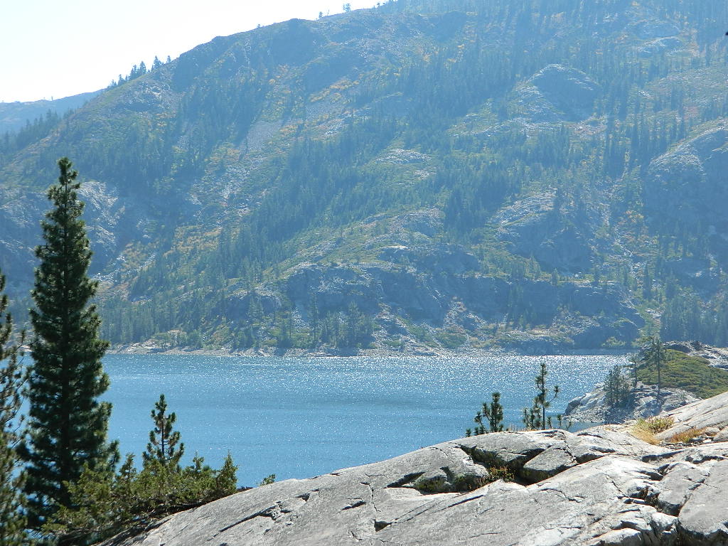
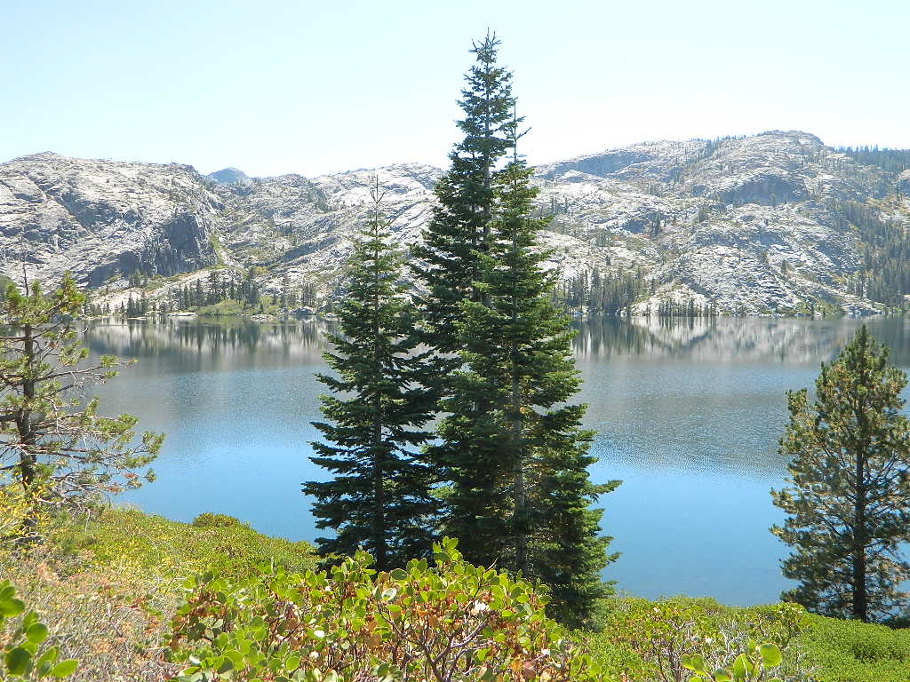
Pacific Crest Trail access –
PCT trail crosses highway near Ebbetts Pass

Great Overland Stagecoach Route of 1849

Canon Sin Nombre
Sunset view of Canon Sin Nombre

San Diego County Road S-2

Great Overland Stagecoach Route of 1849Canon Sin Nombre
San Diego County Rd S2
San Diego County Highway S2

The awesome southern California desert, a stretch of road that traverses north-south direction on the west side Anza Borrego Desert; from Interstate 8 up to to Lake Henshaw @ San Felipe Road. Driving north you gain elevation from sandy badlands into the mountains, but trees are few and far off. Exit I-8 at 400′ elevation above sea level and gradually climb to 3000′ – over near Lake Henshaw & Palomar Mountain.

San Diego Road S-2 is about 50 miles long, through very scenic desert with interesting vegetation and paved the whole way. Perfect for RV travelers, as it has many camping options – from freebie, primitive camp spots to private campground resorts. Palm canyon hide-aways, secret shady spots, endless hiking canyons, and a campground with hot springs.

Carrizo Gorge TrestleS2 Road intersects California SR 78 at Scissors Crossing and continues north through the barren San Felipe Hills. The Southern California portion of the Pacific Crest Trail parallels the ridge line on the east side, with the town of Borrego Springs lying behind that ridge at 590′ elevation. The historic mountain town of Julian sits in the hills above Banner Grade (Hwy 78).

California Historical Landmarks, along S2

# 304 VALLECITO STAGE DEPOT
# 472 BOX CANYON (Anza Borrego Desert)
# 639 PALM SPRINGS (Anza Borrego Desert)
# 647 BUTTERFIELD OVERLAND MAIL ROUTE
# 793 SAN FELIPE VALLEY AND STAGE STATION

points of interest along this route:

California Interstate 8
Ocotillo, CA
Yuha Desert
Fossil Shell Canyon (BLM)
Anza Borrego Desert State Park
Mortero Canyon
Dos Cabezas
Carrizo Gorge Wilderness
Carrizo Palms
Carrizo Gorge Railroad Trestle
Carrizo Badlands & Overlook
Canon Sin Nombre
Coyote Mountains Wilderness
THSDmapHollywood & Vine
Fish Creek Wash
Old Carrizo Stage Station
Sweeney Pass
Bow Willow Campground
Canebrake
Agua Caliente Hot Springs
Vallecito County Park
Oriflamme Canyon
Box Canyon Stagecoach Route
Blair Valley
Ghost Mountain
Vallecito Mountains
Pinyon Mountains
Earthquake Valley
Shelter Valley
Scissors Crossing (@ Hwy 78)
Volcan Mountains Wilderness Preserve
San Felipe Creek
PCT – Pacific Crest Trail


View Larger Map

Antique signs still on trail (2001)

Smile Cheps

Oriflamme Canyon Anza

24N10 – Plumas NF

Lake Davis Loop Drive

Lake Davis Loop: Plumas Forest Road #24N10

Plumas National Forest

also known as the Beckwourth Taylorsville Road

5,800′ elevation
Portola, CA

Lake Davis

Lake Davis Loop is a 20 mile circle around the lake. Drive or mountain bike route. Scenic drive on dirt roads, or an easy bike ride. Average ride time 2 hours for biking.

A flat, easy loop around Lake Davis is best in summer months, as snow usually closes this area in winter. The whole route is a mix of paved, dirt and gravel road. There are picnic areas along the way, lake views, bird and wildlife viewing, wildflowers.

NFSlogo


Numerous primitive camp sites and secondary dirt roads fork in various directions, off of this main loop.  Volcanic ridges line the west side of the lake, dense forest and seclusion can be found all around. Bald eagles fly overhead and wild life is abundant.

  • boat
  • camp
  • fish
  • hike
  • mountain bike
  • stargaze
  • wildlife

CROCKER GUARD STATION

campCrocker Station is for rent and reservations are required. This wooden 2-story home was built in 1912 for Forest Service personnel, and later staffed as a fire station until the 1980s.

Situated at 5700′ elevation, its alpine beauty and cooler temps make it a much sought after, especially in summertime. Located a few miles from the lake and 10 miles northeast of Portola, California. There is a small campground next door called Crocker Campground. A dirt road access to Crocker Meadow is quickest from lake, but the paved route around is longer.

Camp 5 sign

DIRECTIONS:
From California SR 70 (Highway 70) in Portola take West Street approximately 7 miles to the Lake Davis Dam. Park at the information kiosk and get acquainted with maps and the area info.

Drive or bike the lake loop. Travel 1.7 miles west to Forest Service Road 24N10, travel on that for 8.1 miles until you reach the junction with County Road 112. Then turn east and continue around the lake, past the Grizzly Campground a half mile, turn South on Country Road 126 and continue back to the dam.


View Larger Map

Plumas National Forest
Plumas Map USDA


DSCN0077


California Covered Bridge

Covered Bridges of California

Oregon City Bridge
Oregon City Bridge, off Cherokee Rd, N Oroville, CA

Overland pioneers and miners flooded the Sierra Nevada mountains after 1848, when gold was discovered, transforming the natural landscape and native life of California – in horrendous ways. Industrius, eager and using the abundance of natural resources available to build homes, divert creeks, and construct a new way of life. Mining for precious metals was not a hobby, it was a ‘way of life’ for many who sought westward locales. Most traversed a continent on foot with covered wagons to get out here.

Many early bridges made of wood have disappeared in California. Historic places, such as these few wooden bridges of the West, need to be protected and preserved. So no carving your initials; spray paint (tagging), littering – nor bullet holes.

Felton Covered Bridge
Santa Cruz Mountains & Redwoods
Railway Train Rides
Felton, CA

Bridgeport Covered Bridge
(built in 1862)
South Fork of the Yuba River
Northern Gold Country Hwy 49
Nevada City & Downieville, CA

Honey Run Bridge
on Butte Creek @ Skyway
Historic Landmark from 1894
in between Chico & Paradise, CA

Knights Ferry BridgeState Park
State Historic Park

on Sacramento River
North of Sacramento, CA

oregoncitymarker

Oregon City Bridge
(see photo at top of page)
Oregon Gulch, North Lake Oroville
via Table Mountain @ Cherokee Road
North of Oroville CA

Oregon Covered Bridge
Middle Fork of the Yuba River
Northern Gold Country Hwy 49
in between Nevada City & Downieville, CA

Woodson Bridge SRAState Park
State Recreation Area

Woodson Bridge Campground Campgrounds
on Sacramento River, in betweenRV camping
Chico & Corning, CA

Honey Run Bridge
HoneyRun Bridge of Butte County, California

Volcanic Buttes of Chico
Volcanic Buttes of Chico California

Sacramento River Camping

The Sacramento River of Northern California

The main artery from the North; the Big River of California

Sac River California

Mighty Mount Shasta snowmelt flows south, bound to meet the giant Lake Shasta, which merges with the Pit River and numerous other major waterways, becoming the big Sacramento River. Running right down the center of the North Sacramento Valley to merge into the California Delta. Shipping channel links the State Capital city of Sacramento with the San Francisco Bay and the Pacific Ocean. Agriculture and wildlife depend on this river heavily.

tent camping camp sites, campground camping, RV camps, dump stations, marinas, bait, gasoline, public boat ramps, boating, fishing, kayak rentals

Redding Winters

CAMPGROUND PARKS below listed from NORTH to SOUTH

JGW RV Park
Riverland Drive
South Redding, CA

Sacramento River RV Park
Riverland Drive
South Redding, CA

Wildlife Refuge
Sacramento River National Wildlife Refuge
Willows, CA
~ Camping is not permitted on the Sacramento NWR. Along the Sacramento River, camping is permitted on GRAVEL BARS for up to 7 days during a 30 day period. For waterfowl hunting, overnight stay is permitted in a vehicle or RV in designated areas. Tents are prohibited. No person may build or maintain fires except in portable gas stoves.

Orchards

Chico Area

Lake Red Bluff Recreation Area
Red Bluff, CA

Driftwood RV & Fishing Resort
@ Mill Creek Park
Los Molinos, CA

Hidden Harbor Marina & RV Park
Los Molinos, CA

River’s Rest Resort
Los Molinos, CA

Woodson Bridge RV Park
Corning, CA

State Parks
Woodson Bridge State Recreation Area
Historic State Park w/ Campground
South Avenue (A9)
Corning, CA

Bidwell-Sacramento River State Park
Chico, CA

Colusa Landing & RV
Butte Slough Road
Colusa, CA

State Parks
Colusa-Sacramento River State Recreation Area
Colusa SRA Camping

Camping Colusa
Tent Camping Colusa SRA

California Delta Region

State Parks
Brannan Island State Park
Rio Vista, CA

Sandy Beach Solano County Park
2333 Beach Drive
Rio Vista, CA

Vieira’s Resort
California Delta
Isleton, CA

State Parks
Old Sacramento State Historic Park
Downtown
Sacramento, CA

Sacramento Hostel, see more budget lodging