Tag Archives: PCH

Taste of Main Street in Encinitas

Taste of Encinitas

Encinitas: Taste of Main Street

PCH is Pacific Coast Highway 101 @ Encinitas CA features a summertime treat, a Taste of Main Street International Food Fair, where local restaurants & vendors offer food samplings to the general public. Food, wine and beer. One day event, usually held on a week day. 25 years running!

Annual event; August
760-943-1950

ENCINITAS CA

encinitas101.com/event/tasteofencinitas/

Los Padres Group Campgrounds

Los Padres Group Camping – Big Sur, Monterey & Ojai, California

Los Padres Forest is the SoCal camping mecca. Pinyon forests & peaks of nearly 9000′ make this the highest elevations of Kern County. This coastal forest on the San Andreas Fault burns bad due to winds & wildfires, but there is plenty back country to enjoy with minimal crowds – as long as camp fire safety is key.

Southern Los Padres National Forest operates Group Campgrounds for reservations. Several back country camp spots can accommodate a large group. Mount Able’s Camp-O-Alto and Mount Pinos’ Chula Vista walk-in camp can both handle a big crowd, but you may need to call the Lockwood Valley ranger station for more info and availability.

Northern Los Padres – Hwy 1 around the Big Sur/Monterey CA region has 2 Group Campgrounds w/ facilities, flush toilets & reservations online.

Los Padres Group Campgrounds:

campground elev people veg toilet water notes
Arroyo Seco Group Camp 1000′ 49 mixed flush piped Carmel Valley, Greenfield
Holiday Group Camp 2000′ 8 oak vault piped N of Ojai
Plaskett Creek Campsite 600′ 45 pines flush piped South Big Sur coast
Sage Hill Campground 1200′ 50 sycamore flush piped Lake Cachuma

If you are seeking regular campgrounds that take reservations and do not need a large group site, then follow this link below for all other Los Padres campsites.

https://totalescape.com/outside/campsites/los-padres-camping/

Los Padres Camps

Plaskett Campground is across the road from Sand Dollar Beach, a popular day use area. California Coast Campground – the infamous Central Coast Highway – Hwy 1 (so you may hear traffic @ this camp)

camptruck

Hungry Valley SVRA – off-road park located near Interstate 5 @ Gorman, accommodates large and small groups with numerous campgrounds. Expect busy weekends and crowds; sometimes snow during winter months.

Ballinger Canyon OHV Park – off road park near Cuyama River Valley, on Hwy 33 near junction w/ Hwy 166. Campgrounds suited for off-road campers and RVs. Dirt bike trails, off road routes; North of Quatal Canyon (Rd #9N09) & Chumash Wilderness.

maps of Los Padres Central Coast-


Silver Peak Wilderness

Hiking the Southern Big Sur Coastline

faded public lands
Sun-bleached, wooden Los Padres sign – near Salmon Creek trailhead.

Silver Peak Wilderness, Big Sur Coast

Central California Coast

31,555 acres

8 miles South of Gorda, CA
along Pacific Coast Hwy 1
near Big Sur, CA
Los Padres National ForestBig Sur Wilderness Map

Backpacking and hiking trails on the Pacific Coast, steep terrain next to ocean. Coastal redwood canyons, oaks hills, great views. The neighboring Ventana Wilderness is located just north of Silver Peak hiking trails.

Southern Redwood Botanical Area

Silver Peak –3,590′ elevation
Alder Peak –3,744′

trailheads

  • Salmon Creek Trail #5E09
  • Hwy 1 @ connection Trail #5E10
  • Alder Creek Trail #5E09

mm

mile markers along Pacific Coast Highway 1
(Monterey County)

  • Cruickshank Trailhead – 6.5 mm
  • Soda Springs Trailhead – 3.8 mm
  • Buckeye Trailhead – 2.4 mm
  • Salmon Creek Trailhead – 2.2 mm

developed campgrounds nearby –

nearby towns –

Ocean View Hikes Big Sur


View Larger Map

Oak Foothills

Gaviota Hot Springs

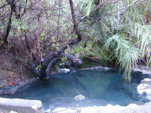
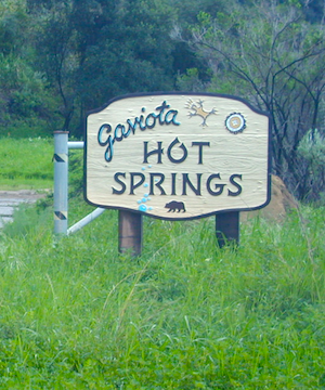
Las Cruces Hot Springs
also known as Gaviota Hot Springs,
and as Gaviota State Park Hot Springs

Top Pool

W of Santa Barbara, W of Goleta, CA
North of Gaviota State Park

US 101

US Hwy 101 @ PCH 1 exit
follow frontage road on south side of the 101


View Gaviota Hot Springs in a larger map

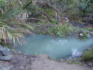
This soaking spot is a convenient stop for those traveling the 101 on the California Central Coast. The hot pools are located in an overgrown canyon, about half mile up the hill from the parking area. The natural earthen pools tend to be warm, mushy, and smelly (like sulfur) but never super hot.

These are old, historic, volunteer built pools that are not maintained regularly, so keep that in mind when comparing this location to other well-manicured springs. Many of the locals that care for these sacred spaces only get paid back by reckless visitors with litter, graffiti and vandalism. If you want places like this to stay open, we must do our part to ensure that we leave it better tan we found it.

Parking fee, lot managed by California State Park. Gate closes at dark.

gaviota park signs

1 mile hike round trip

Poison oak, snake and ticks can be a problem at this location, so do be on the lookout.

swampy pool

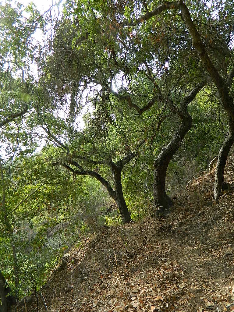
hiking trails from here –
Gaviota Peak (fire road) and Campbell Trail (unmaintained)