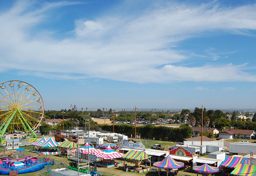
Lompoc Valley Flower Festival
60+ years of this local Flower Festival. Parade, carnival, arts & crafts.
Annual event; May
805-735-8511
Lompoc Valley Festival Association (LVFA)
414 W. Ocean Ave
Lompoc, CA 93436

60+ years of this local Flower Festival. Parade, carnival, arts & crafts.
Annual event; May
805-735-8511
Lompoc Valley Festival Association (LVFA)
414 W. Ocean Ave
Lompoc, CA 93436
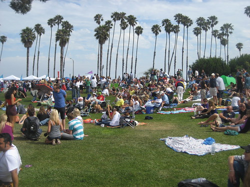
The Pacific Pride Festival takes place on Leadbetter Beach in Santa Barbara California. The local parade is called the “Summer Solstice Parade”.
Annual event; July
805-963-3636

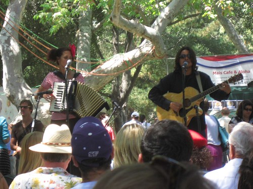
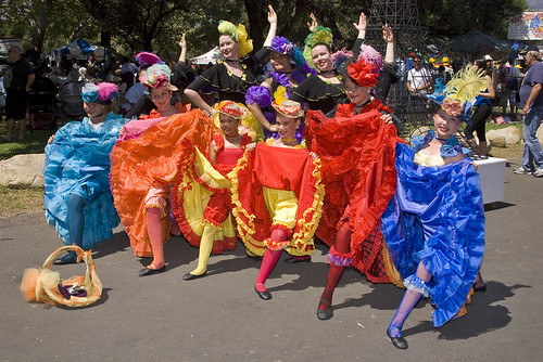
Annual Santa Barbara French Festival coincides with France’s Bastille Day Weekend. 40 acts on 3 stages. The Largest French Celebration in Western US. A great weekend for fabulous food, dancing, and a celebration of everything French.
Annual event; July
64,800 acres
30 miles N of Ojai, CA
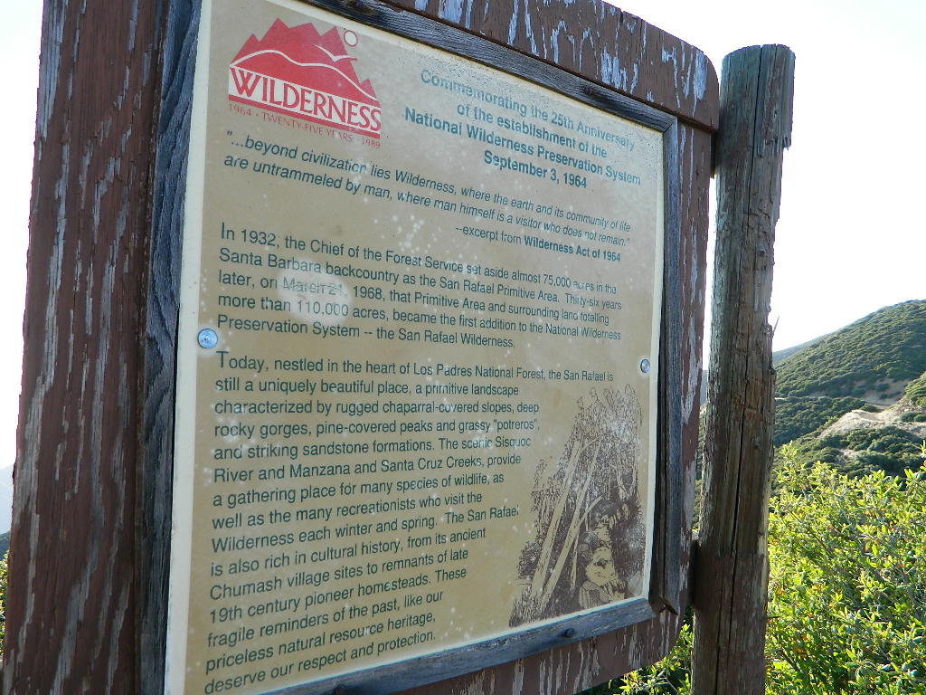
Los Padres National Forest
Los Padres National Forest – Located in between the Santa Barbara coastline and the Cuyama Valley, this coastal wilderness area is situated miles north of Ojai, off Highway 33.
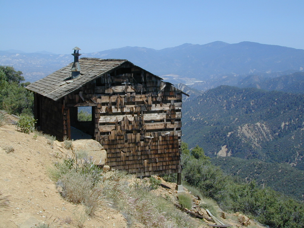
The Dick Smith Wilderness is where the San Rafael Mountains and the Sierra Madre Mountains merge on the east side, next to Pine Mountain Summit (elevation 5080′ @ highway).
This PINE MTN turn off should not to be confused w/ the Pine Mountain Club, on the north side of Cerro Noroeste.
Big Pine Mountain – 6828′ elevation
Cuyama Peak – 5875′
Lizard Head – 5350′
Madulce Peak – 6536′
Samon Peak – 6527′
Closer to Ojai, Matilija Wilderness is on the southern boundary of DickSmith and the San Rafael Wilderness sits to the west side. Native American petroglyphs can be found in this mountainous region. Access to “Painted Rock” on the Sierra Madre ridge, via Road #32S13 (which has a locked gate on both ends), is a long one so you might want to bring the mountain bike. The dirt road hike is about 10 miles (one way) and it starts at the Santa Barbara Canyon trailhead. If you plan to visit the rock art from the west side – take the dirt road up past Bates Canyon Campground. The turn off on Hwy 166 is called Cottonwood Canyon. Park at the hog pen trailhead and follow Road #32S13 for miles.
hiking trailheads –
area campgrounds –
nearby towns –
![]()

197,380 acres
Central Coast Foothills
Los Padres National Forest
 North of Santa Barbara, CA
East of Santa Maria, CA
South of New Cuyama, CA
West of Ventucopa, CA
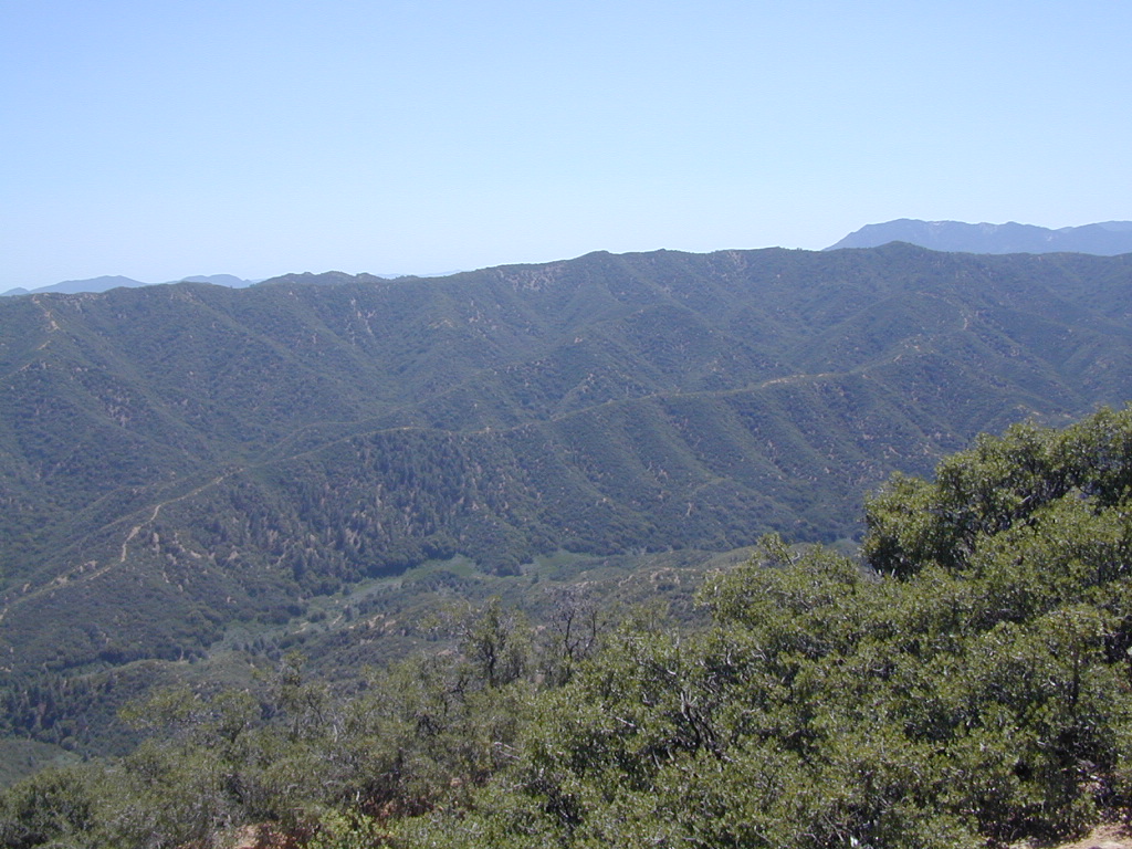
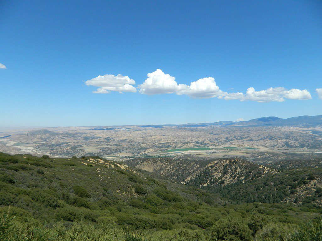
San Rafael Wilderness is otherwise known as the Santa Barbara backcountry. The Sierra Madre mountains and San Rafael mountains make up the this chunk of wilderness, a vast open space near the coast – which extends from Lake Cachuma to the Cuyama River Valley. This is the southern ridge line along Highway 166, with few pine trees, mostly oaks, leading west to Santa Maria River.
 Figueroa Mountain and Lake Cachuma are to the south near Santa Barbara. Vineyards and wineries skirt the western hills of Santa Maria, cattle grazing, oil fields and agriculture line the northern borders near Cuyama Valley. Dick Smith Wilderness is just to the east a little bit, spanning over toward Hwy 33.
OHV: better known as off-roading and dirt biking is common in the foothills behind Santa Barbara, as well as on the west side of the San Rafael Wilderness, near Miranda Pine and Tepusquet Road. Numerous small campgrounds on dirt roads are positioned around the perimeter, but no OHV trails lead into the wilderness areas.
McPherson Peak – 5749′ elevation
Peak Mountain – 5843′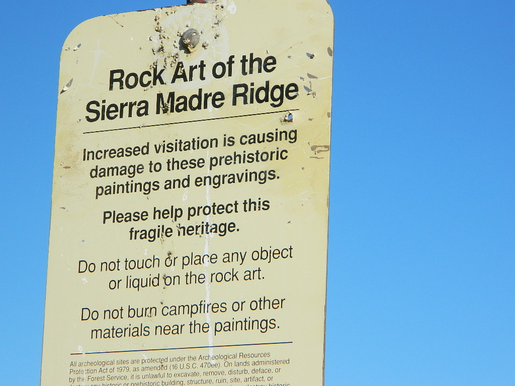
Timber Peak – 4764′
Miranda Pine Mountain – 4120′
Wheat Peak – 2436′
trailheads –
developed campgrounds surrounding the wilderness
back road access –
Native American petroglyphs can be found in this remote region of Central California, but may require topographic skills, detective work, trekking and at least a full day of physical action.
Access to ”Painted Rock” on Sierra Madre ridge is hike/bike in only. The dirt road that access these trailheads are rough road and not maintained. High clearance may be needed. This day trip is an all-day adventure and you might want to consider bringing the mountain bike. Just stay on the road, as rangers will ticket for riding in the designated Wilderness Areas.
from the west – If you plan to visit the rock art from the west side, take Cottonwood Canyon (small sign) turn off of Hwy 166. Pay attention to private property signs, cuz the locals are serious about their lands. Keep on driving up the mountain. Above Bates Canyon Campground up on the ridge, turn left, east on dirt road #32S13 – proceed several miles to the dirt parking area at the pig pen w/ locked gated and signed trailhead.
from the east – dirt road hike is about 10 miles (one way) and it starts at the Santa Barbara Canyon trailhead @ locked gated. Rural back road access requires a good topo map. Find Cuyama River @ Hwy 166, take the route on west side of bridge. East of New Cuyama, CA
Campground Santa Barbara – Lake Cachuma
Los Padres / Santa Barbara District:
| campground | elev | spots | veg | toilet | water | notes |
| Cachuma Campground | 2100′ | 8 | mixed | vault | creek | year round creek |
| Fremont Campground | 1000′ | 14 | oaks | flush | piped | March-Sept |
| Lower Caliente Camp | 1800′ | 2 | oaks | vault | no | hot springs |
| Middle Santa Ynez | 1500′ | 9 | trees | vault | creek | shady |
| Mono Campground | 1400′ | 4 | trees | vault | creek | shady, 3 walk-in |
| Paradise Campground | 1000′ | 13 | oaks | flush | piped | reservations |
| P-Bar Campground | 1500′ | 4 | – | vault | creek | water can close |
| Upper Oso Campground | 1200′ | 23 | oaks | flush | piped | corrals, OHV traffic |
Some of these camps above may have been damaged in recent wildfires, so it’s best to inquire before you make the drive. Call rangers to verify or have a backup alternative (plan B). See more campsites @ Santa Barbara Beach Camping
Los Padres Forest Headquarters
Goleta CA
805/968-6640
Santa Barbara District
Santa Barbara CA
805/967-3481
San Lucia District
Santa Maria CA
805/925-9538
maps of the Los Padres region –


Beach Campgrounds along the coast are made up mostly of State Beaches & Parks. This is a popular and busy part of the California coastline for camping, all year long. Many RVers vacationing year round and big family events are held often. Tent camping is also available – but you will be surrounded by motorhomes, and paying a premium price for a camp spot. With the major highway US 101 zooming along the cliffs at shoreline, some of these campground are located within ear distance from the freeway and the railroad track. Ocean waves may overpower the traffic noise, but we aren’t guaranteeing anything. Early summer vacations tend to be foggy.
Try also, Santa Barbara Mountains Camping
Big Sur Camping, Ojai Camping & Ventura Coast Camping
nearby towns –

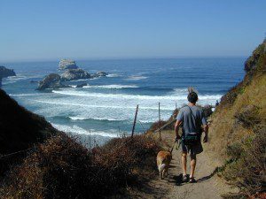
 Coastal hikes are the mildest trails California has to offer, ranging from scenic strolls along the base of beach cliffs to steep redwood forested canyons. From Torrey Pines in San Diego to the multiple redwood parks along the North Coast, there is no shortage of hiking near the coastline. Southern California has more beaches than parks, with tide pool areas being a favorite destination for many. Central Coast has lush, fern canyons with year-round flowing creeks and numerous bluffs and rugged beaches. Bay Area has hiking trails nearly everywhere – along the bay, in the woods or on the coast. NorCal has all the wilderness, parks and remote beaches one could ever hope for. What are you waiting for? Get out there.


Channel Island National Park Map
Los Angeles Hiking Maps
Los Padres NF South (Ojai, Santa Barbara, Frazier)
Los Padres NF North (San Luis Obispo, Big Sur)
Marin Hiking Maps
Mendocino National Forest Map
Six Rivers National Forest Map
Redwoods Map
Ventana Wilderness Map w/ Silver Peak

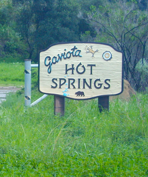
W of Santa Barbara, W of Goleta, CA
North of Gaviota State Park

US Hwy 101 @ PCH 1 exit
follow frontage road on south side of the 101
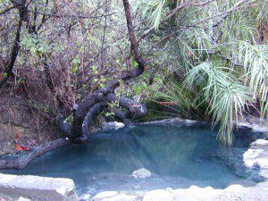
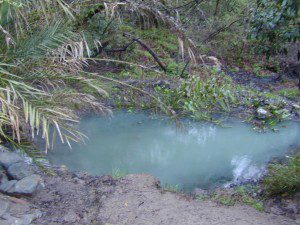
View Gaviota Hot Springs in a larger map
This soaking spot is a convenient stop for those traveling the 101 on the California Central Coast. The hot pools are located in an overgrown canyon, about half mile up the hill from the parking area. The natural earthen pools tend to be warm, mushy, and smelly (like sulfur) but never super hot.
These are old, historic, volunteer built pools that are not maintained regularly, so keep that in mind when comparing this location to other well-manicured springs. Many of the locals that care for these sacred spaces only get paid back by reckless visitors with litter, graffiti and vandalism. If you want places like this to stay open, we must do our part to ensure that we leave it better tan we found it.
Parking fee, lot managed by California State Park. Gate closes at dark.
1 mile hike round trip
Poison oak, snake and ticks can be a problem at this location, so do be on the lookout.
hiking trails from here –
Gaviota Peak (fire road) and Campbell Trail (unmaintained)

