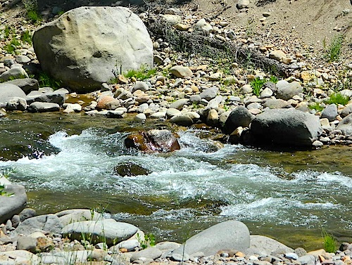
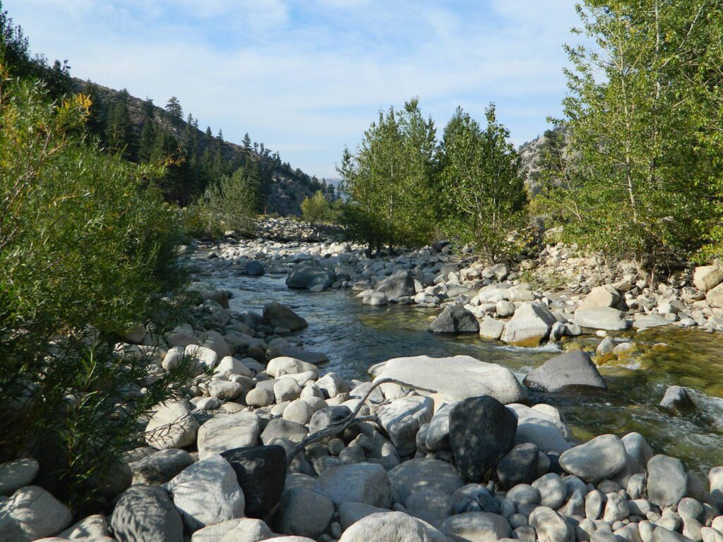
Due the nature of gravity, erosion and heavy rocks, creek beds tend to be rocky ravines near mountains – which collect rocks as they slide downhill. Creeks work as water drainage off the mountains. Inside California we have plenty of mountain ranges and plenty of movement, as the Pacific plate plows into North America, tectonically speaking.
How many Rock Creeks are inside the golden state of California? Heck, I dunno. Let’s try to find them all.
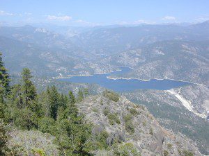
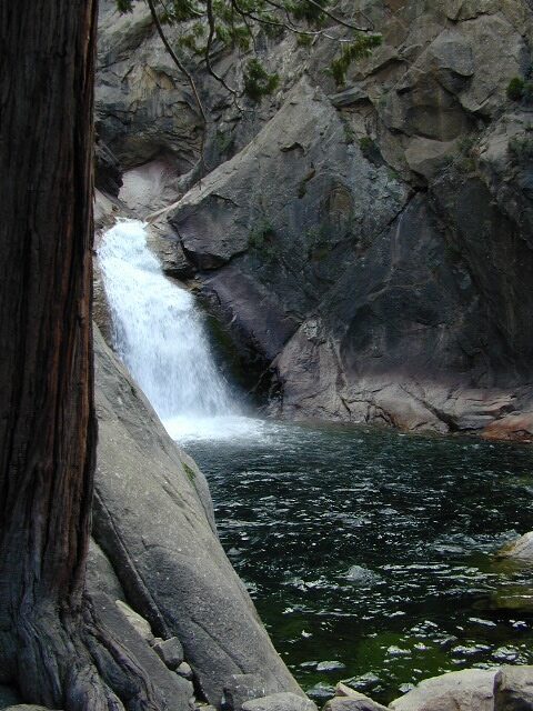
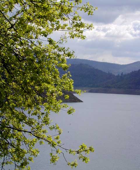
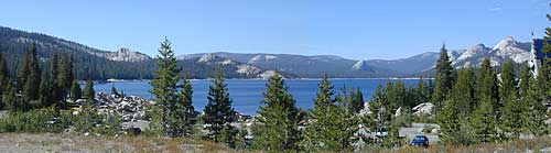
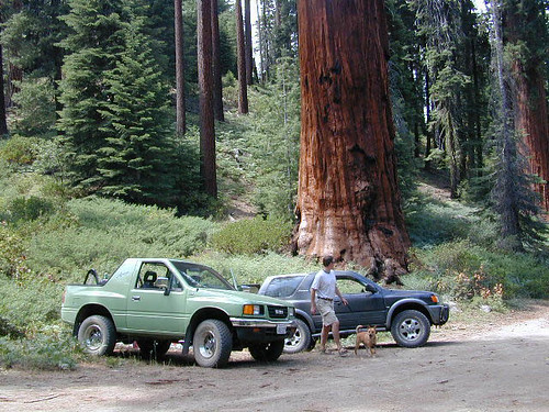
Large feeder creek from the north side of highway (California SR 70), in Plumas National Forest. Located in the popular railroad canyon known as the Feather River Canyon. Right here Rock Creek even has a reservoir.
Sugar Loaf Mountain elev 3553′ with Tobin Ridge line each side of Rock Creek as it descends the mountain tops. The junction where the creek meets the big river is just south of Bucks Creek Power Station @ STORRIE, CA. The overall location is half way in between OROVILLE, CA and QUINCY, CA
Rock Creek Campground – US Hwy 101 NorCal Redwood forests, north of Leggett, CA. Camp located on the Eel River, in the Standish Hickey State Recreation Area. (36 camp sites)
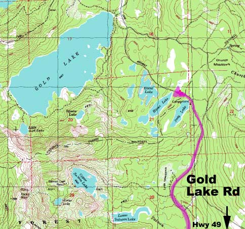
Also the is a small ROCK LAKE located insideLakes Basin Recreation Area, northern Gold Country @ Yuba River headwaters. Hike-in access only.
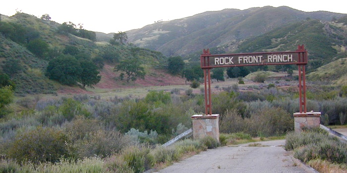
Similarly named ROCK FRONT RANCH is 4×4 trails & 4WD camping area. Cool wind caves, super steep driving terrain (Granny low anyone?) and of course, wildflowers.
Off Highway 166, east of the city of Santa Maria & US 101 – on the Central Coast of California. Way back there, at the edge of the forest, behind the wineries!
Camping Lakes – Campground Lakes
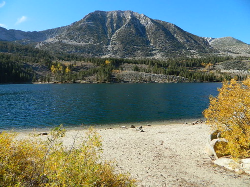
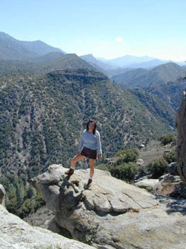
Lake Eastern Sierra California
There is not enough room on this web site to list every single alpine lake in the majestic Eastern Sierra range, since there are hundreds, but we highlight a few of the hike-in accessible ones & the more popular camping lakes below.
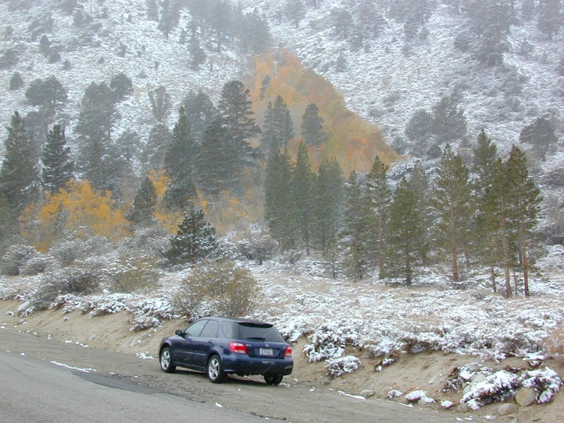
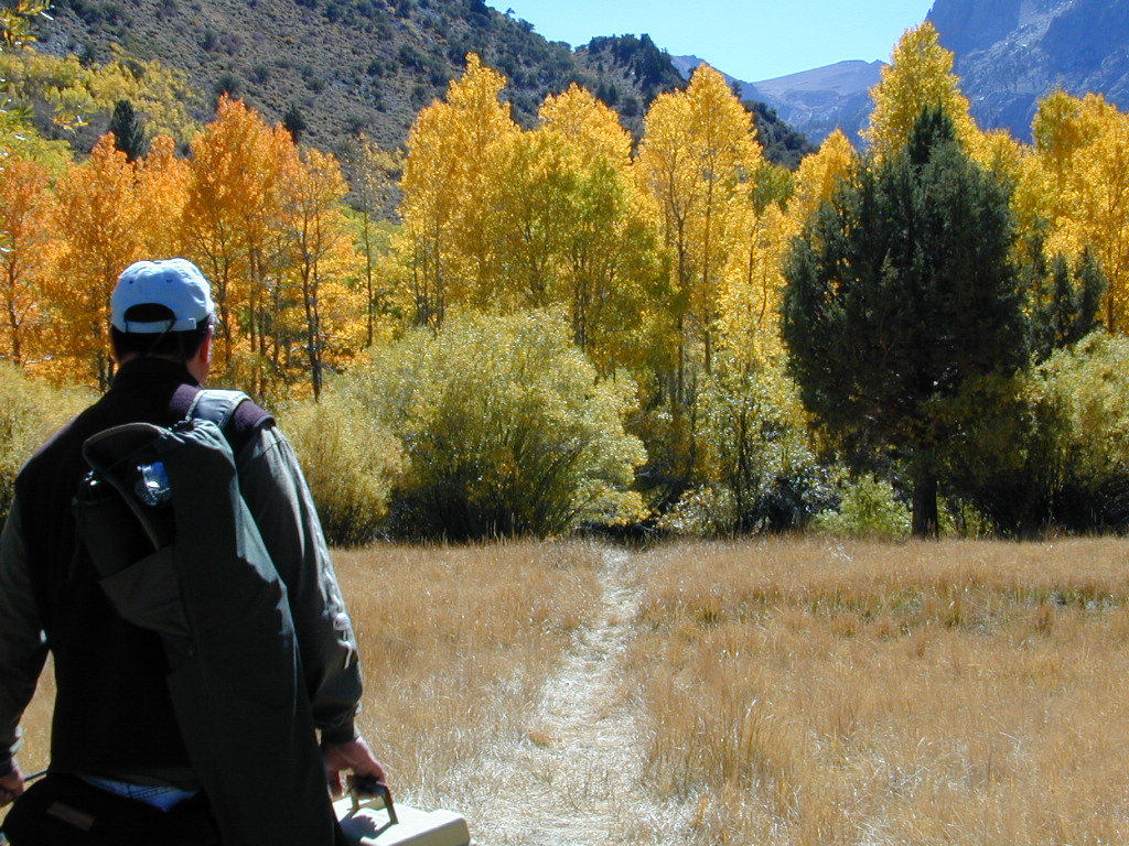
June Lake Loop is a paved, scenic drive highway that has multiple lakes with cabin rentals, camping, fishing, boat rentals. One of the best places to spend autumn looking for fall colors among the aspens.
DanaMite also knows a picture is worth 1000 words, so just click links for photos & enjoy!!!
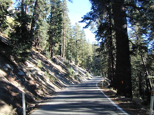
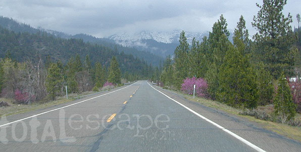
These are the roads that drivers love. More room to roam, more space, more pavement, more scenery to love and less people, less drivers and less distractions. California has endless roadways that wind through every part of the entire state. If you enjoy real driving in California, you like the curvy roads & scenery. Total Escape has dedicated numerous hours to the collection of back roads in California. Some paved, some not.
4000 RPMs or higher / Cerro Noroeste Road to Hwy 166
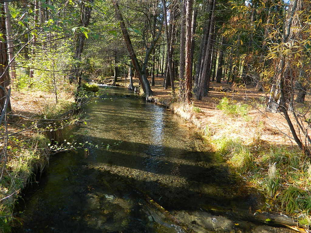
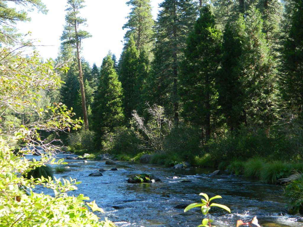
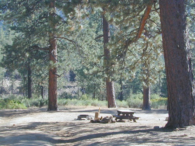
Mount Lassen is part of the Cascade Mountain Range, located north of the Sierra Nevada. The Lassen forest encompasses a large area of wilderness land, snowmelt creeks and an abundant dirt road system. Most of which is covered in deep snow about half the year, so plan accordingly.
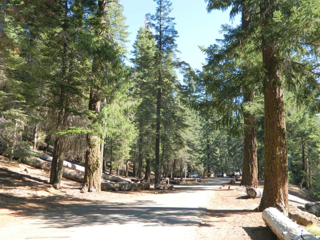
Plenty of great dispersed camping along the old logging roads in this Lassen Forest area, surrounding the Volcanic National Park; in Northern California. Many dirt roads are graded annually to allow for passenger car access. You can make it way back there in a car – just watch for the mud and some boulders!
Camp fire permits required (see below). Pease try to choose a camp that has been used before and pack out your garbage.
HINT: a USDA Lassen National Forest Map is very helpful when camping these remote, Lassen back roads. Stay away from the crowds, avoid camp fees & really enjoy your vacation.
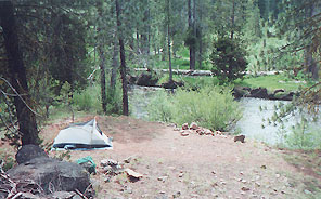
Camp right on a rushing river, alone. With no one in sight or sound. Have that secluded camping experience you’ve always dreamed about. Fishing, relaxing, maybe some hiking too. Or better, your mountain bike. Plenty forest roads to explore.
Numerous waterfalls to discover, water flowing everywhere. Mount Lassen @ 10,457′ elevation, is often snow-capped year round. This Northern California region is covered with pine forests and volcanic history.
Cool Springs @ Butt Lake, California (PG&E Campground)
If you wanna find the nearest biker bar, head over to the rustic and forested Bambi Inn @ Butte Meadows. The place is popular all the time, especially on weekends. Scenic day drive from Chico, located near a nice river and bridge, plus they have cabin rentals too. Sometimes they have big events and it can get pretty crowded and loud w/ drinking and outdoor music.
BSA Camp Lassen is a boy scout camp located E of Chico, off Highway 32 near Butte Meadows, CA
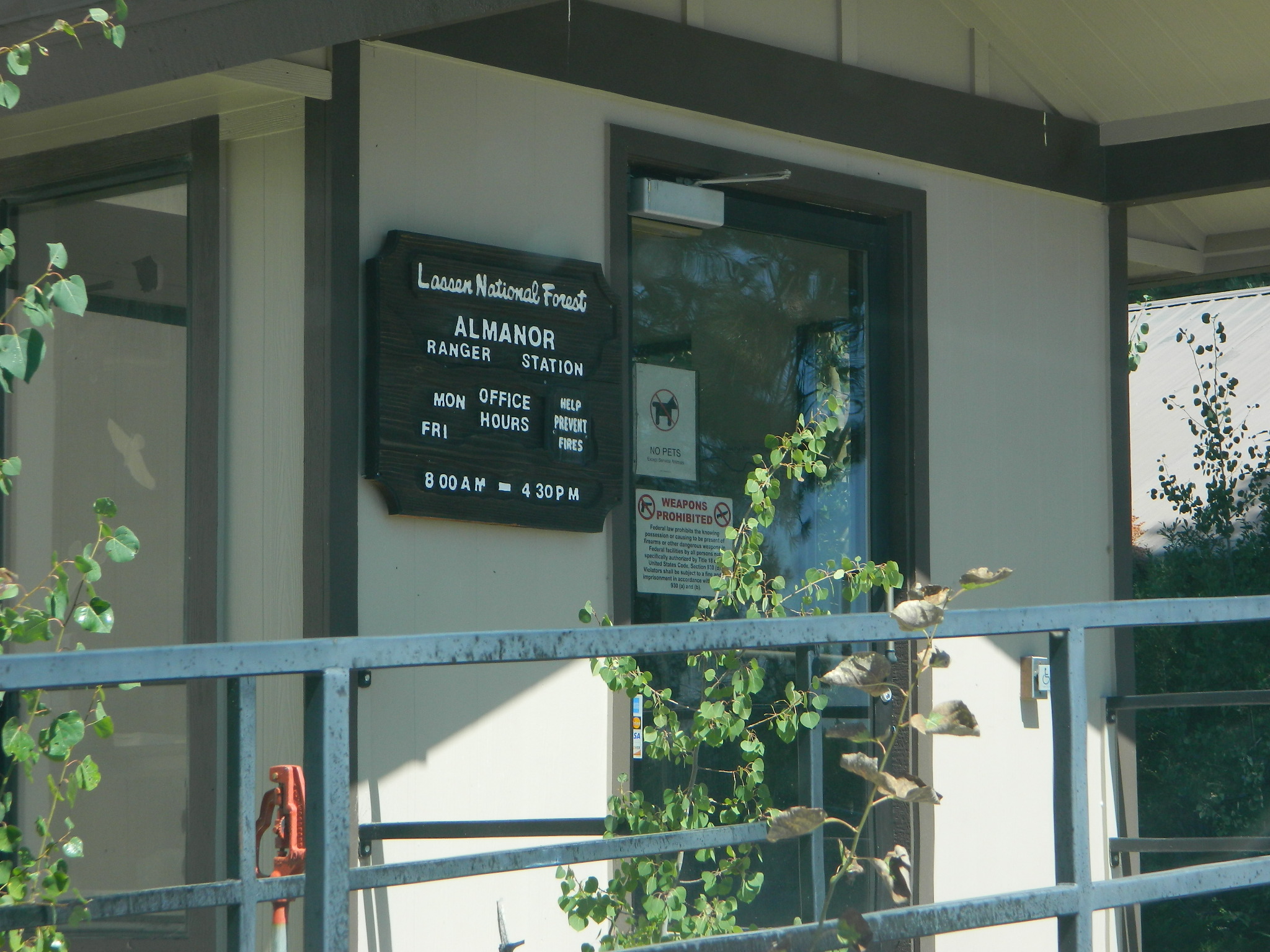
Dispersed Camp sites in Lassen in Lake Almanor Area
campground
elev.
spots
veg
toilet
water
notes
Alder Creek Campground
3900′
6
pines
vault
creek
March-Nov
Benner Creek Campground
5562′
9
pines
vault
creek
May-Nov
Black Rock Campground
2100′
6
pines
vault
creek
year round, fish
Echo Lake Campground
6440′
hike
pines
none
lake
May-Nov, no tables
Soldier Creek Campground
4890′
disp
pines
vault
creek
May-Nov, fall hunters
South Antelope Campground
2700′
4
pines
vault
creek
year round
Willow Lake Campground
–
disp
pines
–
lake
May-Nov, no tables
NORTH LASSEN
Free Camping Lassen
Northside of Mount Lassen
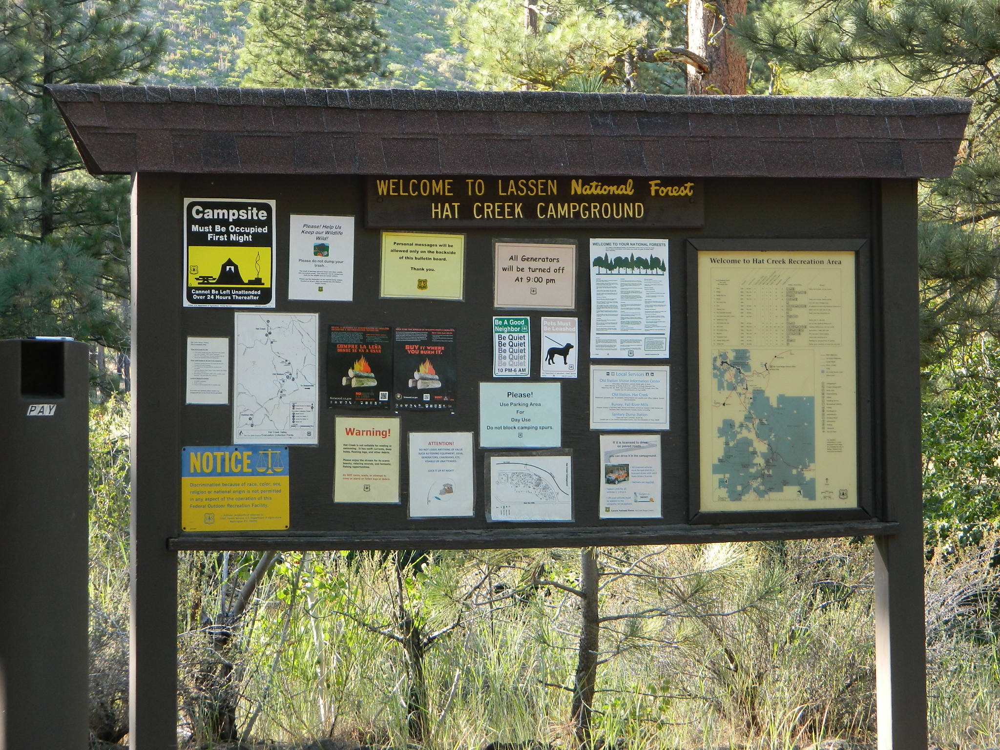
Excellent back roads camping w/ dense forest and free firewood all over the place (bring hand saw). Dispersed, primitive, free camping, near creek, and highway close. Many forest dirt roads turn offs, all along Highway 44 (California SR 44) near junction w/ Hwy 89 @ Lassen National Park.
Big creeks, dense forests, graded dirt roads, dark night skies. PCT access, trailheads, camping, fishing, hiking, hunting, all along Upper Hat Creek.
Campfire permits (shovel, bucket & water) are required when camping outside of a developed campground. Always check on current fire restrictions. Washed out bridges and landslides are common, which means road closed signs can be found on these remote backroads.
Camping areas along Kings River, Sierra Nevada California
Kings is the longest river in the Sierra Nevada and very rugged and remote in most of the length. The Upper Kings is situated in the Wilderness and National Park at the highest of elevation. Granite alpine back country, with abundant small lakes, the Pacific Crest Trail and numerous Wilderness areas.
The tallest peak, Mount Whitney, drains this way – down waterfalls and whitewater, westward to the San Joaquin Valley. Agriculture, farmlands and orchards of fruit.
The Lower Kings is popular among campers, fishermen, kayakers and rafters, accessible most of the year. Upper Kings River is located inside the National Park boundaries.
Upper Kings River Headwaters
8000-10,000′ elevation
PCT trail camping, hiking trails lead 20+ miles from Cedar Grove, skirting the Joh Muir Wilderness
NPS Campgrounds @ National Park South Fork Kings River
Inside Kings Canyon National Park:
Cedar Grove Village @ end of Highway 180
elevation 4600′
may be closed during winter months.
reservations recommended.
Roads End Trailhead
Backpacking trails lead up river from the paved parking area.
NPS – wilderness permits required for overnight stays.
Camping, day hikes and horseback trails. Wildlife and wildflowers abundant in this Cedar Grove / South Fork canyon.
Camping near Lower Kings River
Open all year round. Outside the National Park boundary, westward in lower elevations, many more camping options are available.
NOTE: Sierra National Forest is located on the north side, along the river shore in between Pine Flat Lake & Kings Canyon National Park. But Sequoia National Forest is located on the south side, so you may need more maps. Cell phone service is spotty or non-existent in this deep canyon.
Trimmer Springs Road #11S12: a paved access road, that wraps around the northern shore of Pine Flat Reservoir. Very curvy and long, with 25 mph curves; this main route continues east into the massive Kings River Canyon.
Google Maps may have this road crossing the river, towards the end. Proper signage is questionable in the area, since local rednecks love to shoot up signs. Trimmer route quickly peters out to narrow dirt roads, anywhere past the Mill Flat Campground area.
Lower Kings is NOT easily reached via the National Park, nor Kings Canyon Highway 180. Dirt road travel is required on Road #12S01, which can be steep and rocky at best. The drive is a steep climb up to the highway, which may require 4 wheel drive in some sections, depending on weather and land slides. This road is rough, so you will need at least a high clearance rig and a good forest map. Winter brings some snow and abundant rains (NOV – APRIL).
LANDSLIDES and ROCK SLIDES are common with ROAD CLOSURES not always posted on the Sierra National Forest, NFS web site.
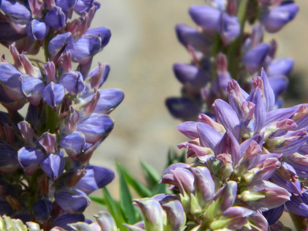
Wildflowers are abundant in this region for springtime. (MARCH-MAY)
both above camps are free camp spots: boondocking, dispersed camps, primitive car camping, tent camping, RV camping, river fishing, kayaking, rafting
Sierra Road #12S01– primitive camping, few pit toilets; fishing access, some trailhead camps and RV spots along river. The northern most arm of this road is also referred to as Road# 12S001 Garnet Dike, on the NFS web site.
BlackRock ReservoirRoad #11S12, another side route (paved) climbs steeply in elevation, along a cliff edge. This spot offers a small NFS campground near a lake, and is located along the North Fork of the river.
Avocado Lake Park is down river and a perfect spot for a picnic or BBQ. A 210 acre day use park providing recreation that includes swimming, fishing and picnicking. The park has picnic tables, a group picnic area, BBQs, boat launching ramp and a playground. West of Pine Flat Reservoir, this grassy county park is only open during daylight and no overnight camping is allowed.
Next park down river is Kings River Green Belt Park, which seems to be popular with joggers and dog walkers. Also run by the county, this place closes at sundown and no camping facility is offered.
@ Highway 180
Riverbend RV Park
17604 E Kings Canyon Rd
Sanger, CA 93657 with seasoned organic firewood
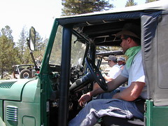
California has no shortage of 4 wheel drive vehicles, but how many of them actually use them for what they were intended? If you’ve had your 4WD for a while and are itching to get to know the local trails, then grab yourself a few good OHV maps & head for the hills.
If you are a total novice and think you might want to get familiar with routes, what your vehicle can and cannot do, and learn the ropes from the pros, then you might want to discover the friendly folks in your local 4×4 club. Below we list as many legitimate groups we can find, with or without web sites. If your club is not listed, then please contact us & we might add it.
Anza Borrego Desert Washes
Off roaders (with running rigs) can enjoy pre-planned back road trips with various 4×4 Groups in California:
Beautiful park setting @ Lee Fong Park, in historic Weaverville
Historic Weaverville’s Car Show
Weaverville Chamber of Commerce & E Clampus Vitus (ECV #62) present NorCal’s summertime CarShow in Weaverville, a highlight of the Trinity River region. This classic auto display is held at a beautiful small town location & it’s been running for years. Event festivities spread out between the SuperMarket parking lot and Lee Fong Park, near downtown Weaverville, California; Camping & fishing are superb in these forests at this time of year. Make a long weekend of it!
Enjoy raffle prizes, Clamper breakfast, raffles, vendors, VFW Tri-Tip Lunch, Music, Shuttle Service to Historic Downtown Weaverville beginning 10 am Saturday.
This auto show event may have been previously referred to as “Car Show in The Park”
California is currently the #1 travel destination in the country. Travel and tourism totals $80 billion annually in California, support jobs for a million Californians and generate $5.3 billion in state and local tax revenues.
Total Escape is the independent travel site for the golden state. We also list some other resources below.
California Guide
locals prefer…. Total Escape, California, Off the Beaten Path
22,700 acres
Kaiser Pass Road
Sierra National Forest
2020 wildfire: CREEK FIRE has burnt the majority of this wilderness, roads, trails, lake shores and most campgrounds
Central Sierra Nevada Mountains/ Kaiser Pass & Kaiser Peak / Highway 168
One of the best cell phone coverage areas for any California Wilderness location, this central Sierra region is located south of Yosemite National Park and known primarily for Shaver Lake.
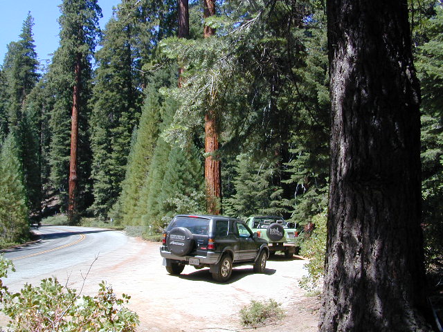
California Hwy 168, along with Dinkey Creek Road (southward) and Kaiser Pass Road (northward) leads off in all splintered directions to secluded campsites, rivers, creeks, lakes, developed campgrounds and amazing forest scenery. Off road trails and hiking trails, everywhere back here! But it is best to have several good maps for cross reference.
Dusy Ershim Trail 4×4 travels past Kaiser Peak and the cell phone towers. Several primitive camp sites with views on ridge. Numerous developed NFS Campgrounds out this way along Kaiser Pass Road.
Trailheads for horseback, hiking, backpackers, mountaineers, rock climbers. Snowmobiles love this amazing route when the snow is deep; some west coast winters can be better than others. Know before you go!
Kaiser Wilderness are granite mountain peaks, near Huntington Lake & the China Peak ski resort, formerly called Sierra Summit Ski; One lane narrow backcountry paved roads: Kaiser Pass Road 80 (east of Huntington Lake) and Stump Springs Road 5 is West Kaiser (west of Huntington Lake)
Sierra Views in 2002White Fir CampsiteChina Peak Hike w/ Map
There are many gorgeous rivers in California that are perfect for camping and fishing, but none are located in Southern California. None! Yep, you read that right. If you think about it, the golden state is about half desert! The majority of our natural water in our state is coming from the north – so take this as a warning: you might need to drive a few hours to find your ideal river camp.
The easy-to-access waterways are found mostly along highways in the Sierra Nevada – or way up in NorCal. Deep granite gorges carved out by glaciers, surrounded by forested peaks is only half the appeal. High elevation lakes, waterfalls, big trees, abundant wildlife, and the alpine villages are all part of the Sierra Nevada experience. Raft, kayak, fly fish, hike, bike or just camp out next to a big, rushing, flowing river. Our selection of California maps will get you narrowed down to a specific region, so you can find that perfect river campground, or explore and discover the back roads – for the most seclusion.
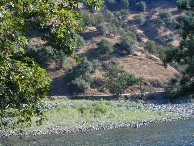
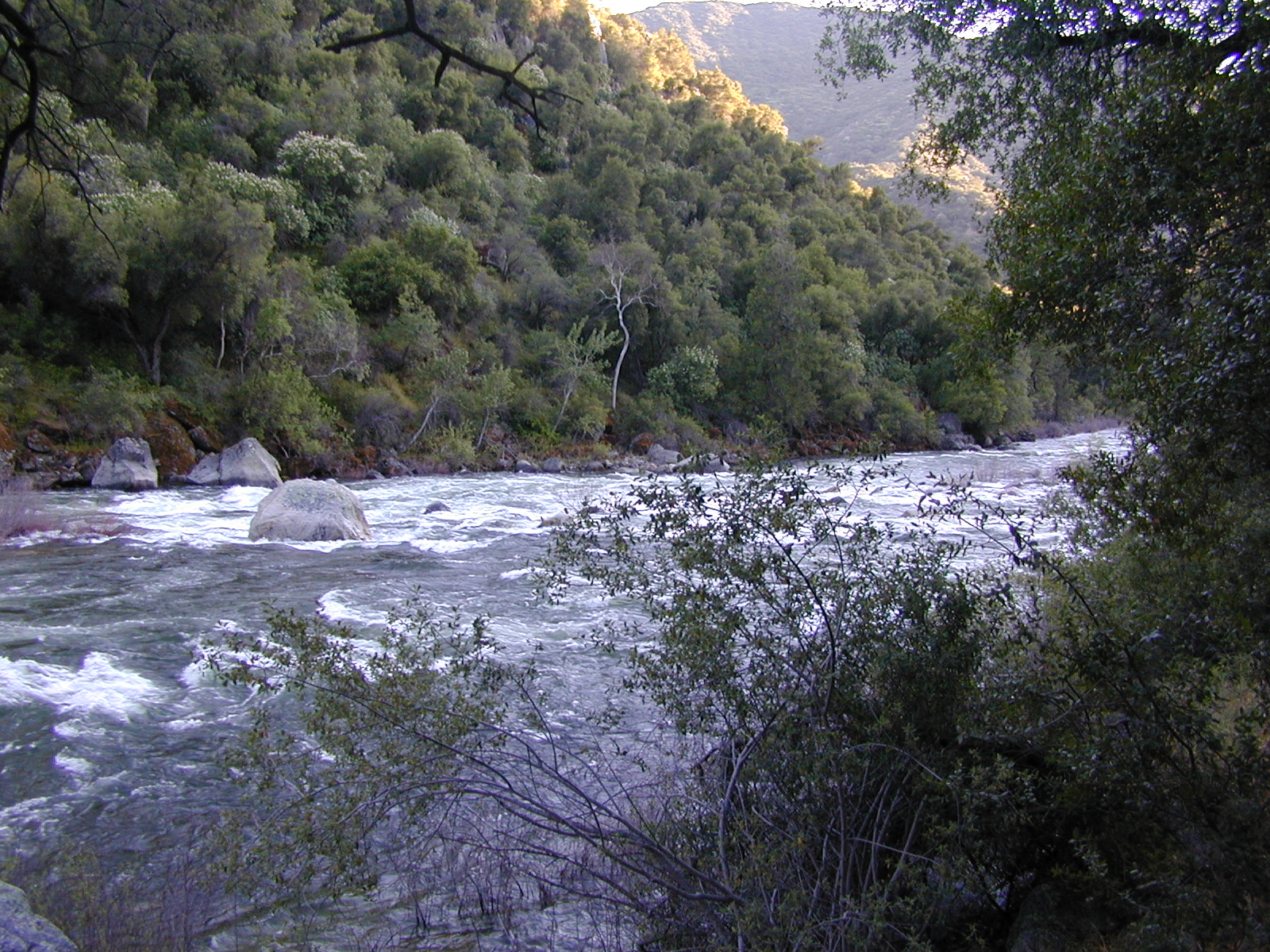
KERN RIVER: The Kern River is one of the most popular of all the Sierra rivers due to its proximity to SoCal. Hurried, stressed-out, Angelinos (LA) can be at this destination in under 3 hours – which makes it a very busy place most months.
So, let it be told, that summer is not the best time to enjoy the Kern. If you do plan a summer outting, make sure you head for the Upper Kern (10+ mi N of Kernville & Lake Isabella) or the North Fork of the Kern (out in Monache Meadows) where 4×4 is often needed.
The Lower Kern River has only 2 developed campgrounds: Hobo (closed for damage 2019) andSandy Flat (open all year). Numerous primitive camp spots are available along Old Kern Canyon Rd, which parallels the Hwy 178 on the south side. None of which are located at the rivers edges. Remington Hot Springs is a popular spot for soaking. Fishing trails, mountain biking trails and hiking trails, all over. Fire danger is great in this area, so pay extra close attention to signs and fire restrictions.
Kern River above Lake Isabella and Kernville is a better choice for camping availability.
Everybody loves Yosemite! This is the most popular park in the whole state; maybe the whole nation.
The majority of campers want to stay “right on the river” when they visit Yosemite NP, but that is just plain old impossible, since reservations go fast and there is only so much room for everyone in this enclosed, narrow, precious valley.
This particular park has some major floods (1997 & 2005) that wiped out bridges, road ways; all the old wooden cabins (at Yosemite Lodge) are gone and only half of the campgrounds are still available. Yosemite has had 11 winter floods since 1916 that have caused substantial damage to property. That number is expected to increase, as winter precipitation is getting less predictable.
Reservations are taken for camping and cabins – far in advance; like one year. No joke!
3 Yosemite Campgrounds are located next to the Merced River (inside spectacular Yosemite Valley)
Way up in the Yosemite high country, which is only open a few months outta the year, the beautiful Tuolumne Meadows Campground is located next to lush meadows and the scenic Tuolumne River. All Yosemite campsites must be reserved well in advance, so visit links above – if you are serious about a Yosemite camping trip anytime soon.
MOKELUMNE RIVER: Way up the road, deep in the western Sierra, Gold Country. Small NFS campgrounds, right on the river; Access is long, narrow paved, switch-back road, not suitable for RVs or trailers.
STANISLAUS RIVER: The Sonora Pass, the fishing is very decent way back in this granite gorge. Highway 108 is only open a few months outta the year, due to deep snow & rock slides – so time is of the essence. Summer time is prime vacation weather up here. Several campgrounds are located right on the river, or on the major feeder streams. Or you can opt for secluded primitive camping on the back roads. Find Sonora camping in Stanislaus National Forest.
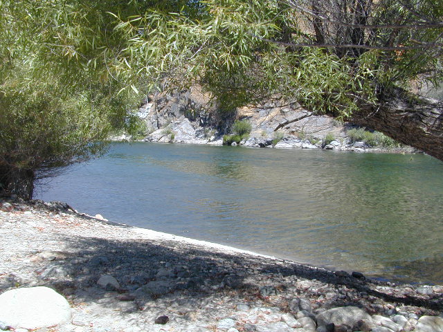
YUBA RIVER: The biggest play time river in the northern Gold Country, this runs along Hwy 49 near Downieville and also has a major South Fork for the best swimming holes and primitive camping in this region. Tubing, rafting, kayaking, fishing, camping, gold panning, you name it, Yuba has it. Look for more on the South Yuba Recreation Map, or the USDA issued Tahoe National Forest Map
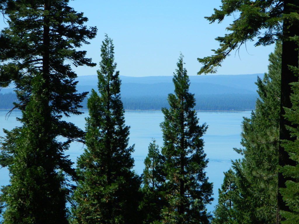
FEATHER RIVER: Top fishing river in the Lassen to Oroville area. Chester and Lake Almanor in the upper reaches. High Bridge Campground is nice paved-camp-site camping; a forested spot where you can fish 2 rivers on the same day. A Plumas NF or Lassen NF map would be quite helpful for this region. Lower down the mountain, lower Feather Rivers which include all 4 forks which feed Lake Oroville – West Fork (Paradise, CA), North Fork, Middle Fork Feather, (Berry Creek, CA) and the South Fork (Lumpkin). Lots of waterways and creeks worth exploring in between Chico and the mountain town of Quincy.
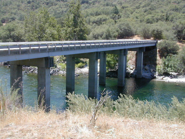
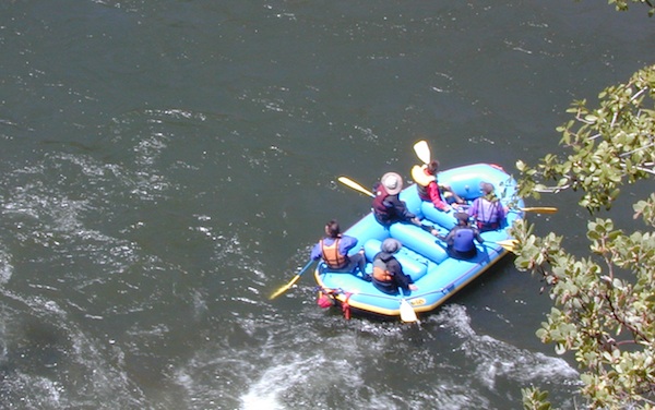
KINGS RIVER: This one particular river is the longest in the Sierra Nevada mountain range, pulling snow melt from the upper reaches of the High Country and Mount Whitney. The river area just to the West of the National Park, over to Pine Flat Reservoir, is all prime for outdoor recreation. Several river rafting companies work this stretch of river.
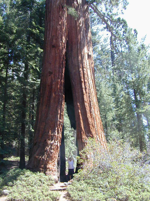
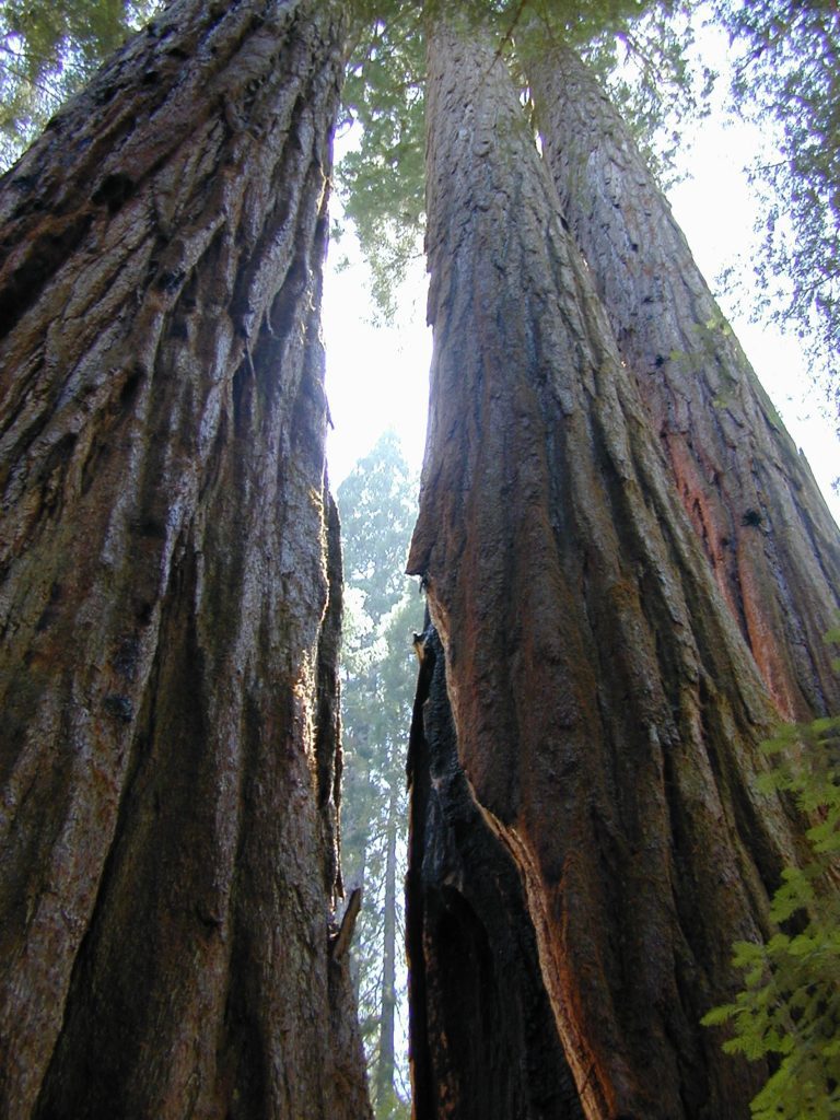
The Western Divide Highway, at 6000 feet elevation, connects the Kern River Valley w/ granite peaks, dome rock, aspen groves & the Giant Sequoia trees! This is one of the southernmost Sequoia groves in the Sierra Nevada mountains. The easy hike is more of a nature trail, wheel chair accessible & approximately 1 mile long. Large Sequoia trees, picnic grounds, near campground.
SEPT 2021: Closed due to the Windy Fire
On busy weekends and holidays the rangers charge a “day use” parking fee, for those wishing to park in the paved parking lots. Avoid this fee by finding additional parking along the highway. Only a few good free parking spots along this busy 3 mile stretch of highway, and don’t forget to park all the way off the pavement.
SOUTHERN SIERRA: Great destination for camping families & sightseers traveling through the Southern Sierra Nevada mountains.
Western Divide Campgrounds
The USDA National Forest Campground across the road from the Trail of One Hundred Giants is called Redwood Meadow Campground. There is also a separate parking lot for the picnic grounds w/ a similar name.
Giant Sequoia National Monument has numerous dirt back roads for free, primitive, car camping. You’ll need a good topo map to find the best ones. Some roads may be muddy, overgrown or extremely rocky, depending on recent weather. Know you vehicles limitations. There is no tow truck service available way back here in the boonies.
Forks of the Kern: Forest Rd# 22S82 – Lloyds Meadow Road Jerky Meadow Trailhead, Sequoia National Forest
SEPT 2021: Closed due to the Windy Fire
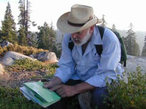
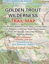
Driving north on Sierra Hwy N of Kernville, California; Passing Fairview & the Johnsondale bridge; After the R Ranch @ Johnsondale, take the right fork off the main highway, which goes deep into Kern River Gorge. This narrow & winding paved road skirts the Upper Kern River Gorge & the impressive Rincon Fault. Numerous primitive camp site can be found on dirt roads off this paved route. The pavement dead ends at Jerky Meadow trail head, which accesses the Golden Trout Wilderness & the Great Western Divide. Backpackers can get to the high country Sierra Nevada & Mineral King in Sequoia National Park from these trails.
Boy Scout Camp Whitsett is one of the first places you pass, near Sentinel Peak.
The Western Divide Hwy runs parallel to road 22S82; way up above it @ 7000′ elevation – with destinations like Dome Rock & the Needles (2 very cool granite features) that overlook this Kern Gorge. The small community of Ponderosa, CA is also up there, along with the quaking aspen groves & the Trail of 100 Giants. Forest Rd# 22S02 connects paved route 22S82 to the Giant Sequoia highway above.
There are many primitive camp areas way above Kern River Gorge – all located on the right side of this road 22S82. Look for small signs for CAMP AREA #1-6. Camps 1-3 are great for RV campers with creeks & dense forests. Long Meadow Creek is one of the first of many streams, you will cross as driving this paved, winding, canyon route. Camp areas #4, 5, & 6 are the best bet for seclusion, plus awesome hiking trails to falls, granite pools & the impressive Kern gorge. Swimming holes are plentiful. Fishing can be decent at times. Many waterfalls can be found in this region as the tributary streams fall towards the deep granite gorge in the Sierra Nevada range. All roads off of 22S82 are dirt roads & most are passenger car accessible. Wetter months could be challenging. Some routes back here are considered to be 4×4 routes tho, so know your vehicles limitations. High clearance is needed to reach some camp sites. Summers can be busy.
This area was burnt from recent wildfires in 2002-2005, but the primitive, dispersed campsites near the streams are full of vegetation & making a nice comeback. Alder Creek runs down from the Sequoias, into Dry Meadow Creek nearby.
Lower Peppermint Campground @ 5300′ elevation, on the west side of the road, is the only developed camp ground on this main forest road. Lower Peppermint has 17 spots, piped water, & picnic tables. Peppermint Meadows & Peppermint Creek are adjacent to the camp area.
Lloyd Meadows @ Sequoia Forest Road# 20S67 – is the Forks of the Kern Trailhead & the dirt road that accesses it, is very popular among equestrian campers. Freeman Creek joins Lloyd Meadows Creek near Pyles Camp. There is a small developed campground called “Forks of the Kern”. Steep trail leads down to the granite gorge where Little Kern River meets the main Kern River; Rattlesnake Creek & Ninemile Creek also join the Kern River in this 10 mile stretch. Kern Hot Springs requires a backpacking trip.
San Luis Obispo County Off Roading
Los Padres National Forest
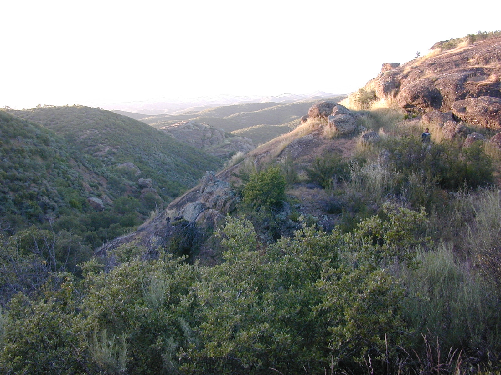
Rock Front Area is located on the north side of Hwy 166 in between New Cuyama and Nipomo, on the very edge of San Luis Obispo county in the center of the Santa Lucia Ranger District of Los Padres National Forest. Landscape varies from rock covered canyons to ridge line trails with outstanding vistas of the the mountains and Cuyama Valley. Remote area features Los Machos Hills, Alder Creek, Branch Creek, Cuyama River, cool rock formations.
15,328 acres
41 miles of trails
From US Hwy 101 @ Hwy 166 travel east 25 miles, left turn into Rock Front Ranch gate on left side. (This road may also be known as Branch Creek Rd on some maps). This off road area can be closed during rainy seasons, so it is best to call rangers ahead of time to ensure the gates are open. There is also one brown Forest Service sign along highway 166, (couple of miles from 101) letting eastbound traffic know if this OHV area is open or closed.
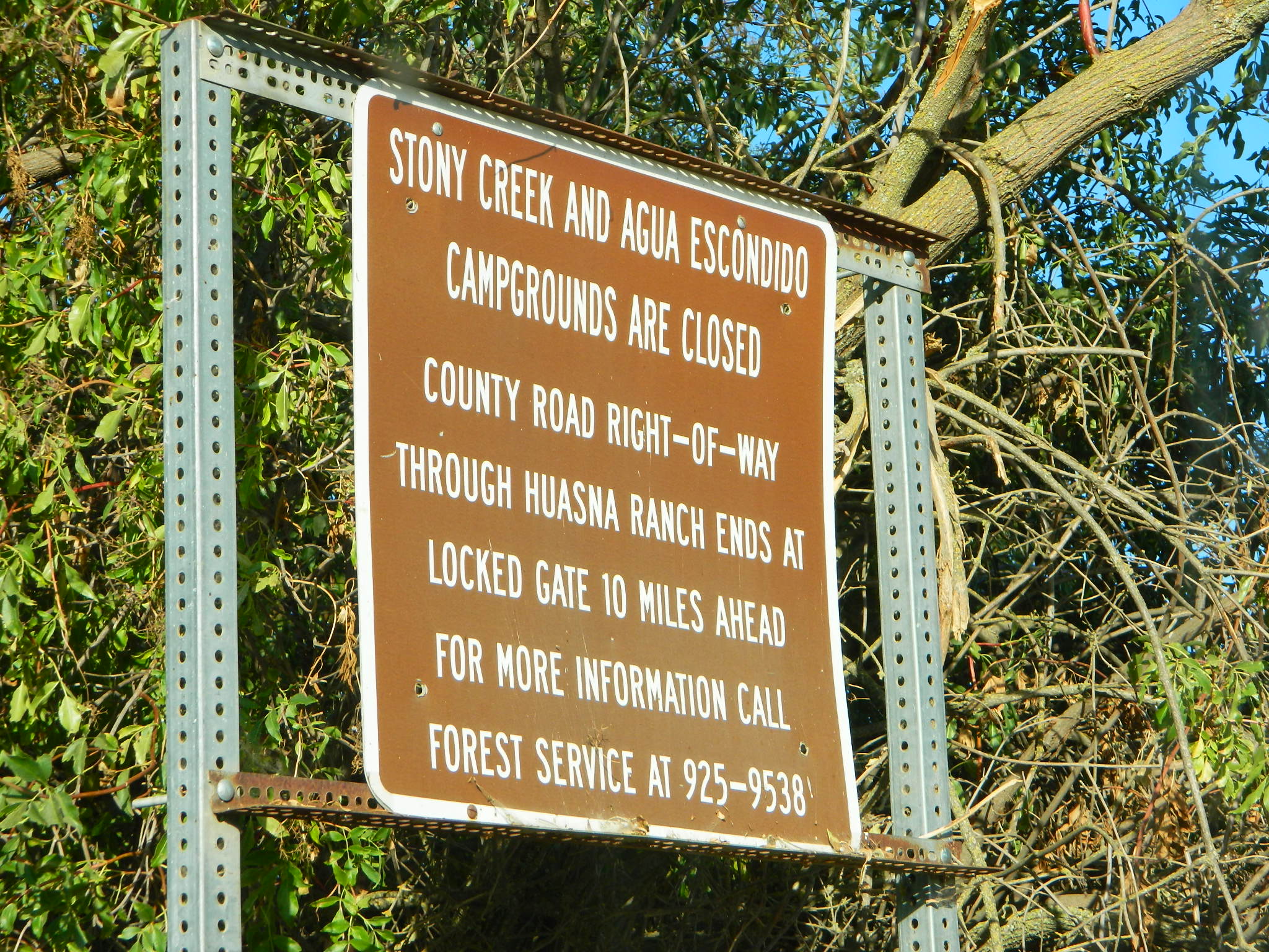
The dirt Road #32S07 (Arroyo Seco) from the west connecting historic Huasna townsite to Rock Front is CLOSED to thru traffic and has a locked gate. Private properties and ranches are abundant in the backcountry of Arroyo Grande, CA
OHV trail ratings in this region are designated below
Green diamond – easy & least difficult
Blue diamond – moderate & more difficult
Black diamond – extreme & most difficult
Logan Ridge Trail #17E05
Green diamond. Least difficult. Open to motorcycles, ATVS, 4WD. 1.4 miles long. This route is a good route for beginning riders. It is located on the main ridge top of Logan Ridge. Route dead-ends at a locked gate.
Shaw Ridge Trail #17E06
Black diamond. Most difficult. Open to motorcycles, ATVS, 4WD. 8 miles long. This route leaves the Twin Rocks route on a spur ridge that drops into the Alamo Creek drainage and dead-ends. A very steep section of trail exists at the end of this route where specialized equipment is recommended. This section is recommended for advanced riders.
Los Machos Trail #17E07
Green diamond. Least difficult. Open to motorcycles, ATVS, 4WD. 2.8 miles long. This route is a good route for beginning riders. It is located on the main ridge top of the Los Machos Hills. Route dead-ends at a locked gate.
Paradise Trail #17E08
Blue diamond. More difficult. Open to motorcycles, ATVS, 4WD. 2 miles long. Access to Paradise Campground and Los Machos route. It is best suited for intermediate riders due to a steep section along the route. Route dead-ends at a locked gate.
Branch Creek Trail #17E09
Blue diamond. More difficult. Open to motorcycles, ATVS, 4WD. 5.5 miles long. Access to Buck Springs Campground, parallels the Big Rock route and offers a loop ride.
Big Rocks Trail #17E10
Blue diamond. More difficult. Open to motorcycles, ATVS, 4WD. 4 miles long. Located on the main ridge top and intersects with the Jack Springs route.
Twin Rocks Trail #17E12
Blue diamond. More difficult. Open to motorcycles, ATVS, 4WD. 3.5 miles long. This route intersects Shaw Ridge and dead-ends at a locked gate. The first half-mile of this trail is steep. Once on top of the ridge you have excellent views of the Cuyama Valley and the Santa Lucia Range.
Kerry Canyon Trail #30W02
Black diamond. Most difficult. For motorcycles only. 6 miles long. This trail must be accessed through Colson Canyon or Sierra Madre. The trail is highly technical and is recommended for advanced motorcycle riders only.
HORSE TRAINING – Along the highway at the gate of Rock Front Ranch is a rock house and ranch, which may or may not offer equine services.
Yellow Stake Camp Sites / Back Roads Camping NFS
near Cajon Pass, Big Bear & Idyllwild CA
YELLOW POST CAMPS are dispersed camping sites on the back roads in Southern California, where fire danger is greatest. Forest authorities have designated certain spots as ‘fire safe’ for remote, open camping options around Big Bear Lake, Fawnskin and the Idyllwild mountain area.
If you prefer to stay out of the developed campgrounds, you will be the minority. But you must know how to read a map well to reach these beauties.
SoCal camping doesn’t have to mean crowded campgrounds. Seek your seclusion on the dirt back roads, where there are no fees, minimal noises & a private site waiting just for you. These are usually on a first come, first serve basis. A high clearance vehicle (SUV, truck or 4×4) may be needed to reach some of the premium camp spots, but there are also sites accessible by passenger cars. And, of course, a fire permit is required.
In the San Bernardino National Forest there are several back woods ‘fire safe’ camping spots, that are noted with a single yellow post & some may require reservations in busy summer months. You can find out more on reserving from the Big Bear Discovery Center, 909-382-2790
Extra caution should be used when winds are high, camp fires are often banned due to wildfire danger. Check with local rangers for up to date conditions and always get your campfire permit.
No restrooms, no water, no facilities. Just a dirt road, a fire ring & a single picnic table. Hopefully your table will not be shot up, by the local rednecks who ‘get off’ doing stupid stuff like this. Pick up any litter & leave the place better than your found it.
These backroad camps are perfect for the 4×4 group, stressed out social club, church group w/ rugged van, or the city SUVer who wants to get away from the crowds. The most sought after camp spots are nearest to the lake or a site accessible by RVs and horse trailers, but there are many more excellent camp sites to be discovered. USDA Forest Service Map is highly advised to reach these remote, dirt road camp areas. Rugged, steep, one lane dirt roads that lead to some of these spots. A passenger car is sometimes not suitable for all dirt roads. Rutted and steep means turn around. Wet weather changes dirt roads. Often routes close for winter w/ locked gates.
California fishing recreation ranges from sport-fishing, an open sea adventure, to solo casting in deep river canyons. Big Sierra Reservoirs near Gold Rush Country to High Country Alpine Lakes, the golden state has the water – and the outdoor recreation you crave.
Below is an alphabetical list of popular fishing destinations within California. Mountains to coastline, there are many maps to choose from.
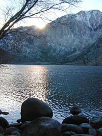
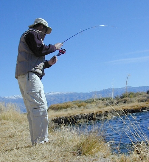
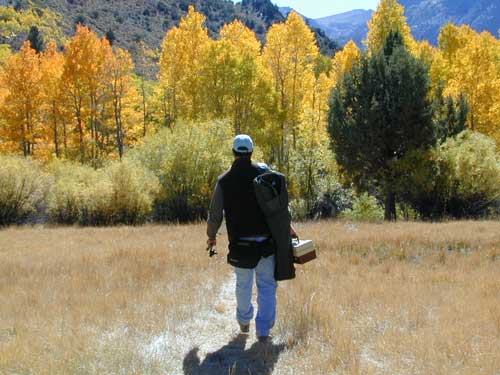
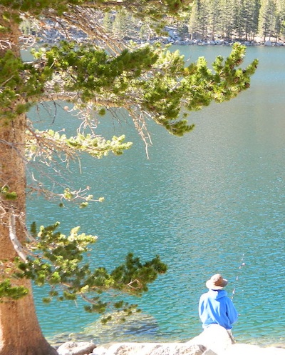
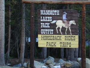
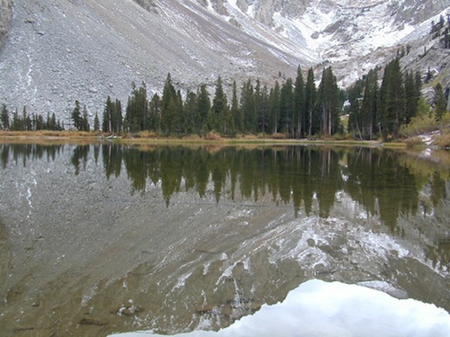
Sure splendor for fishing, most of the time. Lake fishing, stream fishing, river fishing. Fishing the Eastern Sierra area, near Mammoth Lakes, California can be very rewarding. You may have read about places like these in the sports magazines, seen them on a television program, or imagined them in a fishing vacation day dream. Summers can be crowded, so pick a lake and camp carefully. Weather can change quickly, so come prepared. Autumn fishing w/ the golden aspens and less crowds is preferred.
Most of these Eastern Sierra lakes listed below are accessible by car, others by foot. Look at the photos, pick a destination and get a good map of the area, so you can explore everything around too.
Located right on the middle north fork of the Tule River
Small developed campground on the back roads of Mountain Home State Forest. Campground closes seasonally, for winter snow.
Usually open: MAY-OCT
Swimming Holes on Tule River
MOSES GULCH CAMPGROUND
• Elevation: 5,500′
• Number of Sites: 10 walk-in camp sites
• Reservations: No
• Sites Available: First come, First serve
• Vehicle Accessibility: No RVs
• Length of Stay: 14 Days
• Water: River nearby
• Toilet: Vault
• Bear Boxes: Yes
• Trailheads: Tule River; Moses Mountain; Golden Trout
• Season: Closed for winter months
• Fee: Yes
• Operated By: National Forest Service
• Closest Town: Springville, California
tent camping on river
Motorhome RV campers beware; no hook-ups, no paved roads. This is a primitive style camp, way back on a dirt road – not suitable for large vehicles.
NOTE $ This used to be FREE CAMPING, but they recently started charging an overnight fee for this campground.
bike
camp
fish
hike
picnic
stargaze
Golden Trout Wilderness is closeby. Plenty of hiking opportunities, great scenery and several Sequoia groves to visit. Mountain biking is allowed on the dirt roads. Single track trails may be overgrown or even off-limits, due to the fragile eco-system around Sequoia trees.
Tule River, north fork of the middle Tule
Both Moses Gulch and Hidden Falls are accessible via a long, narrow, paved mountain road; then a dirt road, leading 3 miles back to the remote reaches of the Wilderness edge.
western south sierra
North of Springville on Highway 190, turn left (north) on to J37, some call it Balch Park Road (Google Maps has it as Wagner Drive) and follow it up 3.5 miles to Bear Creek Road (#220). Drive 17.5 miles on curvy Bear Creek Road, turn right and follow signs to campground.
Rock climbing, backpacking, fly fishing creeks, snowmobiling, you name it. No matter what kind of trail you seek in California, we have the maps to get you out there, this weekend. If you seek a week long adventure in the Sierra high country, or a weekend getaway destination you’ve never heard of, or a quick after work hike near your home town, we just might have it listed. And we probably have the waterproof, topographical map too.
DOGS & BIKES on TRAILS:
Dog friendly trails include almost anything within the CA National Forests. Remember that most National Parks & State Parks literally forbid dogs on hiking trails. Mountain bikes can access only certain trails in parks, but in the National Forests nearly every trail or dirt road is up for grabs.
OHV ROUTES:
Motorized vehicles, such as quads, ATVs, dirt bikes, Jeeps & 4x4s must stick to designated routes signed specifically for OHV (off highway vehicle) & you won’t be finding many of those inside National Parks & State Parks, so it’s best to look for BLM or NF lands. Many regular, forest, back roads close in winter due to heavy snow pack & thus become cross country ski, snowshoe or even snowmobiling trails. The best ones can be found in the Sierra Nevada mountains.
And if you ever get bored with “reading” text about trails, you can always search the visual database of amazing Cali scenery over at DanaMite’s flickr site


 Mount Lassen is part of the Cascade Mountain Range, located north of the Sierra Nevada. The Lassen forest encompasses a large area of wilderness land, snowmelt creeks and an abundant dirt road system. Most of which is covered in deep snow about half the year, so plan accordingly.
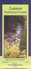


 some other popular web sites for California –


 Motorized vehicles, such as quads, ATVs, dirt bikes, Jeeps & 4x4s must stick to designated routes signed specifically for OHV (off highway vehicle) & you won’t be finding many of those inside National Parks & State Parks, so it’s best to look for BLM or NF lands. Many regular, forest, back roads close in winter due to heavy snow pack & thus become cross country ski, snowshoe or even snowmobiling trails. The best ones can be found in the Sierra Nevada mountains.

