Tag Archives: reservations

National Forest Cabins

California Fire Lookouts for Rent
US Forest Service Cabins
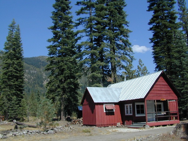
red cabin

NFSlogo
Rent a secluded cabin with an amazing view, a historic tower for wildfire spotting, or a USFS guard station – hidden deep inside USDA California National Forests. Several of these NFS lookouts have been closed recently, so the ones listed below have links to status and reservation information.

Dirt road access is common to reach these remote locations. Some require stair climbing, or steep access hikes. Winter months are usually snowy, inaccessible and sometimes dangerous for these high country locations. Access roads suffer from closures due to rock slides or landslides. Check with the locals ranger station for current conditions.

A few of these rentals are open all year long – in the southern part of the golden state.

El Dorado National Forest USFS

Harvey West Cabin
4,720′ elev. on Silverfork American River, Gold Rush

Loon Lake Chalet
6375′ elev. near Georgetown, Gold Country California

Robbs Peak Lookout
Robb’s Hut / Robbs Cabin
6686′ elev near Placerville, Gold Country California

Sly Guard Cabin
Sly Park @ Jenkinson Lake, near Placerville, Gold Country California

Van Vleck Bunkhouse
6549′ elev. near Georgetown, Gold Country California
download PDF info sheet

Lassen National Forest USFS

McCarthy Point Lookout
overlooking Mill Creek Canyon and Ishi Wilderness
ranger & info 530-258-2141

Mendocino National Forest USFS

Pine Mountain Lookout
>>>> Renovated & ReOPENS soon! April 2020
4400′ elev.  over looking Eel River wilderness
ranger & info 707-275-2361

Plumas National Forest USFS

Crocker Guard Station
5700′ elev. near Meadow on back road
Lake Davis Loop, way out behind Portola, California
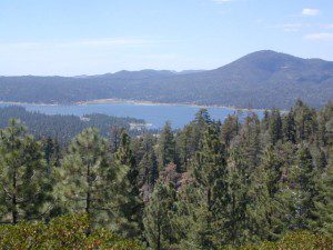
 

Big Bear Lake 2002
Big Bear Lake, Southern California

San Bernardino National Forest USFS

Coon Creek Cabin
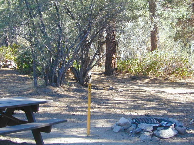
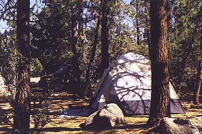
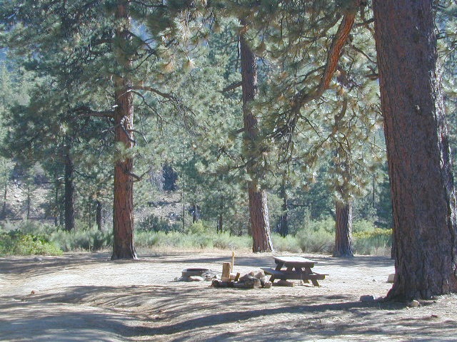
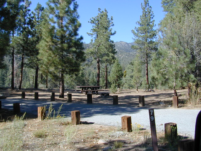
Actually this one is a reservable group campground – next to a set of historic cabins. Big Bear Area Group Camp Site. Heart Bar Rd #1N02 near Angeles Oaks, CA

Morton Peak Fire Lookout
(no longer available overnight stays 2019)
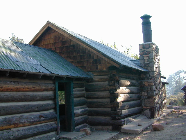
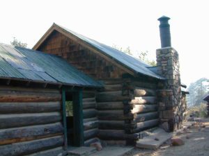
Coon Cabin
Coon Cabin – Southern Cal

Sequoia National Forest USFS

Big Meadows Cabin
Big Meadows Guard Station
off Big Meadows Rd #14S11
7600′ elevation; located in between Sequoia NP & Kings Canyon NP

Camp 4 ½ Cabin
1100′ elevation; Lower Kings River
near Pine Flat Lake, CA

Grouse Valley Cabins
3 cabins near lakes; Giant Sequoia National Monument, Western Divide
4800′ elev.

Mountain Home Guard Station
Mountain Home State Forest, Sequoia Groves
6000′ elev. near Springville, CA

Needles Fire Lookout
(destroyed in structure fire 2011)
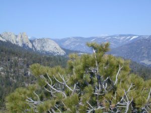
the needles
View of The Needles, from Dome Rock on Western Divide Highway (CLICK TO ENLARGE)

Oak Flat Lookout
Oak Flat Cabin Rental
4900′ elevation; Kern River canyon near Lake Isabella

Poso Guard Station Cabin Rental
open all year round4500′ elev. near Kernville, CA

Quaking Aspen Cabin Rental
Giant Sequoia National Monument, Western Divide Highway near Ponderosa, CA

Wishon Cabin Rental
Tule River, Giant Sequoia National Monument; open all year round. 4000′ elev. near Camp Nelson, CA

Shasta/Trinity National Forests USFS

Forest Glen Guard Station
near Trinity River & Forest Glen, CA

Frog Meadow Guard Station
7760′ elev. near Lake Isabella, CA

Girard Ridge Lookout
Historic Fire Lookout Tower
4809′ elev. near Dunsmuir, CA

Hirz Mountain Lookout Tower
Hirz Mtn. Fire Watch Tower Rental
overlooking Shasta Lake, CA
(currently closed for repairs 2019)

Harris Springs Guard Station
near McCloud, CA

Little Mount Hoffman Lookout
Mt. Hoffman Rental
7000′ elev. near McCloud, CA

Post Creek Guard Station
near Hayfork & Platina, CA


Sierra National Forest USFS

Camp Four and a half Cabin
Camp 4 ½ Cabin Rental
Lower Kings River, open all year round
1100′ elev. near Pine Flat Reservoir


Six Rivers National Forest USFS

Bear Basin Butte Cabin & Fire Lookout
elevation 5300′ in Six Rivers NF / Smith River NRA
(road damage & access issues 2017)

Tahoe National Forest USFS

Calpine Lookout Cabin Rental
near Sierraville, CA

Sardine Peak Fire Lookout
overlooking the Sierra Buttes and serene Lakes Basin, Yuba Rivers, North Gold Country CA

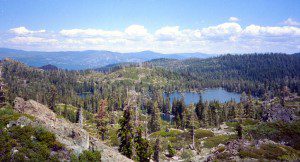
lakes basin views


Sequoia National Forest Camping

Sequoia National Forest Campgrounds
Giant Sequoia National Monument

Sequoia National Forest Campgrounds
Sequoia NF Camping

Sequoia Campground Reservations – Giant Sequoia Campgrounds, Western Divide, Kern Canyon

areas include: Kernville, Kern River, Lake Isabella, Sherman’s Pass, Kennedy Meadows, Forks of the Kern, Western Divide Highway, Camp Nelson, Kings River, Hume Lake & Sequoia National Park

Sequoia Group CampgroundSequoia campgroundsListed below are all the Sequoia National Forest campgrounds, public lands for outdoor recreation. USFS
NFSlogo

Sequoia Campgrounds

campground elev spots veg toilet water notes
Alder Creek Campground 3900′ 13 alder vault creek W of Alta Sierra
Auxiliary Dam Campgr 2650′ dsp flush piped Lake Isabella
Belknap Campground 4800′ 15 pines vault piped April – Oct
Big Meadows Campground 7600′ 25 pines vault creek CLOSED
Boulder Gulch Camp 2650′ 78 oaks flush piped fishing Lake Isabella; RV max 45′
Breckenridge Campground 6600′ 8 pines vault no South of Kern River; no RVs
Buck Rock Campground 7600′ 5 pines vault no Kings Canyon NP
Camp 3 Campground 2800′ 52 oaks vault creek Kings River rafting; RV max 30′
Camp 4 Campground 1000′ 5 oaks vault creek no RVs, Kings River rafting
Camp 4 1/2 Cabin 1000′ 5 oaks vault creek no RVs, Kings River rafting
Camp 9 Camp Area RV 2600′ 109 none flush piped Lake Isabella
Cedar Creek Campground 4800′ 11 pines vault piped W Alta Sierra; no RVs; May-Oct
Coy Flat Campground 5000′ 20 pines vault piped May – Oct
Eshom Creek Campground 4800′ 23 pines vault piped CLOSED
Evans Flat Campground 6100′ 20 pines vault spring equestrian, pasture; RV 20′
Fairview Campground 3500′ 55 mixed vault river upper Kern River; RV 45′
Fish Creek Campground 7400′ 40 pines vault E of Sherman; RV max 27′
Frog Meadow Campground 7500′ 10 pines vault no Sugarloaf Ridge; June-Oct
Frog Guard Station Cabin 7500′ 10 pines vault no Sugarloaf Ridge; 2 nite min
Gold Ledge Campground 3200′ 37 mixed vault Kern River; RV max 30′
Green Cabin Flat Camp 1000′ dsp oaks Kings River; primitive
Hanning Flat Campground 2650′ dsp chem fishing Kern River
Headquarters Campground 2800′ 44 alder vault Kern River; RV max 27′
Hobo Campground 2300′ 35 oaks chem lower Kern River; RV 22′
Horse Camp 7600′ 5 pines vault equestrian campsites
Horse Meadow Campground 7400′ 41 pines vault Sherman’s Pass; RV 22′
Hospital Flat Campground 3000′ 40 alder vault Kern River; RV max 30′
Hume Lake Campground 5200′ 74 pines flush CLOSED
Hungry Gulch Campground 2700′ 78 oaks flush piped Lake Isabella; May-Oct
Kennedy Meadows Camp 6100′ 39 pines vault piped E of Shermans; RV max 30′
Landslide Campground 5800′ 9 pines vault creek CLOSED
Leavis Flat Campground 3000′ 9 pines vault piped California Hot Springs; RV 16′
Limestone Campground 3800′ 22 mixed vault creek Kern River rafting; RV 30′
Live Oak North Campground 2700′ 60 oaks flush piped Lake Isabella; RV max 30′
Live Oak South Campground 2700′ 90 oaks flush piped Lake Isabella; RV max 30′
Long Meadow Group Camp 6500′ 23 pines vault piped CLOSED
Lower Peppermint Campground 5300′ 17 pines vault piped CLOSED
Main Dam Campground 2500′ 82 oaks vault piped Lake Isabella; RV max 45′
Mill Flat Campground 1100′ 5 pines vault creek Kings River rafting; no trailers
Panorama Campground 7400′ 10 pines vault no Sugarloaf Ridge; June-Sept
Paradise Cove Campground 2600′ 138 oaks flush piped Lake Isabella; RV max 30′
Peppermint Dispersed 7100′ 19 vault creek CLOSED
Pioneer Point Campground 2650′ 78 oaks flush piped Lake Isabella; RV max 30′
Princess Campground 5900′ 90 pines vault CLOSED
Quaking Aspen Campgr 7000′ 32 aspen vault creek CLOSED
Redwood Meadow Campgr 6100′ 15 pines vault piped CLOSED
Sandy Flat Campground 2300′ 35 oaks vault Lower Kern River
South Fork Recreation 2650 dsp flush piped some walk-in camp sites
Stine Cove Campground 2650′ dsp oaks vault Lake Isabella
Stoney Creek Campgr 6400′ 49 pines flush piped CLOSED
Tenmile Campground 5800′ 13 pines vault piped CLOSED
Tillie Creek Campground 2650′ 159 oaks flush piped fishing; RV max 45′
Troy Meadow Campground 7800′ 73 pines vault OHV; E Sherman’s; RV 20′
Upper Stony Creek Camp 6400′ 19 pines vault piped Sequoia NP; May-Oct
White River Campground 4000′ 12 oaks vault piped Sugarloaf; May-Oct; RV 16′
Wishon Campground 4000′ 31 oaks vault piped open all year
Hume Lake Camping
Hume Lake, California
Western Divide Wishon Campground
Wishon Campground on the Western Divide

Giant Sequoia Campground

Sequoia Camping & Kernville Vacations, see also –

Topo maps, wilderness hiking maps
Equestrian trails, OHV maps –

Sequoia National Forest Campgrounds

Recent Wildfires:

Castle Fire + Shotgun Fire:
SQF Complex Fire 2020

Colony Fire + Paradise Fire:
KNP Complex Fire 2021

Giant Sequoia Fires
Windy Fire 2021

Sequoia National Forest Campgrounds

Sequoia mountain communities include:

Plumas Campgrounds

Plumas Campsites

Snake Lake Campground near Quincy, California

hikerPlumas National Forest has excellent outdoor recreation and developed campgrounds, as well as secluded, primitive back roads camping sites. If you prefer a camp with table, toilet and a campfire ring, then expect to pay a fee. There are several small, remote campgrounds listed below, but most are located on paved roads. Venture down dirt roads to find a premium camp sites for free. Scroll the map links below to explore the back roads of Plumas, and discover hidden fishing holes.

SOME CAMPGROUNDS are closed due to  wildfire damage in the Plumas region.

#BearFire #NorthComplex wildland fires 2020
#DixieFire wildfire 2021

fish  4x4  camp

Plumas Camping; Sierra Nevada Campgrounds; Feather River, Fishing Lakes, Reservoirs, PCT

campground elev spots toilet water notes
Black Rock Campground 5046′ 20 vault piped Little Grass Valley Res.
Boulder Creek Campground 5000′ 70 vault piped reservations
Antelope Lake
Brady’s Campground 7200′ 4 vault creek Greenhorn
Pine Creek
Cottonwood Springs Group Camp 5700′ 20 vault creek reservations
Conklin Park Campground 5900′ 9 vault creek US Hwy 395
Crocker Campground 5800′ 10 vault creek Eagle Lake
Deanes Valley Campground 4400′ 7 vault creek dirt road
#24N20

Feather Falls Campground 2500′ 5 vault piped CLOSED
Gansner Bar Campground 2300′ 14 flush piped Caribou Road,
North Feather
Gold Lake Campground 6400′ 6 vault lake 4WD camp site, LBRA
Grizzly Creek Campground 5000′ 8 vault piped reservations
Bucks Lake
Hallsted Campground 2800′ 20 flush piped reservations
North Feather
Horse Camp 5046′ 10 vault lake Little Grass Valley Res.
Hutchins Campground 5200′ 10 flush piped Bucks Lake
Lake Almanor Campground 4500′ 53 vault piped reservations
Lakes Basin Campground 6400′ 24 vault piped Lakes Basin Rec.
Laufman Campground 5100′ 6 vault creek US Hwy 395
Little North Fork 4000′ 8 vault creek CLOSED
Lone Rock Campground 5000′ 87 vault creek reservations
Antelope Lake
Long Point Campground 5000′ 38 vault creek reservations
Antelope Lake
Meadow  Campground 6100′ 6 vault no dirt road
#24N29
Mill Creek Campground 5000′ 10 vault piped Bucks Lake
Milsap Bar Campground 1600′ 20 vault creek CLOSED
North Fork Campground 2600′ 20 vault piped reservations
North Feather
Peninsula Campground 5046′ 25 flush piped Little Grass Valley Res.
Queen Lily Campground 2600′ 12 flush piped reservations
North Feather
Red Feather Campground 5100′ 60 flush piped Little Grass Valley Res.
Rock Creek Campground 4000′ 6 vault no dirt road
#24N20
Rogers Cow Camp 4000′ 5 vault no CLOSED
Ross Camp 6070′ 5 vault no high clearance
Silver Lake Campground 5800′ 8 vault lake CLOSED
Snake Lake Campground 4200′ 9 vault lake horse corrals
RV + trailers
Sundew Campground 5000′ 19 vault piped Bucks Lake
Tooms Vehicle Campground 5046′ 20 vault piped Little Grass Valley Res.
Whitehorse Campground 5000′ 20 vault creek reservations
Plumas National Forest Map
 

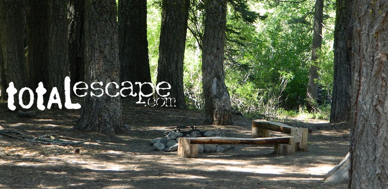
ceremony site
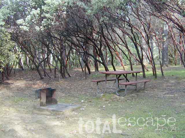
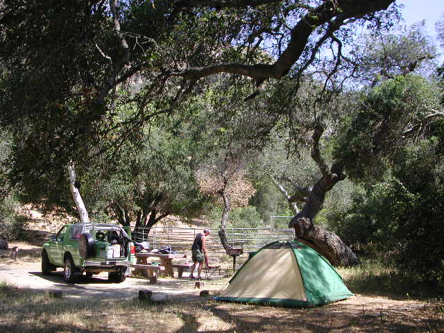
This particular camp spot is shady and has bench seats. A perfect little ceremonial set up.


  • backpackingboatramp
  • boating
  • camping
  • fishing
  • forests
  • hiking
  • hunting
  • kayakingcanoe
  • lakes
  • mountain biking
  • off-roading
  • swimming holes
  • wildlife

see also – Plumas Camping

primitive camp sites hikes camp NFSlogo

FIRE LOOKOUTS & NFS CABINS for rent

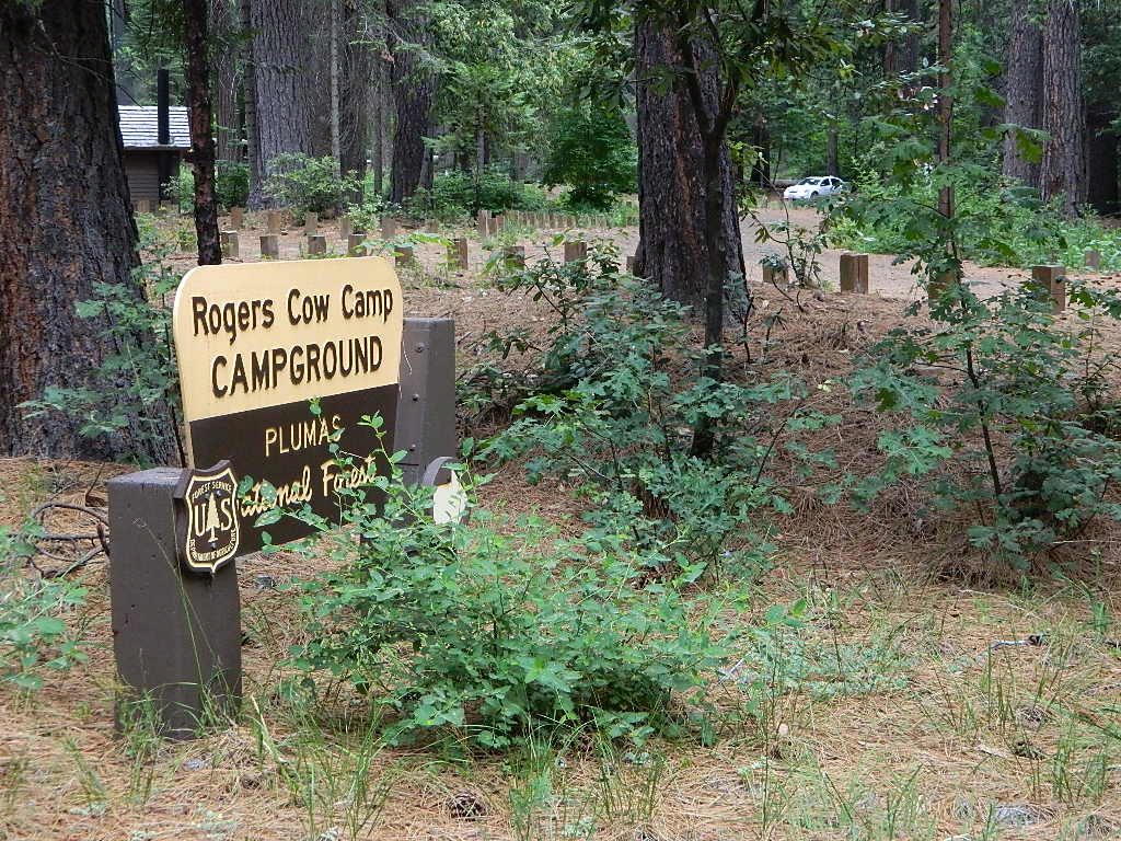
RogersCowCamp
Rogers Cow Camp on Oro-Quincy Highway, North Sierra Nevada
secludedcamp
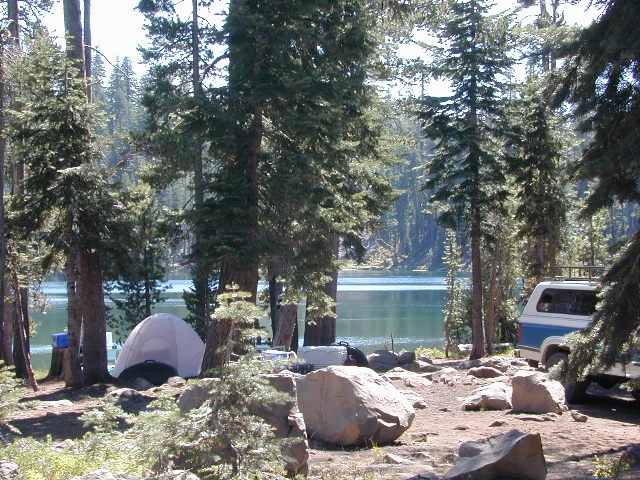
Dense forest @ Deane’s Valley Camp, in between Quincy & Meadow Valley, CA

Plumas Forest Maps

goldshore
Mini Gold Lake, near Silver Lake @ Bucks

Plumas Forest Regions

  • Beckworth Ranger District

Lake Davis, Conklin, Crocker, Gold Lake, Lakes Basin

  • Feather River Ranger District

Little Grass Valley Res., Sly Creek, Feather River

  • Mount Hough Ranger District

Antelope Lake, Bucks Lake, Feather River Canyon, Indian Valley

Bike Trail Lake Almanor

Paved bike path along the west shore of Lake Almanor, a very developed lakeshore community, south of Mount Lassen peak.

Silver Lake California

Silver Lakes @ Bucks
Silver Lake, near Bucks Lake Wilderness

Numerous Silver Lakes, Creeks and other “silver” terrain can be found inside California. After the Gold Rush of 1849 in the western Sierra, Silver was discovered in Nevada shortly after (east of Sierra Nevada mountains). This page is an overview on all places with SILVER in the name, or places that have had a history of silver mining. California Counties are listed in parenthesis. Links below will lead to more detailed pages or campground reservations.

Silver Lake @ Lassen

(Lassen Co)

silver kayaker

Silver Lake @ Bucks

(Plumas Co)

silver88

Silver Lake @ Carson

(Alpine Co)

Silver Fork of the American River. Silver Fork Road connects US Highway 50 & Carson Pass Hwy 88. Silver Fork Campground & China Flat Campground (NFS) are both located on this remote, backcountry route, about 8 miles from US Hwy 50 campground

golden glow june

Silver Lake @ June

(Mono Co)

Autumn aspen groves ignite with color in October. Often, some of the best fall colors in the Eastern Sierra. Day trips w/ fishing. Hiking everywhere. Overnighters or backpackers could be greeted with snow at anytime in October or later. The June Lake Loop (SR 158) closes for snow annually!

California Lakes named Silver

Silver Lake @ Gold Lake

(Plumas Co)

Lakes Basin Recreation Area also has a hike-in Silver Lake, trailhead near Gold Lake on Gold Lake Highway

Silver Lake @ Gold

califrepublic

below are silver mining camps and other silver related destinations, plus some campgrounds


Bodie SHP (State Park) calsp
(Mono Co)
8375′ elev. US Hwy 395 near Bridgeport, CA. Infamous, high desert ghost town, now a California Historic State Park. Large gold mining camp w/ well-preserved, wooden, old town structures. Silver was discovered in nearby Aurora Canyon.  All dirt road access. No developed campground @ Bodie, so try nearby Green Creek Road instead. Or high desert, back road camping on Aurora Canyon Road over to Bridgeport Reservoir.

Cerro Gordo
(Inyo Co)
8500′ elev. Inyo mountains, West of Death Valley, east of US Hwy 395 @ Junction 136. Old mining camp rich in silver history. Someone might even live up there. Extreme remote location in rugged, high desert mountains. 4×4 is always required!

Silver City Sequoia NPS
(Tulare Co)
6935′ elev. cabin resort on Mineral King Road, in the South Sequoia National Park

Silver Creek Campground NFS campground
(Alpine Co)
Developed Campground south of Markleeville, Highway 4, Ebbett’s Pass, Central Sierra Nevada

Silver Creek Campground campground
(Placer Co)
Camp right on the Truckee River, and on busy Hwy 89. in between Truckee & Lake Tahoe, California

Silver Valley Campground & Silver Tip Campground (Alpine Co) are both located near Lake Alpine on Highway 4 Ebbetts Pass , Central Sierra

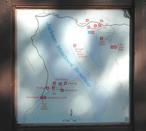
jacksonmdwsign

Silvertip is also a Group Camp at Jackson Meadow Reservoir (Sierra Co) off Hwy 89, North of Truckee, CA. Silvertip Group Campground, as with all group camping facilities, is by reservation only.

Silver Lake @ LA
(Los Angeles Co) a hip and popular, tree-lined neighborhood in Los Angeles, near Griffith Park.

Silver Lake
(San Bernardino Co)
Silver Dry Lake, a dry lakebed in the Mojave desert, near the Hollow Hills Wilderness, north of Baker, CA off I-15

Silver Lakes
(San Bernardino Co)
2430′ elev. a desert community southwest of Barstow, near Helendale, CA. Located on the Mojave River (which flows underground) in between Historic Route 66 & US Hwy 395. Attraction nearby – Exotic World, the Burlesque Hall of Fame.


silverstrand

Silver Strand State Beach State Park

(San Diego Co)
A sliver of sand makes up this narrow beach, barrier island for San Diego Bay. RV Camping, best in SD. South San Diego, Coronado Island campground

silverwood

Silverwood Lake SRA State Park

(San Bernardino Co)
State Recreation Area @ Cajon Pass I-15
in the San Berdu National Forest


lacontedivide

High Sierra, California

hike-in only

backpacking

Silver Pass Lake
Silver Divide & Silver Pass
(Fresno Co)
11,000′ elev

Located in between two 12,000′ peaks
near PCT – Pacific Crest Trail
John Muir Wilderness

backpacking

Silver Lake
(Tulare Co)
11,000′ elev

via Mineral King trailheads
Golden Trout Wilderness
South of Sequoia NP
Southern Sierra Nevada

Another Hike


14S11 – Sequoia NF

trails to meadow

Big Meadows Road: Sequoia Forest Rd# 14S11

SEPT 2021: Closed due to the KNP Complex Fire

GIANT SEQUOIA: in between Sequoia & Kings Canyon, inside Sequoia NF

Sequoia Meadows

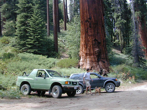
This chunk of National Forest land is perfectly located in between 2 very popular National Parks – Kings Canyon and Sequoia. This primary paved road leads to some great camping, a perfect option for NOT camping inside the crowed National Parks.

Turn east off of Sequoia ‘Generals Highway’ 198, on to the well signed Big Meadow Rd. There is primitive camping all over this area & a few developed campgrounds along this route. Motorhomes be warned: the road narrows to one lane with no “turn outs” or U turn spots for the last 10 miles (on a steep cliff w/ large overhanging rocks)

SEE CAMPING PHOTOS

campIn the first few miles, the dispersed camp sites on the right side have great views & some situated on fairly flat granite slabs, perfect for astronomer campers or adventurous RVs. To the left side of the road is more primitive style campsites in wooded areas. The whole area is also a very popular cross country ski & snowmobiling spot for winter recreation. Hunters also like these camps during hunting season (in September).

horseback

There is a developed Horse Camp on the left side of the road for equestrian campers. This camp is located across from the biggest meadow and may be the first place you notice on this drive.


Buck Rock Campground
(7600′ elevation, 5 spots) & Big Meadows Campground (7600′ elevation, 25 spots) are both family style camps, perfect for those who want picnic tables, plus bathroom nearby. Sorry no flush toilets out here, only pit toilets.


Sequoia maps

Buck Rock Fire Lookout Tower @ 8500′ elevation – is located to the north on Forest Rd # 14S02. It’s a great spot for some impressive views – if you aren’t afraid of heights. To reach the tower you must climb several flights of steel steps. This place is worth a stop if planning a sightseeing day.

Big Meadows Guard Station @ 7500′ elevation (also known as Big Meadows Cabin), is located next to the BIG MEADOW and is available for rent on a weekend basis from the NFS. Hiking Jennie Lakes Wilderness and fly fishing Big Meadows Creek are favorite activities to be enjoyed.

Big Meadows Road is long & narrow – 12+ miles. RVs are not recommended beyond the Big Meadow Campground, as the road is one lane in some spots & it skirts a cliff edge. The views are incredible the farther you go & many creeks feed the region.

The narrow, long paved road eventually forks off into several smaller dirt roads back near Horse Corral Meadow. Way back here, the dirt roads lead out to trail heads for backpacking, horse packing or day hiking in Jennie Lakes & Monarch Wilderness. Backcountry access to either Sequoia or Kings Canyon National Park! Have a good map if you plan to venture out this far. Pay attention & don’t get lost.

GPS would be helpful in this area. Some of the smaller of the dirt roads are not even on the NFS maps. Make sure to GPS way-point your favorite camp site, so you can find in next time…. in the dark.

Sequoia National Forest

Sequoia National Forest MAP

nearby services:

Sequoia Groves

see all – Big Meadows in California 

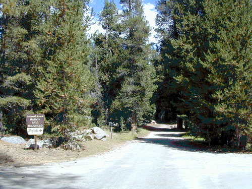
Marvin Pass Trailhead

Trail of 100 Giants Sequoia Grove

seqAmigos

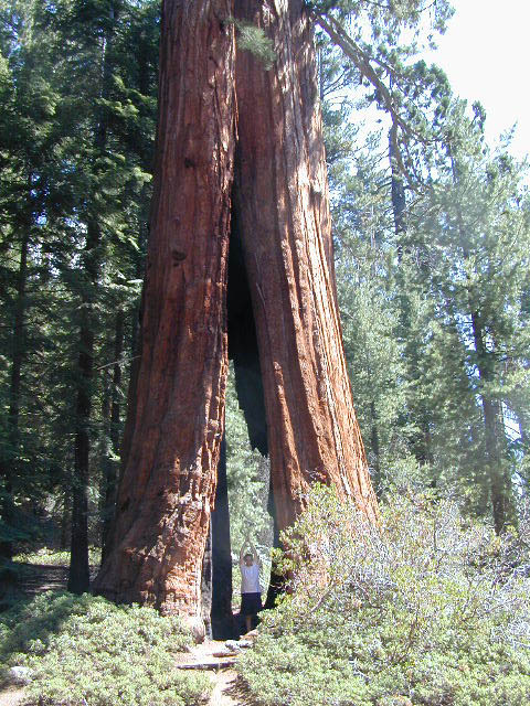
The Western Divide Highway, at 6000 feet elevation, connects the Kern River Valley w/ granite peaks, dome rock, aspen groves & the Giant Sequoia trees! This is one of the southernmost Sequoia groves in the Sierra Nevada mountains. The easy hike is more of a nature trail, wheel chair accessible & approximately 1 mile long. Large Sequoia trees, picnic grounds, near campground.

SEPT 2021: Closed due to the Windy Fire

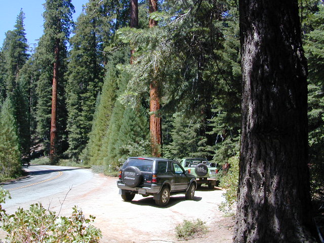
On busy weekends and holidays the rangers charge a “day use” parking fee, for those wishing to park in the paved parking lots. Avoid this fee by finding additional parking along the highway. Only a few good free parking spots along this busy 3 mile stretch of highway, and don’t forget to park all the way off the pavement.

SOUTHERN SIERRA: Great destination for camping families & sightseers traveling through the Southern Sierra Nevada mountains.

Western Divide Campgrounds

The USDA National Forest Campground across the road from the Trail of One Hundred Giants is called Redwood Meadow Campground. There is also a separate parking lot for the picnic grounds w/ a similar name.

Also nearby is Long Meadow, Long Meadow Group Camp, Peppermint Campground, Holey Meadow Group Camp and past Ponderosa. Quaking Aspen Campground and Quaking Aspen has a NFS Cabin Rental too.

Down near Camp Nelson, CA is the Coy Flat Campground.

Giant Sequoia National Monument has numerous dirt back roads for free, primitive, car camping. You’ll need a good topo map to find the best ones. Some roads may be muddy, overgrown or extremely rocky, depending on recent weather. Know you vehicles limitations. There is no tow truck service available way back here in the boonies.

Trail of 100 Giants Photos

All Redwood Groves in California


nearby towns –

Sequoia National Forest Map
Golden Trout Wilderness Trail Map

Hidden Groves near Ponderosa CA

Grover Hot Springs

Grover Drive

Grover Hot Springs Park

JULY 2021 State Park CLOSED due to the wildfire, Tamarack Fire.

California State Park
Sierra Hot Spring Camping Resort
open all year

California State Park RV Winter Camping State Park Winter Camping Hot Springs XC Ski Winter Camping Tahoe Ski Camping Tahoe Snow Camping

Meadow Entrance

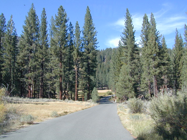
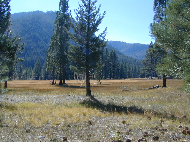
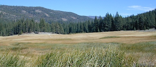
South of Lake Tahoe, hidden in a forest meadow near the small town of Markleeville, sits this super scenic, year-round camping resort in the Sierra Nevada mountains. Popular place for senior travelers, RV campers, families, snow skiers, and tourists.

No lodging available, no cabins. Only Campground Camping – Reservations are recommended. This is a popular destination for the Eastern Sierra Tahoe region. May thru September are peak season. During mid-winter a portion of the campsites are closed and the remainder may be on a first come, first serve basis. State Park is located 4 miles west of Markleeville, at the end of Hot Springs Road.

camping
fishing
hiking
hot springs
cross country skiing
stargazing

RV Camping

grover springs in the sierra

Camping and Day Use
530-694-2248

Pool Information
530-694-2249

California State Park

Piped water, flush toilets, showers, this is luxury camping by State Park standards. Hiking, fishing, stargazing. Quite an ideal spot, especially if you visit during a slow time. Surrounded by mountains that top 10,000′ elevation, expect to see some snow in the winter months.

SwimSuits Required

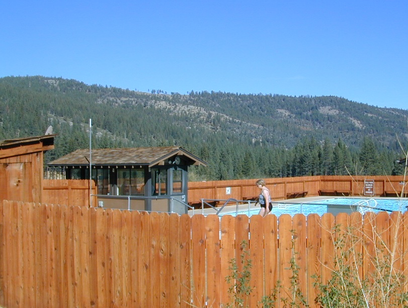
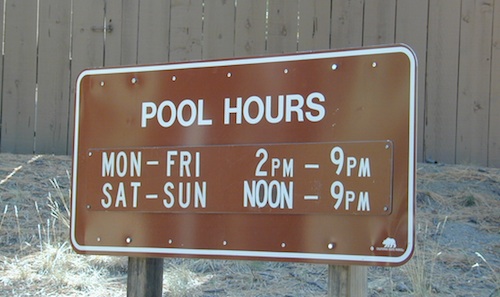
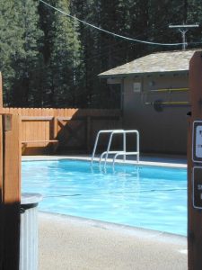
The hot pool resort is open to the public for day soaking w/ a fee. Wheelchair accessible areas. The pool hours tend to fluctuate with the seasons, so be prepared for anything. Even a snow storm!

Grover Hot Spring Campground

• Elevation: 5800′
• Number of Sites: 75
• Vehicle Access: RV 27′ max
• Campsites Reservation: Yes
• Camp Fee: Yes
• Length of Stay: 10 Days
• Season: Open all year
• Trailheads: Carson River

GROVER HOT SPRINGS SP Winter Camping Hot Springs

pool hours

hot pools

meadow views

Oak Bottom Campground

Oakbottom Campground

Whiskeytown Recreation Area:
Oak Bottom Campground

Carr Fire 2018: some portions of this lake, shore, roads and trails may be closed due to the recent wildfire

The large, level, paved campground is right on the north shore of Whiskeytown Lake, on Hwy 299 – E of Redding CA

hiker

101 walk-in campsites
22 RV sites
elevation 1200′

  • boating
  • camping
  • hiking trails
  • kayaking
  • marina
  • mountain biking trails

Campground Reservation on NRA

Camp Sites near Water

Group Camping can be reserved at
Whiskey Creek Group Picnic Area
3 group camping sites with excellent views of the lake and mountains, on the northeastern shore of Whiskeytown Lake.

nearby towns:

Views Westward

canoe

Lake Sunset Whiskeytown

And by golly, there is another

OAK BOTTOM CAMP in Northern California,
way over west near Marble Mountain Wilderness

camp

Salmon River @ Somes Bar:
Oak Bottom Campground NFS

elevation 700′
26 sites
No electricity, water or sewer hookups

Six Rivers National Forest – Oak Bottom Campground loops around a forested hillside with large trees providing ample shading for multiple sites within the campground. A variety of wildlife makes its home in the area.

Located off the main highway, on a side road, with the epic Salmon River! This NFS campground is popular with whitewater enthusiasts in the spring. Rafters, kayakers. Many challenging rapids ranging from Class 3 to 5 are available. Swimming is also popular in the summer and numerous river access areas are a short drive or walk from the campground.

Central Valley Reservoirs

California’s Central Valley Recreational Lakes & Reservoirs

boatingcampingRV campshiking fishing

(listed from north to south)

North State / North Valley / North Sacramento Valleyboatramp

Black Butte Reservoir
Stony Gorge Reservoir
East Park Reservoir
Lake Berryessa
Lake Oroville SRA
Thermalito Afterbay
Thermalito Forebay
New Bullards Bar
Collins Lake

Sunset at the Lake
fishOak foothills of the Historic Gold Country, at the edge of the Sierra Nevada mountains.

  • boating
  • canoe
  • camping
  • fishing
  • hiking
  • houseboats
  • kayaking
  • wildflowers

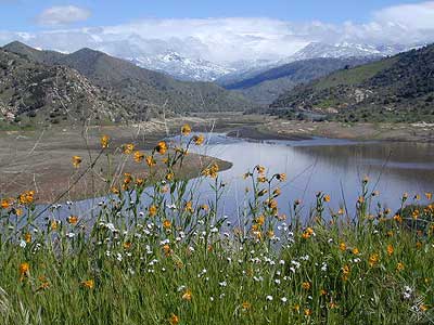
Most Central Valley Reservoirs have blooming wildflowers in early springtime. Summer heat can measure triple digits for months as most of these lakes are located below 1000′ elevation.

Central Sacramento & California Delta

Trimmer Boat Ramp
Trimmer Boat Ramp @ Pine Flat

Central Valley / San Joaquin Valley

Lake Amador
Lake Camanche
Pardee Reservoir
New Hogan Lake
New Melones Lake
Woodward Reservoir
Salt Spring Valley Reservoir
Lake Tulloch
Don Pedro Lake
Turlock Lake SRA
Modesto Reservoir
Lake McClure
San Luis Reservoir SRA
Eastman Lake
Hensley Lake
Woodward Reservoir
Millerton Lake SRA
Redinger Lake
Pine Flat Reservoir
Lake Kaweah
Lake Success
Buena Vista Reservoir

Walk-In Camp Site at Lake
Walk-In Camp Site at New Melones Lake, Gold Co

Kaweah Sequoia Sierra
Lake Kaweah, near Mineral King & Southern Sequoia NP

San Diego Camping

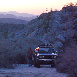
Anza Backroads

Cleveland National Forest Camping – San Diego Campgrounds – Desert Camping Anza Borrego – SD County Campgrounds – BLM Campgrounds – San Diego Beach Camping – San Diego Mountains

campground elev spots veg toilet water notes
Bobcat Meadow 3800′ 16 oaks vault no no RVs
Burnt Rancheria 5000′ 100+ pines vault piped Sunrise Hwy
Cibbets Flats 4200′ 23 oaks vault piped Interstate 8
Corral Canyon 3500′ 20 oaks vault piped OHV near I-8
Dripping Springs 1800′ 26 oaks vault piped Hwy 79, E Temecula
El Cariso North 2600′ 24 oaks vault piped small RV
Fry Creek Campground 4900′ 20 oaks vault piped Palomar Mountain
Indian Flats Campground 3600′ 17 oaks vault piped off Hwy 79
Laguna Mountain 5500′ 75 pines vault piped Sunrise Hwy
Palomar SP Campground 7000′ 13 pines vault piped Palomar Mountain

Anza Camping

Anza Borrego Desert Camping & Campgrounds

Desert Mountain Biking Open Camping Stargazing Hiking

San Diego County Campgrounds

Sweetwater Reservoir, Otay Lakes, Agua Caliente, Vallecito
Camping Reservations 877-565-3600 or 858-565-3600

Camping

Bureau of Land Management

San Diego BLM Camping

Lark Canyon, Cottonwood @ McCain Valley near Interstate 8
El Centro Desert OHV, Hot Springs, Colorado River

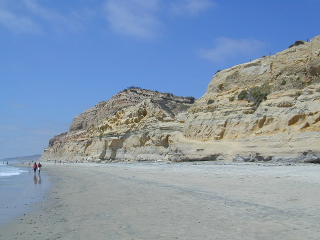
Coastal Cliffs San Diego

San Diego Beach Camping

Coastal Towns with Camping near San Diego –

Chula Vista
Coronado
San Diego
Mission Beach & Bay
Del Mar
Cardiff
Carlsbad
Oceanside

Indian Flats Campground

Indian Flats Campground is located on a dirt road off Hwy 79, near Warner Springs CA. Boulder ridges & manzanita surround this oak filled secluded canyon. Small seasonal creek & waterfall is a short walk from campsite.

Los Coyotes Campground is a tribal camp, located on Hot Spring Mountain in North San Diego County. High desert chaparral, oak groves and boulders.

Free Camping
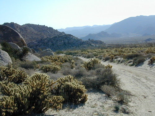
Anza Borrego Desert by far has the best free camping options available near San Diego.

Maps Mountains / Desert Topo / San Diego Area Maps

Ventura Beach Camping

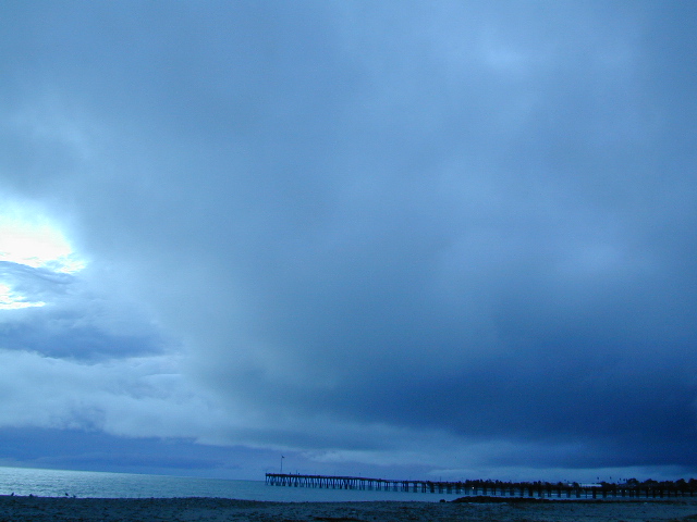
Ventura Campgrounds

DSCN0825

Ventura County Park Campgrounds

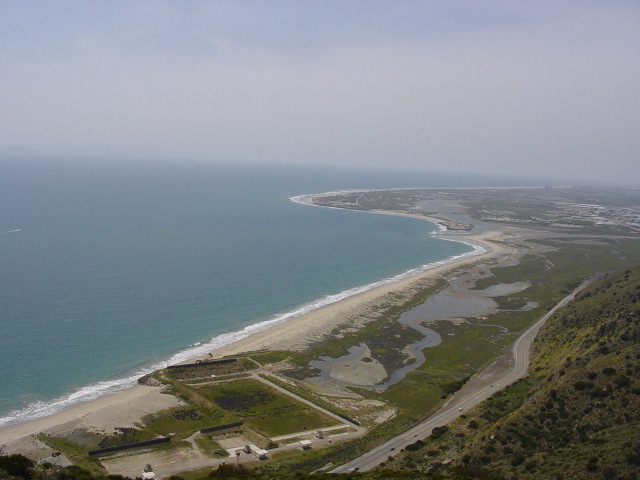
on US Hwy 101 Seacliff / Mussel Shoals stretch of beach

Ventura City Campground RV Parks

blue links lead to State Park pages with camp reservations.

State Park

Ventura State Beach Campgrounds

Ventura County coastal towns

DSCN0810
Beach city w/ nice downtown, north of Los Angeles, CA


canoe

Ventura Lake Parks
located inland from coast

see also – Ojai Camping, Santa Barbara Beach Camping and Santa Barbara Mountains Camping

porthuen_hike_3

Lassen Lakes

Lassen Lakes in California

Lassen Volcanic Park is surrounded by beautiful mountains and lakes, some inside the National Park boundary, but most outside. Lassen National Forest, Thousand Lakes Wilderness, Lake Almanor, Hat Creek and Burney Falls encompass this pristine water wonderland of NorCal. Outdoor recreation all over – rivers, fish, hunt, camp, mountain bike, off road.

LAVA TUBE: Subway cave

Backpack camps, RV campground, fishing lakes, day hikes, off-road and lake side camp sites, we have it all listed on Total Escape.

Hiking, camping, fishing all over this region! Mountain bike, kayak, or relax all day in the hammock – in a shady spot with a view. Water flows freely and annual snow melt is abundant in this part of California. Some locales may not open until July 4th weekend. Always check with the Lassen NFS rangers to make sure.

^ lakes with campgrounds

‘ feet in elevation, above sea level

Lakes inside Lassen National Park:

(lakes located on Lassen Hwy 89)

Lake Helen

Summit Lake ^
Summit Lake Campgrounds – Summit Lake North & Summit Lake South & Horse Corral Camp

shotoverinlake

Manzanita Lake ^ 5847′
Manzanita Lake Camping – Manzanita Lake Campground

(lakes via dirt backroads)

Juniper Lake NPS Lassen ^ 6792′
Juniper Lake Campgrounds –
Juniper Lake Campground & Juniper Lake Group Site & Horse Corral Camp

Butte Lake ^ 6043′
Butte Lake Campgrounds –
Butte Lake Campground & Butte Lake Group Camp & Horse Corral Camp

(lakes on the trail)
Crumberg Lake
Twin Lakes
Jakey Lake
Snag Lake 6076′
Horseshoe Lake
Willow Creek
Long Lake


Lassen National Forest lakes: fishing lakes

Majority of these lakes require dirt road driving to reach them. Often forest roads close for snow, usually during winter months (DEC-MAY)

Wilson Lake 5267′
Crater Lake ^ 6800′
Echo Lake
Widow Lake
Star Lake 6362′
Rising River Lake
Baum Lake
Murken Lake
Haynes Reservoir
Heart Lakefishing lakes
Willow Lake
Shotoverin Lake

killercamp_echo
Killer Camp @ Echo Lake

lassen camps

Caribou Wilderness:

Campsites with hiking lakes and wilderness trailhead access, right next to Lassen Volcanic National Park.

Echo Lake ^
Caribou Lake ^
Silver Lake ^ – Silver @ Lassen
Triangle Lake

LassenAtlas
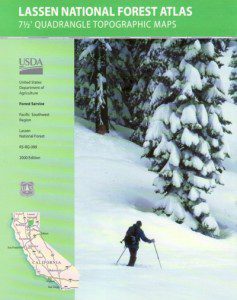
Find Lassen Maps, NFS Topo Atlas

Thousand Lake Wilderness:

North of Mount Lassen is the less-popular Wilderness Area w/ many miles of dirt roads to travel.

North Battle Creek Lake ^ 5571′
Logan Lake
Buckhorn Lake 4776′
Lake Eiler
Terry Lake


NorCal Recreation Lakes nearby:

Lake Britton @ Burney Falls ^ 2732′
Eagle Lake ^ 5100′
Butt Valley Reservoir ^ 4142′
Lake Almanor ^ 4500′

Lone Tree @ Eagle Lake

Northern California towns nearby:

BURNEY
FALL RIVER MILLS
HAT CREEK
OLD STATION
SUSANVILLE
WESTWOOD
CHESTER
MINERAL
MILL CREEK


Stanislaus Campgrounds

Stanislaus Camping / Sonora Pass Camping

dardanelleNFS
NFS Dardanelle Campground along Sonora Pass Highway

camp

Sierra Nevada  Campgrounds inside the Stanislaus National Forest

Hwy 4, Stanislaus National Forest Camping

campground elev spots veg toilet water notes
Big Meadow Campground 6200′ 30 pines flush piped Hi Sierra; no RV hookups
Bloomfield Campground 7800′ 20 pines vault pump Mokelumne River fishing
Board’s Crossing Camp 3800′ 5 pines vault creek Stanislaus River fishing
Hermit Valley Campground 7100′ 8 pines vault creek June-Oct
Lake Alpine Campground 7300′ 25 pines flush piped June-Oct
Mosquito Lakes Camp 8260′ 8 pines vault lake Sierra river fishing
Pacific Valley Campground 7600′ 9 pines vault no meadow, June-Oct
Sand Flat Campground 5900′ 6 pines vault creek 4WD camp, June-Oct
Silvertip Campground 7300′ 23 pines flush piped June-Oct
Silver Valley Campground 7400′ 21 pines flush piped June-Oct
Stanislaus River Campground 6200′ 25 pines vault pump Sierra river fishing

Hwy 120, Groveland Yosemite Camping

campground elev spots veg toilet water notes
Lost Claim Campground 3100′ 10 pines vault pump May-Sep
Lumsden Campground 1500′ 11 mixed vault creek Tuolumne River fishing
Lumsden Bridge Camp 1500′ 9 mixed vault creek Tuolumne River fishing
South Fork Campground 1500′ 8 vault creek Tuolumne River fishing

Hwy 108, Sonora Pass Camping Stanislaus

campground elev spots veg toilet water notes
Crandall OHV Camp 5000′ disp no no May-Oct
Dardanelle RV Park & Cabins 5700′ park pines flush piped 209-965-4355
Boulder Flat Campground 5600′ 20 pines vault piped Stanislaus River
Cascade Creek Campground 6000′ 12 pines vault creek May-Oct
Deadman Campground 6200′ 17 pines vault piped Stanislaus River fishing
Herring Creek Campground 7350′ 7 pines pit creek May-Oct
Mill Creek Campground 6200′ 19 pines vault creek May-Oct
Niagara Creek Campground 6600′ 10 pines vault creek May-Oct
Niagara Creek OHV Camp 6600′ 10 pines vault creek 4×4 camps, May-Oct
Sand Bar Flat Campground 3000′ 10 pines vault piped Stanislaus River fishing
Trout Creek Campground 5400′ disp. chem creek equestrian, May-Oct

GOLD COUNTRY CALIFORNIA Hwy 49

pinetree

see also
Calaveras Big Trees State Park

Calaveras Big Trees

butterfly

nearby towns –

hiker

maps of this Sierra Nevada region –

Campground San Bernardino

whitecliffs

Big Bear – San Bernardino National Forest Camping & Campgrounds

areas include:
Big Bear Lake, Fawnskin, San Gorgonio, Lake Arrowhead, Forest Falls, Green Valley Lake & Idyllwild

Listed below are all the San Bernardino National Forest campgrounds, public lands for outdoor recreation. SoCal campground reservations can be booked online with the linked campsites below.

Big Bear Campgrounds near Big Bear Lake & Fawnskin area

campground elev spots veg toilet water notes
Applewhite Campground 6800′ 42 pines vault piped disabled access, RV 30′
Barton Flats Campground 6300′ 52 pines vault shwrs disabled access, RV 45′
Big Pine Flats Horse Camp 6800′ 17 pines vault piped Way back 3N14, year round
Cold Brook Campground 7000′ 36 pines vault piped RV max 25′
Crab Flats Campground 6200′ 29 pines vault piped 3N16, Green Valley Lk
Dogwood Campground 7000′ 90 pines vault piped disabled access, RV 22′
Green Valley Campground 7000′ 37 pines vault piped Green Valley Lake
Hanna Flat Campground 7000′ 88 pines vault RV max 25′
Heart Bar Campground 6900′ 94 pines vault seasonal Hwy 38, equestrian
Holcomb Valley Campgr 7400′ 19 pines vault no Rd 3N16, year round
Horse Springs Campgr 5800′ 17 pines vault no Rd 3N17, year round
North Shore Arrowhead 5100′ 27 vault piped disabled access
Pineknot Campground 6400′ 48 vault piped disabled access, RV 45′
San Gorgonio Campground 7000′ 54 pines vault shwrs Hwy 38, disabled, RV 43′
South Fork Campground 6400′ 24 pines vault piped Hwy 38, RV max 30′

site12

San Jacinto Campgrounds near Idyllwild area

campground elev spots veg toilet water notes
Black Mountain Group 6000′ 16 pines pit piped group site
Boulder Basin Campground 7300′ 34 pines pit piped CLOSED
Dark Canyon 5800′ 22 pines pit piped CLOSED
Fern Basin Campground 6000′ 22 pines vault piped Rd# 4S02
Marion Mountain Campground 6400′ 24 pines vault piped Rd# 4S02
Pinyon Flat Campground 4000′ 18 pinyon vault piped bighorn sheep, year round
Santa Rosa Springs Camp 7000′ 3 pines pit no no RVs, Toro Peak
Thomas Mountain Camp 6800′ 6 mixed vault no no RVs, Rd 6S13; Lk Hemet
Tool Box Spring Campground 6500′ 6 mixed vault piped no RVs, above Lake Hemet
Toro Campground 7800′ 5 pines pit no Santa Rosa Wilderness

Southern California Camping see also –

Topo maps, wilderness hiking maps, Equestrian trails, OHV maps –

SoCal mountain communities include:

Big Bear Campsites

Heart Bar Campground

Heartbar

San Bernardino National Forest: Heart Bar Campground
National Forest Service

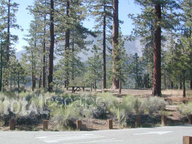
At Hwy 38 & Forest Road #1N02 is a huge, pine forested valley, right next to San Gorgonio Wilderness. Heartbar Campground, Heart Bar Horse Camps, RV Dispersed Sites. Highway 38 – SE of Big Bear Lake, California; Mountain Bike, Hiking & Equestrian Trails with ridges of 10,000′ elevation. SAN GORGONIO peak nearby. Best high elevation scenery for SoCal by far.

  • backpacking
  • camping
  • fishing
  • hiking
  • mountain biking
  • mountain peaks
  • waterfalls
yellows
Primitive Camps on the Back Road #1N02

Heart Bar Campground

Big Bear Forest –  HEART BAR

This gorgeous valley is a developed recreation area w/ 89 camp sites, plus big equestrian area. Picnic, hiking, mountain biking, horseback trails, plenty RV spots, even a creek. (Oooops I meant the Santa Ana River) Highway 38 is kinda the long way into Big Bear Lake, up thru Angelus Oaks. Locals call this stretch of the highway Barton Flats.

spot79

horse camp
Bring the Horses & RVs

Group Campground facilities
Barton Flats – San Gorgonio Recreation Area

out back

Leading out the back way of HeartBar, past the horse camp – is a nice one lane dirt road, narrow in spots, with random, primitive camp sites along the roadway. Authorities refer to these spots as yellow post camp sites.

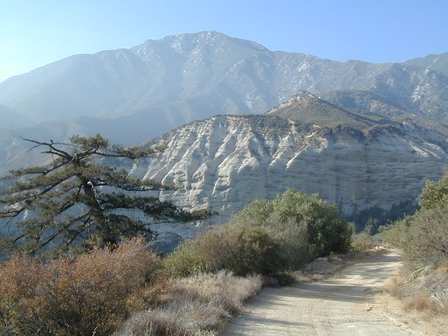
This backcountry route is marked as Forest Service Rd #1N02 – graded dirt road that leads back to Coon Creek Cabin.

Coon Cabin
Coon Cabin Backside

Big Bear Discovery Center
at Big Bear Lake
909-382-2790

ranger

Southern California forest 

San Bernardino maps:

nearby mountain communities:

ForestFalls
Forest Falls, late afternoon

Forest Falls is well worth a stop for a quick picnic or hike – and head dunk. Weekends can be busy and crowded. Since this location is close to Southern California and the population centers, expect weekends to be busy in the Big Bear mountains. Plan a trip for week days to experience less people, and more nature.


Group Campgrounds Eastern Sierra

agnewmdws

Group Campgrounds in the Inyo National Forest camping

These group camping facilities are available by advanced reservation only; open for summer and usually closed during winter months .

campground elev spots veg toilet water notes
Agnew Meadow Horse Camp 8400′ 4 pines chem piped Group & Equestrian
Mammoth
Aspen Group 8100′ 4 aspen flush piped Rock Creek
Big Pine Canyon Group 7600′ 1 pines vault piped W of Big Pine; May-Oct
Bishop Park Group 7500′ 21 oaks flush piped Group Camping; May-Oct
Fossil Group Camp 7220′ 11 pines vault no Hwy 168; E of Big Pine
Juniper Group Camp 7000′ 5 juniper vault piped Hwy 168; E of Big Pine
Obsidian Flat Group 6000′ 50 pines vault no Group Camp Mammoth
Pumice Flat Group 7700′ 17 pines flush piped June-Sept; Mammoth
Rock Creek Lake Group 7600′ 1 aspen flush piped Group Camping; May-Oct

RESERVATIONS REQUIRED

Call ranger station to reserve.
Inyo National Forest
351 Pacu Lane #200
Bishop, CA 93514
760-873-2400

see developed tent & RV Campgrounds – Inyo National Forest

rockcreekcliffs

Obsidian near Hwy 395 & Mammoth
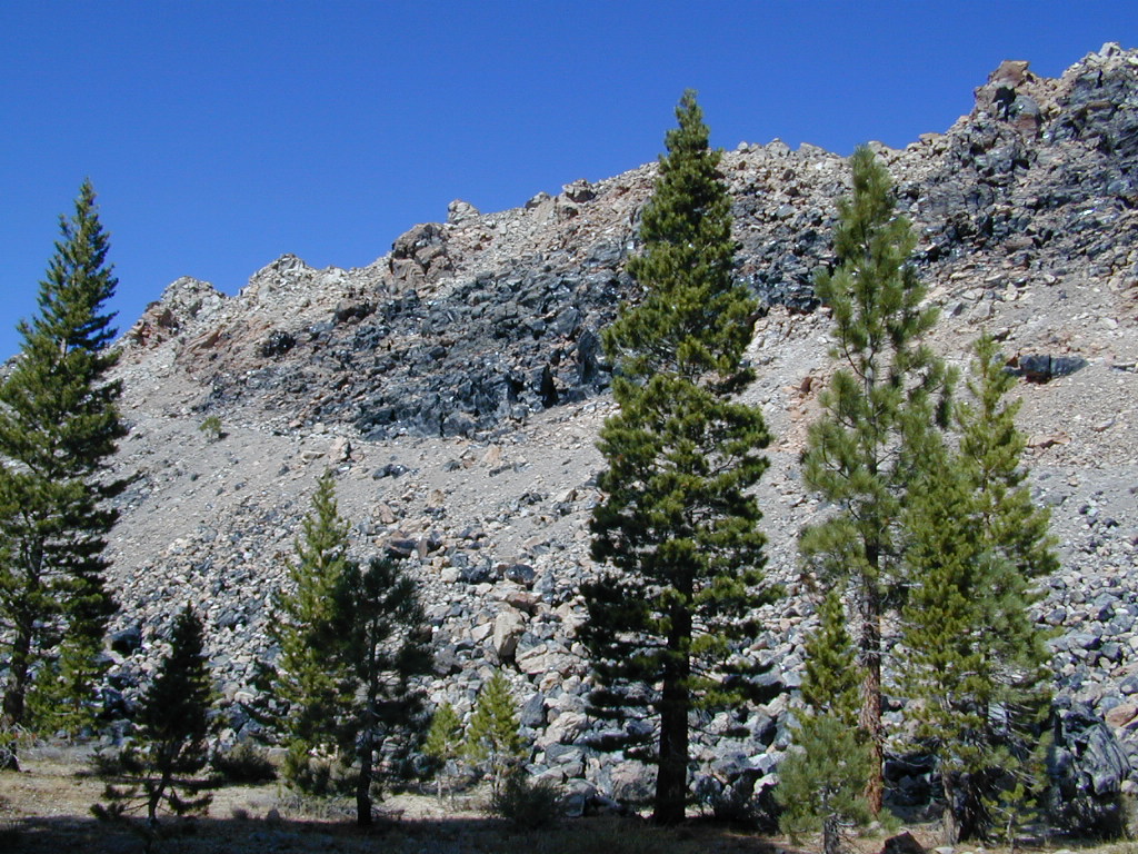
Eastern Sierra Obsidian Dome – near US Hwy 395 & Mammoth Lakes, CA

Eastern Sierra maps –

Topo maps, wilderness hiking maps, fishing maps
Equestrian trails, 4×4 routes, OHV maps –

lake mary

southforkbishop

Bishop Creek near Aspendell, CA

Santa Barbara Camping

Campground Santa Barbara – Lake Cachuma
Los Padres / Santa Barbara District:

campground elev spots veg toilet water notes
Cachuma Campground 2100′ 8 mixed vault creek year round creek
Fremont Campground 1000′ 14 oaks flush piped March-Sept
Lower Caliente Camp 1800′ 2 oaks vault no hot springs
Middle Santa Ynez 1500′ 9 trees vault creek shady
Mono Campground 1400′ 4 trees vault creek shady, 3 walk-in
Paradise Campground 1000′ 13 oaks flush piped reservations
P-Bar Campground 1500′ 4 vault creek water can close
Upper Oso Campground 1200′ 23 oaks flush piped corrals, OHV traffic

Some of these camps above may have been damaged in recent wildfires, so it’s best to inquire before you make the drive. Call rangers to verify or have a backup alternative (plan B). See more campsites @ Santa Barbara Beach Camping

Los Padres Forest Headquarters
Goleta CA
805/968-6640

Santa Barbara District
Santa Barbara CA
805/967-3481

San Lucia District
Santa Maria CA
805/925-9538

NFSlogo

Los Padres National Forest

maps of the Los Padres region –

dscn5027
Upper Oso Campground in oak hills behind Lake Cachuma w / horse corrals

Mount Pinos

Mt. Pinos

Sierra Views from Pinos
Originally uploaded by danamight

Mount Pinos Recreation Area

The Mt Pinos Recreation Area is located on the border of Southern and Central California, inside Los Padres National Forest. After passing Frazier Park, the winding, paved, mountain road starts atop Cuddy Valley and is approximately 12 miles from Interstate 5 @ Tejon Pass. The 8831′ peak is the tallest in Kern County and is a popular spot for both summer and winter recreation: cross country skiing, snow shoeing, backpacking, hiking, mountain biking. The snow gates often close during heavy snow.

Mount Pinos Road starts atop Cuddy Valley Rd, at the “Y” – where it intersects with Mil Potrero Highway, which heads out to Pine Mountain Club, California.

One mile up the Mount Pinos route, you will find McGill trailhead on the right side (it is popular w/ mountain bikers) and then the first snow gate at Burbank Rd. Another 4 miles up hill, you come to the only set of dirt roads accessible on this range. A left turn will take you winding thru pine forest to the valley below. 4×4 is not required, but a National Forest map could be very handy. Unfortunately all the private properties at the bottom have locked gates & no thru access to Cuddy Valley is allowed. Although it is an awesome drive to just go exploring in the woods, there is no way out (once you get down the hill), so you must return the same way you came.

Back on the main route, shortly after the dirt roads is McGill Campground on the right side & another snow gate. In another mile and a half you will reach Mt Pinos Campground on the left side; the entrance is easy to miss. From here you are less than 2 miles from the end of the main road.

Mountain Bike, Hike, Backpack, Camp, XC Ski, Snow Sled

Darkest Skies for Stargazing in Southern California

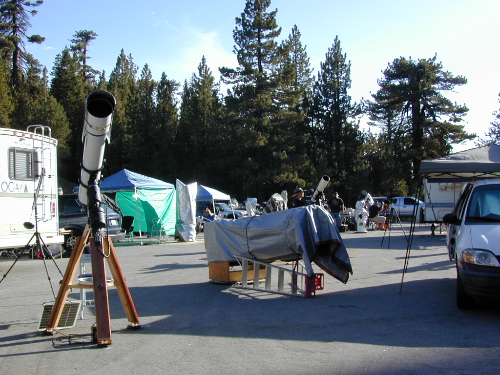
The huge paved parking lot is the dead end (2 miles from the peak of Pinos) – very popular with astronomers, mountain bikers, plus the families and snow sledders in winter (if the gates are open). A National Ski Patrol’s Nordic Base, the only building you will see up this way. At 8300′ elevation, the large parking area is perfect overnight spot for amateur astronomers, so be considerate when visiting night. New moon (no moon) weekends APR-OCT are optimal viewing months. In busy summer months you can often find motorhome campers all set up with expensive equipment tracking the heavens all night long. Please be respectful of their hobby & eyes; Turn off headlights when you approach the parking area at night.

hiker

There is also a hike-in, freebie camp ground called Chula Vista; an easy quarter mile walk from the parking lot to 12 camp sites & a pit toilet. Mountain bikes dig this area too. A large meadow here blooms with wild irises in summer, only sometimes.


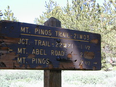
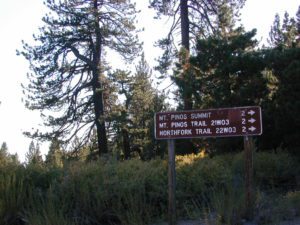
Trail 21W03 Mt Pinos

Originally uploaded by danamight

ROAD CONDITIONS to Mount Pinos, call the rangers 661-245-3731

Pinos – Peak to Peak Hike

The trailhead for Pinos Summit starts at this parking lot. It is a 2 mile moderate, but steep hike on an old fire road. The neighboring peak to the west is called Mount Abel @ 8286′ elevation (aka Cerro Noroeste). The infamous peak to peak hike along the ridge line from Mt Pinos to Mt Abel is 6.5 miles one way – and very popular in summer months. This hike requires 4-6 hours & a car shuttle should be arranged in advance. The Chumash Wilderness sits between Mount Pinos and the tiny community of Pine Mountain, which can be seen below on many places along the hike.

camp

There are 3 developed campgrounds in the Mount Pinos Recreation Area:

McGill Campground accepts reservations online. Campgrounds are often closed during winter months, due to snow. (Oct-April)

DARK NIGHT SKIES: Amateur Astronomers unite!

thebigboys
Pinos star gazers out in force
summitsign
Hiking Trails to Mount Pinos, California


drummersout
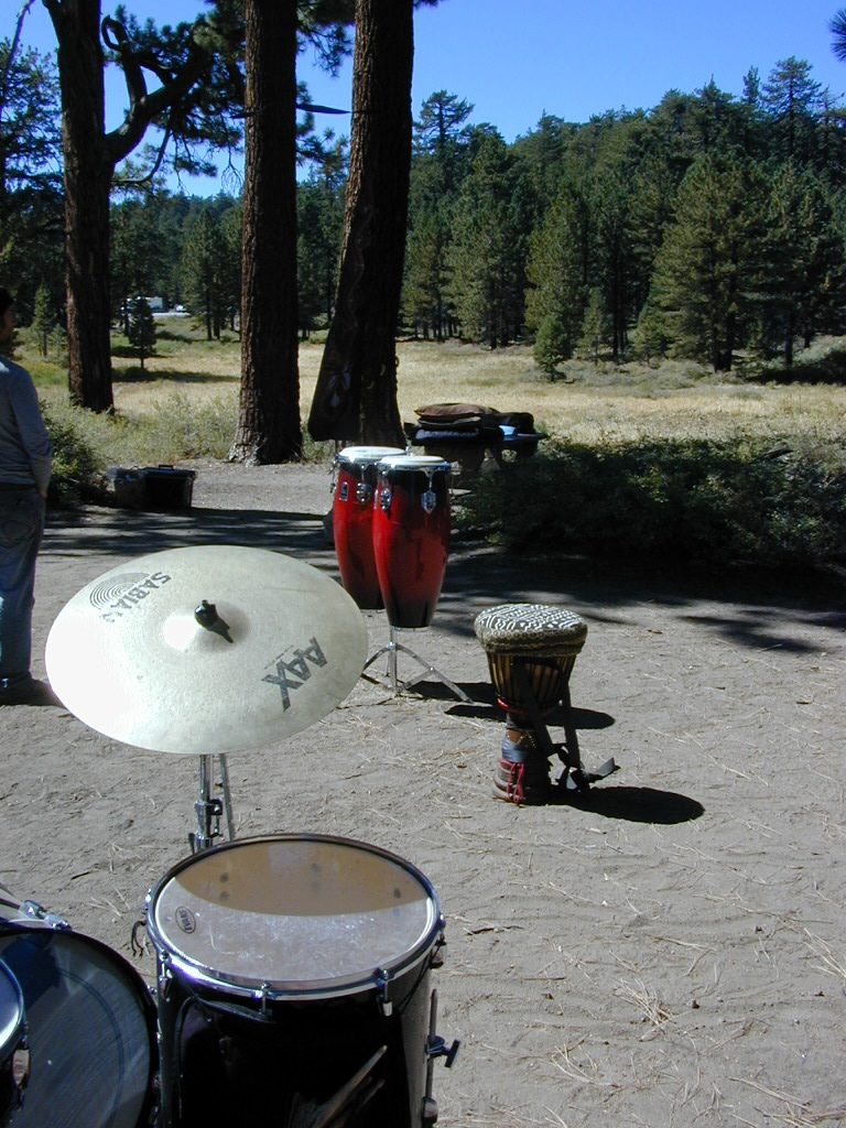
Drummers Solstice Campout

flagspinos

LOS PADRES MAPS:

Los Padres National Forest Map

Los Padres Forest Topo Atlas

NatGeo Los Padres East Map 

Sespe Wilderness Trail Map

Dick Smith Wilderness Map

NEAREST TOWNS:

Chumash Wilderness
Mt Abel trailhead looking East to the Mount Pinos range. Pine Mountain Club, and the Sierra Nevada mountains can both be seen from this vantage point

see the neighboring mountain peak, Mount Abel

Camp O Alto @ Cerro Noroeste

Tahoe Camping

Lake Tahoe Campgrounds

tahoe camping

Lake Tahoe California
campOne of the most popular Sierra destinations – be it summer or winter, Tahoe sure is crowded these days.

Below are all the developed campgrounds surrounding beautiful Lake Tahoe, CA. Most of these are located near the lake or, on the Truckee River. Most accept campground reservations in advance. blue links lead to camp info

campground elev spots veg toilet water notes
Bayview Campground 6000′ 10 pines vault Emerald Bay, SLT
Camp Richardson Tahoe 6500′ 330 pines flush piped South Lake Tahoe
Campground by the Lake 6000′ 157 pines flush piped South Lake Tahoe
D.L. Bliss State Park 6000′ 168 pines flush piped Westshore, Lake Tahoe
Eagle Point Tahoe 6100′ 100 pines flush piped California State Park
Emerald Bay State Park 6000′ 16 pines flush piped South Lake Tahoe CA
Fallen Leaf Lake Campground 6737′ 205 pines flush piped South Lake Tahoe CA
General Creek Campground 6000′ 175 pines flush piped Westshore, Lake Tahoe
Kaspian Campground 5800′ 20 pines flush piped Westshore, Homewood CA
Lake Forest Campground 6300′ 21 pines flush piped Northshore, Tahoe Vista CA
Meeks Bay Campground 6000′ 17 pines flush piped Westshore, Tahoma CA
Mount Rose Campground 8500′ 24 pines flush piped in Nevada @ Tahoe
Nevada Beach Campground 6200′ 54 pines flush piped Nevada Lake Tahoe
Pope Beach Campground 6000′ 49 pines flush piped South Lake Tahoe CA
Sandy Beach Campground 6300′ 44 pines flush piped Northshore, Tahoe Vista CA
Silver Creek Campground 5800′ 26 pines vault piped Truckee River fishing
Sugar Pine Point SP 6200′ 30 pines flush piped Westshore, Tahoma CA
Tahoe Pines Campground 6000′ 49 pines flush piped Meyers California
Tahoe Valley RV Campground 6000′ 413 pines flush piped South Lake Tahoe CA
Tahoe Campground SRA 6200′ 16 pines flush piped West shore, Tahoe City
William Kent Campground 6300′ 95 pines flush piped Westshore, Tahoe City
Zephyr Cove Campground 6200′ 170 pines flush piped boat rentals Tahoe NV

All Tahoe Campgrounds charge a fee; Many require advanced reservations. Nightly rates vary per park. Most campgrounds are closed during the winter due to snow. Check with the ranger districts listed here.

camp RV camps NFS hikes fishing mountain biking camps river fishing

bowmanbig
Bowman Lake

Tahoe Forest

NFSlogoTahoe National Forest encompasses a larger region of the Sierra Nevada mountains surrounding the north portion of Lake Tahoe. American River, Yuba River, Northern Gold Country; Plus many small lakes with excellent forests, including Lakes Basin Recreation Area.

Blue Lakes has several campgrounds, south of South Lake Tahoe.

Grover Hot Springs State Park is also beyond SLT, near Markleeville.

Below are Tahoe Campgrounds located away from the Lake Tahoe Basin; Most small camps are on a first come, first serve basis. blue links lead to camp info.


campground elev. spots veg toilet water notes
Ahart Campground 5300′ 12 pines vault American River
Alpine Meadows 5900′ 25 pines vault Martis Creek
Bear Valley Campground 6600 10 pines vault piped OHV trails, Sierraville
Berger Campground 5900 7 pines vault lake Packer Lake, fishing
Big Reservoir Campground 4000 18 pines vault piped non motor lake, Foresthill
Boca Campground 5605′ 26 pines vault boat launch
Boca Rest Campground 5605′ 25 pines vault piped on Boca Reservoir
Boca Spring Campground 5800′ 17 pines vault piped horses
Bowman Lake 5585 7 pines vault lake Donner area
Boyington Mill Campground 5680′ 12 pines vault Boca Reservoir
Cal-Ida Campground 2000′ 21 pines vault piped Yuba River, Downieville
Canyon Creek Campground 6000′ 20 pines vault creek Donner area
Carlton Flat Campground 2200′ 21 pines vault piped Yuba River, Downieville
Carr Lake Campground 5900′ 5 pines vault lake Carr Feeley Lake
Chapman Creek Campground 6000′ 29 pines vault piped Yuba River
Chute Hill Campground 3400′ 30 pines flush piped Malakoff Diggins SP
Cold Creek Campground 5800′ 13 pines vault piped Sierraville
Cottonwood Campground 5600′ 24 pines vault piped Sierraville
Dark Day Campground 2200′ 16 oaks vault piped Bullards Bar Reservoir
Diablo Campground 5800′ 20 pines vault Gold Lake
Donner State Park Campground 5850′ 154 pines flush Donner Lake
East Meadow Campground 6100′ 46 pines flush piped Jackson Meadows Reservoir
Fiddle Creek Campground 2200′ 15 oaks vault piped Yuba River, Downieville
Findley Campground 6100′ 14 pines flush piped Jackson Mdws Res
Fir Top Campground 6100′ 12 pines vault flush Jackson Mdws Res
French Meadows Campground 5300′ 75 pines vault flush French Meadows Reservoir
Garden Point Campground 2000′ 19 variety vault fishing boats
Giant Gap Campground 3700′ 30 pines vault fishing boats
Goose Meadow Campground 5800′ 24 pines vault piped fish Donner
Grouse Ridge Campground 7400′ 9 pines vault Bowman Lake
Hampshire Rocks Campground 5800′ 31 pines vault piped fishing I-80
Independence Lake Campground 6900′ 20 pines vault piped fishing, Sagehen Forest
Indian Springs Campground 5600′ 35 pines vault piped fishing I-80
Indian Valley Campground 2200′ 17 pines vault piped Yuba River, Downieville
Jackson Creek Campground 5600′ 14 pines vault creek
Jackson Point Campground 6100′ 8 vault boat access Jackson Mdws Res
Lakeside Campground 5700′ 41 vault boat ramp Prosser Reservoir
Lake Spaulding Campground 5000′ 24 vault boat ramp PG&E Campground
Laiser Meadow Horse Camping 6200′ 11 vault piped High Sierra PCT access
Lewis Campground 5300′ 40 pines flush piped French Meadows Reservoir
Lindsey Lake Campground 5900′ 7 vault lake
Lodgepole Camping 5800′ 18 vault Lake Valley Reservoir
Loganville Campground 6000′ 29 vault piped Yuba River, Sierra City
Logger Campground 6000′ 252 pines flush piped Stampede Reservoir
Long Ravine Campground 2300′ 28 pines flush piped Rollins Reservoir
Lower Little Truckee 6000′ 15 vault piped Truckee River fishing
Madrone Cove Campground 2000′ 11 vault Bullards Bar Reservoir
Meadow Lake Campground 7200′ 15 vault Sierra fishing camp
Meadow Lake Shoreline 7200′ 10 vault High Sierra Nevada
Mumford Bar Campground 5300′ 5 vault Foresthill Road
North Fork Campground 4400′ 17 vault piped American River
Onion Valley Campground 2300′ 5 oaks vault Sierra fishing camp
Orchard Springs Campground 2300′ 15 oaks flush piped Rollins Reservoir, Colfax
Pack Saddle Campground 6000′ 15 pines vault pump Packer Lake
Parker Flat OHV Camping 3900′ 7 pines vault off roading trails
Pass Creek Campground 6100′ 30 pines flush piped Jackson Mdws Res
Peninsula Campground 2300′ 58 pines flush piped Rollins Reservoir
Pine Aire Campground 2700′ 75 pines flush piped South Yuba River Camp
Poppy Campground 5300′ 12 pines vault French Meadows Reservoir
Prosser Campground 5800′ 29 pines vault Prosser Res.
Ramshorn Campground 2600′ 16 pines vault piped Yuba River, Downieville
River Rest Campground 2700′ 105 pines flush piped South Yuba River Camp
Robinson Flat Campground 6800′ 5 pines vault well
Rocky Rest Campground 2300′ pines vault Yuba River, Downieville
Rucker Campground 5800′ 10 pines vault Rucker Lake fishing
Sagenhen Campground 6480′ 10 pines vault
Salmon Creek Campground 5800′ 32 pines vault fishing Lakes Basin Recr
Sardine Campground 5800′ 29 pines vault Sardine Lake fishing
Schoolhouse Campground 2200′ 56 oaks flush piped Bullards Bar Reservoir
Scott’s Flat Campground 3200′ 86 oaks flush piped Scotts Flat Reservoir
Shirttail Creek Campground 3700′ 30 pines vault Sugar Pine Reservoir
Sierra Campground 5600′ 16 pines vault Yuba River, Sierra City
Silver Creek Campground 5800′ 27 pines vault Truckee River fishing
Snag Lake Campground 6000′ 12 pines vault Gold Lake California
South Yuba Campground 2700′ 16 pines vault South Yuba River Camp
Sterling Lake Campground 6500′ 6 pines vault lake
Talbot Campground 5600′ 5 pines vault American River
Union Flat Campground 3400′ 11 pines vault piped Yuba River, Downieville
Upper Little Truckee Camp 6100′ 26 pines vault Truckee River fishing
Webber Lake Campground 6800′ 60 pines vault lake Sierra fishing
White Cloud Campground 4200′ 46 pines flush piped biking, Nevada City
White Rock Lake Camp 7800′ 8 pines none High Sierra Nevada
Wild Plum Campground 4400′ 47 pines vault piped waterfalls, Sierra City
Woodcamp Campground 6100′ 20 pines flush piped
Woodchuck Campground 6300′ 8 pines vault creek
Yuba Pass Campground 6700′ 12 pines vault piped Yuba Pass, Hwy 49
Sierra Buttes
The Sierra Buttes, Lakes Basin Recreation Area (Gold Lake Highway) 

towns surrounding Lake Tahoe

towns in the Tahoe region

Tahoe Views

Little Grass Valley Reservoir

LGVR

Little Grass Valley Recreation Area
Plumas National Forest
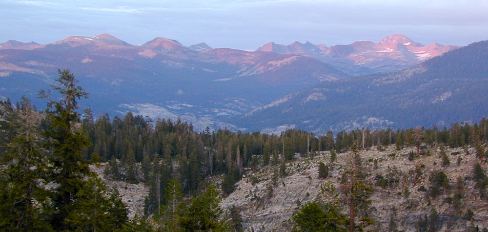
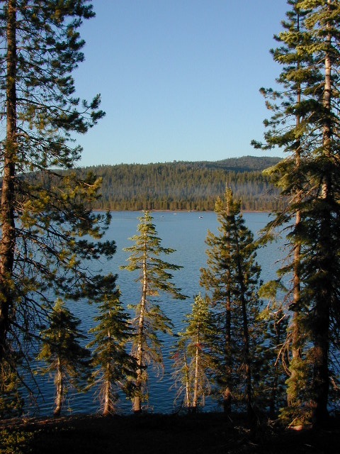
Little Grass Valley Reservoir

Tucked way up in the Northern Sierra Nevada mountains, at the top edge of the California Gold Country, is this popular recreational lake in the forest above the busy Sacramento Valley.

Up on the mountain at 5000 feet above sea level, via La Porte Road (Plumas #120), a Sierra Nevada THRU-ROAD – one which closes for winter snow. The lake destination may be open, but the campgrounds are closed up seasonally. (NOV-APRIL)

Sierra Nevada Lakes


Little Grass Valley Reservoir
Lake Statistics:


Elevation 5,100′
Surface Area 1,433 acres
Shoreline 16 miles
Capacity 93,101 acre-feet

With over 300+ camp sites available in 10 different campgrounds, Little Grass Valley has room for everyone. Reservations are recommended in summer months, although some camps are on a first-come basis.

lake destinations bike trails hiking lake Fishing dark skies picnic wildlife mountains boating equestrian lake trails


3 boat ramps
2 swim beaches
Lakeshore trail
RV Camping
Walk-in tent campsites

RV campsites campground

Camper Trailers up to 40 feet can be accommodated in some of the camping units. 2 RV dump stations are available, near Tooms Boat Launch & Red Feather. Campgrounds have piped water, but no RV hookups.

Fishing, water-skiing, kayaking, sailing, boating.

Swim beaches provide excellent swimming and picnicking opportunities. The Lakeshore Trail (13 miles) winds around the entire lake, for hiking, horseback riding, and mountain biking.

  • Horse Camp

  • Little Beaver Campground

  • Red Feather Campground

  • Sly Creek Campground

  • Strawberry Campground

  • Wyandotte Campground

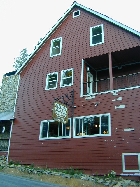
LaPorte Union
LaPorte, California – up the mountain

Sierra Nevada Lakes

TRAVEL NOTE: The nearest town isn’t much of a “town” at all – so driving to get “anywhere w/ tourist services” from here is quite a chore. Gasoline is minimal on this mountain, if any. Plan to bring everything you will need for your outdoor vacation stay, cuz driving to Quincy, or down the hill to O-ville will take more than an hour (one way). Go prepared.

Print a Lake Map [PDF download]

PLUMAS NF PAGE

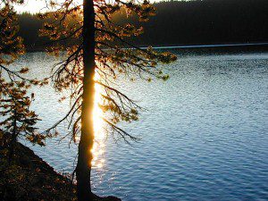
Sunsetting on Lake

Reservoir usually open from Memorial Day to October, annually.

Challenge Visitor Center
18050 Mulock Road
Challenge CA 95925
530-675-1146

Northwest Park Management
530 283-5559

Plumas National Forest
Feather River Ranger District
530 534-6500

nearby towns:
Challenge, CA
La Porte, CA
Oroville, CA
Quincy, CA

LGVR