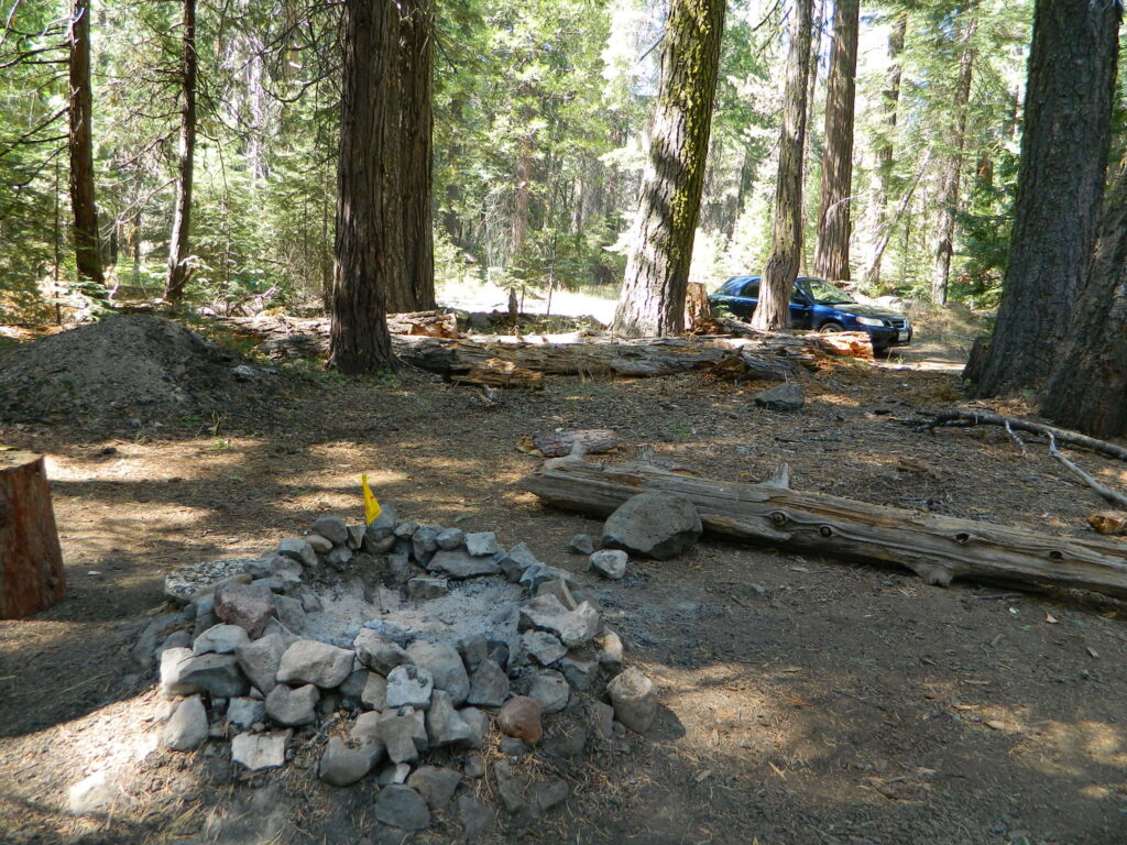
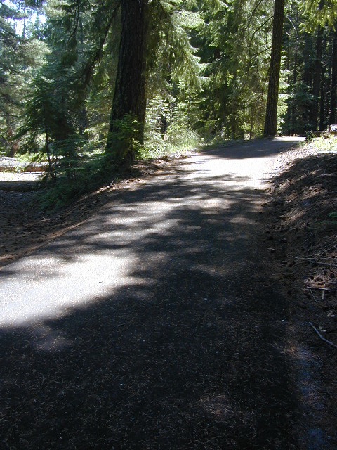
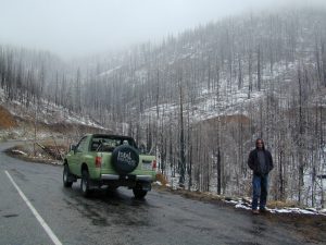
Lassen Back Roads
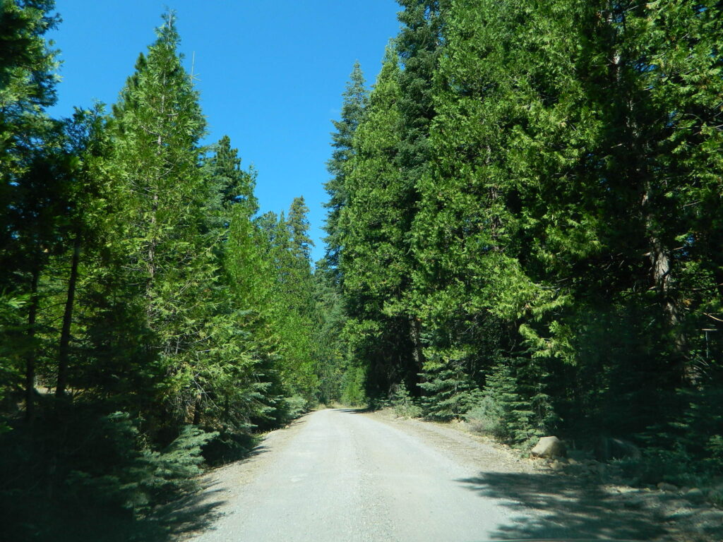
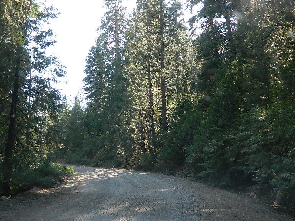
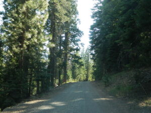
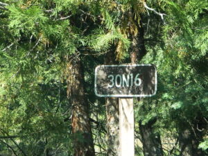
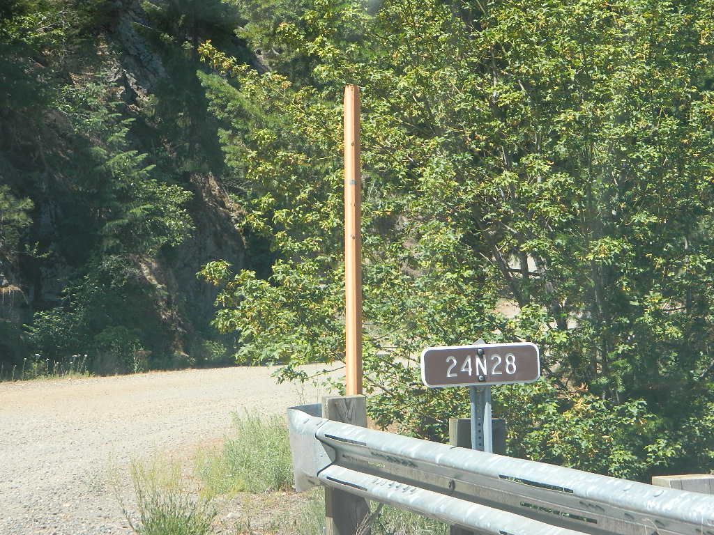
Lassen Rd #30N16 – Lassen National Forest
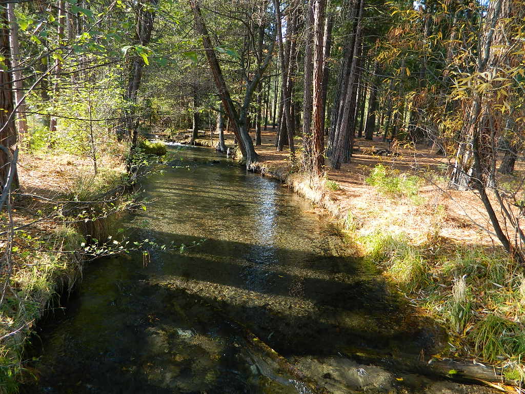
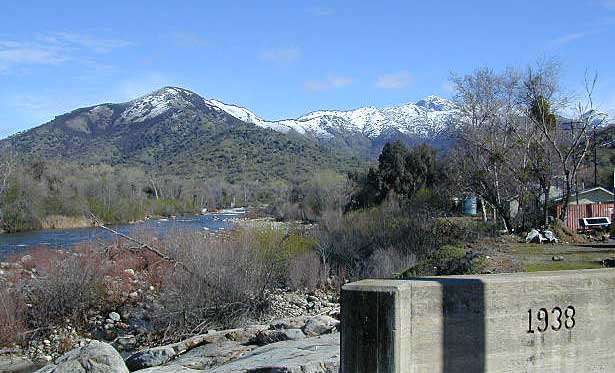
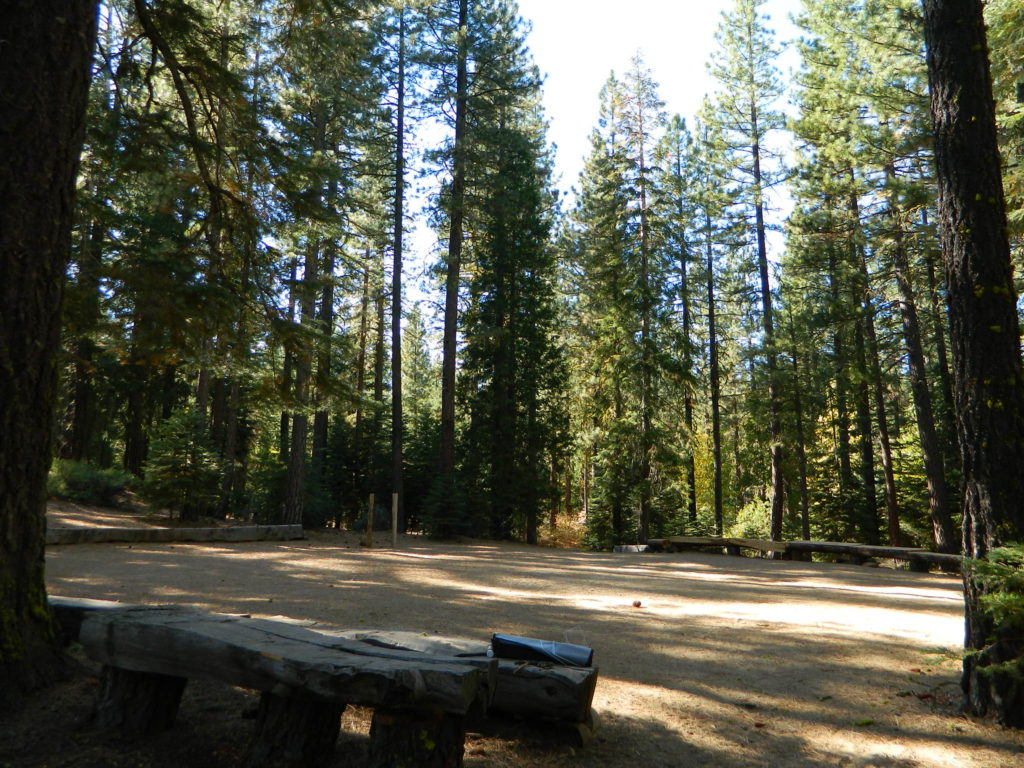
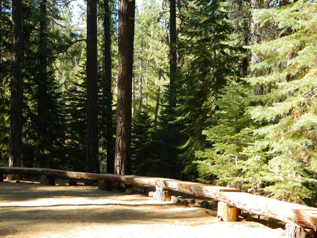
Nanny Creek / McGowan XC
E of Mineral, CA
Narrow dirt road thru dense forest, connects Highway 36 to Lassen Route #29N22 (Dry Lake Trail) and then heads west to meet with Lassen Road 17 (aka #31N45)
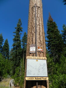
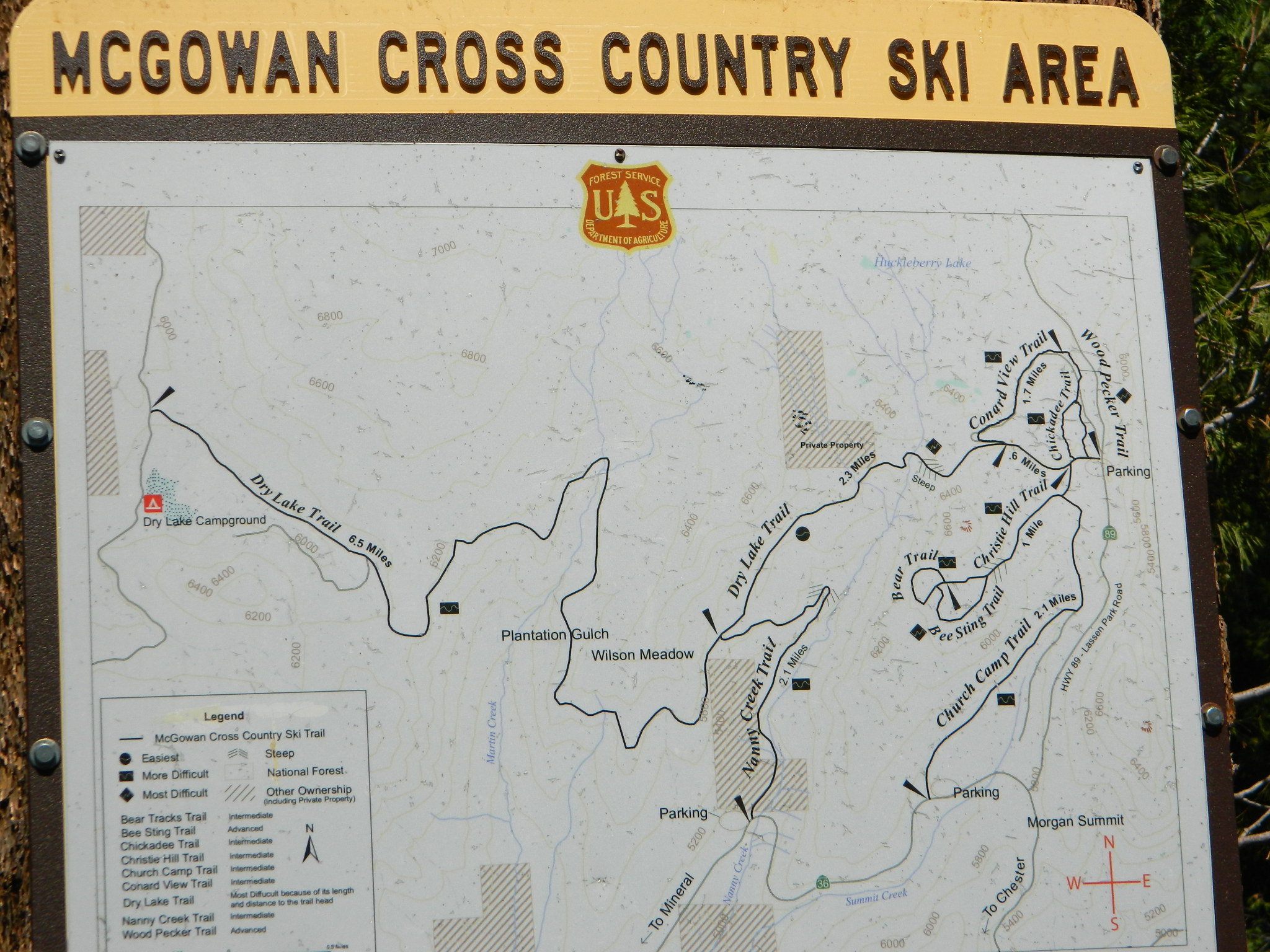
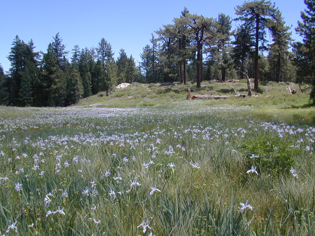
The McGowan Lake Cross-Country Ski Area has been in existence since 1982 and offers 10 miles of trails, 5 miles of which are periodically groomed.
Literally in the shadow of Lassen Peak, McGowan area trails wander through mixed conifer forest and are popular with beginning to advanced skiers. Elevations range from 5,020 to 6,200 feet. McGowan cross-country ski trails are closed to all motorized vehicles.
click to enlarge map
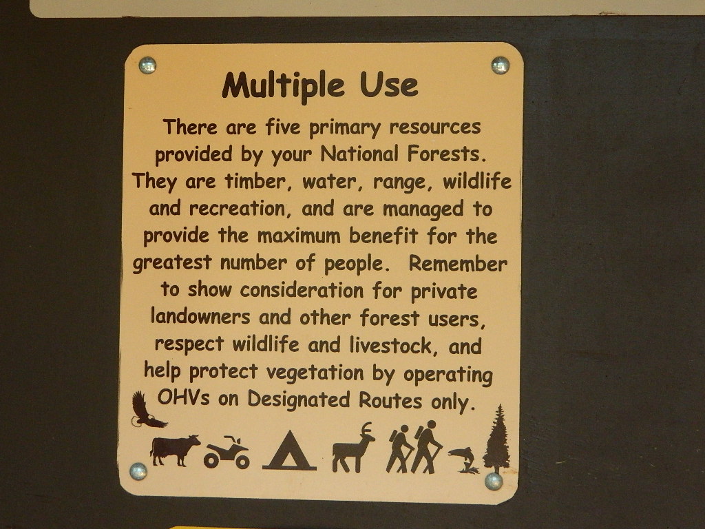
NOTE: No OHV riding, nor snowmobiling on this route!
WINTER – snow fall begins as early as November and lasts thru May. Road can be muddy in late spring.
SUMMER – this dirt road is accessible by automobiles during warmer months only and is not gated.
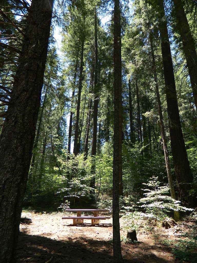
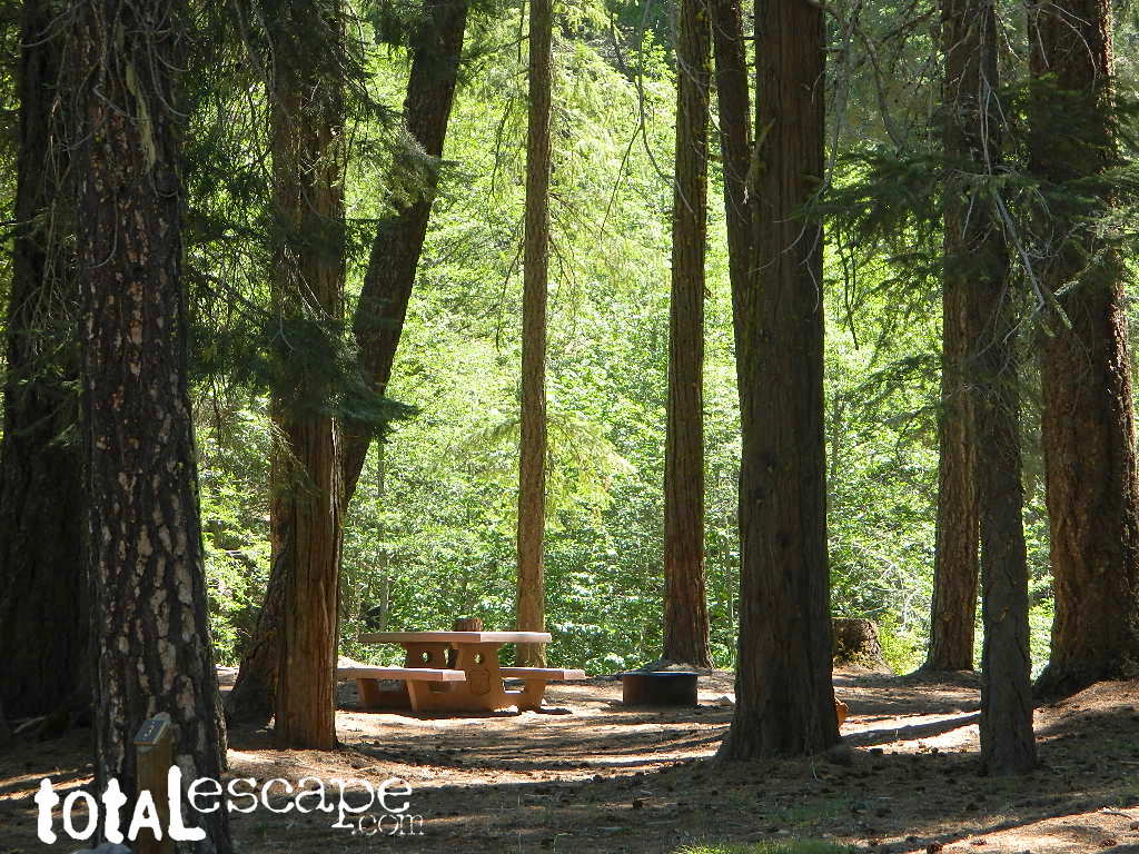
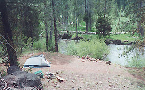
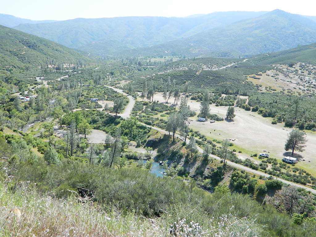
A few dispersed campsites along route 30N16, within the first mile from the pavement (Hwy 32). These precious few camps are usually in high demand during summer months! Head up hill a few more miles, deeper into the forest and find a real secluded site, dispersed style. Campfire Permits are always required for back country fires; found at nearest ranger station USFS in Mineral, CA
The first portion is a 2.1 mile long dirt road follows Nanny Creek about a mile, then it banks left, uphill to meet with 29N22. Sugar Pine Trailhead is located on this upper section of 30N16; a small wooden sign in a dense thicket can be seen on right side of road.
Junction with 29N22 #30N16 @ wide intersection w/ #29N22 – right turn for McGowan Lake, Christie Hill and the Volcanic National Park.
Road 30N16 continues westbound – Left turn for Heart Lake Trailhead, secluded boondock campsites and eventually, this dirt road ends @ Lassen Road 17 (#31N45) which is also a dirt road (and locally known as the Viola-Mineral Road), connecting Hwy 44 to Hwy 36.
DEEP SNOW can keep these dirt roads closed well into summer months, depending on the snow year. Keep this in mind when planning any early season recreation.
Broke Off Trail Lane intersects this 30N16 road right at the highway (36). It is the hard left that heads steeply up the rocky incline and skirts the highway headed west; Connects to the White Fir Lane road system above the small town of Mineral, CA.
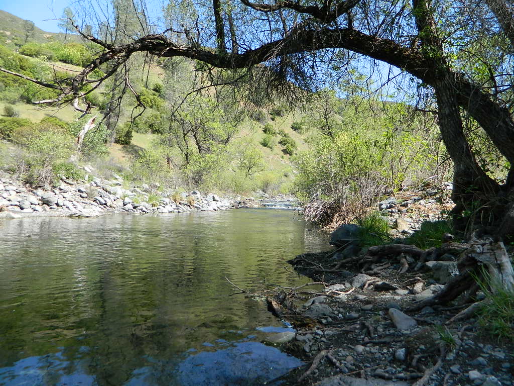
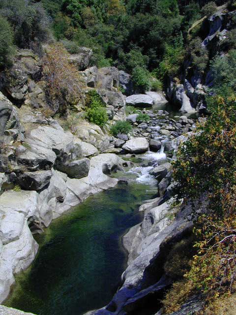
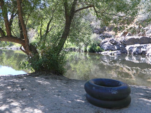
dirt roads, creek, with peace and quiet (mid-week)
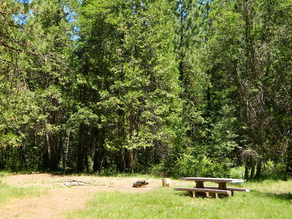
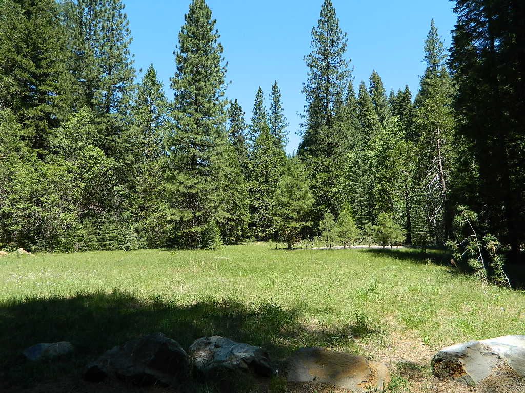
Meadow Camps
NOTE: OHV off roaders, quads, dirt bike use is somewhat common around here. The main dirt road cuts right through the middle of this campground, so passing traffic noise is possible. Choose the meadow side of camp, and get back off the road a bit – for more seclusion and a better night sleep.
The small creek-side meadow is also the proper stargazing area. Bring lawn chairs or blankets and watch for wet soggy spots. Don’t drive on the meadow! Keep campfire low when watching for meteors.
LOCALS TIP: If this small campground is full or not quite far enough, then keep on driving, deeper into the woods – to reach NFS Deanes Valley Campground
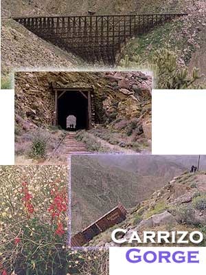
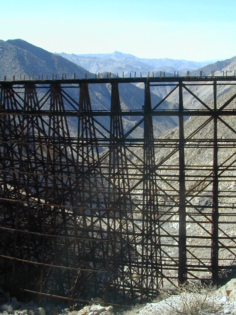
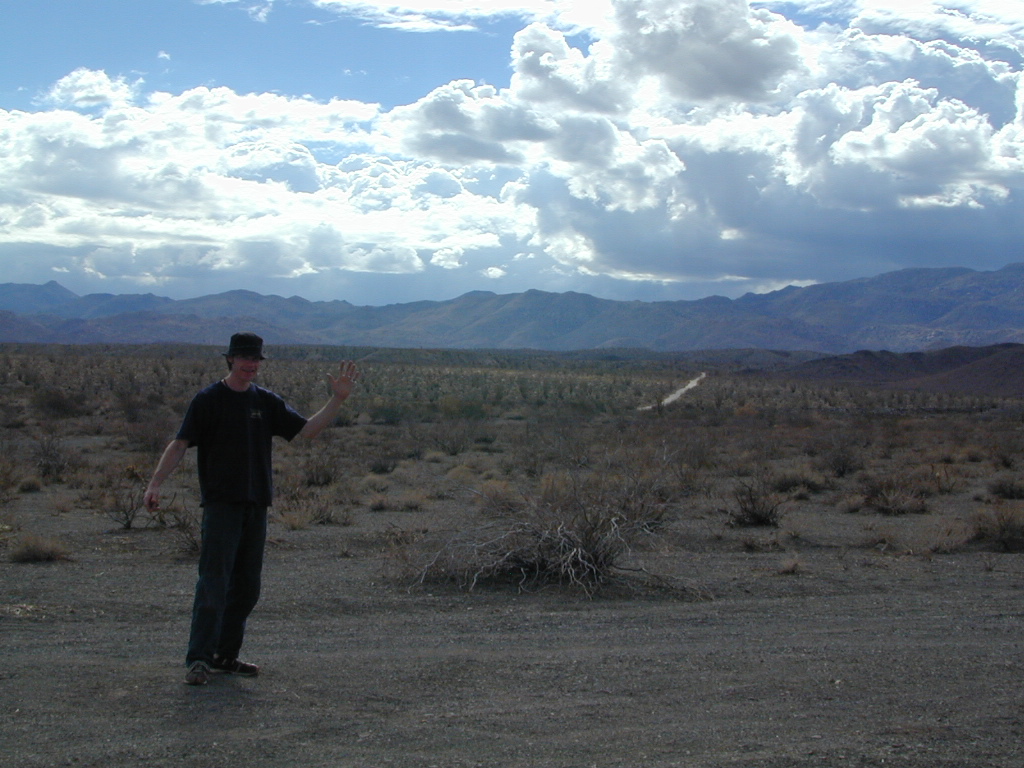
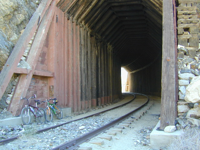
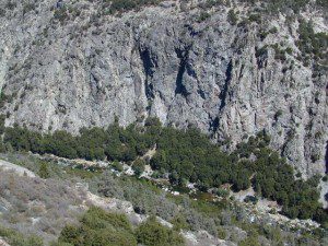
Carrizo Gorge Goat Trestle – via Mortero Wash. Near the south end of Anza Borrego State Park is the infamous ‘goat trestle’, one of the largest wooden rail road trestles in the US.
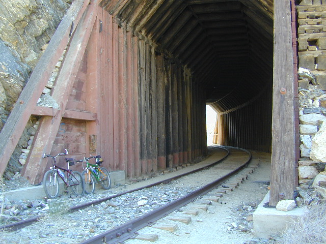
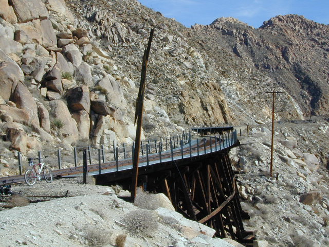
This hike can be reached by driving N on San Diego County Road S2 (from I-8) into Anza Borrego Desert State Park. Near the park boundary keep your eyes peeled for Mortero Canyon Rd (signed) on the left side. This is a sandy, one-lane, dirt road, accessible by passenger car, that leads out to the train tracks & then past to the Mortero Big Boulder campsites. Park at rail road tracks near water tank & start hike from here.
Ground was broken on September 7, 1907 by San Diego’s Mayor, John Forward and the construction of the 140 mile route was completed on November 15, 1919. The first through train was the called the “Golden Spike Limited”, named after the $286 golden spike, which John D Speckels drove into the ground near tunnel #8.
The Goat Canyon Trestle was built in 1932 to re-route tracks due to a landslide.
Passenger Cars Ran until 1951.
The route through Carriso Gorge was closed temporarily by Tropical Storm Kathleen in September of 1976.
And was reopened 1981, and then closed again by recurring storms.
Kyle Railways ran freight cars until mid 1984.
The Carriso Gorge section has fallen into disrepair with two trestles being burned and the collapse of two tunnels as the result of fires. The trestles have been rebuilt and one of the tunnels has been repaired – however, this scenic section of track is used mostly by hikers and mountain bikers.
Other Facts: Derailed cars are from 1984 and were filled with bags of cement. Laborers were brought in to unload the cement but the cars were left. The Goat Canyon Trestle is 185″ tall and 600″ long. During its use it was the tallest wooden structure in daily use. Hence, this trestle was designated a Historic Civil Engineering Landmark in 1986. Carrizo means “reed grass” in Spanish. Total cost of construction was $18 million.
In 1979 the SD & AE west of Plaster City was sold to the Metropolitan Transit Development Board for $18.1 million. SD&A was said to stand for “Slow, Dirty and Aggravating” generally because of the high temperatures, smoke and open windowed trains cars.
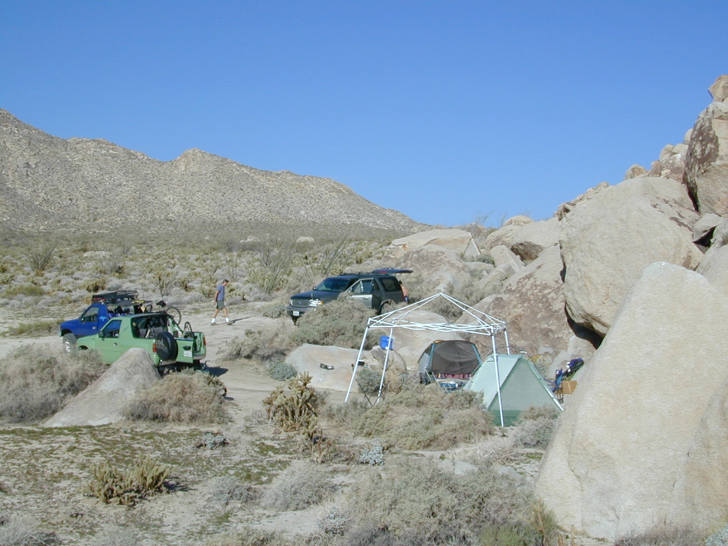
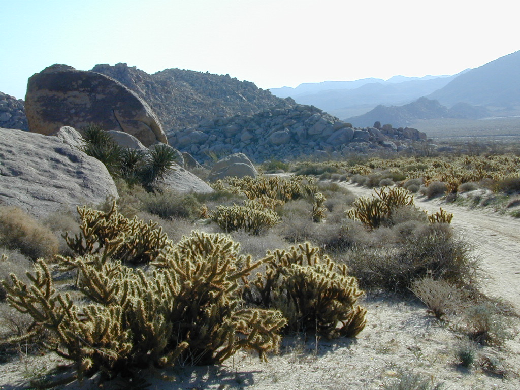
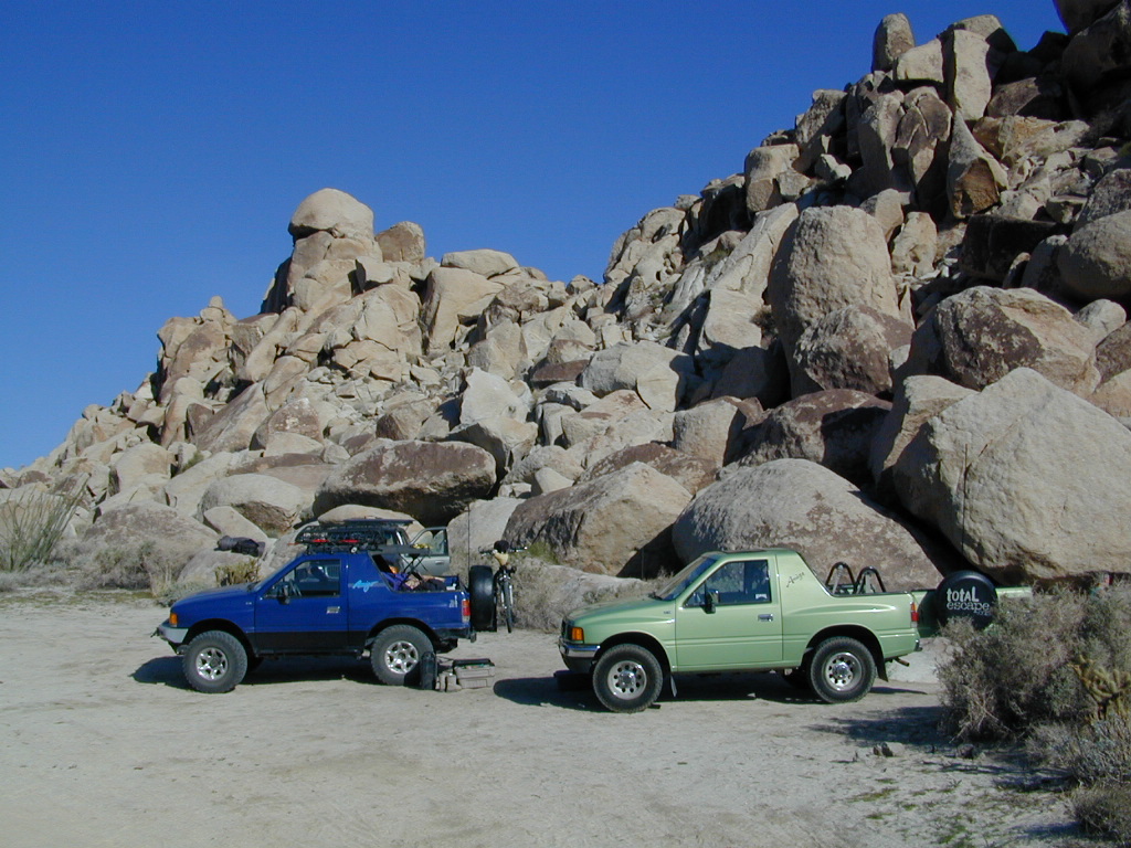
South end of Anza Borrego State ParkDispersed camping (for free) in the Boulders
Interstate 8 EAST from SD / exit Ocotillo. SD county road # S2, the south end near the State Park boundary. Gorgeous every season but summer. Great winter camping close to SoCal.
This dirt road is located in a desert wash area, which starts west – off the paved road S2. The signed white desert wash is a suitable drive for passenger cars (most years). But you best have 4×4 if the rain gets going good. Low riders should watch for the ridge lines – as they are naturally rockier places and could take out an oil pan of a mini SUV (at a high rate of speed).
The giant boulders garden at the far end of this route have nice views of the Imperial desert floor. Better from the top of the boulders too; numerous primitive camp sites are tucked into the coves, surrounding the big boulders.
No toilets; no shade; no water; minimal vegetation. At night the stars are heavenly, but you can see city lights from Calexico and Mexicali.
GOAT TRESTLE?
From this area you can hike or mountain bike up to the “old goat trestle” and numerous historic train tunnels @ Carrizo Gorge Goat Trestle (not to be confused w/ the wildflower destination called Carizo Plains in Kern Co). BRING A HARD COPY topographic MAP of this area, if you wish to explore past camp. Moderate hike, an all day adventure. Bring lunch and water!
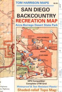
SAN DIEGO Backcountry Map
this waterproof map has the entire State Park covered with all back roads, trailheads, campgrounds and railroad tracks
When you decide to stop the car, look around for the best spot. Park off the road way and preferably in a turn out or camp spot. Turn off the engine, get out of the automobile, stretch your legs, breathe, look, close your eyes – tight and breathe deeply, then open and look around you again. This particular place is special, you can just feel it. Walking around the boulder area, be cautious of snakes.
On the boulders – closely examine them, climb on them, get to the top; you will find (Native American) Indian grinding holes called mortars or morteros.
great side trip option: Across the paved road (SD County Road S2) on the opposite side of the valley is a nice hike to Sand Dollar Hill. (I’m sure this isn’t the real name). Dirt road leads up to a dirt parking area for hikers. Busy lil place sometimes. These desert dirt hills have wind caves and chunks of sand dollars scattered all over them. The real ocean floor way out here, east in the Anza SD desert… how cool is that?
great side trip option:Canon Sin Nombre is just up the road a piece, N on S2, on the EAST side of the road. Amazing viewpoint turn out, right on the highway, overlooking the impressive topography and badlands. If you have a high clearance SUV or any truck you can drive down into the sandy tight, rocky wash. It meets back up with another main wash way back there.
Tons to explore back here. Off roader should think Tread Lightly on this turf and primitive car campers should use a Leave No Trace approach. White sand, deep sand, caves, smoke trees, and the best slot canyon climbing & hiking this side of the Anza Borrego State Park.
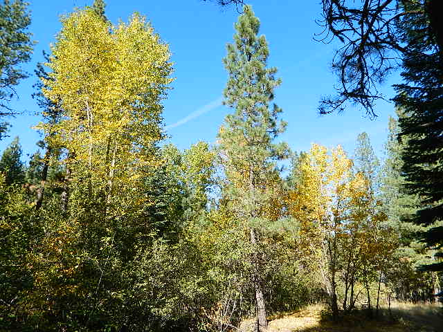
Aspen Groves are easy to recognize with their thick stands. White trunks with dark knots, slender, with oval shaped leaves. Growing in a network of roots, which are found lining creeks, alpine lakes, or spilling out from higher elevations, along scenic canyons.
The unique round leaves which can turn spectacular colors in the fall season. The fluttering and flapping of the oval-shaped, thick, green leaf is a sure sign of summer. When breezes get cooler, Autumn is only a few weeks away and as quick as the cold comes in, what a short and special show they put on.
Green Creek historic cabin, on the Eastern Sierra
California Fall Colors
Aspen trees can be found at higher mountain elevations in California, usually above 4000′ – all the way up to about 10,000′ or higher, depending on the mountain range and local water flows. Groves have an extensive root systems underground, so they often withstand wildfires and can come back after the rest of the forest is gone.
Beavers build dams in creeks around aspen trees, fishermen and campers love to camp next to aspens, and lovers carve their initials into their white bark. These trees do indeed take a beating, from all angles, winter weather included… so stop from cutting them!
BIKE
CAMP
FISH
HIKE
KAYAK
PICNIC
summer and autumn
These deciduous trees are naked half the year, typically from November to April, as winter buries them in snow and ice. Time is of the essence, limited to Summer and Autumn – to enjoy their shade and the beauty of the groves. Scenic meadows and fishing creeks are just an added bonus for searching out the aspen.
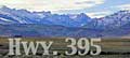
Aspens can be found in hidden canyons, primarily along the Eastern Sierra US Hwy 395 and surrounding mountain lakes. Some Sierra Passes have decent displays of color as well – like Carson Pass Hwy 88 and Yosemite’s Tioga Pass Hwy 120.
Below is a list of Total Escape’s favorite aspen areas of California
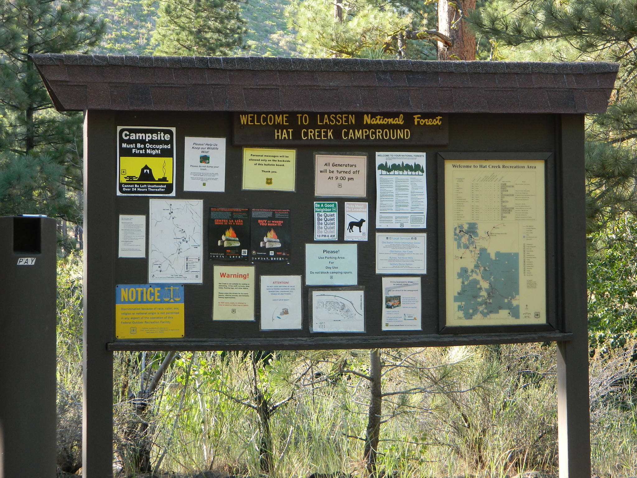
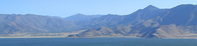
Mount Lassen is part of the Cascade Mountain Range, located north of the Sierra Nevada. The Lassen forest encompasses a large area of wilderness land, snowmelt creeks and an abundant dirt road system. Most of which is covered in deep snow about half the year, so plan accordingly.
Plenty of great dispersed camping along the old logging roads in this Lassen Forest area, surrounding the Volcanic National Park; in Northern California. Many dirt roads are graded annually to allow for passenger car access. You can make it way back there in a car – just watch for the mud and some boulders!
Camp fire permits required (see below). Pease try to choose a camp that has been used before and pack out your garbage.
HINT: a USDA Lassen National Forest Map is very helpful when camping these remote, Lassen back roads. Stay away from the crowds, avoid camp fees & really enjoy your vacation.
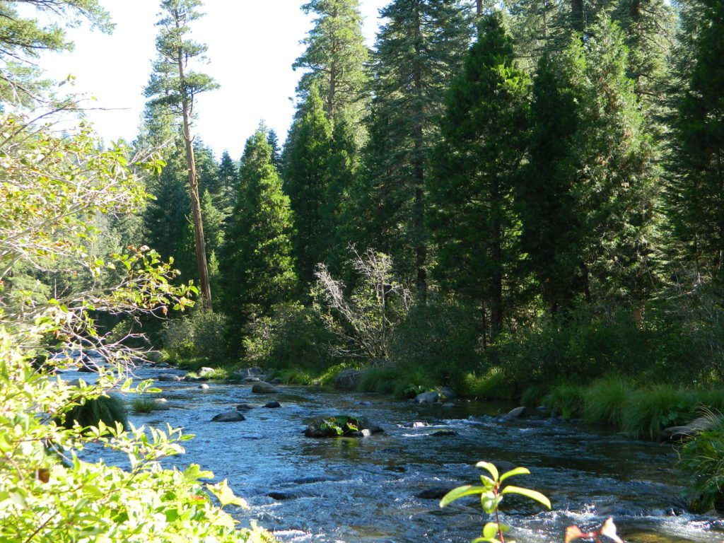
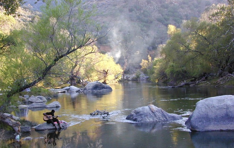
Camp right on a rushing river, alone. With no one in sight or sound. Have that secluded camping experience you’ve always dreamed about. Fishing, relaxing, maybe some hiking too. Or better, your mountain bike. Plenty forest roads to explore.
Numerous waterfalls to discover, water flowing everywhere. Mount Lassen @ 10,457′ elevation, is often snow-capped year round. This Northern California region is covered with pine forests and volcanic history.
Cool Springs @ Butt Lake, California (PG&E Campground)
If you wanna find the nearest biker bar, head over to the rustic and forested Bambi Inn @ Butte Meadows. The place is popular all the time, especially on weekends. Scenic day drive from Chico, located near a nice river and bridge, plus they have cabin rentals too. Sometimes they have big events and it can get pretty crowded and loud w/ drinking and outdoor music.
BSA Camp Lassen is a boy scout camp located E of Chico, off Highway 32 near Butte Meadows, CA
Dispersed Camp sites in Lassen in Lake Almanor Area
campground
elev.
spots
veg
toilet
water
notes
Alder Creek Campground
3900′
6
pines
vault
creek
March-Nov
Benner Creek Campground
5562′
9
pines
vault
creek
May-Nov
Black Rock Campground
2100′
6
pines
vault
creek
year round, fish
Echo Lake Campground
6440′
hike
pines
none
lake
May-Nov, no tables
Soldier Creek Campground
4890′
disp
pines
vault
creek
May-Nov, fall hunters
South Antelope Campground
2700′
4
pines
vault
creek
year round
Willow Lake Campground
–
disp
pines
–
lake
May-Nov, no tables
NORTH LASSEN
Free Camping Lassen
Northside of Mount Lassen
Excellent back roads camping w/ dense forest and free firewood all over the place (bring hand saw). Dispersed, primitive, free camping, near creek, and highway close. Many forest dirt roads turn offs, all along Highway 44 (California SR 44) near junction w/ Hwy 89 @ Lassen National Park.
Big creeks, dense forests, graded dirt roads, dark night skies. PCT access, trailheads, camping, fishing, hiking, hunting, all along Upper Hat Creek.
Campfire permits (shovel, bucket & water) are required when camping outside of a developed campground. Always check on current fire restrictions. Washed out bridges and landslides are common, which means road closed signs can be found on these remote backroads.
An overnight stay out-of-doors. Sleeping out under the stars.
Air bed, camping cot, tent… or just a tarp on the ground.
Perhaps a luxury Cabin Rental in the mountains or on the coast. Your choice.
From a luxurious cabin in the mountains, to a small clearing in near a meadow with a stream nearby – with just a backpack, the idea of “camping” is always a bit different for each person. Roughin’ it for free – in the wilderness, or on the back roads; Or pay dearly for the price of real amenities, while on vacation.
camp sites that require you to physically haul your camp gear from a parking area to the camp spot, ranging from 1/8 mi. walk to a 1-3 mile hike
backpacking
free w/ wilderness permit
ultimate in seclusion, bring it all on your back, on foot into the wilderness & enjoy trail camps
Trinity River Camping, Douglas City, CA
SO CAL CAMP FIRES – Yellow Post Campsites are remote camping spots in secluded areas, in a designated fire safe clearing. No facilities such as toilets or showers. Maybe a picnic table & fire rings, if you’re lucky. Southern California forests have these kinda spots. Required campfire permit & you must double check on local fire restrictions.
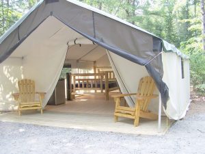
These structures are half way between ‘roughing it in a tent on the ground’ & having a ‘mountain cabin’. Tent cabins have wooden floors w/ canvas walls and roof; Dismantled annually for winter rain/snow, they are usually only available in mild, coastal climates or during summer months in the mountains.
Rentals typically include sleeping cots, but you’ll need to bring your own bedding (sleeping bags, sheets, pillows). Some rentals include shaded porches, wooden decks, minimal furniture, kitchenettes and/or wood burning stoves. Electricity may be available, or maybe not. Ask ahead of time, if you really must have that particular luxury when on vacation.
Yurts are a ’round version’ of this canvas cabin – which need to be aired out, often (to prevent mold). Yurt rentals are very popular and in high demand in California.
Find these type of rentals at yoga retreats, hot springs, beach canyons, remote lakes, redwood forests, high sierra camps, fishing camps and at certain RV parks.
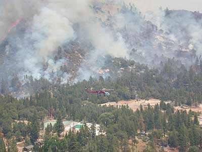
2018 (Mendo Complex Wildfire) Ranch Fire
burnt most of this area
Located in the coastal mountain range north of Clear Lake and west of Stonyford, California; in between I-5 and US 101
On the southern half of the Mendocino National Forest.
60,076 acres
East Snow Mountain Peak – 7056′ elevation
West Snow Mountain Peak – 7038′ elevation
Lake Pillsbury – 1818′ elevation Mendocino National Forest
Eel River
Elk Creek
Cold Creek
Anderson Creek
Corbin Creek
Sheet Iron State Game Refuge
backpacking
camping
hang gliding
horseback trails
off roading
paragliding
snowboarding
snow shoeing
Wilderness permits and campfire permits are required. Check local rangers for up to date weather conditions, road closures, parking and trail conditions.
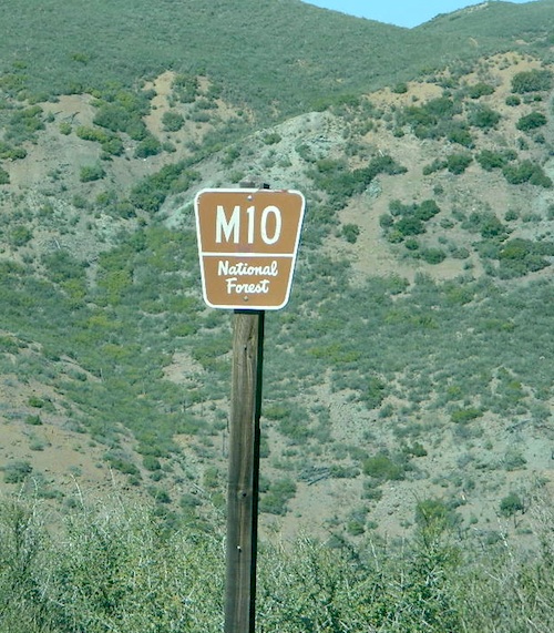
Dirt Roads M10 and M3 are the major routes around this mountain area. Route M10 is also known as 43A on some older maps. Several 4×4 trails skirt the wilderness boundary near the tallest peaks, so you may see some OHV use in this region when hiking.
ranger stations
EAST SIDE
National Forest Office
Grindstone Ranger District
Willows, CA
530-934-3316
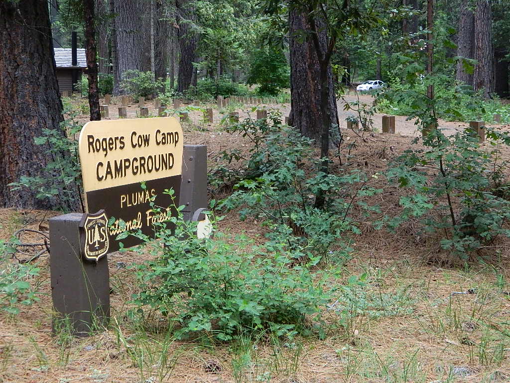
Plumas National Foresthas excellent outdoor recreation and developed campgrounds, as well as secluded, primitive back roads camping sites. If you prefer a camp with table, toilet and a campfire ring, then expect to pay a fee. There are several small, remote campgrounds listed below, but most are located on paved roads. Venture down dirt roads to find a premium camp sites for free. Scroll the map links below to explore the back roads of Plumas, and discover hidden fishing holes.
SOME CAMPGROUNDS are closed due to wildfire damage in the Plumas region.
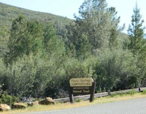
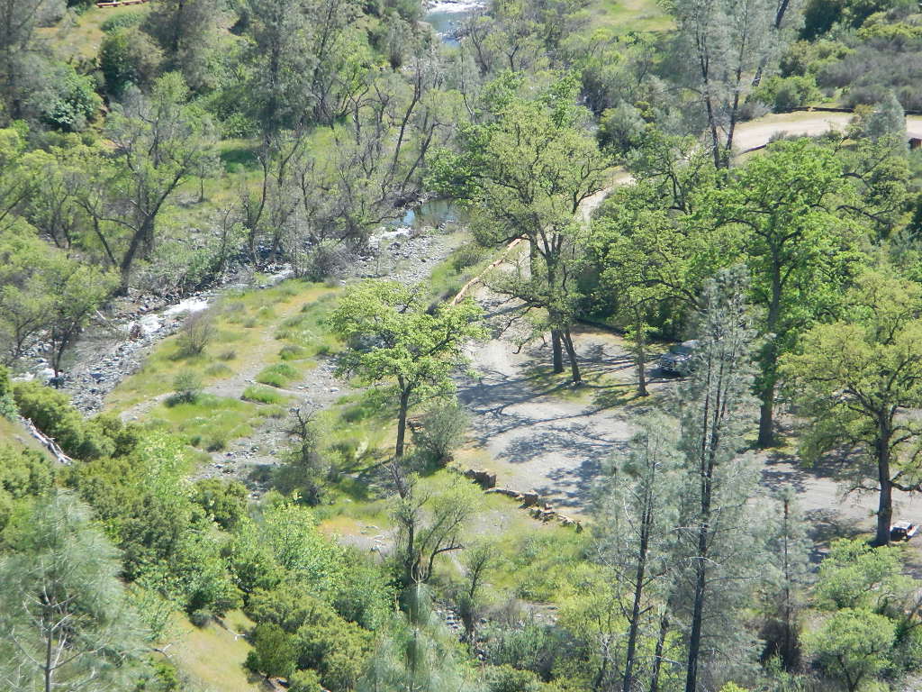
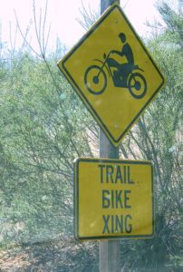
Fouts Springs is multi-use recreation area on the east side of Mendocino National Forest. Located near the Snow Mountain Wilderness trailhead, this region is popular with the off-roaders and dirt bikers. Expect some noise if camping overnight on a weekend.
Excellent picnic spots along creek in springtime. Wildflowers bloom March-May. Campfire restrictions may begin as early as July, so know current fire conditions.
Fouts campgrounds are located on the EAST SIDE of Mendo NF on paved road M10. Situated below 2000′ elevation and open year round.
Road M10 Mendocino
TRAVELERS NOTE: Tent campers, RV and truck campers can easily access this area, all paved roads. Exit Williams or Willows on I-5 and head west. A decent back country map or Mendocino National Forest Map is advised; Numerous canyons, forested creeks and campgrounds. Always check with Mendocino National Forest for road closures and conditions.
OFF-ROADERS NOTE:Use caution on paved access road M10, especially when driving with trailers or large RVs. Narrow road, long and winding with blind curves and no guard rails. Always check with Mendocino National Forest for road closures and trail conditions.
Mendocino Ranger Stations can be found on link below
Placerville hosts this iconic music fest which last 2 days. Overnight camping – tent or RV. No fires or open flames allowed in camping area. FREE showers available onsite.
El Dorado Fairgrounds
100 Placerville Dr
Placerville, CA 95667
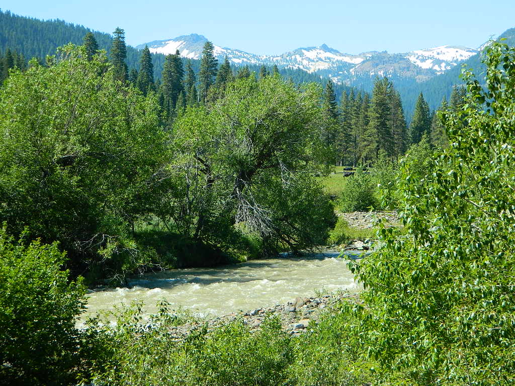
Lassen Camping for Free – on Mill CreekMill Creek w/ Lassen Peaks (July 2011)
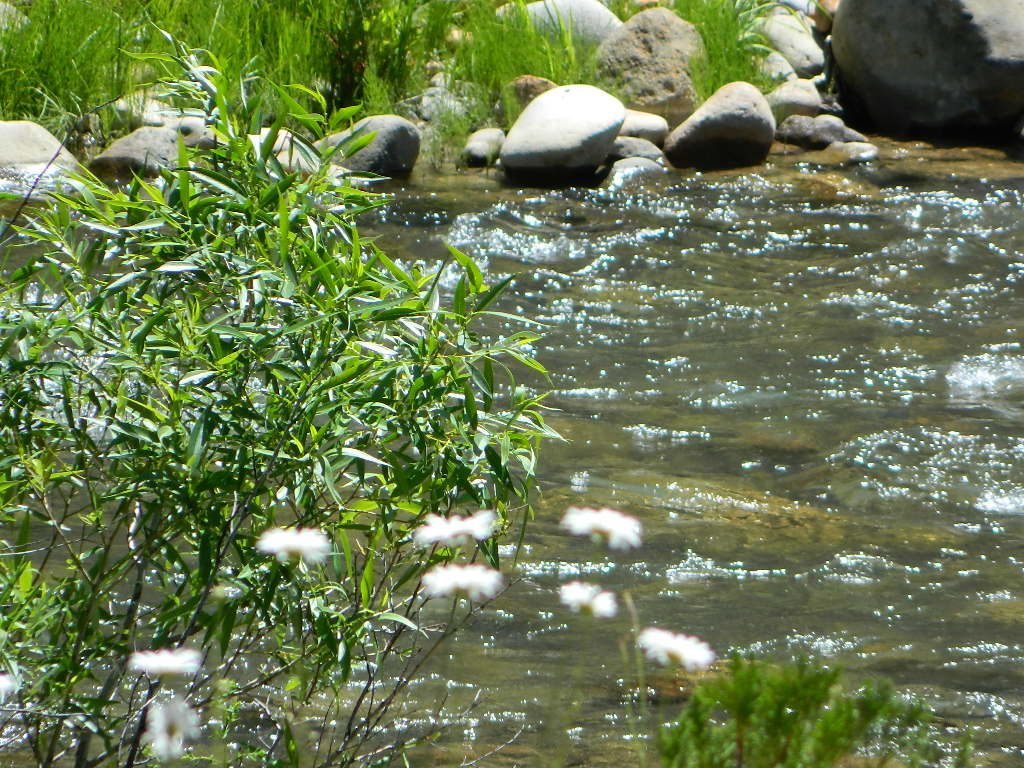
Numerous Mill Creeks exist in the golden state of California. Here we will list most of them, some with campgrounds and others without. Waterfalls, big rivers and
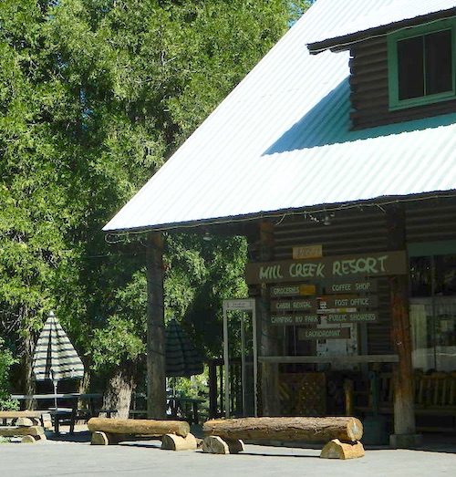
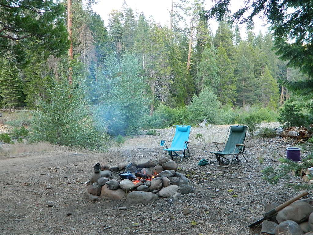
Small mountain resort in the forest near Mill Creek, with cabin rentals, RV camping and campgrounds nearby. A general store is open in summer months, and snow can be found in winter. Highway 172 makes a nice paved loop around this forested area and joins back to Hwy 36. Route may be closed due to snow in winter & spring. Free camping can be found along this creek, although a campfire permit is always required for camping outside of developed campgrounds.
Mill Creek Resort
40271 Highway 172, Mill Creek CA 96061
530-595 4449
Mill Creek Resort Campground
elevation = 4720′
14 tent sites
8 RV sites
reservations & fees
closed in winter
showers & flush toilets
picnic tables
camp fire rings
Mill Creek Indians: Described as a group of ‘renegade and outlaws’, from multiple tribes in NorCal. Mill Creek Indians took shelter in secluded Mill Creek gorge, located below the Mill Creek Rim, a volcanic ridge which extends from Mount Lassen to the Sacramento River Valley. See more on Ishi Wilderness.
Fouts Springsis a popular off-road camping area on the far east side of Mendocino National Forest. Many miles off I-5, near Stonyford, CA. Numerous NFS campgrounds exist is this rugged canyon. One of them is called Mill Creek Campground and it has few pine tree and lots of chaparral, plus a decent little creek flowing nearby. OHV – off highway vehicle use is heavy in this region, so know when to go. At certain times of the year this remote canyon can be quiet and peaceful. Call the local rangers to find out.
Stonyford Workcenter
5171 Stonyford-Elk Creek Road
Stonyford, CA 95979
530-963-3128
NOTE: RANCH FIRE, this whole Mendocino Forest was badly burned by recent wildfires. Mendocino Complex Fire 2018
All of the Snow Mountain Wilderness was burnt and affected, including all the National Forest land surrounding it. Fouts Springs Campgrounds may have been spared, but the hills, trails and roads now lead to blackened forest. Many routes could be closed; check with ranger station in advance of travel.
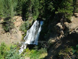
Mill Creek Waterfall is located on the western slopes of the Warner Range, near the South Warner Wilderness. On the headwaters to the Pit River; About 6 miles east of US Highway 395, near the town of Likely, south of Alturas, California
TheBucks Lake Wilderness region also has a developed NFS Mill Creek Campground. The camp location is well off the Bucks Lake Road, tucked deep in a tight canyon; northern most point and near a dam for the large Bucks Lake.
elevation = 5200′
10 camp sites
fee
closed in winter
14 night camp limit
RV = 21′ max
pit toilets
picnic tables
camp fire rings
Bucklin Road (aka Bucklin Dam Rd and Road 33) #24N24 a paved road on the west end of Bucks Lake, connects to Road #24N88X which leads back to this smaller campground; camp sites are paved. Steep driveway down.
This Mill Creek intersects Bucks Lake at the campground, then connects to the PCT hiking trail, although the narrow dirt road #24N88X veers away from creek a few miles up.
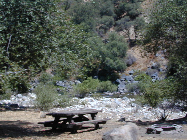
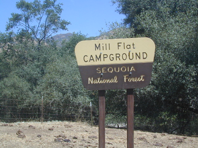
This Mill Creek is located on the south shore of the lower Kings River, above Pine Flat Reservoir. This is the boundary where Sequoia NF meets the big river, and on the other side of the water is the Sierra NF.
Mill Flat Campground (also known as Mill Creek Camp) is a shady, oak flat campground on a dirt road, located at a dead end canyon site, right on the rocky rivers edge.
As usual – the further you drive, the more seclusion you will find. This observation holds true for this Mill Creek location. During peak summer months, there may be families enjoying this spot, but most of the year it is virtually empty and rarely used.
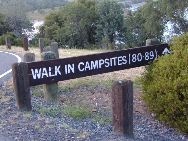
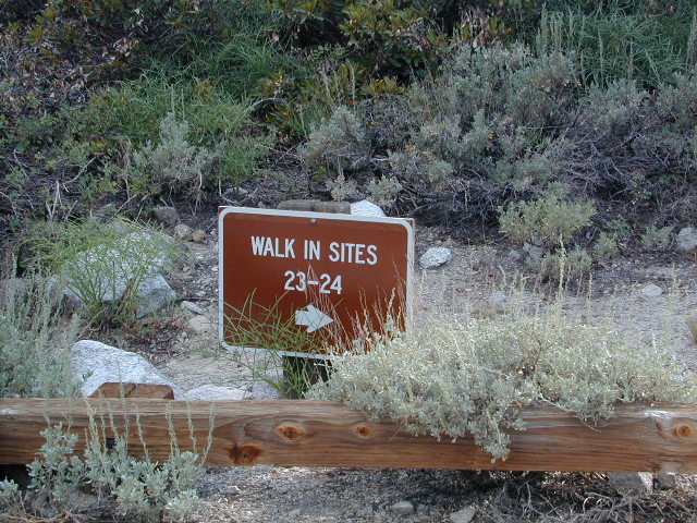
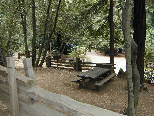
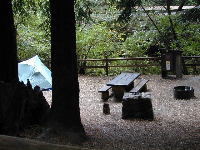
Below are developed campgrounds in California that have walk-in camp spots available. Vehicles are parked and you must carry your gear into the camp site (usually a short distance, but can be up to a half mile).
California Campgrounds with more than a 1-mile trek are not included in this list below. Areas such as – Catalina Island, Crystal Cove SP, Angel Island SP, Point Reyes National Seashore, indeed have many hike-to camps, but most are measured in miles (one way).
walk in campsites are perfect for –
people who wish not to see cars @ camp
people who prefer less noise while camping
physically fit folks, who want exercise
backpackers, who plan to hit the trails soon
avid hikers, who may be out day hiking
cyclists, just passing through
mountain bike campers
one nighters, travelers who only stay one night
late comers to the campground
(hint: these are usually the last campsites to fill up)
Walk in campsites are often located away from car campers & RVs. Some camp sites may have more privacy, tucked away in trees, while others have shared community area with fire pits and/or barbecues. All camp sites will have picnic tables and a some kinda toilet nearby. Bear boxes may be available for storing food properly. Sharing these food storage boxes with neighboring campers is common practice.
Campgrounds with walk-in sites range in elevation from sea level marshlands to high altitude alpine lakes. Most of these camps listed below are located inside developed campgrounds with overnight fees. Many are small campgrounds, while others are large hubs of activity. Some may be smaller campgrounds, with just a few camp sites. The most popular places can be reserved, with the links provided.
Many parks can also have day use fees, so know where you park and what time span is allowed. Ask the campground host if needing assistance. Some campgrounds lock their gates at sunset and do not permit entry at night. Others may not allow campers to check in anytime after sundown. Know their rules before you make reservations.
If you plan on not making camp reservations; make sure to have a plan B or C choice camp – in case your desired campground is already full. Many popular destinations can fill up fast (by noon in the summer).
Spacious Camp @ Aspen Grove Campground, Eagle Lake, CA
Niagra Creek Campground, OHV 4×4 trails, Stanislaus NF
North Battle Creek Reservoir, PG&E Camp, West of Lassen North Grove Campground, Calaveras Big Trees State Park
Southwest Walk-In Camp, 6700′ elev @ Lassen Volcanic NP Squaw Leap Campground, San Joaquin River, Auberry CA Stillwater Cove Regional Park, N of Fort Ross, Sonoma Coast
Table Mountain Group Camp, Bishop Creek Canyon, Inyo NF
Tahoe National Forest
Donner Area Camping Lakes
NFS 530-265-4531
Carr Lake Campground 10 miles north of Highway 20 6,700′ elev 5 walk-in campsites
Rucker Lake Campground 6 miles north of Highway 20 5,462′ elev 7 walk-in campsites
Sterling Lake Campground 9 miles north of Interstate 80 7,000′ elev 6 walk-in campsites
Toad Lake Walk In Camp, PCT @ Shasta National Forest Tuolumne Meadows Camp, Yosemite National Park
(reservations & wilderness permits required)
Walk in campgrounds are considered ‘tent camping‘, as opposed to ‘car camping‘, which is literally camping next to your vehicle. This type of hike-in camping may also be referred to as ‘trailhead camping‘, as many ideal hikes begin at these prime locations. Boat-in, bike-in or hike-in camp sites are also available at some of these locations.
Sequoia Foothills Reservoir, CA SR 198 Kaweah Lake
Southern Sierra lake located on Kaweah River, near the mouth of Mineral King Canyon. In between the western Sierra foothills and the agricultural San Joaquin Valley. West of Sequoia NP, east of Visalia, California.
Crystal Cave
Mineral King
Sequoia National Park
Three Rivers
Visalia
The small town of Three Rivers is just up the road from this small reservoir & their slogan is the ‘southern gateway’ to the Sequoia National Park.
There are several recreational reservoirs that are situated at the base of the Sierras, along the western slopes. The Kaweah River transports snowmelt deep from the Sierra Nevada mountains, down to the San Joaquin Valley (Central Valley), for human consumption, households, and agriculture.
Kaweah Marina has patio boats, fishing boats, and paddle boards available for rent. Reservations are needed in summer for weekends and holidays. 559-597-2526
Kaweah Houseboats
Privately owned house-boats can be seen on this lake, although none are available at the marina for rent. Some can usually be found for sale on visalia.craigslist.org
Sequoia Highway 198 has many side routes worth exploring: Mineral King Road will get you to amazing scenery, but there ARE NOT ANY Sequoia groves up that way; Crystal Cave, open for tours is located near the south entrance of the National Park; and a lesser known campground in this area is called South Fork, off on a residential side route canyon – South Fork Drive (Road #348); Located on the quiet South Fork of the Kaweah River.
Sequoia Atlas Three Rivers is small town, located along the Kaweah River, near south entrance to Sequoia National Park
North Fork Drive: North Fork of the Kaweah River is a seldom traveled dirt back road that leads from the east side of the lake @ Hwy 198, northbound (along the North Fork of Kaweah River), straight into the backdoor of Sequoia National Park’s ridge line highway @ Dorst Campground. The original town of Kaweah (elev 960′) is along this route. Many small dirt roads to explore up this way and a good topo map is advised.
Eshom Campground(on western border of Sequoia NP), a small slice of Giant Sequoia National Monument land, Redwood Creek and a trailhead called Redwood Saddle are all back up in here.
Have a few good maps to cross-reference while traveling back roads and trails.
This major dirt route is often closed and gated by the rangers during wet, winter months.
Numerous Silver Lakes, Creeks and other “silver” terrain can be found inside California. After the Gold Rush of 1849 in the western Sierra, Silver was discovered in Nevada shortly after (east of Sierra Nevada mountains). This page is an overview on all places with SILVER in the name, or places that have had a history of silver mining. California Counties are listed in parenthesis. Links below will lead to more detailed pages or campground reservations.
Silver Fork of the American River. Silver Fork Road connects US Highway 50 & Carson Pass Hwy 88. Silver Fork Campground & China Flat Campground (NFS) are both located on this remote, backcountry route, about 8 miles from US Hwy 50
Autumn aspen groves ignite with color in October. Often, some of the best fall colors in the Eastern Sierra. Day trips w/ fishing. Hiking everywhere. Overnighters or backpackers could be greeted with snow at anytime in October or later. The June Lake Loop (SR 158) closes for snow annually!
below are silver mining camps and other silver related destinations, plus some campgrounds
Bodie SHP (State Park)
(Mono Co)
8375′ elev. US Hwy 395 near Bridgeport, CA. Infamous, high desert ghost town, now a California Historic State Park. Large gold mining camp w/ well-preserved, wooden, old town structures. Silver was discovered in nearby Aurora Canyon. All dirt road access. No developed campground @ Bodie, so try nearby Green Creek Road instead. Or high desert, back road camping on Aurora Canyon Road over to Bridgeport Reservoir.
Cerro Gordo
(Inyo Co)
8500′ elev. Inyo mountains, West of Death Valley, east of US Hwy 395 @ Junction 136. Old mining camp rich in silver history. Someone might even live up there. Extreme remote location in rugged, high desert mountains. 4×4 is always required!
Silver City Sequoia
(Tulare Co)
6935′ elev. cabin resort on Mineral King Road, in the South Sequoia National Park
Silver Valley Campground & Silver Tip Campground (Alpine Co)are both located near Lake Alpine on Highway 4 Ebbetts Pass , Central Sierra
Silvertip is also a Group Camp at Jackson Meadow Reservoir (Sierra Co) off Hwy 89, North of Truckee, CA. Silvertip Group Campground, as with all group camping facilities, is by reservation only.
Silver Lake @ LA (Los Angeles Co) a hip and popular, tree-lined neighborhood in Los Angeles, near Griffith Park.
Silver Lake
(San Bernardino Co)
Silver Dry Lake, a dry lakebed in the Mojave desert, near the Hollow Hills Wilderness, north of Baker, CA off I-15
Silver Lakes
(San Bernardino Co)
2430′ elev. a desert community southwest of Barstow, near Helendale, CA. Located on the Mojave River (which flows underground) in between Historic Route 66 & US Hwy 395. Attraction nearby – Exotic World, the Burlesque Hall of Fame.
Samuel P Taylor State Park
Samuel P Taylor Campground
SamP is one of the large redwood parks north of San Francisco, CA. Coastal redwoods can be found in the mountains above Santa Cruz, as well as on the Point Reyes peninsula in Marin County. Hiking in the region is amazing w/ enchanted forests, dramatic fog, waterfalls, numerous trails in every direction.
One of the best developed campgrounds in the region for car camping and RV campers.
Consisting of several camp loops, a group camp site, a horse camp and hike-in or bike-in camp sites. There are even cabin rentals in the park. This park has several camp sites that can accommodate visitors with disabilities. Reservations are highly recommended, especially during summer months. Be prepared to pay hefty fees for overnight use.
Max RV Camper Length: 31′
Max Trailer Length: 27′
Creekside Loop
Orchard Hill Loop
Madrone Group Site
Madrone Cabins
Horse Camp
Hike & Bike in Sites
(8 person max)
Samuel P Taylor State Park
59 developed campsites
+ cabin rentals
Sir Francis Drake Boulevard
415-488-9897
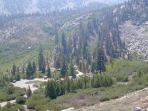
GIANT SEQUOIA: in between Sequoia & Kings Canyon, inside Sequoia NF
This chunk of National Forest land is perfectly located in between 2 very popular National Parks – Kings Canyon and Sequoia. This primary paved road leads to some great camping, a perfect option for NOT camping inside the crowed National Parks.
Turn east off of Sequoia ‘Generals Highway’ 198, on to the well signed Big Meadow Rd. There is primitive camping all over this area & a few developed campgrounds along this route. Motorhomes be warned: the road narrows to one lane with no “turn outs” or U turn spots for the last 10 miles (on a steep cliff w/ large overhanging rocks)
In the first few miles, the dispersed camp sites on the right side have great views & some situated on fairly flat granite slabs, perfect for astronomer campers or adventurous RVs. To the left side of the road is more primitive style campsites in wooded areas. The whole area is also a very popular cross country ski & snowmobiling spot for winter recreation. Hunters also like these camps during hunting season (in September).
There is a developed Horse Camp on the left side of the road for equestrian campers. This camp is located across from the biggest meadow and may be the first place you notice on this drive.
Buck Rock Campground (7600′ elevation, 5 spots) & Big Meadows Campground (7600′ elevation, 25 spots) are both family style camps, perfect for those who want picnic tables, plus bathroom nearby. Sorry no flush toilets out here, only pit toilets.
Buck Rock Fire Lookout Tower @ 8500′ elevation – is located to the north on Forest Rd # 14S02. It’s a great spot for some impressive views – if you aren’t afraid of heights. To reach the tower you must climb several flights of steel steps. This place is worth a stop if planning a sightseeing day.
Big Meadows Guard Station @ 7500′ elevation (also known as Big Meadows Cabin), is located next to the BIG MEADOW and is available for rent on a weekend basis from the NFS. Hiking Jennie Lakes Wilderness and fly fishing Big Meadows Creek are favorite activities to be enjoyed.
Big Meadows Road is long & narrow – 12+ miles. RVs are not recommended beyond the Big Meadow Campground, as the road is one lane in some spots & it skirts a cliff edge. The views are incredible the farther you go & many creeks feed the region.
The narrow, long paved road eventually forks off into several smaller dirt roads back near Horse Corral Meadow. Way back here, the dirt roads lead out to trail heads for backpacking, horse packing or day hiking in Jennie Lakes & Monarch Wilderness. Backcountry access to either Sequoia or Kings Canyon National Park! Have a good map if you plan to venture out this far. Pay attention & don’t get lost.
GPS would be helpful in this area. Some of the smaller of the dirt roads are not even on the NFS maps. Make sure to GPS way-point your favorite camp site, so you can find in next time…. in the dark.
This pine forest is home to the developed NFS campground – which has been named after the tribal elder. The camp location is a sacred spot to the local native tribes. Just above Susanville, CA on the west side, south of the highway; forested w/ creeks and aspen groves. Autumn colors can be found in the creek beds.
Dirt roads all over the place, leading to far away destinations like Diamond Mountain, Antelope Lake and Taylorsville. The backcountry region was recently damaged by wildfires: 2020 Sheep Fire and now the Dixie Fire
FREE CAMPING – W Susanville, CA en route camp
Less than 3 miles of dirt road #29N03 driving will get you back off the highway and into this forest, Hwy 36 W of Susanville. Bring the mountain bike for abundant usage and a week of exploring.
Only 13 miles to downtown Susanville, via the back road. Chaney Creek Road is a main dirt road near Highway 36, which parallels the river, the red rock bluff and the road, downhill into town.
This FREE campground is popular with the hipcampers and pediums – and gets rave reviews; small RV campers do like to use this camp spot, if they don’t mind a little dirt road driving; they’ll need to park in the dirt parking lot, 40+ feet away (not adjacent to the picnic tables or fire rings).
camping
ceremony
drum circle
fishing
hiking
horseback trails
hunting
mountain bike
off road trails
Bear Dance Circle @ Roxie
walk in campground, and close to town
Walk-In Campsites @ Roxie
AUG 2021 – CLOSED due to the Dixie Fire
Roxie P Campground
Susanville, CA – Lassen NF
• Elevation: 4,800′
• Number of Sites: 10 (walk-in only)
• Vehicle Accessibility: any
• Campsites Reservation: No
• Campsite Fee: No
• Length of Stay: 14 Days
• Season: open all year
• Trailheads: Diamond Peak
Flat forest and easy to walk. Shade and pine needles, picnic tables and group fire pits. All facilities are encompassed with a sturdy wooden, fence line. No RV or trailer access to camp sites. Mountain bikers like this spot and so do horseback riders. Travelers passing through eastern California will welcome the convenient location, plus the ease of dirt road.
The Roxie Camp is situated near Willard Creek on the south side of the Highway 36, close to Susanville. Willard is a feeder stream into the Susan River, which flows into town. Quiet camp, most of the time. If a big family is camping here w/ children, or there is a tribal gathering, it could get loud.
PLAN B – head over to Goumaz Campground NFS, due north. Located in between, near the junction of Hwy 38 & 44. Near the railroad tracks and the Susan River. Smaller camp near the NRT (National Recreation Trail), the Biz Johnson Trail (BLM). 2021, this camp is CLOSED!
so find someplace else: PLAN C
(make sure any camp is open by calling rangers before traveling).
OHV activity may be passing the developed campground, but are discouraged – due to the layout of camp. Plenty spots for ‘froaders further out – at the end of the road. Way back there!
Jeeps, 4×4 trucks, quads, dirt bikes, anglers and hunters travel these dirt back roads, as well as rangers, campers, horses, mountain bikes, and big logging trucks. 25 mph slow is always best. Daytime headlights help you get seen in the shadows. Forest is dense and road conditions are ever changing.
Forest Road #29N03 is Gold Run Road, the bumpy dirt road – that skirts around Diamond Mountain on the south side. Lots of one single track or one-lane dirt roads, which will require a National Forest map or a decent topo map to navigate properly.
OHV is common in these areas, but not so busy at this camp. If you seek peace and quiet and solitude, know how to read a map and where the noise is expected to be. Avoid the OHV areas, if you want to nap in the hammock and read a book.
Wild red necks with guns live in NorCal, so pay close attention to property lines and trespassing signs.
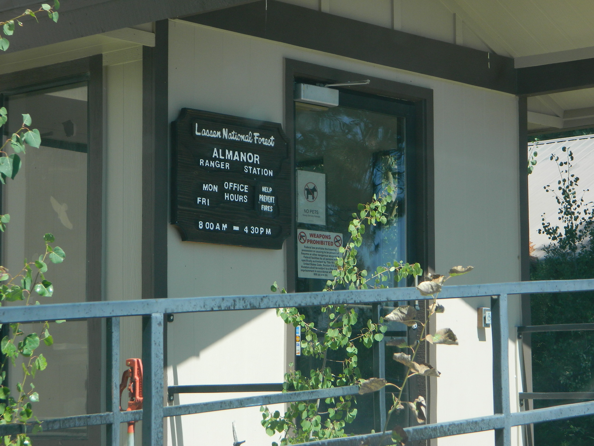
USFS Ranger Station is located on the west side, just outside of town, on the wide downhill grade on the highway @ the Eagle Lake turnoff. Cal Fire station is also located along this stretch of road.
Lassen National Forest
Ranger Station USFS
CA-36 @ Eagle Lake Rd
Susanville, CA 96130
530-257-4188
Cal Fire Station
697 CA-36, Susanville, CA 96130
530-257-4171
Great rural location, in-route to many destinations in Southern Cal. Temecula wine country, Warner Springs, Culp Valley, Anza Borrego Desert State Park, Borrego Springs.
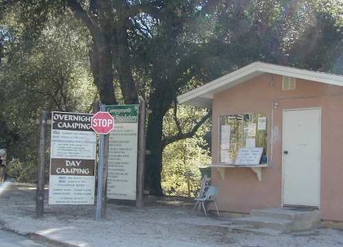
Campground is a popular spot with locals, so note that some weekends can get rowdy. Ask about a more secluded camp site option if needed. There is plenty of primitive land out here.
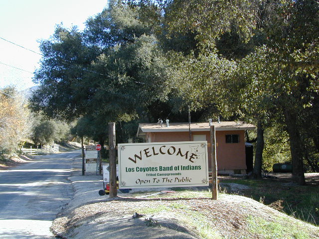
Oak trees and boulder hills, dirt roads, near Hot Springs Mountain. North San Diego County.
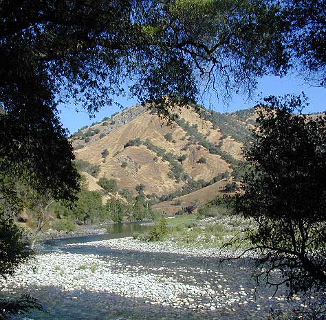
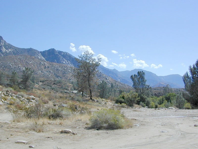
Kern River is a top recreation destination for the lower half of the state, since it is the only big Sierra river within easy reach of Southern California.
Lower mountain elevations 2000-4000′ means camping all year is possible on the Kern. With only a few inches of rainfall, plus an average high temperature of 60 degrees in December & January, Kernville has become a year-round recreation destination for the Southern Sierra Nevada mountains. Kern Canyon and most surrounding mountains are managed by USDA: Sequoia National Forest, which extends south to the Tehachapi range!
Sierra Nevada ROAD CLOSURES during winter restricts that Kern Canyon is only accessible via the Hwy 178 route. Both the Western Divide Highway (to the north) and Sherman’s Pass Road (to the east) close for many months, due to snow. (typically, NOV-APRIL closure)
Popular Kern Recreation – backpacking, camping, fishing, hiking, river rafting, kayaking, rock climbing, mountain biking, off-roading & floating (inner tubing).
Kern River can be divided into 5 different & distinct regions:
Granite gorge, Kern River, South of Whitney
Kern River High Country
headwaters of the Kern River.
High Sierra, Golden Trout Wilderness, Kern Hot Springs, Mount Whitney snowmelt, Kern Gorge. foot access only, wilderness backcountry. fishing, day hikes, backpacking, rock climbing, mountaineering, horse packs.
Johnsondale Bridge
backpackers & fishing trailheads
Big parking lot at the bridge. trails travel rivers edge into a tight canyon, impressive rock gorge continues up to the tallest mountain peaks in the High Sierra.
Shermans Pass Road hard right, up hill, turn-off the main (paved) route that connects Kern River to Mojave desert.
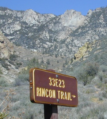
RINCON CAMP – The Rincon Fault (an earthquake fault line) runs in a north-south direction, on the east side of Kern River. Popular and rugged RINCON, a dirt bike and mountain bike trail runs this ridge as well. An overgrown hunters camp (which has been almost destroyed) is located up hill from Brush Creek falls; but accessible via unmaintained dirt road – unsigned pull out, just off Shermans’ Pass Road. High clearance vehicle is needed to reach this spot.
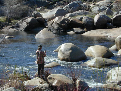
BUSY: This part of the Kern River sees much of the action, with kayakers, river rafters, fishermen, RVs, motorcycles, mountain bikers, backpackers and car campers, seeking easy river access, hiking trailheads or just a good picnic spot.
Numerous small lodges between Kernville & Johnsondale
Brush Creek: awesome waterfalls & pools on Brush Creek, only accessible by hiking trail.
Rincon Trail runs above the river on the east side, via the Rincon earthquake fault. This is right where Brush Creek comes down the steep mountain. RINCON is favorite mountain biking trail, that is also open to dirt bikes (OHV) & equestrian, so share the trail and play nice. Rincon Camp is rugged, may be overgrown and unmaintained. Long dirt road might require high clearance vehicle or possible 4×4, if weather is wet.
Huge recreational reservoir in the southern Sierra Nevada mountains. Dry and high desert terrain. Canyons have more vegetation. East part of lake is a wildlife refuge w/ abundant cottonwood trees, which turn golden yellow in Autumn.
The earthen dam is on the south westside. California State Route 178 (Hwy 178), which connects Mojave desert w/ Bako. This major east-west Sierra route is a four-laner (freeway) cutting thru the valley. EXIT# intersects w/ CA 155 to reach Alta Sierra, Wofford Heights, Kernville and all place north of there.
Breckenridge is a Mountain to the south of Isabella and Lower Kern. Tall pines with an empty campground awaits!
Lower Kern River
(river access / camping, southwest of Lake Isabella)
Minimal to modest campsites in the lower canyon. Most seclusion for overnight spots, can be found along the empty stretches of the Old Kern Canyon Road. Many curvy mountain miles, one lane, paved, several flat spots for easy road-side camping. Caution for cattle in roadway. Speed limit is generally under 40 mph for this historic route which parallels the 178, in between Lake Isabella and Bako.


 Mount Lassen is part of the Cascade Mountain Range, located north of the Sierra Nevada. The Lassen forest encompasses a large area of wilderness land, snowmelt creeks and an abundant dirt road system. Most of which is covered in deep snow about half the year, so plan accordingly.
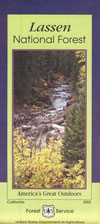


 No facilities such as toilets or showers. Maybe a picnic table & fire rings, if you’re lucky. Southern California
 Rentals typically include sleeping cots, but you’ll need to bring your own bedding (sleeping bags, sheets, pillows). Some rentals include shaded porches, wooden decks, minimal furniture, kitchenettes and/or wood burning stoves. Electricity may be available, or maybe not. Ask ahead of time, if you really must have that particular luxury when on vacation.
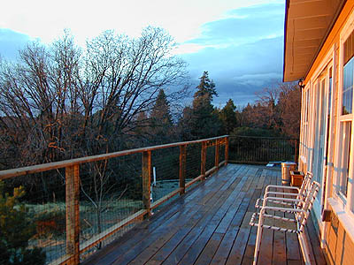


 Max RV Camper Length: 31′
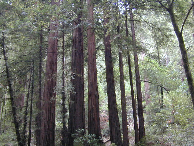


