Tag Archives: RV

Gurnsey Campground

bestcampgurnsey

Gurnsey Creek, Lassen Forests & Fishing

NFS Gurnsey Creek Campground: W of Chester, CA

CLOSED 2020-2022: Campground is undergoing some serious work with removal of hazardous trees and forest clean up. NOTE: DixieFire 2021 did not damage this portion of the forest highway (CA 36)

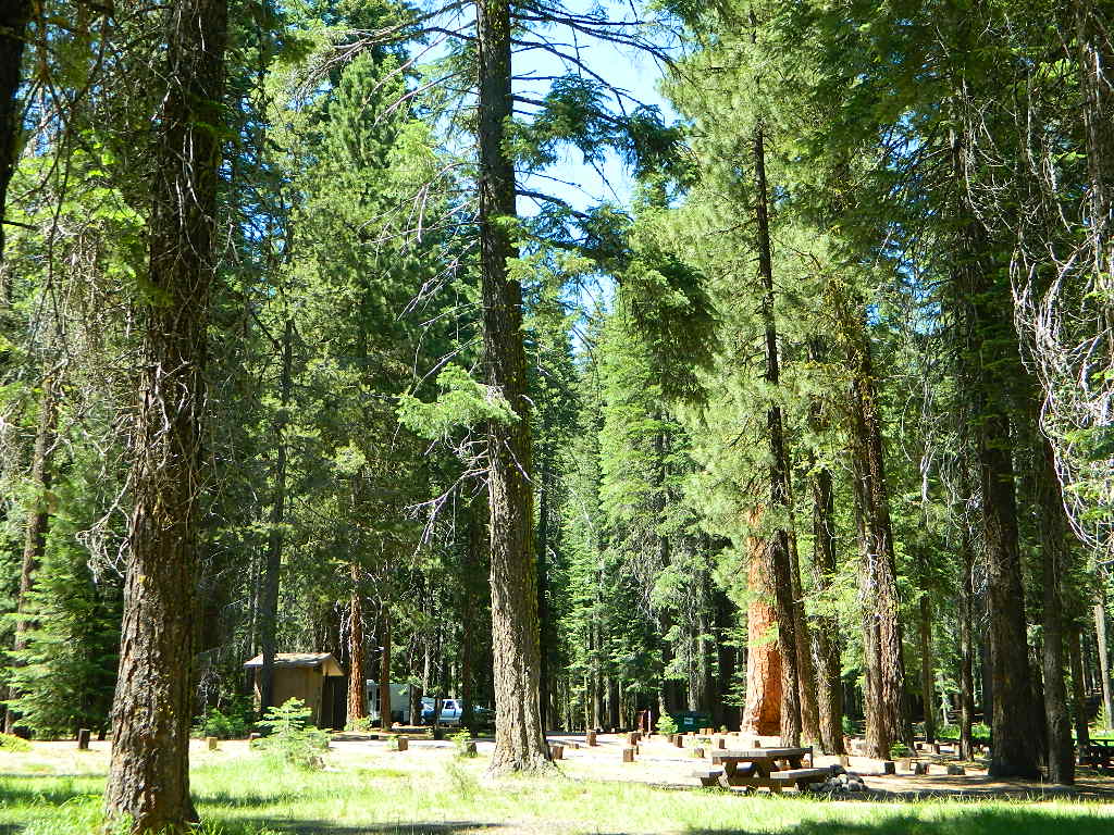
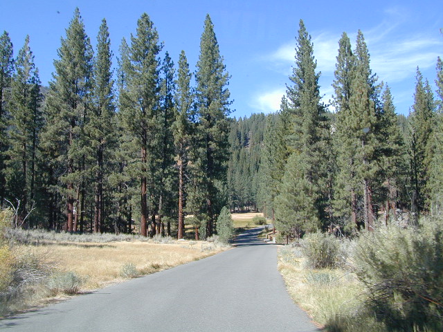
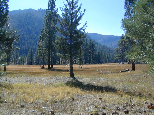
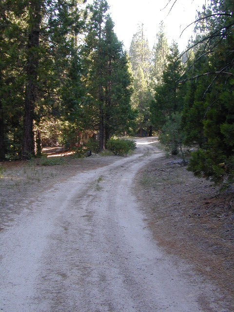
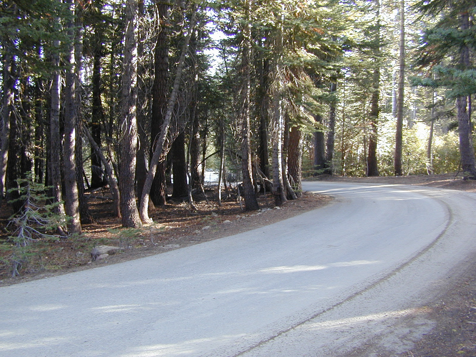
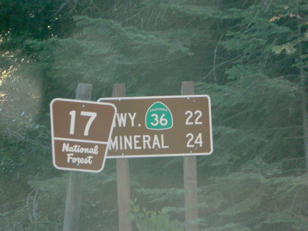
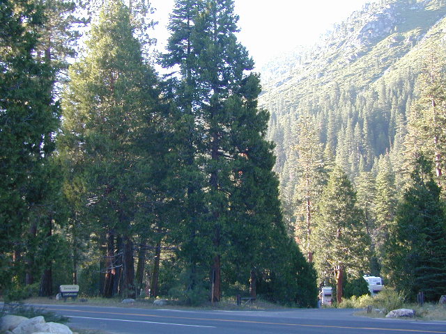
A developed USDA campground along forested Highway 36, near the junction of Chico’s Hwy 32. This stretch of 36  overlaps with north-south Lassen Hwy 89. Awesome fishing creek, meadows, hiking trails and mountain biking trails nearby. Paved, level camp sites w/ easy access to Lassen Volcanic Park and the National Forest.NFSlogo

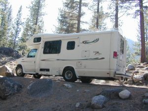
This is a popular camp just south of the Lassen National Park boundary and 5 miles east of Child’s Meadow Resort. Car camp, tent camping, some spaces for large motorhomes. Plenty fishing, hiking and mountain biking trails.

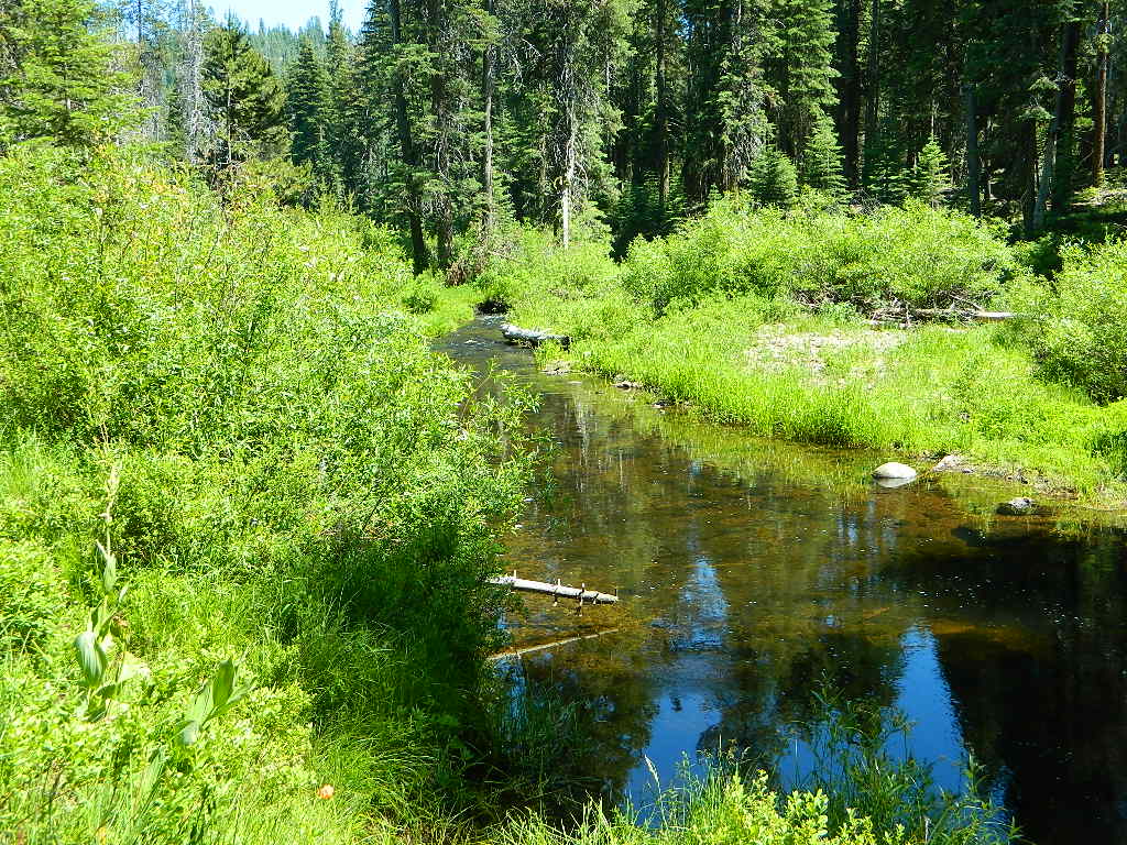
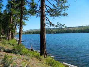
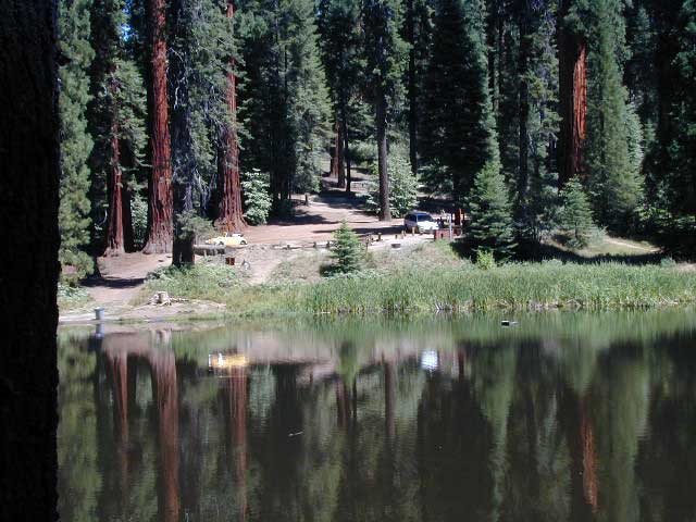
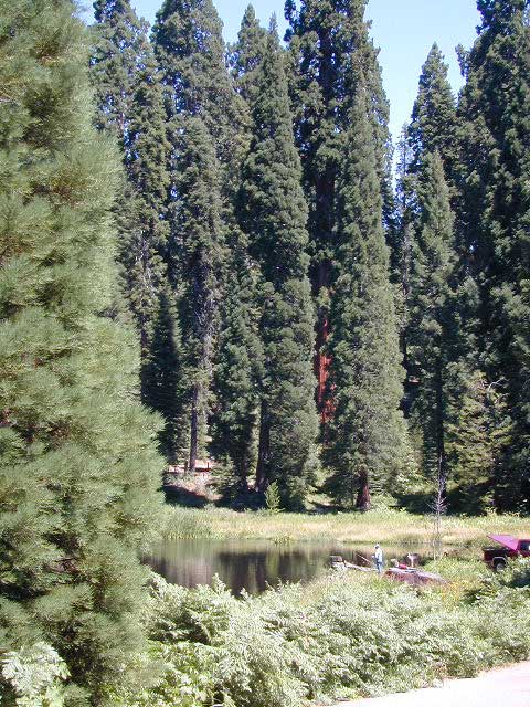
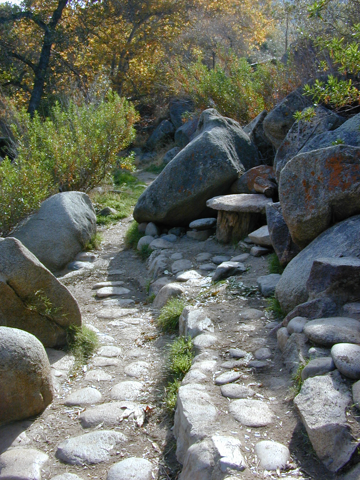
Gurnsey Creek begins in Childs Meadows, north on Hwy 36 – just outside of Lassen National Park 

gurnseycreek

Gurnsey Creek Campground, California

on Gurnsey Creek; Campground open May-October
(depending on snow)
gurnseysign

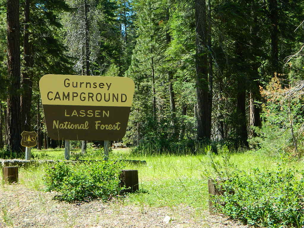
Lassen Creek Camping

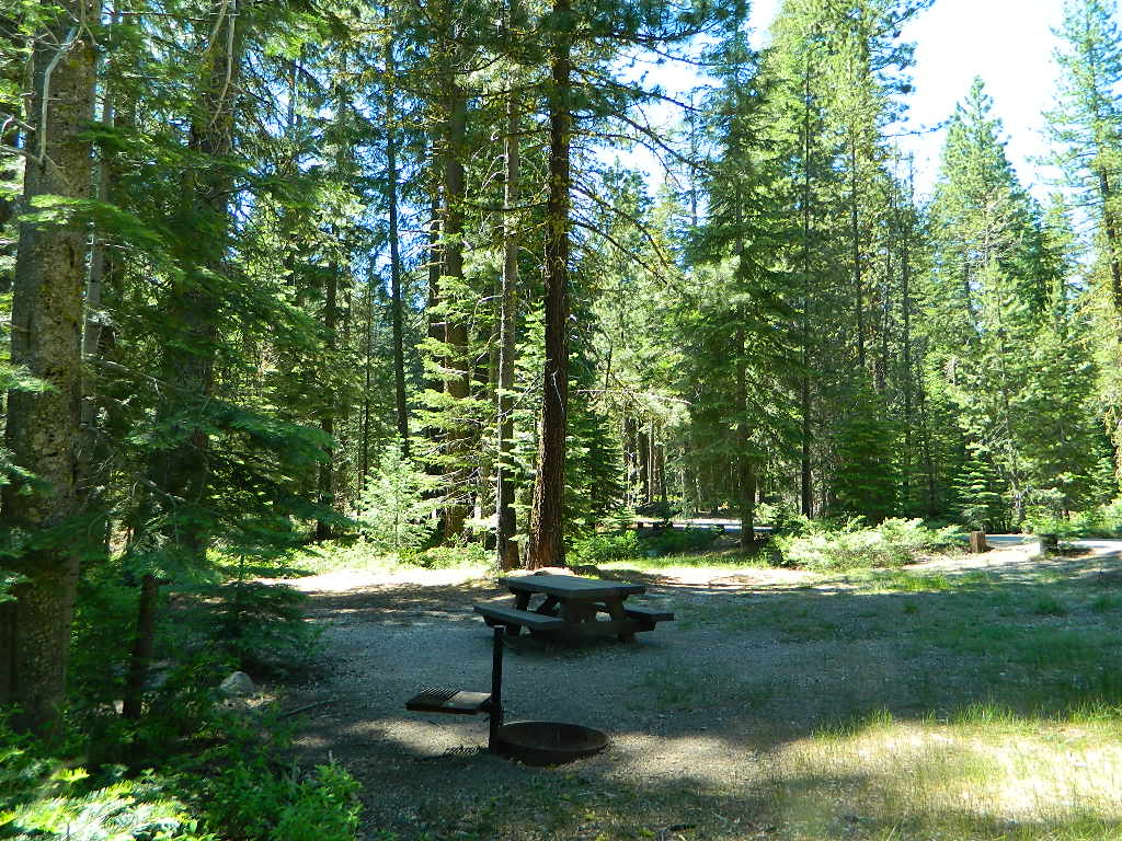
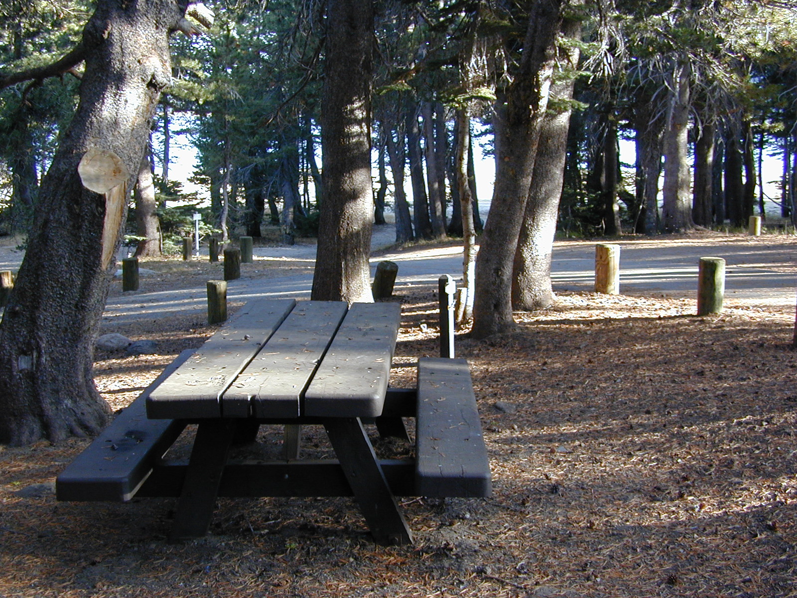
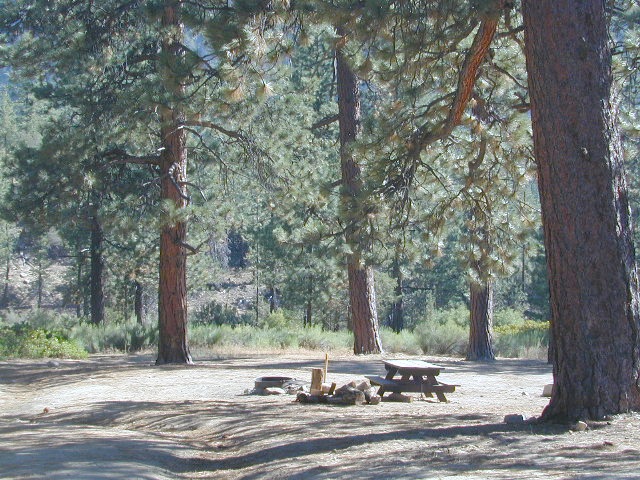
52 camp sites on Gurnsey Creek @ 4700′ elevation; vault toilets, creek and piped water, bear boxes; first come, first serve camping – and reservations are also accepted

GURNSEY CREEK CAMPGROUND

Max Camper Length: no limitations
Shady forest camp sites w/ creek. Numerous fishing spots. Close to Lassen Volcanic National Park, Chester and Lake Almanor. Backpackers, day hikers and horseback riders will enjoy the PCT nearby. Pacific Crest Hiking Trail runs to the east side of this campround.
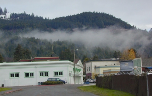
pct

CHESTER, CA ranger
Rangers Office: 530-265-4531
Almanor Ranger DIstrict, Lassen NF

GROUP CAMP RESERVATIONS NFS

2 reservable Group Camps are available at this campground. Group Site 1 can accommodate up to 56 people; Group Site 2 can accommodate up to 112 people.

Free Camping nearby.
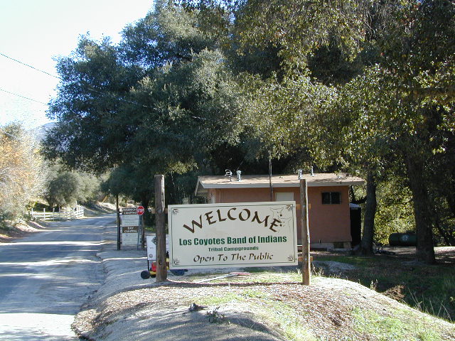
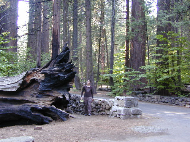
If you are seeking primitive camping in this Lassen area, look for dirt roads in the USDA National Forest lands, which surround the National Park boundary.

to the west – Lassen Road #14 – the Blue Ridge, north off of Hwy 89 @ Mineral.

to the south – Yellow Jacket Road #29N48 around Turner Mountain, which is south-southwest of Mill Creek.

to the east – Lassen Road #10 – head north off of Highway 89 in between Chester & Westwood.

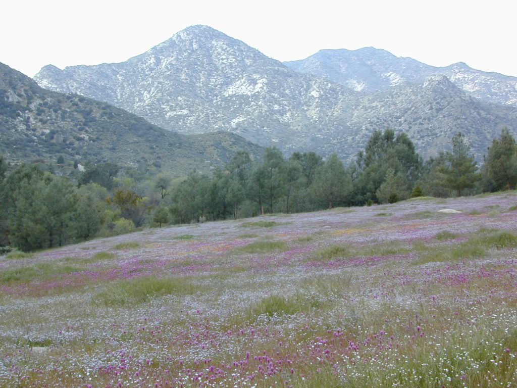
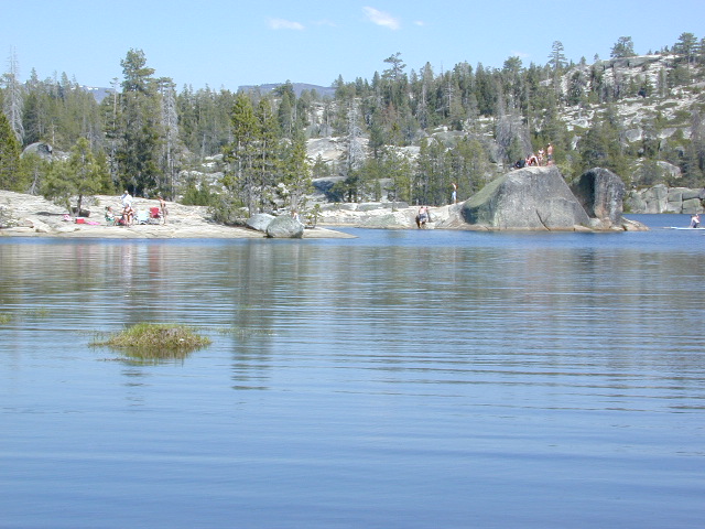
see also – Lassen Lakes

lassen park mapHighly advised: a real map, a printed ‘hard copy’ shows both the National Park and the National Forest of Lassen on one map – with topographic features, all mountain peaks, creeks, lakes, trailheads, plus all dirt and paved roads.

Trailheads near Gurnsey Campground lead out to –

NEARBY TOWNS:


View Larger Map

Gurnsey overview
Mature forested, creek campground, close to the highway

California Aspens

AspenGroves

Aspen Groves are easy to recognize with their thick stands. White trunks with dark knots, slender, with oval shaped leaves. Growing in a network of roots, which are found lining creeks, alpine lakes, or spilling out from higher elevations, along  scenic canyons.

The unique round leaves which can turn spectacular colors in the fall season. The fluttering and flapping of the oval-shaped, thick, green leaf is a sure sign of summer. When breezes get cooler, Autumn is only a few weeks away and as quick as the cold comes in, what a short and special show they put on.

autumncabin
Green Creek historic cabin, on the Eastern Sierra

California Fall Colors

Aspen trees can be found at higher mountain elevations in California, usually above 4000′ – all the way up to about 10,000′ or higher, depending on the mountain range and local water flows. Groves have an extensive root systems underground, so they often withstand wildfires and can come back after the rest of the forest is gone.

Beavers build dams in creeks around aspen trees, fishermen and campers love to camp next to aspens, and lovers carve their initials into their white bark. These trees do indeed take a beating, from all angles, winter weather included… so stop from cutting them!

carvings

fishing creeks mountain biking stargaze Picnic Camp Hiking horseback back roads mountains

  • BIKE
  • CAMP
  • FISH
  • HIKE
  • KAYAK
  • PICNIC

summer and autumn

These deciduous trees are naked half the year, typically from November to April, as winter buries them in snow and ice. Time is of the essence, limited to Summer and Autumn – to enjoy their shade and the beauty of the groves. Scenic meadows and fishing creeks are just an added bonus for searching out the aspen.

Aspens can be found in hidden canyons, primarily along the Eastern Sierra US Hwy 395 and surrounding mountain lakes. Some Sierra Passes have decent displays of color as well – like Carson Pass Hwy 88 and Yosemite’s Tioga Pass Hwy 120.

Below is a list of Total Escape’s favorite aspen areas of California

ASPENDELL
BAKER CREEK (4×4)
BIG PINE CANYON – NORTH FORK TRAIL

BISHOP CREEK
BLUE LAKES, CARSON PASS
BLUE LAKE, MODOC

CONVICT LAKE, US 395
COTTONWOOD CREEK @ ANCIENT BRISTLECONES
COYOTE FLAT (4×4)

CROCKER @ LAKE DAVIS
CROWLEY LAKE, US 395

DUNDERBERG MEADOW

EAGLE LAKE @
ASPEN GROVE CAMPGROUND

GREEN CREEK ROAD, US 395
HASKINS VALLEY @ BUCKS LAKE
HILTON CREEK, US 395
HOPE VALLEY
JUNE LAKE LOOP

LAKE SABRINA
LAKE TAHOE
LAUREL LAKES ROAD, US 395
LEE VINING CANYON
LUNDY LAKE, US 395

MAMMOTH LAKES, US 395

MCCLOUD CREEK @ ALGOMA
MCGEE CREEK, US 395

MILL CREEK to MINERAL, CA
HWY 172 LOOP aspensofmineral1000

MODOC NF @ BLUE LAKE
NORTH LAKE, ASPENDELL @ BISHOP

ONION VALLEY @ INDEPENDENCE
PARKER LAKE RD @ JUNE LAKE LOOP
PINE CREEK ROAD, BISHOP

PLUMAS-EUREKA STATE PARK
@ UPPER JAMISON CREEK CAMPGROUND

PLUMAS EUREKA

QUAKING ASPEN CAMP, GIANT SEQUOIA

RED’S MEADOW, MAMMOTH
ROCK CREEK ROAD @ US HWY 395

ROSS CAMPGROUND, PLUMAS NF

SPALDING, CA @ EAGLE LAKE

TOM’S PLACE, US 395
TWIN LAKES @ BRIDGEPORT
VIRGINIA LAKES, US 395

WISHON RESERVOIR

aspentips
Aspen Tips @ Eagle Lake California


aspenwall
Green Creek Camping

Autumn Camping in California


amigoaspens
Laurel Lake Road @ 9000′ – Eastern Sierra, California


aspensplit

What is Camping?

Old Timers Berry Creek

Basically, what is Camping?

4x4 camping RV camping car camping primitive camping backpacking cabin camping

BLM camping State Park camping National Forest campgrounds National Park camping


An overnight stay out-of-doors. Sleeping out under the stars.
Air bed, camping cot, tent… or just a tarp on the ground.
Perhaps a luxury Cabin Rental in the mountains or on the coast. Your choice.

stars camptruck campfire

camp
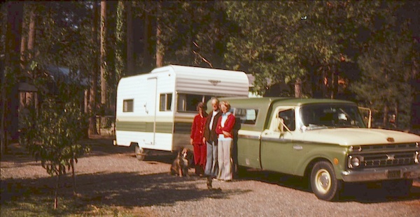
From a luxurious cabin in the mountains, to a small clearing in near a meadow with a stream nearby – with just a backpack, the idea of “camping” is always a bit different for each person. Roughin’ it for free – in the wilderness, or on the back roads; Or pay dearly for the price of real amenities, while on vacation.

car camping

Various types of Camping in California:

type of
camping
average
cost per night
brief description – what to expect
modern cabin $300 – $600 better than a hotel room, full kitchen, phone, internet, TV, real furniture and maybe a hot tub
rustic cabin $90 – $299 bare minimum, beds, kitchen sink, electricity. maybe a bathroom
tent cabins / yurts $60- $150 wood floors, canvas walls, sleeping cots. reservations accepted. (very popular) may be open seasonally
camper vans, motorhome,
recreational vehicle
rentals, or own it all creature comforts on wheels, lots of luxury. camp the back roads.
camper shell own it mini motorhome on the back end of a pickup truck. smaller than RV
RV campground $35- $80 50+ sites, lots of facilities & families w/ RVs. reservations accepted
developed campground $20- $50 usually 30 – 100 sites, paved loop, facilities. toilets, piped water. plenty in our camping section (most popular)
small campground $12- $27 less than 25 camp sites, pit/vault toilets. plenty small campgrounds listed in our camping section
primitive car camping free way-out-there camp spots w/ dispersed camp sites, for the rugged self-contained, self-sufficient camper; access usually via dirt back roads.
SUV/ 4×4 camping free remote spots on long, steep, bumpy dirt roads; dispersed camp sites in secluded areas. 4 wheel drive may be needed
walk-in campsites
bike-in campsites
low cost or free camp sites that require you to physically haul your camp gear from a parking area to the camp spot, ranging from 1/8 mi. walk to a 1-3 mile hike
backpacking free w/ wilderness permit ultimate in seclusion, bring it all on your back, on foot into the wilderness & enjoy trail camps

  pinetree    fish

River Beach Campground
Trinity River Camping, Douglas City, CA

yellowpost

SO CAL CAMP FIRES – Yellow Post Campsites are remote camping spots in secluded areas, in a designated fire safe clearing. Camp Fires
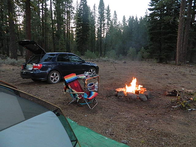
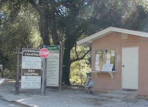
No facilities such as toilets or showers. Maybe a picnic table & fire rings, if you’re lucky. Southern California forests have these kinda spots. Required campfire permit & you must double check on local fire restrictions.

Tent Cabin Rentals

Canvas Tent Cabins & Yurts

These structures are half way between ‘roughing it in a tent on the ground’ & having a ‘mountain cabin’. Tent cabins have wooden floors w/ canvas walls and roof; Dismantled annually for winter rain/snow, they are usually only available in mild, coastal climates or during summer months in the mountains.

deluxe-tent-cabin
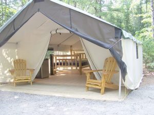
Rentals typically include sleeping cots, but you’ll need to bring your own bedding (sleeping bags, sheets, pillows). Some rentals include shaded porches, wooden decks, minimal furniture, kitchenettes and/or wood burning stoves. Electricity may be available, or maybe not. Ask ahead of time, if you really must have that particular luxury when on vacation.

Yurts are a ’round version’ of this canvas cabin – which need to be aired out, often (to prevent mold). Yurt rentals are very popular and in high demand in California.

Find these type of rentals at yoga retreats, hot springs, beach canyons, remote lakes, redwood forests, high sierra camps, fishing camps and at certain RV parks.

National Forest Service Rangers wildlife

Deck w/ View

National Forest Fire Lookouts
& Historic Cabins

hiker

Tent Camp Yosemite Valley

Camping California Back Roads


Silver Lake California

Silver Lakes @ Bucks
Silver Lake, near Bucks Lake Wilderness

Numerous Silver Lakes, Creeks and other “silver” terrain can be found inside California. After the Gold Rush of 1849 in the western Sierra, Silver was discovered in Nevada shortly after (east of Sierra Nevada mountains). This page is an overview on all places with SILVER in the name, or places that have had a history of silver mining. California Counties are listed in parenthesis. Links below will lead to more detailed pages or campground reservations.

Silver Lake @ Lassen

(Lassen Co)

silver kayaker

Silver Lake @ Bucks

(Plumas Co)

silver88

Silver Lake @ Carson

(Alpine Co)

Silver Fork of the American River. Silver Fork Road connects US Highway 50 & Carson Pass Hwy 88. Silver Fork Campground & China Flat Campground (NFS) are both located on this remote, backcountry route, about 8 miles from US Hwy 50 campground

golden glow june

Silver Lake @ June

(Mono Co)

Autumn aspen groves ignite with color in October. Often, some of the best fall colors in the Eastern Sierra. Day trips w/ fishing. Hiking everywhere. Overnighters or backpackers could be greeted with snow at anytime in October or later. The June Lake Loop (SR 158) closes for snow annually!

California Lakes named Silver

Silver Lake @ Gold Lake

(Plumas Co)

Lakes Basin Recreation Area also has a hike-in Silver Lake, trailhead near Gold Lake on Gold Lake Highway

Silver Lake @ Gold

califrepublic

below are silver mining camps and other silver related destinations, plus some campgrounds


Bodie SHP (State Park) calsp
(Mono Co)
8375′ elev. US Hwy 395 near Bridgeport, CA. Infamous, high desert ghost town, now a California Historic State Park. Large gold mining camp w/ well-preserved, wooden, old town structures. Silver was discovered in nearby Aurora Canyon.  All dirt road access. No developed campground @ Bodie, so try nearby Green Creek Road instead. Or high desert, back road camping on Aurora Canyon Road over to Bridgeport Reservoir.

Cerro Gordo
(Inyo Co)
8500′ elev. Inyo mountains, West of Death Valley, east of US Hwy 395 @ Junction 136. Old mining camp rich in silver history. Someone might even live up there. Extreme remote location in rugged, high desert mountains. 4×4 is always required!

Silver City Sequoia NPS
(Tulare Co)
6935′ elev. cabin resort on Mineral King Road, in the South Sequoia National Park

Silver Creek Campground NFS campground
(Alpine Co)
Developed Campground south of Markleeville, Highway 4, Ebbett’s Pass, Central Sierra Nevada

Silver Creek Campground campground
(Placer Co)
Camp right on the Truckee River, and on busy Hwy 89. in between Truckee & Lake Tahoe, California

Silver Valley Campground & Silver Tip Campground (Alpine Co) are both located near Lake Alpine on Highway 4 Ebbetts Pass , Central Sierra

jacksonmdwsign

Silvertip is also a Group Camp at Jackson Meadow Reservoir (Sierra Co) off Hwy 89, North of Truckee, CA. Silvertip Group Campground, as with all group camping facilities, is by reservation only.

Silver Lake @ LA
(Los Angeles Co) a hip and popular, tree-lined neighborhood in Los Angeles, near Griffith Park.

Silver Lake
(San Bernardino Co)
Silver Dry Lake, a dry lakebed in the Mojave desert, near the Hollow Hills Wilderness, north of Baker, CA off I-15

Silver Lakes
(San Bernardino Co)
2430′ elev. a desert community southwest of Barstow, near Helendale, CA. Located on the Mojave River (which flows underground) in between Historic Route 66 & US Hwy 395. Attraction nearby – Exotic World, the Burlesque Hall of Fame.


silverstrand

Silver Strand State Beach State Park

(San Diego Co)
A sliver of sand makes up this narrow beach, barrier island for San Diego Bay. RV Camping, best in SD. South San Diego, Coronado Island campground

silverwood

Silverwood Lake SRA State Park

(San Bernardino Co)
State Recreation Area @ Cajon Pass I-15
in the San Berdu National Forest


lacontedivide

High Sierra, California

hike-in only

backpacking

Silver Pass Lake
Silver Divide & Silver Pass
(Fresno Co)
11,000′ elev

Located in between two 12,000′ peaks
near PCT – Pacific Crest Trail
John Muir Wilderness

backpacking

Silver Lake
(Tulare Co)
11,000′ elev

via Mineral King trailheads
Golden Trout Wilderness
South of Sequoia NP
Southern Sierra Nevada

Another Hike


Weaverville Car Show

Lee Fong Park
Beautiful park setting @ Lee Fong Park, in historic Weaverville

Historic Weaverville’s Car Show

Weaverville Chamber of Commerce & E Clampus Vitus (ECV #62) present NorCal’s summertime CarShow in Weaverville, a highlight of the Trinity River region. This classic auto display is held at a beautiful small town location & it’s been running for years. Event festivities spread out between the SuperMarket parking lot and Lee Fong Park, near downtown Weaverville, California; Camping & fishing are superb in these forests at this time of year. Make a long weekend of it!

Enjoy raffle prizes, Clamper breakfast, raffles, vendors, VFW Tri-Tip Lunch, Music, Shuttle Service to Historic Downtown Weaverville beginning 10 am Saturday.

This auto show event may have been previously referred to as “Car Show in The Park”

Annual event; June
530-623-6101
weavervillecarshow.com

WEAVERVILLE CA

Trinity Alps Hiking Map

Los Coyotes

los coyotes SD

Los Coyotes Camping
Los Coyotes Reservation Campground

North County San Diego
Camping SD

Way out there, on your way to the Borrego desert, past Warner Springs somewhere is this little gem of a location. Near the southern slopes of Palomar Mountain, on the edge of Cleveland National Forest.

Los Coyotes Band of Indians Tribal Campground

open to the public

Great rural location, in-route to many destinations in Southern Cal. Temecula wine country, Warner Springs, Culp Valley, Anza Borrego Desert State Park, Borrego Springs.

Campground is a popular spot with locals, so note that some weekends can get rowdy. Ask about a more secluded camp site option if needed. There is plenty of primitive land out here.

Oak trees and boulder hills, dirt roads, near Hot Springs Mountain. North San Diego County.

Los Coyotes Band of Cahuilla & Cupeño Indians

Warner Springs, CA 92086
RECREATIONAL# 760-782-0712
ADMIN# 760-782-0711

payherebooth

snowx
Hot Springs Mountain SD

Grover Hot Springs

Grover Drive

Grover Hot Springs Park

JULY 2021 State Park CLOSED due to the wildfire, Tamarack Fire.

California State Park
Sierra Hot Spring Camping Resort
open all year

California State Park RV Winter Camping State Park Winter Camping Hot Springs XC Ski Winter Camping Tahoe Ski Camping Tahoe Snow Camping

Meadow Entrance

South of Lake Tahoe, hidden in a forest meadow near the small town of Markleeville, sits this super scenic, year-round camping resort in the Sierra Nevada mountains. Popular place for senior travelers, RV campers, families, snow skiers, and tourists.

No lodging available, no cabins. Only Campground Camping – Reservations are recommended. This is a popular destination for the Eastern Sierra Tahoe region. May thru September are peak season. During mid-winter a portion of the campsites are closed and the remainder may be on a first come, first serve basis. State Park is located 4 miles west of Markleeville, at the end of Hot Springs Road.

camping
fishing
hiking
hot springs
cross country skiing
stargazing

RV Camping

grover springs in the sierra

Camping and Day Use
530-694-2248

Pool Information
530-694-2249

California State Park

Piped water, flush toilets, showers, this is luxury camping by State Park standards. Hiking, fishing, stargazing. Quite an ideal spot, especially if you visit during a slow time. Surrounded by mountains that top 10,000′ elevation, expect to see some snow in the winter months.

SwimSuits Required

The hot pool resort is open to the public for day soaking w/ a fee. Wheelchair accessible areas. The pool hours tend to fluctuate with the seasons, so be prepared for anything. Even a snow storm!

Grover Hot Spring Campground

• Elevation: 5800′
• Number of Sites: 75
• Vehicle Access: RV 27′ max
• Campsites Reservation: Yes
• Camp Fee: Yes
• Length of Stay: 10 Days
• Season: Open all year
• Trailheads: Carson River

GROVER HOT SPRINGS SP Winter Camping Hot Springs

pool hours

hot pools

meadow views

Blue Lake Modoc

Modoc Blue Lake
Blue Lake in Modoc National Forest
Hiking Lake
Hiking Lake w/ Loop Trail in far Northern California

Blue Lake
Modoc National Forest

When you really wanna get away from it all, take a week off and head up to Modoc – the top northeast corner of California, where the volcanic mountains line the Great Basin.  The population is minimal, cattle are abundant and the campers few. Even in mid summer, this ideal lake campground rarely fills up.

camp

Jess Valley Road leads east off US 395 @ Likely, CA – 16 miles back to this hidden gem.

Headwaters to the Pit River.

NFS Campground is shady, well managed, and spread out on the eastern slope w/ numerous paved loops. Tent campers, cross country cyclists, truck campers w/ canoes, SUV families, motorhomes with kayaks and kids.

modoc map
Modoc Map

Blue Lake Campground NFS
• Elevation: 6,050′
• Number of Sites: 48
• Vehicle Accessibility: 32′ RV
• Camp Fee: Yes
• Campsite Reservation: No
• Water: Piped
• Length of Stay: 14 Days
• Season: May –October
• Trailhead: Lake Loop
• Boat Ramp: Yes

Group Camp Facilities (by reservation only)
Modoc NF Warner Ranger District
@ 530-279-6116

Lava Blue Lake
Lava Rock @ Blue Lake Loop, in Modoc County, CA

Blue Lake National Recreation Trail

hikerRight next to camp: A pretty much perfect LAKE LOOP (1.5 mi) hiking trail is worth a serious stroll; footbridge, wildflowers, fishing spots, minimal hills, lava rocks, and awesome scenery. Plenty of wildlife can be seen, including butterflies and bald eagles. Trail is shaded by tall white fir and ponderosa pine trees. Trailhead is located at the Day Use parking lot, w/ paved boat ramp, dock, and picnic area.

stars canoe  fish

  • back roads
  • boating
  • camping
  • canoeing
  • fishing
  • hiking
  • kayaking
  • mountain biking
  • picnicking
  • swimming
  • stargazing
  • wildflowers
  • wildlife

Wild Blue Lake

NOTE: not every CAMPSITE has a LAKE VIEW

Certain campsites are adjacent to the lake; some are set facing a meadow (Autumn w/ aspen groves), or the alpine forest w/ deer grazing. Perhaps an inner circle (interior) campsite, for those who like to be close to bathrooms and piped water. Large families will love the abundance of camp settings and accommodations.

Paved Loop
Plenty of Vault Toilets
Piped Water
Recycles & Trash Service

Large Campsites
Large Campsites can accommodate Motorhomes
  • no paved camp stall
  • no hook-ups
  • no dump station
  • no cell phone signalcamptruck

popular lake camp for motorhomes

When driving a large RV back in here, be courteous of other campers. Nothing sucks more than driving a long distance to the boonies, to arrive at camp just before dark and annoying everyone else already there.

Those needing to drive the campground loops (more than twice) looking for the biggest, levelest, best camp site – and burning $10 in gasoline doing so, should consider walking in.RV

Park that beast (near boat ramp area, before the camp entrance). Get out and walk the hills and loops, BREATHE & relax – prior to a choosing camp site.

Unhitch any tow vehicles; use that to scout out your perfect spot, if you cannot hike it. Trailers and large motorhomes will find this place ideal, but getting the right camp, can make all the difference.

Trail around Campground

Paved Trail around Campground

The wildfire: BLUE FIRE burned this region in 2001, but it is lush and green again (2019). Northern California gets some real weather. Rain and snow, more than half the year. The campground closes annually due to snow.

Kayaking is best done in the morning, cuz wind picks up in the afternoon. Canoes can launch at boat ramp, or at shoreline from trails near campsite.

Hiking trails can be found all around lake and campground. Wilderness access can be found at South Warner trailheads within a short drive from the lake.

Cyclists also love this camp, as it is located near a major highway and is a perfect place to really relax, soak in the scenery and get some quiet-nights sleep.

Modoc National ForestNFSlogo
225 West 8th Street
Alturas, CA 96101
530-233-5811


south warner sign

South Warner Wilderness is close by, driving distance; accessible by graded dirt roads. Signage is decent.

Modoc Forest Road #64 is a through-route, across the lower South Warners – 40
miles connecting to east side of the mountain, at Eagleville, CA.

Dirt Roads are suitable for trucks w/ trailers. SUVs and rugged passenger cars are okay. Motorhomes are not advised on this route.  Washboard conditions are typical. Winter closure on this route is common.

south warner mountains map

MODOC RD 64

Several miles away from Blue Lake, 2 rustic trailhead campgrounds are located back this way – East Creek Campground & Patterson Campground. Less than 10 camp sites each, equipped  w/ horse stalls, vault toilets and maybe piped water. Trailhead parking for backpackers. No RVs!

Autumn colors w/ aspen groves. Open, large meadows and mature forests w/ wildfire scars. Cattle can be found grazing all around, many cattle crossing.

Minimal primitive camping options, along road sides. Campfire permits required. No camping within one mile of a developed campground.

Cow Country
Modoc is Cow Country
Road64
Day Trippin – Out exploring Modoc Road 64 (and cutting firewood)

nearby towns –

see also –
Mill Creek Falls Campground

Oak Bottom Campground

Oakbottom Campground

Whiskeytown Recreation Area:
Oak Bottom Campground

Carr Fire 2018: some portions of this lake, shore, roads and trails may be closed due to the recent wildfire

The large, level, paved campground is right on the north shore of Whiskeytown Lake, on Hwy 299 – E of Redding CA

hiker

101 walk-in campsites
22 RV sites
elevation 1200′

  • boating
  • camping
  • hiking trails
  • kayaking
  • marina
  • mountain biking trails

Campground Reservation on NRA

Camp Sites near Water

Group Camping can be reserved at
Whiskey Creek Group Picnic Area
3 group camping sites with excellent views of the lake and mountains, on the northeastern shore of Whiskeytown Lake.

nearby towns:

Views Westward

canoe

Lake Sunset Whiskeytown

And by golly, there is another

OAK BOTTOM CAMP in Northern California,
way over west near Marble Mountain Wilderness

camp

Salmon River @ Somes Bar:
Oak Bottom Campground NFS

elevation 700′
26 sites
No electricity, water or sewer hookups

Six Rivers National Forest – Oak Bottom Campground loops around a forested hillside with large trees providing ample shading for multiple sites within the campground. A variety of wildlife makes its home in the area.

Located off the main highway, on a side road, with the epic Salmon River! This NFS campground is popular with whitewater enthusiasts in the spring. Rafters, kayakers. Many challenging rapids ranging from Class 3 to 5 are available. Swimming is also popular in the summer and numerous river access areas are a short drive or walk from the campground.

23S16 – Sequoia NF

Sugarloaf Ridge, Greenhorn Mts
Alta Sierra, Kern River Canyon

sugarloafrd
Sugarloaf Road, above Kern River Canyon

SOUTH SIERRA: This route is located in between the Western Divide Highway and the cedar community of Alta Sierra, CA

Sequoia Camping

Sugarloaf Ridge: Forest Rd# 23S16 – Thompson Camp Spring, The Den @ Sequoia National Forest

Driving north on Sierra Hwy N of Kernville, California; Passing Fairview & the Johnsondale bridge; After the R Ranch @ Johnsondale, take the left fork on the main highway; After you climb in elevation, look for brown signs on right side of road & turn left on Forest Service Rd# 23S16. Primitive camp sites are located throughout this area along Packsaddle Creek. Do not turn left up Sugarloaf Rd. There are no good camp sites up that way (unless you wanna make one).

RV campers are very common at Thompson Camp Spring, as this road is paved up to this point. The paved road is windy & narrows after this point. It is not advised for trailers or long motorhomes past Thompson.

For the more adventurous, Bear Meadow & Packsaddle Mdw are located up the dirt road a bit on #23S64.

Vsugar

Paved Sequoia route# 23S16 continues to climb, which leads to the Speas Meadow, the Greenhorn Mountains & you best have a real good map if you are heading up this way. 20 miles of awesome open meadows, small streams, dense forest, wildflowers, some primitive camp sites & great viewpoints overlooking the Kern Canyon. All passenger car accessible! Elevations between 6000-7000′. Sugarloaf Peak has cross country skiing.

Side route #23S05 will take you to White River Campground w/ 12 spots. The paved road winds west down the mountain to Posey & eventually Glennville on Hwy 155.

Instead, to easily reach Hwy 155 – you’ll need to get on dirt for a few miles. While on 23S16, look for the Panorama Campground (@ 7400′ elevation w/ 10 sites). Take dirt road #24S15 to get back to civilization @ Alta Sierra, California.

NFSlogo

Sequoia National Forest

Sequoia National Forest MAP

Sequoia Forest Topo Atlas


nearby small towns are:

Vbeardrive

Best Paved Roads in the Sierra Nevada

Pine Canyon Road
Inyo National Forest Rd # 6S17
Bishop, CA

Western Divide Highway
Giant Sequoia NM
Ponderosa, CA
(LIMITED ACCESS 2021, due to wildfire damage)

Forks of the Kern: Sequoia National Forest
Forest Rd# 22S82
(CLOSED 2021, due to wildfire damage)

23N16 Motorcylce Ride: Pashnit
pashnit.com/ca-forest-road-23s16

kernwildflowers
Kern River Wildflowers (April) w/ Sugarloaf Mountains

Blue Lakes California

Blue Lakes
Hwy 88 @ Carson Pass
South of Tahoe

Blue Lake California
ADA Camping (Americans with Disabilities) Handicap accessible camp sites at Blue Lakes, near Hope Valley, CA

Blue Lake Campgrounds

highest lake campgrounds in the vicinity

Eldorado National Forest in Amador Ranger District; a forest south of Lake Tahoe in the central portion of the Sierra Nevada mountain range. This set of scenic, alpine lakes sits in between both Eldorado, Toiyabe National Forests and the Mokelumne Wilderness. But please take note that the Blue Lake facilities are owned and operated by utility company PG&E

No Reservations.
most camp sites are available first-come, first-serve

RV limitations: 30 feet

69 miles east of Jackson, CA on Highway 88 and then another 12 miles south on Blue Lakes Road. This area is close to Hope Valley, south of Lake Tahoe, CA

Blue Lakes consist of several developed campgrounds. Blue Lakes Rd# 13 is a well signed, paved road off Hwy 88, just east of Carson Pass (8560′ elev). The route is closed during winter snow, while it serves as a winter recreation area. The main paved road becomes dirt near the campgrounds. A dirt road continues past the lakes and south to Deer Creek and meets w/ Hwy 4 near Ebbett’s Pass.

RVblue lakes eldorado

RV campers, fishing folks, hikers, kayakers and disabled travelers like this lake camp area due to the easy access, paved parking and campground amenities. Handicapped camp sites are also prime lake front locations.

Group Campgrounds are reservable. Picnic Areas, Group Sites and campfire rings. Piped water, bear boxes and vault toilets. No RV hookups, no dump station, no showers. Unimproved boat ramps are available at Upper and Lower Blue Lakes.

Lower Blue Lake Campground
elev. 8055′
camp sites: 16

Blue Lake Dam
camp sites: 25

Middle Creek Campground
camp sites: 5

Upper Blue Lake Campground
elev. 8136′
camp sites: 32

Overflow Camp
camp sites: 34

hikesBackpackers and day hikers: Sierra trailheads out here lead south into the Mokelumne Wilderness Area. The infamous Pacific Crest Trail also passes thru this high elevation region: PCT access @ Carson Pass, Upper Lake & Tamarack Lake

recreation –PCT

  • backpacking
  • boating (non-motorized)
  • camping
  • fishing
  • hiking
  • horseback
  • kayaking

local topographic maps:

nearby townsLower Blue Lake


Tahoe Back Roads

driftwood

another blue lake?

Yep, there is more than one Blue Lake in California

Blue Lake Modoc
Blue Lake Modoc NF

Modoc Blue Lake

BLUE LAKE CAMPGROUND
NorCal region of the South Warner Wilderness in Modoc National Forest. That’s way out near Alturas. Likely, CA is the turn off US 395. Northeast California, real seclusion.

EASTBOUND Paved Road #64 is Jess Valley, which leads along the Pit River, cool volcanic cliffs, and up to forested Blue Lake Campground, elevation 6051′

Wild Blue Lake
Wildlife viewing @ Blue Lake Modoc

hiker

Donner Blue Lake

DONNER PASS – Sierra Nevada
Interstate 80

BLUE LAKE CAMPGROUND
i80 Donner Pass, near Truckee, CA; a PGE Campground w/ 4×4 access and hike-in only. First come, first serve. No tables or restrooms, elevation 5900′

fish

camp

Lake County – Blue Lakes

THE LODGE AT BLUE LAKES
Mendocino Lake Country

Highway 20, East of US101

Lake side resort w/ boat rentals and fishing, near Upper Lake, CA
elevation 1357′

A small resort w/ hotel suites and a lakeside setting w/ abundant nature. Two small lakes, kinda close to the highway. Non motorized boats only, kayaks, paddle boards, canoe, swimming, birdwatching, bike paths and fishing.  Wedding venue next to lake. Wineries, restaurants, and a casino nearby.

canoe

Humboldt County: Blue Lake, CA

Blue Lake, California  95525
Historic lumber town, located East of Arcata along the Mad River. Accessible via Highway 299

foggytown
Coastal fog is common in this neck of the woods.

pinetree

Free RV Camping

Free RV Campsites / RV Campsite California

picnicThe best free camping in California for RVs & motorhomes is NOT the WalMart parking lot in some random town, but the gems that you find here on Total Escape.

The California back roads is where it’s at. Star filled skies, fresh cedar scents & tall pines, plus the awesome views. Primitive camping at it’s best, with your kitchen sink. No hook-ups, no fees, no problem.

the back roadscamptruck

So, if you are one of those that are terrified of driving your big luxury camper on dirt roads, these may not suit your taste. But if you crave the back country camps with your RV, then you might enjoy the list below.

Still many dispersed, primitive FREE camp sites to be found – but you’re not gonna find them on those big web sites, that everyone goes to.

check

no hookups, no paved stalls, no dump station

These are camping areas, that you can pull into anytime of the night or day & find a flat spot. Some places may have picnic tables or campfire rings, but not all. No OHV parks, no large developed campgrounds, just dispersed FREE camp sites on the back roads of Cali.

Camping National Forest
Somewhere out near Dinkey Creek in Sierra NF

Dispersed Camping for RVers in California:

camp

SoCal Areas & Deserts

campersatcalkin
Calkins Flat on Kern River

Southern Sierra Nevada California

Eastern Sierra California

uticasummer

Central Sierra Nevada California

RV

Rd #54 Tahoe
Rd #54 – South of Lakes Basin Recreation Area

Northern Sierra Nevada Mountains

Free North Lassen
Lassen Rd #32N12D, 1 mile past Twin Bridges

Northern California

LassenWestRd17
Lassen Forest Road 17 @ Hwy 44
vanlifenorcal
Van Life, on McCloud Creek @ Algoma


Central Valley Reservoirs

California’s Central Valley Recreational Lakes & Reservoirs

boatingcampingRV campshiking fishing

(listed from north to south)

North State / North Valley / North Sacramento Valleyboatramp

Black Butte Reservoir
Stony Gorge Reservoir
East Park Reservoir
Lake Berryessa
Lake Oroville SRA
Thermalito Afterbay
Thermalito Forebay
New Bullards Bar
Collins Lake

Sunset at the Lake
fishOak foothills of the Historic Gold Country, at the edge of the Sierra Nevada mountains.

  • boating
  • canoe
  • camping
  • fishing
  • hiking
  • houseboats
  • kayaking
  • wildflowers

Most Central Valley Reservoirs have blooming wildflowers in early springtime. Summer heat can measure triple digits for months as most of these lakes are located below 1000′ elevation.

Central Sacramento & California Delta

Trimmer Boat Ramp
Trimmer Boat Ramp @ Pine Flat

Central Valley / San Joaquin Valley

Lake Amador
Lake Camanche
Pardee Reservoir
New Hogan Lake
New Melones Lake
Woodward Reservoir
Salt Spring Valley Reservoir
Lake Tulloch
Don Pedro Lake
Turlock Lake SRA
Modesto Reservoir
Lake McClure
San Luis Reservoir SRA
Eastman Lake
Hensley Lake
Woodward Reservoir
Millerton Lake SRA
Redinger Lake
Pine Flat Reservoir
Lake Kaweah
Lake Success
Buena Vista Reservoir

Walk-In Camp Site at Lake
Walk-In Camp Site at New Melones Lake, Gold Co

Kaweah Sequoia Sierra
Lake Kaweah, near Mineral King & Southern Sequoia NP

Yellow Post Campsites

yellowpost


Yellow Post Camping

Yellow Stake Camp Sites / Back Roads Camping NFS
near Cajon Pass, Big Bear & Idyllwild CA

YELLOW POST CAMPS are dispersed camping sites on the back roads in Southern California, where fire danger is greatest. Forest authorities have designated certain spots as ‘fire safe’ for remote, open camping options around Big Bear Lake, Fawnskin and the Idyllwild mountain area.

If you prefer to stay out of the developed campgrounds, you will be the minority. But you must know how to read a map well to reach these beauties.

Map Big Bear

camping

SoCal camping doesn’t have to mean crowded campgrounds. Seek your seclusion on the dirt back roads, where there are no fees, minimal noises & a private site waiting just for you. These are usually on a first come, first serve basis. A high clearance vehicle (SUV, truck or 4×4) may be needed to reach some of the premium camp spots, but there are also sites accessible by passenger cars. And, of course, a fire permit is required.

HeartBar14

In the San Bernardino National Forest there are several back woods ‘fire safe’ camping spots, that are noted with a single yellow post & some may require reservations in busy summer months. You can find out more on reserving from the Big Bear Discovery Center, 909-382-2790

campfires bannedExtra caution should be used when winds are high, camp fires are often banned due to wildfire danger. Check with local rangers for up to date conditions and always get your campfire permit.

No restrooms, no water, no facilities. Just a dirt road, a fire ring & a single picnic table. Hopefully your table will not be shot up, by the local rednecks who ‘get off’ doing stupid stuff like this. Pick up any litter & leave the place better than your found it.

Yellow Post Camps

These backroad camps are perfect for the 4×4 group, stressed out social club, church group w/ rugged van, or the city SUVer who wants to get away from the crowds. The most sought after camp spots are nearest to the lake or a site accessible by RVs and horse trailers, but there are many more excellent camp sites to be discovered. USDA Forest Service Map is highly advised to reach these remote, dirt road camp areas. Rugged, steep, one lane dirt roads that lead to some of these spots. A passenger car is sometimes not suitable for all dirt roads. Rutted and steep means turn around. Wet weather changes dirt roads. Often routes close for winter w/ locked gates.

Big Bear Back Roads Camping

download PDF maps
on Big Bear Yellow Post Sites

Campsite7

Big Lots

Cajon Pass Camping near I-15

Idyllwild Dispersed Camping

thomas camp
Topo maps, Wilderness hiking maps, Equestrian trails, OHV maps –

Balch Park

Balch Park / Sequoia Park

Balch Park Campground

BALCH PARK campground is on a first come basis; no campground reservations needed.

2021 – THIS CAMPGROUND IS CLOSED indefinitely,
due to the Castle Fire 2020

Balch Park open May to October
Park info # 559 539-3896

Hedrick Pond lined w/ Sequoia trees

Balch County Park is right in the middle of Mountain Home State Forest, which is within the bigger Sequoia National Forest (aka Giant Sequoia National Monument). But don’t let all the bureaucracy mislead you, this is an ideal park and location, well worth your trip. The campground is the most developed one within the area – with paved roads, RV spaces, flush toilets and a fee to go along with all that. Even gotta fishing pond.

  • Bears are a big deal in these neck of the woods. Please store all your food properly to avoid a un-welcomed visitor
  • A Sequoia Grove is nearby with plenty of creeks & meadows.
  • Trailers not recommended due to the long curvy road leading up the mountain.

Balch Park & Campground NOT TO BE CONFUSED with utility company residences of BALCH CAMP between Pine Flat & Blackrock Reservoirs


View Larger Map

Helpful Maps:

Nearby cities & towns:

campground elev. spots veg toilet water fee
Balch Park
559-539-3896
6500′ 71 pines flush piped yes no reservations
first come basis

DSCN0021

Northern California Mountains

Mountains of Northern California / NorCal Mountain

California sure has a lot of mountains. West Coast land is home to the tallest Sierra Nevada range, plus the Cascade range, which extends northwards to Canada. (Many of which have volcanic peaks.)

We break down all the mountainous regions in the north part of the state below w/ links, topo maps, lakes, rivers, wilderness, parks and forests. Small towns & cities are linked in red.

sacramento river
Sacramento River, above Lake Shasta

North Coast Mountains

canoeRedwood forests and rivers are what make up most of the Northwest part of California, just below the Oregon coast. Logging and fishing are the big industries up here. Lumber mill towns and camps still exists today. Wilderness areas, dirt back roads, river kayaking, stream fishing, camping and real wild indians. Oh yeah, and Big Foot!

The landscape in more dramatic along the North Coast of California, as the steep rocky terrain tumbles into the sea w/ the San Andreas fault running parallel to the shore. Marine life, rocky shores w/ small towns. Del Norte County & Humboldt County. Wild rainy weather, at least half the year; fog and sun the other half.

Six River National Forest

California towns near Redwoods & Mountains:

NorCal California

the North State

fishThe furthest north is Siskiyou County, which borders the state of Oregon. We have the Klamath River flowing south into California, with plenty of mountain peaks, forests and wilderness. Interstate 5, Highway 3 and Highway 96

Pacific Crest Trail passes through the area and backpacking is common (all year long). Notable spots – Klamath Knot and The Eddy’s. Prominent Mount Shasta is actually situated inside Siskiyou County, not Shasta.

Klamath National Forest

California towns near Klamath Mountains:

NorCal California

shasta

Shasta Trinity Mountains

Giant Mount Shasta is located inside Siskiyou County, and Shasta County & Trinity is everything located to the south of it. Interstate 5, Highway 3 and Highway 299. Recreational lakes, rivers and streams, and off roading trails.hiker

Waterfalls, hot springs, mountain biking and stream fishing can be found within this region. Mining history and museums are primarily situated around Weaverville. Houseboats and boat rentals can be found on the big reservoirs. Whiskeytown was totally toasted in wildfire of 2018. Alpine lakes, granite spires, campgrounds and cavern tours, all located along the Interstate 5 corridor.

Shasta Trinity National Forest

California towns near Trinity Alps & Shasta Forest:

Lee Fong Park
Beautiful park setting @ Lee Fong Park, in historic Weaverville, CA
River Beach Campground
Trinity River Camping, Douglas City, CA

Mendocino Mountains

dirtbikesCoastal mountains located above the Napa & Sonoma wine country. US 101 & Highway 20. Rivers, forests, wilderness and redwoods is the key terrain that make up the Mendocino County mountains.

There is a fair amount of off road trails and dirt roads located in and around Mendocino, so you can expect to see 4x4s, dirt bikes and toy haulers on the east side of the mountain range. The coastal side of the Mendo National Forest will have the rivers and redwood parks.

Mendocino National Forest

California towns near Mendocino Mountains:

Spring Fouts Mendo
Fouts Springs Camping OHV

Plumas Mountains

pctNorthern Sierra Nevada mountains is where the granite rock of the Sierra meets to volcanic rock of Lassen Volcano.  Butte County and Plumas County is the Feather River drainage, all flowing south from Mount Lassen.

Pacific Crest Trail is routed through Bucks Lake Wilderness and the Feather River Canyon, so backpacking is popular. Highway 70

Plumas National Forest

California towns around the Plumas Mountains:

goldshore
Mini Gold Lake, near Silver Lake @ Bucks

Lassen Mountains

snowmoTechnically speaking, the Susan River is the top waterway of the Sierra Nevada mountains. Lassen County spans the distance from the Nevada state line, west to Plumas forest and the Feather Rivers (all 4 forks).

Lassen Peak is the middle of the National Park and the National Forest totally surrounds that. Numerous lakes, hiking trails, wilderness areas and dirt roads make up this huge forested area. Snow-mobiling is popular in winter months around the town of Chester.

Lassen National Forest

California towns around the Lassen Mountains:

nlassen
Camping N Lassen

Northeast California

The far northeast corner of the golden state is the remote cattle range lands of Modoc Country inside Modoc County. Drier than the rest of NorCal, the high desert sage brush meadows, a few lakes and pine forest mountains. Highway 299 & US 395

Modoc National Forest

California towns near Modoc Mountains:

mill creek falls
Mill Creek Falls in Modoc

Lassen Forest Roads

Lassen Backroads

Lassen National Forest roads and trailheads, surrounding Lassen NP

Lassen Forest

Lassen National Park is completely encompassed by National Forest land with dirt roads, off road trails, serene lakes, secluded camp sites, hiking trailheads and wilderness access

California State Route 89 (highway 89) runs north/south thru the middle of the park and closes for months due to winter snow.

California State Route 36 (highway 36) runs east/west on the south side of the National Park, connecting Red Bluff to Susanville, CA

California State Route 44 (highway 44) runs east/west on the north side of the National Park, connecting Redding to Susanville, CA

camp

East of Lassen National Park

Lassen Forest Road #10
Echo Lake, Silver Lake, Caribou Lake. Campgrounds, trailheads, backpacking, day hikes, parking, equestrian.

Crater Lake on the north side of Hwy 44

Lassen Forest Road #318
Juniper Lake Road (aka Chester Juniper Lake Rd)
N of Chester, CA
paved first 5 miles, then becomes graded dirt road for another 5.

Benner Creek runs along the first half of this route w/ Banner Creek Campground: elevation 5562′ / 9 camp sites / open May-Nov

Juniper Lake at end of road w/ NPS campground
elevation 6792′ / 18 camp sites / open June-Sept

Lassen Forest Road #312
Warner Valley Road (aka Drakesbad Road)
N of Chester, CA
10 miles long, paved most of the way, then becomes graded dirt road out to Drakesbad meadow.

Lassen Forest Road #311
W of Chester, CA

Wilson Lake Road, connects Hwy 36 to Road #312
Domingo Springs Campground: elevation 5060′ / 18 camp sites / open May-Nov

fish

Lassen Road #29N18
W of Chester, CA
Loop route off Forest Road #311 w/ North Fork of the Feather River, leading to Elizabeth Lake trailhead

Lassen Road #29N19
W of Chester, CA
Graded dirt road w/easy access. Connects Forest Road #311 to highway, paralleling Hwy 36. Lost Creek runs along this route w/ Willow Springs Campground: elevation 5100′ / 14 camp sites / open May-Nov

West of Lassen National Park

Lassen Forest Road #17
W of Lassen NP
North-South dirt road that connects highway 36 to highway 44.

Heart Lake trailhead
At the south end on Hwy 36 is Battle Creek Campground: elevation 4800′ / 50 camp sites / open April-Oct

Lassen Forest Road #29N22
Mineral Road connects Hwy 89 to Viola on Hwy 44
McGowan Lake Winter Recreation Area at South entrance of Lassen National Park

nlassen
Camping North Lassen

North of Lassen National Park

Lassen Forest Road #32N13
Lassen Forest Road #32N22 (PCT crosses this route)
Twin Bridges networks dirt roads @ Hat Creek.
near Old Station Visitors Center (junction Hwy 89 & 44).

Hat Creek and Cave Campground on highway 89, Big Pine Campground off highway; Numerous dirt back roads for dispersed camping, near the viewpoint on highway 44

Road #32N20
Road #32N56 – road just south of Subway Cave near Old Station, off SR Hwy 44 lead to small Baker Lake.

Road #32N92Y side route leading from Hwy 44 to Road #32N21 along Butte Creek.
Butte Lake Ranger Station and Butte Lake Campground: elevation 5600′ / 20 camp sites /open May-Oct

Road #32N09 connects Forest Road #10 to Widow Lake trailhead and Butte Lake.
Road #32N60 is Bogart Winter Recreation Area, at Hwy 44

Hat Creek Lassen Road #18 runs north/south along Hat Creek Rim. Dirt road parallels Hat Creek Valley on the east side of Hwy 89
Road #22 connects Hwy 89 to Hat Creek Rim. A popular hang glider launch area after the University of California Radio Astronomy Observatory, then the road continues eastbound to cross Pittville Rd #111 and ends up at Little Valley

Lassen NF Road #111 is Pittville Rd, runs north/south paralleling Hat Creek Rim to the east side. This 30 mile long route connects Hwy 44 to Pitt River at Hwy 299 near Fall River Mills, CA

LASSEN MAPS

Lassen Camping for Free, Mill Creek @ 172
Lassen Camping for Free on Mill Creek

campfire

see also – Thousand Lakes Wilderness & Lassen Lakes

Stanislaus Campgrounds

Stanislaus Camping / Sonora Pass Camping

dardanelleNFS
NFS Dardanelle Campground along Sonora Pass Highway

camp

Sierra Nevada  Campgrounds inside the Stanislaus National Forest

Hwy 4, Stanislaus National Forest Camping

campground elev spots veg toilet water notes
Big Meadow Campground 6200′ 30 pines flush piped Hi Sierra; no RV hookups
Bloomfield Campground 7800′ 20 pines vault pump Mokelumne River fishing
Board’s Crossing Camp 3800′ 5 pines vault creek Stanislaus River fishing
Hermit Valley Campground 7100′ 8 pines vault creek June-Oct
Lake Alpine Campground 7300′ 25 pines flush piped June-Oct
Mosquito Lakes Camp 8260′ 8 pines vault lake Sierra river fishing
Pacific Valley Campground 7600′ 9 pines vault no meadow, June-Oct
Sand Flat Campground 5900′ 6 pines vault creek 4WD camp, June-Oct
Silvertip Campground 7300′ 23 pines flush piped June-Oct
Silver Valley Campground 7400′ 21 pines flush piped June-Oct
Stanislaus River Campground 6200′ 25 pines vault pump Sierra river fishing

Hwy 120, Groveland Yosemite Camping

campground elev spots veg toilet water notes
Lost Claim Campground 3100′ 10 pines vault pump May-Sep
Lumsden Campground 1500′ 11 mixed vault creek Tuolumne River fishing
Lumsden Bridge Camp 1500′ 9 mixed vault creek Tuolumne River fishing
South Fork Campground 1500′ 8 vault creek Tuolumne River fishing

Hwy 108, Sonora Pass Camping Stanislaus

campground elev spots veg toilet water notes
Crandall OHV Camp 5000′ disp no no May-Oct
Dardanelle RV Park & Cabins 5700′ park pines flush piped 209-965-4355
Boulder Flat Campground 5600′ 20 pines vault piped Stanislaus River
Cascade Creek Campground 6000′ 12 pines vault creek May-Oct
Deadman Campground 6200′ 17 pines vault piped Stanislaus River fishing
Herring Creek Campground 7350′ 7 pines pit creek May-Oct
Mill Creek Campground 6200′ 19 pines vault creek May-Oct
Niagara Creek Campground 6600′ 10 pines vault creek May-Oct
Niagara Creek OHV Camp 6600′ 10 pines vault creek 4×4 camps, May-Oct
Sand Bar Flat Campground 3000′ 10 pines vault piped Stanislaus River fishing
Trout Creek Campground 5400′ disp. chem creek equestrian, May-Oct

GOLD COUNTRY CALIFORNIA Hwy 49

pinetree

see also
Calaveras Big Trees State Park

Calaveras Big Trees

butterfly

nearby towns –

hiker

maps of this Sierra Nevada region –

Remington Hot Springs

lower kern river
hike-in hot springs

Remington Kern River

Remington Kern River

This place was the alternate choice to Miracle Hot Springs, but since that one is now closed – this is the main attraction out here, along the lower stretch of the Kern River.

USFS Forest Hobo Campground is about a mile away and it may be closed due to landslide repairs. There is also plenty primitive style camping options if you so choose.

Remington is by far, one of the nicest primitive hot tubs in the whole region and easy to access. If you can find it, the rewards are great!! Can be crowded on weekends. If the dirt parking lot is totally full, come back later or wait it out. You can find travelers, mountain bikers, dirt bikers, hikers, backpackers, campers, off-roaders, RVers, burners, desert rats, military boys, local kids, LA couples,  techno DJs from Russia – a wide variety of people soaking at this not-so-secret spot.

These unique hand-crafted stone tubs are located on the Lower Kern, overlooking the big river and the fish. 3 volunteer built cement & river rock hot spring pools sit adjacent to the Kern River. There is also another small cooler tub on the trail perched above the thick brush.

This prime recreation spot is located a few miles west of Hobo Campground (old Miracle Hot Springs) is sometimes busy: dirt parking lot, minimal sign & the tubs are not viewable from the road. From parking area you must hike down a steep grassy trail for about a mile.

Bring towels, beverages & everything you will need from the vehicle, as turning around to go back & get everything half way down will prove to be a challenging trail up. Boulders & oaks on steep hillsides. A few campsites down along main trail. Wildflowers here are wonderful in Spring (April-May). Please pick up litter & keep this place beautiful.

West of Kernville & Lake Isabella, CA
along Kern River in the Lower Kern Canyon Gorge, Southern Sierra Nevada mountainsSequoia Kern Hot Springs

Remington primitive hot springs are located inside the lower Kern Canyon, southwestern part of Sequoia National Forest. Take Highway 178 east to the 4 lane portion, look for Borel Road right turn which climbs a steep hill up to Old Kern Canyon Road. At this stop sign you will see a sign for Remington Trail (3.5 miles) pointing to the right.

NFS

Remington Trailhead (signed) & dirt parking lot across from trail, is located on Old Kern Canyon Rd, which runs parallel to the 4-laner  Hwy. 178 on the opposite side of the Kern River. The well known Kern Canyon Road is also labeled as “Cort 214” on GoogleMaps.

Remington Ridge Trail #32E51 – Mountain bike, hike and horseback trail

Breckenridge Road #28S06, access via Havilah, CA. Breckenridge has pine forest at higher elevation, and is the tallest mountain to the south of Kern River.

lower Kern hikes

clothing optional is the norm

Ardell’s Tip: Remington is one of the few spots in California that you can fish a major river from inside a hot tub.

Best Naked Fishing
click on the photo for more

lodging in nearby townsRiver Path

camp

Minimal camping spots with very little privacy at the main dirt parking lot at Remington Hot Springs. The best tent camping is located down on the trails, so you may choose to hike-in to the secluded oaks to the sandy beach camps below. No facilities at Remington, no tables, no toilets, no electricity, so come very prepared to “rough it”.

Primitive Camping in California

USFS Sandy Flat Campground and Hobo Campground are a few miles away (to the east), on the same Kern Cyn Road; Breckenridge Campground is on a tall pine forested ridge just to the south, but requires a long drive around the mountain, or a super rugged 4WD vehicle for a steep dirt road.

Folks seeking more seclusion can choose to primitive camp along the narrow paved road leading to the west. Motorhome campers like the option of road side boondocking with great views; several level pullouts can accommodate most any camper. 4×4 camping is closer to Lake Isabella @ Keyesville or BLM River Camping. Primitive camp spots on numerous dirt roads are located in this Lower Kern River area, but you will need to check with Sequoia National Forest ranger for gate closures, fire permit & fire current restrictions.


View Remington Hot Springs in a larger map