California Fire Lookouts for Rent
US Forest Service Cabins
Rent a secluded cabin with an amazing view, a historic tower for wildfire spotting, or a USFS guard station – hidden deep inside USDA California National Forests. Several of these NFS lookouts have been closed recently, so the ones listed below have links to status and reservation information.
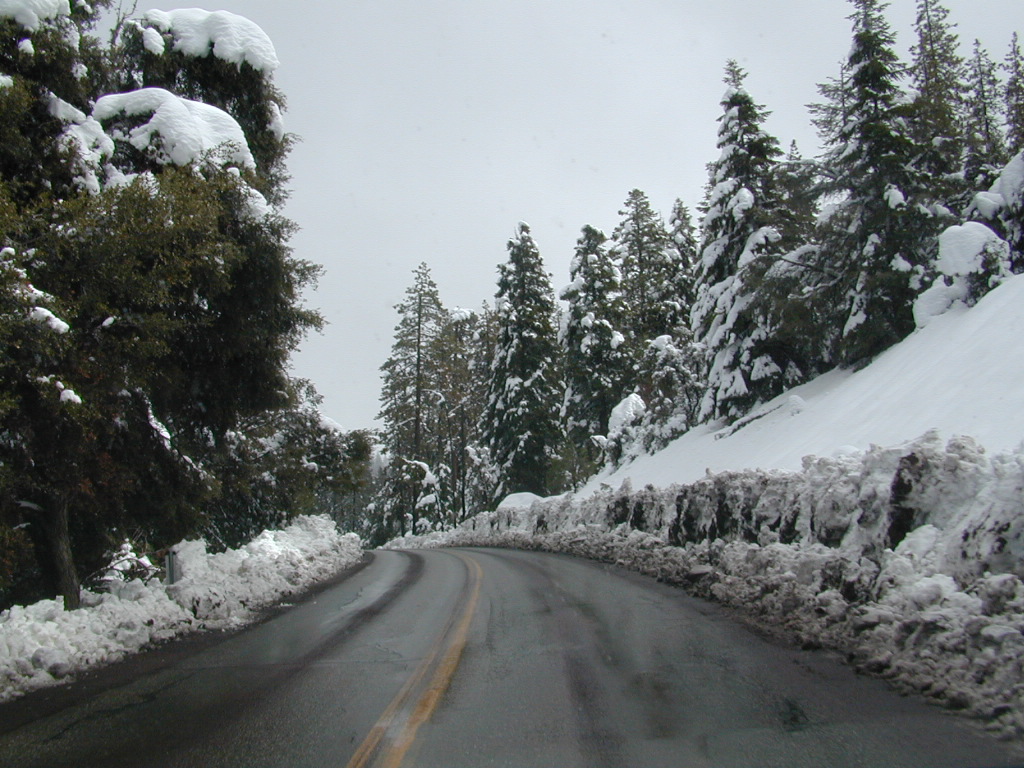
Dirt road access is common to reach these remote locations. Some require stair climbing, or steep access hikes. Winter months are usually snowy, inaccessible and sometimes dangerous for these high country locations. Access roads suffer from closures due to rock slides or landslides. Check with the locals ranger station for current conditions.
A few of these rentals are open all year long – in the southern part of the golden state.
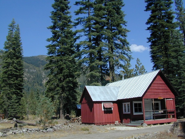
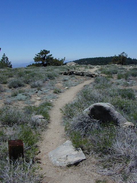
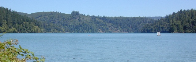
El Dorado National Forest
Harvey West Cabin
4,720′ elev. on Silverfork American River, Gold Rush
These are the roads that drivers love. More room to roam, more space, more pavement, more scenery to love and less people, less drivers and less distractions. California has endless roadways that wind through every part of the entire state. If you enjoy real driving in California, you like the curvy roads & scenery. Total Escape has dedicated numerous hours to the collection of back roads in California. Some paved, some not.
4000 RPMs or higher / Cerro Noroeste Road to Hwy 166
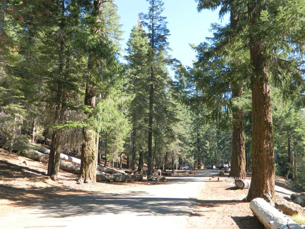
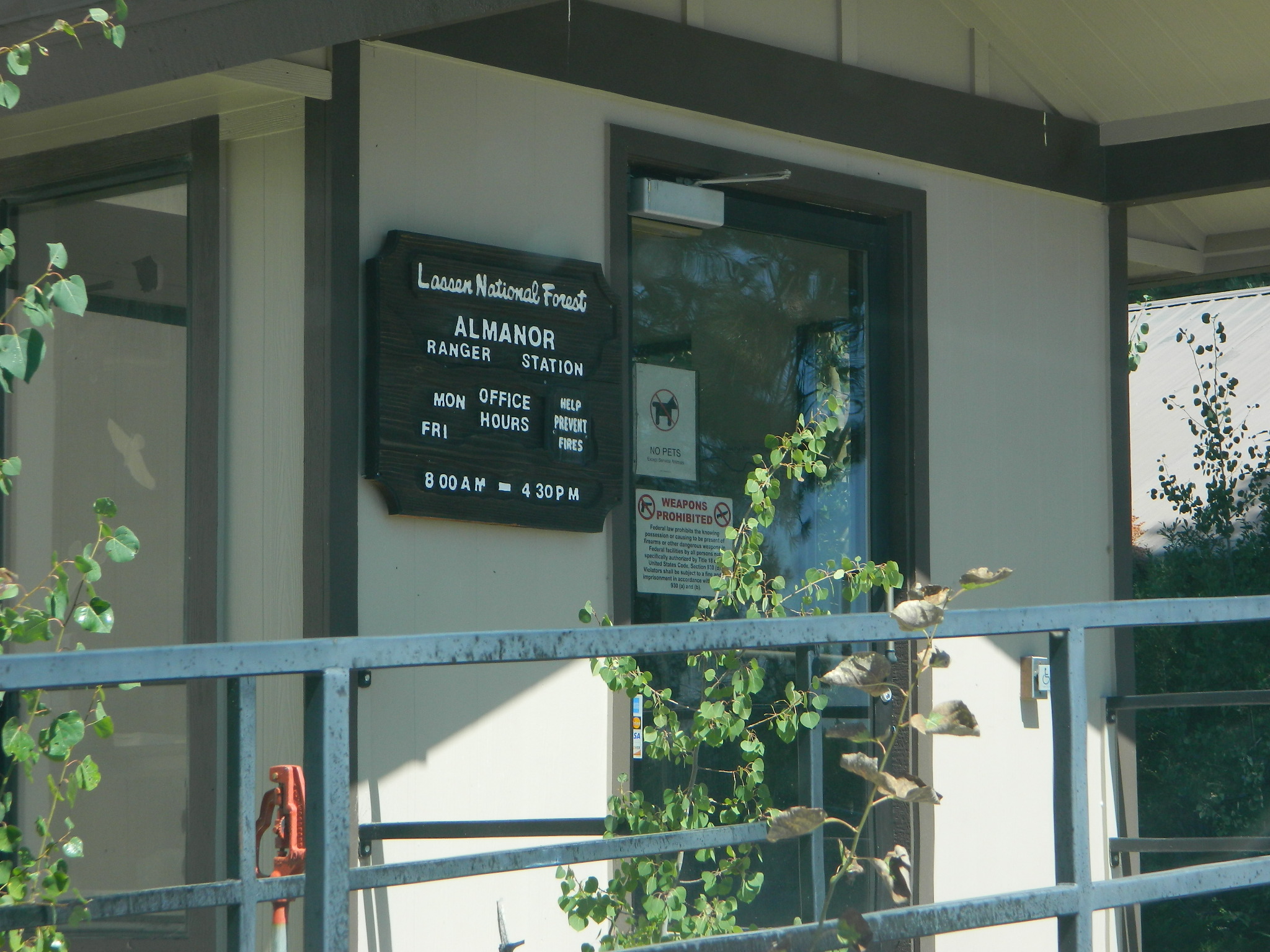
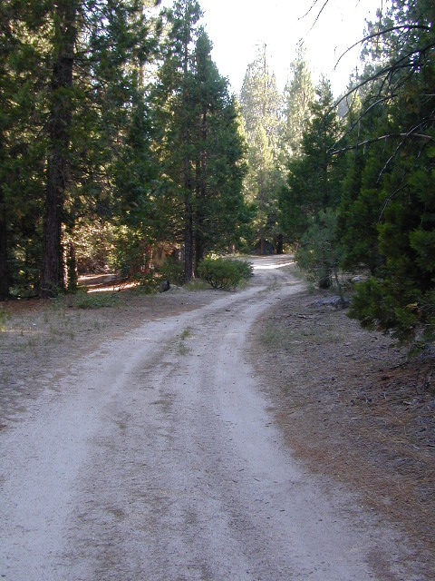
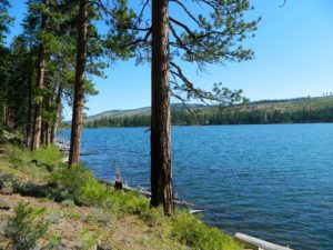
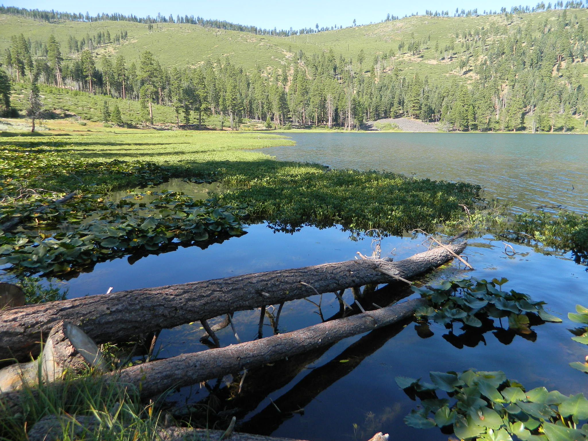
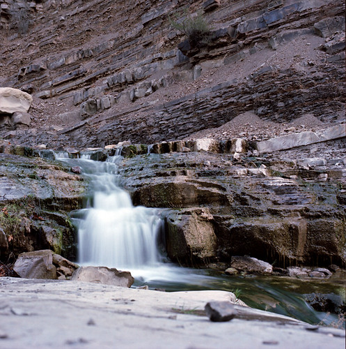
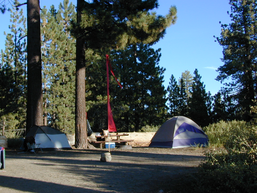
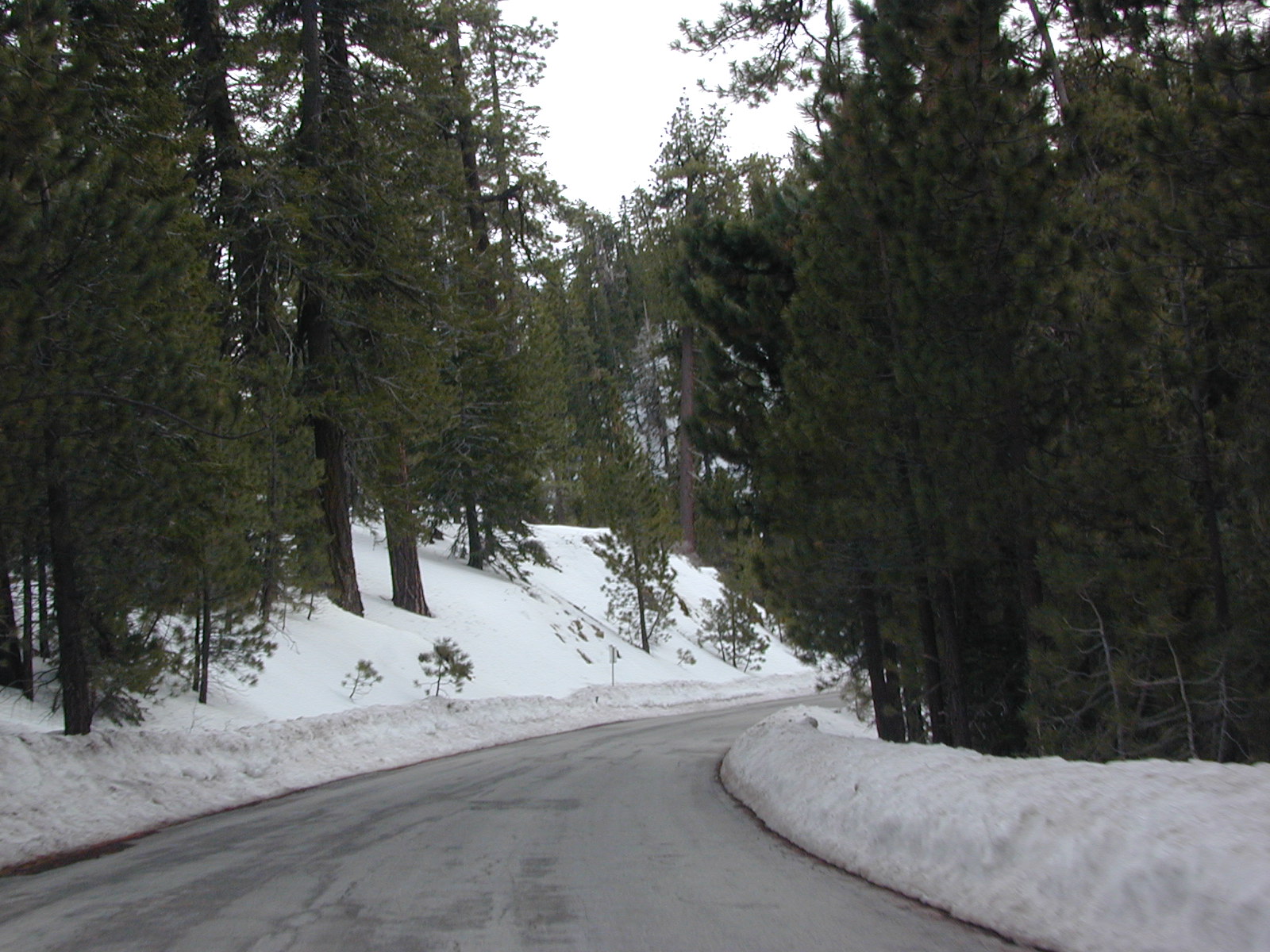
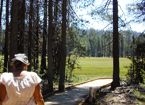
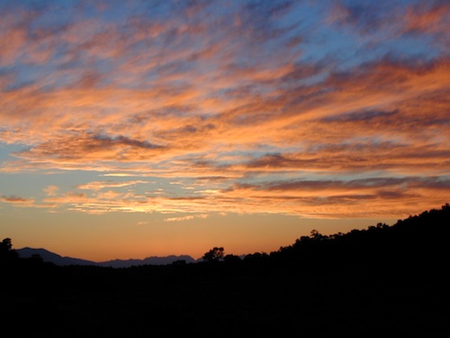
Mount Lassen is part of the Cascade Mountain Range, located north of the Sierra Nevada. The Lassen forest encompasses a large area of wilderness land, snowmelt creeks and an abundant dirt road system. Most of which is covered in deep snow about half the year, so plan accordingly.
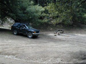
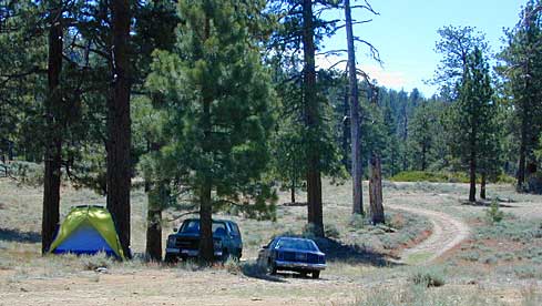
Plenty of great dispersed camping along the old logging roads in this Lassen Forest area, surrounding the Volcanic National Park; in Northern California. Many dirt roads are graded annually to allow for passenger car access. You can make it way back there in a car – just watch for the mud and some boulders!
Camp fire permits required (see below). Pease try to choose a camp that has been used before and pack out your garbage.
HINT: a USDA Lassen National Forest Map is very helpful when camping these remote, Lassen back roads. Stay away from the crowds, avoid camp fees & really enjoy your vacation.
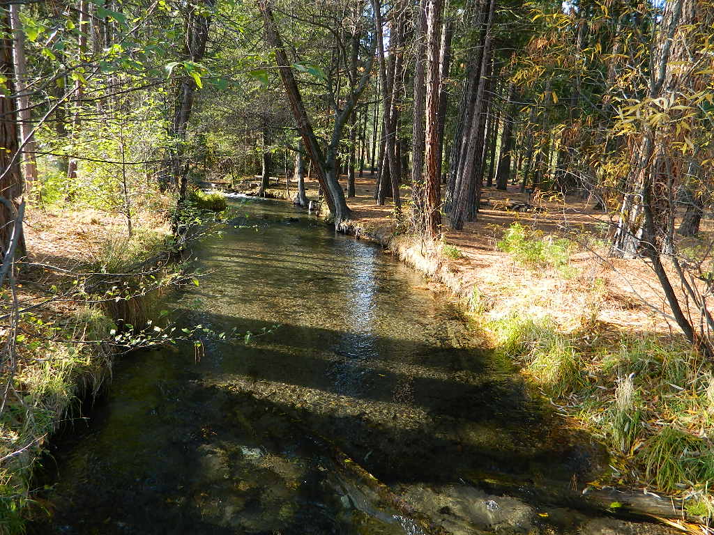
Camp right on a rushing river, alone. With no one in sight or sound. Have that secluded camping experience you’ve always dreamed about. Fishing, relaxing, maybe some hiking too. Or better, your mountain bike. Plenty forest roads to explore.
Numerous waterfalls to discover, water flowing everywhere. Mount Lassen @ 10,457′ elevation, is often snow-capped year round. This Northern California region is covered with pine forests and volcanic history.
Cool Springs @ Butt Lake, California (PG&E Campground)
If you wanna find the nearest biker bar, head over to the rustic and forested Bambi Inn @ Butte Meadows. The place is popular all the time, especially on weekends. Scenic day drive from Chico, located near a nice river and bridge, plus they have cabin rentals too. Sometimes they have big events and it can get pretty crowded and loud w/ drinking and outdoor music.
BSA Camp Lassen is a boy scout camp located E of Chico, off Highway 32 near Butte Meadows, CA
Dispersed Camp sites in Lassen in Lake Almanor Area
campground
elev.
spots
veg
toilet
water
notes
Alder Creek Campground
3900′
6
pines
vault
creek
March-Nov
Benner Creek Campground
5562′
9
pines
vault
creek
May-Nov
Black Rock Campground
2100′
6
pines
vault
creek
year round, fish
Echo Lake Campground
6440′
hike
pines
none
lake
May-Nov, no tables
Soldier Creek Campground
4890′
disp
pines
vault
creek
May-Nov, fall hunters
South Antelope Campground
2700′
4
pines
vault
creek
year round
Willow Lake Campground
–
disp
pines
–
lake
May-Nov, no tables
NORTH LASSEN
Free Camping Lassen
Northside of Mount Lassen
Excellent back roads camping w/ dense forest and free firewood all over the place (bring hand saw). Dispersed, primitive, free camping, near creek, and highway close. Many forest dirt roads turn offs, all along Highway 44 (California SR 44) near junction w/ Hwy 89 @ Lassen National Park.
Big creeks, dense forests, graded dirt roads, dark night skies. PCT access, trailheads, camping, fishing, hiking, hunting, all along Upper Hat Creek.
Campfire permits (shovel, bucket & water) are required when camping outside of a developed campground. Always check on current fire restrictions. Washed out bridges and landslides are common, which means road closed signs can be found on these remote backroads.
Sugarloaf Ridge, Greenhorn Mts
Alta Sierra, Kern River Canyon
Sugarloaf Road, above Kern River Canyon
SOUTH SIERRA: This route is located in between the Western Divide Highway and the cedar community of Alta Sierra, CA
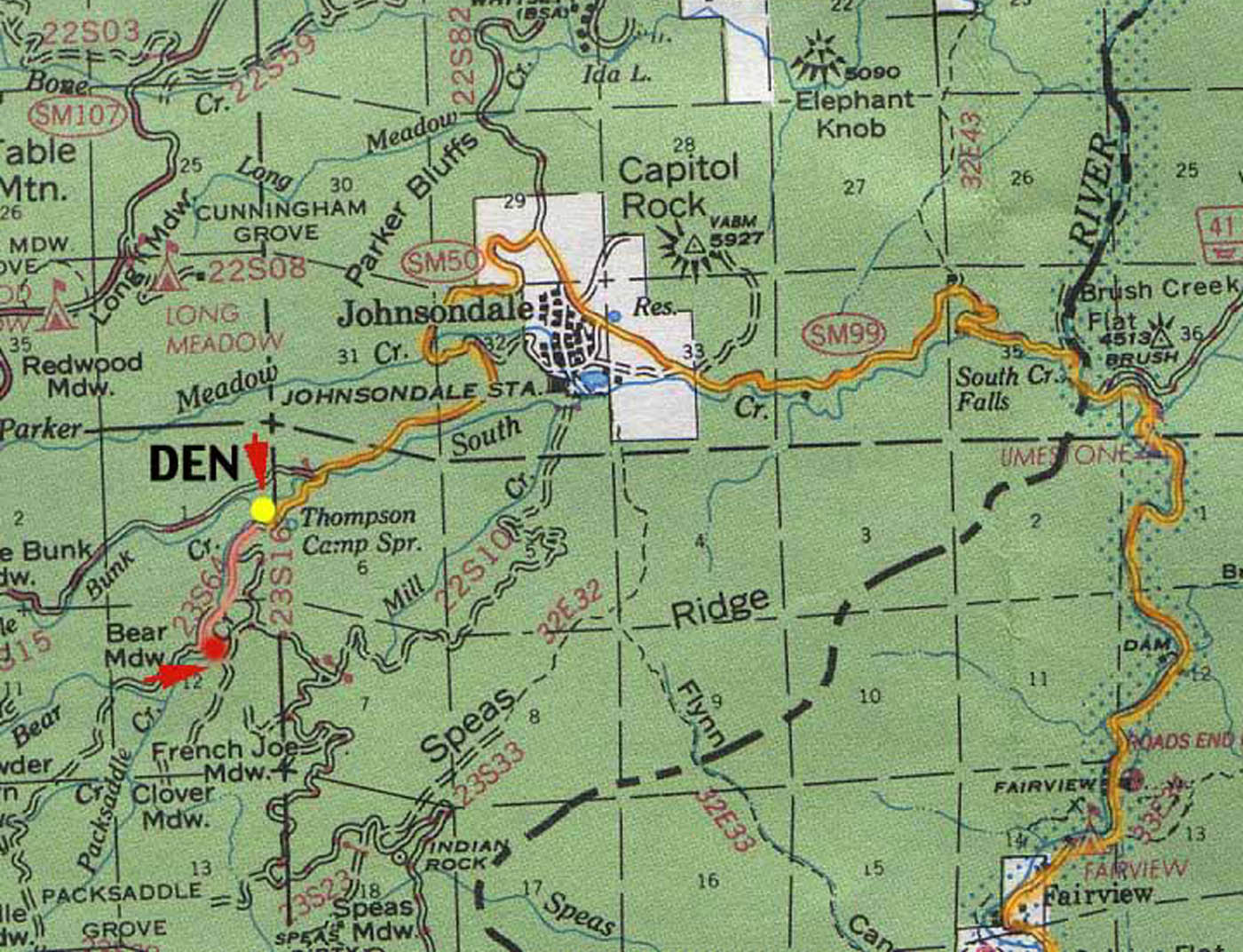
Sugarloaf Ridge: Forest Rd# 23S16 – Thompson Camp Spring, The Den @ Sequoia National Forest
Driving north on Sierra Hwy N of Kernville, California; Passing Fairview & the Johnsondale bridge; After the R Ranch @ Johnsondale, take the left fork on the main highway; After you climb in elevation, look for brown signs on right side of road & turn left on Forest Service Rd# 23S16. Primitive camp sites are located throughout this area along Packsaddle Creek. Do not turn left up Sugarloaf Rd. There are no good camp sites up that way (unless you wanna make one).
RV campers are very common at Thompson Camp Spring, as this road is paved up to this point. The paved road is windy & narrows after this point. It is not advised for trailers or long motorhomes past Thompson.
For the more adventurous, Bear Meadow & Packsaddle Mdw are located up the dirt road a bit on #23S64.
Paved Sequoia route# 23S16 continues to climb, which leads to the Speas Meadow, the Greenhorn Mountains & you best have a real good map if you are heading up this way. 20 miles of awesome open meadows, small streams, dense forest, wildflowers, some primitive camp sites & great viewpoints overlooking the Kern Canyon. All passenger car accessible! Elevations between 6000-7000′. Sugarloaf Peak has cross country skiing.
Side route #23S05 will take you to White River Campground w/ 12 spots. The paved road winds west down the mountain to Posey & eventually Glennville on Hwy 155.
Instead, to easily reach Hwy 155 – you’ll need to get on dirt for a few miles. While on 23S16, look for the Panorama Campground (@ 7400′ elevation w/ 10 sites). Take dirt road #24S15 to get back to civilization @ Alta Sierra, California.
ADA Camping (Americans with Disabilities) Handicap accessible camp sites at Blue Lakes, near Hope Valley, CA
Blue Lake Campgrounds
highest lake campgrounds in the vicinity
Eldorado National Forest in Amador Ranger District; a forest south of Lake Tahoe in the central portion of the Sierra Nevada mountain range. This set of scenic, alpine lakes sits in between both Eldorado, Toiyabe National Forests and the Mokelumne Wilderness. But please take note that the Blue Lake facilities are owned and operated by utility company PG&E
No Reservations. most camp sites are available first-come, first-serve
RV limitations: 30 feet
69 miles east of Jackson, CA on Highway 88 and then another 12 miles south on Blue Lakes Road. This area is close to Hope Valley, south of Lake Tahoe, CA
Blue Lakes consist of several developed campgrounds. Blue Lakes Rd# 13 is a well signed, paved road off Hwy 88, just east of Carson Pass (8560′ elev). The route is closed during winter snow, while it serves as a winter recreation area. The main paved road becomes dirt near the campgrounds. A dirt road continues past the lakes and south to Deer Creek and meets w/ Hwy 4 near Ebbett’s Pass.
RV campers, fishing folks, hikers, kayakers and disabled travelers like this lake camp area due to the easy access, paved parking and campground amenities. Handicapped camp sites are also prime lake front locations.
Group Campgrounds are reservable. Picnic Areas, Group Sites and campfire rings. Piped water, bear boxes and vault toilets. No RV hookups, no dump station, no showers. Unimproved boat ramps are available at Upper and Lower Blue Lakes.
Upper Blue Lake Campground elev. 8136′
camp sites: 32
Overflow Camp camp sites: 34
Backpackers and day hikers: Sierra trailheads out here lead south into the Mokelumne Wilderness Area. The infamous Pacific Crest Trail also passes thru this high elevation region: PCT access @ Carson Pass, Upper Lake & Tamarack Lake
BLUE LAKE CAMPGROUND
NorCal region of the South Warner Wilderness in Modoc National Forest. That’s way out near Alturas. Likely, CA is the turn off US 395. Northeast California, real seclusion.
EASTBOUND Paved Road #64 is Jess Valley, which leads along the Pit River, cool volcanic cliffs, and up to forested Blue Lake Campground, elevation 6051′
Wildlife viewing @ Blue Lake Modoc
Donner Blue Lake
DONNER PASS – Sierra Nevada
Interstate 80 BLUE LAKE CAMPGROUND
i80 Donner Pass, near Truckee, CA; a PGE Campground w/ 4×4 access and hike-in only. First come, first serve. No tables or restrooms, elevation 5900′
Lake side resort w/ boat rentals and fishing, near Upper Lake, CA
elevation 1357′
A small resort w/ hotel suites and a lakeside setting w/ abundant nature. Two small lakes, kinda close to the highway. Non motorized boats only, kayaks, paddle boards, canoe, swimming, birdwatching, bike paths and fishing. Wedding venue next to lake. Wineries, restaurants, and a casino nearby.
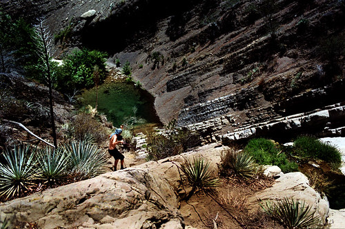
The coastal mountain range wilderness located approximately 12 miles north of Ojai, CA. Drive 5 miles N on Highway 33; left at the Matilija Canyon Road turn off.
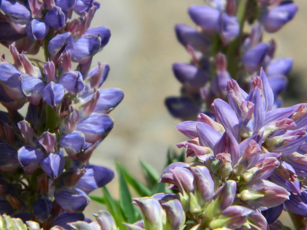
Chaparral is the prevalent vegetation with poppies plentiful in springtime. Cottonwood, alder and maple trees dominate the canyon. One trail has trail campsites along it and follows 9 miles of the North Fork, gaining about 3,400′ feet in elevation as it makes a north-south journey, and leaving the Wilderness at a parking area on Cherry Creek Road. This road is open seasonally from Aug. 1 to Dec. 15
This whole area burnt in a recent wildfire and much of it may be closed off to the public.
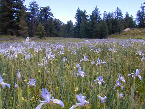
A little bit of high altitude, alpine forests in Southern Cal. Mount Pinos campgrounds are the ones on the way up to Mt Pinos 8831′ on the paved route to the top parking lot, Mount Pinos Road. Only 2 campgrounds take reservations & can be busy in summer months. Chula Vista Camp (at the top parking lot, short walk on trail) has an amazing wildflower meadow w/ group camp area. Drum circles are common on summer weekends.
backpacking
camping
hiking
mountain biking
sledding & snow play
stargazing
Mount Pinos parking lot is well known among RVers, astronomers & cross country skiers. If the 2 snow gates are open, you’ll find RVs camping out here until winter officially starts. The peak to peak trail from Mt Pinos to Mt Abel 8243′ starts at this parking area & trail head. Cool ski hut that no Forest Personnel every seems to be operating. Portable toilets available.
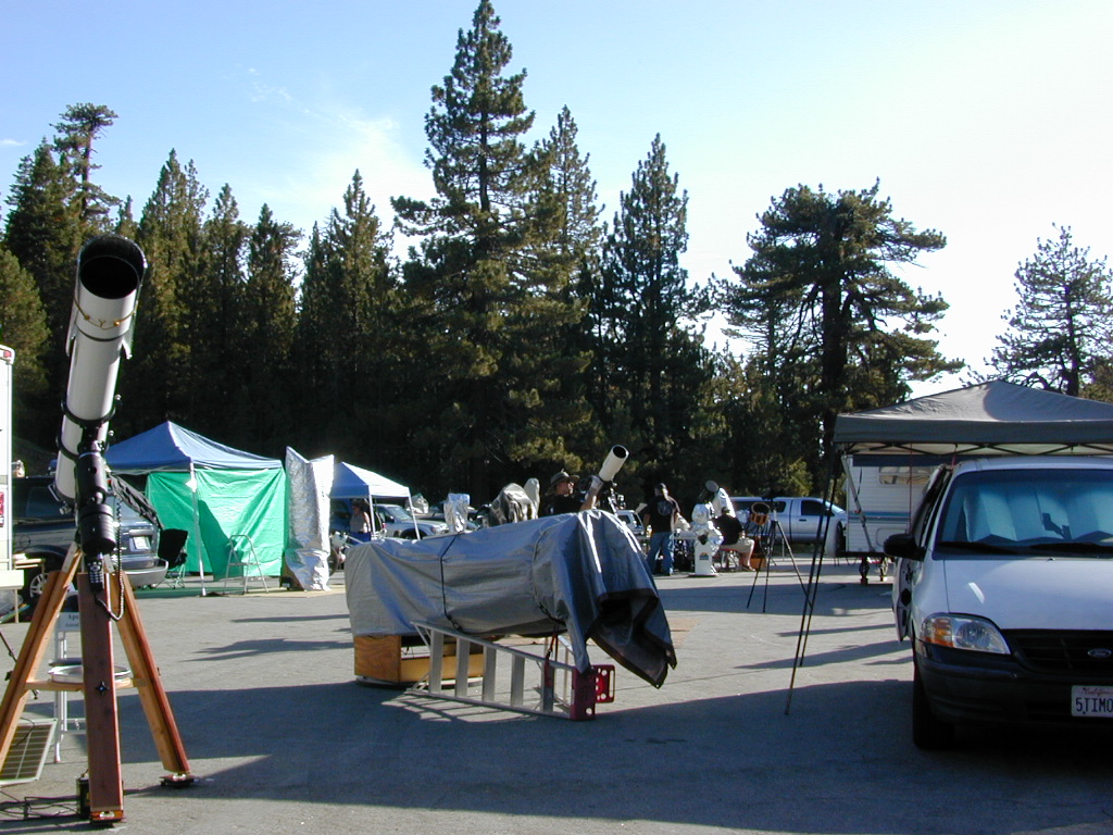
Pinos Star Party
In the mid-winter, snow is almost guaranteed up here. Families & sledders flock to this region for snow play causing major traffic jams & parking problems. On the busiest of weekends w/ a recent snow storm, you may find several miles of vehicles, backed up from Pinos to the freeway (causing 10 miles of traffic jam in the mountains). It is not uncommon to see CHP managing traffic flow on the weekend. Snow play areas are located at the top on Pinos, if the gates are open.
Mil Potreo Highway, on a good winter 2005
If not the “Y” – where Cuddy Valley meets Mil Potrero Hwy. is the main snow-play destination. This is a very busy intersection at all times of the year, as it is the main route entering Pine Mountain Club, located 5 miles to the west. Be considerate! Do not litter and please park OFF THE PAVEMENT; keep kiddies, sleds & BBQs out of the road ways.
The pinyon pine forests surrounding Mount Pinos Recreation Area is Los Padres National Forest, where there is every kinda camping imaginable.
Outdoor resort communities such as Pine Mountain Club & Lockwood Valley Road are close by and surround the highest mountain peak in Kern County. Mil Potrero Campground, developed NFS Campground, open during summer only.
Rugged backpacking, or back road motorcycle 4×4 camps – with maybe one camp fire ring (still intact). Windwolves Preserve, Quatal Canyon, Cerro Noroeste, Valle Vista, Lockwood & Cuyama Valley.
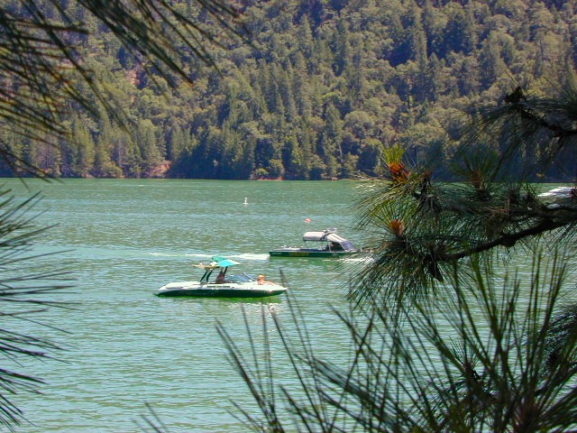
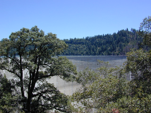
BULLARDS BAR Dark Day is a lakeside walk-in campground on a small reservoir, located deep in the Gold Country foothills. Flush toilets and hiking trails, kayak rentals and fishing.
West of Highway 49. Huge dam for hydro-electric power. Minimal roadways along the lake and steep canyons make for optimum hiking and boating. Floating and fishing. Relaxing in the mountains, with fresh water!
On most maps the official name of this lake may read New Bullards Bar Reservoir, or Lake Bullards Bar, but locals just call it simply – Bullards Bar!
Sierra Nevada Foothills. Yuba River, California.
Northern Gold Country, California
Near Camptonville, West off Hwy 49
in between Oroville and Nevada City, CA
Located not far from historic Downieville, Bullard’s Bar is an excellent base camp location for exploring the upper reaches of the Gold Country region. Old mining locations, museums, a covered bridge, various parks, Yuba River, Sierra Buttes, Lakes Basin. Grass Valley & Nevada City are also nearby. Mountain bike trails, river rafting and hiking all around.
roads around lake: Marysville Road (south of lake and east side w/ Hwy 49), Moonshine Road (south of lake), Oregon Hill Road (west side), Pendola Road (north side), and Forest Route #47 (dirt road on north side)
One of the few lakes in the Sierra Nevada that offer boat in camping at developed camp sites, and also to allow boaters primitive camping along the shoreline. No drinking water is available. No pit toilets, so a portable chemical toilet is always required. Plus, pack out all garbage.
No charge for DAY USE areas: parking or boat launch ramps
NOTE: Dark Day & Schoolhouse Campgrounds are the only car camping & RV accessible camping on this lake. These both have flush toilets and drinking water piped in. Hiking trails & boat launch nearby. Wheelchair accessible campsites are available.
CAMPS OPEN: APRIL – OCTOBER Campgrounds @ BullardsBar are usually open from April to October annually and all are closed for winter months.
Located 5 miles northwest of Dark Day Boat Ramp on the west side of the reservoir. Boat in only access. It is used as an over flow campground. There are campsites, but no bathrooms. Portable chemical toilet required. More info call Emerald Cove Marina at (530) 692-3200
Second Spillway – in the works?
Yuba Water Agency has just committed to building a $160 million second spillway at the New Bullards Bar Dam; beginning in 2021, with a completion date of 2025.
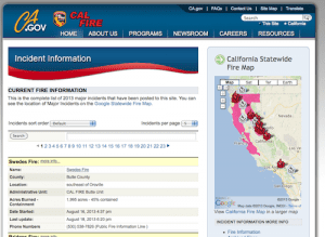
locking down the forests, before they burn (again)
Outside of developed campgrounds and permitted facilities, igniting, building, maintaining or using a fire on national forests in California will be prohibited.
List of Current Fire Restriction Orders for all USFS National Forests in California w/ links.
Fire Restrictions are now in effect for most all public lands in California. Data and news change weekly, so follow links for most up-to-date restrictions, before you make your drive.
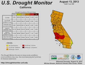
These are the earliest and most restrictive campfire orders ever. No? Maybe the long drought years would be equivalent. Below is a brand new list broken down by federal land regions – forest and deserts, including BLM camping areas.
Looks like we are already into Stage II Restrictions for the begining of summer 2020.
NOTE: BBQ grills, all stoves, smoking, firecrackers, welding, chainsaws, off roading, dirt biking, hunting and target shooting are restricted within these orders. A few of these fire restrictions are dated to extend until DEC 31, 2025
More details and specifics can be found on each forests .gov web site, so please use THESE LINKS BELOW (before they break).
The land is dry and wildfire threat is an ongoing battle in California.
FOREST-WIDE FIRE RESTRICTIONS IN PLACE
Wildfires ravage California wild lands every year. Severity, longevity, most deadly. Let this year be different.
Northern California
BLM (Bureau of Land Management)
no campfires outside of developed campgrounds (statewide) (APR 29, 2020 – DEC 31, 2025)
see the current 2020 BLM Campfire Map
USDA PDF map shows only 26 places that you have have a campfire inside Modoc. The far drive could be worth it – for minimal crowds, darkest skies and maximum fishing. Best for week long road trips, super lazy summer style.
Persons with a valid California Campfire Permit are not exempt from the prohibitions.
However, persons with a valid California Campfire Permit may use a portable campfire ring/pit, stove, or lantern ( 5+ feet from flammable materials) IF THE UNIT burns gas, kerosene, jellied petroleum or pressurized liquid fuel, and is EQUIPPED w/ a shut-off valve.
Wow, what a mouthful. Guess the propane campfire is okay?
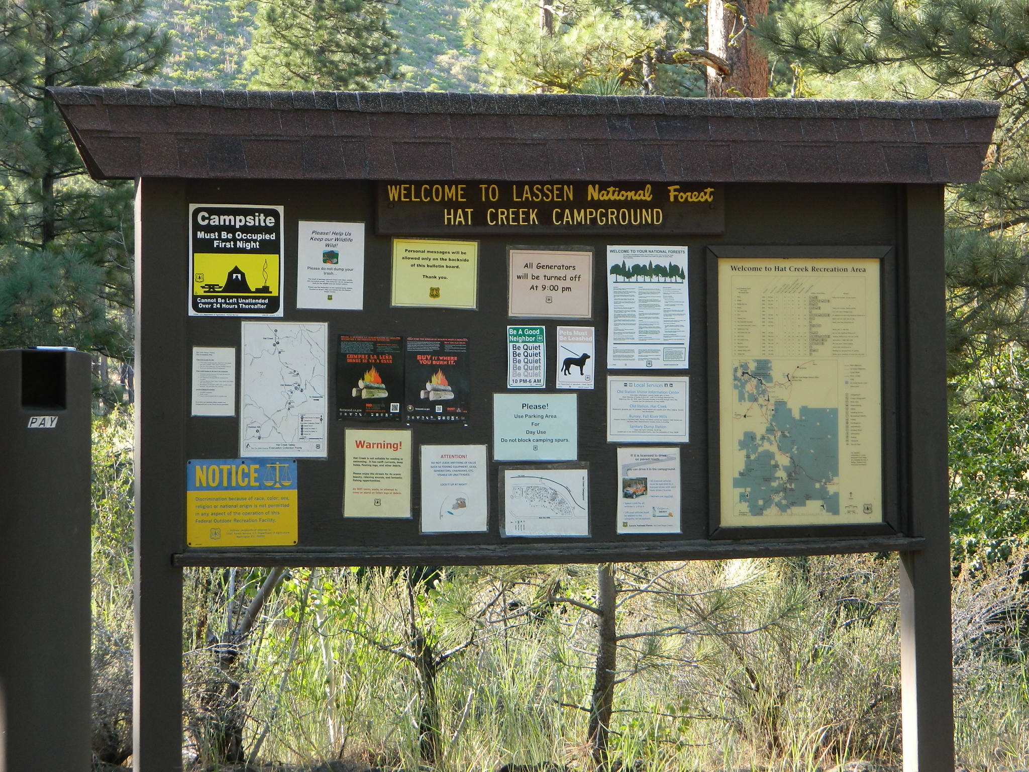
SUSANVILLE, Calif. May 29, 2020 – Lassen National Forest is enacting campfire restrictions… effective immediately and until further notice. Outside of developed campgrounds and certain permitted facilities, igniting, building, maintaining or using a fire on national forests in California will be prohibited.
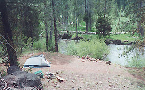
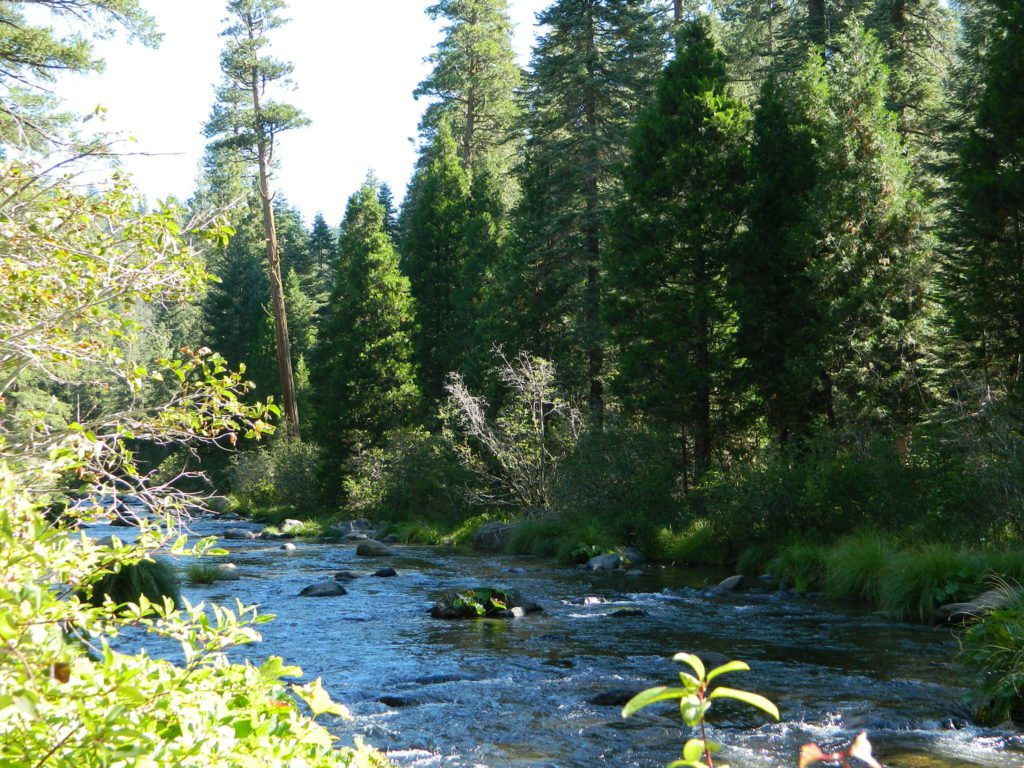
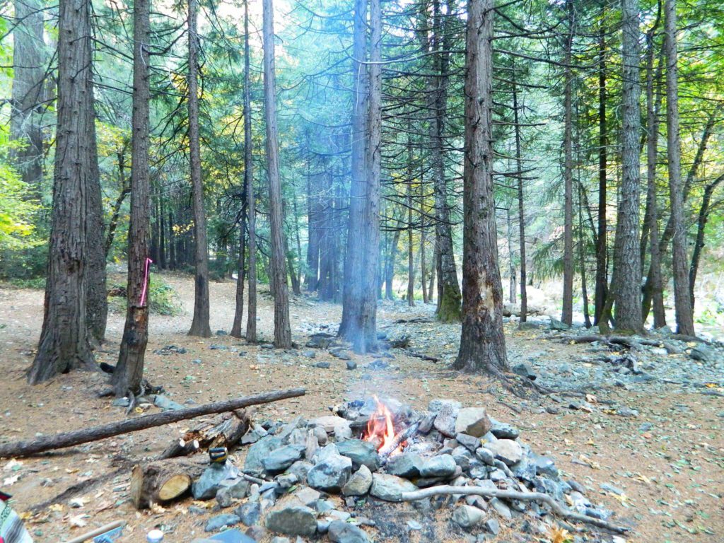
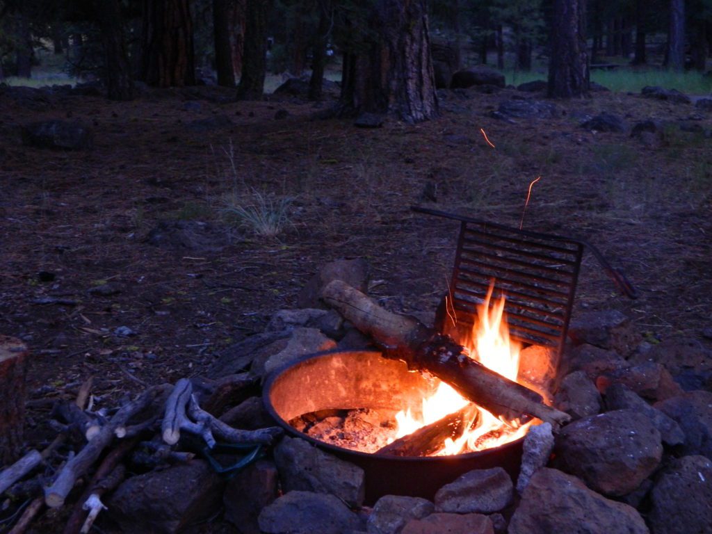
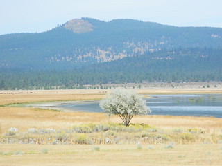
Lassen Camping near a creek in Northern California
BLM Eagle Lake
no campfires outside of developed campgrounds (APR 29, 2020 – DEC 31, 2025)
see the current 2020 BLM Campfire Map
North Sierra where the granite meets the volcanic rock of Lassen. Feather River Watershed, Lake Oroville SRA, Bucks Lake Wilderness, Bald Rock, Quincy, Lakes Basin Recreation Area
Deane’s Valley Campground, way off the main road, between Quincy and Bucks Lake.
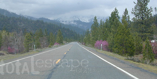
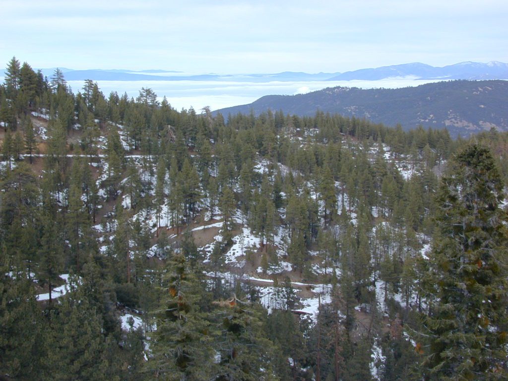
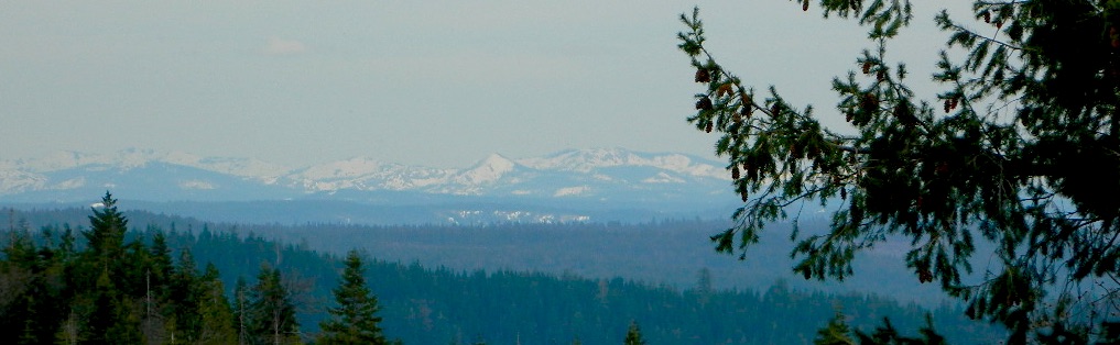
Donner Summit and Lake Tahoe get a majority of the Sierra Nevada snowfall and traffic. Deepest snowpacks are measured way up here, with dozens of small lakes surrounded by granite. Less snow means drier forests for 2020, and more tourists means more campfires. One spark is all it takes!
Tahoe National Forest (snowy mountains) April 2020, taken from Oro-Quincy Hwy looking southeast to Donner.
Yosemite’s west side w/ Bass Lake, Mammoth Pool, Granite Creek, Dinkey Creek, McKinley Grove, Shaver Lake, Huntington Lake, San Joaquin River, Mono Hot Springs, Edison Lake, Florence, Ward, Courtright, Wishon, Blackrock, and the Kings River. Biggest water reservoirs draws the largest crowds. Be fire safe and camp inside of a developed campground this summer.
Sonora Pass and the Gold Country have been hit hard by recent wildfires in the past decade, so now we pay the price w/ much tighter campfire restrictions. Popular mid Sierra region, easy access w/ many lakes and reservoirs; highways of CA 108 & CA 44
Campfires banned throughout the Eastern Sierra region until the end of 2022, within both the USFS and BLM campgrounds. US Highway 395, Mount Whitney, Mammoth, June Lake Loop & Mono Lake
Tighter than normal campfire rules for the drier Southern Sierra. Kern River Canyon, Kennedy Meadows, Chimney Peak and beyond. Drive up hill, gaining levation to Sherman’s Pass or the Western Divide Highway and find a cooler campground in the dense trees. Forget the triple digit heat, brushy river and the masses, and climb to a higher altitude for the Big Trees and Big Meadows. Breckenridge, Horse Meadow, Long Valley, Mountain Home.
The possession or use of any steel jacketed or steel core ammunition of any caliber. This would include handgun, rifle and shotgun ammunition unless a person is in possession of a valid State of California hunting license and is actively engaged in the legal take/pursuit of game and non-game species in accordance with current California hunting regulations, and
During the issuance of Red Flag Warnings and Fire Weather Watches, as determined by the National Weather Service (NWS), all recreational shooting and use of campfires, is temporarily suspended to reduce the potential of unintended wildland fire ignitions for the period of the event.
Stage II Restriction:
All the restriction in Stage I above, and
Setting, building, maintaining, attending, or using open fire of any kind is prohibited, except campfires within approved fire pits and grills provided for in developed recreation sites; or campfires within the Imperial County Special Recreation Management Areas with a valid California Campfire Permit. Controlled flame devices such as portable stoves and lanterns with shut-off valves,using gas, jellied petroleum, or pressurized liquid fuel are allowed and require a valid California Campfire Permit, and
Smoking, except within an enclosed vehicle or camp trailer or while stopped or standing in a three-foot diameter area barren or cleared of all flammable materials and away from federal facility doors, windows and air ducts.
Stage III Restriction:
All the restrictions in Stage I above, and
Setting, building, maintaining, attending, or using open fire of any kind is prohibited. Controlled flame devices such as portable stoves and lanterns with shut-off valves,using gas, jellied petroleum, or pressurized liquid fuel are allowed with a valid California Campfire Permit, and
Smoking, except within an enclosed vehicle or camp trailer unless prohibited by State or local laws.
Plumas Road #24N29, off Bucks Lake Road
East of Bucks Lake, California.
a six mile, one lane, dirt road is the only vehicle access into this high elevation, dammed reservoir, tucked back against the wilderness. Secluded lake campsites await, you’ll just need to get a little dusty first. The turn off, at a small brown sign reading “Silver Lake”, one which is very easy to miss – due to the amount of homes, cabins, fencing and driveways in the vicinity.
No swimming allowed at this Silver Lake, as it serves as a drinking water source for the neighborhoods below. Canoe & kayaking are allowed. Fishing is also popular at this location. Hiking trailheads at Silver Lake lead to the PCT (Pacific Crest Trail), Mount Pleasant, Spanish Peak and a small gem of a swimming hole, we call mini Gold Lake.
This small campground is actually set downhill from the rock earthen dam, which is something to ponder before/during a big earthquake. With sites 1-5 in a shady forest area and the others a bit closer to the lake, no campsite is too close to another. These are all well-spaced-out sites, providing decent privacy and minimal noise from neighboring campers. No campsites are located at the lake edge, as the rocky dam is a long structure and quite complex with water control measures.
All the campsites have new bear boxes for food storage, cuz ‘wilderness’ usually means black bears are roaming about. Deer tend to frequent campsites 1 & 2.
2020 update: overnight camping fees now charged at this campground
Silver Lake Campground NFS
• Elevation: 5800′
• Number of Sites: 9
• Vehicle Accessibility: RV 22′
• Campsite Reservations: No
• Camp Fee: Yes
• Toilet: Vault
• Water: No piped/potable
• Length of Stay: 14 Days
• Season: May – October
• Trailheads: PCT, Gold Lake, Rock Lake, Granite Gap, Bucks Lake Wilderness
As with most of the high elevation lakes in California, winter months can mean deep snow and dirt road closures. This campground is usually open through the end of October, but call head to the local rangers if in doubt.
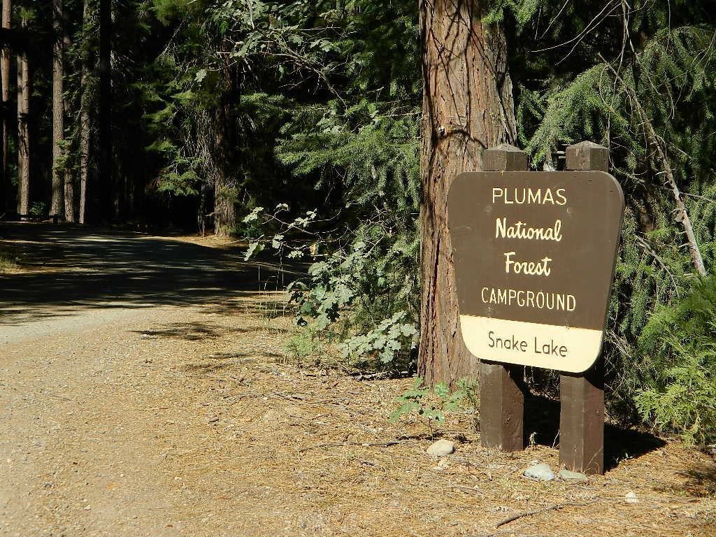
Plumas National Forest
Mt. Hough Ranger District
39696 State Highway 70
Quincy, CA 95971
530-283-0555
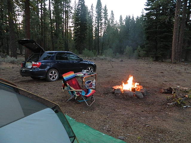
Free camping outside of a developed campground, for a self-contained camper who wants seclusion and privacy. Real relaxation in total peace and quiet. More nature, less people and minimal vehicles.
Free Campsites • Dispersed Camps • Open Camping • Boondocking
primitive camp sites –the bare minimum. a clearing for a tent, maybe a fire ring. no toilet, no fees; dirt road access.
campfire permits required. And it is up to you to know the current fire restrictions in the area you seek to camp overnight.
The further out you are willing to drive, the more remote you can be. Good topo maps of the region help you to find these ultimate, secret camping spots. National Forests & BLM Lands require a free camp fire permit to have a campfire.
Fire safety is always a big concern in wildfire prone areas like California. Additional Permits & Passes may be needed in some forests or parks; each location is different. Check with the local ranger station for up to date restrictions.
Many dirt roads lead avid campers to the best out-of-the-way camp sites. Camps may have picnic tables or just a fire ring, but usually NO toilets. Have the “No Bathroom Blues”? Don’t sweat it. check out the page onCamp Potty
Some camp sites are as bare as a small clearing, a rock fire ring if you’re lucky. A detailed backcountry map is always advised. If you count on your digital mobile device and online access for mapping, you could find yourself very lost. GoogleMaps is known for mislabeling the smallest of back roads – and they do not feature dirt roads either.
Turtle Mountain Road, SoCal
A high clearance vehicle may be needed to reach certain camp spots, but many can be accessed with a standard passenger car. Low riders will likely bottom out and motorcycle riders will get dusty.
Know your vehicles limitations for any off-road use and don’t get stuck in a bad situation. Soft sand is quite common in deserts and 4×4 might be needed. There aren’t any tow trucks out in the boonies and if you do find one, it’ll cost you something fierce. Watch for large rocks, deep ruts or tree limbs in the road (at any time) and watch low overhanging branches when driving a motorhome in to such spots. Some dedicated, hard-core RV campers prefer to camp in remote locations.
Southern California has something called yellow post camps, but we’ve really ONLY seen them inside San Bernardino National Forest areas, which includes Idyllwild and Mount San Jacinto, plus all the Big Bear Lake Mountains.
YELLOW STICK? These are fire safe spots w/ picnic table; secluded in the forest, some accessible by passenger cars, while other camps require a 4×4 to reach. Yellow post sites campfires are often off limits during fire restrictions, when only fires are allowed inside the larger developed campgrounds.
dirt road and trailheads
Backpackers trailheads often have a few camp sites near the parking lot, but these may be busy during summer months. Dirt roads leading to trailheads can have primitive camp sites along them as well. Long, big creeks in the forests are notorious for having awesome camp sites. Big river camp sites are sometimes free, if you know where to look. Sometimes the smallest of California campgrounds have no charge, first come, first serve (BLM, National Forest, or State run).
Before it got labeled BOONDOCKING: Primitive Camping in remote spots was what we lived for. Camp outside of developed campgrounds, for free. Campfires will usually be banned on these back roads during the driest part of the year. Check with local ranger stations for current fire restrictions.
Inyo High Country RoadsMcCloud #39N06 – Grizzly Peak Lookout Rd
pros and cons
possible dirt road access, seclusion, privacy, darker skies, no fees, no crowds, real peace & quiet
no toilet, no picnic tables, no pavement, no hospital, a long hike out, no cell phone service?
always be prepared to hike out (if need be).a giant tree can come down and block your exit road. landslides often happen on dirt back roads. the vehicle could break down or become disabled. get a topographic map and know how to read the terrain, without your device/phone.
PAY extra close attention when driving in (visually with terrain and your eyes and your map). You never know when you may need to back track – or turn around to find a PLAN B campsite.
Avid camper people are indeed known to GPS waypoint their favorite pick campsites (way on the back roads), so they can arrive after work, in the dark, on a Thursday night. Now that’s planning ahead!
Sherman’s Pass, Sequoia National Forest
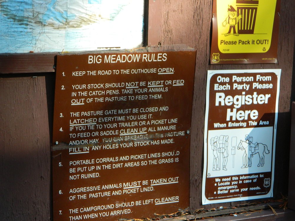
Big Meadow borders Dome Land Wilderness
in the Southern Sierra Nevada mountains
There are many large and gorgeous meadows inside Sequoia National Forest, but none compare in ‘grandeur’ to this southern Sierra public pasture. BIG MEADOW KERN
Find your way north of Kernville and the river really comes into view. Up close, right there! Stop, get out of the vehicle for a stretch break and breathe; take it all in. This is only the start of the adventure. Gorgeous Big Meadow is located up on the Kern Plateau, 3000′ above the river on the eastern ridges. Only accessible half the year due to snow, this meadow is a must see for those exploring the eastern side of the Kern River.
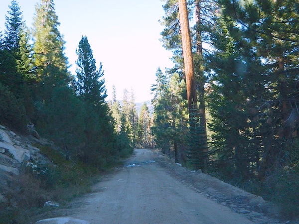
Sherman’s Pass Road #22S05 is a hard right turn after the Johnsondale Bridge. It is well signed and still easy to miss. Climb out of the dryness and into the dense forests and meadows of higher altitudes. Driving this southern Sierra-crossing route, Sherman’s Pass Rd. will require all of your concentration. Steep, curvy road without guard rails. Plus epic, scenic views (NOT to die for).
At this point – Rock slides, snow gates and road closure are typical in winter months. Check w/ rangers in Kernville about road conditions (before you head up this way).
The partially paved road will lead south a few miles, then becomes GRADED DIRT and ventures another 15+ miles – way, way out into dead-end territories. Not one road connects down to Lake Isabella!
Spur roads (all one lane, dirt roads) lead out to various places like – Cherry Hill, Big Meadow, Horse Meadow Campground, Dome Land Wilderness Trailheads, Manter Meadow, Salmon Creek Falls, Cannel Meadows, dozens of trails and spurs. Plenty of primitive camping back in these forest areas. A high clearance rig may be required the further back you go. Mud and snow are quite common in spring and fall.
Extra Large Camp Sites
BIG MEADOW is a favorite camp area among –
backpackers (trailheads)
equestrian (horse campers)
hunters
mountain bikers
off-road campers
westside drive: ample parking and camping for horse trailers
no ‘froading on meadows
Back Loop Road, around the Big Meadow. Narrow & muddy
Or perhaps this is not the Big Meadow near Sequoia that you are seeking. The scenic, giant, public horse pasture listed above is not to be confused with #14S11 Big Meadows Road, also in National Forest land, located in between popular Sequoia National Park and Kings Canyon. (100 miles north of here)
Heart Bar to Big Bear Lake, via the dirt road
San Bernardino National Forest
Big Bear Back Roads
Highway 38, East of Heart Bar @ Road #1N02
Southern California
alt big bear
This 8 mile long forested, dirt road begins right off Hwy 38, just east of Heart Bar Campground and is an easy turn to miss. One tiny, brown sign is all that is found (on the guard rail). Driving too fast, you are bound to miss it.
The unimproved route heads north through the National Forest, up and over and around SugarLoaf Mountain (elev 9952′), then down to the Big Bear Lake region.
Several primitive sites – yellow post camp sites – can be found way back in here, but you might NOT be able to have a campfire (depending on fire restrictions). Check w/ local rangers before you head out.
Forest roads are often closed (gated) during the winter, when snow and rain make a muddy mess of the terrain. Rock slides are also common in wetter months. Call the local rangers to inquire on road conditions or if this route is open.
The whole Big Bear Mountain area is a SoCal favorite forest destination, for weekenders and travelers alike. Mountain biking, hiking, backpacking, horseback riding, camping and 4-wheeling.
Plus the recreational lake is full of more water recreation w/ tourist shops and restaurants. Stay away from the crowds and take the back roads for adventure and recreation. Spend less money, stay outta town and camp for free.
Yosemite is a top destination, all year long. California masses converge on the sacred valley each summer, so expect more as the buses keep rolling in. Plan a Yosemite trip before Memorial Day weekend – or after Labor Day weekend, for less people.
Camping close to Yosemite National Park without being inside the park boundaries. The scenery and wildness doesn’t stop in the back country. There are numerous National Forests surrounding the popular National Park, so much public land has been set aside for these recreation purposes. Granite-lined mountain meadows, dense forests, raging creeks, wildlife and real seclusion. Plenty of great paved back roads, dirt roads and camping options in the Sierra Nevada.
No campground reservations needed, cheaper fees (or free), less crowds, less noise. More freedom, more privacy, more nature.
Hundreds of developed, small campgrounds can be found around Yosemite. A few private RV resorts, cabin rentals, lodging on the main highways. Primitive style camping is considered “camping outside of developed campgrounds”. USDA National Forests usually allows open-camping within the forest boundary – with a required camp fire permit. Sometimes wildfire danger is too extreme, so they often ban campfires in dry conditions.
Gold Country Foothills – listed below are valley reservoirs. Oaks, dry hills, which can can be super hot in summer. Boating, camping and water recreation can be found at most Reservoirs, out in these parts.
Tioga Pass on Hwy 120 (elevation 9410′) is only open during summer months. Generally June through October. Always check road conditions before your trip.
Camping Hiking Lakes @ Tioga Very high elevation meadows, aspen groves, snowmelt lakes. Just east of Yosemite National Park border, near the EAST GATE, inside Inyo National Forest
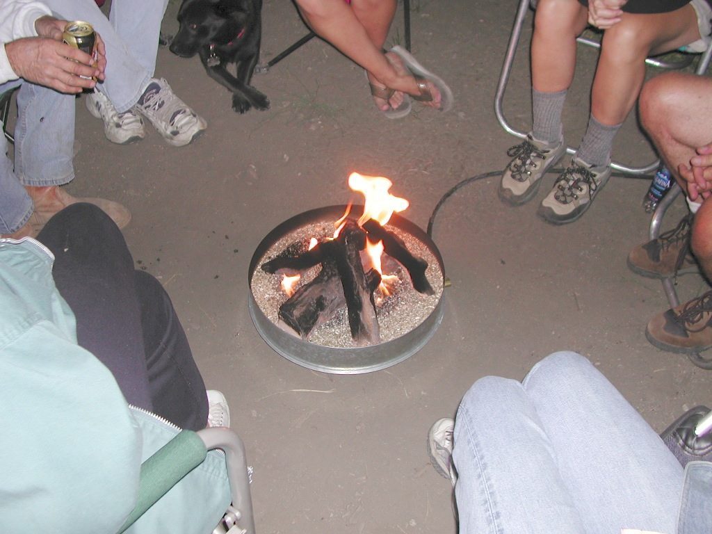
Deserts & beaches are the only places for bonfires.
kill your television
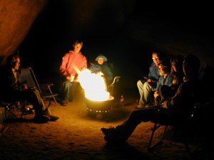
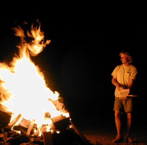
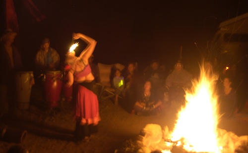
The heat source, the light source, the cook source, the sock drier, the night supplier, the outdoor LIVING ROOM. The campfire is the center stage for all entertainment, dining, drinking, music, true tales and ghost stories alike.
Since the beginning of time humans have gathered around the campfire at dark. This nightly ritual is built into us on the deepest level. We miss this today. We miss the real conversations, the community, the bonding, the stories, the soul searching. We miss the connection with nature, the fresh air and the great outdoors. The night sky filled with stars and maybe a meteor shower, a hot drink and the glow of the campfire coals. Enjoying the wilderness requires certain skills. FIRE is only ONE skill – for survival, for cooking, for warmth, for safety.
Total Escape is dedicated to those who yearn to camp, often.
photo – Charlie Sweeney 2010
Some folks cannot imagine camping without a campfire, but we better get used to it here on the West Coast. Weather patterns swing from years of super-dry drought to deluge and drenching – as we’ve seen of recent in California. Dry conditions means high wildfire dangers, tight camp stove and strict campfire restrictions.
Each California region, National Forests and State Parks have their own fire restrictions, so call ahead to rangers for current fire conditions on the place you wish to visit. Certain mountain locations will ban fires in the back country, fires on the back roads and sometimes in extreme conditions, no fires allowed even inside a developed campground.
Sagebrush could be cleared back another few feet, at least.
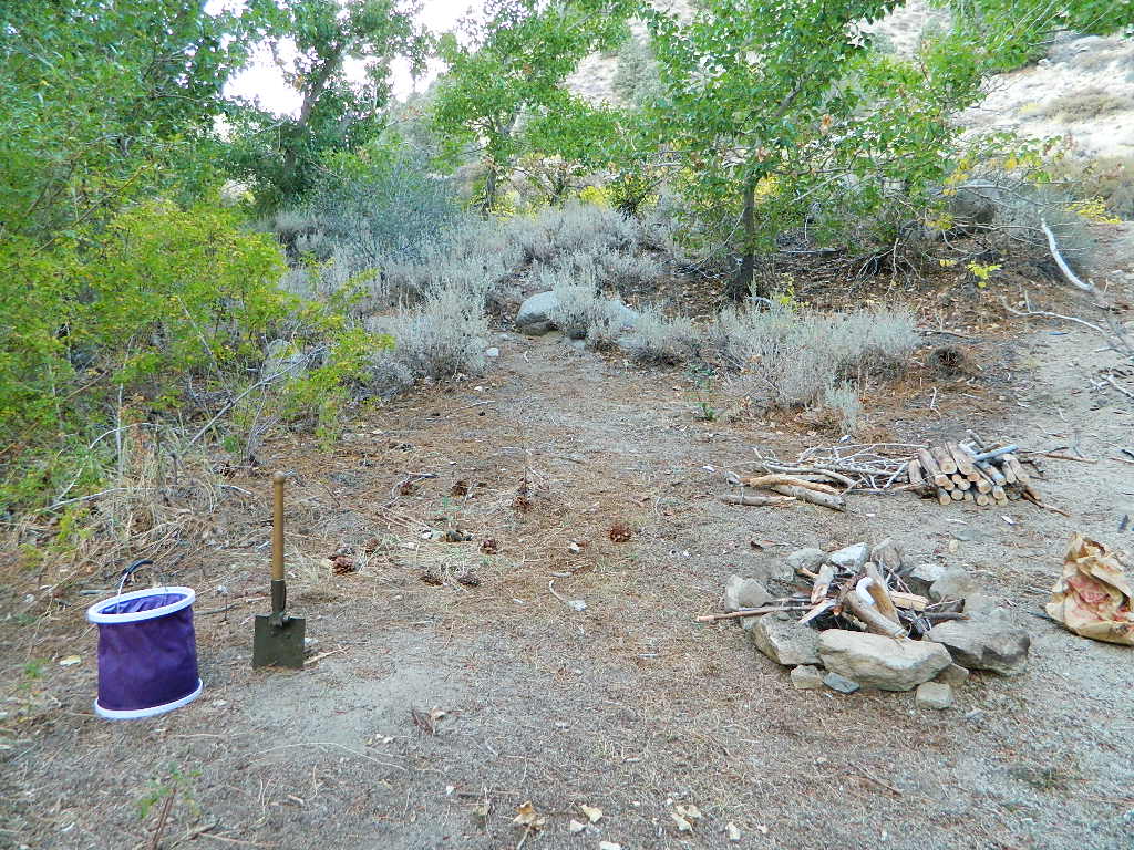
Campfire Restrictions
California is well known for its unforgiving drought conditions and its seasonal wildfire danger. Always know the fire conditions in the area you plan to camp. Most Southern California regions have banned ‘open campfires’ in forested areas, due to wildfire threat and population density. Call ahead to get an update on road closures and current campfire restrictions. Find California BLM offices & NFS ranger stations
Campfire Permits
If you plan on camping outside of a developed campground, you will need to get a free “camp fire permit”, which can be obtained at the local rangers office.
Build campfires in designated rings. Always try to use an existing ring when possible. If you must build a new rock fire ring, follow the guide on FireSafe
You will need water source & bucket, plus a decent shovel for building, maintaining and controlling a campfire. BRING enough water & tools with you to control a fire.
A ten foot clearance – all around, down to the bare dirt is the best practice. No brush close to the ring, no bushes, no leaves or pine needles. No dry over-hanging tree branches.
You might need to clean trash out of the fire pit, so bring heavy duty trash bags, or a spare old box. Shovel comes in handy here.
Kindling is key to getting a good fire going fast, so gather more of the small stuff. Wood gathering away from camp is usually better pickens.
Use environmentally friendly fire starters (with damp wood, if you must); not the BBQ lighter fluid or gasoline
Building fires up against a big boulder scars them w/ black soot, and although it can reflect heat back to you, it is seldom worth the unsightly damage
Bring chainsaws or hand saws for cutting your own campfire wood in the forest
Gathering wood for fuel — use only dead and down wood
A ranger issued “wood cutting permit” is required if you plan on cutting a full cord
Never burn plastics, batteries or other toxic materials in campfires
Tossing beer bottle caps into a campfire only litters site for future campers
While glass bottle smelting is a real treat among boys at night, which one is actually gonna get their hands dirty & clean up broken glass out of the campfire the following morning?
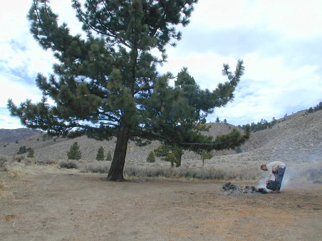
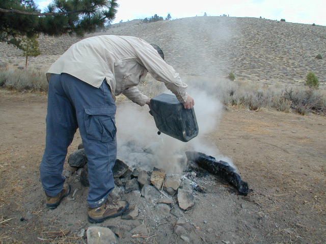
Do not leave any hot coals during the day (if you are away from camp). Winds could pick up.
Always douse campfire with water completely when breaking camp. Stir it, feel for heat, and drown it more if you hear sizzling or see bubbling.
Read more wild fire / campfire info on our FireSafe page
The Final Step of Breaking Camp
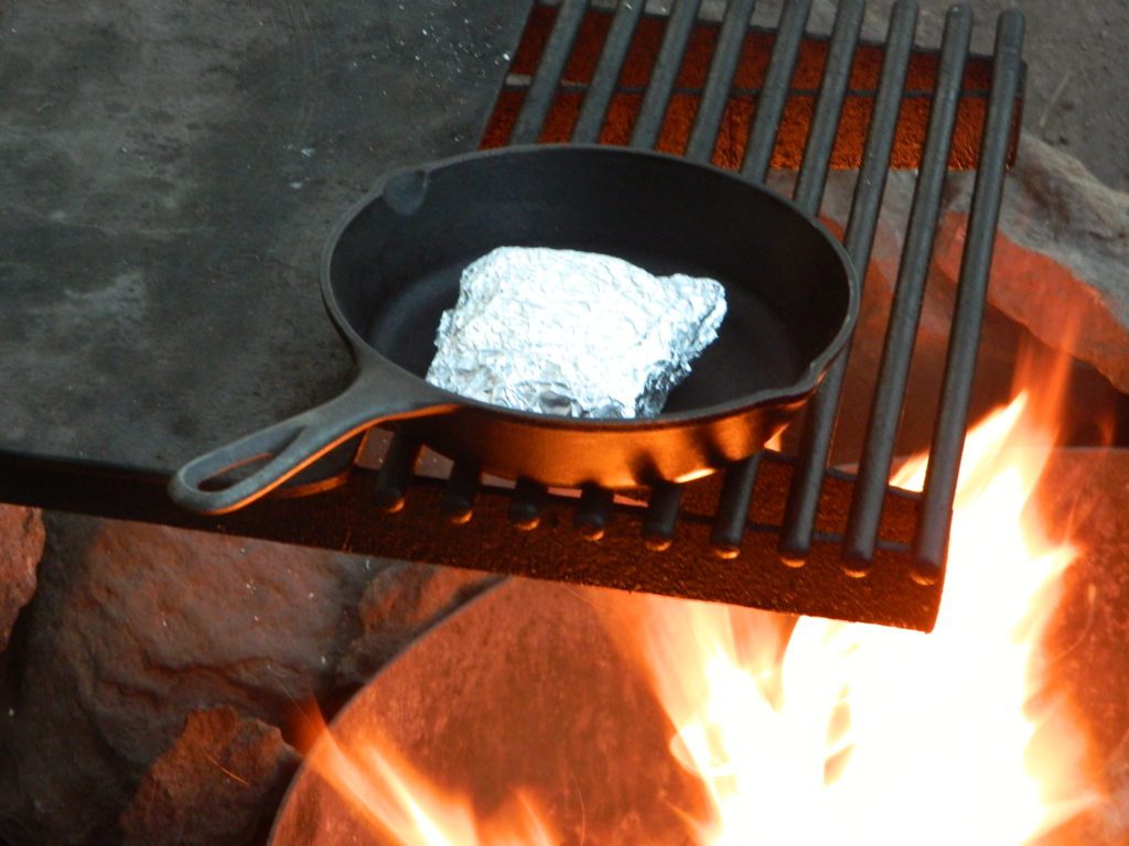
Campfire Pits & Fire Containers
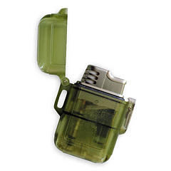
Stormproof Lighters
Developed Campgrounds offer sturdy, permanent, metal campfire pits. Many have adjustable grills built in.Primitive Camping is allowed in National Forests throughout California. Campfire permits are required. This style of camping is more peaceful and secluded, without neighbors, without fees and without amenities (no table, no fire ring, no toilet)
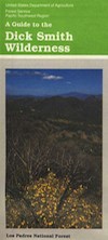
Los Padres National Forest – Located in between the Santa Barbara coastline and the Cuyama Valley, this coastal wilderness area is situated miles north of Ojai, off Highway 33.
The Dick Smith Wilderness is where the San Rafael Mountains and the Sierra Madre Mountains merge on the east side, next to Pine Mountain Summit (elevation 5080′ @ highway).
Significant mountain peaks within Dick Smith Wilderness Area:
Big Pine Mountain – 6828′ elevation
Cuyama Peak – 5875′
Lizard Head – 5350′
Madulce Peak – 6536′
Samon Peak – 6527′
Closer to Ojai, Matilija Wilderness is on the southern boundary of DickSmith and the San Rafael Wilderness sits to the west side. Native American petroglyphs can be found in this mountainous region. Access to “Painted Rock” on the Sierra Madre ridge, via Road #32S13 (which has a locked gate on both ends), is a long one so you might want to bring the mountain bike. The dirt road hike is about 10 miles (one way) and it starts at the Santa Barbara Canyon trailhead. If you plan to visit the rock art from the west side – take the dirt road up past Bates Canyon Campground. The turn off on Hwy 166 is called Cottonwood Canyon. Park at the hog pen trailhead and follow Road #32S13 for miles.
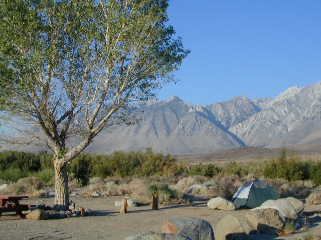
Inyo Forest Campgrounds – Eastern Sierra Campgrounds
areas include: Lone Pine, Mount Whitney, Independence, Onion Valley, Ancient Bristlecone Pines, Big Pine, Bishop [Hwy 168], High Sierra, Owens River, Lake Crowley, Rock Creek, Mammoth Lakes [Hwy 203], June Lake Loop [Hwy 158], Lee Vining & East Yosemite National Park [Hwy 120]. Camping on Eastern Sierra Highway 395
Eastern Sierra recreation – backpacking, horse packing, day hiking, creek fishing, mountain biking, mountaineering, rock climbing
Listed below are Inyo National Forest campgrounds, County Parks, BLM public camps for outdoor recreation. Many campgrounds are closed for winter months. Blue links lead to more camp information. Boldface links to detailed information & photos on campground.
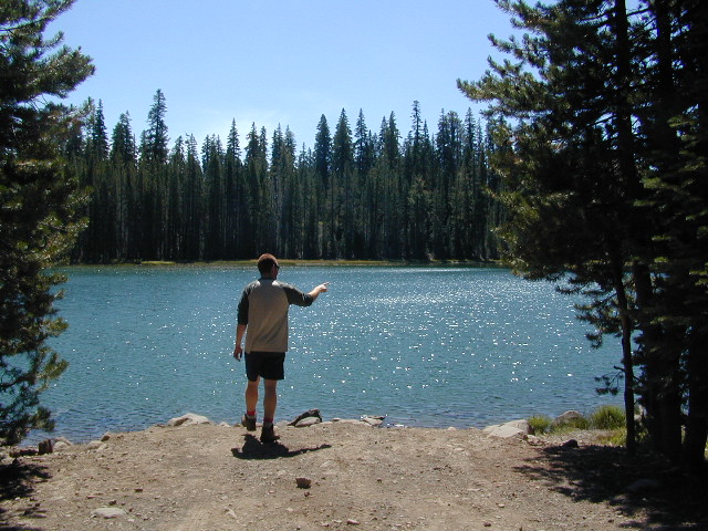
Lassen Volcanic Park is surrounded by beautiful mountains and lakes, some inside the National Park boundary, but most outside. Lassen National Forest, Thousand Lakes Wilderness, Lake Almanor, Hat Creek and Burney Falls encompass this pristine water wonderland of NorCal. Outdoor recreation all over – rivers, fish, hunt, camp, mountain bike, off road.
Backpack camps, RV campground, fishing lakes, day hikes, off-road and lake side camp sites, we have it all listed on Total Escape.
Hiking, camping, fishing all over this region! Mountain bike, kayak, or relax all day in the hammock – in a shady spot with a view. Water flows freely and annual snow melt is abundant in this part of California. Some locales may not open until July 4th weekend. Always check with the Lassen NFS rangers to make sure.
(lakes on the trail)
Crumberg Lake
Twin Lakes
Jakey Lake
Snag Lake 6076′
Horseshoe Lake
Willow Creek
Long Lake
Lassen National Forest lakes:
Majority of these lakes require dirt road driving to reach them. Often forest roads close for snow, usually during winter months (DEC-MAY)
Wilson Lake 5267′ Crater Lake ^ 6800′
Echo Lake
Widow Lake
Star Lake 6362′
Rising River Lake
Baum Lake
Murken Lake
Haynes Reservoir
Heart Lake
Willow Lake
Shotoverin Lake
Killer Camp @ Echo Lake
Caribou Wilderness:
Campsites with hiking lakes and wilderness trailhead access, right next to Lassen Volcanic National Park.
Echo Lake ^
Caribou Lake ^
Silver Lake ^ – Silver @ Lassen
Triangle Lake
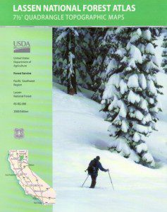
Find Lassen Maps, NFS Topo Atlas
Thousand Lake Wilderness:
North of Mount Lassen is the less-popular Wilderness Area w/ many miles of dirt roads to travel.
North Battle Creek Lake ^ 5571′
Logan Lake
Buckhorn Lake 4776′
Lake Eiler
Terry Lake
State Parks, State Forests, State Recreation Area, National Parks, National Monuments, National Forests – What is the Difference?
Forest, Park, Reserve, Monument, Recreation Area, BLM, Nature Preserve… arghh!
Don’t let all the park and forest names confuse you. It is all California and it is your public land! No bikes on trails, No gathering wood, No dogs here, No camping there; Now what?
Below is our overview graph for all California parks and forests – the basic concepts & the rules broken down for anyone to understand. Permits may be needed in certain areas. Only the government officials understand the true nature of all the ridiculous red tape.
Back country lands very protected from roads and human impact. Off limits to vehicles & mountain bikes. Only accessible by backpacking, hiking or horseback. Endangered species; Hard to reach terrains in the High Sierra. Overnight visits may require a wilderness permit.
Federal lands are national parks, preserves & monuments; highly regarded as some of the most scenic in world & protected. Very popular places and crowds often in summer. Limited use areas for camping & recreation. No mountain biking on trails. No dogs on trails. Try off-season. Drive thru entrance fees.
NM: California
National Monument
Located within the National Park System & more specific to a region. Historic buildings, geological features and deserts ruins qualify. Some National Monuments become National Parks. Many locations have entrance fees.
NRA: National Recreation Area
Located within the National Park System & somewhat specific to a waterways, coastlines, lakes and reservoirs. Some locations have entrance fees.
NSA:
National Scenic Area National Seashore
Located within the National Park System & is basically scenic area worth preserving. Usually no entrance fees.
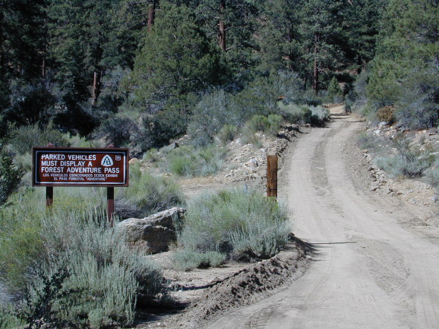
Areas of forest lands throughout state; some surround the National Parks. 18 national forests make up 20 million acres of federal land. Multiple use areas: snow skiing, mining, grazing, off-roading. OHV & SVRA Tons of small campgrounds, recreation & primitive spots for real seclusion. Best bet for finding a spot away from the crowds. Get a free fire permit & camp on back roads. No entrance fees, some parking or day use fees; SoCal requires an Adventure Pass.
California Department of Parks & Recreation manages more than 260 parks. These smaller parks are located near cities with historical parks, as well as remote wild state land & coastal beaches. Entrance fees, day use, picnic and some have campgrounds. State Parks charge fees for day use, parking and overnight camping.
California SF: California State Forest
California Demonstration Forests, areas to be protected. Redwoods & Sequoia Groves; fragile eco-systems. Handle with care. May charge entrance fee or day use fee.
California SRA:
State Recreation Areas
California Department of Parks and Recreation. Lakes, Reservoirs, Rivers. Many have boat rentals and active marina. Recreation lakes charge entrance, day use, parking or boat launch fees.
Off Roading folks and dirt bikes can have their fun wheelin. Lands set aside for OHV use; dune buggies, quads & 4×4 enthusiasts. Most in desert regions; forest lands. Developed campgrounds large enough to accommodate RVs and trailers. Fees may apply in these off-road areas for day use or camping.
California County Parks
Desert hot springs, oak foothills and campgrounds, local hills w/ hikes, parks close to urban regions. Back roads & rural land protected from freeways & development. May require parking or entrance fees. Find these listed on the California A-Z town pages
City Parks in California
Urban Parks & Recreation, inside the city limits. Usually no entrance fees. Find these on California A-Z town pages
All public lands that do not fall into the above categories. Little to no fees for day use, recreation or overnight camping. Plenty of desert & off roading areas. Some forest lands, certain lakes. Small campgrounds or open camping allowed. Fees may apply in developed campgrounds. Camp overnight almost anywhere out here for free, with a ranger issuedcamp fire permit.
Sequoia – which one?
Sequoia National Park
Sequoia National Forest
Giant Sequoia National Monument
Imagine that the Southern Sierra mountains is home to 3 different public parks named Sequoia. Yep, it’s true. Sequoia National Park, Sequoia National Forest, and Giant Sequoia National Monument. Other parks that have Sequoia groves are – Mountain Home State Forest, Calaveras Big Trees State Park, as well as Yosemite National Park.
As far as the Coastal Redwoods, most are included under State Parks. Find these parks on the Central Coast Big Sur and Santa Cruz mountains, plus Marin County, and all along the north coast US Hwy 101 from Mendocino to the Oregon border. Numerous redwoods parks are located along rivers.
The super scenic Big Sur coastline is home to Julia Pfieffer Burns State Park and to the similarly named Pfieffer Big Sur State Park. Leave it to park personnel, state officials or the non-locals to create such a confusing naming system within our most-visited state.
Lava Rock @ Blue Lake in Modoc CountyHolcomb Valley Camp, Big Bear Lake, CA
Lassen Camping near a creek in Northern California
California Outdoor Recreation:
All parks, forests, preserves, monuments, public lands, lakes, rivers, wilderness, historical sites and museums can be found listed separately on our super duper local A-Z town pages


 Mount Lassen is part of the Cascade Mountain Range, located north of the Sierra Nevada. The Lassen forest encompasses a large area of wilderness land, snowmelt creeks and an abundant dirt road system. Most of which is covered in deep snow about half the year, so plan accordingly.


 NOTE: BBQ grills, all stoves, smoking, firecrackers, welding, chainsaws, off roading, dirt biking, hunting and target shooting are restricted within these orders. A few of these fire restrictions are dated to extend until DEC 31, 2025


 A high clearance vehicle may be needed to reach certain camp spots, but many can be accessed with a standard passenger car. Low riders will likely bottom out and motorcycle riders will get dusty.
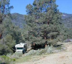


 Eastern Sierra communities include:


