Mid summer in Northern Cal & the small town of Gasquet, near Klamath River, is holding its annual rafting celebration.
Race or not. Decorated rafts, floating, paddling the middle fork of the Smith River, all the way from the Horace Gasquet Bridge to Shady Bend Park. July is the time for fun in the sun & the water, with BBQ, local breweries featuring their stuff, craft vendors, plus tons of fun for the families. 52+ years running!
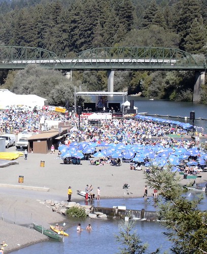
Summertime warms up and being outdoors is THE plan. The Russian River Jazz & Blues Festival is held annually near the redwood forests of Guerneville, California. Located of event is Johnson’s Beach – right on the Russian River. This is a great opportunity to camp out in the inland, North Coast region. Plenty beach parks & campgrounds nearby.
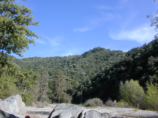
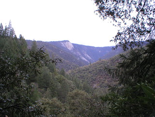
Numerous Silver Lakes, Creeks and other “silver” terrain can be found inside California. After the Gold Rush of 1849 in the western Sierra, Silver was discovered in Nevada shortly after (east of Sierra Nevada mountains). This page is an overview on all places with SILVER in the name, or places that have had a history of silver mining. California Counties are listed in parenthesis. Links below will lead to more detailed pages or campground reservations.
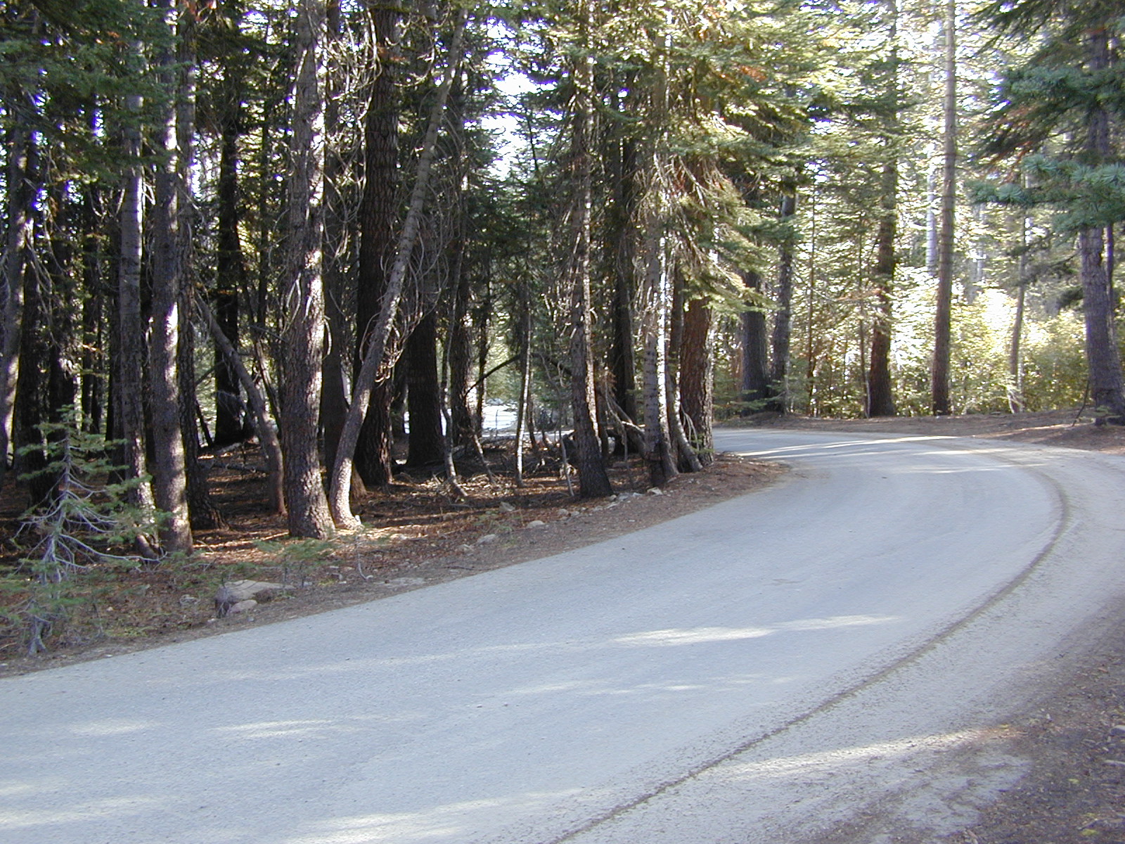
Silver Fork of the American River. Silver Fork Road connects US Highway 50 & Carson Pass Hwy 88. Silver Fork Campground & China Flat Campground (NFS) are both located on this remote, backcountry route, about 8 miles from US Hwy 50
Autumn aspen groves ignite with color in October. Often, some of the best fall colors in the Eastern Sierra. Day trips w/ fishing. Hiking everywhere. Overnighters or backpackers could be greeted with snow at anytime in October or later. The June Lake Loop (SR 158) closes for snow annually!
below are silver mining camps and other silver related destinations, plus some campgrounds
Bodie SHP (State Park)
(Mono Co)
8375′ elev. US Hwy 395 near Bridgeport, CA. Infamous, high desert ghost town, now a California Historic State Park. Large gold mining camp w/ well-preserved, wooden, old town structures. Silver was discovered in nearby Aurora Canyon. All dirt road access. No developed campground @ Bodie, so try nearby Green Creek Road instead. Or high desert, back road camping on Aurora Canyon Road over to Bridgeport Reservoir.
Cerro Gordo
(Inyo Co)
8500′ elev. Inyo mountains, West of Death Valley, east of US Hwy 395 @ Junction 136. Old mining camp rich in silver history. Someone might even live up there. Extreme remote location in rugged, high desert mountains. 4×4 is always required!
Silver City Sequoia
(Tulare Co)
6935′ elev. cabin resort on Mineral King Road, in the South Sequoia National Park
Silver Valley Campground & Silver Tip Campground (Alpine Co)are both located near Lake Alpine on Highway 4 Ebbetts Pass , Central Sierra
Silvertip is also a Group Camp at Jackson Meadow Reservoir (Sierra Co) off Hwy 89, North of Truckee, CA. Silvertip Group Campground, as with all group camping facilities, is by reservation only.
Silver Lake @ LA (Los Angeles Co) a hip and popular, tree-lined neighborhood in Los Angeles, near Griffith Park.
Silver Lake
(San Bernardino Co)
Silver Dry Lake, a dry lakebed in the Mojave desert, near the Hollow Hills Wilderness, north of Baker, CA off I-15
Silver Lakes
(San Bernardino Co)
2430′ elev. a desert community southwest of Barstow, near Helendale, CA. Located on the Mojave River (which flows underground) in between Historic Route 66 & US Hwy 395. Attraction nearby – Exotic World, the Burlesque Hall of Fame.
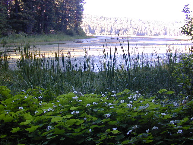
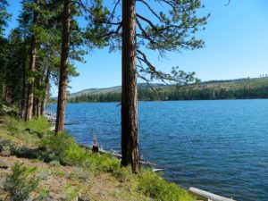
Blue Lake in Modoc National ForestHiking Lake w/ Loop Trail in far Northern California
Blue Lake
Modoc National Forest
When you really wanna get away from it all, take a week off and head up to Modoc – the top northeast corner of California, where the volcanic mountains line the Great Basin. The population is minimal, cattle are abundant and the campers few. Even in mid summer, this ideal lake campground rarely fills up.
Jess Valley Road leads east off US 395 @ Likely, CA – 16 miles back to this hidden gem.
Headwaters to the Pit River.
NFS Campground is shady, well managed, and spread out on the eastern slope w/ numerous paved loops. Tent campers, cross country cyclists, truck campers w/ canoes, SUV families, motorhomes with kayaks and kids.
Modoc Map
Blue Lake Campground NFS
• Elevation: 6,050′
• Number of Sites: 48
• Vehicle Accessibility: 32′ RV
• Camp Fee: Yes
• Campsite Reservation: No
• Water: Piped
• Length of Stay: 14 Days
• Season: May –October
• Trailhead: Lake Loop
• Boat Ramp: Yes
Group Camp Facilities (by reservation only)
Modoc NF Warner Ranger District
@ 530-279-6116
Lava Rock @ Blue Lake Loop, in Modoc County, CA
Blue Lake National Recreation Trail
Right next to camp: A pretty much perfect LAKE LOOP (1.5 mi) hiking trail is worth a serious stroll; footbridge, wildflowers, fishing spots, minimal hills, lava rocks, and awesome scenery. Plenty of wildlife can be seen, including butterflies and bald eagles. Trail is shaded by tall white fir and ponderosa pine trees. Trailhead is located at the Day Use parking lot, w/ paved boat ramp, dock, and picnic area.
back roads
boating
camping
canoeing
fishing
hiking
kayaking
mountain biking
picnicking
swimming
stargazing
wildflowers
wildlife
NOTE: not every CAMPSITE has a LAKE VIEW
Certain campsites are adjacent to the lake; some are set facing a meadow (Autumn w/ aspen groves), or the alpine forest w/ deer grazing. Perhaps an inner circle (interior) campsite, for those who like to be close to bathrooms and piped water. Large families will love the abundance of camp settings and accommodations.
Paved Loop Plenty of Vault Toilets Piped Water Recycles & Trash Service
Large Campsites can accommodate Motorhomes
no paved camp stall
no hook-ups
no dump station
no cell phone signal
popular lake camp for motorhomes
When driving a large RV back in here, be courteous of other campers. Nothing sucks more than driving a long distance to the boonies, to arrive at camp just before dark and annoying everyone else already there.
Those needing to drive the campground loops (more than twice) looking for the biggest, levelest, best camp site – and burning $10 in gasoline doing so, should consider walking in.
Park that beast (near boat ramp area, before the camp entrance). Get out and walk the hills and loops, BREATHE & relax – prior to a choosing camp site.
Unhitch any tow vehicles; use that to scout out your perfect spot, if you cannot hike it. Trailers and large motorhomes will find this place ideal, but getting the right camp, can make all the difference.
Paved Trail around Campground
The wildfire: BLUE FIRE burned this region in 2001, but it is lush and green again (2019). Northern California gets some real weather. Rain and snow, more than half the year. The campground closes annually due to snow.
Kayaking is best done in the morning, cuz wind picks up in the afternoon. Canoes can launch at boat ramp, or at shoreline from trails near campsite.
Hiking trails can be found all around lake and campground. Wilderness access can be found at South Warner trailheads within a short drive from the lake.
Cyclists also love this camp, as it is located near a major highway and is a perfect place to really relax, soak in the scenery and get some quiet-nights sleep.
South Warner Wilderness is close by, driving distance; accessible by graded dirt roads. Signage is decent.
Modoc Forest Road #64 is a through-route, across the lower South Warners – 40
miles connecting to east side of the mountain, at Eagleville, CA.
Dirt Roads are suitable for trucks w/ trailers. SUVs and rugged passenger cars are okay. Motorhomes are not advised on this route. Washboard conditions are typical. Winter closure on this route is common.
MODOC RD 64
Several miles away from Blue Lake, 2 rustic trailhead campgrounds are located back this way – East Creek Campground & Patterson Campground. Less than 10 camp sites each, equipped w/ horse stalls, vault toilets and maybe piped water. Trailhead parking for backpackers. No RVs!
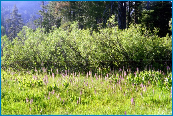
Autumn colors w/ aspen groves. Open, large meadows and mature forests w/ wildfire scars. Cattle can be found grazing all around, many cattle crossing.
Minimal primitive camping options, along road sides. Campfire permits required. No camping within one mile of a developed campground.
Modoc is Cow CountryDay Trippin – Out exploring Modoc Road 64 (and cutting firewood)
Group Camping can be reserved at Whiskey Creek Group Picnic Area
3 group camping sites with excellent views of the lake and mountains, on the northeastern shore of Whiskeytown Lake.
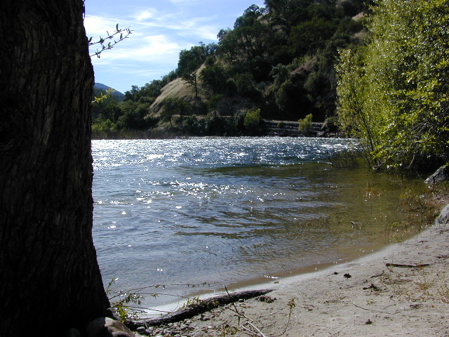
Salmon River @ Somes Bar:
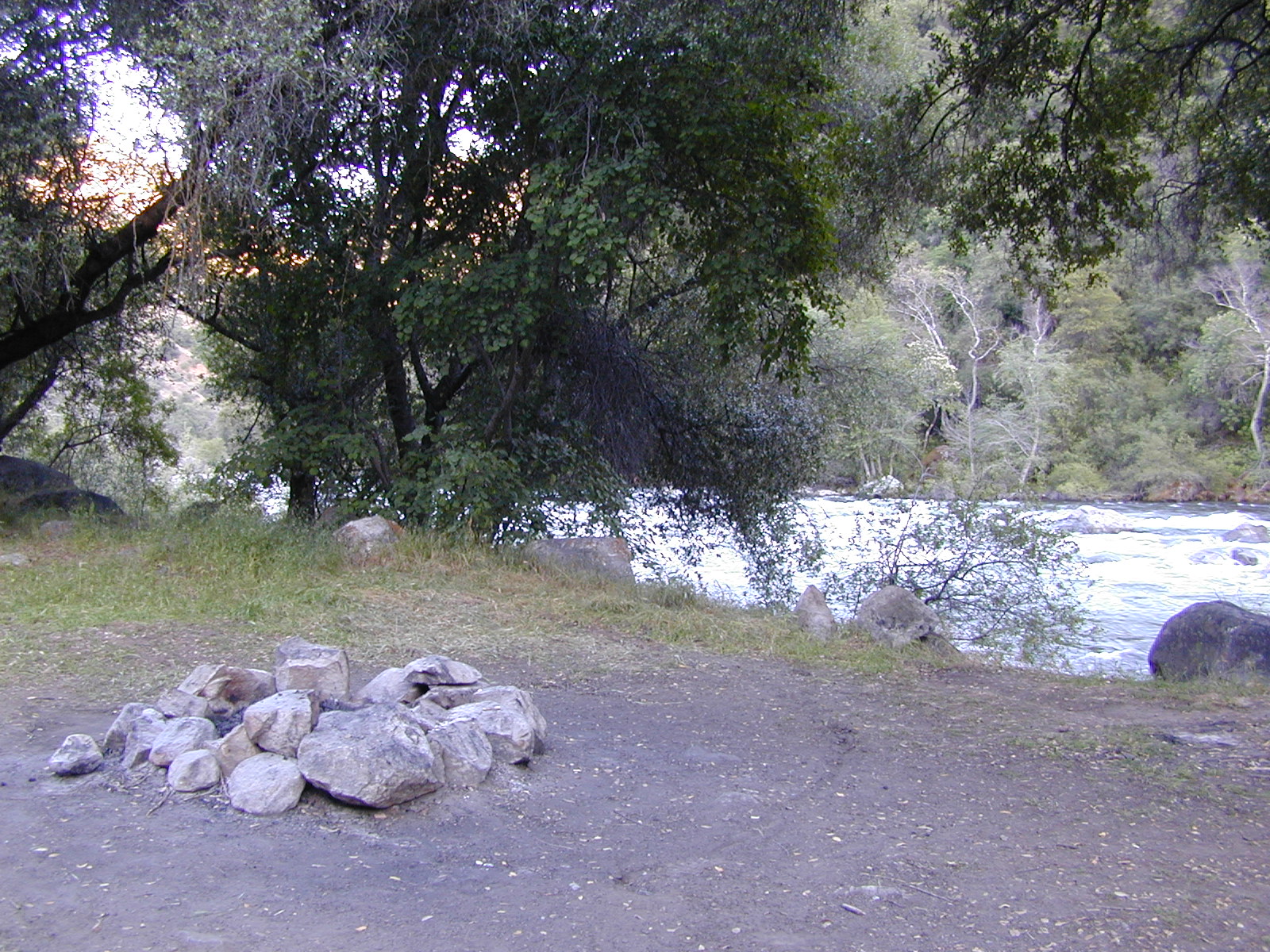
Oak Bottom Campground NFS
elevation 700′
26 sites
No electricity, water or sewer hookups
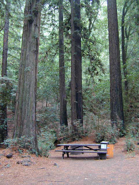
Six Rivers National Forest – Oak Bottom Campground loops around a forested hillside with large trees providing ample shading for multiple sites within the campground. A variety of wildlife makes its home in the area.
Located off the main highway, on a side road, with the epic Salmon River! This NFS campground is popular with whitewater enthusiasts in the spring. Rafters, kayakers. Many challenging rapids ranging from Class 3 to 5 are available. Swimming is also popular in the summer and numerous river access areas are a short drive or walk from the campground.
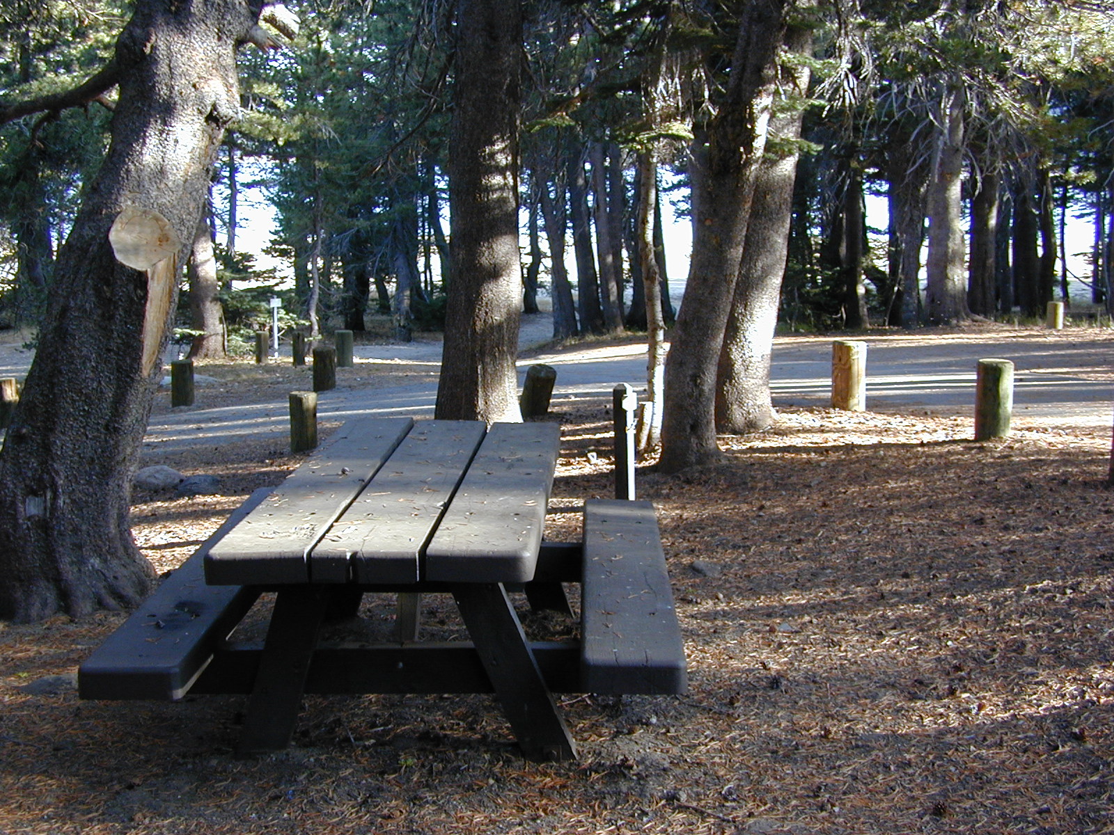
ADA Camping (Americans with Disabilities) Handicap accessible camp sites at Blue Lakes, near Hope Valley, CA
Blue Lake Campgrounds
highest lake campgrounds in the vicinity
Eldorado National Forest in Amador Ranger District; a forest south of Lake Tahoe in the central portion of the Sierra Nevada mountain range. This set of scenic, alpine lakes sits in between both Eldorado, Toiyabe National Forests and the Mokelumne Wilderness. But please take note that the Blue Lake facilities are owned and operated by utility company PG&E
No Reservations. most camp sites are available first-come, first-serve
RV limitations: 30 feet
69 miles east of Jackson, CA on Highway 88 and then another 12 miles south on Blue Lakes Road. This area is close to Hope Valley, south of Lake Tahoe, CA
Blue Lakes consist of several developed campgrounds. Blue Lakes Rd# 13 is a well signed, paved road off Hwy 88, just east of Carson Pass (8560′ elev). The route is closed during winter snow, while it serves as a winter recreation area. The main paved road becomes dirt near the campgrounds. A dirt road continues past the lakes and south to Deer Creek and meets w/ Hwy 4 near Ebbett’s Pass.
RV campers, fishing folks, hikers, kayakers and disabled travelers like this lake camp area due to the easy access, paved parking and campground amenities. Handicapped camp sites are also prime lake front locations.
Group Campgrounds are reservable. Picnic Areas, Group Sites and campfire rings. Piped water, bear boxes and vault toilets. No RV hookups, no dump station, no showers. Unimproved boat ramps are available at Upper and Lower Blue Lakes.
Upper Blue Lake Campground elev. 8136′
camp sites: 32
Overflow Camp camp sites: 34
Backpackers and day hikers: Sierra trailheads out here lead south into the Mokelumne Wilderness Area. The infamous Pacific Crest Trail also passes thru this high elevation region: PCT access @ Carson Pass, Upper Lake & Tamarack Lake
BLUE LAKE CAMPGROUND
NorCal region of the South Warner Wilderness in Modoc National Forest. That’s way out near Alturas. Likely, CA is the turn off US 395. Northeast California, real seclusion.
EASTBOUND Paved Road #64 is Jess Valley, which leads along the Pit River, cool volcanic cliffs, and up to forested Blue Lake Campground, elevation 6051′
Wildlife viewing @ Blue Lake Modoc
Donner Blue Lake
DONNER PASS – Sierra Nevada
Interstate 80 BLUE LAKE CAMPGROUND
i80 Donner Pass, near Truckee, CA; a PGE Campground w/ 4×4 access and hike-in only. First come, first serve. No tables or restrooms, elevation 5900′
Lake side resort w/ boat rentals and fishing, near Upper Lake, CA
elevation 1357′
A small resort w/ hotel suites and a lakeside setting w/ abundant nature. Two small lakes, kinda close to the highway. Non motorized boats only, kayaks, paddle boards, canoe, swimming, birdwatching, bike paths and fishing. Wedding venue next to lake. Wineries, restaurants, and a casino nearby.
Oak foothills of the Historic Gold Country, at the edge of the Sierra Nevada mountains.
boating
canoe
camping
fishing
hiking
houseboats
kayaking
wildflowers
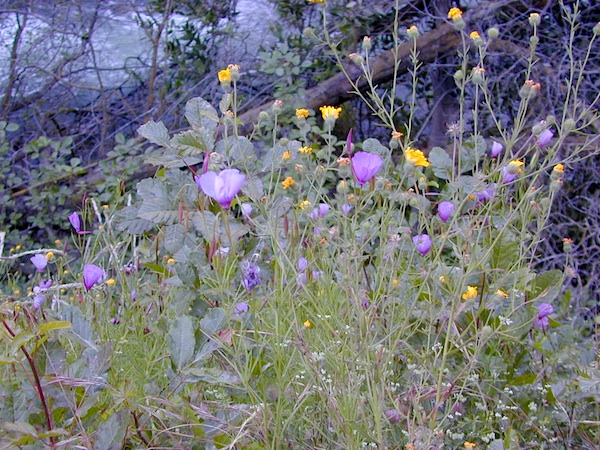
Most Central Valley Reservoirs have blooming wildflowers in early springtime. Summer heat can measure triple digits for months as most of these lakes are located below 1000′ elevation.
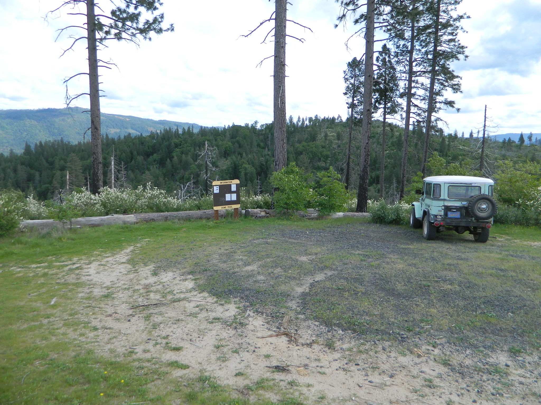
On paved Bald Rock Road a rusted metal sign reads “Dome Trail 3” which is where the fun begins, on the dirt.
3 mile drive to trailhead from pavement
4.6 miles RT hike
w/ a 2000 feet elevation drop to the river
Plumas Forest Rd #21N51Y is located in the forested community of Berry Creek – opposite from Upper Zink Road. Road 21N51Y becomes Bean Creek Rd #21N36: The forested route passes a few private properties and gates, the dirt road leads 3 miles down to an old wildfire (2008) burn area and eventually dead-ends at the Dome trailhead. The hiking trail descends down while overlooking the Bald Rock Canyon with the Middle Fork of the Feather River.
Rated as a moderately difficult hike: Steep hillsides, plenty switchbacks, downed trees across trail, boulder hopping, cliff edges, extreme heights and rock slides. Delighted by dozens of wildflowers, the old metal staircase still in use, steel pipe railings and the minimal fencing and of course, the big river deep inside an impressive rock canyon. Sierra Nevada spectacular!
Indian Creek spills down into Curtain Falls up the canyon, sometimes within view. Secluded Milsap Bar Campground is also up the river from here. The stretch of the whitewater river is popular with rafters and kayaks. Rock climbers gravitate to the big walls above. Bring a picnic lunch and water filter for this amazing all day hike.
Granite Domes & Bald Rocks
There are numerous granite domes and bald rocks within the Plumas National Forest, most located near the big river canyons. This particular granite dome is situated overlooking the Middle Fork of the Feather River, and it is called Bald Rock Dome w/ 3509′ elevation.
Not to be confused with another shorter hike nearby on Bald Rock Road at a well marked trailhead for Bald Rock, which over looks the forest and valley to the west side. The official peak is named “Big Bald Rock” as listed on most maps.
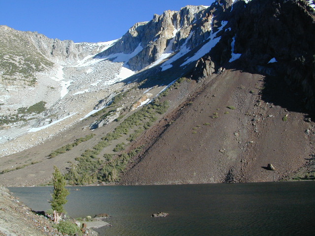
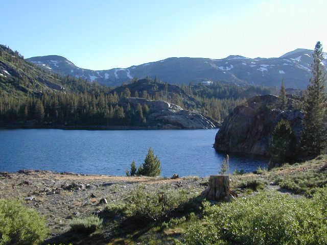
Inyo National Forest @ Yosemite East
Tioga Pass Hwy 120
This spectacular setting has a top-of-the-world feeling to it. Gorgeous meadow area, right along the main highway, with a small lake next to giant rock slides and impressive granite mountains.
The air is thin, the sky is clearest blue, the snow is melting, the stream is trickling and the nights are chilly – even in summer. Bring a winter coat and extra blankets, if you plan to camp.
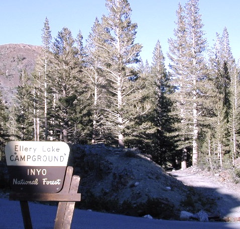
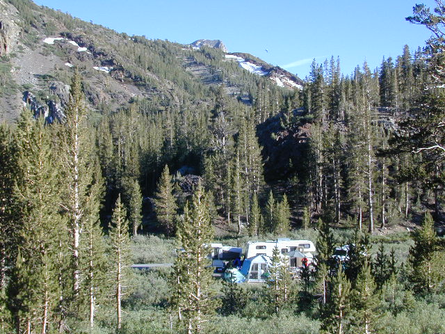
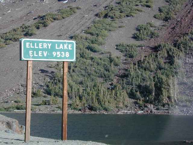
Ellery is small campground is located just outside the EAST GATE of Yosemite National Park, along Highway 120 Tioga Pass. Easily accessible and fully paved, this camp is only open half the year due to deep snowpack. The snow usually melts by June, and camp often closes early due to higher elevation weather, sometime in October or November.
Lee Vining Canyon is to the east and Mount Dana is to the west.
Ellery Lake is one of those magical places, where you can spend all day out in nature – without needing to drive anywhere. Gorgeous high country scenery surrounds you in every direction. Walk over to nearby meadows, creeks or neighboring lakes. Climb mountain peaks or enjoy extended day hikes. Watch wildlife from camp or fish in the lake. Stargaze at night w/ the darkest skies around.
Or how about, walk to dinner? This place is easy walking distance to the historic Tioga Pass Resort, where you can enjoy a real, sit-down meal at the cafe. (Hope they will re-open 2020)
Ellery Lake – camp, hike, fish or kayak. No motor boats allowed.
Travelers heading to or from the National Park, often stop at Ellery to take photos and walk around. There is always a flurry of activity around easily accessible lakes and this one is no different. The busy highway and constant traffic may be heard from camp, but the ideal location and epic lake makes up for the inconvenience.
This NFS campground is one of many small camps located along the highway, on the east side of Yosemite National Park. This special place is in high demand, can fill up fast and is quite busy most of the summer.
perfect for tent campers
Small parking areas, tight walkways, landscape and minimal campsites makes this a “no-turn-around” kinda campground, so don’t bring that huge RV (cuz it won’t fit).
Most sites do not have enough room to park a second vehicle at all. Each campsite has a locker for food storage. (bear country = store food properly)
Ellery Lake Campground
• Elevation: 9,538′
• Number of Sites: 12
• Camping Reservations: No
• Sites Available: First come, First serve
• Vehicle Accessibility: Vehicle limit 28 ft.
• Length of Stay: 14 Days
• Water: Potable water
• Toilet: Vault
• Season: Closed during winter & spring
• Fee: Yes
• Operated By: National Forest Service
• Closest Town: Lee Vining, CA
Spicer Meadow Reservoir & more lakes: Paved Forest Rd #7N01
Spicer, Utica & Union Reservoirs, Central Sierra, Stanislaus National Forest
Stanislaus National Forest
North Fork of the Stanislaus River
Highland Creek
Carson Iceberg Wilderness Area
Spicer Meadow Reservoir (6418′ elev)
Union Reservoir (6850′ elev)
Utica Reservoir
Spicer Meadow Reservoir can also be found on various publications, listed as Spicer Meadows, Spicer Mdws, Spicer Lake and Spicer Reservoir.
Ebbett’s Pass is California State Route (SR 4) Highway 4, which cuts thru the middle of the Sierra Nevada mountains (east-west). Wilderness peaks and rivers surround this whole region. Deep snow pack is common, so much of this region is off-limits half the year (or more). Always check with local rangers by phone before venturing out, as winter conditions can keep these roads closed late into the year.
N of Arnold, California; Continue up SR 4. Passing Calaveras Big Trees State Park & Camp Connell; After Big Meadow Campground, take the paved right turn for Spicer Meadow; This is forest road 7N01. Meandering thru a forest and descending in elevation, road will dead end at Spicer Reservoir.
7N01, the main paved mountain road, is located on the south side of the highway. The highway turn off reads ‘Spicer Reservoir’. Suitable for travel w/ RVs and trucks with boat trailers. Quite curvy, scenic and about 7 miles long. There are developed campgrounds in the vicinity.
The dirt side roads off the pavement can be narrow, muddy, rocky and overgrown, so be cautious when exploring. Choosing a dispersed camp site should be done during daylight hours, and will require a campfire permit ahead of time. Use an existing camp site whenever possible, instead of creating new ones.
Several man-made reservoirs attract outdoor seekers, mountain bikers, campers, canoes and fishermen. Kayakers tend to love Union and Utica, but power boats and sail boats prefer Spicer Lake.
Volcanic features mix with Sierra granite in this part of the forest, and geologic formations make for interesting hikes. Mountain biking is common around these lakes, as well as day hiking and backpacking.
NFS Campgrounds in the region:
Stanislaus River Campground
Spicer Campground
Spicer Group Camp
Campgrounds only open June-September. Some campsites at the campground are wheelchair accessible. Boat ramp located near campgrounds.
Left fork turn off, Dirt Road #7N05 leads out to Utica & Union Reservoirs. Granite rock, alpines lakes w/ forests surrounding. No motorized boats allowed on those two lakes. Very popular among the stand up paddlers (SUP), all kayaks and canoes.
No developed campgrounds back that way either. No flush toilets, nor paved roads. No flat RV spots; only primitive style camping. These 2 scenic lakes get crowded during summer weekends, so opt for a mid-week stay if possible.
Another dirt road treks steeply up the hill from Union Reservoir to Lake Alpine (at the highway). That primitive truck trail is actually a (somewhat designated, but not well-signed) 4×4 route and suitable for high clearance vehicles only.
Spur Road #7N29Y is another small dirt road which leads a couple miles into the forest, over to overgrown trailheads and primitive camping options. Ideal for accessing all the lakes (on foot) from this prime location. A camp fire permit is required. No water, no bathrooms, no facilities, no garbage services.
7N01 – Los Padres NF
There is another USFS Road in California named 7N01, but that one is a 4×4 OHV access route @ Dutchman Campground, located in South Central California; the southern part of Los Padres National Forest. We have mention of it on the page for Frazier Park Camping.
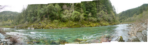
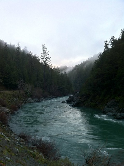
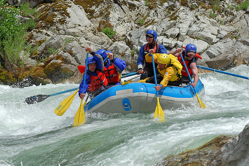
One of the most remote & biologically intact watersheds left inside California. The headwaters of the Salmon River flow from the Trinity Alps, Marble Mountains, and the Russian Wilderness Areas. 850,000 acres of Wilderness surrounding the Salmon River watershed.
You gotta know how to read a map if you wanna find this hidden gem. For those who love seclusion! This NorCal river region is a prime destination for true nature lovers: campers, hikers, fishermen, river rafters, river kayakers, mountain bikers, backpackers, birdwatchers and horse enthusiasts. Summer is the busiest time and of course, the best weather. The remainder of the year, you’ll basically have the place all to yourself. Winters can be wet and sloppy, so don’t get stuck in the mud. Cell phone reception is minimal in these densely forested backwoods.
Rafting, river beaches, kayak spots. Campground camping, RV camping, tent camping, primitive and wilderness too.
A significant part of the Klamath River’s watershed is in the Karuk Tribe’s Ancestral Territory. Karuk Indians have carefully managed their lands through an integrated continuum with the aquatic and terrestrial ecosystem functions for thousands of years. Salmon, or “Ama” in the Karuk language, was a major source of food and spiritual renewal.
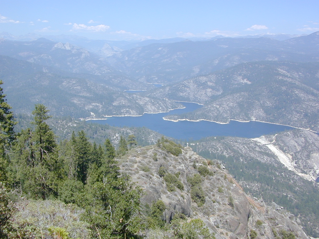
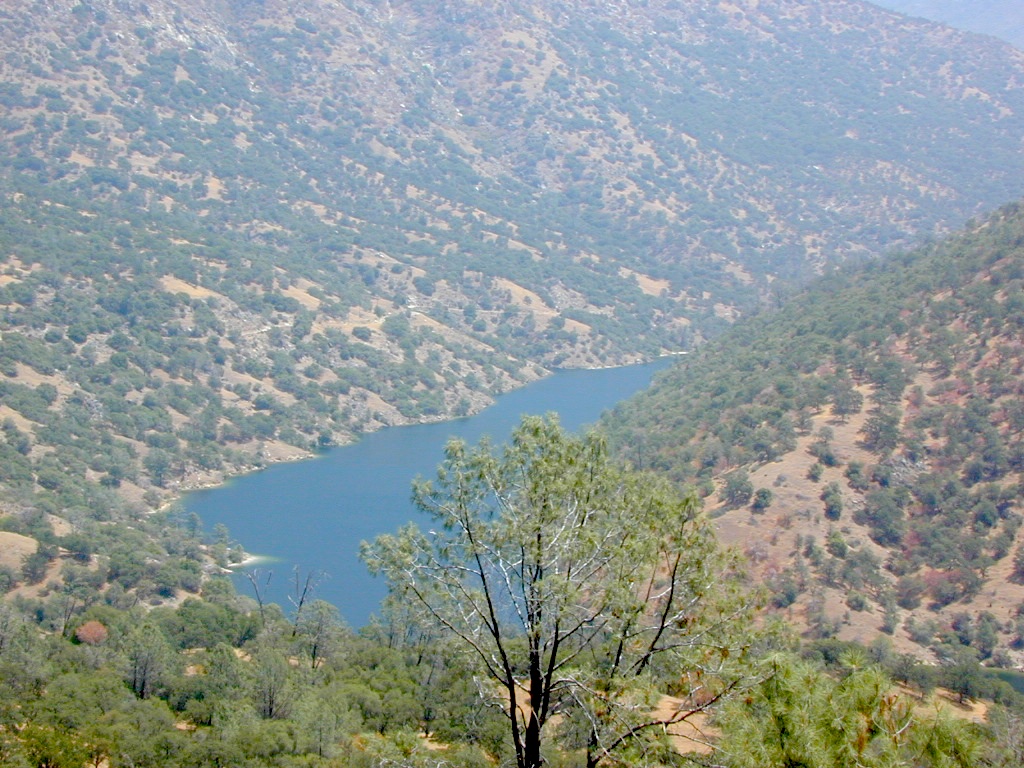
Awesome granite domes of the western Sierra, plus a scenic recreational lake that is only accessible half the year. Home to “Hells Half Acre” – Mammoth Pool Lake is one of the lesser known reservoirs in the western Sierra Nevada mountains. It’s kinda hard to get to although it is located on the border of Yosemite National Park. Area is totally surrounded by granite creeks, hiking trails, dirt roads and wilderness. This Mammoth Pool is an hours drive, way back behind Bass Lake (off Highway 41), and NOT located near Mammoth Lakes in the Eastern Sierra.
Camping just outside of Yosemite. Although the National Park boundary and trailheads are near by, accessing Yosemite Valley for day trips from this location will be quite tiresome and difficult, with long winding roads and over 2 hours drive one way. Better to camp near Bass Lake if you wanna be convenient to Yosemite NP.
(loop road, backcountry route closed in winter months)
Near the town of Oakhurst and Bass Lake California, get off the main highway and head over to the small town of North Fork. Take South Fork Road 225 (Italian Bar Rd) to Minarets Road (#81) also called Mammoth Road. Side trip paved Auberry Road (#222) which skirts oak hills down to Redinger Lake Road. Hook up w/ Minarets Road (#81) that parallels the San Joaquin River on the forested ridge above, traveling 20 miles to Numerous developed campgrounds and primitive camping sites off this route. Mammoth Pool is a signed right turn down Mammoth Pool Road, a steep road w/ a couple of campground near the lake shore and the only public boat launch is narrow, one at a time and it is not paved.
The lake is closed to the public during May and the first half of June to allow migrating deer to swim across the reservoir. The reservoir is inaccessible following the first snowstorm, as the access road is not snowplowed.
Grizzly Road, a paved route that leads deeper into the woods and connects over to BEASORE. Back on the main route (Road #81) on the far north end of the loop, a narrow, paved side route connects Clover Meadow Ranger Station and the impressive Granite Creek Campground. Plenty water and hiking trailheads that lead into Ansel Adams Wilderness and Yosemite National Park.
Back on the main route (Road #81) – the pavement becomes dirt in some sections and the route loops down to Beasore Road (#7), which traverses past meadows and dense forest, and heads back towards Bass Lake.
backpacking, boating, camping
fishing, water ski, kayaking
sailing, swimming
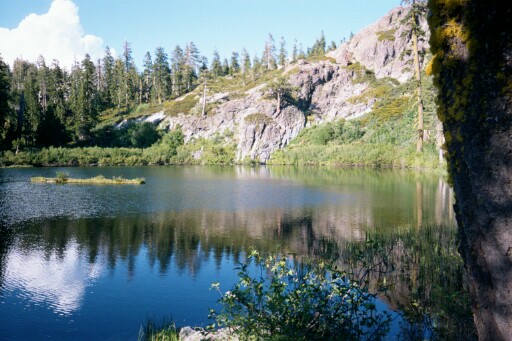
Numerous places called SMITH LAKE exist in the Sierra Nevada.
Lakes Basin Recreation Areahas two different spots named SMITH LAKE. This region is in the Northern Sierra Nevada mountains, near Downieville, at the north end of the California Gold Country @ Highway 49.
Smith Lake hiking trail can be accessed from the Gray Eagle Lodge area along Gold Lake Highway; or this hiking lake can also be accessed from a park on the north side. Plumas Eureka State Park, via the Jameson Creek trail.
Lakes Basin also has a small set of two lakes called “Smith Lakes” – located on Smith Creek. Way back behind the larger, most famous Gold Lake.
4×4 Road #11E71 will lead you to this remote destination, with the proper vehicle, of course. Creek crossings and large rocks; A quality topographic map and a 4 wheel drive rig is needed for this adventure.
Lakes Basin Recreation Area
North Sierra mountains, Sierra granite meets Cascade volcanic rock. Bordering of State Park & 2 National Forests
Snake Lake Campground, located west of Quincy, CA – has a small neighboring lake named Smith Lake. Chances are Smith is covered with lily pads, just like Snake Lake. Smaller Smith is accessible via dirt road only. Many people hike, horseback, mountain bike or dirt-bike back on these narrow dirt roads, so use caution when traveling. Butterfly Valley Botanical Garden is located way back here, if you can find it. A real forest service map is advised.
This is California – the beautiful, where millions flock on vacation. California is crowded: the population & tourists are only increasing each year. Thousands of people are looking for hiking mountains or better, a hiking lake – each weekend. Many are using the web for destinations, like the research you are doing right now. All folks seeking nature, water, cooler temps, fresh air & views. High Sierra, NorCal, SoCal Reservoirs, we list the best of these hiking lakes below.
Some of the lakes have mountaineering routes nearby; equestrian trails, regular hiking trails, campgrounds, some even have sorta level paved (granny) trails for biking, hiking & skating around.
High elevation or alpine lakes can be accessed best in summer months. Mountain bike, backpack, horseback into these hidden treasures. With any Sierra Nevada destination, snow pack deep can be in certain seasons. Major Highways (Sierra Passes) can be closed into June or July, due to rock slides and late snow melt. Snow shoes, snowmobile or 4×4 vehicles may be needed to reach such lakes, any months OCT-MAY (fall to spring). Winter can come early & stay late at these higher elevations of California; Be prepared for true Wilderness experience.
But maybe you are just looking for some easy hiking, loop trails & picnic spots; Or perhaps an overnight stay near a lakeside camp w/ kayak rentals. California reservoirs to alpine lakes, we have a wide variety listed below.
This page contains links to some favorite lakes with hiking trails around the lake, along the shoreline or routes on ridge lines overlooking the lake. If no good lake page could be found, we’ve linked to some photos of the lake on Flickr.
California has so much land and sheer beauty, it’s hard to wrap your mind around the vastness, much less the amazing and awe inspiring scenery. Snow skiing, kayaking, horseback, snowmobile, sleigh rides, dinner cruises, beer trains, wine tasting and so much more.
Drive California top to bottom (from Shasta to Baja) and you could be looking at months of prime vacation time. If you have that kinda luxury free time. If not, you might be looking for a local weekend of adventure, cave history or sightseeing. Total Escape has been featuring California tours for decades. We have something perfect just for you!
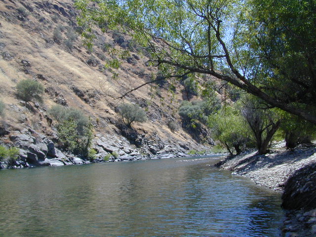
Low elevation Western Sierra: a big river at the beginning of Kings Canyon. Fishing, biking and hiking. The Kings Cyn National Park is directly east, upriver.
Oak woodlands, steep granite canyons, waterfall hikes, rock beaches, river fishing, mountain biking and wildflowers. Day time temperatures get triple-digit in summer months, so best time to visit is the rest of the year. Small RV accessible, paved road, river close – and best of all, open all year long!
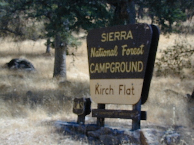
Kirch Flat Campground
Due EAST of Fresno, California in a large river canyon, Western Sierra Nevada
Located 18 miles up Trimmer Springs Road (paved), 5 miles above Pine Flat Lake. Sierra National Forest; River rafting take-out spot for Middle Kings River.
• Elevation: 1100′
• Number of Sites: 17
• Camp Fee: No
• Vehicle Accessibility: RV 22′ max
• Campsites Reservation: No
• Length of Stay: 14 Days
• Season: Open Year Round
• Trailheads: Kings River
Kings River, Sierra National Forest Road #12S01 – Lower Kings
Located in between Kings Canyon National Park and Pine Flat Reservoir. Graded dirt road w/ trailhead parking & camping; Primitive car camping, vault toilets, some areas accessible by small RV. Campfire permits are required.
Long, (sometimes rough) dirt road, that parallels the north side of the Kings River. Dirt road used by families, fishermen, kayakers, campers, mountain bikers, rafters and rafting shuttle buses, seasonally. May be gated and closed off to the public in wetter months of the year.
Bear Wallow Trailhead
Kings River Trailhead
click to enlarge
Forest Route 12S01 crosses the river and leads to the south side of the river, near Green Cabin Flat. Mill Flat Campground is back this way.
Road 12S01 gains in elevation, turns to high-clearance, continuing up McKenzie Ridge thru a small slice Sequoia National Forest to the highway Kings Canyon National Park. 4×4 may be needed in wet/snowy weather.
Ancient volcanic peaks mix with Sierra Nevada granite rock, pine forests and fresh, clear, clean mountain water! California, of course.
Stanislaus Forest Road #7N01 leads down from Highway 4 to this popular series of alpine lakes and reservoirs. Camping, fishing, hiking and mountain biking. Sailing, canoeing, kayaking, swimming, floating and fishing are also popular water activities.
Rules of the Reservoir:
10 mph speed limit on Western Arm.
No motorized boating in Eastern Arm.
Camp only in developed Campgrounds.
2 NFS Campgrounds at west end of lake:
Spicer Campground (60 sites)
Spicer Group Camp (75 people max)
Campgrounds only open June-September. Some campsites at the campground are wheelchair accessible.
Additionally, Stanislaus River Campground w/ only 8 sites, is located just off the main access road #7N01, right near the river.
Numerous smaller lakes in the region make this a hot spot for summer vacations. Union and Utica Reservoirs (both with dirt road access) are good for kayaking and canoes, while power or sail boats prefer the larger Spicer Lake. Summit Lake and Elephant Rock Lake are perfect for quite picnics and day hikes. Trails (many unmarked) connect the lakes to each other. Area gets buried with snow in winter, so these roads are generally only open half the year.
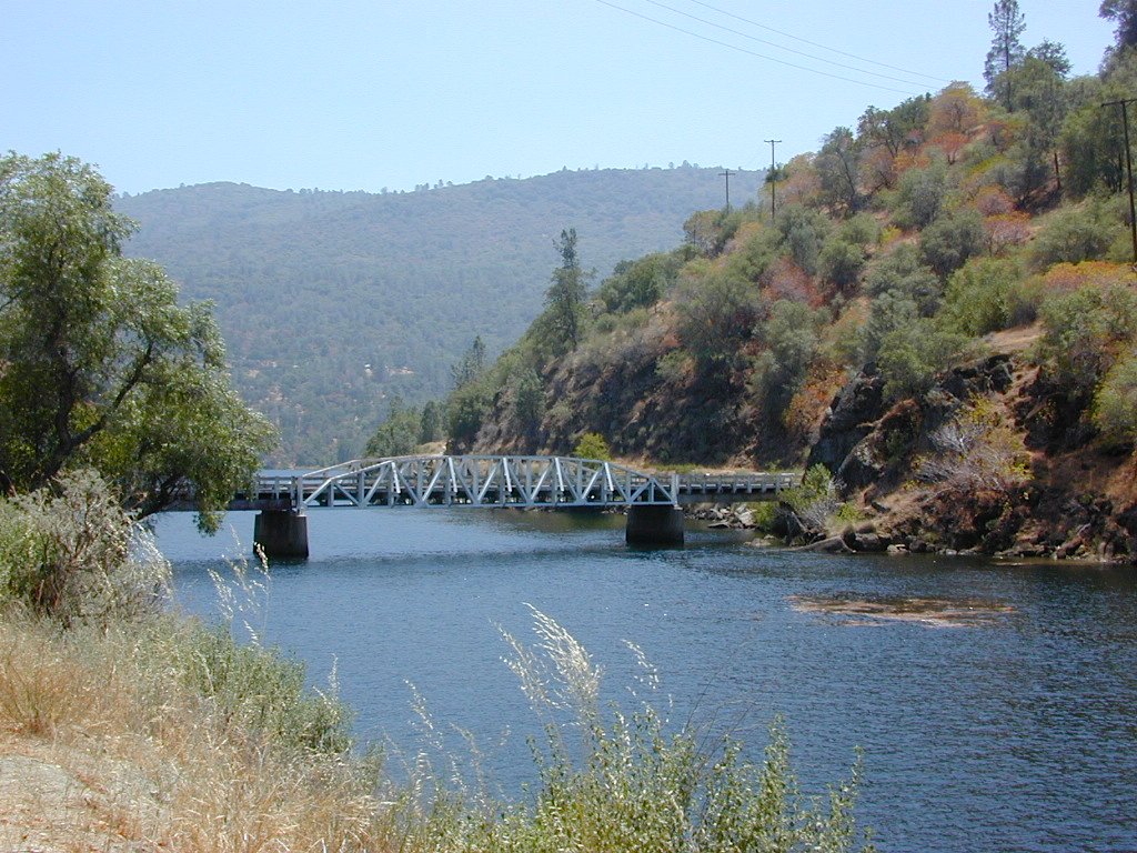
Officially this lake is actually a reservoir, located in the low lands of the Sierra foothills country. Narrow, winding back roads, a way outta the way kinda spot.
a long, narrow lake w/ steep hills, inside a tight canyon
canoe
fishing
hiking
jetski
kayak
waterski
The San Joaquin River flows west, down from the highest granite peaks of the Sierra Nevada and into the Central Valley foothills. If you find your way off the main highway 41, exploring way back behind Bass Lake, CA – then you may consider this scenic loop to Redinger.
off the beaten path
Truthfully, this place is usually an afterthought, sorta near Yosemite National Park. Not exactly a top destination for tourists, but it is very accessible most anytime of the year due to low elevation.
Spring wildflowers can be decent.Summers do get super hot here, so take that into consideration when planning your visit. Due to extreme wildfire danger, no campfires are allowed at any time.
Lake, Reservoir, or a good wide section of the San Joaquin River w/ hydro-electric dam.
elev. 1000′
public boat launch ramp
Camping is restricted to a large open area near the dam. No fee is charged. No campfires are permitted. Services limited, no drinking water or garbage pick-up available. Nearest town 7 miles away.
Redinger Lake Road (Rd# 235) can be found south of the town of North Fork, CA. The paved route down is long, steep and winding. At the bridge crossing, the road loops to Joe Basin Road, which connects to the small community of Auberry, CA
Way up river, a dozen plus miles, is the utterly beautiful Mammoth Pool, only accessible half the year.
A few miles down river from Redinger, around the horse shoe bend, another neighboring reservoir called Kerschoff Lake (elev 971′) has a developed campground.


 Right next to camp: A pretty much perfect LAKE LOOP (1.5 mi) hiking trail is worth a serious stroll; footbridge, wildflowers, fishing spots, minimal hills, lava rocks, and awesome scenery. Plenty of wildlife can be seen, including butterflies and bald eagles. Trail is shaded by tall white fir and ponderosa pine trees. Trailhead is located at the Day Use parking lot, w/ paved boat ramp, dock, and picnic area.


 Grizzly Road, a paved route that leads deeper into the woods and connects over to BEASORE. Back on the main route (Road #81) on the far north end of the loop, a narrow, paved side route connects Clover Meadow Ranger Station and the impressive Granite Creek Campground. Plenty water and hiking trailheads that lead into Ansel Adams Wilderness and Yosemite National Park.