Tag Archives: stonyford

Fouts Springs

fout springsFouts Springs California

dirtbikes

2018 Mendo Complex Wildfire has affected this area. Expect some closures on trails and roads.

Stonyford Recreation Area
USFS Grindstone Ranger District
Mendocino National Forest

roadtofouts
Paved Road M10, Mendo National Forest

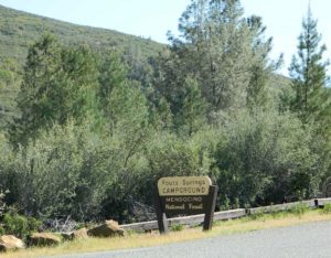
Fouts Campground NFS

Lat – 39° 21′ 35.05307″
Long – 122° 39′ 07.87442″
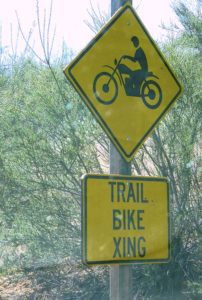
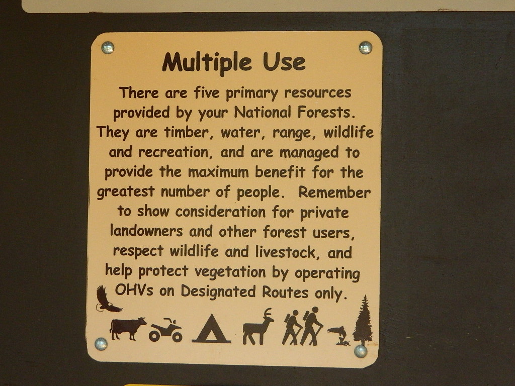
4x4

OHV

off highway vehicle use is abundant

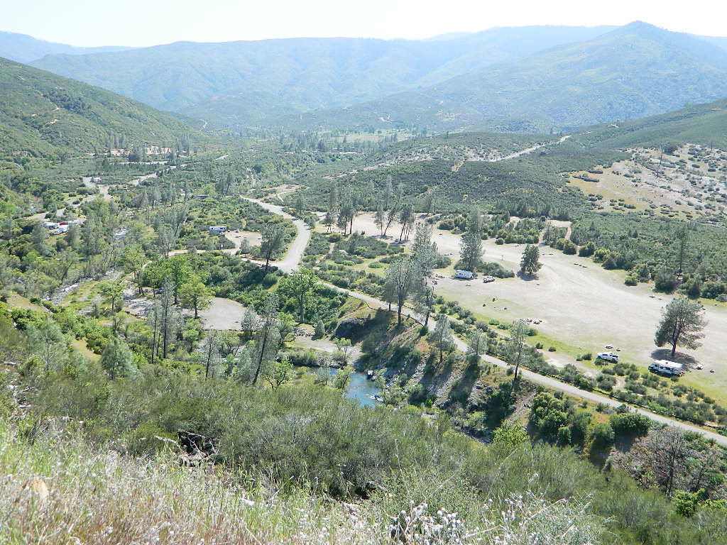
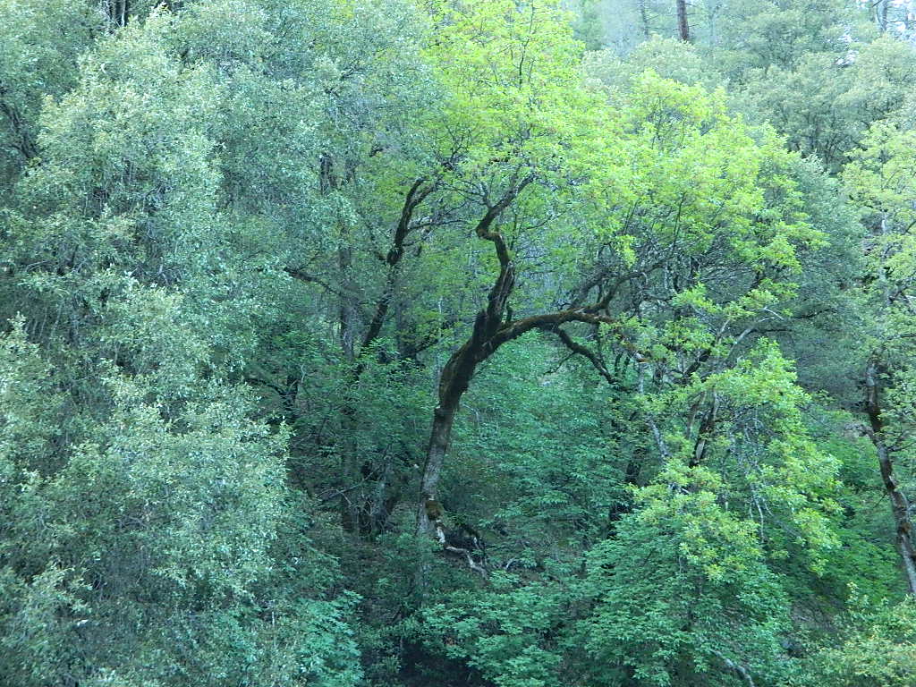
Fouts Springs is multi-use recreation area on the east side of Mendocino National Forest. Located near the Snow Mountain Wilderness trailhead, this region is popular with the off-roaders and dirt bikers. Expect some noise if camping overnight on a weekend.

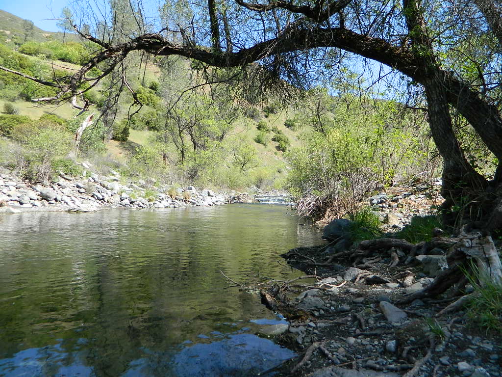
Excellent picnic spots along creek in springtime. Wildflowers bloom March-May. Campfire restrictions may begin as early as July, so know current fire conditions.

fouts water

fouts camp

camp

campground elev spots veg toilet water notes
Davis Flat Campground 1700′ 20 mixed vault no OHV + RV trailers
Fouts Campground 1700′ 11 mixed vault piped OHV trails
Little Stony Campground 1500′ 8 pines vault no OHV trails
Mill Creek Campground 1700′ 5 mixed yes no OHV trails
South Fork Campground 1700′ 4 mixed vault creek Stony Creek

Spring Fouts Mendo
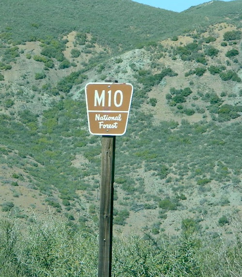
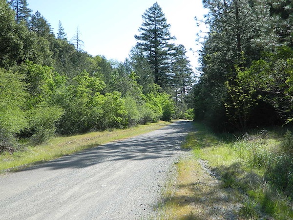
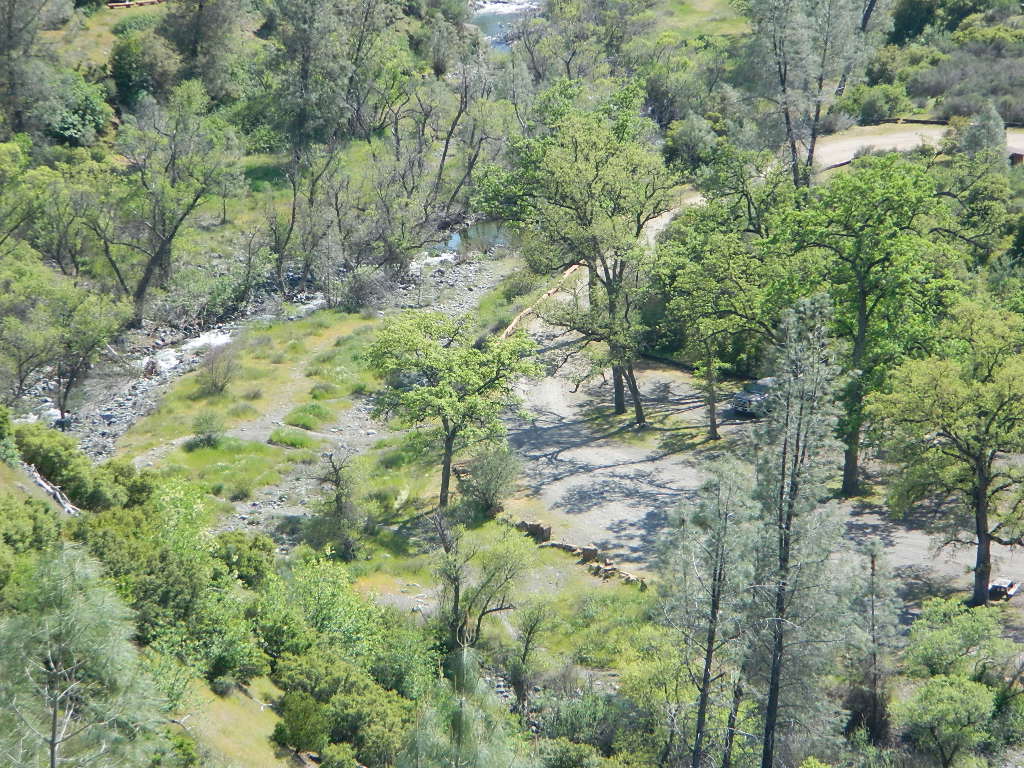
Fouts campgrounds are located on the EAST SIDE of Mendo NF on paved road M10. Situated below 2000′ elevation and open year round.

Road M10 Mendo
Road M10 Mendocino

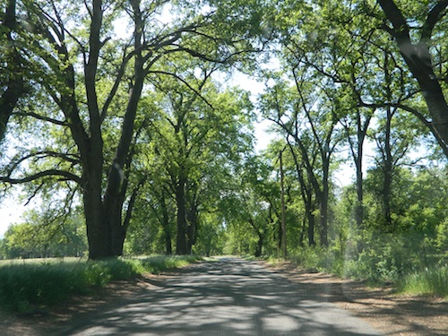
TRAVELERS NOTE: Tent campers, RV and truck campers can easily access this area, all paved roads. Exit Williams or Willows on I-5 and head west. A decent back country map or Mendocino National Forest Map is advised; Numerous canyons, forested creeks and campgrounds. Always check with Mendocino National Forest for road closures and conditions.

dirt bike crossing

OFF-ROADERS NOTE: Use caution on paved access road M10, especially when driving with trailers or large RVs. Narrow road, long and winding with blind curves and no guard rails. Always check with Mendocino National Forest for road closures and trail conditions.

4x4

Mendocino Ranger Stations can be found on link below

NFSMendocino National Forest

foutspicnic

picnic

wildflower

20N01- Mendo NF

20N01

Forest Road #20N01 – Mendo National Forest

Road 308 Ivory Mill Road. Located on the EAST SIDE of the coastal mountain range, west of Stony Gorge Reservoir.

South Fork of Elk Creek, California

Lodoga Stonyford Rd #306 – also known as just plain Stonyford Road, skirts the coastal foothills in a north south direction, on the east side of the range. Oaks and ranches, livestock grazing and fences everywhere. CHP out in force, so watch your speed (55). Public lands and forests are up the hill, above the valley, on the dirt roads. Free camping, off roading, hiking, creeks, lakes, mountains.

Drive up paved Road 308 passing the ranch lands and private properties.

Just inside the National Forest boundary, 308 peels off sharply to the left, uphill and steep, super sandy. The views over the valley, hills and reservoir are epic, but the dirt road is fluffy dry dirt, tight curves, no guardrails. A long and winding track, with very little spot to turn around. Maybe designated as OHV route?

This whole area is where the Ranch Fire of 2018 was burning; contained at road 308. The wildfire burnt half a million acres in Mendo NF (the largest fire in California history). Some of these roads may be closed off now. Call the rangers for current, up-to-date accessibility!

So… back at the National Forest boundary: Straight. Take the right fork instead, which goes straight into the forested canyon, up the creek. Elk Creek, south fork coming from the higher peaks above. This pleasant forest drive is called Mendocino Rd #20N01 and it climbs upward with hairpin turns; continues up to the top of the forested ridges @ 5000’+ elevation.

Forest Oaks Mendo

Wildflowers in Spring. Snow in winter. This back route may have been paved once in 1960, but it is nearly back to dirt again in most sections. Suitable for passenger car travel at slow speeds. Unless of course, it is raining or snowing, then 4WD may be best. And being that this is real Northern California territory, rain and snow are annual.

Campfires on the Back Roads
SPRINGTIME: Free Camps and Campfires on the Back Roads

Dispersed camping is allowed in this region with a valid fire permit.

Various camping spots near roadside, after mile 8. Reset trip meter when your turn off main drag (Lodoga Stonyford Road).

Mendo National Forest
Mendocino National Forest Map

Snow Mountains Wilderness
Fouts Springs

towns nearby:

Alder Springs
Elk Creek, CA
Stonyford
Williams, CA
Willows, CA