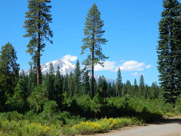
aka Pilgrim Creek Road or Stevens Pass Road East of McCloud, CA
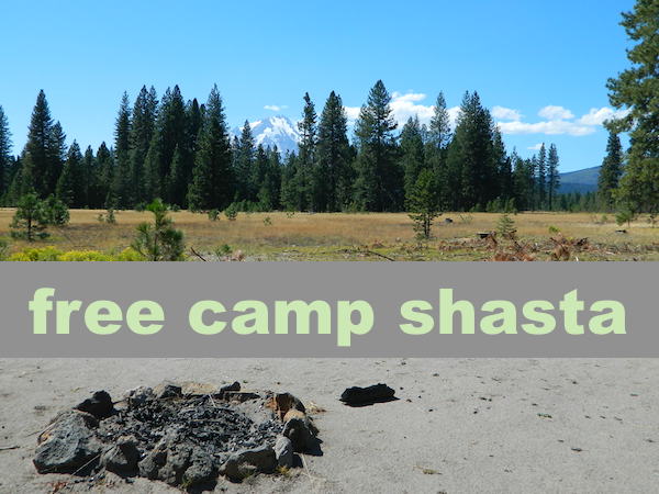
Explore the roads on the backside of Mount Shasta, well off Interstate 5 and miles from Highway 89. This epic paved route will get you away from the tourists at McCloud Falls and all those busy campgrounds.
Loggers and lumber trucks on week days; so drive cautiously. Paved road most of the way. Numerous dirt road turn offs lead deeper into seclusion. Wonderful views of Mt Shasta from many locations. So close, you can ‘reach out and touch it’ kinda views.
And no, we haven’t been to either, cuz the dang boon-docking is excellent, so why would you need a campground?
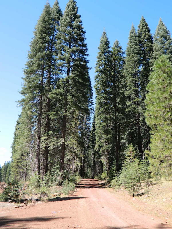
Long paved main road has numerous turn offs on to dirt roads on both sides. Timber lands, National Forest, and some private properties. Watch carefully for gates, fence lines and any signage. The night skies are super dark way back in here, so excellent stargazing!
Road #19 Military Pass Road intersects at the snowmobile park and heads NW – behind Mount Shasta.
Past the snowmo parking lot, Road 13 changes from Pilgrim Creek to Stevens Pass Road and continues to gradually climb up in elevation. Eventually Road 13 peters out around the backside of Harris Mountain.
Road #15 Volcanic Legacy Scenic Byway – intersects shortly before Harris Springs, and continues northbound. It eventaully becomes Davis Road (#44N05) which leads up between Pumice Stone Mountain and Little Glass Mountain.
Little Mount Hoffman Lookout (historic fire lookout tower) is way back here on Road #43N77 and it is available to rent overnight (by reservation). The lookout is accessible by car, but the last 4 miles are on unpaved roads and difficult for RVs and cars with trailers to navigate. The accommodations of this lookout may be rustic, but the views guarantee that visitors will have a memorable stay.
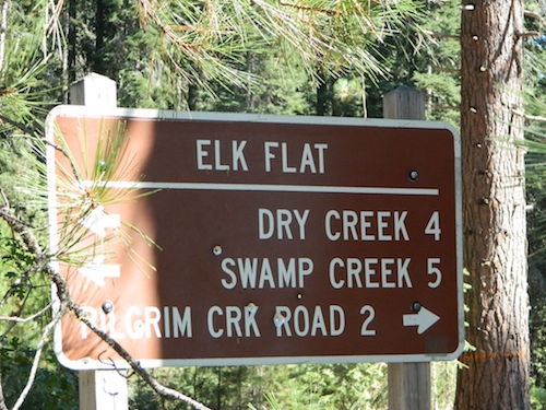
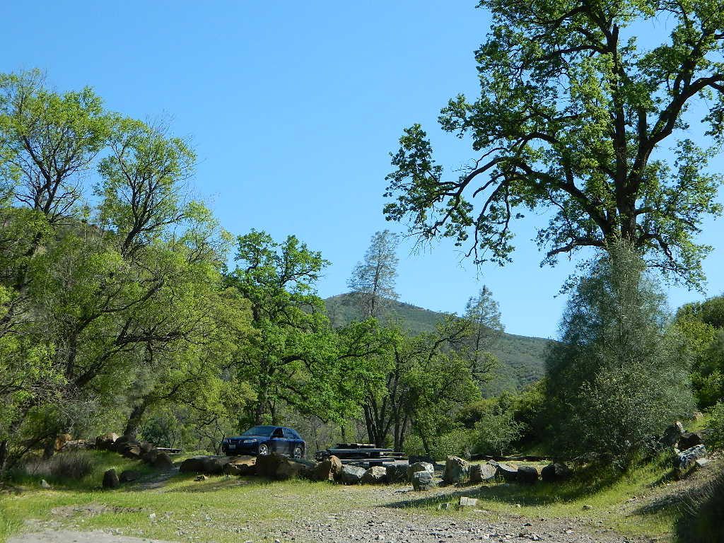
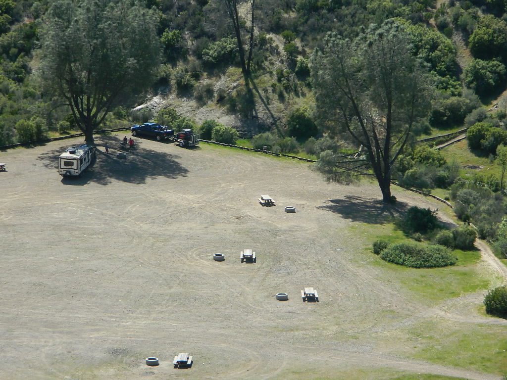
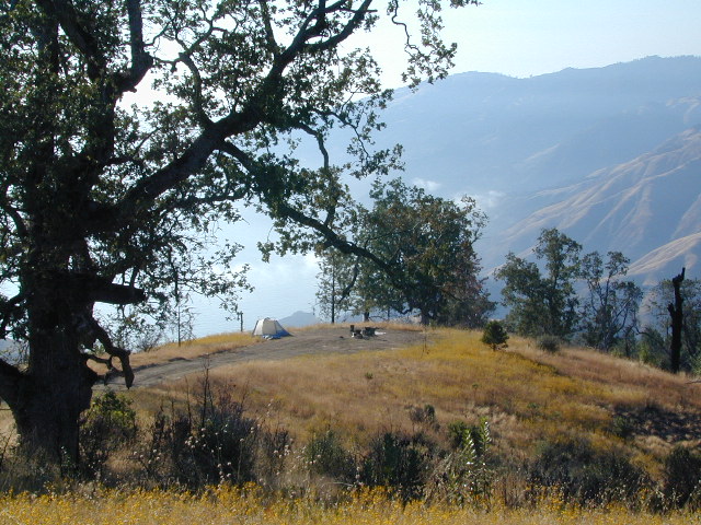
ELK FLAT is an area worth exploring for the meadows and view of Mount Shasta. Stealth camping back in here on dirt roads with a passenger car.
Road conditions on dirt roads change with the weather and the seasons. This route can be rocky and uneven in spots. One lane road, on a big hill w/ minimal pullouts. Snow is possible, during winter & springtime. This route often closed during winter months – or for rock slides. Trailers and RVs are not recommended on this dirt road, although small motorhome campers can try.
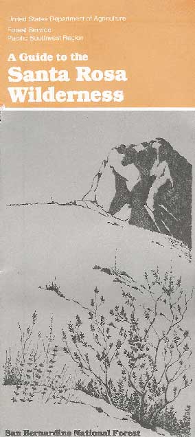
Elevation approx 6000′ @ HWY
w / route continuing up to Toro Peak @ 8740′
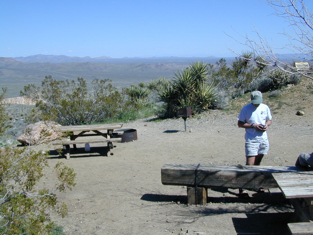
NFS local camp sites:
Santa Rosa Campground
Santa Rosa Springs Campground
Toro Campground
Bare bones, primitive camp sites. Tables, fire rings. Must have a campfire permit for this region. Vault toilets? None.
Did I mention the wind yet? Tall trees do block a majority of the wind, but some areas get whipping – so choose your tent site wisely. And stake it down well, before that quick day hike. Since this is a mountain ridge line, expect thunderstorms, wind and possibly light snow.
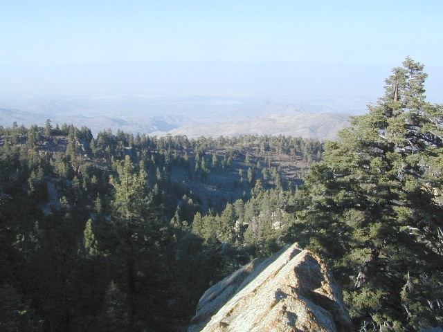
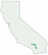
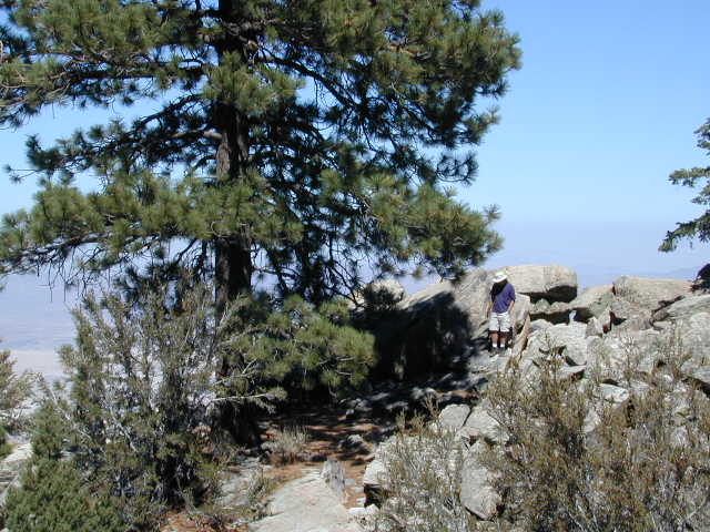
The big, famous Palm Canyon in Palm Springs starts below. The impressive desert canyon trails lead up to highway 74. Continue on foot uphill, southbound, cross the pavement, and end up in this Toro Peak region. Small campgrounds, few people, great views over the desert. Pick a smog free weekend (with wind) for best Coachella Valley views.
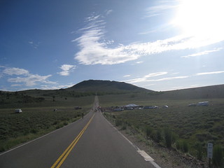
A summer tour of the California Alps in a High Sierra 129 mile long cycling course. This is one of the premier cycling events – held for more than 30 years!
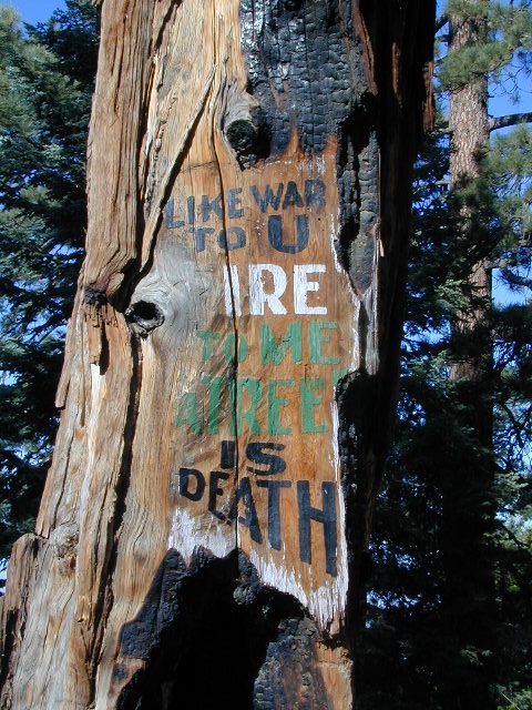
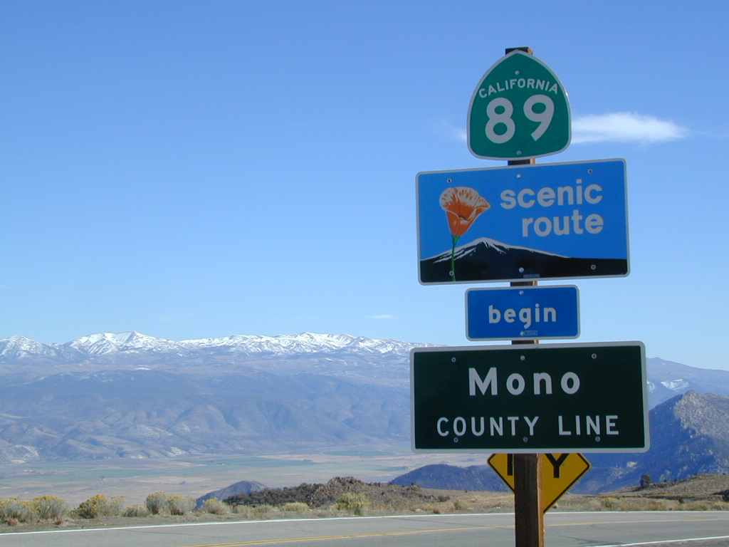
Markleeville CA & Monitor Pass (Hwy 89) are south of Lake Tahoe, connecting US Highway 395 to the upper alpine heights of the Sierra Nevada mountains. Car camping spots and backpacking in this region are located near the aspen groves, lakes, creeks or pine forest.
Starting in 2014 Death Valley National Park announced that there will be NO sporting events of any kind held within Death Valley National Park, so this particular event has been relocated to the high desert region of Reno, Nevada
Claimed as the “Toughest 48 hours in Sport”, a 508-mile bicycle race revered the world over for its epic mountain climbs, stark desert scenery, desolate roads, and its reputation as one of the toughest but most gratifying endurance challenges.
*NOTE: moved from the month of October to September
Rock climbing, backpacking, fly fishing creeks, snowmobiling, you name it. No matter what kind of trail you seek in California, we have the maps to get you out there, this weekend. If you seek a week long adventure in the Sierra high country, or a weekend getaway destination you’ve never heard of, or a quick after work hike near your home town, we just might have it listed. And we probably have the waterproof, topographical map too.
DOGS & BIKES on TRAILS:
Dog friendly trails include almost anything within the CA National Forests. Remember that most National Parks & State Parks literally forbid dogs on hiking trails. Mountain bikes can access only certain trails in parks, but in the National Forests nearly every trail or dirt road is up for grabs.
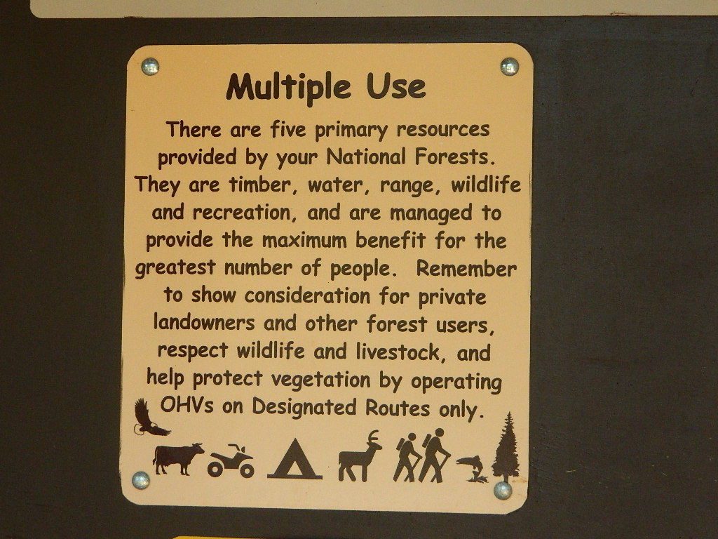
OHV ROUTES:
Motorized vehicles, such as quads, ATVs, dirt bikes, Jeeps & 4x4s must stick to designated routes signed specifically for OHV (off highway vehicle) & you won’t be finding many of those inside National Parks & State Parks, so it’s best to look for BLM or NF lands. Many regular, forest, back roads close in winter due to heavy snow pack & thus become cross country ski, snowshoe or even snowmobiling trails. The best ones can be found in the Sierra Nevada mountains.
And if you ever get bored with “reading” text about trails, you can always search the visual database of amazing Cali scenery over at DanaMite’s flickr site
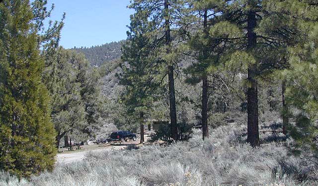
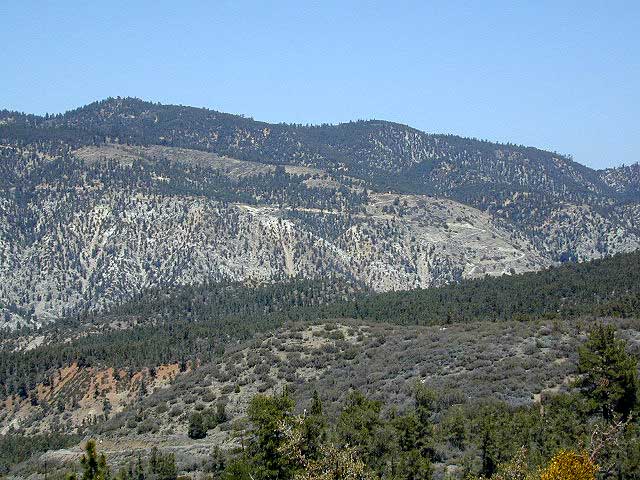
Los Padres National Forest, Mount Pinos Ranger District
Forested campground, paved access; Up behind the Lockwood ranger station
campground
elev.
spots
veg
toilet
water
comment
Chuchupate
6300′
29
pines
vault
no
open year round
open year round; campground reservations 805-434-1996
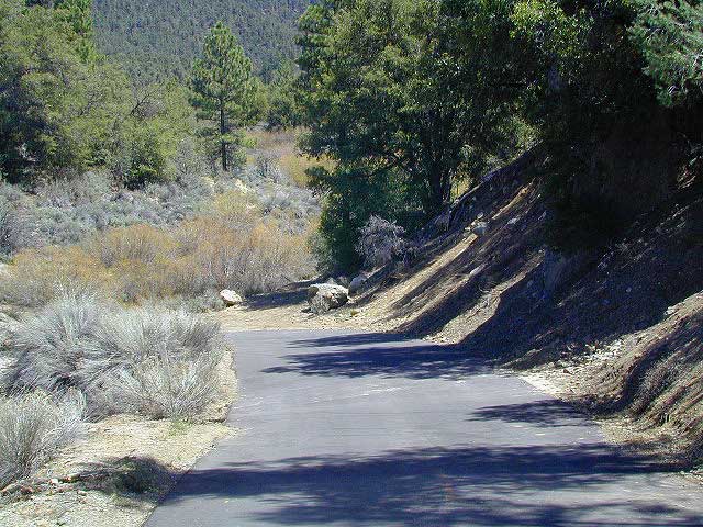
Pinyon w/ jeffrey pines, a high desert feel to this mountain side ideal camp – where the Mojave desert merges with the coastal ranges in Lockwood. Up high near the Tejon Pass @ Gorman. Sage brush slopes w/ forested campground is approx. 6 mi. off Lockwood Valley Rd. via paved road #8N04 (also called, Frazier Mountain Road).
Adequate for RVs, small creeks around this camp provide
decent vegetation. The sites on the outside back loop are best
for shade & seclusion. Good for a base camp for the weekend
& drive out to see the rest of Los Padres National Forest.
For the mtn. biker, this is a prime spot for hitting up the dirt
back roads on Frazier Mtn. Plenty of hiking and nice views
of the valley around too.
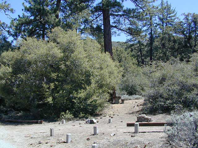
Small campground w/ fee. On forested slopes of Frazier Mountain.
The easy to reach USFS campground can accommodate motorhomes, RVs, camper trailers up to 26 feet long. Paved access road is narrow and curvy and climbs the hill behind the large ranger station on Lockwood Valley Road.
Attention fair weather campers: Snow is possible in this location from DEC-APRIL. Call head for local conditions and know weather forecast before you climb the I-5 (Grapevine).
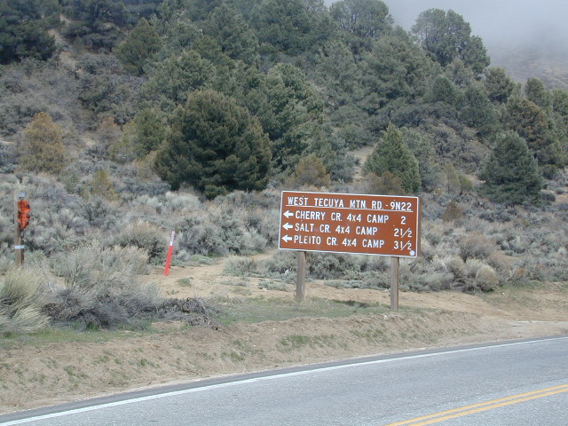
Tecuya Mountain 4x4camps, Los Padres National Forest
4×4 Camps @ Tecuya:
Cherry Creek Camp
Seeking a dark shady hole to spend the night? Then Cherry Creek canyon is choice for a quick overnighter near Frazier Park and the I-5 Tejon Pass. Steep dirt road access will challenge even the biggest skeptic.
free campsite
4WD only access
The 4×4 Camp (signed) turn off is along Cuddy Valley Road, on the north side of the pavement – just a few miles west of Frazier Park, inside Los Padres National Forest.
Oak trees and brush clog the dense hillsides. Owls live in this canyon. Deer and wildlife sightings are common – which makes this an ideal hunters camp for those looking to explore on foot.
The canyon gets narrower as it heads down hill (northward) w/ the single track route becoming a blanket of slick dark mud (in the wet months). Without trees on the worst section, making a self-rescue impossible.
Real 4 wheel drive is needed for this camp! All wheel drive vehciles (SUV & sportwagons) should not attempt this location without a tow strap or winch – AND another 4WD vehicle to help out. Yep, seriously. We know, because we had to rescue someone last time we were here.
Sparse accommodations w/ minimal sunlight reaching this steep canyon
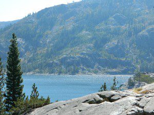
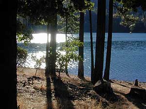
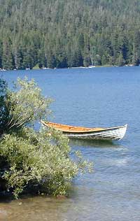
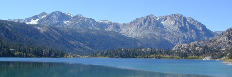
Large, granite, alpine lake in the Central Sierra Nevada Mountains. Abundant trout fishing, swimming, camping, boating, hiking, floating, kayaking, picnic sites, and high altitude backpacking trailheads. Shoreline fishing is just as good as by boat. Fishing boats can be rented at Kit Carson Lodge.
The high altitude location makes this a winter wonderland half the year w/ snow ski resorts nearby! It is an awesome summertime family vacation destination as well. Fishing is excellent through Autumn months. Campgrounds close up shop in October, generally when the snow starts. High Sierra – Deep snow pack means they will not reopen until May (at the earliest).
Carson is major Sierra Pass highway, but it closes for big snows, so always check CalTrans before you make the drive up the mountain. Carson Pass is California State Route 88, which connects the Gold Country (on the western slopes) to the South Lake Tahoe region (on the eastern border), near Nevada.
Check Current Highway Conditions for HWY 88 roads.dot.ca.gov
Cal Trans 800-427-7623
Silver Lake Day Use Areas
These areas listed below are operated by El Dorado Irrigation District and they do charge a day-use fee for many of the amenities provided. Boat Launch fee? Yep. Parking fee? Maybe. Picnic stop! How much? Eat fast!
Ferguson Point is located on the north shore of Silver Lake: 10 picnic tables & vault toilets.
Sandy Cove is on NW shore of Silver Lake: Wheel-chair access to lake edge, 5 picnic tables, piped water & vault toilets.
Oyster Creek Rest Area, up along Highway 88, 1 mile NE of Silver Lake: 10 picnic tables & vault toilets.
Historic Memories: Camp Minkalo, Camp Silverado & Kays Silver Lake Resort are all closed now.
Many small businesses come and go in the rural mountains of California. Throughout the decades, some do survive, but many change hands, change names, or have a difficult time ‘making it all work’ in the off-season. Always call ahead (real phone w/ real person) before you make a big drive to a remote location.
National Forest Campgrounds in this lake vicinity:
East Silver Lake Campground – 62 sites
West Silver Lake Campground – 42 sites Kirkwood Lake Campground – 12 sites
Silver Lake Campground NFS
• Elevation: 7200′
• Number of Sites: 62
• Vehicle Accessibility: RV 30′
• Campsite Reservations: Yes
• Camp Fee: Yes
• Toilet: Vault
• Length of Stay: 14 Days
• Season: June – October
• Trailheads: Hidden Lake, Sandy Cove
El Dorado National Forest
Amador Ranger District
26820 Silver Drive
Pioneer, CA 95666
209-295-4251
Older lodges, resorts, camps and cabins at Silver Lake were mainly built in the 1920s, while the oldest resort dates back to the mid 1800s. Wow, how cool is that! Much history in this mountain region w/ Kit Carson Emigrant Trail, all stories totally worth exploring.
2018 & 2019 Hit especially hard by wildfires recently. Certain campgrounds and roads are closed to the public, due to the significant fire damage.
Mendocino National Forest has an abundance of small campgrounds and 4×4 camps, many of which, due to snow & elevation, can only be accessed in summer months. Many developed campgrounds are located on dirt roads, so know the road conditions before you get out there.
NOTE: all camps 2000′ elevation or lower are OPEN ALL YEAR LONG Red text for OHV = off road use, dirt bikes, quads, 4x4s, trailers.
OFF-ROADERS NOTE:3 OHV camps are located in higher elevations; the rest are 2000′ or lower and open year round. Always check with National Forest for road closures and conditions.
Mill Creek Camp @ Fouts Springs
Mendocino Ranger Stations can be found on link below
This camp list is comprised of primitive camp sites and developed campgrounds with good views overlooking a large area (valley, town, canyon, desert, river, ocean). Many ideal spots may require dirt road driving, and a few might need a 4-wheel drive vehicle to reach.
We were suggesting this very spot way back in 1999, well before anyone else was ‘blogging’ about it. This area is by far the best, free coastal camping on the Central Coastline of Big Sur. Dirt roads traverse 10 miles out to vacant ridges overlooking the Pacific, with steep hills down to the highway. Camp above the fog layer and above the crowds. Explore the beaches during the day, and camp above the traffic & crowds at night.
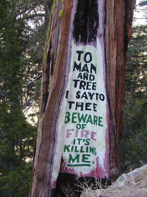
Dry brush is abundant on the mountains of Los Padres National Forest. Camp fire restrictions should be of utmost concern in this area, since wildfires burn here often. Camp fire permits are required for camping on the back roads, and much of the time camp fires are banned in this region. Call ahead to the rangers to find out the current conditions.
Two prime walk-in camp sites, on a shady point, high above a beach cove w/ scenic waterfall.
Called “environmental camps” these highly desirable spots need advanced reservations w/ fees many months in advance. Tables, fire rings and a vault toilet. Bare bones basics, but the ideal location is worth it. A forested cliff on the edge of the ocean, high above a secluded cove. This location a can get windy if a storm moves in (generally October – March).
There are several primitive campsites off of M10 with views of chaparral and canyons. Just above Stonyford, CA, on the way up to Fouts Springs. Unfortunately Mendocino National Forest is may be closed for 2019 due Ranch Fire (wildfire 2018) w/ Snow Mountain Wilderness completely 100% burnt.
Planning more scouting of this region summer 2019. Stay tuned.
Angeles National Forest
Mount Pacifico Campground
Angeles Forest Highway
Lightning Point Group Campground
near Jackson Lake @ Hwy 2
San Berdu has more than a few trail camps for 4×4 enthusiasts. Weekends can be busy all year long. Snow usually closes some routes. Pine forest in southern California means very tight campfire restrictions. All yellow post camp sites include table and a fire ring. Campfire permits are required.
East ridge line, rocky, dusty, 4WD-only route, the John Bull Trail (near Holcomb Valley) has ONE real awesome view camp spot with great spans over the Mojave desert w/ smog and city lights @ night.
Culp Valley – boulders, primitive camps on dirt roads; better views off-road. Vault toilet. Few tables, no signs. Small campground at the highway is easy to find. Boulders and bouldering. Mountain biking and hiking. Wildflowers in spring.
Interstate 15 & I-40 Mojave Desert
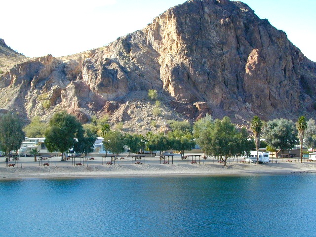
Providence Mountains SRA @ Mitchell Cavern. Campground is perched on rocky hill overlooking desert.
Boulder Outcroppings w/ primitive camp spots, tucked back on one lane dirt roads, behind Mid Hills Campground. Mojave National Preserve
Coyote Flat @ Pinyon Boulders – 4×4 required, one primitive camp w/ great views overlooking the Owens Valley & peaks to the east. Coyote Flat has views toward the Sierra
Oh! Ridge Campground Off the main highway 158, June Lake Loop
(148 sites @ 7600′ elev.) near June Lake, CA
Road 308 Ivory Mill Road. Located on the EAST SIDE of the coastal mountain range, west of Stony Gorge Reservoir.
South Fork of Elk Creek, California
Lodoga Stonyford Rd #306 – also known as just plain Stonyford Road, skirts the coastal foothills in a north south direction, on the east side of the range. Oaks and ranches, livestock grazing and fences everywhere. CHP out in force, so watch your speed (55). Public lands and forests are up the hill, above the valley, on the dirt roads. Free camping, off roading, hiking, creeks, lakes, mountains.
Drive up paved Road 308 passing the ranch lands and private properties.
Just inside the National Forest boundary, 308 peels off sharply to the left, uphill and steep, super sandy. The views over the valley, hills and reservoir are epic, but the dirt road is fluffy dry dirt, tight curves, no guardrails. A long and winding track, with very little spot to turn around. Maybe designated as OHV route?
This whole area is where the Ranch Fire of 2018 was burning; contained at road 308. The wildfire burnt half a million acres in Mendo NF (the largest fire in California history). Some of these roads may be closed off now. Call the rangers for current, up-to-date accessibility!
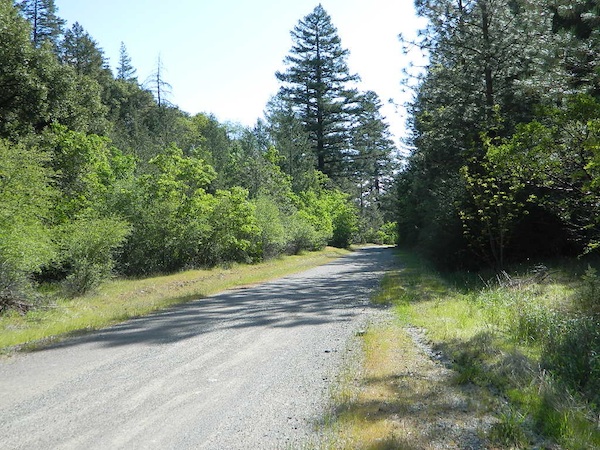
So… back at the National Forest boundary: Straight. Take the right fork instead, which goes straight into the forested canyon, up the creek. Elk Creek, south fork coming from the higher peaks above. This pleasant forest drive is called Mendocino Rd #20N01 and it climbs upward with hairpin turns; continues up to the top of the forested ridges @ 5000’+ elevation.
Wildflowers in Spring. Snow in winter. This back route may have been paved once in 1960, but it is nearly back to dirt again in most sections. Suitable for passenger car travel at slow speeds. Unless of course, it is raining or snowing, then 4WD may be best. And being that this is real Northern California territory, rain and snow are annual.
SPRINGTIME: Free Camps and Campfires on the Back Roads
Dispersed camping is allowed in this region with a valid fire permit.
Various camping spots near roadside, after mile 8. Reset trip meter when your turn off main drag (Lodoga Stonyford Road).
If you are thinking about fishing or camping the Eastern Sierra, North of Bishop & you are not up for the crowds at Mammoth or June Lakes, then try the Bridgeport area, north on Hwy 395. Rural ranch lands along main road, Bodie ghost town turn off across the highway and Virginia Creek Settlement are also nearby
Green Creek is a 11 mile long dirt road in the lush Eastern Sierra the northern portion. The wide, graded dirt road is signed and dead ends at a Toiyabe National Forest campground called Green Creek Campground. The drive up can be washboard bumpy in some parts, but that doesn’t stop the hundreds of adventurous motorhomes that make this trek annually. This place features some of the best prime Sierra back roads camping options for RVs.
Another dirt route, Dunderberg Meadow Road peels off to the left. Dunderberg departs off Green Creek a couple of miles from the highway and well maintained. This route leads to meadows, aspens, picture perfect scenery and much more seclusion. Passenger car accessible, wide graded dirt roads to wilderness edges. Two-track one lane trails lead to meadow edges and more creeks. Very impressive views of the Sierra peaks over here on this side. Meadows are sensitive areas, wonderful for picnics and you should always minimize impact.
Plain old passenger cars can easily make this route deep into the Eastern Sierra aspen canyon. Graded dirt and4x4 could be needed winter months. Backpackers can enjoy easy access to the Hoover Wilderness trailheads. There is plenty semi-primitive camping spots along the way, right on the creek, for free…. so no need to sleep in your vehicle upon arrival.
Autumn Aspen Groves: fall colors peak in October, which is usually when the first snows for the winter season start. November – usually the freeze gets them and lifeless brown leaves dangle, until the Sierra Nevada wind gust blow real good.
Green Creek Camping
DIRT ROAD CAMPING
alpine lakes
backpacking
car camping
day hikes
fishing camping
meadows
RV camping
tent camping
Dispersed, primitive camp spots along this main dirt road are on a first come basis. You’ll need a fire permit. Many flat camps are set along the creek in aspen groves, some pines, others have cubby hole privacy. Large granite valley, big creek, bird, scenery and nature everywhere. Some folks spend weeks camping out here in the warm weather months. Fishing is a big attraction.
Old Cabin in autumn leaves, up near the top of the dirt road deep in the aspen groves
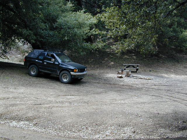
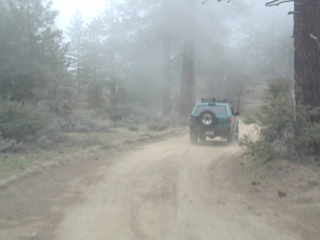
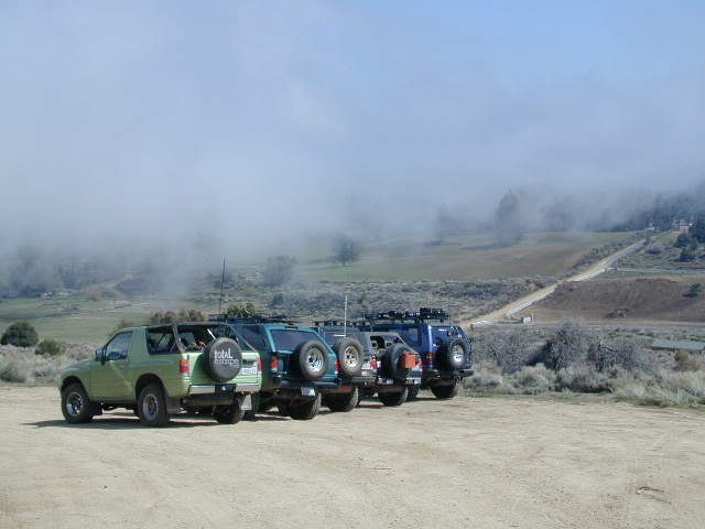
An avenue made of dirt, earthen highways, dirt trails, forest roads, fire roads, jeep road, graded roads. Dirt driving trails that lead into the middle of nowhere. No stop signs, no billboards, no stores, no one else around… for miles. Enjoy less crowds and more open space.
If you are fed up with city life, sitting in traffic & need to vacate your mind among the barren hills of California (if only for a weekend), then Total Escape is your place. You seek solitude, peace, maybe a mini tailgate party & BBQ on a dry lake bed, with the heavenly stars above. Imagine the warm camp fire light reflecting off the high canyon walls, your music echoing, moonlight hikes for a few miles.
California has some awesome spots to drive on dirt, get way back in nature. Right up to the edge of the Wilderness boundary. That’s what this one silly “dirt street” page is all about… helping you get out there, the easiest & best way possible. We even got you the right maps!
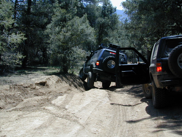
Most of this is just dirt road driving, graded, some hills, easy stuff. But on occasion you might come across a 4×4 required sign – or perhaps a triple black diamond trail. Having several good maps on hand will help you enjoy these roads, instead of stressing & wondering if there is a lock gate at the other end – 18 miles in.
Some dirt streets lead to campgrounds, some to waterfalls, some to viewpoints, some have loop options & others are just dead end; sometimes at old mines. Get ready to explore with your truck or SUV. 2WD or low clearance vehicles (such as passenger cars) should be ready to turn back if the road get too nasty. Any decent precipitation can make any unpaved road much worse & may require 4 wheel drive, so have a plan B or C as a backup idea.
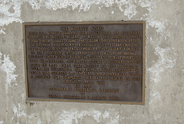
The historic Mojave Road spans the high desert region of east California – crossing the Colorado River westward to roughly Los Angeles. Now a network of dirt and paved routes follow the original overland trade route. Click the plaque photo below to read more.
The rugged, dirt road cuts right through the middle of the Mojave National Preserve. Mid Hills, Kelso Depot, Cima.
mojave topo maps
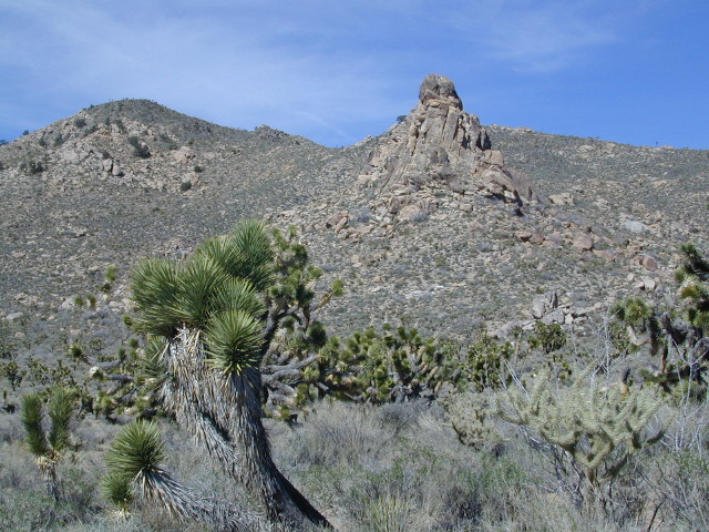
Joshua Trees, mountains, boulders, sand dunes, railroad history. The high desert is abundant with wildlife, plant life, lava tubes, caverns, camping, and dirt roads. Plus wild windy weather.
MOJAVE PARK
Located on the way to Vegas, NV – or the Grand Canyon in Arizona. Mojave NP is in the triangle space in between Interstate 15 and Interstate 40, on the eastern side of southern California. Freeway close, free camping in the Mojave does indeed exist, if you know where to look.
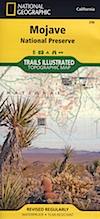
Mojave Map by Trails Illustrated NatGeo
National Geographic acquired Trails Illustrated Maps more than a dozen years ago. Ever since these plastic topo maps have gone 2 sided, full-color w/ more details featured than ever before. Updated regularly. Waterproof plastic, perfect for outdoor desert travels.
Mitchell Cavern, called Providence Mountains SRA, has camping, but it is situated up on an exposed bluff overlooking the freeway. Location gets windy as hell. Better campground is at Hole in the Wall, or even better, Mid Hills Camp.
Primitive, free camping can be found off of Kelbaker Road, but be warned: dirt roads can get deeply rutted and impassible during extreme wet weather. 4WD may be required sometimes.
CAMPGROUND CAMPING
FREE CAMPING
GROUP CAMPING
HIKING TRAILS
HISTORIC MONUMENTS
HORSE CAMPING
HORSEBACK TRAILS
JOSHUA TREES
LAVA TUBES
MINING HISTORY
MOUNTAIN BIKE TRAILS
OFF ROAD CAMPING
RAILROAD HISTORY
RANCHES
RV CAMPING
SAND DUNES
VOLCANIC TERRAIN
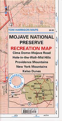
Mojave Desert Map by Tom Harrison
One of the first readily available topographic style maps of the Mojave desert. Waterproof plastic, Tom Harrison brand maps are perfect for any type of backcountry travel, on foot, on horse, or off-road.
AAA & NPS: one-page freebie; excellent overview map created by the Automobile Association of Southern California w/ the National Park Service. Handed out at Visitors Center and ranger stations (1990s)
BLM Maps of Mojave: OHV (off highway vehicle) maps can be found at the local Bureau of Land Management ranger stations:
This premium full state atlas has the whole, massive Mojave desert covered, which extends north into Death Valley National Park and south to Joshua Tree National Park.
California Sierra Lakes Sierra Lake Destinations Sierra Lake Campgrounds
One of the best physical features about California is the amount of lakes and reservoirs it holds – in the mountains, foothills and the canyons, throughout the state.
recreational lakes – Huge, dammed reservoirs to the secluded, alpine lakes in the high country and all the variations in between.
There are literally thousands of lakes located within the Sierra Nevada mountains and it would be ridiculous to try to list them all here. Many of them can only be reached by hiking into Wilderness.
Most California lakes are popular and well known recreation spots, but others are secluded – if you drive far and long enough back on the dirt road. Some do not allow motorized boats and most do allow fishing and swimming. Some have campsites on the waters edge, while other camps are up on a hill over looking the lake.
Below listed are some Sierra lakes that allow camping on the lakeshore or nearby. Most campgrounds are suitable for RVs, tent camping, and some may require 4 wheel drive to reach them.
Several miles south of the town of Needles numerous desert washes cross the highway with dirt roads leading off into both directions. Turtle Mountain is just one dirt road to explore in this region, but there are many more unmarked, secluded roads. This region is perfect for “campers in-route” traveling who need a quick overnight camp spot (off the freeway).
Turtle Mountain Road is a one lane dirt road that runs next to a wash, in between Turtle Mountain Wilderness and Stepladder Mountain Wilderness. Leading approx 12 miles from US Highway 95 to the northern edge of the desert wilderness. The Turtle Mountain route continues westward to meet Water Road with Old Woman Mountain Wilderness nearby. Sunflower Springs Road continues north to Essex @ Interstate 40
BLM signage along US Hwy 95 is minimal. Look for vertical brown markers w/ reflectors, numbers or names. Driving slower than typical traffic, coast at 50 mph and keep your eyes peeled to the west side. Turtle Mountain Rd is marked at the pavement, but the marker is very small.
Eastern California Desert Wildflowers
Exploring the eastern side of Southern California, one can find the Colorado River and Arizona border region an excellent destination for winter camping. Springtime offers wildflower blooms, open camping and decent weather with sunny 70 degree days. Wildflowers and BLM beauty awaits those who venture off the paved routes.
Palo Verde trees line the washes and much vegetation can be seen throughout this remote region. Cacti include the cholla, ocotillo, barrel, beavertail, just to name a few. Wildflower blooms here are just as good as Anza Borrego Desert SP.
MARCH & APRIL are both prime months for the desert bloom
Drive more than a mile from the highway if you plan to camp in peace and quiet, as the overnight truck traffic goes all hours.
RV accessible camp spots are few and far in between. They can be found in large, level pullouts close to the main road, but you will be hearing traffic zoom by. Some dirt roads are in better shape than others; Seasonal storms in the low desert can wash out even paved roads. 4×4 may be needed in some areas.
Open camping in this desert is free and there is plenty of room to spread out. Imagine not seeing anyone pass by your camp or drive down your road for days. Camping in a sandy wash may seem appealing, but you best know the weather forecast and if rain is at all predicted nearby, be prepared to break camp (in the middle of the night) before a flash flood hits.
The Needles BLM Rangers Office is located on US Hwy 95, on the south edge of town and they can provide maps and more information.
Needles BLM Office
1303 S. US Hwy 95
Needles, CA 92363
760-326-7000
Lake Havasu BLM Office
2610 Sweetwater Avenue
Lake Havasu City, AZ 86406
928-505-1200
Since sport utility vehicles were invented for California yuppies, it makes perfect sense that this California market also has the awesome terrain to use these rugged rigs. After the first shopping cart door ding or windshield crack, most folks are open to taking their utilitarian vehicles on dirt roads, but some will only dream about it.
Here at Total Escape, we are here to change all that. The fear of outdoors, the unknown, the capability, the driving skill. Your SUV is a good reason to be outdoors in the golden state, at bare minimum. No excuses. Enjoy the California you never knew – and sometimes that means getting off the pavement. Yes, more than 2 miles.
SUV trail – any path, dirt road or route that can be driven on; high clearance vehicle are often necessary, 4×4 needed on occasion. National Forests, canyons, deserts, mountains, country lane style drives, some classic routes skirt the wilderness boundaries. We have it all for ya here. Rock crawling Rubicon adventures, all the way down to the leisurely ‘Sunday drive’ thru a forest to a meadow for a picnic.
MAPS will get you out there!
Dust, dirt, mud, snow. Beyond the county line, way back there, where you can discover ghost towns, old mines in the desert, hot springs, historic lodges, petroglyphs, river gorges, fire lookouts, waterfalls, and so much more.


 Motorized vehicles, such as quads, ATVs, dirt bikes, Jeeps & 4x4s must stick to designated routes signed specifically for OHV (off highway vehicle) & you won’t be finding many of those inside National Parks & State Parks, so it’s best to look for BLM or NF lands. Many regular, forest, back roads close in winter due to heavy snow pack & thus become cross country ski, snowshoe or even snowmobiling trails. The best ones can be found in the Sierra Nevada mountains.


 Mitchell Cavern. Campground is perched on rocky hill overlooking desert.


 If you are fed up with city life, sitting in traffic & need to vacate your mind among the barren hills of California (if only for a weekend), then Total Escape is your place. You seek solitude, peace, maybe a mini tailgate party & BBQ on a dry lake bed, with the heavenly stars above. Imagine the warm camp fire light reflecting off the high canyon walls, your music echoing, moonlight hikes for a few miles.
 or C as a backup idea.