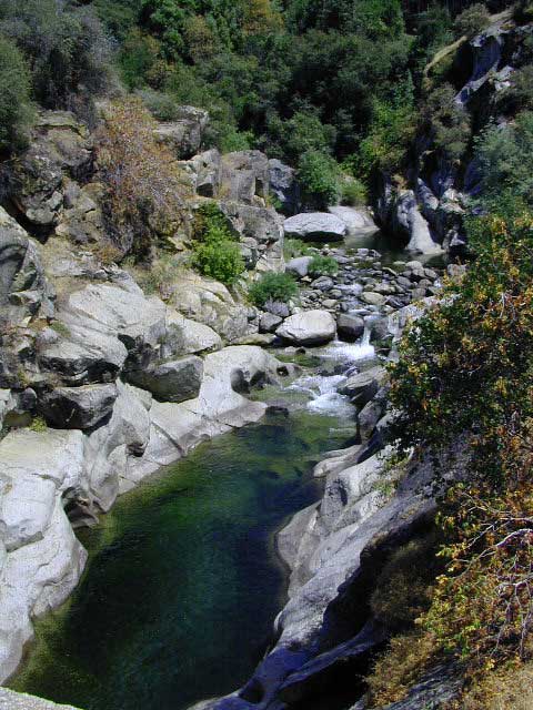
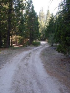
Trinity is NorCal’s jewel of alpine lakes and granite peaks – many above 8000′ elevation, about 40 miles inland from the ocean. Trinity is located in between the infamous redwood coast and the I-5 corridor. Rivers, creeks, lakes, and trails into the high elevations regions, bqckpackers and equestrian campers alike.
Hiking trailheads are accessed from all sides -On the east side you have Trinity Lake & Trinity River w/ Highway 3 running lengthwise in a north-south direction. Hwy 299 runs east-west along the south side of the wilderness. Klamath River Hwy 96 lies on the west side of the wilderness. Salmon River, Scott Mountains and Cecilville are north of the alps.
Both the small Russian Wilderness & the larger Marble Mountain Wilderness are located to the north of Trinity Alps, along with rural towns near the Scott Mountains and the Salmon River. Castle Crags Wilderness is to the eastern side, near Interstate 5.
The mountainous area is quite unique, as exposed granite mountain peaks and alpine lakes are pretty rare in the coastal Cascade ranges. The only other spot in California that has an 8000′ peak nearing the coast is just north of Los Angeles – Los Padres’s Mount Abel & Mount Pinos peaks, both over 8000′ in elevation.
TRINITY ALPS TOPO MAP
The USDA map for Trinity Alps Wilderness was outta print for nearly 2 years and it has recently been updated and reprinted. New edition released in 2013 and now available at the Total Escape map store. Printed on waterproof map paper and updated in 2012.
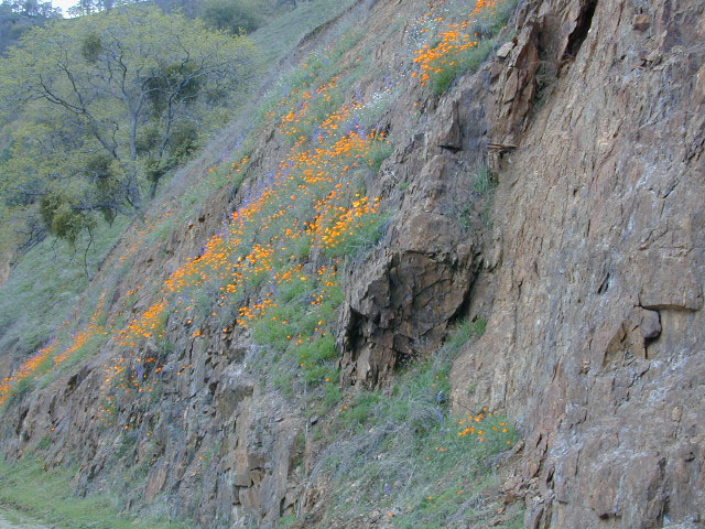
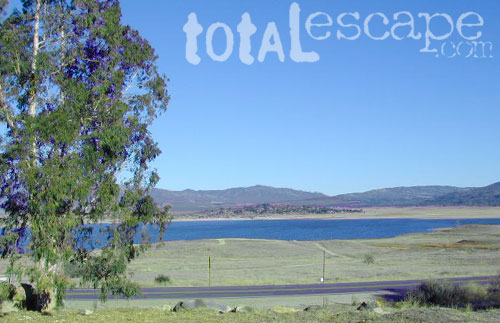
Black Butte Lake, West of Chico, CA
On the west side of Interstate 5. Campgrounds, boating, wildflowers and hiking trails.
Clear Lake Area
Bear Valley Road (long dirt road) which connects Hwy 20 to Stonyford. Look for small dirt road turn off (north) off of Highway 20. NE of Clear Lake, CA
BLM Glen Eden Trail
Lakeport @ Clear Lake, CA
w/ California Fawn Lilies and camping
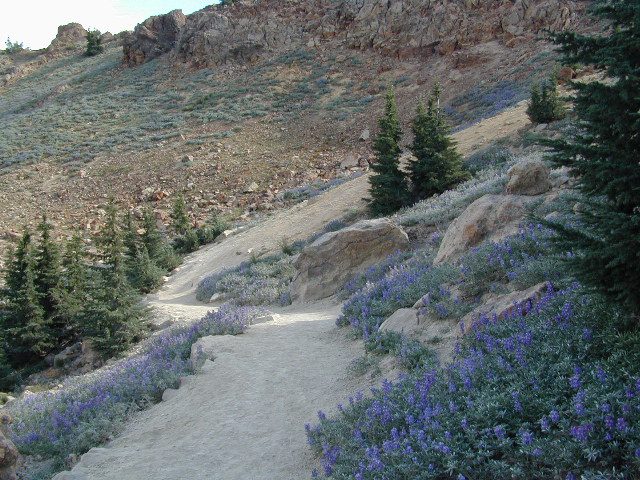
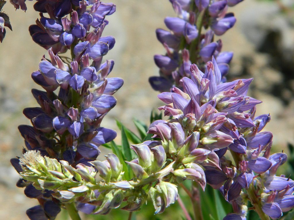
Mill Creek, California
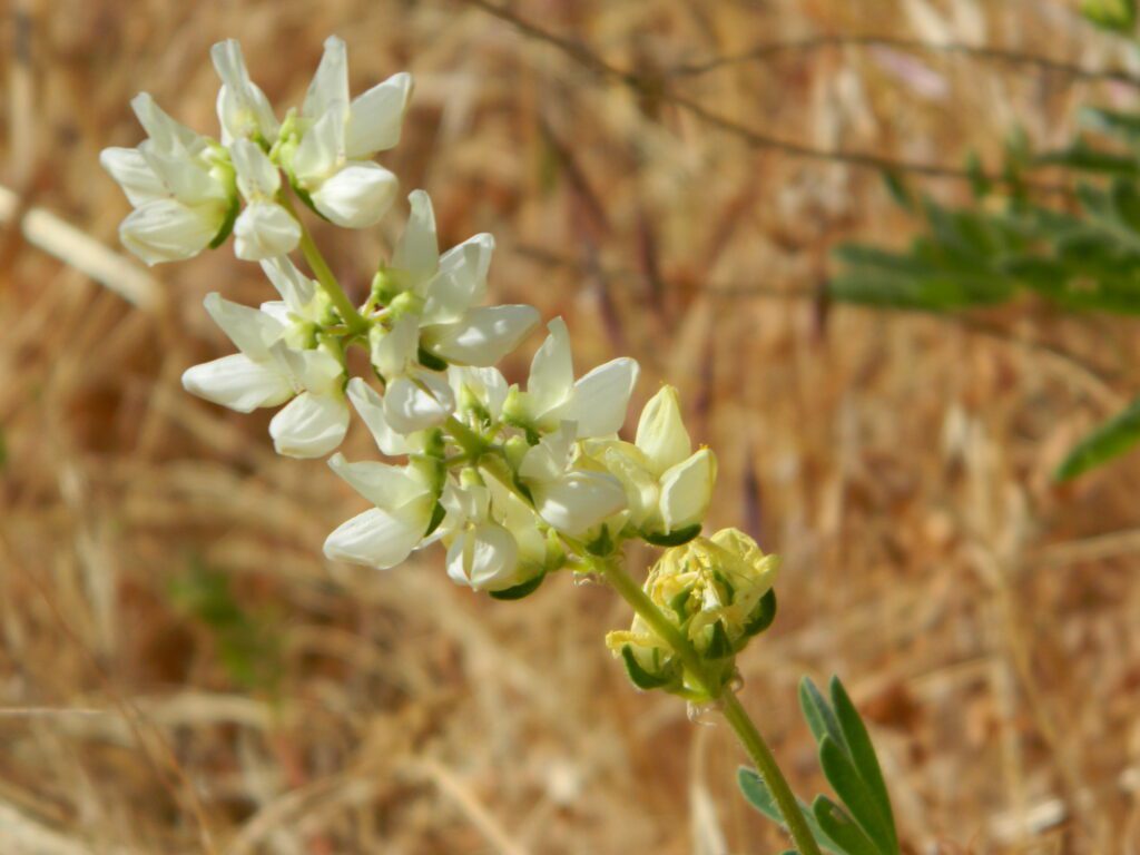
Giant, curly lupine on a big creek, just south of Lassen National Park. Park along Hwy 172 on the east side, about a mile before the Mill Creek Resort and hike along creek to find large lupine. Great picnic area.
Curly Lupine @ Mill Creek, CA
wildfire note: burn scars are excellent spots to find wild flowers
North Sierra Nevada Mountains
Bald Rock Road Loop, Berry Creek, CA
Granite dome above Lake Oroville SRA
Hiking trailhead, Scenic drive loop. Lupine, poppies, monkey flower, dogwoods. Wildflower drive through a recently burnt forest (2020) #BearFire
Butte County Bicycle Ride Chico Wildflower Century Ride
Bike riders can enjoy the hilly Wildcat 100 & 125, the traditional Wildflower 100 & 65, the Flatflower 60 & 30, and the Childflower 12. Wildfest pre-ride party.
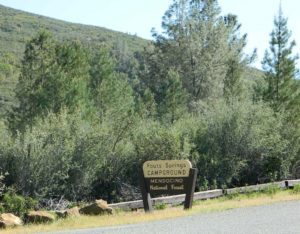
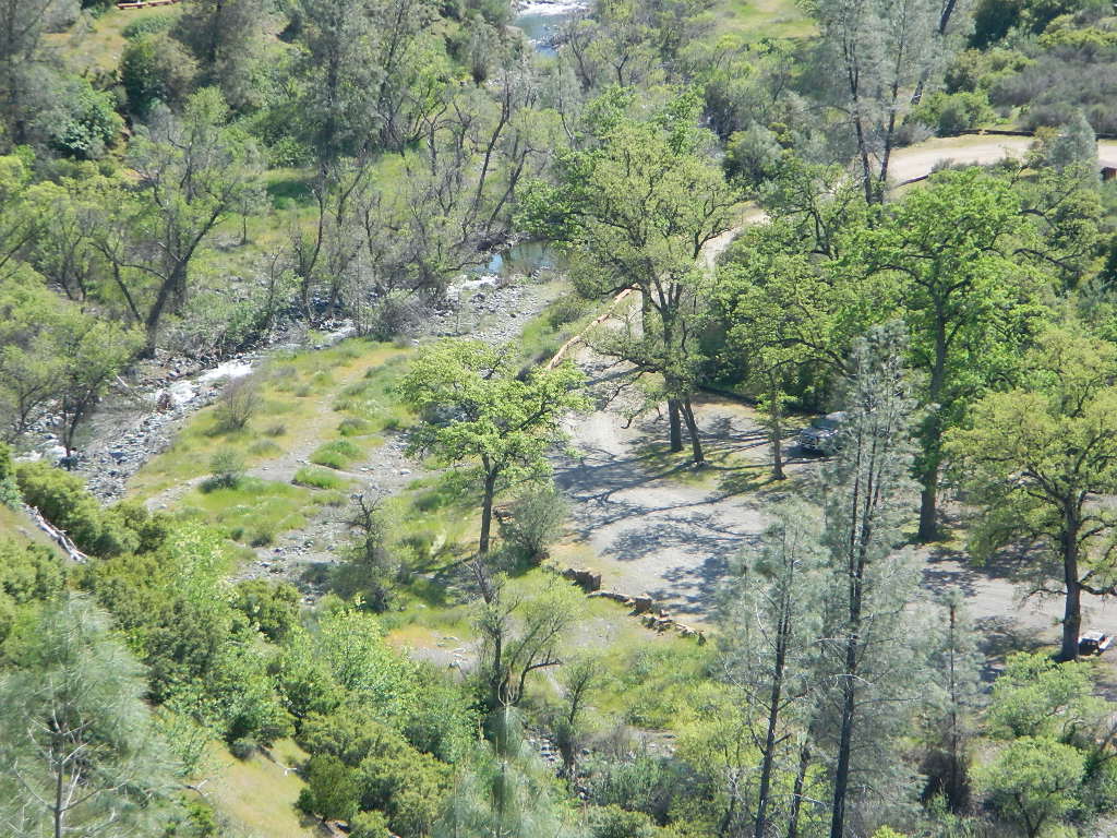
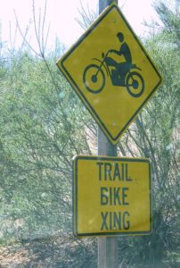
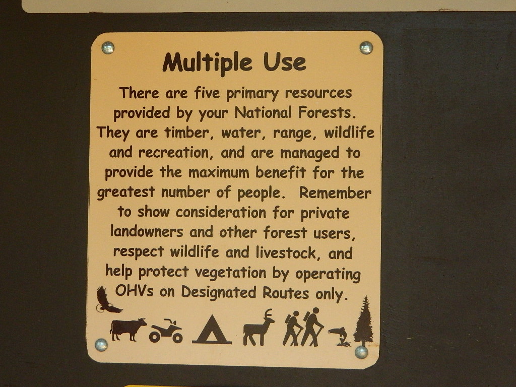
Fouts Springs is multi-use recreation area on the east side of Mendocino National Forest. Located near the Snow Mountain Wilderness trailhead, this region is popular with the off-roaders and dirt bikers. Expect some noise if camping overnight on a weekend.
Excellent picnic spots along creek in springtime. Wildflowers bloom March-May. Campfire restrictions may begin as early as July, so know current fire conditions.
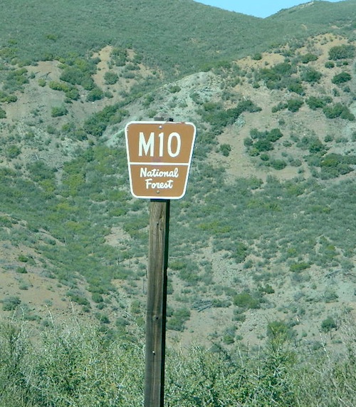
Fouts campgrounds are located on the EAST SIDE of Mendo NF on paved road M10. Situated below 2000′ elevation and open year round.
Road M10 Mendocino
TRAVELERS NOTE: Tent campers, RV and truck campers can easily access this area, all paved roads. Exit Williams or Willows on I-5 and head west. A decent back country map or Mendocino National Forest Map is advised; Numerous canyons, forested creeks and campgrounds. Always check with Mendocino National Forest for road closures and conditions.
OFF-ROADERS NOTE:Use caution on paved access road M10, especially when driving with trailers or large RVs. Narrow road, long and winding with blind curves and no guard rails. Always check with Mendocino National Forest for road closures and trail conditions.
Mendocino Ranger Stations can be found on link below
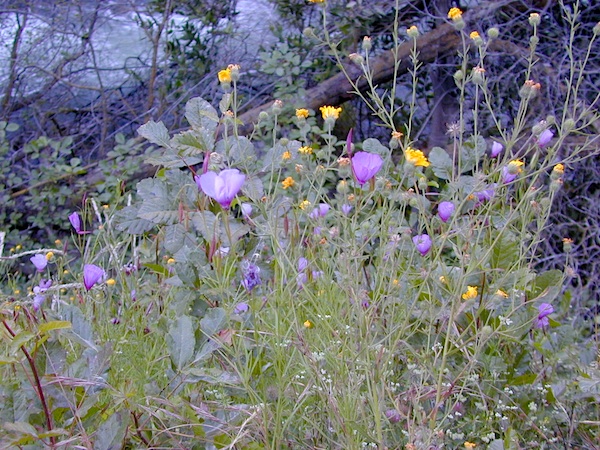
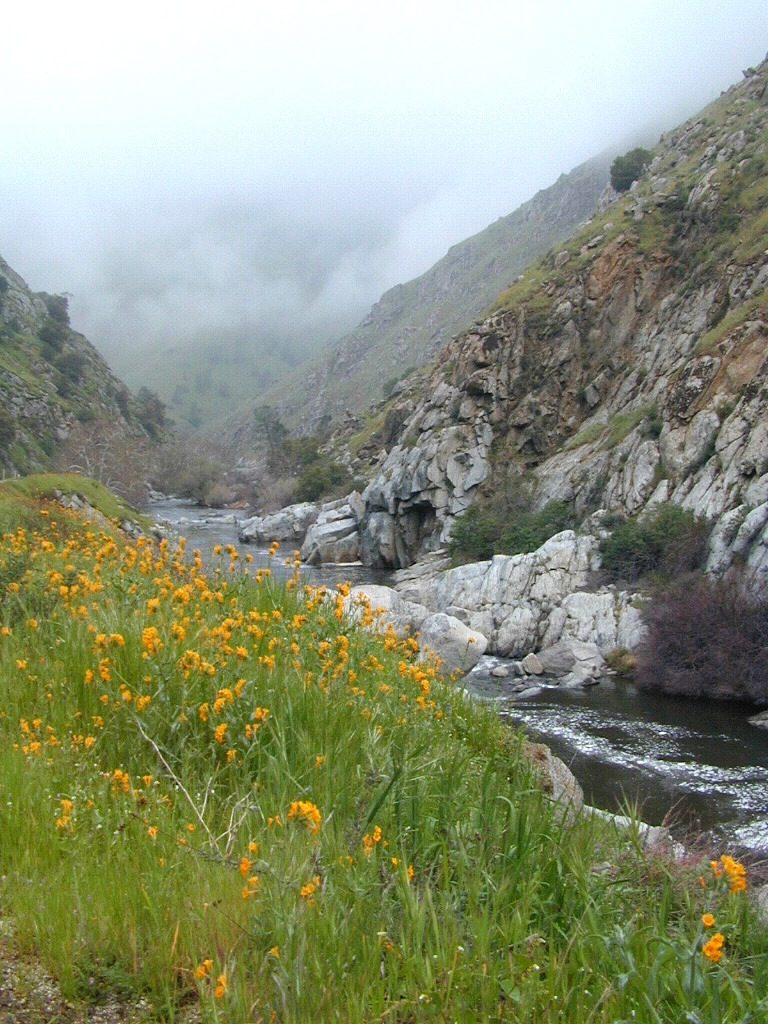
West facing canyons of the Sierra Nevada mountain range are prime spots for wild flora, especially in Springtime. Lots of rain means a great show can usually be found. Rivers exit the mountains and carve deep into the landscape. Lush green hills, oaks, boulders. Perfect picnic spots everywhere.
wildflowers bloom: March – July
make a whole day of it
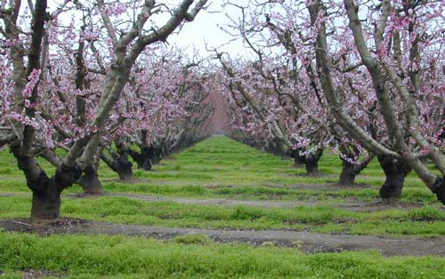
Lower elevations bloom first in the year. Remember if the Central Valley is blooming fruit trees, the mountain foothills are starting up too. Mid-elevations, above 3000′ bloom in summer months, but below that – plenty of river canyons and reservoirs are superb locations to search for wild flowers.
High Sierra wildflowers start to bloom after the snow melt (and roads open) usually JUNE – JULY
Orchards Blooming, San Joaquin Valley, California
The steep Eastern Sierra canyons near US 395, do have some wildflowers in Spring. Rocky, higher elevations bloom in mid-summer. And what Eastern Sierra may lack in wildflowers, they make up for in Autumn Colors (best in the state)
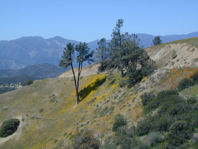
One of the premiere counties for wildflowers inside California. Kern offers amazing displays (blankets of flowers) along roadways, on hillsides, and in the numerous canyons.
Obvious I-5
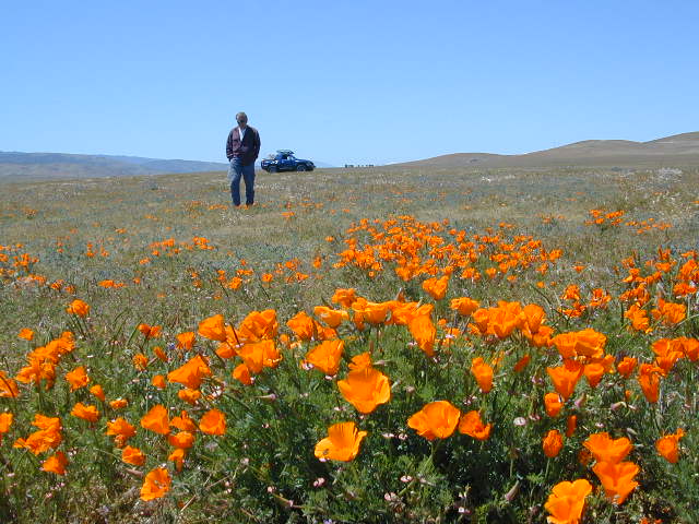
Interstate 5 – from the Grapevine up past Tejon Ranch, and over to Gorman is epic blooms of poppy and lupine. Annually in April and only if the previous winter was wet or snowy. For safety sake, please exit the freeway to view the flowers!
The famous high desert Poppy Preserve is located off of I-5, east on Hwy 138, way before the town of Lancaster, CA
But all this mentioned above is not technically the Sierra Nevada mountains, so we will move on…
CALIENTE ROAD
Off of Hwy 58 west (below Tehachapi) Often called Caliente exit, or Caliente Creek Road – the Bodfish-Caliente Road is a narrow, paved, back road that connects Highway 58 to the Lake Isabella area.
Driving this countryside route is long and curvy, but there are numerous pull-outs and places to see wild flora. Plan for half a day to reach Hwy 178. Gold Pan Canyon and rolling oak hills. Dirt roads lead into National Forests, but watch for private property and no trespassing signs. NOTE: You may need to stop the car. Get out and walk around to find these little beauties.
Historic Havilah has an old schoolhouse and a museum.
LewisHillPreserve (559) 738-0211
Along N Plano Street. North of Porterville, CA
NOTE: Lewis Hill Preserve is not open to the public except for special tours and events.
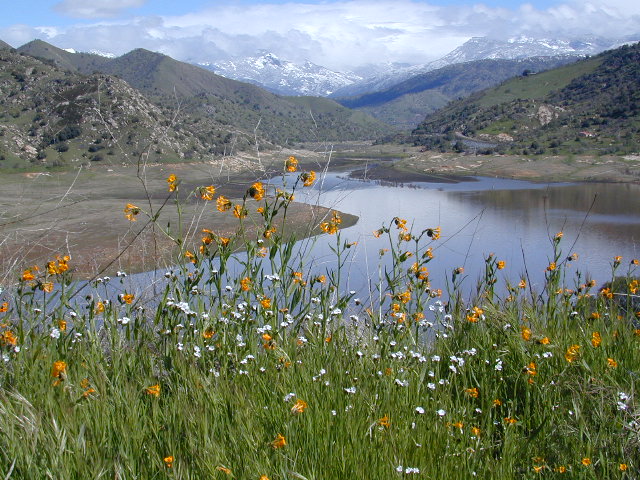
Lake Kaweah @ Three Rivers, CA
south of Sequoia National Park has wildflower displays along the lake shore, and with snow capped mountains in the background, it can make for excellent photos.
Sequoia Road J21 – HOMER RANCH Dirt back road on the north side of the Lake Kawaeah which connects to Sequoia National Park (the long way). Dry Creek Preserve, McKee Canyon, Ragle Canyon, Indian Canyon. Homer Ranch Preserve, open to the public weekends only, from November 1st – June 1st
Calif Gold Country
Foothills & River Canyons
American River Canyon – Hwy 49, South of Auburn, CA
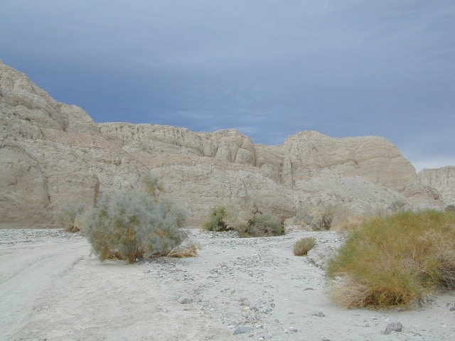
East San Diego County Road S2 winds thru the lower passes & washes of Anza Borrego Desert State Park. On the edge of the State Park boundary Vallecito is a small campground & park, but it was a stage coach route in the 1800’s.
California Historic Marker #304
VALLECITO STAGE STOP – A 1934 reconstruction of Vallecito Stage Station (originally built in 1852) on the eastern slopes of the mountains in the high desert. A super important stop on the first official transcontinental route, serving ‘The Jackass Mail‘, the Butterfield Overland Stage Line, and the southern emigrant caravans.
Vallecito Campground
elev. 1555′
camp sites: 44
overnight fee
first come, first serve
reservations accepted
Campfire pits, picnic tables, bathrooms, & historic buildings; 22 sites are tents only. RV 40′ limit; Additional 8 equestrian campsites w/ corrals. No RV hookups, no dump station. No piped water. No gasoline, no store, no amenities. No firewood, no collecting of firewood. No shade trees, just tall desert brush. Arrive adequately prepared for real desert roughin it.
Closed during the hottest months of summer: JUNE-AUG. Open seasonally: Labor Day weekend through the fall, winter and spring, up until the last week in May.
A neighboring and very rural stage coach stop is further down a long wash, to the south east. Getting there usually requires 4×4, since you must ford a muddy desert wash w/ creek & deep holes. There are no signs out in this sandy desert wash, so you best have a good map and a compass.
The Old Carrizo Stage Station site is accessible by 4 different dirt roads (desert washes) way off the paved highway. None of these are well signed at the highway: Vallecito Creek, Willow Creek near Mountain Palm Springs, Carrizo Creek near Bow Willow, and Canyon sin Nombre.
Agua Caliente, Bow Willow Campground, Canebrake, Sweeney Pass, the badlands overlook, mud caves and slot canyons are all located south of Vallecito. California SR 78 and Blair Valley are north of Vallecito.
Vallecito is located at the apex of the gap in the Carrizo Badlands created by Carrizo Creek and its wash in its lower reach, to which Vallecito Creek is a tributary. Once a seasonal village of the native Kumeyaay people, on a trail across the desert from the Colorado River, this oasis, became a crucial stopping place for Spanish and then Mexican travelers to recover from the desert crossing between Sonora and New Mexico to California. The non native settlement of the site began in 1850, as a camp with a one room sod warehouse as the U.S. Army Depot Vallecito for the supply of Fort Yuma. It was later increased in size and became a store, a stage station, and a ranch house. read more on wiki
Yep! Small community of about 400 folks in the western Sierra Nevada foothills. Gold Rush Country, mining region. Up off the Historic 49 and it used to be called Murphy’s Old Diggings.
Sequoia Foothills Reservoir, CA SR 198 Kaweah Lake
Southern Sierra lake located on Kaweah River, near the mouth of Mineral King Canyon. In between the western Sierra foothills and the agricultural San Joaquin Valley. West of Sequoia NP, east of Visalia, California.
Crystal Cave
Mineral King
Sequoia National Park
Three Rivers
Visalia
The small town of Three Rivers is just up the road from this small reservoir & their slogan is the ‘southern gateway’ to the Sequoia National Park.
There are several recreational reservoirs that are situated at the base of the Sierras, along the western slopes. The Kaweah River transports snowmelt deep from the Sierra Nevada mountains, down to the San Joaquin Valley (Central Valley), for human consumption, households, and agriculture.
Kaweah Marina has patio boats, fishing boats, and paddle boards available for rent. Reservations are needed in summer for weekends and holidays. 559-597-2526
Kaweah Houseboats
Privately owned house-boats can be seen on this lake, although none are available at the marina for rent. Some can usually be found for sale on visalia.craigslist.org
Sequoia Highway 198 has many side routes worth exploring: Mineral King Road will get you to amazing scenery, but there ARE NOT ANY Sequoia groves up that way; Crystal Cave, open for tours is located near the south entrance of the National Park; and a lesser known campground in this area is called South Fork, off on a residential side route canyon – South Fork Drive (Road #348); Located on the quiet South Fork of the Kaweah River.
Sequoia Atlas Three Rivers is small town, located along the Kaweah River, near south entrance to Sequoia National Park
North Fork Drive: North Fork of the Kaweah River is a seldom traveled dirt back road that leads from the east side of the lake @ Hwy 198, northbound (along the North Fork of Kaweah River), straight into the backdoor of Sequoia National Park’s ridge line highway @ Dorst Campground. The original town of Kaweah (elev 960′) is along this route. Many small dirt roads to explore up this way and a good topo map is advised.
Eshom Campground(on western border of Sequoia NP), a small slice of Giant Sequoia National Monument land, Redwood Creek and a trailhead called Redwood Saddle are all back up in here.
Have a few good maps to cross-reference while traveling back roads and trails.
This major dirt route is often closed and gated by the rangers during wet, winter months.
There once was a time when we connected more with nature. Before we closed ourselves off, behind the doors and windows, behind the computer screens, before the internet became part of daily life.
Overweight and obesity is now epidemic in America (as if you didn’t notice). Fast food feasting and soda pop, GMO-gut disorders – and yet we’re still frustrated or disappointed with life; Addicted to television, processed food, copious amounts of sugar, daily coffee, smoking, prescription drugs, and what else.
Wi-fi streaming, video games, always indoors, online, enjoying air conditioned cubes. Inactive physically, emotionally vacant, bored with our choices and always on social media.
Stop and think. Look what has happened to us.
Is this the life you envisioned?
Cooking over a camp fire and real conversation are just a few examples of what we have lost in our modern world of technology, fantasy and face-time. Fresh air, wild flowers, alpine lakes, star filled skies and total silence – all still exist in certain areas, but you must know where to look. Birds and bees, wildlife is disappearing at extinction levels. Pollution, powerful corporations and politics.
Stop and look. See what has happened to earth.
Is this the world you envisioned?
Gone! Away, split, out of town. Off work, out of school, on vacation. Outdoors, always. Far, far away. Unplugged, out of range, vacant lands, big trees, open skies, clear views. California is the land of dreams. Opportunity, fantasy, education, agriculture, terrific terrain and epic scenery. Campfires, waterfalls and mountain meadows are waiting for you.
Taking time off of work – or your typical daily routine – is often rewarding physically as well as mentally. Imagine a week away in a gorgeous location, with minimal to do. Really relax, zone out, chill. Gaze at the water, nap in a hammock, find wildflowers, deer bones, or bear fur on a tree. Cook over the campfire, stargaze every night.
Running to a general store for ice will be your biggest task of the week.
Wilderness boundary, abundant dirt roads and freedom; cell phone calls dropped. Beyond the city limits. Well past the county line.
Roads do lead out of the matrix, if you desire to follow them. Concentrate on a new reality – and disconnect long enough to commune with nature. Find the free time to really relax and re-evaluate life. Explore other options, consider real life in the bigger picture. Hike, bike, walk, camp, birdwatch. Be outdoors, often!
Beat the Summer Heat and head to upper elevation Cool ForestsCurly Lupine @ Mill Creek, CA
Cheap Road Trips
Total Escape is your California planner. We’ve been doing this “region” for more than 30 years, always focusing on the back roads. Discover hidden secrets, meadows and unknown waterfalls. Find free campsites, canyons, rivers, creeks and new places to explore.
Blue Lake in Modoc National ForestHiking Lake w/ Loop Trail in far Northern California
Blue Lake
Modoc National Forest
When you really wanna get away from it all, take a week off and head up to Modoc – the top northeast corner of California, where the volcanic mountains line the Great Basin. The population is minimal, cattle are abundant and the campers few. Even in mid summer, this ideal lake campground rarely fills up.
Jess Valley Road leads east off US 395 @ Likely, CA – 16 miles back to this hidden gem.
Headwaters to the Pit River.
NFS Campground is shady, well managed, and spread out on the eastern slope w/ numerous paved loops. Tent campers, cross country cyclists, truck campers w/ canoes, SUV families, motorhomes with kayaks and kids.
Modoc Map
Blue Lake Campground NFS
• Elevation: 6,050′
• Number of Sites: 48
• Vehicle Accessibility: 32′ RV
• Camp Fee: Yes
• Campsite Reservation: No
• Water: Piped
• Length of Stay: 14 Days
• Season: May –October
• Trailhead: Lake Loop
• Boat Ramp: Yes
Group Camp Facilities (by reservation only)
Modoc NF Warner Ranger District
@ 530-279-6116
Lava Rock @ Blue Lake Loop, in Modoc County, CA
Blue Lake National Recreation Trail
Right next to camp: A pretty much perfect LAKE LOOP (1.5 mi) hiking trail is worth a serious stroll; footbridge, wildflowers, fishing spots, minimal hills, lava rocks, and awesome scenery. Plenty of wildlife can be seen, including butterflies and bald eagles. Trail is shaded by tall white fir and ponderosa pine trees. Trailhead is located at the Day Use parking lot, w/ paved boat ramp, dock, and picnic area.
back roads
boating
camping
canoeing
fishing
hiking
kayaking
mountain biking
picnicking
swimming
stargazing
wildflowers
wildlife
NOTE: not every CAMPSITE has a LAKE VIEW
Certain campsites are adjacent to the lake; some are set facing a meadow (Autumn w/ aspen groves), or the alpine forest w/ deer grazing. Perhaps an inner circle (interior) campsite, for those who like to be close to bathrooms and piped water. Large families will love the abundance of camp settings and accommodations.
Paved Loop Plenty of Vault Toilets Piped Water Recycles & Trash Service
Large Campsites can accommodate Motorhomes
no paved camp stall
no hook-ups
no dump station
no cell phone signal
popular lake camp for motorhomes
When driving a large RV back in here, be courteous of other campers. Nothing sucks more than driving a long distance to the boonies, to arrive at camp just before dark and annoying everyone else already there.
Those needing to drive the campground loops (more than twice) looking for the biggest, levelest, best camp site – and burning $10 in gasoline doing so, should consider walking in.
Park that beast (near boat ramp area, before the camp entrance). Get out and walk the hills and loops, BREATHE & relax – prior to a choosing camp site.
Unhitch any tow vehicles; use that to scout out your perfect spot, if you cannot hike it. Trailers and large motorhomes will find this place ideal, but getting the right camp, can make all the difference.
Paved Trail around Campground
The wildfire: BLUE FIRE burned this region in 2001, but it is lush and green again (2019). Northern California gets some real weather. Rain and snow, more than half the year. The campground closes annually due to snow.
Kayaking is best done in the morning, cuz wind picks up in the afternoon. Canoes can launch at boat ramp, or at shoreline from trails near campsite.
Hiking trails can be found all around lake and campground. Wilderness access can be found at South Warner trailheads within a short drive from the lake.
Cyclists also love this camp, as it is located near a major highway and is a perfect place to really relax, soak in the scenery and get some quiet-nights sleep.
South Warner Wilderness is close by, driving distance; accessible by graded dirt roads. Signage is decent.
Modoc Forest Road #64 is a through-route, across the lower South Warners – 40
miles connecting to east side of the mountain, at Eagleville, CA.
Dirt Roads are suitable for trucks w/ trailers. SUVs and rugged passenger cars are okay. Motorhomes are not advised on this route. Washboard conditions are typical. Winter closure on this route is common.
MODOC RD 64
Several miles away from Blue Lake, 2 rustic trailhead campgrounds are located back this way – East Creek Campground & Patterson Campground. Less than 10 camp sites each, equipped w/ horse stalls, vault toilets and maybe piped water. Trailhead parking for backpackers. No RVs!
Autumn colors w/ aspen groves. Open, large meadows and mature forests w/ wildfire scars. Cattle can be found grazing all around, many cattle crossing.
Minimal primitive camping options, along road sides. Campfire permits required. No camping within one mile of a developed campground.
Modoc is Cow CountryDay Trippin – Out exploring Modoc Road 64 (and cutting firewood)
Sierra Madre Road Sierra Madre Ridge, San Rafael Wilderness
Los Padres National Forest Forest Road #32S13
off of Cuyama Valley Hwy 166
East of Santa Maria, CA – along Highway 166 (on the south side of the pavement) are several dirt roads that lead up to the main ridge road that access this part of Los Padres National Forest.
backpacking
camping
dirt bike trails
dirt roads
hiking
horse camping
mountain biking
off road routes
petroglyhs
wildflowers
4WD not required, but high clearance is helpful. Open almost all year. Rainy season gate closures (at hwy) during winter months.
Sierra Madre Ridge is forest road #32S13, which parallels Hwy 166 (Cuyama River) for over 50 miles on the Sierra Madre Ridge at approx. 5000 feet elevation.
NOTE: A good stretch of this dirt road is closed to vehicle traffic. Although it connects to Santa Barbara Canyon near Ventucopa, you cannot drive it. Only hike or mountain bike!
NFS Gate locked at the HOG PEN trailhead, and from there you can bike or walk all the way the other end at Santa Barbara Canyon near Cuayama Fire Lookout @ Dick Smith Wilderness
Small campgrounds in the region:
off Highway 166 Miranda Pine Campground (on 32S13 @ 11N03) Bates Canyon Campground (via Cottonwood Canyon Rd) also known as White Oaks Campground Aliso Canyon Campground (via Aliso Canyon Road) not accessible by vehicle, from dirt road 32S13; only by trail
in the backcountry Painted Rock Camp (hike-in) Sycamore Camp (hike-in)
Angeles National Forest extends far north of Santa Clarita, CA. Way up Interstate 5, almost to Tejon Pass (4144′ elev). On the west side of the freeway is Los Padres National Forest and on the opposite side is Angeles National Forest. Both sides have abundant off roading and dirt roads, trails and camping areas.
A few developed campgrounds exist along I-5, but who really wants to camp out and listen to the freeway traffic? This route is a skinny dirt road, leading out to small remote campgrounds, often visited by off roaders. No facilities and no running water; you’ll be lucky if the picnic table isn’t shot up. Simple, bare bones, middle of nowhere for L.A. County.
Forest Road # 7N23
Long dirt road that begins at Three Points Road, off of Hwy 138 – the Antelope Valley freeway which connects the Grapevine and Tejon Pass @ I-5 to the Mojave Highway 14 out east.
USDA National Forest Map is advised, a high clearance vehicle is recommended – and free time needed to enjoy such a spot. 4WD may be needed during snow and really wet weather.
PCT access
The ever popular Pacific Crest Trail passes by this small NFS campground listed below. Backpackers, horse packers, dirt bikes and truck campers can all access this dirt road, but be warned it is WAY OUT THERE.
Yes, it snows up here (very infrequently) – terrain elevations range from 1000-5000′ around this region. Basic note: if Interstate 5 has snow warnings, this small, backcountry dirt road will get winter weather too. And sometimes that can be significant, during JAN-MARCH. If more than a few inches of snow are predicted, you best have a 4×4 and/or snow chains.
camping
dirt roads
hiking
off roading
wildflowers
Wildflowers bloom in April, and will need a decent amount of winter rain/snow to display the vivid colors. This area is not too far from the California Poppy Reserve in the Antelope Valley.
Hungry Valley SVRA is a large, popular off road park, located to the north. On the edge of the Los Padres National Forest @ the GORMAN exit.
Bear Campground [2021 CLOSED, due to wildfire from 2020]
open all year
elevation: 5400′
7 camp sites
no toilets
no water
no fee
Oak trees, sage, chaparral w/ wide open sky views. Picnic tables, fire rings and fresh air. Well spaced sites, with lots of room to spread out. OHV trucks & trailers do frequent this spot, so be warned.
Far from everything, so no impromptu beer runs to the mini -market. Bring everything you will need for any overnight stay, including ice, food, drinking water, washing water, and campfire water. LOTS of water is always good. No creeks flow year round. Summer and autumn can be very hot in these hills.
Oak foothills of the Historic Gold Country, at the edge of the Sierra Nevada mountains.
boating
canoe
camping
fishing
hiking
houseboats
kayaking
wildflowers
Most Central Valley Reservoirs have blooming wildflowers in early springtime. Summer heat can measure triple digits for months as most of these lakes are located below 1000′ elevation.
California meadow is a common term people search for when dreaming of their mountain retreat vacation or upcoming weekend camping trip.
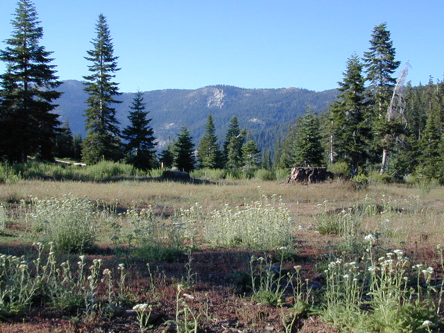
Meadows are places in the forest where cool air collects and settles. Deer among other wildlife, can often be found here grazing around dawn and dusk. Alpine meadows are usually surrounded by trees with lush green grasses, located at higher altitudes above 6000′ – the ‘highcountry’ as most like to say.
Find meadows on National Forest lands from 3000-10,000′ elevation, and it is not uncommon to see cattle grazing in these same regions. California National Parks have some of the most protected meadows in the golden state!
MT SAGE – mountain sage meadows
High desert mountains have drier landscapes, with large sage brush meadows surrounded by sparse pinon pine and/or juniper forest. The Mojave desert’s sagebrush reaches out westward to the peaks of West Kern County. High deserts and mountain meadows can both have significant wildflower blooms. The deserts start to show color in March & April, while the highest elevations of the Sierra Nevada can bloom as late as July & August. All California Wildflowers depend on autumn seasonal rains & snow melt.
Kennedy Meadows from Bald Mountain Fire Lookout
Wilderness Meadows
The best places to find secluded wildflower meadows is on the high country trails of various mountains – Mount Pinos, Sierra Nevada, Shasta, Trinity & Lassen – all have marvelous meadows, some have easy access w/ parking nearby and others are hike-in only. Locate hiking trailheads for meadows and possibly find camp nearby.
Excellent near Meadows:
Stargazing, Wildflowers, Wildlife Viewing, Horse Camping
Explore dirt back roads of California to find your very own meadow. If you would like to explore at this level, a good topo map is highly advised. The Sierra Nevada mountains have the most beautiful meadows in the state (by far). Their scenery w/ granite outcroppings and wild flowers, surpasses all else. Although on rare occasions, even the Antelope Valley can look amazing — with poppies.
Mountain Meadows are sacred spaces: Do not disturb the lush, grassy landscape, as wildlife rely on these areas for survival.
No driving on meadows. No camping on meadows; No Campfires; Camp next to (or nearby), but not on top of the meadow. Picnicking should be kept on the sidelines.
Stay on designated dirt roads: No tires across the meadow; No mountain biking, No dirt bikes, No off roading. You’re not spreading the seeds, you’re destroying a fragile ecosystem.
Ranch FENCING w/ barbed-wire is quite common around meadows, to keep cattle out of certain problem areas. Fences also help keep the wandering public out of private lands or sensitive areas.
When hiking – stay out of the muddy spots and know that if you choose to hike directly across meadow, you may encounter water and deep, sinking mud. HINT: There is usually a shallow creek running through most meadows, during all times of the year.
Winter snow usually blankets these fragile areas in winter, and when deep enough – making this terrain prime destinations for snowmobilers.
Spicer Meadow Reservoir & more lakes: Paved Forest Rd #7N01
Spicer, Utica & Union Reservoirs, Central Sierra, Stanislaus National Forest
Stanislaus National Forest
North Fork of the Stanislaus River
Highland Creek
Carson Iceberg Wilderness Area
Spicer Meadow Reservoir (6418′ elev)
Union Reservoir (6850′ elev)
Utica Reservoir
Spicer Meadow Reservoir can also be found on various publications, listed as Spicer Meadows, Spicer Mdws, Spicer Lake and Spicer Reservoir.
Ebbett’s Pass is California State Route (SR 4) Highway 4, which cuts thru the middle of the Sierra Nevada mountains (east-west). Wilderness peaks and rivers surround this whole region. Deep snow pack is common, so much of this region is off-limits half the year (or more). Always check with local rangers by phone before venturing out, as winter conditions can keep these roads closed late into the year.
N of Arnold, California; Continue up SR 4. Passing Calaveras Big Trees State Park & Camp Connell; After Big Meadow Campground, take the paved right turn for Spicer Meadow; This is forest road 7N01. Meandering thru a forest and descending in elevation, road will dead end at Spicer Reservoir.
7N01, the main paved mountain road, is located on the south side of the highway. The highway turn off reads ‘Spicer Reservoir’. Suitable for travel w/ RVs and trucks with boat trailers. Quite curvy, scenic and about 7 miles long. There are developed campgrounds in the vicinity.
The dirt side roads off the pavement can be narrow, muddy, rocky and overgrown, so be cautious when exploring. Choosing a dispersed camp site should be done during daylight hours, and will require a campfire permit ahead of time. Use an existing camp site whenever possible, instead of creating new ones.
Several man-made reservoirs attract outdoor seekers, mountain bikers, campers, canoes and fishermen. Kayakers tend to love Union and Utica, but power boats and sail boats prefer Spicer Lake.
Volcanic features mix with Sierra granite in this part of the forest, and geologic formations make for interesting hikes. Mountain biking is common around these lakes, as well as day hiking and backpacking.
NFS Campgrounds in the region:
Stanislaus River Campground
Spicer Campground
Spicer Group Camp
Campgrounds only open June-September. Some campsites at the campground are wheelchair accessible. Boat ramp located near campgrounds.
Left fork turn off, Dirt Road #7N05 leads out to Utica & Union Reservoirs. Granite rock, alpines lakes w/ forests surrounding. No motorized boats allowed on those two lakes. Very popular among the stand up paddlers (SUP), all kayaks and canoes.
No developed campgrounds back that way either. No flush toilets, nor paved roads. No flat RV spots; only primitive style camping. These 2 scenic lakes get crowded during summer weekends, so opt for a mid-week stay if possible.
Another dirt road treks steeply up the hill from Union Reservoir to Lake Alpine (at the highway). That primitive truck trail is actually a (somewhat designated, but not well-signed) 4×4 route and suitable for high clearance vehicles only.
Spur Road #7N29Y is another small dirt road which leads a couple miles into the forest, over to overgrown trailheads and primitive camping options. Ideal for accessing all the lakes (on foot) from this prime location. A camp fire permit is required. No water, no bathrooms, no facilities, no garbage services.
7N01 – Los Padres NF
There is another USFS Road in California named 7N01, but that one is a 4×4 OHV access route @ Dutchman Campground, located in South Central California; the southern part of Los Padres National Forest. We have mention of it on the page for Frazier Park Camping.
Located inside the Sierra Juarez Mountains
Parque Nacional Constitucion de 1857, or
Constitucion de 1857 National Park, Baja California, Mexico
Pine forests in Baja California: Dirt roads access Laguna Hanson, so come prepared to drive many miles with dust & potholes — more than 20+ miles from the paved highway just to reach this prime high elevation destination. Since most of Baja is desert, dirt and coastline, this location is a rare treat for those wishing to travel (off the beaten path). The tallest mountain peak in Baja is nearby with the University Observatory.
San Pedro Martir
Baja Camping in the Mountains
Water levels drop well below normal & what we end up with is a shallow lake with huge boulders emerged. Kinda surreal looking. Tall pines & dense forest surrrounding lake. Wide open & flat areas perfect for biking, stargazing and group camping.
This Baja National Park campground is more like dispersed, or open camping around lake shore. Very popular place in the summer months & if you want seclusion camp away from the lake, deep in the forest. The best quiet spots are located in the north east vicinity.
No motorhomes allowed: the road is steep, long, all dirt and narrow in certain spots.
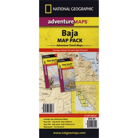
Baja Maps from NatGeo
bouldering (rock climbing)
camping
dirt bike trails
hiking trails
horseback trails
hunting
kayaking
mountain biking
off-roading
sightseeing
No services at lake. Minimal camping facilities. Self sufficient campers a must.
BRING EVERYTHING = ice chest w/ block ice, drinking water, flat tire repair kits, tow strap; extra blankets, medication, first aid kit. There is no store within 30+ miles of here, and the dirt road is very long (both ways) – so it is best to be prepared with all food and beverages.
LOCALS NOTE: An occasional rancher may approach your camp with his farm truck, selling fresh made cheese, beef jerky or other farm produce.
No pavement, no picnic tables. Minimal pit toilets, few rangers patrolling and rock fire rings.
CAMPERS TIP: The toilets can be nasty!! Bring a shovel and wipes; walk into the forest for your bathroom break.
OHV trails are nearby. OFF ROADING, dirt biking and 4×4 routes are essentially any dirt road that is within this forest; Drive slower, keep your ears peeled and watch out when they pass you, cuz they are most nimble and quicker.
No motorcycles signs are posted, but that doesn’t stop them riding all hours of the night. The mountains near Tecate and Mike’s Sky Ranch both cater to dirt bikers and tours, and are located nearby (sorta).
Park rangers & rules here are a lot more lax that in the “States”.
MAP NOTE: Google Maps has this place listed as Laguna Juarez
Lake Genevieve, hike-in only access. Way up behind Convict Lake @ Mammoth Lakes, CA
calif lakes / secluded lakes / loop hike around lake / best lake in california / lake elevation / geology lakes / alpine lakes
hike-in lakes
Wilderness lakes are as pure as it gets. No cattle, no roads nearby. Snow melt, cool days, good fishing, great mountain scenery, granite, fresh air & clean water. You have to really wanna reach them. You must physically WORK to get to these remote alpine wonderlands – hike, bike, or horseback.
Heart Lake, near Onion Valley & Kearsarge Pass
Some lakes are accessible via a day hike, with miles of forest trails or granite switchbacks in between. Waterfalls, wildflowers and wildlife will keep you entertained, as you enjoy your trek. No rush, no pressure; Go slow and take it all in. Remember, it’s not a race!
Most people prefer to backpack in to these locations and stay a while. Why not? These puppies are ACCESSIBLE only a few months outta the whole year. May as well enjoy them while you can. The rest of the time they are frozen solid or buried with serious snow. Wilderness areas do not allow dogs nor mountain bikes on trails, so plan accordingly.
camp, fish, hike, horseback, swim
California is lucky to have hundreds of lakes within protected wilderness areas. Almost all are gorgeous and have very limited access. While we haven’t yet been able to hike every Wilderness in Cali, we will leave you with the visuals and links, plus a way to buy the specific topo maps.
HIGH ALTITUDE LAKES: 4000′ elevation to 14,000′ elevation
SEASONAL deep SNOW makes many of these beautiful lakes inaccessible for more than half the year. Call ahead to local rangers to make sure your desired destination is indeed open for traffic. Certain locations may require snow shoes, snowmobile or a 4WD to access.
Forget the hike!
If you are seeking a remote mountain lake that you can drive to, you will need to search for one that has the fewest people. A high clearance vehicle will help you exit the tourist traps, via plenty of the back roads. Some dirt roads are acessible with just a passenger car or AWD wagon. Talk to the ‘field ranger’ for up-todate road conditions and closures.Make sure to get a campfire permit, before you camp outside of developed campgrounds. Always steer clear of crowded, holiday weekends.
The lake list above samples most of the lakes in California. For secluded locations and rare finds (accessible by vehicle), see the list below and follow links for more info.
Fern Lake – hike in access, June Lake Loop Hwy 158
More California regions with pristine lakes, but not dubbed Wilderness:
If you are imagining a forested alpine lake near Palomar Mountain, this is not it. Henshaw is a countryside area w/ meadow setting near ranches with open skies and open terrain. Can be windy at times! Can be hot in late summer.
Perfect remote spot for stargazing. Henshaw is the nearest body of water to Mount Palomar & is located on Hwy. 76, but the terrain is quite the contrast to the pine topped mountain nearby.
TREES: Lake Henshaw has very few trees; mostly large open spaces & fields surrounding it. Cattle grazing & rolling hills w/ mountain backdrop. Stargazing and fishing cabins is more fitting of a description. This bare bones basic, little cabin resort offers a true get away from civilization for maximum relaxation close to SoCal cities.
Lake Henshaw specs: elevation: 2740′ surface area: 1137 acres
Sierra Road number 9 is a north turn off of Trimmer Springs Road. Marked as National Forest Rd #10S69, as well as just plain NINE. Big Crk. canyon is after the Maxson Road junction, and before the Balch Camp / Blackrock Reservoir turn off on #11S12. The area is known for abundant wildflowers in the early season.
A popular dirt road drive for the western Sierra – Pine Flat Lake region. A forested, south facing canyon in the Southern Sierra Nevada Mountains. Big Creek, wide, graded, dirt road w/ primitive camp sites. 4×4 could be needed in wetter months.
The higher you go on this route, the more pine trees you will experience. Winter weather can close this route. A campfire permit is required to camp along this road.
The lower part of the canyon has rock features, small waterfalls, swimming holes, picnic spots and sometimes cattle grazing. Several prime unmarked, primitive camp sites along this road – but few and far between. High clearance or 4WD may be needed, depending on road conditions.
Soaproot Saddle Road is a not-so-obvious left fork (dirt, without signs) that leads steeply up away from main road. Climbs a steep hillside, way up above and along Rush Creek; continues for many miles. Less people back this way, if you are seeking seclusion. Few primitive camp sites on right side of road, near where the creek breaks away from road. Good for stargazing way back here. 4×4 may be needed. Road may or may not connect through to desired destination.
The mid-route climbs into pine forest and the dirt road switchbacks, steeply, with a few more camp sites available; usually found on short side roads off the main road.
At Sierra #9, a major junction w/ dirt road #10S69, called Dinkey Trimmer Road. This leads way off through the rugged terrain, many miles, over to the pavement at Dinkey Creek Jct – Campground, Trailhead and Dinkey Lakes Wilderness.
Big Creek will turn left (north), and follows the large Big Creek Canyon. Several steep miles climb up into the dense pine forest, following the creek the whole way. Several prime creekside camp sites fill up fast in this stretch. Great views, steep dirt roads. GPS waypoint these camp driveways – so you can find it next time, (first, before everyone) on Friday, Thursday before midnight.
Peterson Mill Road is Rd #10S02, found on the left (west) side of Sierra #9. That westbound route becomes pavement half way back to Highway 168. This way is the quickest way from Fresno, out to the developed NFS Bretz Campground.
Sierra #9 Big Creek Road arrives in the densest of forests. Many camp sites and side routes to explore. Dark, upper elevations, snow lingers long in the shade. 4WD may be needed in wet areas. Mud is quite common MOST of the year in this spot, so know your vehicles capabilities before you get yourself stuck (or stranded). It’s a very long walk to any kinda civilization!
Hunters like to use these upper camps during hunting season. A camp fire permit is required, so bring your shovel and bucket; self-sufficient campers enjoy the back roads most often.
Bretz Campground NFS is up here on the main road, number nine. Clock it w/ dash trip meter; 15 miles from the road start @ Pine Flat Lake. Popular with OHV and 4×4 groups. Max RV or trailer length = 24′
Open all year long; No fee.
Sierra Forest Road #9 the far north end, enters Blue Canyon @ #10S18, but the Rd #9 route continues NE as Providence Creek Road. Eventually intersecting @ Dinkey Creek Rd w/ Rock Creek & Dinkey Dome closeby. Great granite 4×4 Trail @ Bald Mountain (elev. 7832′) overlooking Shaver Lake.
Jeepers on granite @ Bald Mtn, above Shaver Lake, CA
Being the largest State Park inside California, Anza Borrego has certain advantages. Lots of land to explore, abundant dirt roads, free camping and a very diverse terrain. Located in SoCal, this desert has lots to offer the outdoor enthusiasts, all year round.
Anza Borrego Desert
with hundreds of miles of dirt roads to explore
SUV / 2WD / AWD / 4WD / 4×4 / OHV
The Anza Borrego desert, in east San Diego County, is quite large and very easily accessible from Southern California. The park spans mid-elevation, mountain foothills (3000′ elevation) down to dry lake beds near sea level. Large, vast and varied terrain – and full of vegetation in certain spots. Borrego Desert Wildflower blooms attract thousands of visitors between March-May each Spring.
While the majority of the dirt roads inside the ANZA DESERT are passable with a regular passenger car (on most days), some specific areas and routes are indeed considered “too hairy” and may require a 4 wheel drive. Rains change landscape fast in this region, so know before you go.
FLASH FOOD WARNING: Wet weather (anywhere nearby) can make a mild, soft, sandy wash into a wild, flowing river. On occasion desert washes are ‘washed out’ during big rain, often becoming mini rivers that can swallow your vehicle; Road and weather conditions can change suddenly in the California deserts. Wind can also play a huge factor in a selecting a decent camp site. Know the weather report in advance and always be on the watch for big clouds on mountains to the west.
Deep sand washes, steep sandy hillsides, boulder passes, rock yards to boulder hopping, soggy bottoms to straddling ruts, the deserts of SoCal are indeed fun and challenging. Enjoy your public lands responsibly and pick up some litter, stay on the trail and do not target shoot inside park boundaries.
To find these off-roading areas: OHV routes, camp areas and gear heads galore. Or try avoid them. Keep reading.
Anza Borrego Desert State Park itself is NOT AN OFF ROAD PARK. If you want the free-for-all, open, OFF-ROAD areas, with sand dunes and terrain to explore, then the list above should help. Some places can be secluded and private for camping, and only one Jeep may pass by (for the whole weekend).
On the other end of the spectrum, most OHV camping areas are closer to paved routes and busy w/ motorized activity. On weekends, traffic, events and crowds are the norm. ATV, dirt bikes, buggies, quads, jeeps, families, RVs. Often, a big noisy scene.
Seeking to travel to distant places to avoid crowds? then this site can help point to the best destinations. Follow links, browse images, get a decent topo map – and discover private desert camping for free.
most w/ 2WD access; high clearance vehicle is preferred (and as usual, 4WD may be needed in storm conditions). Not all 4×4 routes will be signed. Signs get washed away in desert areas, so don’t count on them. Have a good hard-copy, topo map handy – just in case.
The Tom Harrison Map of Anza Borrego Desert is actually called the San Diego Backcountry Recreation Map and is by far the best seller of the region.
Wilderness Press makes an excellent topographic map for the Borrego Desert, with all the details on terrain and info for camping, hiking & off roading.
MORE AREA MAPS
The infamous west coast backpacking route, the Pacific Crest Hiking Trail runs above the desert (a few thousand feet), on the ridges of Mount Laguna.
Cleveland National Forest borders the west side of Anza Borrego Desert, on the rugged steep slopes of the big mountains (7000′ elev). More Maps links are provided:
Wetlands in the desert? Not that rare, water does flow downhill. Some established well-traveled roads may have added gravel to the soggy marsh areas, but many water crossings are bare, and vulnerable to erosion. Try to avoid driving in and around water. DRIVE SLOW through water where route crossing is obvious. Wildlife need these water sources to survive, so don’t muck it up.
Palm canyons and large boulders are numerous in this desert, water sources scarce. Camping near palms can be limited to walking distance. Several palm oasis camps along San Diego County Road S-2, some RV accessible. Even the county-run Hot Springs Park has some palms. Of course, Palm Canyon is the State Park Campground. Visitors Center headquarters in downtown Borrego Springs has the most popular hikes, hotels, restaurants, with abundant campground camping. Very walk-able town. Super hot during summer, triple digits!
back roads: weekends
Weekends are always busier than week days, in general, all over Cali. Keep that in mind when seeking seclusion. Camping in Anza Borrego desert is always best at least 2 miles off the pavement, well away from the traffic on the highway and for those masses seeking the easy camping.
Campfires always require a metal bucket in Anza!
OPEN-CAMPING: camping outside of developed campgrounds, also referred to as ‘primitive camping’ is quite common in Anza Borrego desert. Many Borrego Camping Areas are accessible with regular cars, close to main roads and usually have no bath rooms, or facilities. The further you drive from the pavement, the more likely you are to encounter obstacles like boulders, deep ruts, soft sand and uneven terrain.
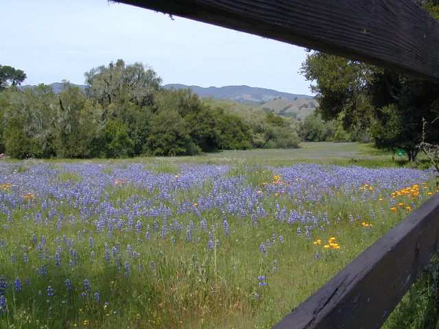
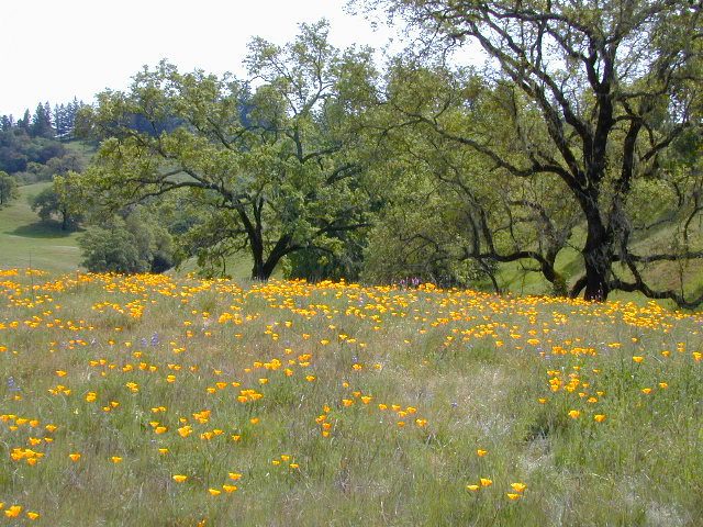
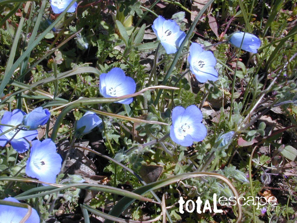
Wildflowers bloom all over California – from the desert in winter months, to the High Sierra in mid summer. Remember that the timing is everything, since most of these precious, delicate beauties only last a week or so. Out there alone, all day in the bright sunshine, whipping in the seasons strongest breezes. Flora!
The higher the elevation, the later the bloom.
Lower elevation deserts begin to show as early as February and higher elevation peaks thaw in May. Wilderness meadows and flowers can be found in the mountains in summer. Generally in California, Springtime – between MARCH and JUNE is the best viewing time.


 Hiking trailheads are accessed from all sides -On the east side you have Trinity Lake & Trinity River w/ Highway 3 running lengthwise in a north-south direction. Hwy 299 runs east-west along the south side of the wilderness. Klamath River Hwy 96 lies on the west side of the wilderness. Salmon River, Scott Mountains and Cecilville are north of the alps.
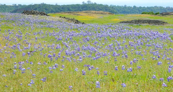


 There once was a time when we connected more with nature. Before we closed ourselves off, behind the doors and windows, behind the computer screens, before the internet became part of daily life.
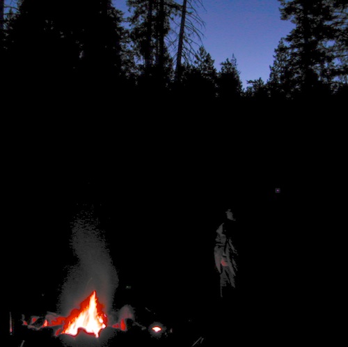
 Fresh air, wild flowers, alpine lakes, star filled skies and total silence – all still exist in certain areas, but you must know where to look. Birds and bees, wildlife is disappearing at extinction levels. Pollution, powerful corporations and politics.


 nearby destinations:
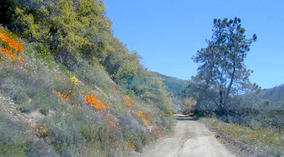

 The ever popular Pacific Crest Trail passes by this small NFS campground listed below. Backpackers, horse packers, dirt bikes and truck campers can all access this dirt road, but be warned it is WAY OUT THERE.


 BRING EVERYTHING = ice chest w/ block ice, drinking water, flat tire repair kits, tow strap; extra blankets, medication, first aid kit. There is no store within 30+ miles of here, and the dirt road is very long (both ways) – so it is best to be prepared with all food and beverages.


 TREES: Lake Henshaw has very few trees; mostly large open spaces & fields surrounding it. Cattle grazing & rolling hills w/ mountain backdrop. Stargazing and fishing cabins is more fitting of a description. This bare bones basic, little cabin resort offers a true get away from civilization for maximum relaxation close to SoCal cities.


 SDBKCO Recreation Map


