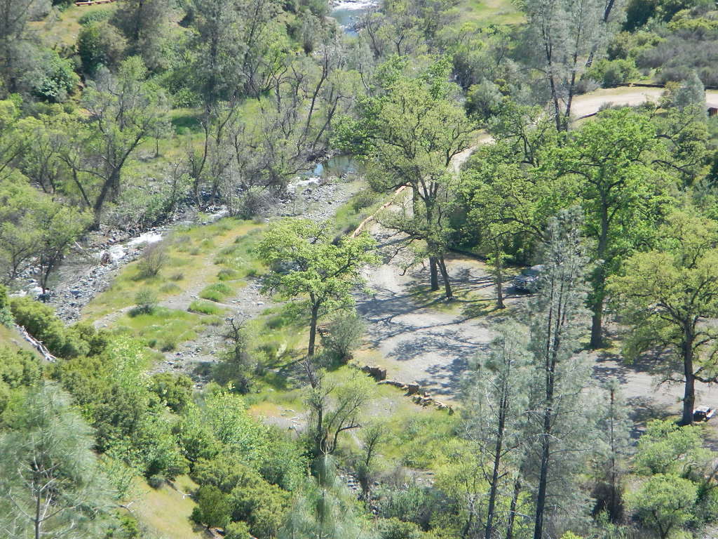
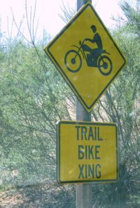
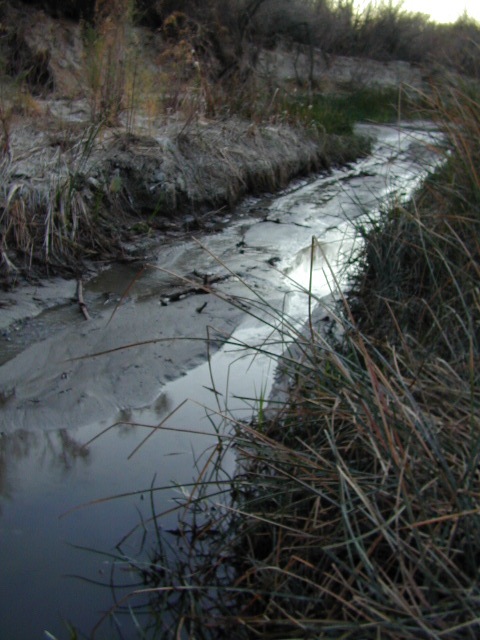
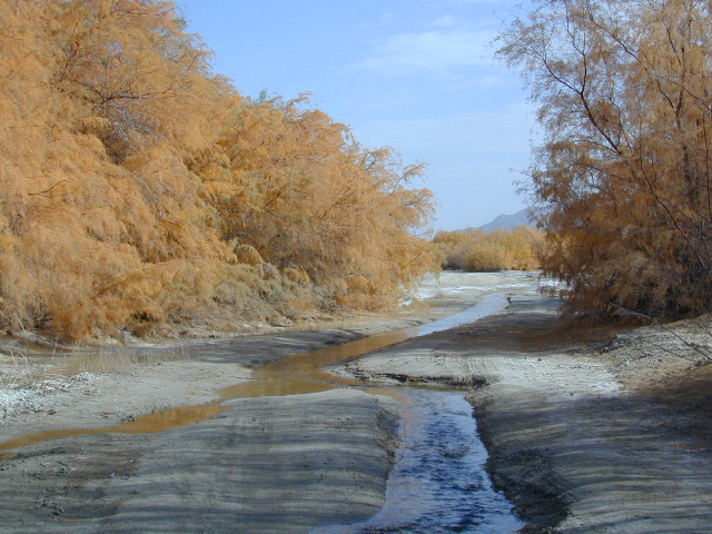
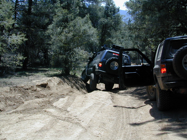
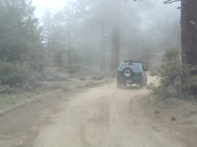
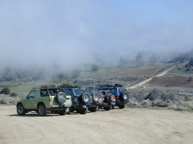
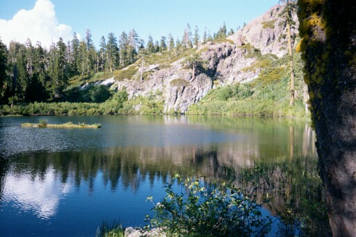
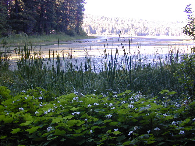
Fouts Springs is multi-use recreation area on the east side of Mendocino National Forest. Located near the Snow Mountain Wilderness trailhead, this region is popular with the off-roaders and dirt bikers. Expect some noise if camping overnight on a weekend.
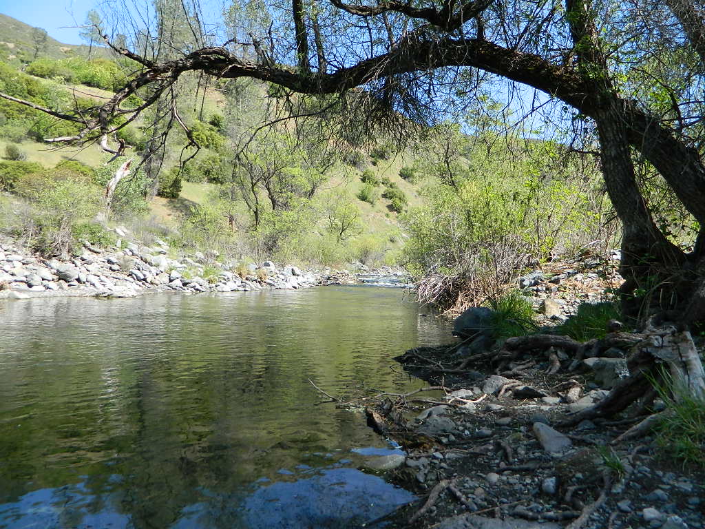
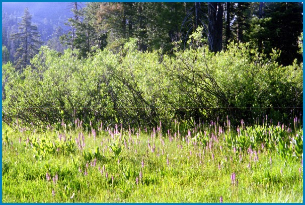
Excellent picnic spots along creek in springtime. Wildflowers bloom March-May. Campfire restrictions may begin as early as July, so know current fire conditions.
Fouts campgrounds are located on the EAST SIDE of Mendo NF on paved road M10. Situated below 2000′ elevation and open year round.
Road M10 Mendocino
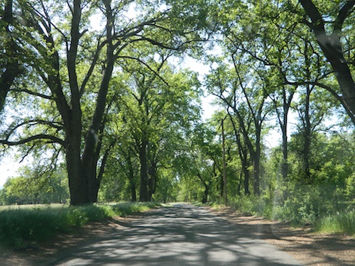
TRAVELERS NOTE: Tent campers, RV and truck campers can easily access this area, all paved roads. Exit Williams or Willows on I-5 and head west. A decent back country map or Mendocino National Forest Map is advised; Numerous canyons, forested creeks and campgrounds. Always check with Mendocino National Forest for road closures and conditions.
OFF-ROADERS NOTE:Use caution on paved access road M10, especially when driving with trailers or large RVs. Narrow road, long and winding with blind curves and no guard rails. Always check with Mendocino National Forest for road closures and trail conditions.
Mendocino Ranger Stations can be found on link below
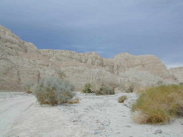
East San Diego County Road S2 winds thru the lower passes & washes of Anza Borrego Desert State Park. On the edge of the State Park boundary Vallecito is a small campground & park, but it was a stage coach route in the 1800’s.
California Historic Marker #304
VALLECITO STAGE STOP – A 1934 reconstruction of Vallecito Stage Station (originally built in 1852) on the eastern slopes of the mountains in the high desert. A super important stop on the first official transcontinental route, serving ‘The Jackass Mail‘, the Butterfield Overland Stage Line, and the southern emigrant caravans.
Vallecito Campground
elev. 1555′
camp sites: 44
overnight fee
first come, first serve
reservations accepted
Campfire pits, picnic tables, bathrooms, & historic buildings; 22 sites are tents only. RV 40′ limit; Additional 8 equestrian campsites w/ corrals. No RV hookups, no dump station. No piped water. No gasoline, no store, no amenities. No firewood, no collecting of firewood. No shade trees, just tall desert brush. Arrive adequately prepared for real desert roughin it.
Closed during the hottest months of summer: JUNE-AUG. Open seasonally: Labor Day weekend through the fall, winter and spring, up until the last week in May.
A neighboring and very rural stage coach stop is further down a long wash, to the south east. Getting there usually requires 4×4, since you must ford a muddy desert wash w/ creek & deep holes. There are no signs out in this sandy desert wash, so you best have a good map and a compass.
The Old Carrizo Stage Station site is accessible by 4 different dirt roads (desert washes) way off the paved highway. None of these are well signed at the highway: Vallecito Creek, Willow Creek near Mountain Palm Springs, Carrizo Creek near Bow Willow, and Canyon sin Nombre.
Agua Caliente, Bow Willow Campground, Canebrake, Sweeney Pass, the badlands overlook, mud caves and slot canyons are all located south of Vallecito. California SR 78 and Blair Valley are north of Vallecito.
Vallecito is located at the apex of the gap in the Carrizo Badlands created by Carrizo Creek and its wash in its lower reach, to which Vallecito Creek is a tributary. Once a seasonal village of the native Kumeyaay people, on a trail across the desert from the Colorado River, this oasis, became a crucial stopping place for Spanish and then Mexican travelers to recover from the desert crossing between Sonora and New Mexico to California. The non native settlement of the site began in 1850, as a camp with a one room sod warehouse as the U.S. Army Depot Vallecito for the supply of Fort Yuma. It was later increased in size and became a store, a stage station, and a ranch house. read more on wiki
Yep! Small community of about 400 folks in the western Sierra Nevada foothills. Gold Rush Country, mining region. Up off the Historic 49 and it used to be called Murphy’s Old Diggings.
22,700 acres
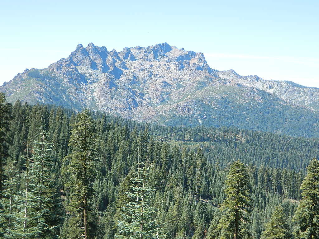
Kaiser Pass Road
Sierra National Forest
2020 wildfire: CREEK FIRE has burnt the majority of this wilderness, roads, trails, lake shores and most campgrounds
Central Sierra Nevada Mountains/ Kaiser Pass & Kaiser Peak / Highway 168
One of the best cell phone coverage areas for any California Wilderness location, this central Sierra region is located south of Yosemite National Park and known primarily for Shaver Lake.
California Hwy 168, along with Dinkey Creek Road (southward) and Kaiser Pass Road (northward) leads off in all splintered directions to secluded campsites, rivers, creeks, lakes, developed campgrounds and amazing forest scenery. Off road trails and hiking trails, everywhere back here! But it is best to have several good maps for cross reference.
Dusy Ershim Trail 4×4 travels past Kaiser Peak and the cell phone towers. Several primitive camp sites with views on ridge. Numerous developed NFS Campgrounds out this way along Kaiser Pass Road.
Trailheads for horseback, hiking, backpackers, mountaineers, rock climbers. Snowmobiles love this amazing route when the snow is deep; some west coast winters can be better than others. Know before you go!
Kaiser Wilderness are granite mountain peaks, near Huntington Lake & the China Peak ski resort, formerly called Sierra Summit Ski; One lane narrow backcountry paved roads: Kaiser Pass Road 80 (east of Huntington Lake) and Stump Springs Road 5 is West Kaiser (west of Huntington Lake)
Sierra Views in 2002White Fir CampsiteChina Peak Hike w/ Map
Sierra Madre Road Sierra Madre Ridge, San Rafael Wilderness
Los Padres National Forest Forest Road #32S13
off of Cuyama Valley Hwy 166
East of Santa Maria, CA – along Highway 166 (on the south side of the pavement) are several dirt roads that lead up to the main ridge road that access this part of Los Padres National Forest.
backpacking
camping
dirt bike trails
dirt roads
hiking
horse camping
mountain biking
off road routes
petroglyhs
wildflowers
4WD not required, but high clearance is helpful. Open almost all year. Rainy season gate closures (at hwy) during winter months.
Sierra Madre Ridge is forest road #32S13, which parallels Hwy 166 (Cuyama River) for over 50 miles on the Sierra Madre Ridge at approx. 5000 feet elevation.
NOTE: A good stretch of this dirt road is closed to vehicle traffic. Although it connects to Santa Barbara Canyon near Ventucopa, you cannot drive it. Only hike or mountain bike!
NFS Gate locked at the HOG PEN trailhead, and from there you can bike or walk all the way the other end at Santa Barbara Canyon near Cuayama Fire Lookout @ Dick Smith Wilderness
Small campgrounds in the region:
off Highway 166 Miranda Pine Campground (on 32S13 @ 11N03) Bates Canyon Campground (via Cottonwood Canyon Rd) also known as White Oaks Campground Aliso Canyon Campground (via Aliso Canyon Road) not accessible by vehicle, from dirt road 32S13; only by trail
in the backcountry Painted Rock Camp (hike-in) Sycamore Camp (hike-in)
Rock climbing, backpacking, fly fishing creeks, snowmobiling, you name it. No matter what kind of trail you seek in California, we have the maps to get you out there, this weekend. If you seek a week long adventure in the Sierra high country, or a weekend getaway destination you’ve never heard of, or a quick after work hike near your home town, we just might have it listed. And we probably have the waterproof, topographical map too.
DOGS & BIKES on TRAILS:
Dog friendly trails include almost anything within the CA National Forests. Remember that most National Parks & State Parks literally forbid dogs on hiking trails. Mountain bikes can access only certain trails in parks, but in the National Forests nearly every trail or dirt road is up for grabs.
OHV ROUTES:
Motorized vehicles, such as quads, ATVs, dirt bikes, Jeeps & 4x4s must stick to designated routes signed specifically for OHV (off highway vehicle) & you won’t be finding many of those inside National Parks & State Parks, so it’s best to look for BLM or NF lands. Many regular, forest, back roads close in winter due to heavy snow pack & thus become cross country ski, snowshoe or even snowmobiling trails. The best ones can be found in the Sierra Nevada mountains.
And if you ever get bored with “reading” text about trails, you can always search the visual database of amazing Cali scenery over at DanaMite’s flickr site
Gold Lake, Sardine Lake, Upper Sardine, Smith Lake, Packer Lake, Grass Lake, Sand Pond, Goose Lake, Snag Lake, Long Lake, Jamison Lake, Round Lake, Deer Lake, Tamarack Lakes, Young America Lake, Frazier Falls
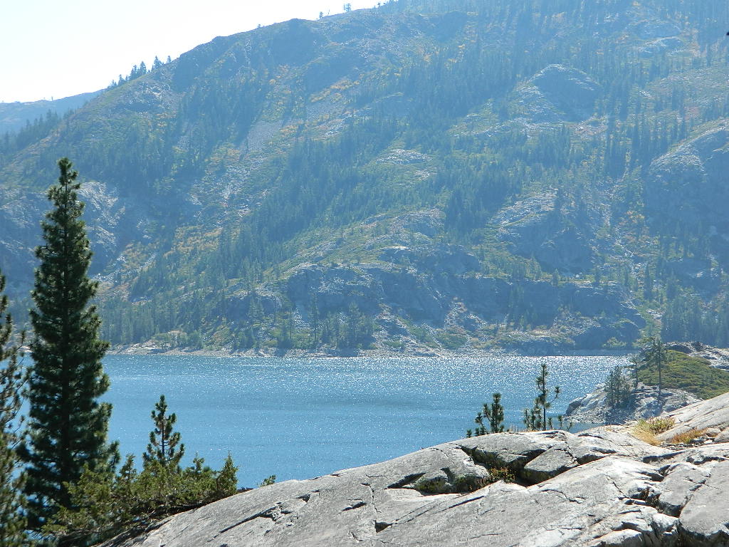
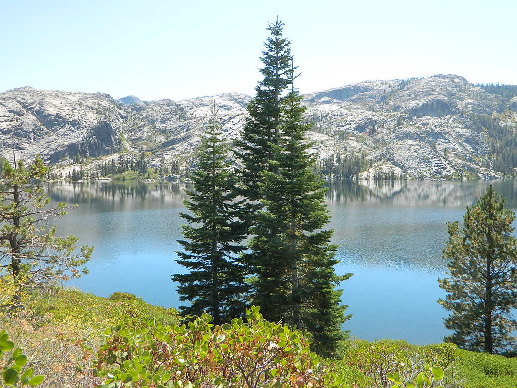
California is the land of granite peaks. Rocky, exposed mountains that stick up out of the landscape for all to see. Southern Cal has a few of them, but most granite peaks in California are found in the Sierra Nevada.
US 395 Eastern Sierra impressive ridge lines are the highest and most photographed and Lake Tahoe has plenty of big granite surrounding it. The farther you go north, the less granite you will see – not because it isn’t there, mostly cuz it is just buried with tall dense forests.
lakes basin day hikers
NORTH SIERRA – The Sierra Buttes are the impressive granite peaks located in between the North fork of Yuba River and Sardine Lake.
SE of Mount Lassen and NW of Lake Tahoe, at the tippy top of the historic gold country. Gold Lake Road #24 connects Gold Country Highway 49 to North of Tahoe Highway 89. Road #24 is often closed for winter snow, so most visitors enjoy this region in the summer months.
The infamous PCT (aka. Pacific Crest Trail) passes the peak and goes north through this basin of alpine lakes, so backpackers are often seen. Tent camping is very popular, as well as RV camping w/ numerous developed campgrounds and open camping as well. Some of the hard to reach primitive camp sites (next to lakes) can be accessed via 4×4 vehicle. Gotta have a good topo map.
Downieville is well known for the mountain biking trails, so this whole region is covered with amazing trails. Snowmobilers and cross country skiers love the area during a good winter snow and they can access this area from the north off Hwy 89.
Small campgrounds and secluded camps, accessible by dirt bikes or 4-wheel drive vehicles. Numerous dirt roads, sand dunes and canyons to explore, some with developed campgrounds, other areas w/ primitive camping. Self sufficient campers will enjoy this list.
4×4 camping in California
Okay, you got your 4 wheel drive vehicle dirty, it is now several years old & maybe you even have a scratch or two. Now is the time to finally start using that beast for real off road adventures. The real edge-of-wilderness trips you dream about when your sitting in your cubical wondering what life is really about. Fishing, camping, off roading and enjoying nature, of course!
4×4 camping in California is plentiful. California has trails for OHV use – which means ‘off highway vehicle’, that can accommodate your machine. These remote camps are always primitive camp sites, with picnic tables, fire rings & maybe a pit toilet (if you are lucky). You can find total seclusion on these back roads & trails, well away from the developed campgrounds & RV parks.
Anza Borrego Desert 4×4 Trails – pretty much everywhere in Borrego desert is off road heaven. Minimal pavement and maximum desert means dirt roads galore, white sandy washes, slot canyons, badlands, wind caves, wildflowers, petroglyphs, boulder outcroppings, old railroad trestles and so much more. The San Diego desert elevations range from near sea level to 4000′ on the eastern slopes of Laguna Mountain.
San Bernardino National Forest – has a few trail camps for 4×4 enthusiasts. John Bull Trail (near Holcomb Valley) has one real awesome camp spot with great views over the desert night lights. Holcomb Creek Trail also has a few spots near the creek. Overall this area is somewhat crowded for wheelin’ (especially on the weekends), as the population is so dense nearby.
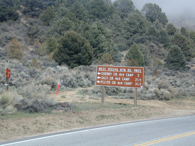
Los Padres National Forest – the most 4×4 camping, readily accessible to Southern California. This is truly the best kept secret for Angelinos wanting an escape. The southern portion of the forests has Tecuya Ridge #9N22, with several camps only minutes from I-5. Cherry Creek 4×4 Camp, with a few other campsites tucked way back in there. Dome Springs Campground is located off Lockwood Valley Road, while Nettle Springs Campground is over near Highway 33.
Out west, Cerro Noroeste Road has the Blue Ridge w/ Marion and Caballo Camps. Red dirt high desert wash Quatal Canyon #9N09, is right next to the Chumash Wilderness.
2 OHV parks in the Los Padres Area: Hungry Valley & Ballinger both serve the off road crowds and have ample facilities, large camp spots to accommodate RVs and trailers.
The northern section of Los Padres (near Big Sur) has plenty of dirt roads & primitive camps, but none are truly 4×4 routes, as most can be accessed easily with a passenger car. See more on Big Sur Camping and Big Sur BackRoads.
Sequoia National Forest– Southern Sierra Nevada area has 4×4 camping right along the Kern River @ Keyesville, at the junction where Hwy 178 meets Hwy 155. Also, further up the river, Forest Rd#22S82 leads to primitive Camp 4, where there are several spots near granite pools, that can only be accessed by 4 wheel drive. The Big Meadows area also has some gorgeous forested back roads worth exploring. Kern Plateau has hundreds of miles of OHV trails near Troy Meadow.
High elevation Monache Meadows is a prime fishing & hiking destination on the south fork of the Kern River, accessed by an authentic “Jeep Road”.
Sierra National Forest– central Sierra forest has plenty of 4×4 routes that lead to granite rock gardens & mighty fine, secluded, forested camp sites. Gorgeous Red Lake & Coyote Lake are popular spots that require some technical skills & much patience to access. Both are frequented by fishermen & horses. Bald Mountain trailhead has awesome creekside camps on Rock Creek. Up near Wishon Reservoir is the dead end trail of Spanish Lake. Onion Springs Meadow is awesome back behind Edison Lake. Near the granite wonderland Courtright Reservoir is the infamous Dusy Trail signed #28E34 (aka #7S32, the Dusy Ershim), second only to the Rubicon Trail for high Sierra granite.
Stanislaus National Forest– camping in the Crandall & Niagara Creek OHV section of the forest, right off Hwy 108. Elevations range from 5000′-7000′. Higher up on the other side, Levitt Lake (access road near Levitt Falls) on the east end of the mountain range, east of the Sonora Pass sign.
El Dorado National Forest – has an area called Rock Creek for off roading in the Gold Country. Plus the ever popular Rubicon Trail starts hear (near Georgetown) & leads 20 miles across the High Sierra Nevada granite slabs to Lake Tahoe. Tons of camping back here in the National Forest.
Lakes Basin Recreation Area – Northern Gold County, just above the Yuba River. Gold Lake has many campable lakes. The area sees a lot of snowmobile traffic during winter snows, but warmer months are the time for fishing and camping. Most of the big lakes have small developed campgrounds, some are minimal, or primitive style camp sites on dirt roads without facilities. Maybe a picnic table at most.
Smith Lake is a place that fishermen and 4×4 enthusiasts love. It is small, secluded and kinda hard to find. You’ll need a good topo map of the region. Situated on the border of Tahoe and Plumas National Forest off the Gold Lake Hwy (aka Road #24). The PCT cuts thru this Lakes Basin area w/ Sierra Buttes There are dirt roads and off road trails leading deep into the backcountry from the Packer Lake and Gold Lake areas. Snag Lake is a free camp right on the main road.
Snake Lake Campground has numerous dirt roads and trails leading out to Butterfly Valley. Horse campers use this popular camp spot, so no loud vehicle activity inside the campground. No shooting up the bear locker either!
Milsap Bar is a long, narrow 9 mile dirt road which leads from Bald Rock Road in Berry Creek, down to the Middle fork of the Feather River. NFS Campground on the big river without fees!
China Gulch Road #60, a very long and winding dirt road, leads from Oro-Quincy Highway down to the Little North Fork. Although the NFS Campground is closed due to a landslide (1 mi before camp) there still is primitive camping at the second bridge. Be warned: the campsite at the first bridge is often over run with giant, juicy slugs at night.
Out there east of Quincy, somewhere off the historic, long and winding La Port Road, a few decent 4WD trails thru forest, access ridge lines or the big river below. Great fishing, amazing scenery & very secluded.
(north of La Porte Road)
– Feather River access
@ Cleghorn Bar Campground, 4 campsites (Road #23N24)
@ Stag Point Campground, 5 campsites (Road #22N80Y)
@ Hartman Bar NRT to Dan Beebe Camp (Road 94 to #22N42Y)
(south of La Porte Road)
– Poker Flat Camp near Sawmill Ridge & Table Rock (Road 800)
Sly Creek Reservoir is a super popular NFS Campground with trailheads and dirt roads leading deeper into the forests. The camp area is a favorite amongst the off roaders and dirt bikers that migrate up to the mountains for the weekend, to escape from the heat of the summer in the Sacramento Valley. LGVR is another body of water back in these parts and is more scenic and peaceful than the Sly Creek.
This coastal range is dirt road heaven, graded dirt roads, ridge routes, hiking trails, equestrian trails, big lakes, small lakes, creeks, meadows, forests, wilderness and 4×4 routes. Snow can be the most fun and challenging for the 4WD crews. Mud, snow, some road closures seasonally.
2019 WILDFIRE: Ranch Fire – wiped out most of this area. South of Snow Mountain Wilderness, plenty off road trails leading to peaks and ridge lines. Numerous small campgrounds to choose from, trailheads everywhere, acres and acres of wild mountainous areas, and a lake resort nearby. Lake Pillsbury is kinda the center of all the 4×4 action in Mendo.
Fouts Springs – Numerous NFS Campgrounds catering to the off-road types a portion of the year, but mostly quiet other times.
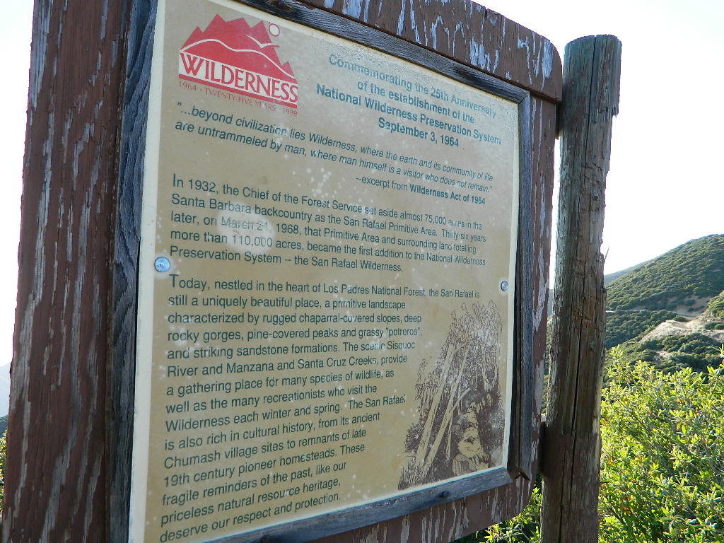
North of Santa Barbara, CA East of Santa Maria, CA South of New Cuyama, CA West of Ventucopa, CA
San Rafael Wilderness is otherwise known as the Santa Barbara backcountry. The Sierra Madre mountains and San Rafael mountains make up the this chunk of wilderness, a vast open space near the coast – which extends from Lake Cachuma to the Cuyama River Valley. This is the southern ridge line along Highway 166, with few pine trees, mostly oaks, leading west to Santa Maria River.
Figueroa Mountain and Lake Cachuma are to the south near Santa Barbara. Vineyards and wineries skirt the western hills of Santa Maria, cattle grazing, oil fields and agriculture line the northern borders near Cuyama Valley. Dick Smith Wilderness is just to the east a little bit, spanning over toward Hwy 33.
OHV: better known as off-roading and dirt biking is common in the foothills behind Santa Barbara, as well as on the west side of the San Rafael Wilderness, near Miranda Pine and Tepusquet Road. Numerous small campgrounds on dirt roads are positioned around the perimeter, but no OHV trails lead into the wilderness areas.
Native American petroglyphs can be found in this remote region of Central California, but may require topographic skills, detective work, trekking and at least a full day of physical action.
Access to ”Painted Rock” on Sierra Madre ridge is hike/bike in only. The dirt road that access these trailheads are rough road and not maintained. High clearance may be needed. This day trip is an all-day adventure and you might want to consider bringing the mountain bike. Just stay on the road, as rangers will ticket for riding in the designated Wilderness Areas.
from the west – If you plan to visit the rock art from the west side, take Cottonwood Canyon (small sign) turn off of Hwy 166. Pay attention to private property signs, cuz the locals are serious about their lands. Keep on driving up the mountain. Above Bates Canyon Campground up on the ridge, turn left, east on dirt road #32S13 – proceed several miles to the dirt parking area at the pig pen w/ locked gated and signed trailhead.
from the east – dirt road hike is about 10 miles (one way) and it starts at the Santa Barbara Canyon trailhead @ locked gated. Rural back road access requires a good topo map. Find Cuyama River @ Hwy 166, take the route on west side of bridge. East of New Cuyama, CA
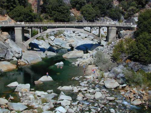
Yuba county, city and river are located in the upper Sierra Nevada, north Gold Country. Only a few small towns around here, but lotsa National Forest land and gorgeous granite rock. Yuba City is well known for its orchards, agriculture and diverse population. Yuba River is a recreation hot spot most of the year – spanning from the foothill canyons up to higher elevation alpine lakes. Camping, kayaking, fishing, camping, hiking, swimming holes & waterfalls.
Most of us want to dunk ourselves in a cool mountain stream when the temperatures get beyond 100 degrees, which is summer months in Central California. Big rivers, like the Yuba are popular spots for all kinds of outdoor recreation and they really draw the crowds. Find your own piece of solitude by getting a good topo map of the region and exploring well away from the main road.
This Yuba River gold country region of the Sierra Nevada mountains, is only about an hour drive up the hill from Sacramento; obviously, the further you drive the better it gets. Tons of one lane and dirt roads to explore. Fishing and camping almost everywhere.
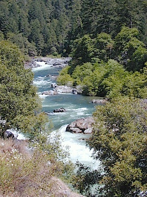
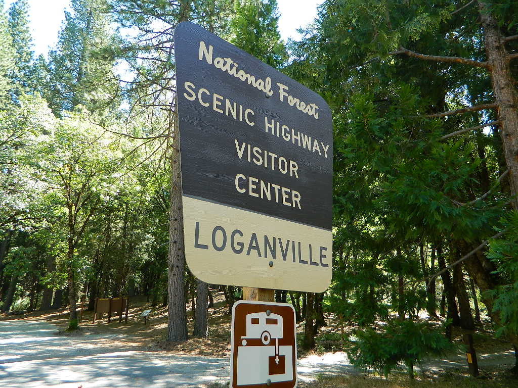
Several NFS Campgrounds, line the North Yuba River right along the Highway 49, between Bassetts and North San Juan, CA
Wild Plum Campground
Loganville Campground
Union Flat Campground
Cannon Point Campground
Ramshorn Campground
Rock Rest Campground
Indian Valley Campground
Fiddle Creek Campground
MIDDLE FORK of the YUBA
This water comes from the rugged and remote Henness Pass area. The long, dirt, historic route Road 293 which connects Reno, NV to the old mining camps along Highway 49 @ Camptonville, south of Downieville.
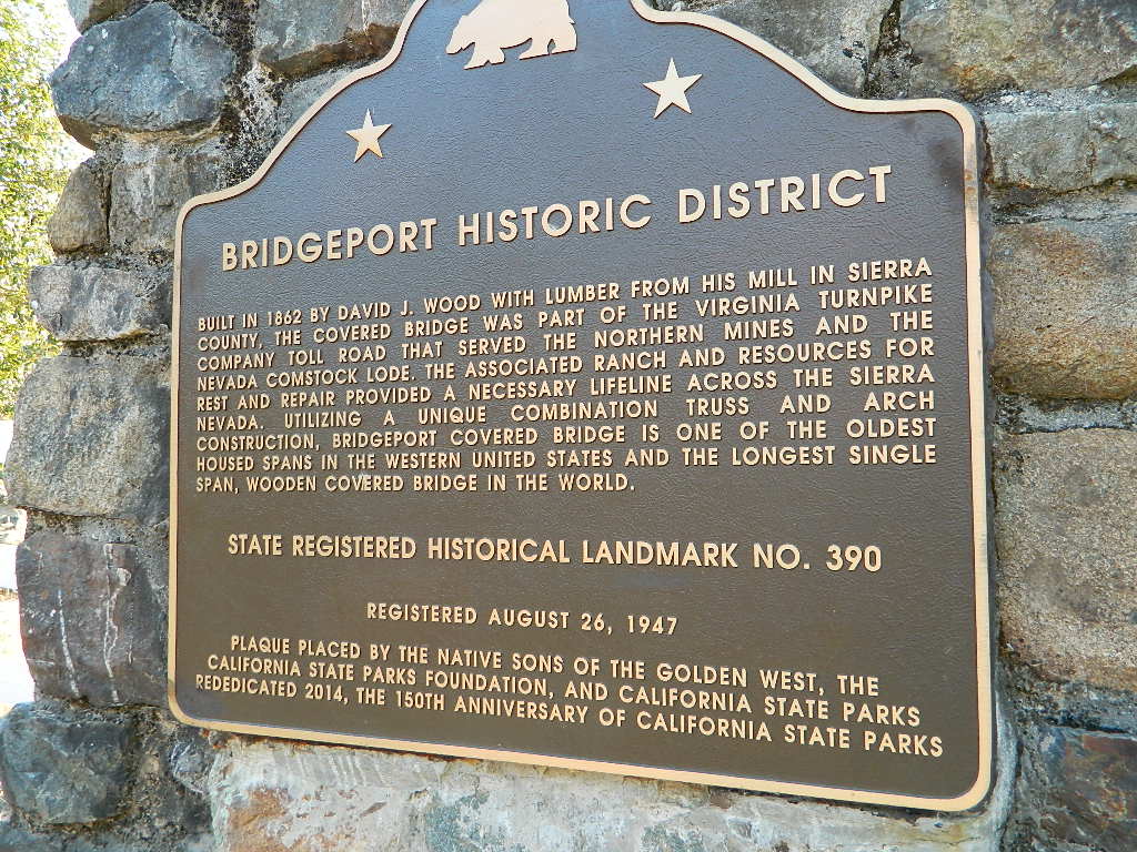
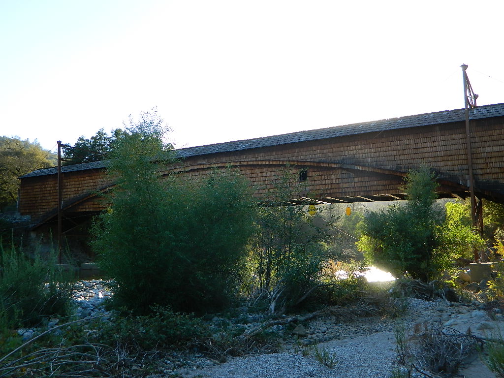
The Oregon covered bridge and the Bridgeport covered bridge run along this fork of the river. There is another State Park down @ Bridgeport; although bridge may be in reconstruction 2020.
A nice place to dip into the this fork of the river – is right off main Highway 49 on Moonshine Road, a secondary road that leads over to Bullards Bar Lake. Minimal parking spots and a steep hike down to the river; and you may have the whole place to yourself (on a weekday morning.)
SOUTH FORK of the YUBA
Donner Pass in the Truckee region, North side of Interstate 80. Snowmelt becomes creeks, around alpine lakes like Spaulding, Bowman, which all flow west. Graniteville & Washington, CA
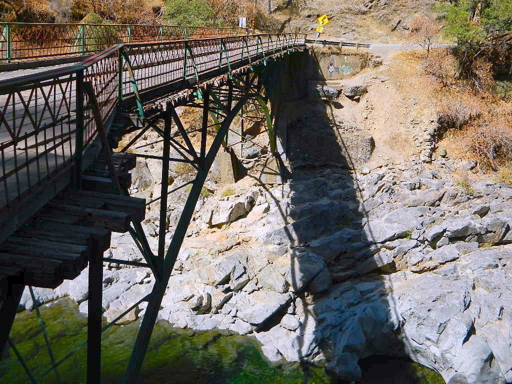
Edwards Crossing from 1898
A very popular State Park for South Yuba is located along Hwy 49, north of Nevada City, CA. Many backpacking trails, mountain biking trails and day hiking trails, plus several old bridges (crossings), built before 1900 still exist and in use. Bureau of Land Management has the quietest and cheapest developed campground around these parts, accessible only by dirt road (North Bloomfield Road).
Few National Forest Campgrounds are located on the South Fork. Many scenic, small lakes exist up in these higher altitudes, where the best camping is. Granite peaks, numerous creeks, forests and gravel roads.
Big Bowman Lake
BEAR RIVER, Lake Faucherie, Sawmill Lake and Bowman Lake are all part of this Yuba watershed, along with about a dozen other lakes. Rugged granite gravel rock rocks will lead deep into these areas. 4WD or high clearance vehicle may be needed to reach these destinations.
The whole region gets buried DEEP feet in snow, so access is usually limited to summer and autumn only.
Tecuya Mountain 4x4camps, Los Padres National Forest
4×4 Camps @ Tecuya:
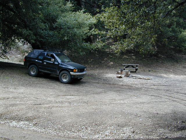
Cherry Creek Camp
Seeking a dark shady hole to spend the night? Then Cherry Creek canyon is choice for a quick overnighter near Frazier Park and the I-5 Tejon Pass. Steep dirt road access will challenge even the biggest skeptic.
free campsite
4WD only access
The 4×4 Camp (signed) turn off is along Cuddy Valley Road, on the north side of the pavement – just a few miles west of Frazier Park, inside Los Padres National Forest.
Oak trees and brush clog the dense hillsides. Owls live in this canyon. Deer and wildlife sightings are common – which makes this an ideal hunters camp for those looking to explore on foot.
The canyon gets narrower as it heads down hill (northward) w/ the single track route becoming a blanket of slick dark mud (in the wet months). Without trees on the worst section, making a self-rescue impossible.
Real 4 wheel drive is needed for this camp! All wheel drive vehciles (SUV & sportwagons) should not attempt this location without a tow strap or winch – AND another 4WD vehicle to help out. Yep, seriously. We know, because we had to rescue someone last time we were here.
Sparse accommodations w/ minimal sunlight reaching this steep canyon
Gold Hill Campground (which is now closed) – right next to Piru Creek.
Frazier Park and neighboring towns, like freeway-close Lebec and Gorman, is where the Los Angeles hills meet the Kern County mountains. Mojave Desert meets to Coastal Range. EXIT I-5 @ Tejon Pass (elev 4144′)
Wildflower hills, seasonal creeks, forested peaks, high desert canyons. Bike trails, hike trails, off road routes. High elevation backpacking, hang gliding, mountain biking and camping in every direction.
Mountain Bikers love the trails at Mount Pinos.
High desert washes, oak creeks, pinyon pine forests, mountain meadows and numerous peaks – Frazier Peak, Reyes Peak, Alamo Mountain, Mount Pinos, Mount Abel (Cerro Noroeste) and north facing San Emigdio ridge.
Many dirt roads are gated seasonally for wet weather or snow. Call rangers to find out which routes are open before you plan your weekend. Or have a plan B and C camp site ready if route is closed. Flashfloods, thunderstorms, and erosion means you may all-of-a-sudden need to use your 4WD. This is the mountains after all. UNpredictable weather is common.
Primitive Camping in Quatal Wash, next to the OHV Route and the Chumash Wilderness
Peak-to-Peak Hike: the toughest climb you’ll do, this decade.
Numerous places called SMITH LAKE exist in the Sierra Nevada.
Lakes Basin Recreation Areahas two different spots named SMITH LAKE. This region is in the Northern Sierra Nevada mountains, near Downieville, at the north end of the California Gold Country @ Highway 49.
Smith Lake hiking trail can be accessed from the Gray Eagle Lodge area along Gold Lake Highway; or this hiking lake can also be accessed from a park on the north side. Plumas Eureka State Park, via the Jameson Creek trail.
Lakes Basin also has a small set of two lakes called “Smith Lakes” – located on Smith Creek. Way back behind the larger, most famous Gold Lake.
4×4 Road #11E71 will lead you to this remote destination, with the proper vehicle, of course. Creek crossings and large rocks; A quality topographic map and a 4 wheel drive rig is needed for this adventure.
Lakes Basin Recreation Area
North Sierra mountains, Sierra granite meets Cascade volcanic rock. Bordering of State Park & 2 National Forests
Snake Lake Campground, located west of Quincy, CA – has a small neighboring lake named Smith Lake. Chances are Smith is covered with lily pads, just like Snake Lake. Smaller Smith is accessible via dirt road only. Many people hike, horseback, mountain bike or dirt-bike back on these narrow dirt roads, so use caution when traveling. Butterfly Valley Botanical Garden is located way back here, if you can find it. A real forest service map is advised.
Lake Davis Loop is a 20 mile circle around the lake. Drive or mountain bike route. Scenic drive on dirt roads, or an easy bike ride. Average ride time 2 hours for biking.
A flat, easy loop around Lake Davis is best in summer months, as snow usually closes this area in winter. The whole route is a mix of paved, dirt and gravel road. There are picnic areas along the way, lake views, bird and wildlife viewing, wildflowers.
Numerous primitive camp sites and secondary dirt roads fork in various directions, off of this main loop. Volcanic ridges line the west side of the lake, dense forest and seclusion can be found all around. Bald eagles fly overhead and wild life is abundant.
boat
camp
fish
hike
mountain bike
stargaze
wildlife
CROCKER GUARD STATION
Crocker Station is for rent and reservations are required. This wooden 2-story home was built in 1912 for Forest Service personnel, and later staffed as a fire station until the 1980s.
Situated at 5700′ elevation, its alpine beauty and cooler temps make it a much sought after, especially in summertime. Located a few miles from the lake and 10 miles northeast of Portola, California. There is a small campground next door called Crocker Campground. A dirt road access to Crocker Meadow is quickest from lake, but the paved route around is longer.
DIRECTIONS:
From California SR 70 (Highway 70) in Portola take West Street approximately 7 miles to the Lake Davis Dam. Park at the information kiosk and get acquainted with maps and the area info.
Drive or bike the lake loop. Travel 1.7 miles west to Forest Service Road 24N10, travel on that for 8.1 miles until you reach the junction with County Road 112. Then turn east and continue around the lake, past the Grizzly Campground a half mile, turn South on Country Road 126 and continue back to the dam.
Golden gems of California, a collection of alpine lakes on the north end of Historic Gold Country, North Yuba River, Northern Sierra Nevada
EAST of Downieville, CA
California’s Gold Lake and surrounding lakes; the granite spires of the Sierra Buttes and the creeks, waterfalls, headwaters of the Yuba River — total wild beauty. Steep, granite, river canyon from Downieville drive east on Highway 49 from Sierra City to Bassetts, a gasoline and market stop; they have a small hotel there too.
Take the left turn, north on to the Gold Lake Highway. The alpine and extremely scenic Lakes Basin Area consist of all small lakes in between Hwy 49 to Hwy 89, along GOLD LAKE HWY [Road S620] some maps read Road #24 or call this Gold Lake “Road” instead of highway. Snow closes in this route during winter months.
Frazier Falls Trail
Length: 1 mile RT / Directions: Trail head is located on Old Gold Lake Road, about 5 miles from the Highway 89/Gold Lake Road intersection. Take the signed, narrow paved access road 4 miles to the trail head.
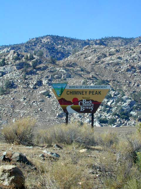
East of Lake Isabella and west of Walker Pass, there is a small community called Canebrake along Highway 178 Canebrake Road, a graded dirt road climbs up into pinyon pine forests. Lamont Peak (aka Lamont Pinnacles) is a decent hike & rock climbers dig it too.
Chimney Creek Campground is along the main road and has RV access (28′ max), for the motorhomes who do not mind a little dirt road driving. Easy trail access to numerous area hikes. The PCT is routed close by.
Long Valley Campground is tucked way back in the boonies with trailhead leading into the granite Dome Lands; Fishing and river access to the South Fork of the Kern.
Long Valley Loop Road (2001)
Long Valley Loop Road circles the Chimney Peak Wilderness, which skirts the Domeland Wilderness. THE LOOP is washed out and ROAD is NOW CLOSED in one portion. See BLM web site for up to date info.
If you are thinking about fishing or camping the Eastern Sierra, North of Bishop & you are not up for the crowds at Mammoth or June Lakes, then try the Bridgeport area, north on Hwy 395. Rural ranch lands along main road, Bodie ghost town turn off across the highway and Virginia Creek Settlement are also nearby
Green Creek is a 11 mile long dirt road in the lush Eastern Sierra the northern portion. The wide, graded dirt road is signed and dead ends at a Toiyabe National Forest campground called Green Creek Campground. The drive up can be washboard bumpy in some parts, but that doesn’t stop the hundreds of adventurous motorhomes that make this trek annually. This place features some of the best prime Sierra back roads camping options for RVs.
Another dirt route, Dunderberg Meadow Road peels off to the left. Dunderberg departs off Green Creek a couple of miles from the highway and well maintained. This route leads to meadows, aspens, picture perfect scenery and much more seclusion. Passenger car accessible, wide graded dirt roads to wilderness edges. Two-track one lane trails lead to meadow edges and more creeks. Very impressive views of the Sierra peaks over here on this side. Meadows are sensitive areas, wonderful for picnics and you should always minimize impact.
Plain old passenger cars can easily make this route deep into the Eastern Sierra aspen canyon. Graded dirt and4x4 could be needed winter months. Backpackers can enjoy easy access to the Hoover Wilderness trailheads. There is plenty semi-primitive camping spots along the way, right on the creek, for free…. so no need to sleep in your vehicle upon arrival.
Autumn Aspen Groves: fall colors peak in October, which is usually when the first snows for the winter season start. November – usually the freeze gets them and lifeless brown leaves dangle, until the Sierra Nevada wind gust blow real good.
Green Creek Camping
DIRT ROAD CAMPING
alpine lakes
backpacking
car camping
day hikes
fishing camping
meadows
RV camping
tent camping
Dispersed, primitive camp spots along this main dirt road are on a first come basis. You’ll need a fire permit. Many flat camps are set along the creek in aspen groves, some pines, others have cubby hole privacy. Large granite valley, big creek, bird, scenery and nature everywhere. Some folks spend weeks camping out here in the warm weather months. Fishing is a big attraction.
Old Cabin in autumn leaves, up near the top of the dirt road deep in the aspen groves
Dirt roads, backroads, desert trails, OHV routes, single tracks, dunes, fire roads, gravel roads, 4×4 roads
When you wanna explore a new area, California has plenty of public land to offer. Off Road Maps can get you away from the crowds & the main staging areas. Maps can show you prime areas to ride & camp that you may not have ever imagined. Secluded, wide open, or freeway close. Terrain – the endless deserts, the mountain foothills, the higher hills , way above the city. The choice is yours.
Whether you seek secluded stream side camp sites, with some fishing or a dusty, long, desert trail that spans the entire Mojave desert, you can find these secret spots with good old fashioned topographic maps. Hard copies! The real deal. No cell signal? No problem.
4×4 Panamint Valley has numerous canyons & ridges to conquer
The most trusted full-state book-atlas that Total Escape recommends. When you must have a (hard copy) map for local road trips – Benchmark Atlas is the best one by far.
NFS, USDA
Forest Atlas: National Forest Topo Atlas
Spiral bound book of all topographic quads, of select National Forests in California.
Awesome California locations w/ off-road trails nearby. DanaMite has compiled a list of first-hand knowledge information, links, photos, campsites, maps, all revolving around rural California. Check out the ever growing list and get ready to explore the back roads, like never before.
OHV area, motor vehicle use, 4×4 camps, dirt trails, forest routes; Download maps for various off-roading areas in California.
What the heck is it ???
4WD = 4 wheel drive
4×4 = (same as above)
2WD = 2 wheel drive
4×2 = (same as above)
AWD = All wheel drive
SUV = Sport Utility Vehicle
MTB = Mountain Bike
MX = Motocross (dirt bike motorcycle)
SNOMO = Snow Mobile (sled machine)
GAS-POWERED RECREATION: The past two decades have emerged with vehicle redesigns from well known brands, creating a number of new “utility vehicles” for the sport of off-roading (otherwise known as, burning gasoline while recreating in the outdoors). Here is a breakdown on the acronyms, but they all basically refer to much of the same “off road type vehicles”.
ATV = All Terrain Vehicle (quad)
MOHUV = Multipurpose Off-Highway Utility Vehicle
ROPS = Roll Over Protection System
ROV = Recreational Off-Highway Vehicle
RUV = Recreational Utility Vehicle
SxS = Side by Side Vehicle (2 seated)
SSV = (same as above)
UTV = Utility Task Vehicle
Common abbreviations for off-road on public lands:
OHV – Off Highway Vehicle SVRA – State Vehicular Recreation Areas BLM – Bureau of Land Management NFS – National Forest (USDA) MVUM – motor vehicle use map (NFS)
PVT – private land / keep out
MTR – motorized
RD – road
CO – county
RTE – route
SR – state route
FR – forest route / road
EXT – exit
CK – creek
EL – elevation
MT – mountain
STA – station (ranger/fire station)
PO – post office
Around 2012 the National Forest Service printed up a bunch of nice off-road maps for various popular regions of California. Oddly, they told me not to sell them and I never heard anything about them again after that. Not even sure if these above are available to the public, but if you dig around you might find ’em. Call the rangers, they might know.
If interested, you could call the ranger station and ask about any local off-road maps, and availability. Mostly they have freebie one page print-outs, black & white — to keep the crowds where they want them. Other times they might have real color, printed maps for sale at the station. Maps that can get you deeper into the terrain, with wild edges of reality nearby. 4×4 maps, OHV map, MVUM
BLM Maps (Bureau of Land Management)
Government agency that manages large amounts of California land. Public lands that do not fall into the National Forest or National Park or State Park realm. BLM oversees some mountain areas, river canyons and primarily, desert regions within California. Visit a local BLM office to see the selection of area maps.
Turtle Mountain Road
Decent & FREE: dirt road maps can be found at BLM ranger station, south of NEEDLES, on US Hwy 95. Explore Turtle Mountain and find free camping IN ROUTE; Eastern California Desert.
An avenue made of dirt, earthen highways, dirt trails, forest roads, fire roads, jeep road, graded roads. Dirt driving trails that lead into the middle of nowhere. No stop signs, no billboards, no stores, no one else around… for miles. Enjoy less crowds and more open space.
If you are fed up with city life, sitting in traffic & need to vacate your mind among the barren hills of California (if only for a weekend), then Total Escape is your place. You seek solitude, peace, maybe a mini tailgate party & BBQ on a dry lake bed, with the heavenly stars above. Imagine the warm camp fire light reflecting off the high canyon walls, your music echoing, moonlight hikes for a few miles.
California has some awesome spots to drive on dirt, get way back in nature. Right up to the edge of the Wilderness boundary. That’s what this one silly “dirt street” page is all about… helping you get out there, the easiest & best way possible. We even got you the right maps!
Most of this is just dirt road driving, graded, some hills, easy stuff. But on occasion you might come across a 4×4 required sign – or perhaps a triple black diamond trail. Having several good maps on hand will help you enjoy these roads, instead of stressing & wondering if there is a lock gate at the other end – 18 miles in.
Some dirt streets lead to campgrounds, some to waterfalls, some to viewpoints, some have loop options & others are just dead end; sometimes at old mines. Get ready to explore with your truck or SUV. 2WD or low clearance vehicles (such as passenger cars) should be ready to turn back if the road get too nasty. Any decent precipitation can make any unpaved road much worse & may require 4 wheel drive, so have a plan B or C as a backup idea.
lake camp, hike, mountain bike, off-road, ski, snowmobile
Tahoe Trail Maps / Tahoe National Forest
Numerous State Parks dot the shoreline at Tahoe, while the National Forest lands and Wilderness Areas span most of the peaks above. Camping, backpacking, boating, kayaking, fishing, climbing, mountaineering, mountain biking, snow skiing, snowmobiling are all popular recreation in this Sierra region. US Highway 50 and Interstate 80 are the main western access routes to Lake Tahoe. US Hwy 395 leads to Tahoe, up from the Eastern Sierra and Southern California.
Wanna find every waterfall or every creek to fish? This is the place that will help you find them. Easily, with good old fashion printed maps. Hard copies, some waterproof & tear resistant, most with topographical data and all roads, trails, campgrounds and parks. Whether or not you water ski or cross country ski, these maps will save your ass – when you are way back there in the boonies.
Tahoe’s Rubicon Trail connects the historic Gold Country to the alpine lake via granite wilderness sky ways above 7000′ elevation, but a real 4×4 and overnights are required. The back roads and trails are endless in these parts of the Central Sierra Nevada mountains.
San Diego Backcountry
600,000 acres of SoCal desert
BLOOM: mid-March thru May Anza Park elevations range from low to high. Lowest near eastern border (next to the Salton Sea) to the upper reaches of the western slopes @ 4000′. Wide, deep, sandy, long desert washes, native petroglphs, wind caves, slot canyons and split mountain. This uncrowded state park has the most acreages than all of the parks.
OPEN CAMPING
Camp in a developed campground, a small back country site or camp primitive on nearly any dirt road. Car camping to 4×4, this park has lots to offer folks wishing to really escape. No ground fires allowed, so bring your metal campfire bucket and large trash bag to carry out your ashes. The last thing you want is to scar these pristine white desert washes.
DESERT WILDFLOWERS
Steep rocky canyons on the Laguna mountain foothills can be challenging terrain, so bring good, sturdy hiking boots. Wildflowers can be abundant on certain years. Lower elevations sprout up first; Higher elevations along County Rd S-2 & S-22 bloom later in Spring. By June 1st most of the color is gone in and around Borrego Springs, so this is a real Winter and Spring vacation kinda spot. California desert wildflowers include primrose, barrel cactus, prickly pear, monkey flower, ocotillo & many more.
This is the largest State Park in California and “open car camping” is allowed on the back roads. (also referred to as primitive camping, free camping or 4×4 camping) One of the few places in Southern California that you can camp outside of a developed Campground and still have a campfire. You gotta bring a large metal bucket to have your campfire in – as ashes scar white sandy washes and ground fires are not allowed.


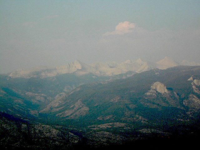
 Fouts Springs California
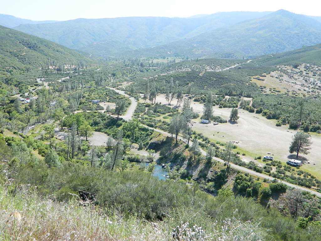


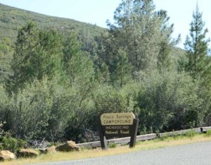

 Fouts campgrounds are located on the EAST SIDE of Mendo NF on paved road M10. Situated below 2000′ elevation and open year round.
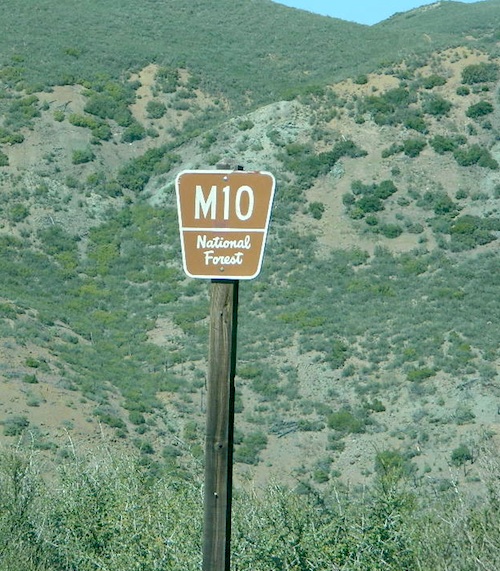
 Mendocino National Forest


 nearby destinations:
 Motorized vehicles, such as quads, ATVs, dirt bikes, Jeeps & 4x4s must stick to designated routes signed specifically for OHV (off highway vehicle) & you won’t be finding many of those inside National Parks & State Parks, so it’s best to look for BLM or NF lands. Many regular, forest, back roads close in winter due to heavy snow pack & thus become cross country ski, snowshoe or even snowmobiling trails. The best ones can be found in the Sierra Nevada mountains.


 North of Santa Barbara, CA
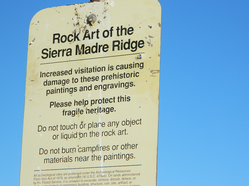


 If you are fed up with city life, sitting in traffic & need to vacate your mind among the barren hills of California (if only for a weekend), then Total Escape is your place. You seek solitude, peace, maybe a mini tailgate party & BBQ on a dry lake bed, with the heavenly stars above. Imagine the warm camp fire light reflecting off the high canyon walls, your music echoing, moonlight hikes for a few miles.
 or C as a backup idea.


