Tag Archives: swipe

Childs Meadow

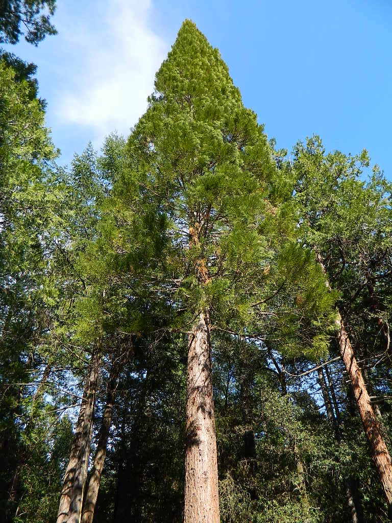
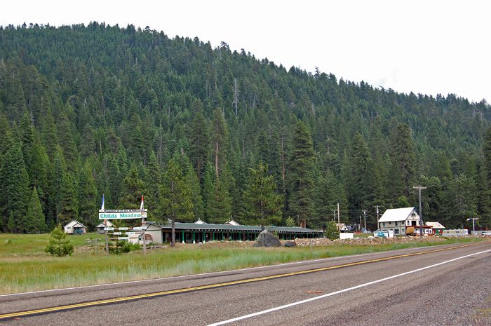
Childs Meadows @ Lassen Forest

on the Lassen National Forest map this huge meadow area along Highway 36 is marked as “Childs Meadows”

morgan mtn burnt
Morgan Mountain above Childs Meadow after the fire 2021

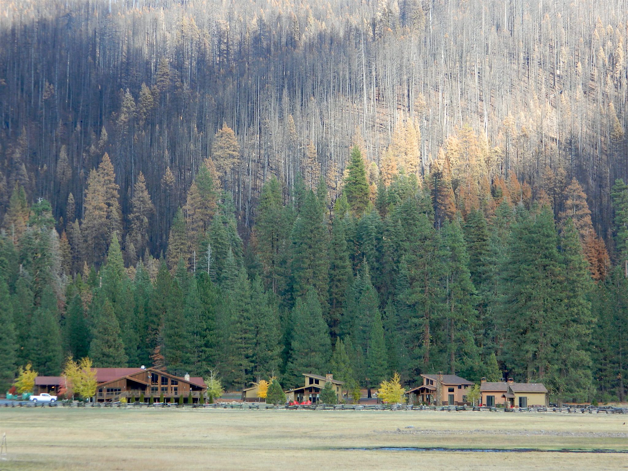
Childs Meadow sits at 5000 feet in elevation, on the edge of the Mill Creek drainage, just south of Lassen National Park. The meadow spans from Mill Creek, eastward along State Route 36 for many miles. Gurnsey Creek flows down Wild Cattle Mountain, near the resort, crosses the pavement, and heads east to meet up with the Deer Creek drainage above Chico, California

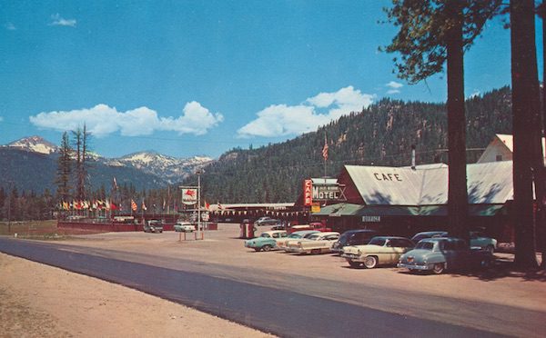
This sacred meadow was the summer camp and ceremonial ground for native tribes that existed long before the white men showed up. The meadow basin was originally owned by J.C. Tyler who used it for summer grazing land. He established a resort about 1864 and by 1896 it was a regular stage stop for travelers.

In 1900, Tyler sold the land to Abner Nanny who used it for summer grazing. Frank Childs purchased it in 1909 and also grazed livestock there seasonally. By the late 1930s a service station and cafe had been established. Then came cabins that were the precursor of the privately owned Childs Meadow Resort, which burned down some time later. These days Highlands Ranch Resort is the newest place to call this location home.

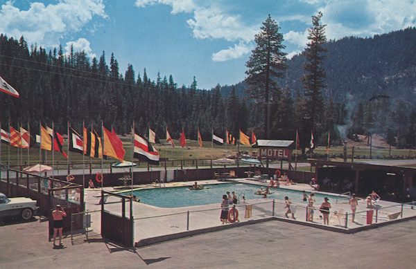
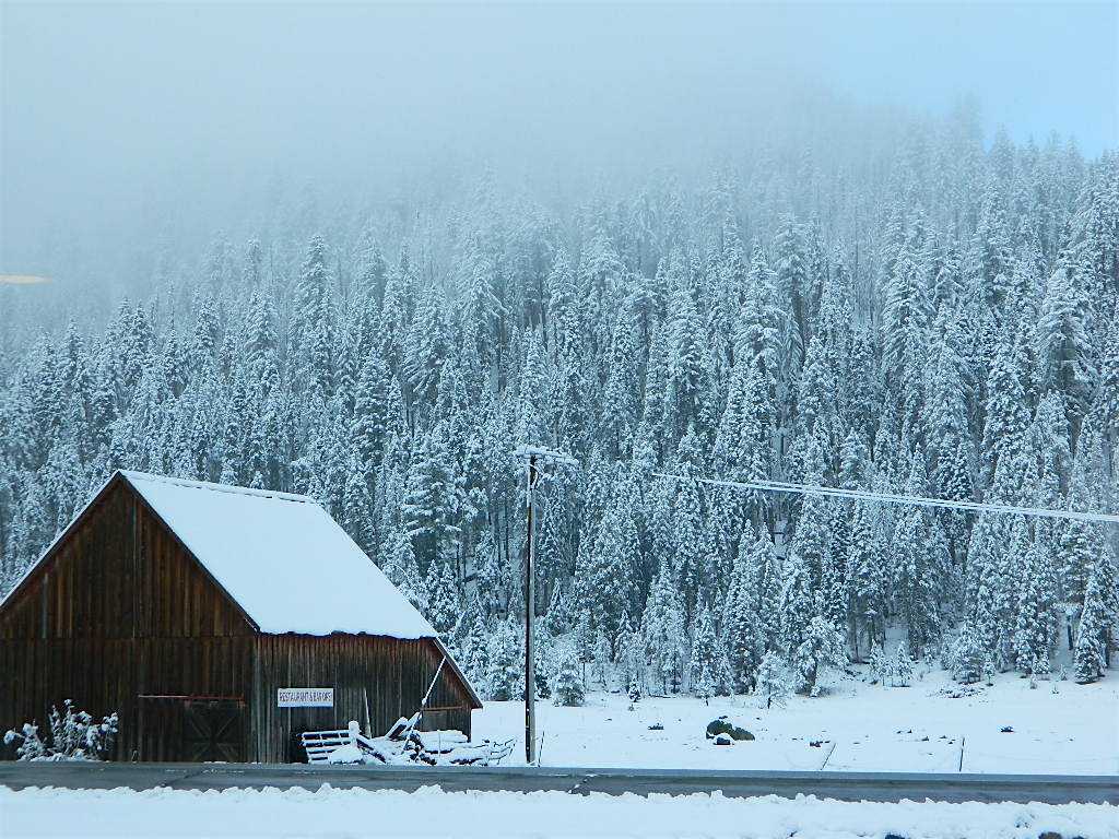
Lassen: Childs Meadow (before the fire)

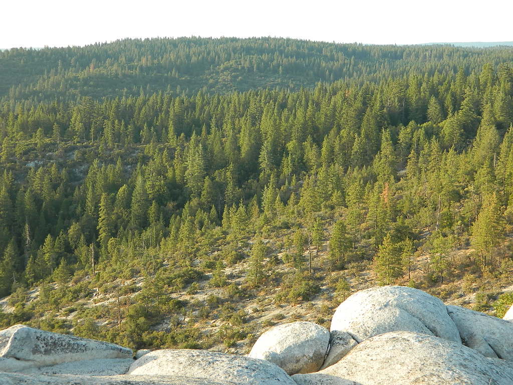
July 2011 vs. July 2021

lassenmeadows2011

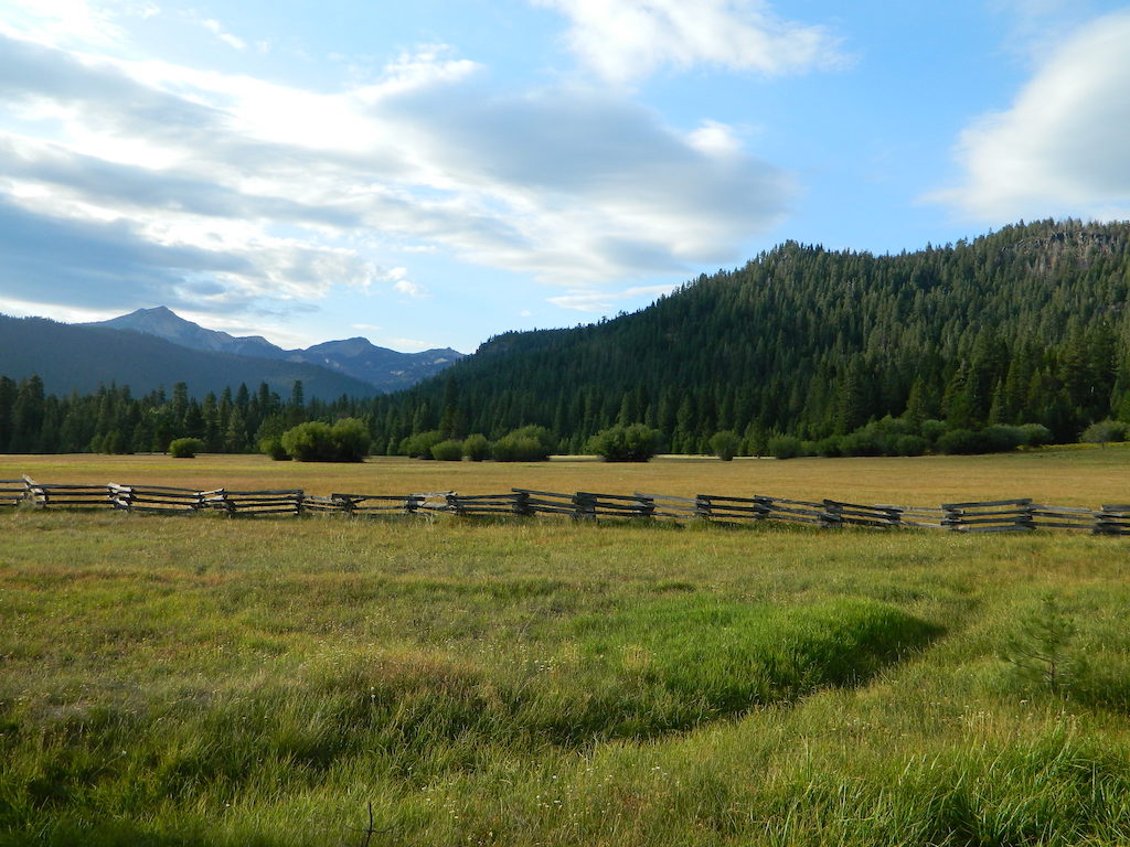
What a difference a decade makes. Drought in California makes a green meadow brown!

Childs Meadow 2010
Childs Meadow Resort in 2010

NEW Highlands Ranch Resort @ Lassen

NEW Highlands Ranch Resort @ Lassen
Upscale Highlands Ranch Resort – Bar, Restaurant & Cottages

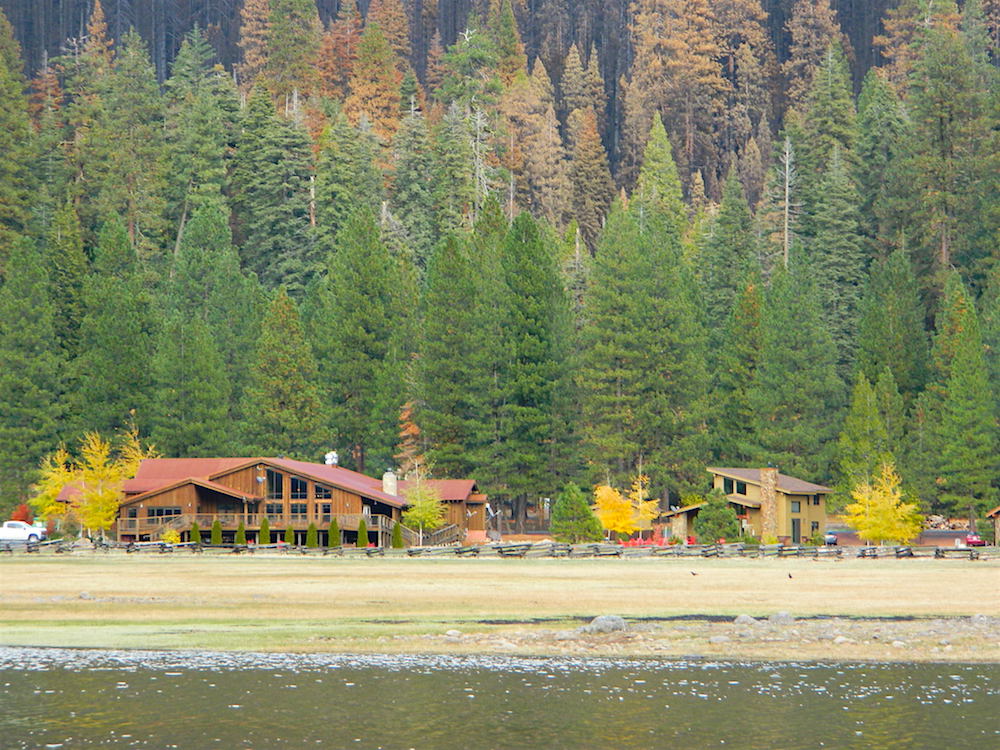
RENOVATED (2017) across the street
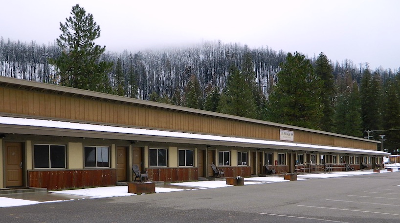
Village Inn at Highlands Ranch

Village Inn Childs Meadow Lassen
Village Inn @ Childs Meadow, South Lassen

mountains

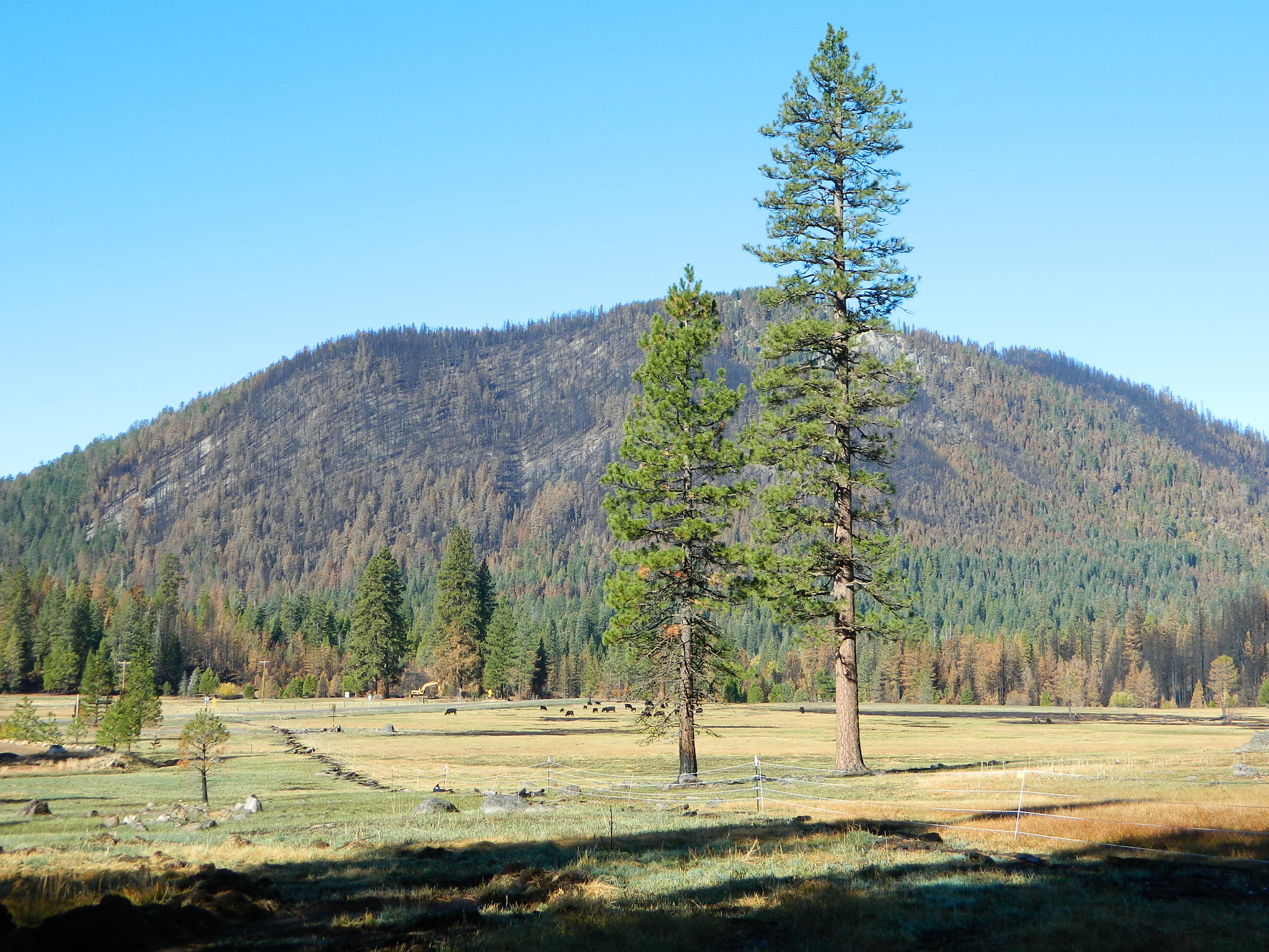
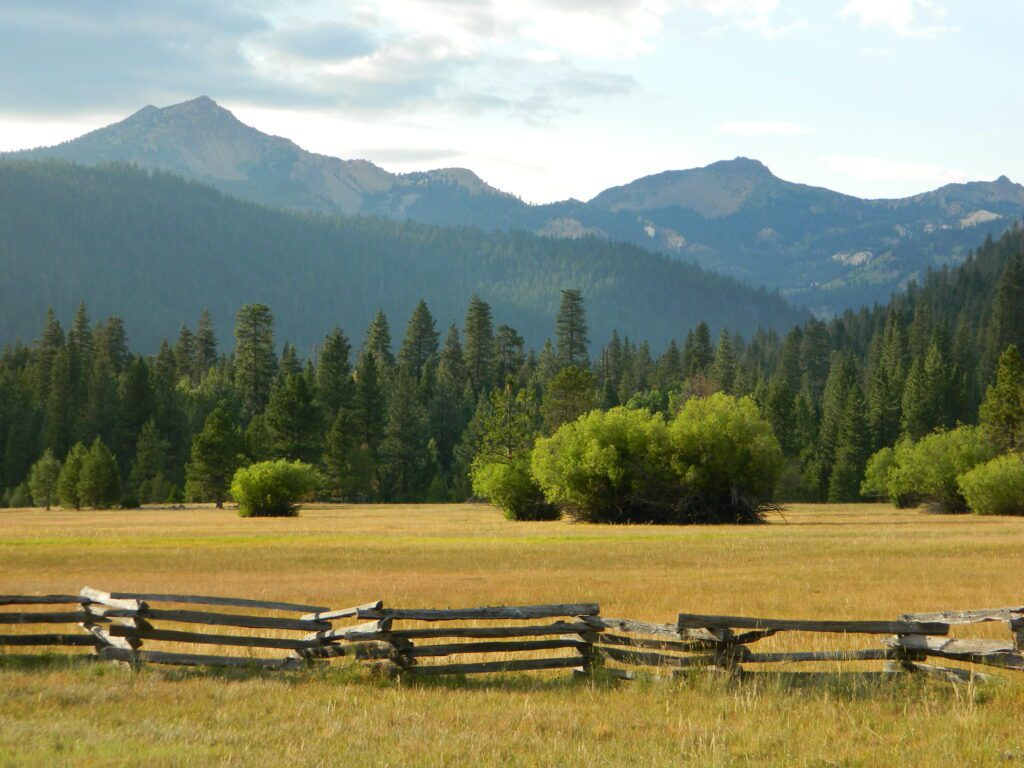
MOUNT LASSEN MEADOWS
Lassen Peak @ 10,457 feet has the highest known winter snowfall amounts in California. There is an average annual snowfall of 660 inches, and in some years, more than 1,000 inches of snow falls at its base elevation of 8,250 feet.

childs meadows

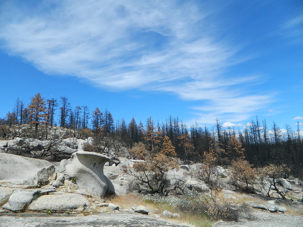
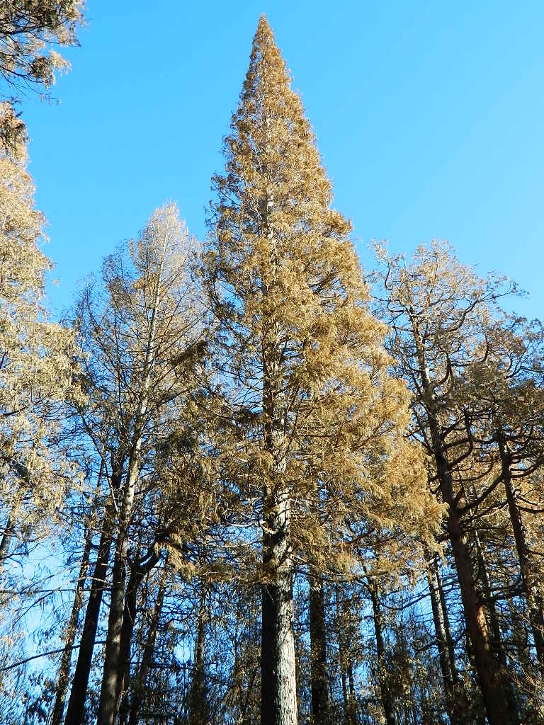
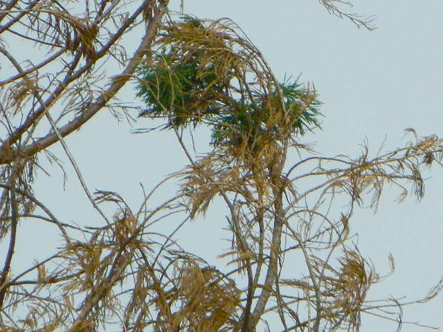
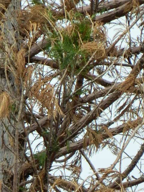
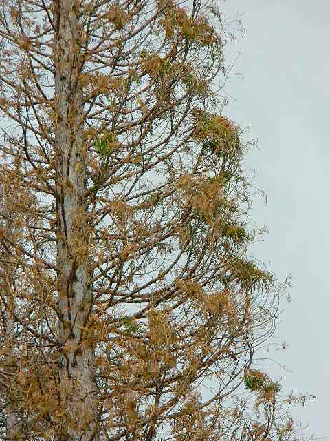
and a month later (after I start this post)…
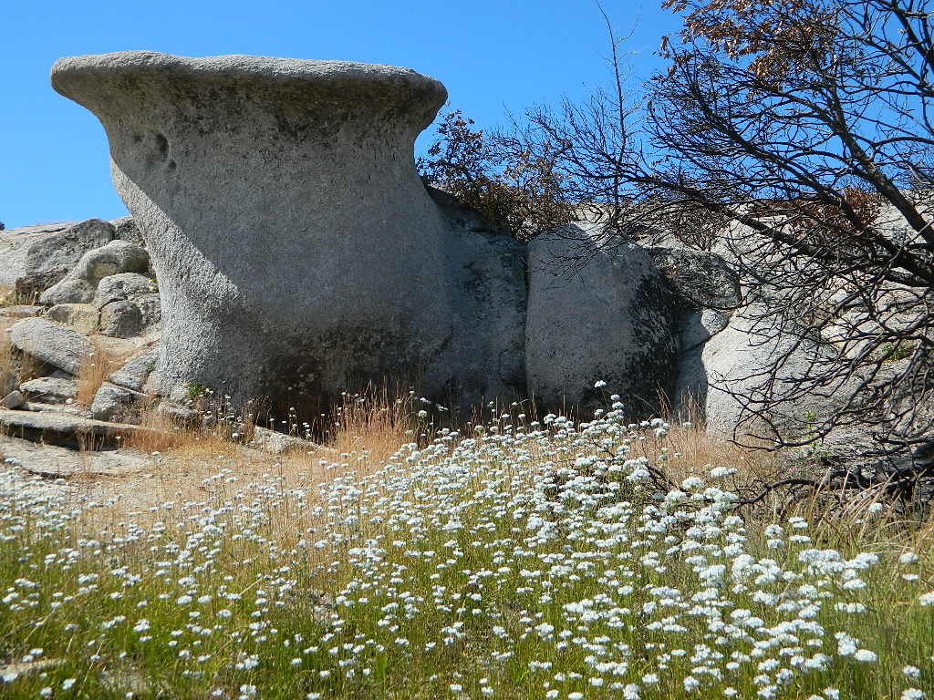
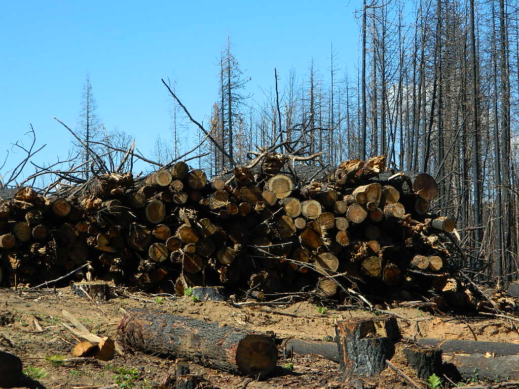
AUG 2021 the DIXIE FIRE

Burnt Above
Highlands Ranch Resort with Dixie Fire burn scar on ridge above 2021
October Snow Barn
Historic Barn – early snow in October 2021

2007 – Nature Conservancy Buys Childs Meadow
times-standard.com/2007/10/20/the-nature-conservancy-buys-childs-meadow/

cafe and motel
Cafe and Motel (1950s postcard )

As for the spelling on the name:
Childs Meadows is commonly seen on USFS maps, and found inside a book called Tehama County Place Names.
Most locals know it as Childs Meadow, but it also seen spelled with an apostrophe s – Child’s Meadow

Swimming Pool at Childs
Swimming Pool at Childs Meadow Resort (1950s postcard)

Top O Zink

Before and After

SWIPE photo of the
Top of Zink Road
#BearFire 2020

topofzinkroadBear Fire Zink Road

off of Bald Rock Road
Berry Creek, California

Butte County

Zink Trail 21N78

Plumas National Forest
Trail #21N78

Before and After Photo

Straw Swipe

21N78before21N78after

Trailhead at Top of Zink Road in Berry Creek, California
This route is Straw Rd on GoogleMaps

In summer 2017 this trail from Zink saddle to the Big Bald Rock was so dense and overgrown that I only made it half a mile, before I quit and turned back.

SEPT 8, 2020 #BearFire cleared it all in one night.

21N78straw

Decimated Plumas Forest

Plumas Forest View
from the top of Bald Rock

Before and After Photo

Forest Swipe

Burnt Forest

We used to have such a beautiful, lush and diverse forest in the Northern Sierra Nevada, but all that has changed with recent wildfires that have scorched millions of acres of National Forest land in the past few years.

Survivor

An unbelievable amount of destruction has taken place with losses in wildlife, forest ecosystems, personal property, and human lives, as well as buildings of historic value.

Sadly, I find my California landscape photographs are now mere documentation of what beauty once was.


Plumas National ForestNFSlogo

Berry Creek, California


decimated
Decimated forest at Bald Rock

California Areas Affected by Wildfires

Our Sequoia

Before and After Photo

CALIF WILDFIRE:
Bear Fire, North Complex Fire @ Berry Creek, CA

Sequoia Swipe

No this is not Sequoia National Park, nor Giant Sequoia National Monument, although certain historic groves did burn this past summer – inside Mountain Home SF.

This Sequoia here, is the best tree in our front yard.

Some say that older Sequoia trees can withstand fire, but not if the fire burns the crown (tippy top).  Since our tree is young (60+ years old), compared to most Sequoia trees, we’re not too sure if ours will survive. But we have been watering it for months and hoping for a good winter rain w/ snow.

UPDATE DEC 2021

Puff of green started appearing late Spring. However minimal, I still got excited enough to photograph it.

Mostly brown, but green appearing May 2021.
Sequoia Strong
Holding out hope for the Sequoia.

Sequoia toasted

We watered this Sequoia all summer (2021) long and now we have a good rain spell in Autumn heading into Winter, so I am hoping our Sequoia – plus the neighbors 2 Sequoias, can make a serious come back.

SEQUOIA PROGRESS

Will keep posting our growth progress, as soon as I see more green – mid 2022.

No one is sure when these Sequoia trees in the Berry Creek region were established, since these pre-date our knowledge and the county records.

June & Curly may have planted these back in 1950; or maybe Mr. Coe or Sorensen around 1960. Could it have been the Maidu tribe (native Americans) who transplanted seeds from south to north? Doubtful.

califrepublic

Footed Rock

Footed Rock @ Bald Rock
Berry Creek, California

Before and After Photo

Wildfire: Bear Fire / North Complex 2020

The Skinny Lone Cedar hangs on with Footed Rock. Bushes on the right side, had the flames licking at this tiny tree.

Footed Swipe

Berry Creek, CAfooted rock 95916

Many thanks to whoever cut/broke the mistletoe off in recent years. I never seem to hike with my loppers.

Bald Rock California

Footed Rock is a part of the popular Bald Rock hike. summer 2021 CURRENTLY CLOSED hiking trail in Berry Creek, CA

Mushroom Rock
Mushroom Rock @ Bald Rock


Lumber for Market
Lumber for Market, just sitting on the side of the road.

Log Truck Drivers make over $100/hour – yet there is still a job shortage in 2021. Go figure!

mountains

see more swipe photos –