on the Lassen National Forest map this huge meadow area along Highway 36 is marked as “Childs Meadows”
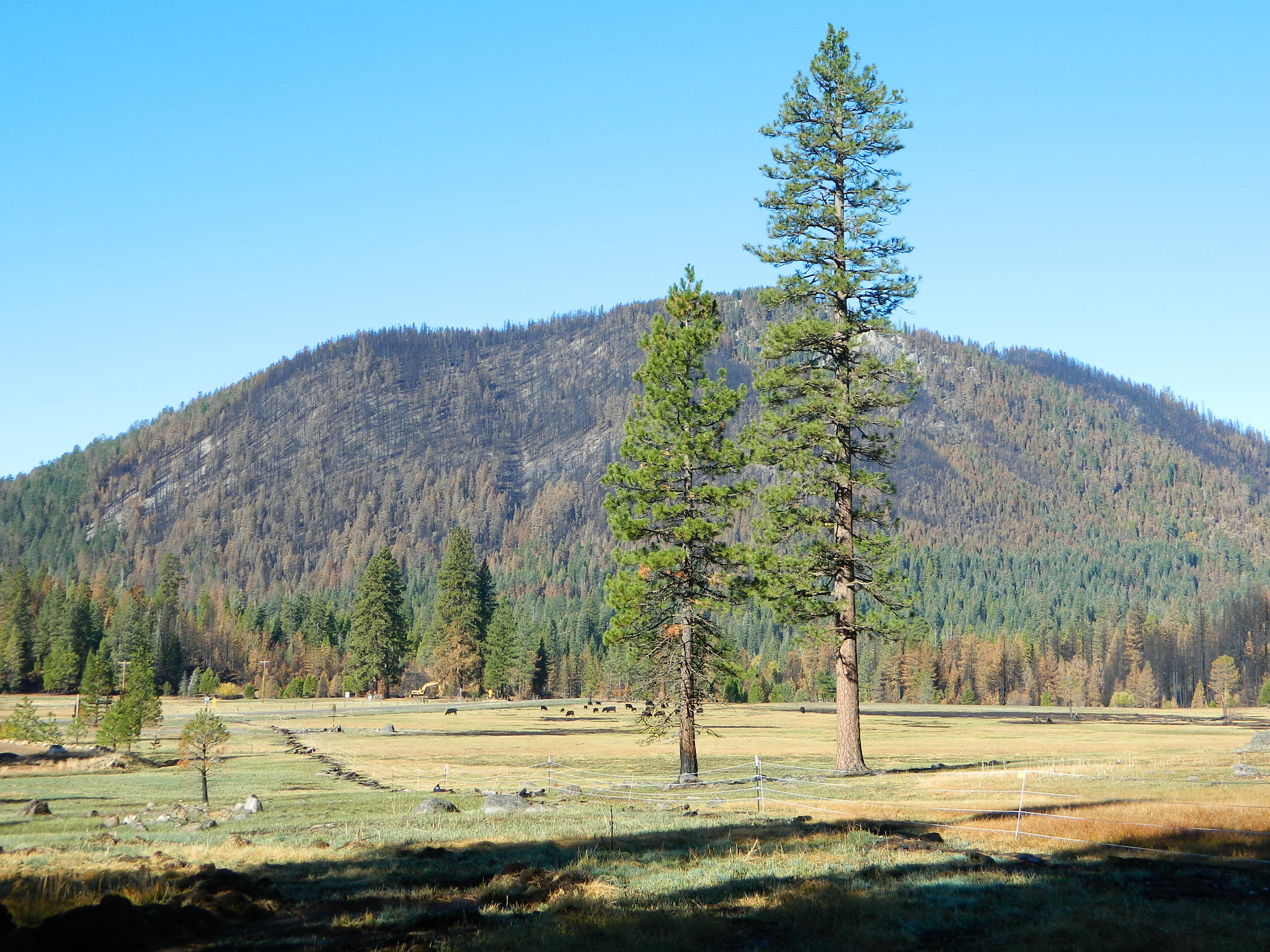
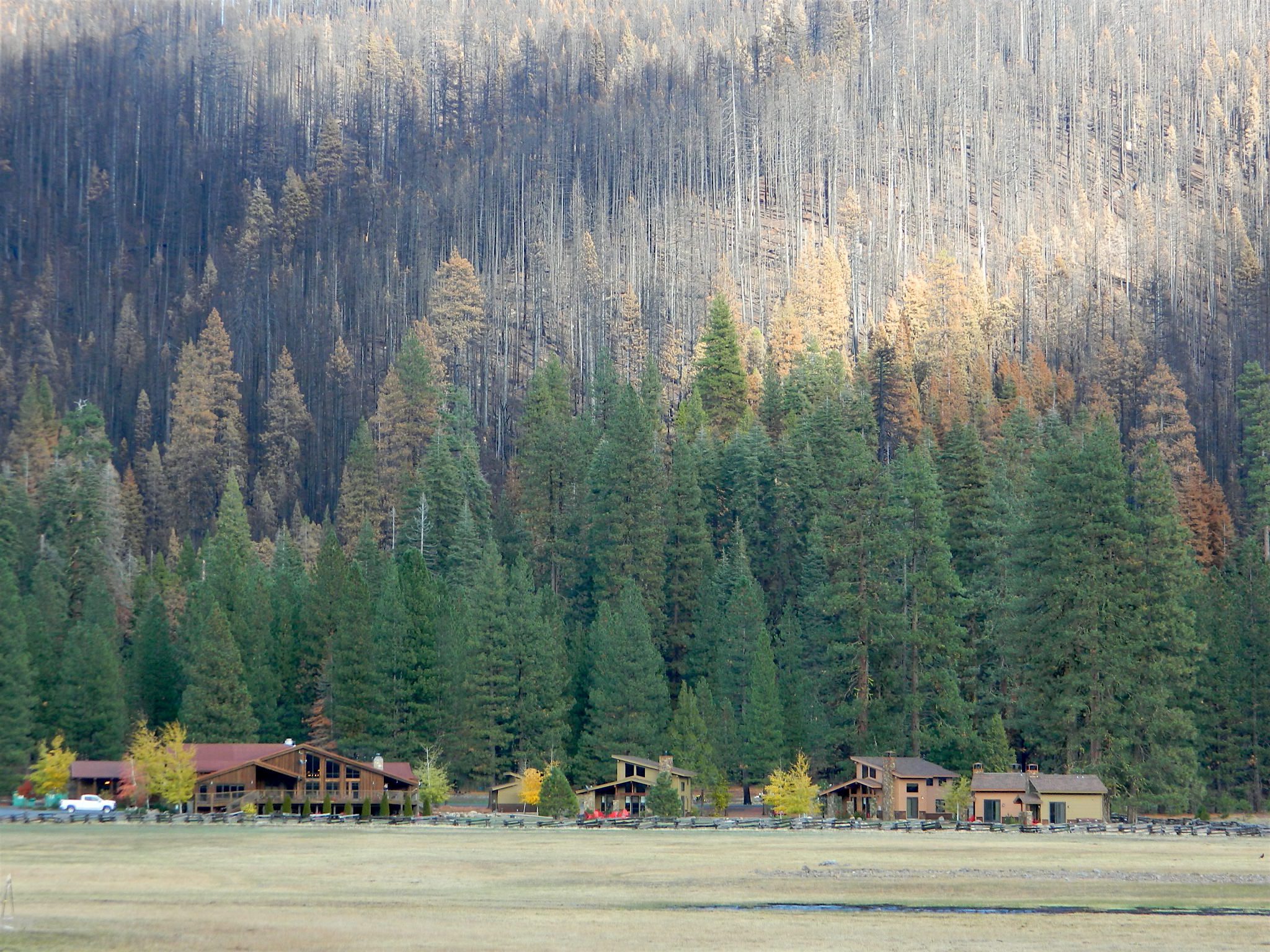
Morgan Mountain above Childs Meadow after the fire 2021
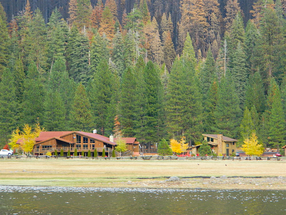
Childs Meadow sits at 5000 feet in elevation, on the edge of the Mill Creek drainage, just south of Lassen National Park. The meadow spans from Mill Creek, eastward along State Route 36 for many miles. Gurnsey Creek flows down Wild Cattle Mountain, near the resort, crosses the pavement, and heads east to meet up with the Deer Creek drainage above Chico, California
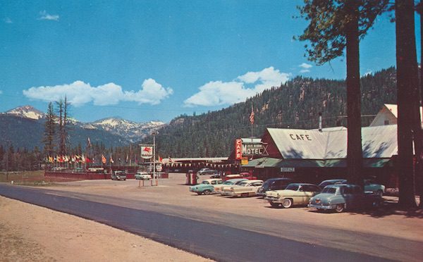
This sacred meadow was the summer camp and ceremonial ground for native tribes that existed long before the white men showed up. The meadow basin was originally owned by J.C. Tyler who used it for summer grazing land. He established a resort about 1864 and by 1896 it was a regular stage stop for travelers.
In 1900, Tyler sold the land to Abner Nanny who used it for summer grazing. Frank Childs purchased it in 1909 and also grazed livestock there seasonally. By the late 1930s a service station and cafe had been established. Then came cabins that were the precursor of the privately owned Childs Meadow Resort, which burned down some time later. These days Highlands Ranch Resort is the newest place to call this location home.
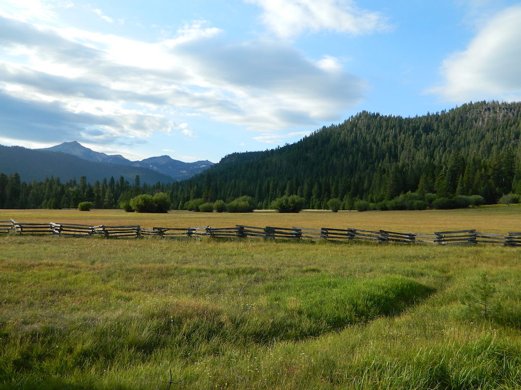
Lassen: Childs Meadow (before the fire)
July 2011 vs. July 2021
What a difference a decade makes. Drought in California makes a green meadow brown!
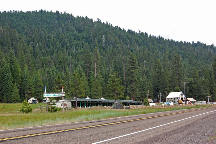
Upscale Highlands Ranch Resort – Bar, Restaurant & Cottages
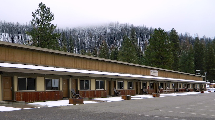
RENOVATED (2017) across the street Village Inn at Highlands Ranch
Village Inn @ Childs Meadow, South Lassen
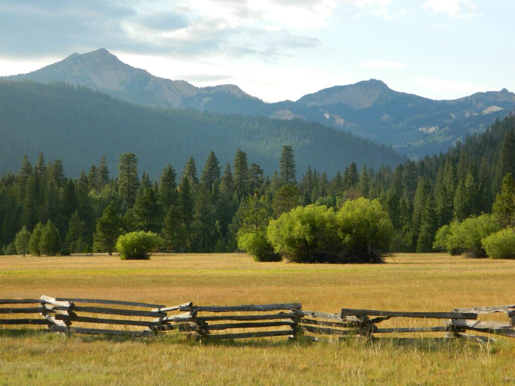
MOUNT LASSEN MEADOWS
Lassen Peak @ 10,457 feet has the highest known winter snowfall amounts in California. There is an average annual snowfall of 660 inches, and in some years, more than 1,000 inches of snow falls at its base elevation of 8,250 feet.
and a month later (after I start this post)…
AUG 2021 the DIXIE FIRE
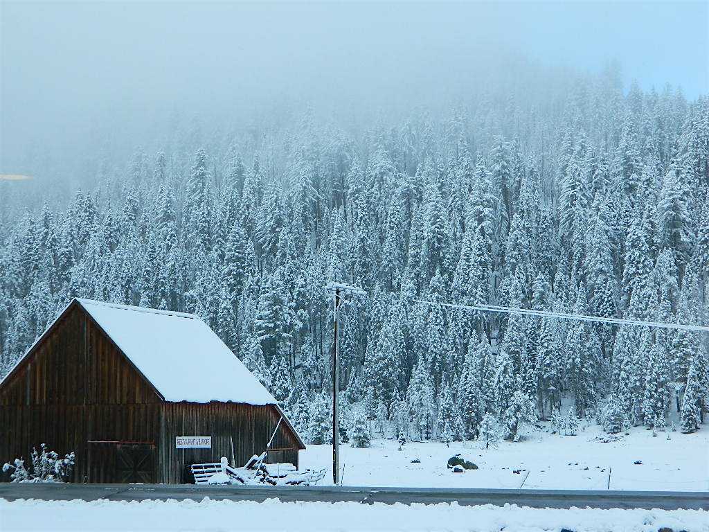
Highlands Ranch Resort with Dixie Fire burn scar on ridge above 2021Historic Barn – early snow in October 2021
As for the spelling on the name: Childs Meadows is commonly seen on USFS maps, and found inside a book called Tehama County Place Names.
Most locals know it as Childs Meadow, but it also seen spelled with an apostrophe s – Child’s Meadow
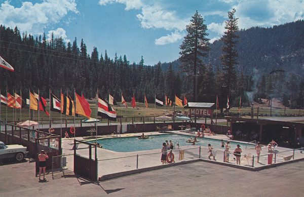
Swimming Pool at Childs Meadow Resort (1950s postcard)
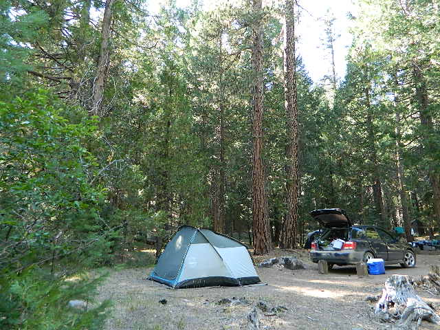
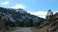
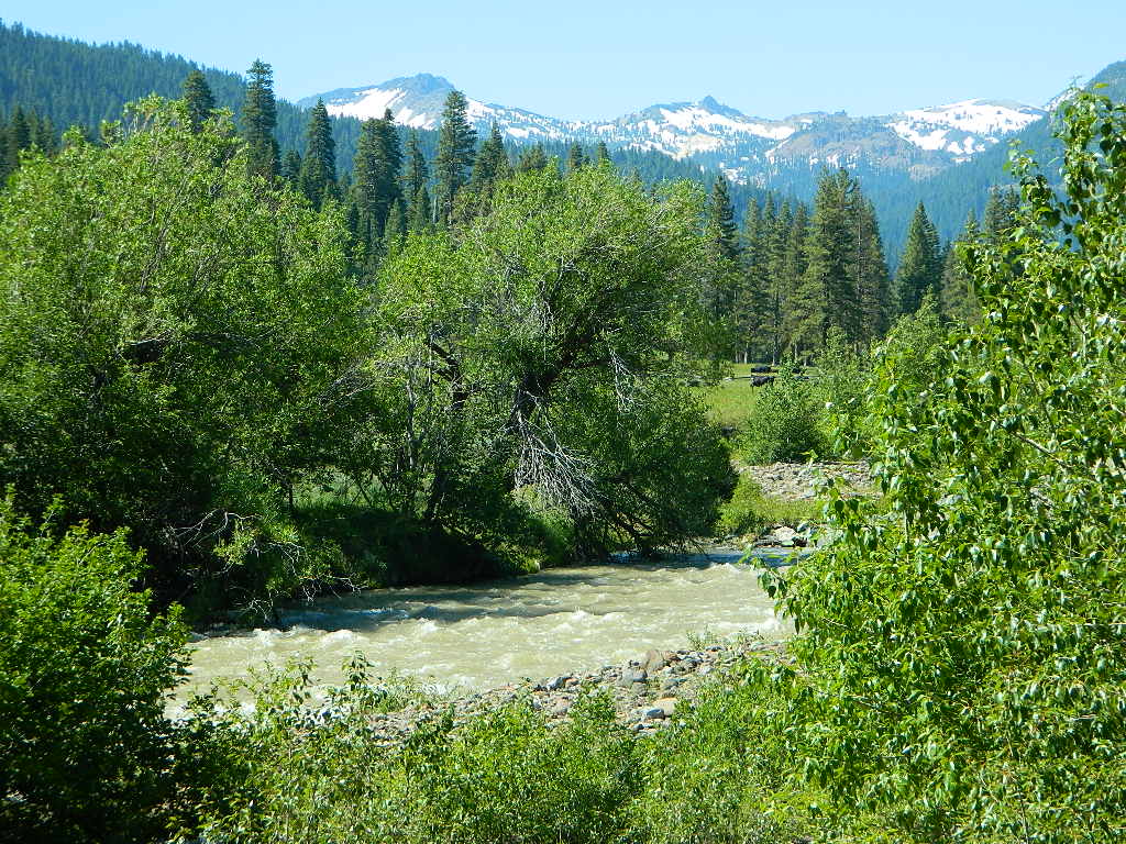
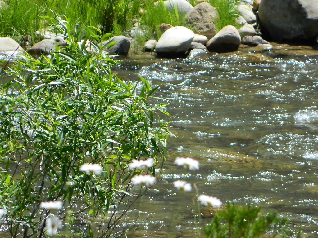
Lassen Camping for Free – on Mill CreekMill Creek w/ Lassen Peaks (July 2011)
Numerous Mill Creeks exist in the golden state of California. Here we will list most of them, some with campgrounds and others without. Waterfalls, big rivers and
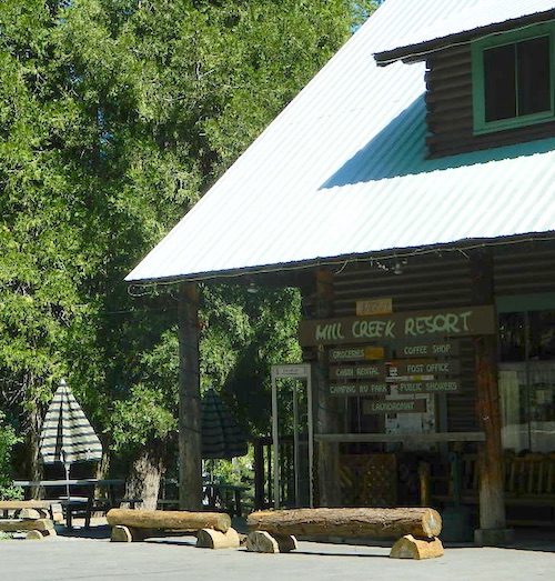
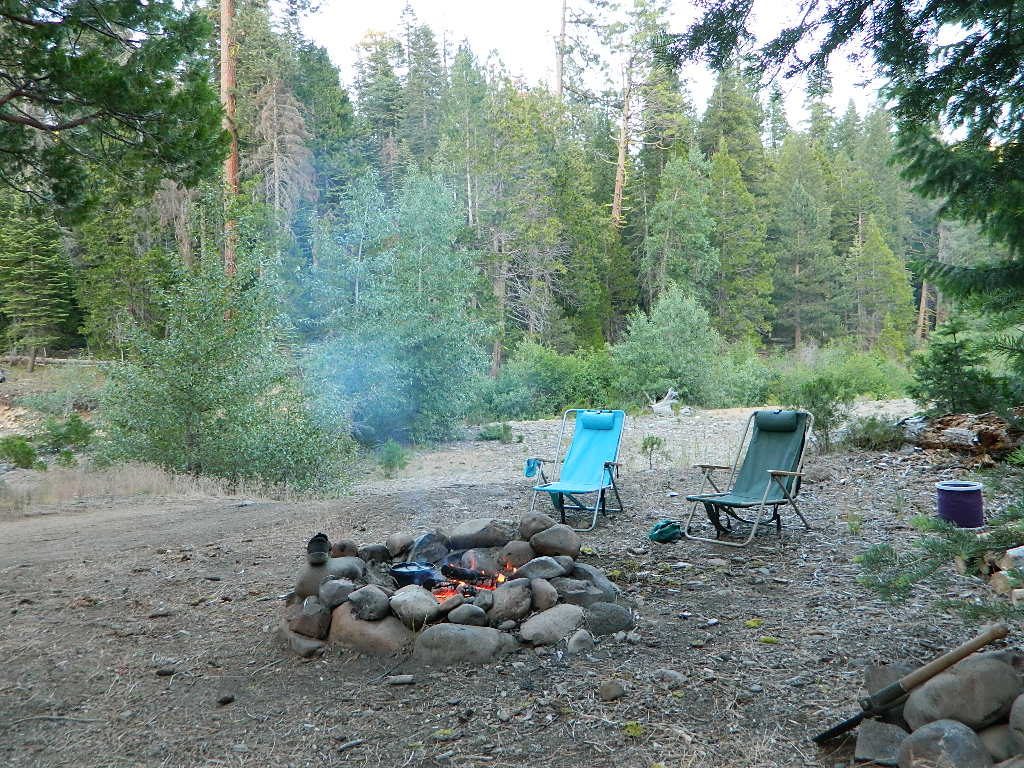
Small mountain resort in the forest near Mill Creek, with cabin rentals, RV camping and campgrounds nearby. A general store is open in summer months, and snow can be found in winter. Highway 172 makes a nice paved loop around this forested area and joins back to Hwy 36. Route may be closed due to snow in winter & spring. Free camping can be found along this creek, although a campfire permit is always required for camping outside of developed campgrounds.
Mill Creek Resort
40271 Highway 172, Mill Creek CA 96061
530-595 4449
Mill Creek Resort Campground
elevation = 4720′
14 tent sites
8 RV sites
reservations & fees
closed in winter
showers & flush toilets
picnic tables
camp fire rings
Mill Creek Indians: Described as a group of ‘renegade and outlaws’, from multiple tribes in NorCal. Mill Creek Indians took shelter in secluded Mill Creek gorge, located below the Mill Creek Rim, a volcanic ridge which extends from Mount Lassen to the Sacramento River Valley. See more on Ishi Wilderness.
Fouts Springsis a popular off-road camping area on the far east side of Mendocino National Forest. Many miles off I-5, near Stonyford, CA. Numerous NFS campgrounds exist is this rugged canyon. One of them is called Mill Creek Campground and it has few pine tree and lots of chaparral, plus a decent little creek flowing nearby. OHV – off highway vehicle use is heavy in this region, so know when to go. At certain times of the year this remote canyon can be quiet and peaceful. Call the local rangers to find out.
Stonyford Workcenter
5171 Stonyford-Elk Creek Road
Stonyford, CA 95979
530-963-3128
NOTE: RANCH FIRE, this whole Mendocino Forest was badly burned by recent wildfires. Mendocino Complex Fire 2018
All of the Snow Mountain Wilderness was burnt and affected, including all the National Forest land surrounding it. Fouts Springs Campgrounds may have been spared, but the hills, trails and roads now lead to blackened forest. Many routes could be closed; check with ranger station in advance of travel.
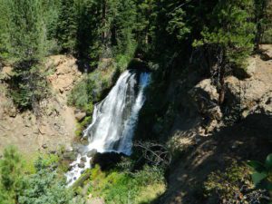
Mill Creek Waterfall is located on the western slopes of the Warner Range, near the South Warner Wilderness. On the headwaters to the Pit River; About 6 miles east of US Highway 395, near the town of Likely, south of Alturas, California
TheBucks Lake Wilderness region also has a developed NFS Mill Creek Campground. The camp location is well off the Bucks Lake Road, tucked deep in a tight canyon; northern most point and near a dam for the large Bucks Lake.
elevation = 5200′
10 camp sites
fee
closed in winter
14 night camp limit
RV = 21′ max
pit toilets
picnic tables
camp fire rings
Bucklin Road (aka Bucklin Dam Rd and Road 33) #24N24 a paved road on the west end of Bucks Lake, connects to Road #24N88X which leads back to this smaller campground; camp sites are paved. Steep driveway down.
This Mill Creek intersects Bucks Lake at the campground, then connects to the PCT hiking trail, although the narrow dirt road #24N88X veers away from creek a few miles up.
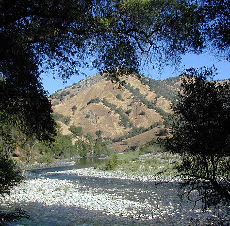
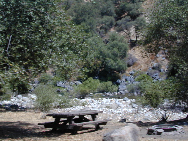
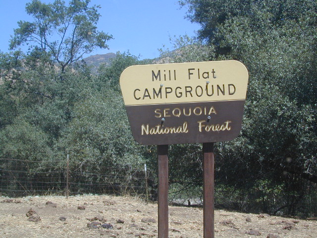
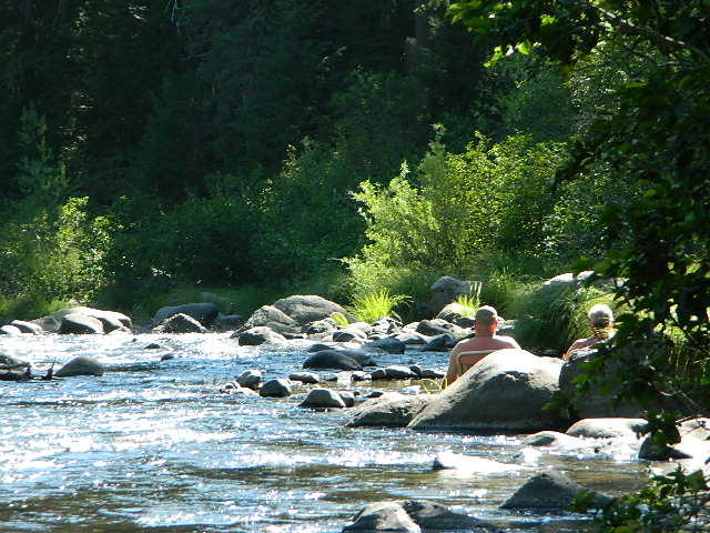
This Mill Creek is located on the south shore of the lower Kings River, above Pine Flat Reservoir. This is the boundary where Sequoia NF meets the big river, and on the other side of the water is the Sierra NF.
Mill Flat Campground (also known as Mill Creek Camp) is a shady, oak flat campground on a dirt road, located at a dead end canyon site, right on the rocky rivers edge.
As usual – the further you drive, the more seclusion you will find. This observation holds true for this Mill Creek location. During peak summer months, there may be families enjoying this spot, but most of the year it is virtually empty and rarely used.
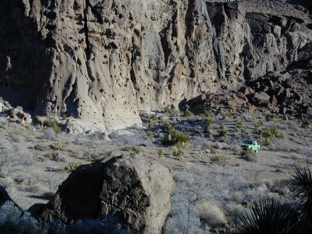
Hole-in-the-Ground Campground NFS Lassen National Forest
dirt road access #28N06, off Hwy 172 @ Mill Creek, CA
South of Highway 36, near jct Hwy 89
• Elevation: 4,300′ • Number of Sites: 13 • Vehicle Accessibility: No trailers • Campsite Fee: Yes • Campsite Reservation: No • Campsite Water: hand-pump well • Toilet: vault • Length of Stay: 14 Days • Season: April – October • Trailheads: Mill Creek Trail
Shady pines campground situated near the wild and raging Mill Creek, on the south side of Mount Lassen. Outside of the Lassen National Park, this NFS camp offers a real backwoods feel and more seclusion. Easy foot access to Mill Creek and also theIshi Wilderness.
Picnic tables and metal campfire rings provided at these campsites. Summers can be busy, but mid week you may have the whole place to yourself. NOTE: 3 miles dirt road access Lassen Forest Road #28N06. Trailers and large RVs are not recommended on this dirt road.
Hole in the Ground, is also the name of a remote wilderness canyon deep in the Sierra Nevada mountains. Located on the Upper Kern River – in Grasshopper Flat near Hockett Peak (8551′ elev). All inside the Golden Trout Wilderness; accessible only by horseback or hiking trail. Find it on foot @ Jerky Trailhead on National Forest Road# 22S82
Hole in the RockBackside Hole in the Wall, Mojave NP
Hole in the Wall, California
Similarly named, Hole in the Wall Campground is a popular spot in the Mojave National Preserve. Group facilities, horse corrals, developed campgrounds, centrally located, yet close to Interstate 40.
Stop by the “Hole in the Wall” Information Center (760) 252-6104, for more info and maps. The most popular hike, the Ring Trail, will leads thru rock face (above) to the campground on Black Canyon Road, on the other side of this huge rock wall.
Mid Hills Campground (nearby) has better choice on secluded camping, but rougher road to access. Mojave desert has abundant camping, so there is plenty space for everyone!
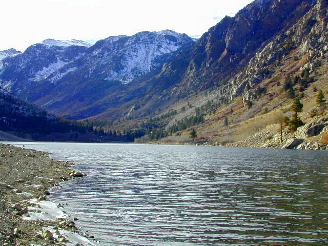
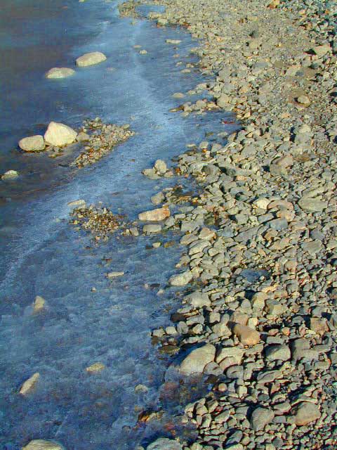
Lundy Canyon is located at the very northern boundaries of the Inyo National Forest, bordering the Humboldt Toiyabe National Forest & Virginia Lakes. Mill Creek flows down Lundy Canyon from the Sierra Nevada; Lundy is a small lake in a deep, rugged canyon with wilderness trailheads, East of Yosemite National Park.
Lundy Canyon Campground
Mono County Dept of Public Works
760-932-5440
36 camp sites w/ picnic tables, fire-rings & bear boxes
Lundy Lake Resort
Bait, tackle, general store, fishing lake, boat ramp.
626-309-0415
21 camp sites, 8 cabins, 3 camp huts, 5 RV camp sites
There is not any NFS Campgrounds in this Lundy Canyon, but plenty can be found nearby at Lee Vining Canyon, at junction US 395 & Hwy 120.
Mono Lake also has camping at the county park. And free camping (boondocking) can be found – all up and down US 395
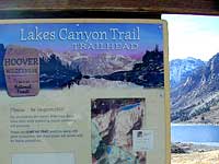
Lakes Canyon Trailhead
Backpackers & Horse Packer Trains have excellent access to the Hoover Wilderness in the High Sierras. Plus this prime Lundy Canyon location is situated at the back door of Yosemite NP.


 Bucks Lake.