Category Archives: Wildfire

California Wildfires 2020

wildfire fawn

2020 Wildfires in California

TOTAL ACRES 
4,397,809 acres

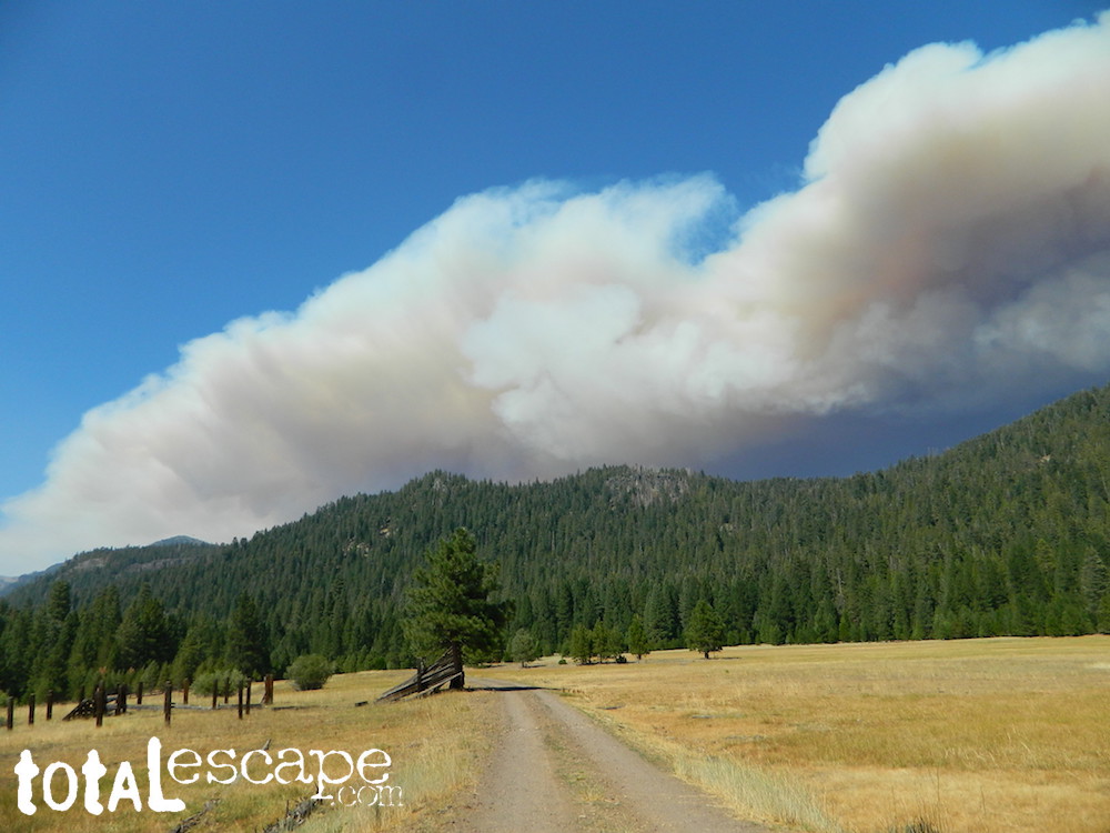
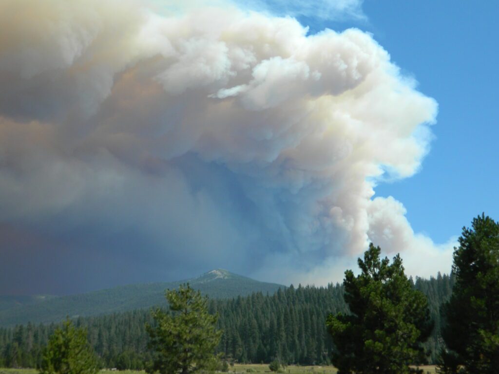
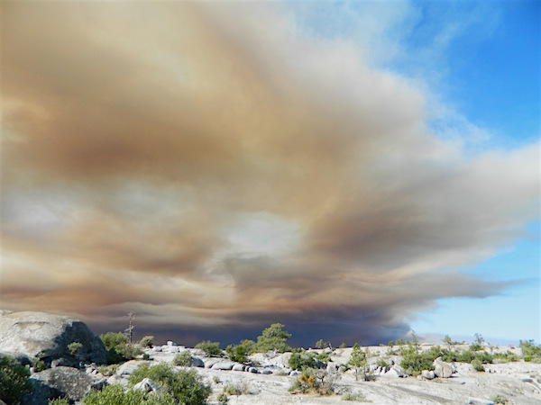
This was a year of many “Complex Fires” inside California. These names were given to a grouping of multiple forest fires caused by lightning strikes, during dry thunderstorm events in mid August. The coastal Santa Cruz redwoods were on fire; then shortly after the Sierra Nevada started burning fast, and campers were rescued by helicopter. We started loosing Giant Sequoia trees at an alarming rate – starting this year.

_______________________________

Riverside Co
33,424 Acres
_______________________________
 
Glenn, Mendocino, Lake, Tehama, Trinity, Shasta Counties
1,032,648 Acres
_______________________________
 
Blue Ridge Fire
Orange, San Bernardino, Riverside Counties
13,694 Acres
_______________________________
 
Los Angeles Co
115,997 Acres
_______________________________
 
Butte/Tehama/Glenn Lightning Complex 
Butte Co
19,609 Acres
_______________________________
 
Fresno, Madera Counties
379,895 Acres
_______________________________
 
San Mateo, Santa Cruz Counties
86,509 Acres
_______________________________
 
Monterey Co
124,924 Acres
_______________________________
 
Dome Fire (Mojave Preserve)
San Bernardino Co
43,273 Acres
_______________________________
 
San Bernardino, Riverside
22,744 Acres
_______________________________
 
Napa, Sonoma Counties
67,484 Acres
_______________________________
 
Lassen Co
22,634 Acres
_______________________________
 
Hog Fire
Lassen Co
9,564 Acres
_______________________________
 
July Complex
Modoc, Siskiyou Counties
83,261 Acres
_______________________________
 
Colusa, Lake, Napa, Sonoma, Solano, Yolo Counties
363,220 Acres
_______________________________
 
Loyalton Fire
Lassen, Plumas, Sierra Counties
47,029
_______________________________
 
Fresno Co
29,667 Acres
_______________________________
 
Mountain View Fire
Mono, Alpine Counties
20,385 Acres
_______________________________
 
North Complex
Bear Fire
Plumas, Butte Counties
318,935 Acres
_______________________________
 
Humboldt, Siskiyou, Trinity Counties
144,698 Acres
_______________________________
 
River Fire
Monterey Co
48,088 Acres
_______________________________
 
Santa Clara, Alameda, Contra Costa, San Joaquin, Merced, Stanislaus Counties
396,624 Acres
_______________________________
 
Sheep Fire
Plumas, Lassen Counties
29,570 Acres
_______________________________
 
Orange Co
12,466 Acres
_______________________________
 
Siskiyou, Del Norte Counties
166,127 Acres
_______________________________
 
Slink Fire
Alpine, Mono Counties
26,759 Acres
_______________________________
 
SQF Complex
Castle Fire
Tulare Co
174,178 Acres
_______________________________
 
Valley Fire
San Diego Co
16,390 Acres
_______________________________
 
W-5 Cold Springs
Lassen, Modoc Counties
84,817 Acres
_______________________________
 
Shasta Co
56,338 Acres


California Wildfire Affected Areas

California Wildfires 2021

Dixie Fire @ Childs Meadow AUG 2021

2021 Wildfires in California

TOTAL ACRES
3,083,507 acres

_______________________________

Alisal Fire
Santa Barbara Co
16,970 Acres
_______________________________
 
Siskiyou Co
145,632 Acres
_______________________________
 
Beckwourth Complex
Plumas, Lassen Co
105,670 Acres
_______________________________
 
Caldor Fire
Eldorado Co
221,835 Acres
_______________________________
 

Dixie Fire
Butte, Lassen, Plumas, Shasta, Tehama Counties
963,309 Acres
_______________________________

Fawn Fire
Shasta Co
8,578 Acres
_______________________________
 

French Fire
Kern Co
26,535 Acres
_______________________________

(Sequoia National Park Fire)
Tulare Co
88,307 Acres
_______________________________
 
Siskiyou Co
26,409 Acres
_______________________________
 
Siskiyou Co
94,962 Acres
_______________________________
 
Shasta, Tehama, Trinity Counties
122,653 Acres
_______________________________
 
Trinity Co
223,124 Acres
_______________________________
 
Siskiyou, Trinity Co
199,359 Acres
_______________________________
 
River Fire
Mariposa, Madera Co
9,656 Acres
_______________________________
 
Salt Fire
Shasta Co
12,660 Acres
_______________________________
 
Tamarack Fire
Fresno Co
68,637 Acres
_______________________________
 
Tennant Fire
Siskiyou Co
10,580 Acres
_______________________________
 
Tulare Co
8,777 Acres
_______________________________
 
Tulare Co
97,528 Acres

58 counties

California Wildfire Affected Areas

Forest Fires in California

pinetree

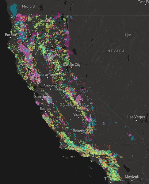
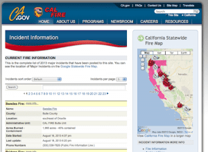
A list of recent wildfires in California, with counties and acres affected. Forest fires listed here are the ones that have affected public lands – like National Forests, National Parks, State Parks and BLM land.

On public lands you may see signs like –

Warning: Entering a Burned Area
Potential Hazards include:

  • LOOSE ROCKS
  • FALLING TREES + LIMBS
  • STUMP HOLES
  • FLASH FLOODING
  • DEBRIS FLOWS

>>> Entering a CLOSED FOREST with burn scar is a crime and can result in jail time. Check USFS forests web site for current closures. 

Forest Fires listed below are alphabetical. Green & blue links to more data on these wildfires.

Dixie Fire
2021 Dixie Fire @ Lassen National Forest

2022 Wildfires in California (coming soon)

California Wildfire Affected Areas


California Wildfire Affected Areas
2020 Bear Fire @ Zink Road; North Complex

In 2020 alone, old growth Redwoods, a million Joshua trees, and hundreds of giant Sequoias have perished. Shocking reality from the New York Times

disaster zone

CapRadio WILDFIRES MAP

California Wildfire Map
click above for interactive map spanning 150 years of wildfires


California Wild fires

California Wildfire Affected Areas
Madrone trees burned hot with 60 mph winds

Top O Zink

Before and After

SWIPE photo of the
Top of Zink Road
#BearFire 2020

topofzinkroadBear Fire Zink Road

off of Bald Rock Road
Berry Creek, California

Butte County

California Wildfires 2018

2018 Wildfires in California

Whaleback Fire
Whaleback Fire near Spaulding, CA – West Eagle Lake

Camp Fire @ Town of Paradise
153,336 Acres
Butte County
Lake Concow, CA
Paradise, CA
Pulga, CA
_______________________________

Carr Fire @ Whiskeytown
229,651 Acres
Old Shasta, W of Redding, CA
Shasta State Historic Park
Whiskeytown NRA
_______________________________

County Fire
90,288 Acres
aka Guinda Fire
Lake County
Napa County
Yolo County
Lake Berryessa, CA
_______________________________

Delta Fire
63,311 Acres
(merged w/ Hirz Fire)
Shasta County
Lake Shasta, CA
_______________________________

Donnell Fire
36,450 Acres
Tuolumne County
Sonora Pass Hwy 108
Stanislaus National Forest
_______________________________

Ferguson Fire
96,901 Acres
Sierra National Forest
Yosemite National Park
Wawona, CA
_______________________________

Hirz Fire
46,150 Acres
Shasta County
Lake Shasta, CA
_______________________________

Holy Fire
23,136 Acres
Orange County
Riverside County
_______________________________

38,008 Acres
Siskiyou County

_______________________________

Lions Fire
13,347 Acres
Madera County
_______________________________

Mendocino Complex
459,123 Acres
Ranch Fire + River Fire
N of Clear Lake, CA
Mendocino National Forest
Snow Mountains Wilderness

Forest Oaks Mendo

Natchez Fire
38,134 Acres
California & Oregon Border
Del Norte County, Siskiyou County
Happy Camp, CA
_______________________________

Pawnee Fire
15,185 Acres
Lake County
_______________________________

Stone Fire
39,387 Acres
Modoc County
_______________________________

Waverly Fire
12,300 Acres
San Joaquin County
_______________________________

Whaleback Fire
18,703 Acres
Lassen County
Eagle Lake, CA
Lassen National Forest
_______________________________

Woolsey Fire
96,949 Acres
Los Angeles County
Ventura County

Whaleback Drive
Driving past Whaleback Fire Scar @ Eagle Lake

califrepublic

California Wind Storm

wind wildfires
Wildfires spread rapidly with strong winds.

“It was sport to have a gale in such weather as this. Yet it blew like a hurricane. The wind seemed to come with a spite, an edge to it, which threatened to scrape us off the yards. The mere force of the wind was greater than I had ever seen before.”
– Richard Henry Dana, Jr.
Two Years Before the Mast (1843)

califrepublic

In the early days of California cargo shipping, the sailers referred to the wild winds as “south-easterlies”. So strong and unpredictable in fact, that they often had to cut anchor and drift far out to sea – to wait out the wind event.

offshore winds

Various nicknames have been given to the easterly winds in California. They develop from a high or low pressure system that builds in the Great Basin, pushing winds from the desert towards the west, over the Sierra mountains and into California.

Wind events can last for days, but usually not a full week.

  • Santa Ana Winds

  • Southeasters

  • Sundowners

  • Mono Winds

  • Diablo Winds

  • Indian Summer

  • Northeasters

  • North-easterlies

pinetree

Wind gusts measuring over 100 mph typically recorded in Sierra passes


check

RED FLAG – Weather forecasters announce “Red Flag Warnings” when predicting, banning all outdoor burning and all use of campfires. Humidity levels drop into single digits or teens, and created extremely critical wildfire conditions. Utility companies are now preemptively cutting electric power to millions of customers across the state to reduce the risk of fires (sparking from power poles). Extreme fire weather can last for months, usually in the last half of the year. December rains usually put an end to the wildfire dangers, but the wind events can last all winter long.

windy poppies
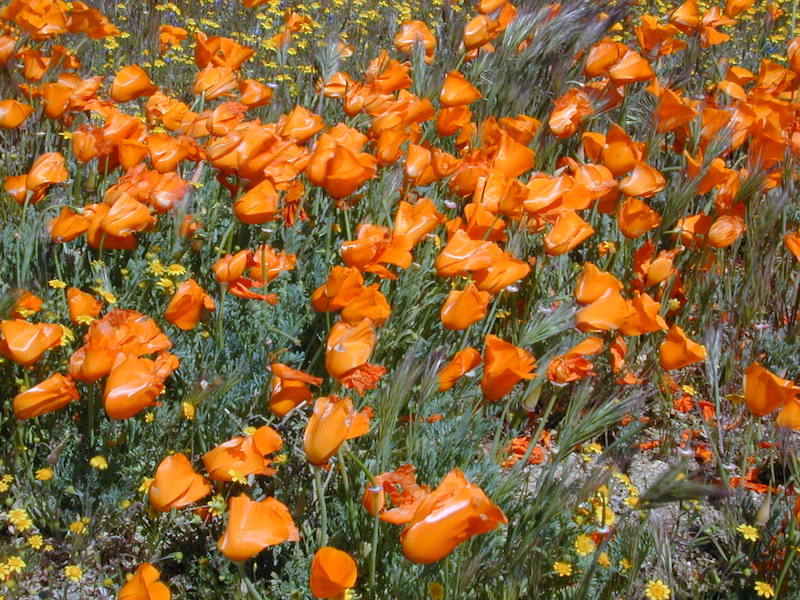
Wind whipped Golden poppies in the high deserts of Antelope Valley.

winds and tents
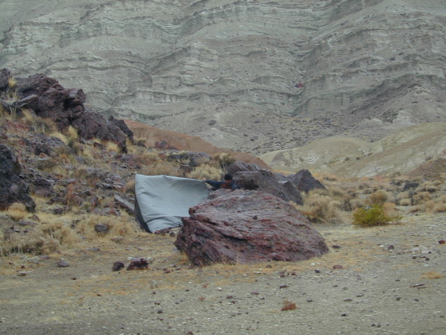
Desert winds are harsh. Not properly staking down your tent results in gear rolling down canyon.

140 mph gust recorded as incredible winds rake California
Oct 2020

high wind advisory

This is a term often used for travel. High profile vehicles can literally tip over (while driving) in strong winds. Aircraft can be grounded and unable to fly, during such events. Helicopters generally do not fly during strong winds. Boats at harbor may need to be secured.

Electronic Freeway signs can display messages about high winds. These type of vehicle should heed the warnings.

  • big rigs
  • camper vans
  • 5th wheel travel trailers
  • motorhomes
  • moving trucks / rentals
  • RVs (recreational vehicles)
  • trailers in tow
  • truck campers
  • u-haul trucks

camptruck

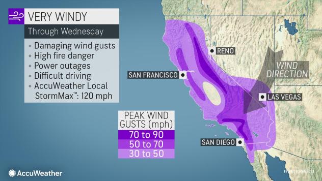
California places that experience top wind speeds –

wind caves
Wind Caves in Anza Borrego Desert

hint.fm/wind

wind.willyweather.com/ca.html

mountains

accuweather winds

Decimated Plumas Forest

Plumas Forest View
from the top of Bald Rock

Before and After Photo

Forest Swipe

Burnt Forest

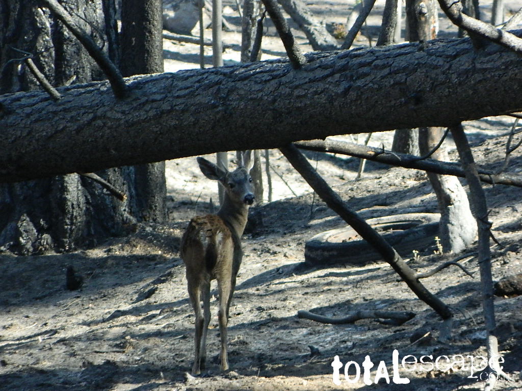
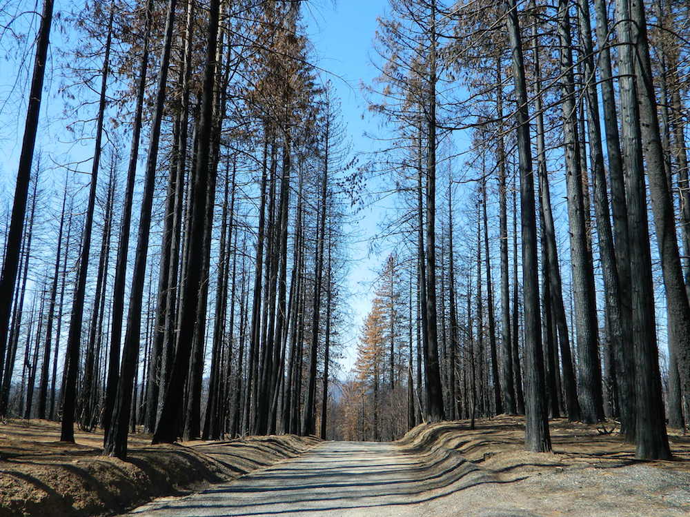
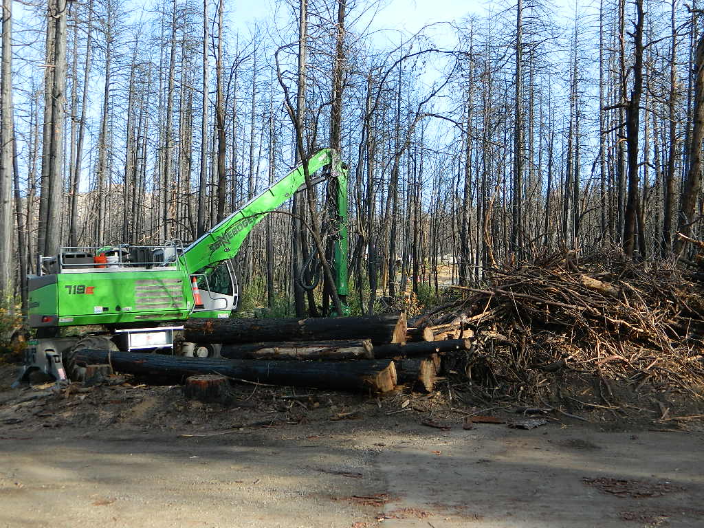
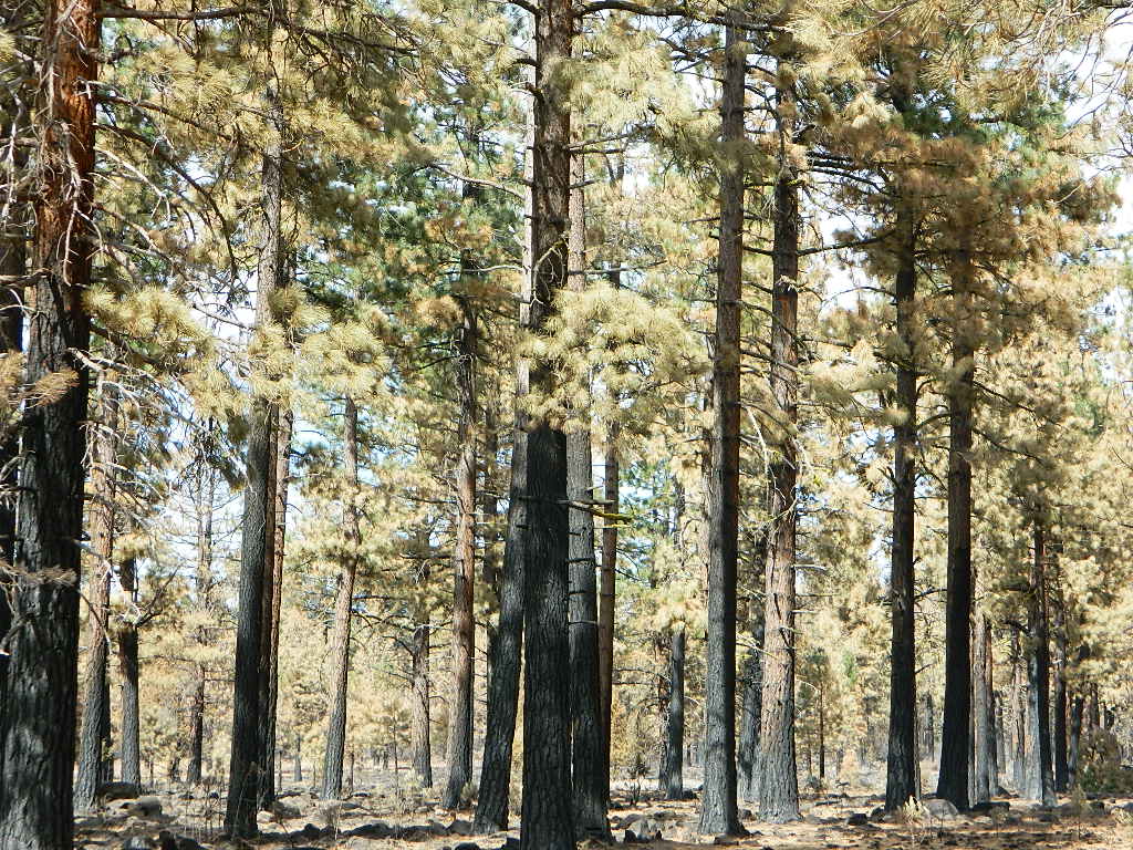
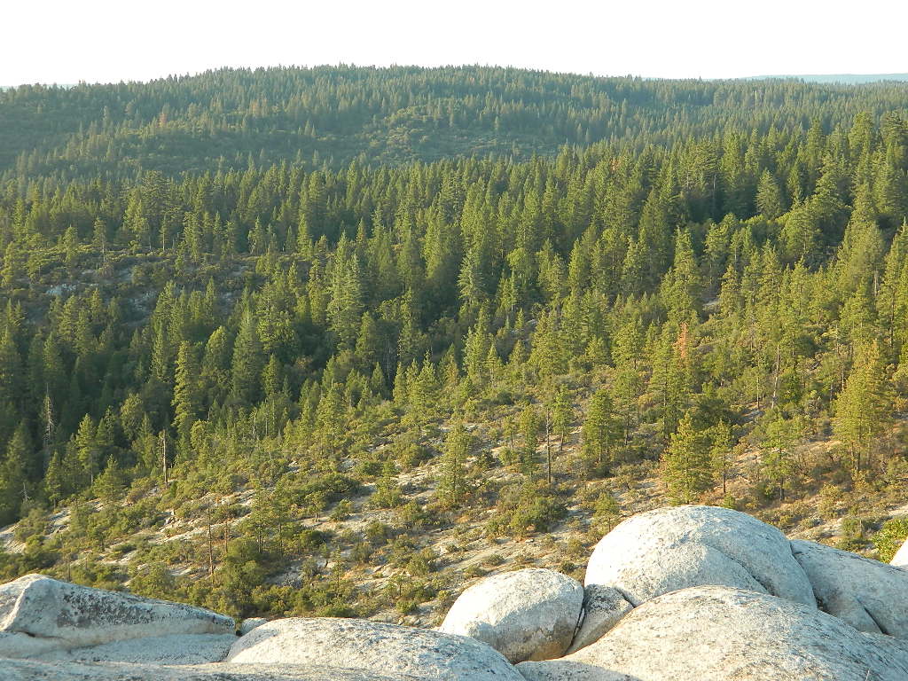
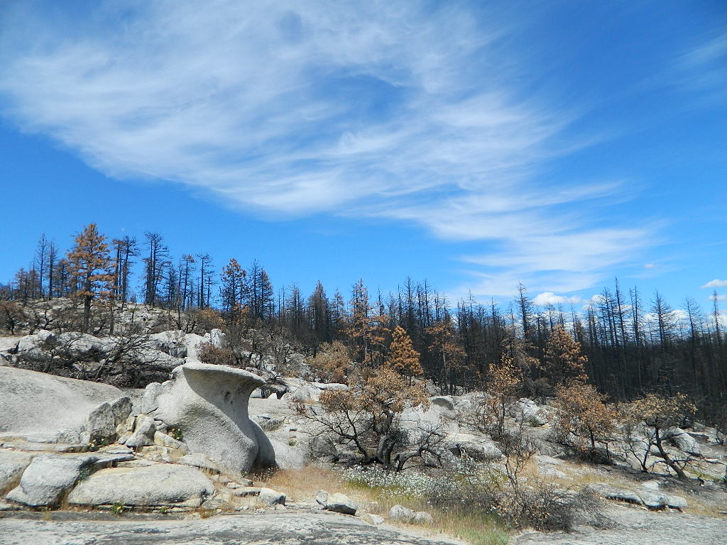
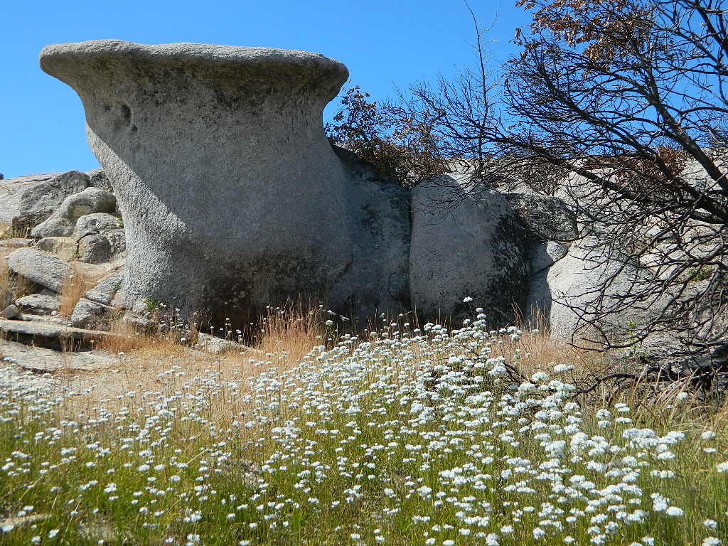
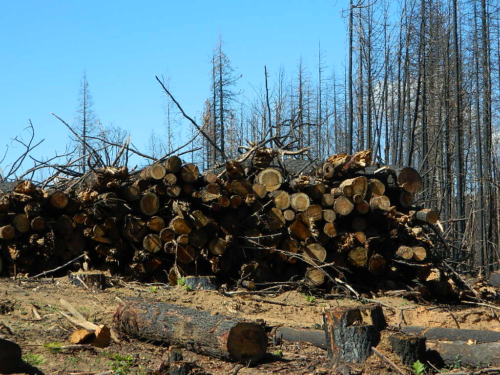
We used to have such a beautiful, lush and diverse forest in the Northern Sierra Nevada, but all that has changed with recent wildfires that have scorched millions of acres of National Forest land in the past few years.

Survivor

An unbelievable amount of destruction has taken place with losses in wildlife, forest ecosystems, personal property, and human lives, as well as buildings of historic value.

Sadly, I find my California landscape photographs are now mere documentation of what beauty once was.


Plumas National ForestNFSlogo

Berry Creek, California


decimated
Decimated forest at Bald Rock

California Areas Affected by Wildfires

Footed Rock

Footed Rock @ Bald Rock
Berry Creek, California

Before and After Photo

Wildfire: Bear Fire / North Complex 2020

The Skinny Lone Cedar hangs on with Footed Rock. Bushes on the right side, had the flames licking at this tiny tree.

Footed Swipe

Berry Creek, CAfooted rock 95916

Many thanks to whoever cut/broke the mistletoe off in recent years. I never seem to hike with my loppers.

Bald Rock California

Footed Rock is a part of the popular Bald Rock hike. summer 2021 CURRENTLY CLOSED hiking trail in Berry Creek, CA

Mushroom Rock
Mushroom Rock @ Bald Rock


Lumber for Market
Lumber for Market, just sitting on the side of the road.

Log Truck Drivers make over $100/hour – yet there is still a job shortage in 2021. Go figure!

mountains

see more swipe photos –

California Fire Departments

California Fire Maps

CAL Fire – California Dept of Fire
USFS, National Forests
Calif County & Volunteer Fire Departments

calfiremap

Cal Fire Map
https://www.fire.ca.gov/incidents/
CALfire: California Department of Fire

Inciwebranger
https://inciweb.nwcg.gov/
USDA / USFS
National Forest Wildfires

NASA https://firms.modaps.eosdis.nasa.gov/map/

UC Fire Activity Maphttps://ucanr.edu/sites/fire/Safety/Current/

Fire & Smoke
https://fire.airnow.gov/

Real Time Satellite Data
https://zoom.earth/


drohghtgov

Drought.gov
https://www.drought.gov/drought/data-maps-tools/current-conditions

fireforce

califrepublic

California County Fire Departments
Volunteer Fire Departments

Campfire Restrictions in California

Campfire Bans for 2020

locking down the forests, before they burn (again)

Outside of developed campgrounds and permitted facilities, igniting, building, maintaining or using a fire on national forests in California will be prohibited.

califrepublic

campfire

List of Current Fire Restriction Orders for all USFS National Forests in California w/ links.

Fire Restrictions are now in effect for most all public lands in California. Data and news change weekly, so follow links for most up-to-date restrictions, before you make your drive.

These are the earliest and most restrictive campfire orders ever. No? Maybe the long drought years would be equivalent. Below is a brand new list broken down by federal land regions – forest and deserts, including BLM camping areas.

Looks like we are already into Stage II Restrictions for the begining of summer 2020.

dirtbikesNOTE: BBQ grills, all stoves, smoking, firecrackers, welding, chainsaws,  off roading, dirt biking, hunting and target shooting are restricted within these orders. A few of these fire restrictions are dated to extend until DEC 31, 2025

More details and specifics can be found on each forests .gov web site, so please use THESE LINKS BELOW (before they break).

The land is dry and wildfire threat is an ongoing battle in California.

FOREST-WIDE FIRE RESTRICTIONS IN PLACE

vanish views
Wildfires ravage California wild lands every year. Severity, longevity, most deadly. Let this year be different.


fish

Northern California

BLM (Bureau of Land Management)blm camps

no campfires outside of developed campgrounds (statewide)
(APR 29, 2020 – DEC 31, 2025)
see the current 2020 BLM Campfire Map

Six Rivers National ForestNFS

campfires only allowed @ developed recreation areas, campgrounds and certain designated fire safe sites
(MAY 29 – NOV 1, 2020)
https://www.fs.usda.gov/alerts/srnf/alerts-notices

Klamath National Forest NFS

campfires allowed only @ developed campgrounds & inside wilderness areas (MAY 29 – NOV 1, 2020)
https://www.fs.usda.gov/alerts/klamath/alerts-notices/?aid=59110

Modoc National Forest NFS

no campfires outside of developed campgrounds (MAY 28)
https://www.fs.usda.gov/alerts/modoc/alerts-notices/?aid=5889

USDA PDF map shows only 26 places that you have have a campfire inside Modoc. The far drive could be worth it – for minimal crowds, darkest skies and maximum fishing. Best for week long road trips, super lazy summer style.

Shasta Trinity National Forest NFS

no campfires outside of developed campgrounds (MAY 29)
https://www.fs.usda.gov/detail/stnf/news-events/?cid=FSEPRD745550

Persons with a valid California Campfire Permit are not exempt from the prohibitions.

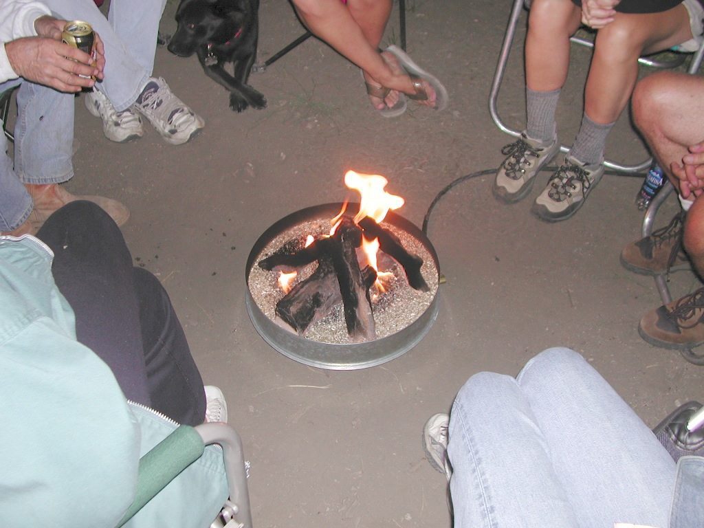
However, persons with a valid California Campfire Permit may use a portable campfire ring/pit, stove, or lantern ( 5+ feet from flammable materials) IF THE UNIT burns gas, kerosene, jellied petroleum or pressurized liquid fuel, and is EQUIPPED w/ a shut-off valve.

Wow, what a mouthful. Guess the propane campfire is okay?

propanecampfire
Whatever.

Lassen National Forest NFS

no campfires outside of developed campgrounds ( MAY 29)
https://www.fs.usda.gov/alerts/lassen/alerts-notices/?aid=59049

SUSANVILLE, Calif. May 29, 2020 – Lassen National Forest is enacting campfire restrictions… effective immediately and until further notice. Outside of developed campgrounds and certain permitted facilities, igniting, building, maintaining or using a fire on national forests in California will be prohibited.

holeinthegroundsign
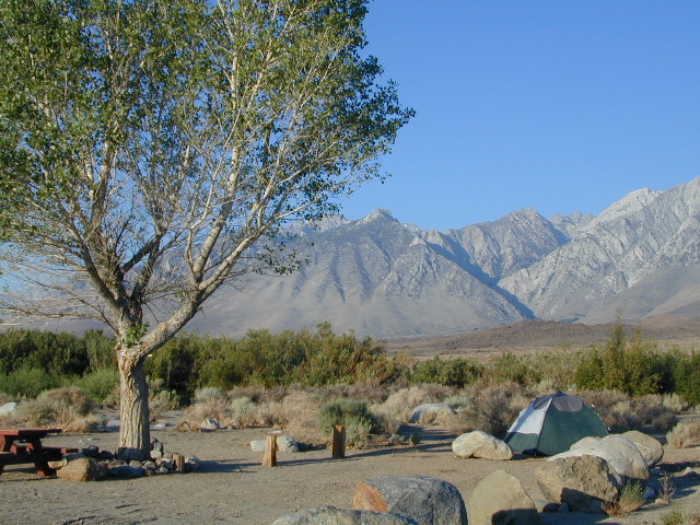
Lassen Camping near a creek in Northern California

BLM Eagle Lakeblm camps

no campfires outside of developed campgrounds
(APR 29, 2020 – DEC 31, 2025)
see the current 2020 BLM Campfire Map

Mendocino National Forest NFS

campfires allowed only @ developed campgrounds & inside wilderness areas (MAY 29 – NOV 30, 2020)
https://www.fs.usda.gov/alerts/mendocino/alerts-notices

fout springs
Fout Springs, Stonyford, Northern California


mountains

Sierra Nevada California

Plumas National ForestNFS

no campfires outside of developed campgrounds (MAY 29)
https://www.fs.usda.gov/alerts/plumas/alerts-notices

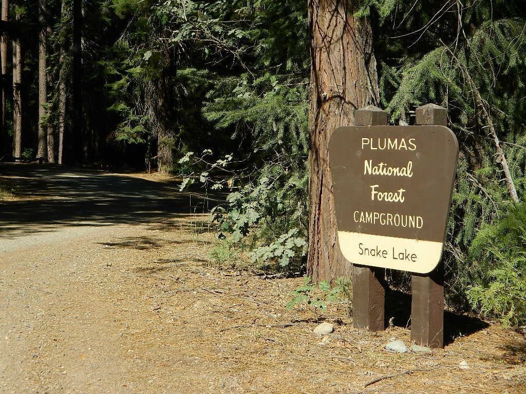
North Sierra where the granite meets the volcanic rock of Lassen. Feather River Watershed, Lake Oroville SRA, Bucks Lake Wilderness, Bald Rock, Quincy, Lakes Basin Recreation Area

secludedcamp
Deane’s Valley Campground, way off the main road, between Quincy and Bucks Lake.

New Signs

Tahoe National Forest NFS

no campfires outside of developed campgrounds (MAY 29)
https://www.fs.usda.gov/alerts/tahoe/alerts-notices/?aid=58962

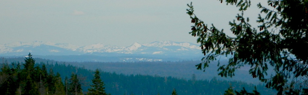
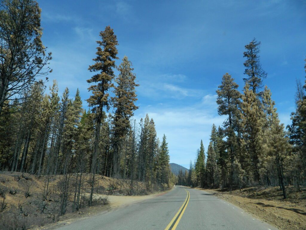
Donner Summit and Lake Tahoe get a majority of the Sierra Nevada snowfall and traffic. Deepest snowpacks are measured way up here, with dozens of small lakes surrounded by granite. Less snow means drier forests for 2020, and more tourists means more campfires. One spark is all it takes!

southward2donner
Tahoe National Forest (snowy mountains) April 2020, taken from Oro-Quincy Hwy looking southeast to Donner.

Sierra National Forest NFS

campfires allowed only @ developed campgrounds & inside wilderness areas (JUNE 4 – NOV 30)
https://www.fs.usda.gov/alerts/sierra/alerts-notices/?aid=34784

Yosemite’s west side w/ Bass Lake, Mammoth Pool, Granite Creek, Dinkey Creek, McKinley Grove, Shaver Lake, Huntington Lake, San Joaquin River, Mono Hot Springs, Edison Lake, Florence, Ward, Courtright, Wishon, Blackrock, and the Kings River. Biggest water reservoirs draws the largest crowds. Be fire safe and camp inside of a developed campground this summer.

Stanislaus National Forest NFS

no campfires outside developed campgrounds
(MAY 28 – NOV 30)
https://www.fs.usda.gov/alerts/stanislaus/alerts-notices/?aid=59004

Sonora Pass and the Gold Country have been hit hard by recent wildfires in the past decade, so now we pay the price w/ much tighter campfire restrictions. Popular mid Sierra region, easy access w/ many lakes and reservoirs; highways of CA 108 & CA 44

Eldorado National Forest NFS

no campfires outside of developed campgrounds
(MAY 29 – NOV 30)
https://www.fs.usda.gov/alerts/eldorado/alerts-notices/?aid=58902

BLM Mother Lode
(Gold Country Foothills)blm camps

no campfires outside of developed campgrounds (MAY 29)
https://www.blm.gov/press-release/blm-mother-lode-field-office-initiates-seasonal-fire-restrictions

see the current 2020 BLM Campfire Map

Humboldt-Toiyabe National Forest NFS

no campfires outside of developed campgrounds
(MAY 31 – OCT 31, 2020)
https://www.fs.usda.gov/alerts/htnf/alerts-notices/?aid=58910

Eastern Sierra, south of Lake Tahoe, alpine lakes and the headwaters to the Carson River. Walker River, Twin Lakes, Bridgeport, CA

Inyo National Forest NFS

no campfires outside of developed campgrounds
(MAY 13, 2020 – DEC 31, 2022)
https://www.fs.usda.gov/alerts/inyo/alerts-notices/?aid=23491

Campfires banned throughout the Eastern Sierra region until the end of 2022, within both the USFS and BLM campgrounds. US Highway 395, Mount Whitney, Mammoth, June Lake Loop & Mono Lake

goodale
Goodale Creek, Eastern Sierra California

BLM Bishop blm camps

no campfires outside of developed campgrounds
(APR 28 – NOV 1, 2020)
https://www.blm.gov/press-release/blm-bishop-field-office-issues-seasonal-fire-restrictions-0

see the current 2020 BLM Campfire Map

Sequoia National Forest NFS

no campfires outside of developed campgrounds
ABOVE 5000′ elevation
(MAY 28 – NOV 30, 2020)
https://www.fs.usda.gov/alerts/sequoia/alerts-notices/?aid=58934

Tighter than normal campfire rules for the drier Southern Sierra. Kern River Canyon, Kennedy Meadows, Chimney Peak and beyond. Drive up hill, gaining levation to Sherman’s Pass or the Western Divide Highway and find a cooler campground in the dense trees. Forget the triple digit heat, brushy river and the masses, and climb to a higher altitude for the Big Trees and Big Meadows. Breckenridge, Horse Meadow, Long Valley, Mountain Home.

Kern Meadows Camping

BLM Bakersfield blm camps

no campfires allowed at all (APR 28)
https://www.blm.gov/press-release/blm-bakersfield-field-office-issues-seasonal-fire-restrictions

see the current 2020 BLM Campfire Map

hiker

Southern California
& Central Coast

Cleveland National Forest NFS

no campfires outside of developed campgrounds (all year)
https://www.fs.usda.gov/detail/cleveland/home/?cid=fseprd549882

San Bernardino National Forest NFS

no campfires outside of developed campgrounds
(MAY 29 – DEC 15, 2020)
https://www.fs.usda.gov/detail/sbnf/learning/safety-ethics/?cid=FSBDEV7_007776

Angeles National Forest NFS

no campfires outside of developed campgrounds
(DEC 10, 2019 – FEB 1, 2021)
https://www.fs.usda.gov/alerts/angeles/alerts-notices/?aid=55824

Los Padres National Forest NFS

no campfires outside developed campgrounds
(MAY 12 – NOV 30, 2020)
https://www.fs.usda.gov/alerts/lpnf/alerts-notices

reyespeakcamp
Camping out near Reyes Peak, off Hwy 33 N of Ojai, CA


BLM Deserts Southern Californiablm camps

no campfires allowed at all (APR 29)
see the current 2020 BLM Campfire Map

hiker

Stages of Fire Restriction in California

campfires

Stage I Restriction (ALL YEAR-ROUND):

  • The possession or use of any steel jacketed or steel core ammunition of any caliber. This would include handgun, rifle and shotgun ammunition unless a person is in possession of a valid State of California hunting license and is actively engaged in the legal take/pursuit of game and non-game species in accordance with current California hunting regulations, and
  • During the issuance of Red Flag Warnings and Fire Weather Watches, as determined by the National Weather Service (NWS), all recreational shooting and use of campfires, is temporarily suspended to reduce the potential of unintended wildland fire ignitions for the period of the event.

Stage II Restriction:

  • All the restriction in Stage I above, and
  • Setting, building, maintaining, attending, or using open fire of any kind is prohibited, except campfires within approved fire pits and grills provided for in developed recreation sites; or campfires within the Imperial County Special Recreation Management Areas with a valid California Campfire Permit. Controlled flame devices such as portable stoves and lanterns with shut-off valves,using gas, jellied petroleum, or pressurized liquid fuel are allowed and require a valid California Campfire Permit, and
  • Smoking, except within an enclosed vehicle or camp trailer or while stopped or standing in a three-foot diameter area barren or cleared of all flammable materials and away from federal facility doors, windows and air ducts.

Stage III Restriction:

  • All the restrictions in Stage I above, and
  • Setting, building, maintaining, attending, or using open fire of any kind is prohibited. Controlled flame devices such as portable stoves and lanterns with shut-off valves,using gas, jellied petroleum, or pressurized liquid fuel are allowed with a valid California Campfire Permit, and
  • Smoking, except within an enclosed vehicle or camp trailer unless prohibited by State or local laws.