Tag Archives: berry creek

California Wildfires 2020

wildfire fawn

2020 Wildfires in California

TOTAL ACRES 
4,397,809 acres

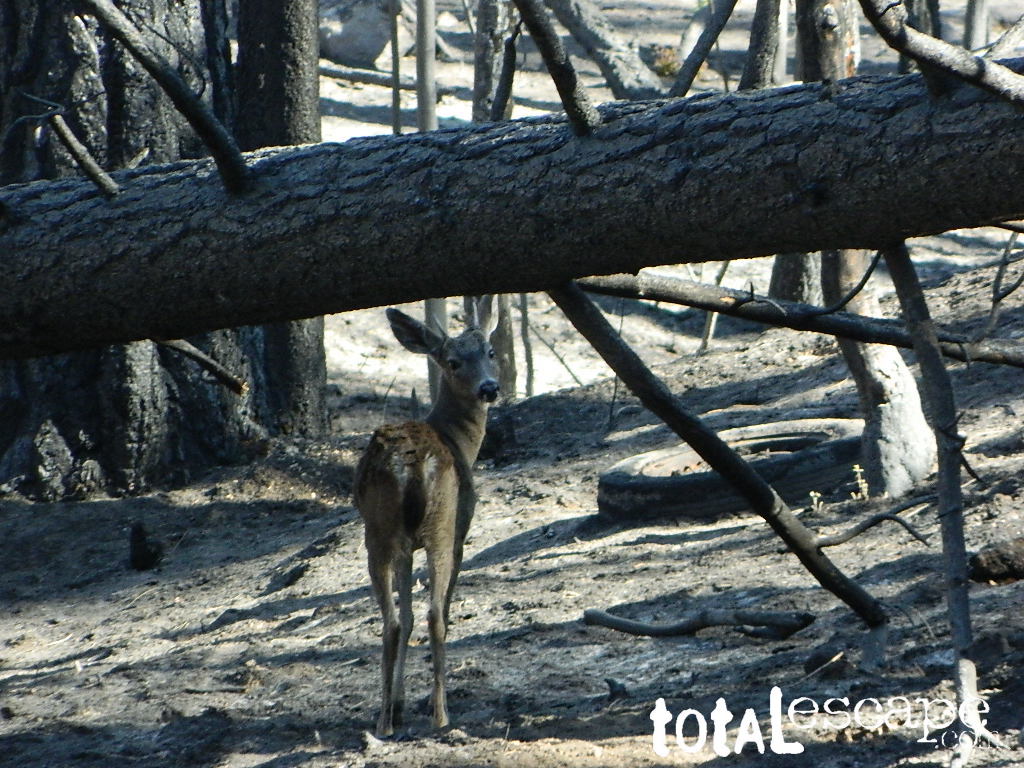
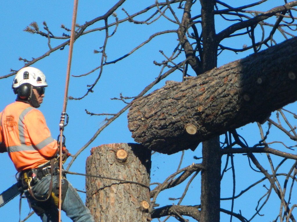
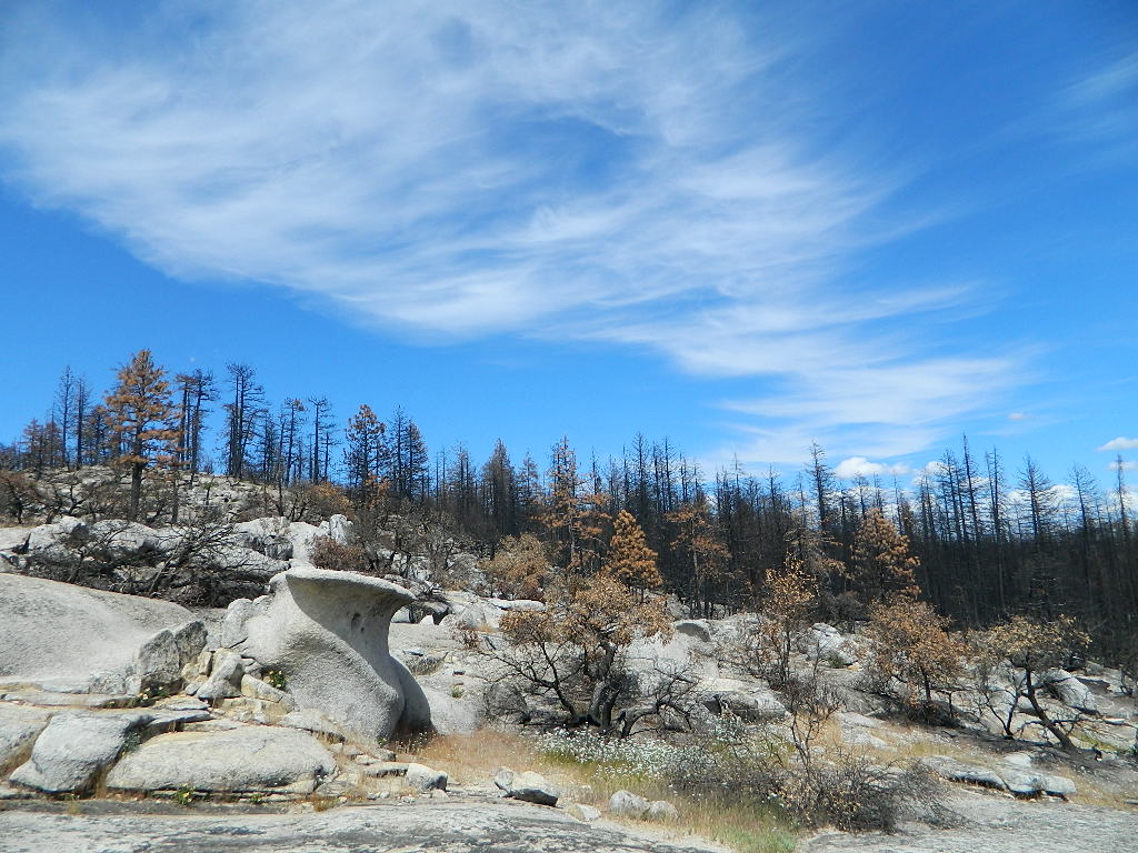
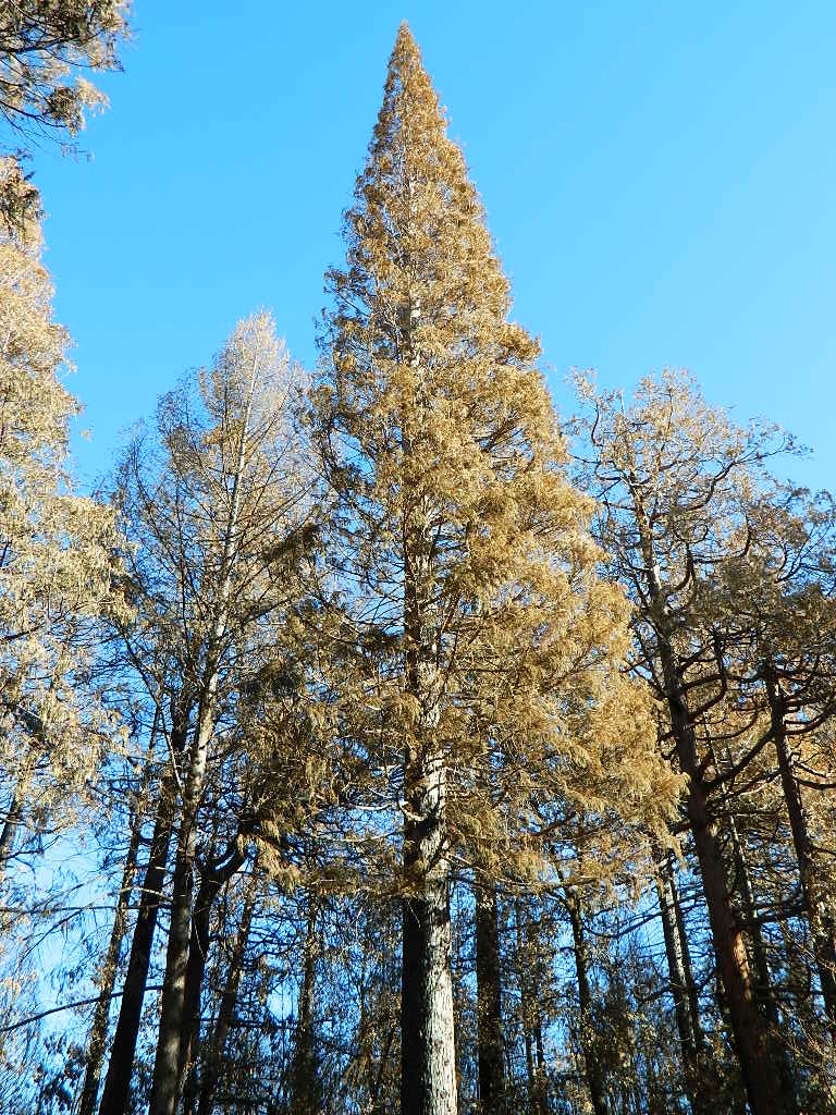
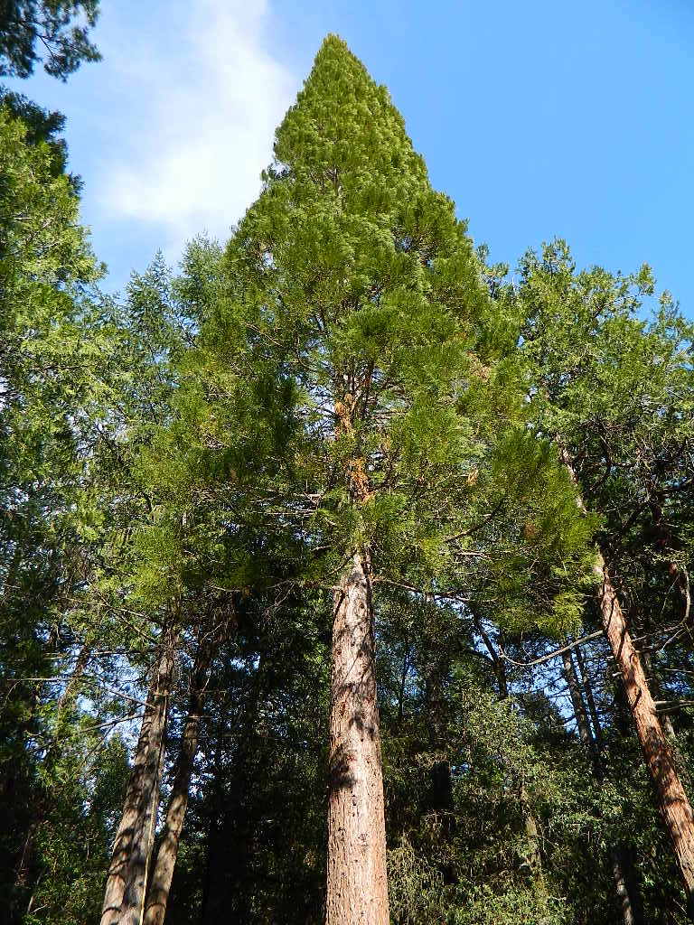
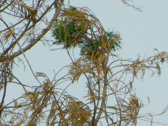
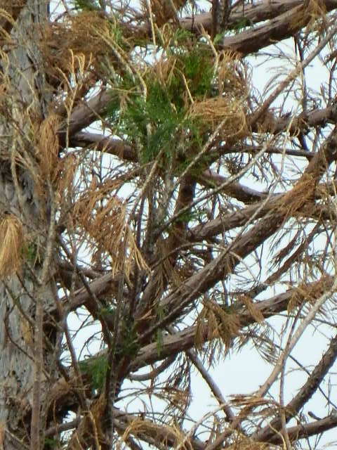
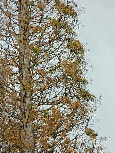
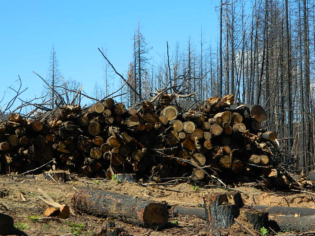
This was a year of many “Complex Fires” inside California. These names were given to a grouping of multiple forest fires caused by lightning strikes, during dry thunderstorm events in mid August. The coastal Santa Cruz redwoods were on fire; then shortly after the Sierra Nevada started burning fast, and campers were rescued by helicopter. We started loosing Giant Sequoia trees at an alarming rate – starting this year.

_______________________________

Riverside Co
33,424 Acres
_______________________________
 
Glenn, Mendocino, Lake, Tehama, Trinity, Shasta Counties
1,032,648 Acres
_______________________________
 
Blue Ridge Fire
Orange, San Bernardino, Riverside Counties
13,694 Acres
_______________________________
 
Los Angeles Co
115,997 Acres
_______________________________
 
Butte/Tehama/Glenn Lightning Complex 
Butte Co
19,609 Acres
_______________________________
 
Fresno, Madera Counties
379,895 Acres
_______________________________
 
San Mateo, Santa Cruz Counties
86,509 Acres
_______________________________
 
Monterey Co
124,924 Acres
_______________________________
 
Dome Fire (Mojave Preserve)
San Bernardino Co
43,273 Acres
_______________________________
 
San Bernardino, Riverside
22,744 Acres
_______________________________
 
Napa, Sonoma Counties
67,484 Acres
_______________________________
 
Lassen Co
22,634 Acres
_______________________________
 
Hog Fire
Lassen Co
9,564 Acres
_______________________________
 
July Complex
Modoc, Siskiyou Counties
83,261 Acres
_______________________________
 
Colusa, Lake, Napa, Sonoma, Solano, Yolo Counties
363,220 Acres
_______________________________
 
Loyalton Fire
Lassen, Plumas, Sierra Counties
47,029
_______________________________
 
Fresno Co
29,667 Acres
_______________________________
 
Mountain View Fire
Mono, Alpine Counties
20,385 Acres
_______________________________
 
North Complex
Bear Fire
Plumas, Butte Counties
318,935 Acres
_______________________________
 
Humboldt, Siskiyou, Trinity Counties
144,698 Acres
_______________________________
 
River Fire
Monterey Co
48,088 Acres
_______________________________
 
Santa Clara, Alameda, Contra Costa, San Joaquin, Merced, Stanislaus Counties
396,624 Acres
_______________________________
 
Sheep Fire
Plumas, Lassen Counties
29,570 Acres
_______________________________
 
Orange Co
12,466 Acres
_______________________________
 
Siskiyou, Del Norte Counties
166,127 Acres
_______________________________
 
Slink Fire
Alpine, Mono Counties
26,759 Acres
_______________________________
 
SQF Complex
Castle Fire
Tulare Co
174,178 Acres
_______________________________
 
Valley Fire
San Diego Co
16,390 Acres
_______________________________
 
W-5 Cold Springs
Lassen, Modoc Counties
84,817 Acres
_______________________________
 
Shasta Co
56,338 Acres


California Wildfire Affected Areas

Top O Zink

Before and After

SWIPE photo of the
Top of Zink Road
#BearFire 2020

topofzinkroadBear Fire Zink Road

off of Bald Rock Road
Berry Creek, California

Butte County

Zink Trail 21N78

Plumas National Forest
Trail #21N78

Before and After Photo

Straw Swipe

21N78before21N78after

Trailhead at Top of Zink Road in Berry Creek, California
This route is Straw Rd on GoogleMaps

In summer 2017 this trail from Zink saddle to the Big Bald Rock was so dense and overgrown that I only made it half a mile, before I quit and turned back.

SEPT 8, 2020 #BearFire cleared it all in one night.

21N78straw

Decimated Plumas Forest

Plumas Forest View
from the top of Bald Rock

Before and After Photo

Forest Swipe

Burnt Forest

We used to have such a beautiful, lush and diverse forest in the Northern Sierra Nevada, but all that has changed with recent wildfires that have scorched millions of acres of National Forest land in the past few years.

Survivor

An unbelievable amount of destruction has taken place with losses in wildlife, forest ecosystems, personal property, and human lives, as well as buildings of historic value.

Sadly, I find my California landscape photographs are now mere documentation of what beauty once was.


Plumas National ForestNFSlogo

Berry Creek, California


decimated
Decimated forest at Bald Rock

California Areas Affected by Wildfires

Our Sequoia

Before and After Photo

CALIF WILDFIRE:
Bear Fire, North Complex Fire @ Berry Creek, CA

Sequoia Swipe

No this is not Sequoia National Park, nor Giant Sequoia National Monument, although certain historic groves did burn this past summer – inside Mountain Home SF.

This Sequoia here, is the best tree in our front yard.

Some say that older Sequoia trees can withstand fire, but not if the fire burns the crown (tippy top).  Since our tree is young (60+ years old), compared to most Sequoia trees, we’re not too sure if ours will survive. But we have been watering it for months and hoping for a good winter rain w/ snow.

UPDATE DEC 2021

Puff of green started appearing late Spring. However minimal, I still got excited enough to photograph it.

Mostly brown, but green appearing May 2021.

Sequoia Strong
Holding out hope for the Sequoia.

Sequoia toasted

We watered this Sequoia all summer (2021) long and now we have a good rain spell in Autumn heading into Winter, so I am hoping our Sequoia – plus the neighbors 2 Sequoias, can make a serious come back.

SEQUOIA PROGRESS

Will keep posting our growth progress, as soon as I see more green – mid 2022.

No one is sure when these Sequoia trees in the Berry Creek region were established, since these pre-date our knowledge and the county records.

June & Curly may have planted these back in 1950; or maybe Mr. Coe or Sorensen around 1960. Could it have been the Maidu tribe (native Americans) who transplanted seeds from south to north? Doubtful.

califrepublic

Oroville Salmon Festival

Lake Oroville

Lake Oroville Salmon Festival
Salmon Fest in O’ville

Feather River Fish Hatchery, Feather River Nature Center and Riverbend Park

On the Feather River between Historic Downtown Oroville and the Fish Hatchery, the town bursts with fish-flavored activities during the annual Salmon Festival. Friday night starts @ Feather River Nature Center for dinner & dance. Saturday brings on the fun, food, music and vendors on Main Street. Lots of great local info – salmon recipes, water/drought, fishing and environmental issues.  Big pancake breakfast, a farmer’s market, live music, a craft fair, clowns, rides for the kids. Hatchery tours. The Bounty of Butte County will be located atop Myers Street, next to the Municipal Auditorium leading into Salmon Court. FREE to attend and tastes sold as desired. There will be food demonstrations, local food vendors, restaurant tastings and so much more.

Annual event; September
530-538-2542

Oroville, CA

salmonfestoroville.org

Oro Hatch

Oro Hatch - 14

Historic Downtown Oroville

Footed Rock

Footed Rock @ Bald Rock
Berry Creek, California

Before and After Photo

Wildfire: Bear Fire / North Complex 2020

The Skinny Lone Cedar hangs on with Footed Rock. Bushes on the right side, had the flames licking at this tiny tree.

Footed Swipe

Berry Creek, CAfooted rock 95916

Many thanks to whoever cut/broke the mistletoe off in recent years. I never seem to hike with my loppers.

Bald Rock California

Footed Rock is a part of the popular Bald Rock hike. summer 2021 CURRENTLY CLOSED hiking trail in Berry Creek, CA

Mushroom Rock
Mushroom Rock @ Bald Rock


Lumber for Market
Lumber for Market, just sitting on the side of the road.

Log Truck Drivers make over $100/hour – yet there is still a job shortage in 2021. Go figure!

mountains

see more swipe photos –

Bald Rock California

decimated
Decimated forest at Bald Rock: Trail Closed 2020-2021

bigbaldrocks
Bald Rock, North Sierra Nevada Mountains

Big Bald Rock

elevation: 3350′

2021: CLOSED due to wildfire damage

Bald Rock Trailhead, Berry Creek, CA
Located above Lake Oroville and near the Middle Fork of the Feather River, this well known trailhead is a 1 mile (short, steep & sweet) climb on top of granite rocks – to a wonderful view over the North Sacramento Valley. Dirt parking lot w/ bathroom in a forested setting.  Can get muddy during winter. Seasonal creek runs along first part of the hiking trail. Locals like to party here at night. Families hike during daylight and sunset hour.  Trailhead sign is well marked on paved Bald Rock Road, about 6 miles from the Oro Quincy Highway.

see more info for this hike

digger pines

Bald Rock Country
Bald Rock Country


footed
Footed Rock @ Bald Rock, Berry Creek, CA

The granite dome hike (above) is often confused with a neighboring trail to the south, called Bald Rock Dome, located at the granite gorge of the Middle Feather River. A much longer hike w/ a canyon view, switchbacks, and longer dirt road access…..hiker

Dome Trail Hike

approx. elevation: 3200′

2021: CLOSED due to wildfire damage

Another dome hike in the same area as above, but on the other side of the pavement; gravel parking lot, and trailhead via dirt road; a right turn off Bald Rock Road (when going north). Near the residential forest of Berry Creek, CA

see more details

Plumas National Forest, above Lake Oroville, CA

The official map for Lake Oroville SRA has a granite dome marked as Little Bald Rock @ 3334′ elev. The USDA Plumas National Forest map has both a Little Bald Rock and a Bald Rock Dome (3509′) located on this side of Bald Rock Road.

As you can see listed below, giant granite domes or mountain peaks or river canyons often have the generic name of ‘bald rock’ There are also a heck of a lotta Bald Mountains inside the golden state.

camptruck

also, in the vicinity –

campBald Rock Canyon is downstream from the big waterfall, Feather Falls, on the Middle Fork of the Feather River; This stretch of wilderness waterway is called Feather Falls Scenic Area which includes, Milsap Bar Campground; Maybe be accessible, by 4×4 and steep foot trail – from the opposite side of the river. Off Lumpkin Road, which is off Forbestown Road (@ 162 above Lake Oroville) 2021: CLOSED due to wildfire damage

Bald Rock Peak (elev 7166′) a mountain peak near Chilcoot Campground and Frenchman Lake, N of Hwy 70 in East Plumas National Forest

Bald Mountain (5780′) off the Skyway, next to Stirling City, CA
Fire Lookout CDF, weather cam & antenna site

canoe

Little Grass Valley Reservoir has two Balds

pinetree
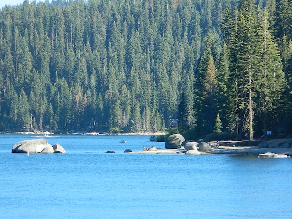
On the north side of the lake is Grass Valley Bald Mountain (5906′ elev) in between Black Rock Creek and the northern shore.

The La Porte Bald Mountain Peak (5906′ elev) is located in dense forest, in Plumas National Forest; In between LGVR and the town of La Porte, CA 4959′

Area accessible via a long and curvy La Porte Road, which closes in winter on the north end (East Quincy). This Plumas County area is popular w/ snowmobiling due to the amount of snow they receive.

snowmo

Bald Mountain Range, due north of Truckee and Stampede Reservoir. Near the CA / NV border. Babbitt Peak @ 8790′ is the tallest peak within this range. Historical Henness Pass Road passes through this area.

fish

Bald Mountain OHV Staging Area, on Rock Creek Trails
inside Eldorado National Forest 

dirtbikes

Bald Mountain Peak @ Sugarloaf Ridge State Park
(2279′ elev) located in between Napa Valley and Sonoma Valley.

M22 Mendocino Forest, eastside
Forest Route #M22 is on Valentine Ridge, east of South Yolla Bolly (elev 8092′) and near Bald Rock Mountain (7762′)Road M-22 is also known as Bald Rock Road.
Mendocino National Forest – Two trailheads up this way are Ides Cove and Horsepacker. M22 wraps around south to Ball Rock @ 6663′ elevation, near Rocky Cabin Campground. Cold Springs Guard Station, Ball Mountain 6557′ and Whitlock Campground are on this route. Much this region has been burnt in recent wildfires of 2020 #ElkhornFire

driftwood

similarly named – BALD

Mount Baldy, Ranch Cucamonga Wilderness
San Gabriel Mountains, Los Angeles, CA

Popular, local snow ski destination for “the southland”; south of Pasadena, near Rancho Cucamonga, in the San Gabriel Mountains.’

snowski

Bald Mountain Road, also known as Inyo Forest Road #01S05, near Indiana Summit and the Mono Craters. East of the Eastern Sierra & US 395; south of Mono Lake, California.

Bald Mountain Road, near Bummerville, California.
Gold Country Sierra Forests, East of Hwy 49 @ Jackson, CA

Bald Mountain Road, rural ranches & residential;
and Bald Mountain Nursery in Browns Valley, near Marysville, CA


Bald Hills Rd
Bald Hills Road, Redwoods NP

Bald Hills Road, Northern California

Well- traveled, graded dirt road connecting the Redwood National Park to the Klamath River @ Hwy 96. Primitive camping, but check on fire restrictions. Must have camp fire permit.  Active logging roads on National Forest land, so weekdays could be busy: watch for equipment and big trucks.

pinetree

Kennedy Meadows from Bald
Kennedy Meadows from Bald Mountain Fire Lookout

Bald Mountain @ Shermans Pass
Kern Plateau; 4×4 access to reach Fire Lookout Tower
Sherman’s Pass Road# 22S05, near Dome Land Wilderness
Sequoia National Forest

NFSlogo

Bald Mountain 4×4 Trail
Western Sierra NF, overlooking Shaver Lake, CA

bald mtn
Jeepers on granite @ Bald Mtn, above Shaver Lake, CA

4x4

Bucks Lake Campgrounds

indian rock
Indian Rock is a beach (day use only) on the west side.

Bucks Lake, California

Below is a list of all the developed campgrounds & RV Parks surrounding the Bucks Lake region of Plumas National Forest in the Northern Sierra Nevada mountains. The infamous Pacific Crest Trail (PCT) runs through Bucks Lake Wilderness, so there are also trailhead camps and backcountry camp sites that are not in this list. This high elevation region closes the campgrounds for winter: NOV- APRIL

campgrounds RV campgrounds fishing lakes campgrounds launch lake camping hiking lakes

Campgrounds at Bucks Lake

campground elev spots veg toilet water
Hutchins Group Camp 5200′ 10 pines flush piped
Lower Bucks Campground 5200′ 6 pines vault piped
Mill Creek Campground 5200′ 10 pines vault piped
Sundew Campground 5200′ 19 pines vault piped

NFS camps

NFS Camps nearby

campground elev spots veg toilet water
Deanes Valley Campground 4400′ 7 mixed vault creek
Grizzly Creek Campground 5400′ 8 pines vault piped
Silver Lake Campground 5800′ 9 pines vault lake
Snake Lake Campground 4200′ 14 mixed vault lake
Whitehorse Campground 5200′ 20 pines vault creek

USDA
Plumas National Forest

Oroville Ranger Station NFS
530-534-6500

Quincy Ranger Station NFS
530-283-0555

Bucks Lake CA

PG&E Campground @ Bucks Lake

Haskins Valley Campground
16731 Bucks Lake Rd
530-283-0256

Grizzly Forebay Campground
CLOSED in 2013 by PG&E
530-896-4263 (for more info)

RV Parks @ Bucks Lake

Bucks Lake Camp & RV
280 Bucklin Road
530-283-2221

Bucks Lake Marina
16469 Bucks Lake Rd
530-283-4243

Lakeshore Resort
16001 Bucks Lake Rd
530-283-2848

grizzly creek